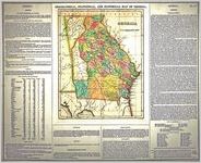
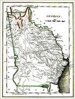
- No40
J. Kyle Spencer Map Collection

Early maps of Georgia and the United States dating from 1585 to 1864.
More About This Collection
Date of Original
1500/1800
Subject
Southern States--History--Maps
Georgia--History--Maps
United States--History--Revolution, 1775-1783--Maps
United States--History--Civil War, 1861-1865--Maps
Coasts--Georgia--History--Maps
Transportation--Maps
Georgia
Southern States
Location
United States, Georgia, 32.75042, -83.50018
Medium
maps
Type
Still Image
Description
The J. Kyle Spencer Map Collection documents the emergence and evolution of the American colonies, specifically Georgia, and the formation of the United States as a whole, ranging from the late 1500s to the late 1800s.
Holding Institution
Columbus State University. Archives


!["Mississippi Territory and Georgia." W. Barker, sc. Published in Matthew Carey's American Pocket Atlas, [1805].](https://dlg.usg.edu/thumbnails/columbus/jksm/columbus_jksm_31.jpg)
