- Collection:
- Historic Maps (Georgia Archives)
- Title:
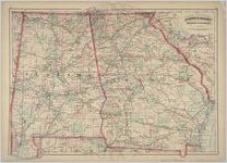
- "Asher and Adams' Georgia & Alabama."
- Creator:
- Asher & Adams
- Publisher:
- Washington, D. C.: Asher & Adams, 1874.
- Date of Original:
- 1874
- Subject:
- Georgia--Maps
Alabama--Maps - Location:
- United States, Alabama, 32.75041, -86.75026
United States, Georgia, 32.75042, -83.50018 - Medium:
- maps (documents)
- Type:
- Still Image
- Format:
- image/jpeg
- Description:
- In: Unidentified atlas, 35-36.
Scale [1:1,267,200]. 20 miles to an in. (W 88°30'--W 80°45'/N 35°20'--N 30°15').
Relief shown by hachures.
Shows townships, distances along railroads, etc.
Prime meridians: Greenwich and Washington.
Scanned raster image of original: 1 map : hand col. ; 43 x 57 cm. - External Identifiers:
- Metadata URL:
- https://vault.georgiaarchives.org/digital/collection/hmf/id/8
- Language:
- eng
- Extent:
- 24 x 17.25
- Original Collection:
- hmf0140, Historic Maps, Surveyor General, RG 3-8-65, Georgia Archives
Historic Maps, Surveyor General, RG 3-8-65, Georgia Archives - Holding Institution:
- Georgia Archives
- Rights:
-
