- Collection:
- Georgia Historical Markers
- Title:
- Brushy Mountain Line historical marker
- Creator:
- Seibert, David, 1941-2020
- Date of Original:
- 1996/2014
- Subject:
- Historical markers--Georgia--Cobb County
- Location:
- United States, Georgia, Cobb County, 33.94147, -84.57667
- Medium:
- photographs
- Type:
- Still Image
- Format:
- image/jpeg
- Description:
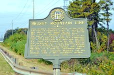
- Location: U.S. 41 south of Greer's Chapel Rd.
Text of marker: "BRUSHY MOUNTAIN LINE. June 19, 1864. McPherson's Army of the Tenn., left wing of Sherman's army [U.S.], moved into this sector - the rugged terrain of Brushy Mtn. - on the Kennesaw Mountain front. The 17th A. C. & Garrard's Cav. were N. E. of this point; 15th & 16th, S. W. [U.S.] Hood's A. C. & Wheeler's Cav. [C.S.] (E. of Kennesaw Mtn.) were opp. the 17th A. C.; Polk's A. C. (Loring), on the mtn.; Hardee's A.C. on Loring's left [C.S.], S. of the mtn. June 21. Hood was shifted to Hardee's left - prolonging the line S. to the Powder Springs road, leaving Wheeler's cav. to hold the Confederate right..For two weeks, Kennesaw Mountain was the strategic point of the Confederate position. 033-47 GEORGIA HISTORICAL COMMISSION 1954" - External Identifiers:
- Metadata URL:
- https://dlg.usg.edu/record/dlg_ghm_brushy-mountain-line
- Digital Object URL:
- http://dlg.galileo.usg.edu/do:dlg_ghm_brushy-mountain-line
- Language:
- eng
- Rights Holder:
- Copyright held by David Seibert. Please contact markers@davidseibert.com about commercial reproduction and use
- Holding Institution:
- Digital Library of Georgia
- Rights:
-
