


- Collection:
- Georgia Government Publications
- Title:
- A preliminary report on a part of the phosphates and marls of Georgia
- Creator:
- McCallie, S. W. (Samuel Washington), 1856-1933
- Publisher:
- Atlanta, Ga., G. W. Harrison, state printer
- Date of Original:
- 1896
- Subject:
- Phosphates
- Location:
- United States, Georgia, 32.75042, -83.50018
- Medium:
- state government records
government records - Type:
- Text
- Format:
- application/pdf
- External Identifiers:
- Call Number GA M500.G4 B1 no. 5-A
- Metadata URL:
- https://dlg.galileo.usg.edu/id:dlg_ggpd_s-ga-bm500-pg4-bb1-bno-p-b5-ha
- Digital Object URL:
- https://dlg.galileo.usg.edu/do:dlg_ggpd_s-ga-bm500-pg4-bb1-bno-p-b5-ha
- Language:
- eng
- Extent:
- 1 p. ., 98, [3] p. illus., iii pl. (incl. front.) 26 cm.
- Holding Institution:
- University of Georgia. Map and Government Information Library
- Rights:
-

Pf/OSPIIATES AND lf'!ARLS OF GEORGIA
FRONT!SP!ECE
PL.~ Tl:' f
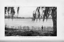
FAIRVIEW LAKE, NEAR WHlGHAM, DECATUR COUNTY, GEORGIA.
GEOLOGICAL SURVEY OF GEORGIA
W. S. YEATES, State Geologist
BULLETIN NO, 5-A
A PRELIMINARY REPORT
ON .A. PART OF THE
Phosphates and
OF
GEORGIA
BY
S. VV. McCALLIE Assistant Geologist
'GED. W. HARRISON, STATE PRINTER
'FRANKLIN PRIN'PING AND PUBLISHING COMPANY
Atlanta, Ga.
THE ADVISORY BOARD
of the Geological Survey of Georgia
(Ex-'Officio) Hrs ExcELLENCY, vV. Y. ATKINSON, Governor of Georgia,
PRESIDENT OF THE BOARD
HoN. R. T. NESBITT
Commissioner of Agriculture
Hor\r. G. R. GLENN .
Commissioner of Public Schools
BoN. R. U. HARDEMAN
Q
-=
State Treasurer
HoN. vV. A. WRIGHT .
Comptroller-General
HoN. A. D. CANDLER
BoN. J. M. TERRELL o o
Secretary of State Attorney-General
GEOLOGICAL SURVEY OF GEORGIA,
ATLANTA, October 12th, 1896.
To His Excellency }V. Y. Atkinson, Gove1nor, and President of the Adviso1y Board of the Geological Survey of Georgia : -
Sir:- I have the honor, to transmit, here~ith, the report of ::M:r.
S. \V. 111:c0allie, ASisistarrt Geologist, On a part of the Phosphate's and l\f.arls of Georgia, to he ~ssued ~as one of a ser~es of bulletins on this mbje!Ct.
In his -vvork 'On 'th'e Phosphates, ,as at :6.rslt begun, Mr. McCallie found, that the JYiarls ~ere so clos'ely identified with the Phosphate clel5osit,s, th,at it would he best iJo incorpm~ate the two subjects under one report. This bulletin will, therefore he Of interest rto the farmer, as well to the manu:fia.ctur:e:r 'of fertilizers; and in this connection, I desire to eall special attention to the \vriter's oonclU!sions, 1a;s to the greai value. of the 111::arl deposits of Georgia, ~hen properly applied as a fertilizer.
Very respectfully yours, W. S. YEATES, State Geologist.
PHOSPHATES AND MARLS OF GEORGIA
CHAPTER I
GENERAL DISTRIBUTION OF PHOSPHATE
DEPOSITS
Phosphorus, the element which enters so largely into the composition of commercial fertilizers, is of almost universal occurrence, in horth organic rand inorgan.i:c bodies. It rexis~s, in morre Or less albundance, in rfrll sedimentary arnd crystalline Tiocks; ~t en'terrs largely intio the composition of the bones of animals; and it is found in the tissues of plants, being especially abundant in the fruits and grains. It never occurs in nature in a free state; but it is always combined with other elements, forming a number of compounds, known as phosphates. The most important of these, is calcium phosphate, or bone-ash, which is one of the essential constituents of a productive soil, and which is the :first of the plant-foods, to become exhausted by the growing crops. To Testore this essential ingredient to the soil, at the least possible cost, has, for many yeaTs, been one of the most important practical questions, that has been presented to the agricul~ural scientist, for solution. The Romans and tl1e Peruvians, at a very early elate, are said to have used the excrements o:f birds, to restore their cultivated fields tc tb eir original :fertility. About the miclclle of the last Oen-
(7)
8
DISTRIBUTION OF PHOSPHATES
tury, we find the English farmers, in the vicinity of Sheffield, using the chippings of bones from the knife-factories for a similar purpose; but they, like the Romans and the Peruvians, appear to have been ignorant of the fact, that the fertilizing properties of bones, as well as the excreanents ;of birds, are mainly due i:lo iJh!e calcium ph!osphate, thre:y contain. It was not until1843, that the Duke of Richmond, an eminent English scientist, demonstrated by a series of elaborate experiments, t'hat ~the :6ertilizing pr:operties ,a 'these ou:"ganic manm~es wetre caused by their high percentage of phosphoric acid. This discovery was soon followed by the use of the mineral phosphates, which were already known to occur, both in Europe and America, for the purpose of man1uacturing commercial fertilirers. Three years previm1s to this, the first twenty barrels of guano wetre imported to England from Peru. Humboldt described these deposits, and called the attention of Europe to them, as early as 1804; and six years afterwards, Sir Humphry Davy suggested, that they would likeJy p1.,ove to be a valuable manure. It seems quite likely, from the reports of the early explorers of the Peruvian coast, who found, at various places, ancient mines in the guano beds, containing crude wooden quarrying implements, fua't rtJhe valUe o:f the deposits wlaS mown, and m!Oa:''8 OT leSS extensively used, by the ancient inhabitants, hefor'e the discovery of America. History shows, that these deposits were held in great value by the Incas, who imposed the penalty of death on any subject for : kil1ing 'a sea-bir:d, or even vi>Simng the :i!s~am.ds, during the breeding season.
Guano 1 of lthe best qu:aHty is made up mainly of 'ffuie excr:errnents, skeletons m:rd t:he .frragments ;of eggs ,of fi'slh-~eating sea-biiDds, whi!cfu., in great numbers, have found the rainless rocky islands near the coast, a suitable roosting-place, for many centuries. The Peruvian deposits,
1 A corruption of huanu, the Peruvian word for dung.
DISTRIBUTION OF PHOSPHA.TES
9
the most valuable so far discovered, formerly existed in large quantities, covering a considerable portion of a number of small islands, where, in places, it attained the depth of more than a hundred feet; but, owing to the extensive shipments to North America and the European countries, it is now practically exhausted. The largest shipment from these islands was made alJout tl1e year 1870, when Great Britain's importation alone, was valued at more than $12,000,000, and the royalty, exa.cted by the PenTvi.ans from these exportations, iar exceeded all the other revenues, accruing to their general government. Since then, the shipments gradually decreased, from year to year, until 1883, when further exportations were finally prohibitei by an act of the Peruvian government.
V e~nezuela, Guiana and the coast of Africa, in the last decade, have :furnished the European markets witl1 considerable quantities of guano; but, as a result of the more humid conditio'Il of the atmosphere, under which it has been accumulated, it is usually inferior to the p,eruvian deposits in 'ammonia, and, consequently, less valued as a :fertilizer.
Previous to the introduction of guano into Europe, the chief commercial fertilizws U!Sed, were 'amimal charooal and crushed hon:e, th1e only form of phosphates then known. On account o:f the insolubility of these manures, it was frequently necessary to use from one to two thousand pounds per acre, in order to obtain satisfactory results. During the year 1841, Dr. Liebig, the German chemist, discovered a procss of treating bones with sulphmic acid, which rendered the calcium rhosphate soluble. Bones, thus treated, were found, by experiment, to have increased their fertilizing property more than fourfold. This important discovery was almost jmmediately followed by the
erection of the first acid phosphate factory, in London, by J. B.
Lawes, for the purpose of making artificial fertilizers from bones
10
DISTRLfJUTION OF PHOSPHATES
treated with sulphuric acid. Soon after this, Prof. Henslow, whohad previously made a study of the Cambridge phosphatic nodules, suggested their us-e as a valuable substitute for bone, in the manufacture of commercial fertilizers. This suggestion vyas soon carrid out,. with encouraging results; and, as a consequenoo, the phosphate deposits of England and France, formerly considered of only local importance, were now, for the first t.ime, seen to be of gr-eat val~e in the manufact11re of manures.
THE PHOSPHATES OF ENGLAND
The Greens1ands of England 1have been used -as 1a soil stimulant, by the farmers in the locality where they occur, for more than a century. These deposits, be_longing to the Cretaceous period, outcrop at variou& places in the eastern part of England, where thex form a belt, :more or less continuous, many miles in length. They oonsist principally of a greenish sand, in which are emb-edded nlrmerorus nodul.es. of. phosphate, weigbing from a fraction of an ounce to five pounds. Thesenodules, :5ormerly disc'aJ.''C1ed by the English f'armers as WO!I"thless, are usually of a gray or dark color, and form, with the associat.ed phosphatic shell-casts, bones and teeth, a stratum, varying from a few. inches to two feet in thickness. In the coli.nties of Cambridge, Bedford rrnd Suffolk, where these nodules have been worked for the last filty years, they are found to carry from forty to sixty per cent. of calcium phosphate. The Tertiary formation of Norfolk, Suffolk and Essex have also produced considerable phosphate, in the' form of nodules and bones; however, it is said to be generally inferior, both in quality and quantity, to the Cretaceous deposit. The production of
DISTRIBUTION OF PHOSPH_4.TES
11
phosphate in England appears to have reached its greatest development in 1876, when the entire output aggregated 250,000 tons. Since then, on account of the best deposits becoming partially exhausted, and on account of the extensive importations of the highgrade phosphates from the United States, t!he amount mined has become gradually less, from year to year, until it has ceased to be of importance in the phosphate markets of the world.
THE PHOSPHATES OF WALES
In 1863, phosphate was discovered in the Lower Silurian formation near Llanfyllin, Wales. It occurs there, as a bed of nodules, cemented together with a dark-colored matrix, containing fossil remams. The average thickness of the bed is not over ten inches. A number of mines were opened, ami worked to a limited extent, m the vicinity of Berwyn; but they were finally abandoned as unprofitable.
THE PHOSPHATES OF BELGIUM
Workable phosphate occurs m the southern portion of Belgium, near the French border. It has been discovered here, in two very dissimilar beds, both of which belong to the Cretaceous formation. Th.e upper bed, known as the Conglomerate, consists of brownishcolored phosphatic nodules of various sizes, -vvith fossils cemented to-
12
DISTRIBUTION OF PHOSPHATES
gether by calcium carbonate. The deposit is said to attain a thickness, in places, of three feet; but it is usually much thinner. It has been \\1orked to a limited extent. However, it has generally proved to he unp1o:fitable, on account of its low grade, and the difficulty, with which it is' separated from the calcareous matrix. The lower bed, which furnishes the greater part of the Belgium phosphate, used in making commwcirul :fertilizer, is ma;de up of a very fragile, poTous limestone or chalk, in which occur numerous small phosphatic concretions, no 1arger than 1a muSlbard seed. Tlhe ;conc:rreJt~ons :frBquently form ten
. per cent. oi the entire mass. They are separated from the calcareous
matrix, by washing, after having heen ground or allowed to become disintegrated, by exposure to the atmosphere. In 1890, the mines in the vicinity of Mons and Liege produced ovm 300,000 tons of phosphate. The greater part of this output was exported to France, England and the United States, wh:ecre it was used as a drier, and to mix with the high grades of phosphates, deficient in calcium carbonate.
THE PHOSPHATES OF FRANCE
Phosphate was discovered in the. old pro;vince of Guyernne, now t~e departmerut of Gir1onde, ~ soutih.west Fm1!1!ce, in 1865; but no mining operations of any importance were attempted, until 1870, when a number of mines were opern.ed, w;hich produced annually, for :five years, 20,000 tons of high-grade phosphates, for expor-tation. At the
expi"r!ltion of this time, the most. valuable deposits were either ex-
hausted, or were found to be unpro-fitable; and no mining, except to supply a limited, local demand, has since boon carried on. The phos-
DISTRIBUTION OF PHOSPHATES
13
phatic material is found in a grayish, compact Jurassic limestone, where it occurs in two different sets of fissures or ca-.;;rities, running at almost right-angles with one another. These fissures sometimes attain a thickness< at the surface, of 25 feet, though they do not usually e:xtend to any great depth, and are always limited to a few hundred feet, or even much less, in length. The phosphate appears in a number of forms. It may be nodular, radiate, mammillary, compact, amorphous, or even fibrous in structure. The best variety, which is compact, and has a hardness of apatite, is of a yellowish-brown color; but reel, blue .and whirte also ~occur. Phospha:te is also found in the Cretaceous formation in the departments of Ardennes and Meuse, in the northeastern part of France. It was discovered here in the Greensands in 1852, and has since been extensively worked. Its mode of occurrence and general appearance is quite similar to the :English and Belgian deposits, ,of whid.1 it may be eonsiderecl a continuation.
The most noted phosphate deposits of Fmnce, 'and probably the ric:hest :in the world, we>re clisaovered at Beauv,al, in the department of Somme in 1886. Phospha.rbe in the orin .of nodules was kno'Wll to occur at va.r:ious places in Somme, as etarly as 1863; but it was not until near'ly a quarter of a century 1arter, ~tlha:t 1\!LonsieuT l\1:er1e, a French geologist, a'nnounced that the so~called sand, whic:h was then being used at BeauVlal, :6o:r making brick and mort:ar, was a high-grade phosphate. This announcement was followed by extensive pros1Jecting, which revealed a number of deposits, in the neighborhood of Beauval, of marvelous richness. An instance is cited, where three acres, which changed hands for the sum of $120,000, produced 80,000 tons of phosphate. The area, over which these deposits extend, is said to be limited to less than 500 acres; and it has been estimated to contain 1,500,000 tons of 70 per cent. phosphate. The deposits arefound in the Cretaceous chalk; where they occur, as a phosphate sand, in large cyl-
14
DISTRIBUTION OF PHOSPHATES
inder or cone~shaped pockets, from ten to twenty feet in diameter, and, sometimes, a hundred feet in_depth. The Somme deposits produced, in 18 90, 170,000 tons of phosphate, much of which was exported. The Cretaceous deposits of central Fraillce also produce a limited quantity of phosphate; but it is usually of a low grade; and the entire output goes to supply the local demand.
THE PHOSPHATES OF SPAIN
The phosphates of Spain, a variety of the mineral, apatite, called phosphorite, occur in the province of Estremadura, near the towns of Logrosan and Caceres. The Logrosan deposit was knoWill as early as 1782, while those of Caceres appear not to have been discovered, until 1860. Mining operations, on a small scale, we!re begun at the former place in 1855, and at the latte,r, five years afterwards. The Logrosan deposit occurs in veins, varying from two to thirty_ feet in thickness, and from a few yards to three miles in length. They 'penetrate or lie at the point of jurrcti011 of the slates and gneisses, which are supposed to belong to the Silurian formation. The phosphate has
I
a fibrous, mammiUary, massive, or semi-crystalline s'trll!Cituil"e, wil!th the hardness of apatite, which renders it yery difficult to pulverize. The color, however, is somewhat variable. The high grades, running from 80 to 85 per cent. of bone phosphate, are usually of a yellowishwhite. On account of the expoose of transportation, together with the difficulty o grinding, the 'output of t~1ese mines hats been limited to only a few hundred tons per annum. The Cacer:es phosphates occur in pockets in limestone and quartz vei111S. They ha:ve. been quite extensively worked, and have furnished nearly all the p~l'Os-
DISTRIBUTION OF PHOSPH_4..TES
15
phate for exportation. In structure and color, they differ but little from the Logrosim phosphates. Spain has also valuable deposits of .apatite at Malpartida de Caceres, Ceclavin and other places, which have produced, from time to time, several thousand tons per annum; but the output from these mines, for various reasons, has c-eased to be of importance.
THE PHOSPHATES OF RUSSIA
The pl1osphate beds of Russia are found mainly in the Cretaceous
formation, between the Dnieper and Volga ri-vers, where they un-
derlie an area of s.everal thousand square miles. The territory, over
which these deposits outcrop, is probably the most extensive known;
but the quality -of the phosphate is of a low grade; m11d it is usually
-overlaid by such a heavy overburd:ecn, that it is too 8Ji..1!ensive to WOTk.
It
occurs
in
the
Greensands'
in
the
:6orrn
of
nlodul:es
and
sheU-castiS, .
eit<her as a loose mass, m cemented togetJher into a c:onglomerate, by
.sand or oalcJareou:s ma.t1erral. The dep-o:sit was diseovered, in the early
part of tihe present century; but it1s value was not made known, unrtil
1845. Sir R. I. Murchis1on, in his geological survey of Russia, speaks
-of it as "shelly conglomemte, wd concretionary iron~st~on.e." On ac-
count od: the heavy oveLrburden and the low grade of the pb!osphate,
the mines, whicih :have been opened in the bst. few years, h:ave not
always proved to be fin1ancial successes. Tthe exports to England of small shipments were uns1atisarctoa.oy, in the manufacture of superph1os-
phate. The entire output, at present, is used to sup1Jly the loc-al de-
rn:and. High-grade phosphates are alsro reported to be found in the
Silurian and other geological formati1ons of Russia. However, t;hey
have not as yet become o:f any commeTcial importance.
16
DISTRIBUTION OF' PHOSPHATES
THE PHOSPHAT'EiS OF GERMANY
.
The phosphate deposits of Germany, discovered in 1864, are located in the Hessian province. The most extensive mining operations are carried on, in the valley of the Lahn river, where two large acid-phosphate factories now consume almost the entire output of the mmes, amounting, at present, to about 30,000 tons per annum. Formerly, much of the material was shipped to England, where it brought a :fair price; this trade, however, was finally discontinued, owing to the aburndance and cheapness of the higher gr.ade phosphates, that flood the English market. In structure and general appearance, this phosphate resembles, very closely, the phosphorites of Spain. It occurs .in the Devonian limestone, fill~ng large irregular cavities, and varying from n few inches to four :feet, in thickness. It carries from forty to sixty per cent. of calcium phosphate, and runs quite high in both iron and aluminum.
THE PHOSPHATES OF NORWAY
The phosphates of Norway are apatites, found on the southwest coast. They occur in the old crystalline formation, as veins penetrating the gneisses, granits, .schists etc. The veins are from a few inches to several feet in width, and of unknown depth. They dip at a high angle; a:nd, where they attain their greatest thickness, they usually carry mica and hornblende, forming alternate bands with the apatite. The first m:i!ning was dorne near Kmgero in 1854; it was :bol-
DISTRIBUTION OF PHOSPHATES
17
lowed, a few years afterwards, by the opening of the mor-e productive mines, at Oedegarden and Bamle. The entire output of these mines, for a number of years, did not exceed 4,000 tons per annum. The larg-est shipment, so far, reported for any one year, was made in 1890, when about 12,000 tons were exported. The min-eral appears, both in a massive and a crystalline form and is commonly of a greenish or reddish gray color. Picked specimens yi-eld 92 per cent. of calcium phosphate, the richest of all known phosphates.
THE PHOSPHATES OF TUNIS AND ALGIERS
In 1886, the French explorers repo:rted the finding of extensiv-e deposits of phosphate in Tunis. This was followed, in 1893, by the announcement, that similar deposits had b-een discoYered in the eastern IJart of .Algiers, in the region of Tebessa. The former deposits, either on account of their unfa.vorable location or oth-erwise, seem, so far, not to hav-e attracted v-ery wide attention, while the latter hav-e been pretty thoroughly invstigated. Both English and French capitalists hav-e made large investments, and are now constructing railroads and making surv-eys of the deposits, with a view of beginning work at an early elate, on a Jarg scale. Two English and one Scotch company, which were early in the neld, have already become producers. The output of these companies, for 1894, was -estimated at about 30,000 tons. The phosphate is said to be composed mainly of bones and sharks' teeth, which form beds, in places ten fet thick. It av-erages from 60 to 70 per cent. calcium phosphate, while choice specimens haYe been kno-wn to run as high as 83 per cent.
18
DISTRIBUTION OF PHOSPHATES
THE PHOSPHATES OF CANADA
The first description of the Canadian phosphates or apatites was given; in. the Canadian geological report, by Dr. T. Sterry Hunt, in 1848. At that time, they appeared to attract but little attention; and it was not until 1863, that mining began in Lanark county, Ontario. For a number of years, the work was carried on, i'll. a very unscientific way. The entire output was extracted. by the farmers, who owned. the lodes, devoting a portion of their leisme time, during the winter, to mining. The gTeater part of the apatite, thus mined, was collected by buyers or agents, and was used in the manufacture ()f commercial fertilizers. The r_esult of this peculiar, haphazard mode ()I mining is said to be still quite noticeable, in the great number of now partially filled pits, scattered. along the Iine of the outcroppings ()I the phosphate vains i~ Lanark and Leeds counties. The first regular mining operations of any importance were commenced, by the Buckingham Mining Company, on the Lievre river illl the.Ottawa district, in 1871. These works were successfully operated, until 1875, when a reduction in the price of phosphate caused the mines to shut down, after which, work was continued, on a small scale, by i'lldividual parties, until 1880, when :English and American capital became interested in the deposit, and large investments we:re made. This was soon followed by the organization of several companies, the purchas ing of ma!chinery and the beginning of very active mining operations. In 1891, thirteen companies, with capital varying from $30,000 to $700,000 were engaged in the Oanadian phosphate industry. The total output for that year, most of which was exported to England, was 251000 tons, valued at $400,000. 9n account of not being able
DISTRIBUTION OF' PHOSPHATES
19
i:o compete with the low prices of the phosphates from the United 'States, which have recently glutted the European markets, all these -companies have, since, either suspended operations, or greatly re-duced their working-force; and, as a cons-equence, the output has be-come of minor importance.
The Canadian, like the N orw.egian apatites, are found in the Ar-chrean, the oldest of the geological formations, which is made up of _granite, gneiss, hornblende, and other crystalline rocks, supposed to be of igneous origin. Apatite, in -vvorkable quantity, appears in both QuebGc and Ontario. In the former province, they occ1u in a belt, from j 5 to 20 miles wide, and 60 miles long; while, in the latter, the belt is from 50 to 60 miles wide, and more than 100 miles in length. Within these belts, are to be found a great number of veins, or irregular fissures, from a few inches, to many feet in width, consisting of :apatite, pyroxene and other associated minerals. The veins can sometimes be traced, for many miles; but the workable part usually con--sists of enlargements or pockets in the main vein, which extends down to very great depth. The apatite nearly always contains foreign minerals, so intimately associated with it, that they can only be gotten rid of, by hand-picking. This extra labor adds considerable to tho Original cost of mining. However, it appears to be the only practicable way of producing from the mines the high-grade phosphates, in 1arge quantities for. exportation. In 1890, the various gTades of Canadian phosphate, costing on board of vessels at Montreal $14 per ton were selling in the European markets at the f.ollowing prices: -
'For phosphates, guaranteed to contain 85 per cent ________ $25.00 per ton
"
"
" " " 80 " -------- 22.50 " "
"
"
" "'' "
'' ,, '' 75 " -------- 18.00 '' ''
" " " 70 " " " " 65 "
14.50 " " 11.25 " "
20
DISTRIBUTION OF PII-Q$PII.:ti"TES
The physical condition of the apatite is quite variable. It occurs in a massive granular'or crystalline form; also as crystals, some of which have been found, weighing several hundred pounds. The color of the best varieties is usually some shade of green; but yellow and red, white and black are also common.
THE PHOSPHATES OF SOUTH CAROLINA
In 1837, Prof. F. S. Holmes, then a young, enthusiastic student in. g8ology, became interested in the geological fm~mations in the vicinity of Charleston. By diligeiJlt work, and frequent excursions into the surrounding country, he was able, in a very short time, to make quite a collection of fossils and rock specimens, from a number of localities. It apJ?ears to have been on one of these excursions, that his attention w:as first directed to the numerous water-worn nodules scattered over
,
an old rice field, on the west bank of Ashley river, in St. Andrew's
Farish, near Charleston. The nodules, supposed to be composed.
mainly of lime carbonate, we~e fo~nd to contain,many shell-casts and fossilTemains. These curiosities, for the time being, seemed to have absorbed the entire attention of the collector; and no attempt was made to ascertain their true chemical composition. Mr. Ruffin, who was appointeQ. to make an agricultural and geological survey of South Carolina, at the suggestion of Prof. Holmes, visited, in 1844, the old rice-fields, with a view of locating marl deposits. His report OiJl the outcropping of marl, on the river-bank, near by, was quite favorable; but the nodules were thought not to have sufficient lime, to be of any value as a fertilizer. About the same time, while a prospecting-pit was being put down, for marl, on an adjoining rice-field,.
DISTRIBUTION OP PHOSPHATES
21
a stratum of nodules, twelve inches in thickness, was struck, only a .shoxt distance :from the surface. This material was compared with that, Ecatt.ered over the sudace of the neld, and was found to be almost identical, -vvhich was supposed to be sufficient evidence, to condemn it, as worthless :fm agricultural purposes.
Prof. Tuomey, J\fr. Ruffin's successor, published his complete geological xeport of South Carolina, in 1846; but it contains nothing of importance, concexning the Ashley river nodules. It is said that Prof. Tuomey, duxing the survey, had some analyses made of nodules, collected in the vicinity of Charleston, which ran as high a:s 16 per cent. of calcium phosphate. These analyses, however, for some rcas'on, seem never to have been published in the official report. In 1867, Dr. N. A. Prratt, -vvho has since become so well identinecl with the phosphate industry of the United States, was handed a specimen of a nodule by Dr. St. Julien Ravenel, from Goose creek, with a request, t.hat an analysis of it be made. It was found to contain nearly 35 Tler cent. :of calcium phosphate. This result was unexpected; but, neverthel-ess, it was of unusual interest to Dr. Pratt, as he had already contemplated the ereotion DI a plant at Charleston, for the manufacture of commercial fertilizer; and, if this material could be found in large quantities, he .sJw, at once, that it would greatly aid him in carrying out his plans. A short time afterwards, Dr. Pratt called on Prof. Holmes, who was well acquainted with the geological formations of the State, especially
. in the vicinity of Charleston, and show. ed him a :fragment. 'Of the nod-
u1e, which he had secured from Dr. Ravenel. Prof. Holmes ex.amined the specimen, and stat<?cl, that he 1vas quite familiar with the material, and had known of an extensive deposit of it on the Ashley riyer, for a number of years. Specimens from this locality were se.curecl from Prof. Holmes's private collection, and being analyzed,
22
DISTRIBUTION OF PHOSPHATES
they showed about 60 per cent. of calcium phosphate. Two days: afterwards, Dr. Pratt visited the deposit, and was greatly delighted, to find it more extensive, than he had anticipated. He at once realized the value of the discovery, and immediately W1IJ..t to WOrk, assisted by Prof. Holmes, to organize a company for the purpose- of mining and manufacturing the material into artificial fertilizer. But little encour2,gement was given to this new enterprise, by the people of Charleston; and it was generally looked upon, as a visionary scheme.
Fortuna:tely, at this time, Dr. .Ansted's book on practical geol'ogy fell into the h'ands '0 the projectors of the so called visiouary phosphate scheme. The description of the Cambridgeshire phosphate deposits of England, herein given, were found to correspond almost exactly with the description of the Ashley river deposits. This was a strong argument, in favor of the importance of the discovery; and it had its influence on James T. Weisman of Charleston, who furnished Dr. Pratt and Prof. Holmes with t:he necessary me1ans to- make a trip 'to Philadelphia, for the purpose of organizing a comp:any. Their tripwas qnite successful, and resulted in the organization o! the Charles_; ton, South Carolina, Mining and Manufacturing Company. The company, in a short time, began mining operations on the Ashley river; an.d in 1868, the :first shipment of phosphate was made; to Philadelphia.
Other companies were soon o.rganiZied; and, in a 0omparatively short Hme, the deposits of phosphate in the vicinity of Charleston were pretty thoroughly explored; and the phosphate industry quickly became one of the most important industries in the State.
The workable. phosphate deposits of South Carolina occur, in three separate localities, which may be designated as the Oh1arleston, J-acksonboro and Beaufort deposits. Th!e Charleston de'Posit is l-ocated a few miles northwest of the city, where it has been fo1mcl -to uTiderlie
DISTRIBUTION OF PHOSPHATES
23
an area of about 200 square miles of lowland, drained by iJhe Oooper
and Ashley rivers. It contains the most valuable land deposits, and
has been extensively worked. The Jacksonboro deposit occupies both sides of Edisto river immediately west of Ja>cksonboro. It is supposed t10 cov.er an 'area of nearly 100 square miles; but, o~'iling to the thinning out of the beds in some places, and the thickness of the overburden in others, only a small piortion of t.he total area will probably p:ay for working. The Beaufort deposit o-ccurs in the beds of the streams, a.nd underlying the islands and swamps, in the neighborh'Ood of Beaufort. It covers an area of about 75 squ&re miles, and is noted for its valuable river deposits.
The phosphate is found on the land, beneath 'a thin overburden of clays and sands, where it forms a well-defined layer or stratum, from a few inches to two feet in thickness. It also occurs in streams, forming beds of variable thickness. The former, called land phosphates, is composed of innumerable, irregular nodules, usually of a dark- or light-brown color, and varying in size, from a mustard seed to pieces weighing several pounds. Associated with these nodules, there also occur sharks' teeth and fragments of bones of both living and extinct animals. The latter deposit, called river phosphate, has been derived from the land by washing, and differs from the land phosphate only in being usually of a darker color and more water-worn. Both vaTieties run from 50 to 70 per cent. of calcium phosphate, and cost, on board of vess~ls, dried, and ready foT shipment, from $2.00 to $4.00 a ton. The market value varies gTeatly. The first cargo sold in Philadelphia at $14.50 per ton; but, since then, it has been known to sell, as low as $3.00 a ton.
The follo1'iling table shows the total production of South Carolina phosphate, from 18 67 to 1893 inclusive : -
24
DISTRIBUTION OF f'HOSPH:ilTJJJS
I Y-ea1-s Ending
I
I May, 1867
1868
1869
Land Companies (Long tons)
6 12,262 31,958
River c;ompanies - (Long tons)
..
.. ..
I87o
63,252
I,989
I87I
56,533
I7,655
I872
36,2 58
22,502
I873
~ 33,426
45,777
I874
5I,624
57.7I6
I875
54,82 I
67,969
I
I
I876
50; 566
8I,9I2
I
1877
36,43 I
I 26,569
I878
I 12,622
97,700
I879
I00,779
98,5B6
I88o
I25,60I
65,I62
I88I
142, I93
I24,54I
I882
I9I,305
I 40,772
I883
2I9,202
159,I78
I
r884
2 50,297
I8I,482
I885
I
Dec.. 31, I885
I886 2
2
I887
i
1888 2
I88g 2
2
I89o
I89I 2
i
1892 2
2
a
I893
225,9I3
I69,490
I49.400
I28,389
253,484
r77,o65
26r,6,5'8 I 2I8,9oo
290,689
I57,878
329,543
353.757
2I2,I02 II0,24I
344,978
I30,528
243,652
rso,s75
308,42 5
I94,I25
1 From June rst to Dec. 3rst.
2 calendar year.
Total (Long tons)
6 12,262 31,958 65,24I
74, I 88
58,760 79,203 I09,340 I22,790
I 32,478
I63,000 210,322 I99.365 I90,763 z66,734 332,077 378,380 43I,779 395,403
277.789
430,549 480,558 448,567 5:4I,645 ' 463,998 475,506 394,228 502,564
DISTRIBUTION OF PHOSPHATES
25
The total output for 1893, 502,564 tons, was valued at $4,136,070, giving an average value of nearly $8.25 per ton. At present, a large 11er cent. of the en tire production is exported and sold, mainly in the English and German markets.
The future of the phosphate industry of South Carolina, although not now so encouraging, as it was, before the discovery of other extensive deposits in the United States, nevertheless, has lJeen established on a solid scientific and financial basis, and will evidently continue, for many years, to be one of the most important industries in the State.
THE PHOSPHATES OF FLORIDA
Capt. J. F. LeBaron of the Lnited States Army, while employed, in 1881, by the Government, in making a preliminary survey for a -canal, uniting the l1eadwaters of the St. J olm's river and Charlotte harbor, was attracted by the numerous water--vvorn pebbles and fragments of bone, in the bed of Peace river. It is said, that a number of barrels of the material were collected by him, and sent to the Smithsonian Institution, where it was examined, under the direction of Prof. Baird, who became much interested in the collection, and at once made efforts to have a complete geological survey made of the river .and the adjacent country. His plans, however, for some reason, were never canied out. The importance of the discovery seemed to have been fully realized by Capt. Le Baron; but, having been called away .o~ other duties, he was unable to make further investigation.
Returning in 1886, after an absence of :five years, he made a more extensiYe examination of the river-bed, and reported the result of his
26
DISTRIBUTION OF PHOSPHATES
investigations to. a party of norbhern crupi'talists, wh!oan he wished to
interest in the deposits. His plaJ;J.s for p:urckasing a large tract on the-:
Peace river, for the purpose of mining phosphate, did not meet theapproval of the capitalists, and his project was finally abandoned..
Abrout this time, Ool. G. W. Scott, of Atlanta, who was interested in the manufacture of commercial fertilizers, hearing of these phosphatebeds, at once had the ~eposits investigated; and, as: a result, he pur"" c:hasecl. a large area of land along the Peace river. Slml'ltly after this, Mr. T. S. Morehead, of Pennsylvania, made a similar purchase on the rh:er, in the vicinity of Arcadia, and began mining-operations, during the following spring. In May, 1888, the first shipment of Florida phosphate was made from these works, consigned to the G. W. Scott 1\fanufacturing Company, of Atlanta, Ga. Other shipments soon followed; new companies were quickly orgaillized; mining maehinery was purchased; and, in a comparatively short time, PeEUce river hecame the seat of very active mining operations.
About the first of J\fay, 1888, Mr. Albertus Voght, while having ~ well put down at Dunnellon, in Marion county~ discovered> a peculiar rock, -which he submitted to Dr. R. R. Snowden, of Ocala, for examination. . A chemical analysis o the specimen showed, that it contained over 76 per cent. calcium phosphate. This led to further examination of the rocks, in the vicinity of Dunnellon, l'esulting in thediscovery of an extensive deposit of phosphate. Prospecting now became general, and almost the entire western coast of Florida, from Tallahassee to Charlotte harbor, was soon fo:t.md to have 1ich beds of phosphate.
The Florida phosphates occur in the form of pebbles and: water-worn grains, or as hard or soft rock. The former are found in the beds of streams; also on land, where they form beds, from a few inches to a number of feet in thickness. They are of a light-gray or v-cry. dark color, and vary in size, up to three inches in diameter. As-'
DISTRIBUTION OF PHOSPHATES
27
sociated with them, are numerous bones of the elephant, the mastodon, the shark, the alligator etc., all united by a sandy or clay matrix into a more or less compact stratum. The land pebbles have nearly always an overburden of sand or clay, of various thicknesses, the removal of which, frequently adds greatly to the cost of mining, and is one of the most important points, to take into consideration, in estimating the Yalue of a deposit. The pebble-phosphates are confined principally to Polk, DeSoto, Hillsborough and :11:ana'tee counties, where they are known to underlie 'a large tract of country; but only a small part of the total area can })robably be worked with profit, ~on account of the thickness of the bed, and the great depth of the overburden. The percentage of calcium phosphate is always high, usually running from 60 to 80 per cent.
The hacrd :and soft 1ock-phosphates, which differ from each other, principally in their physical conditions, are frequently found asscciated together, in the same depos1it, a.nd haYe evidently had a cmnmon orngm. They appear to rea1eh their greatest development in the neighhOThood of Dunnellon, although V"aluable deposits, which are now being extensively worked, occur in the counties, both north and south of this point. The 1)hysical structure of the hard rock-phosphate is Yariable. It may be either laminated, concretionary, or compact; and it frequently resem1)les, very closely, limestone, or some of the Yarieties of :flint, which are associated with it. The preYailing color is white or light-gTay; but a dose approximation to black, and other colors, besides white and light-gray, are to be seen. It occurs in pockets or beds, of limited extent, either as small nodules 'or large bowlders, embedded in a clay or sandy matrix. These deposits sometimes extend to the depth of 50 to GO feet, where they come in contact with the eroded surface of the Eocene limestone, \Yhich underlies much, if not all, of the phosph'ate region.
28
DISTRIBUTION OF PHOSPHATES
The age, to which the phosp\h,ates themselves belong, h'as not yet been fully decided. However, it probably belongs to the early J\fiocene, or late Eocene.
The hard and sod:t r'O<ck-phospna:tes run fi'Om 60 to 80 per 'Cent. of call3ium phosphate, and cost on board of cars, ready f.or shipment, :from $2.00 to $4.00 per ton. The total ar-ea, covred by these deposits, is known to aggregate, at present, several hundred square miles, which is gradually being increased, from year to year, by new discovenes.
Tha :following table shows the amount and value of the production of FloTida ph:osph,ates, foT 1893 and 1894: -
.,
Hard rock. Soft rock. Land pebble River pebble .
Total.
I893
I8g4
Quantity \ (Long tons)
Value
I Quantity
. (Long tons)
Value
I.
2I5,685 $I, I I7,732i 326,461 $ 979,383
I 3,67 5
64,626 . .
. ..
86,624 359,127 98,8g 5 296,65 5
I 22,820 437,571 I02,307 390,77 5
438,'804 $I,979,056I 527,6 53 $I,666,8I3
THE :)?HOSPHATES OF TENNESSEE 1
The Tennessee phosphate is a comparatively recent discovery.
However, sufficient is already known about it, to demonstrate, that
1 Since this report was written, Dr. C. w. Hayes, of the U.S. Geological Survey, has published
a valuable paper on th~ Tennessee Phosphates. See Sixteenth Annual Report of the Director of
the U.S. Geological Survey, Part IV., p. 6ro.
1
DISTRIBUTION OF PHOSPHATES
29
it is one of the most important deposits known. It reaches its greatest dev-elopment in Hickman and Lewi.s counties, wl1ere it forms two 'Nell-cle.ned beds, one abov-e, and the other below, the DeYonian Black Shale. The upper layer is fOTmed of a layer of kidney-shaped concretions of phosphate, usually too thin to be worked with profit, vYhile the lower consists of a compact dark-colored oolitic and fossilife:rous layer of high-grade phosphate, from 1 to 4 feet in thickness. In places, the interYening Black Shale is said to thin out, so that the two beds can be worked together. Dr. J. M. Safford, State Geologist of Tennessee, who has examinecl the deposit with considerable care, and who is thoroughly conYersant with the Geology of the State, estimates the amount of workable phosphate in Hickman and Lewis counti.es, at 123,000,000 tons. SeYeral companies are, at present, in activ-e operation, with a daily output of about 300 tons, 1vhich runs from 50 to 70 per cent. of calcium phosphate.
The phosphate industry of Tennessee seems, at present, to have a very bright future; and it is tl10ug11t- to be only a question of time, when these phosphates will -control the entire interior trade.
CHAPTER II
ORIGIN OF PHOSPHATES
Deposits of calcium phosphate are found in all the geological formations, from the earliest to the most recent. They exist in the form of the mineral, apatite, :filling veins and :fissures, in the old crystalline rocks, which are, probably, much altered portions of the original molten crust of the earth; they are, also, found in the salt marshes along
\
our seacoast, where theyare, at present, being deposited. Deposits, which have thus been accumulating, for long ages, must have been brought about, at various times, by the action of different agencies; and, as a consequence, no one theory, alone, can satisfactorily explain the origin of all these deposits. In the e~rliest geological times, while the earth's 'crust was still in a highly heated condi.tion, and the elements were arranging themselves into various chemical combinations, calcium phosphate, mainly in the form of apatite, seems to have crystallized out of the molten magma, or to have condensed from the cooling phospl1atic vapors. This is, at least, a probable explanation o'f the origin of the mineral apatite, found in crystalline form, sparingly ,scattered through the primitive granites, mica-schists, gneisses, hornbJende rocks etc. From these crystalline forms, which have, since, undergone many modi:fications, brought about by chemical, physical and organic agencies, have originated the extensive beds and deposits of phosphate, that are now known to occur, in the various geological formations.
T;he Canadian phosphates are considmecl, by the late Dr. T. Sterry Hunt, to be segregations, which have been collected from the sur-
(30)
ORIGIN OF' PHOSPHATES
31
Tounding rocks by means of hot water, and deposited in fissures, in the same manner as quartz and other vein-forming minerals. This theory is supported by the occurrence of apatite crystals, with rounded .aiJgles, drusy cavities in the veins, and masses of calcite within apatite crystals. Sir William Dawson supposed, that they were of animal .origin; and he points out the great abundance of graphite, iron ore .and the remains of the Eozoon Canadense, found in the associated Tocks, as an argument in .favor of his belief.
Still others are of the opinion, that apatite is of igneous orign, a:nd ilas been brought to the surface, by volcanic action. Prof. A. R. C. .Selwyn, formerly Director of the Geological Survey of Canada, holds this view, and thinks, that they had a similar origin to that of the Iforwegian apatite, which has been irnvest1gated by Brogger and Reusch. These latter deposits have a banded structure, t'he outsidB material o.f the veins being :fine-gTained, vvhile the inside is coarsegrained. This peculim' structure of the Yein is accounted for, by supposing, that the material was injected into open :fissures in a molten -condition, where the difference in the rate of cooling, of the outer and inner portions of the mass, produced the aboYe effect. It has, fur-thermore, been suggested by some, that heated phosphatic gases, es.caping from the earth's interior, have been condensed, in 1open :fis:B1ues, where they gaYe rise to ap:atit.e veins. The deposits of pb:osphorite, in the Triassic limest.one of S~outhwestecrn France, m'e thus ..accounted fOT, by Combes. These different theories are all based, on well established, scientific fact; and they appear to explain the origin -of many, if not of all, of the deposits of mineral phosphate, or apatite, -found in the older geological formations.
The more recent phosphate deposits, however, seem to haYe a somewhat different origin. They have evidently been deriYed from the .()lder deposits of phosphatic material, in the ancient crystalline rocks,
32
ORIGIN OF PHOSPHATES
by a long oon'tinued process. The C'Onditions rand the manner, under which these changes are supposed to have been brought about, have given rise :to a nu:r~.ber orr interesting the1ories, as to their 'Origin.
One '() the fiTSt 'attempts, to speculate on the origin of ro:ck-phosplvate, was ma:de, becf'Ore they hec1ame o CJommerci:al value, and when but little was known '()If their true 'llature. The theory thus advanced~ which asserted that all-phosphatic nodules are coprolites or the fossilized excrements orr 1an!mals, seems to have been based on :an imperfect examination of the nodules of the Greensands of England. It was supposed, by the advocates of this theory, that, during the deposition of the English Gree'llsand, the sea was teeming with innumerable fishes and reptiles,. the excrements of which gave rise to extensive beds of phosphatic material. The theory, first applied, as an explanation of the origin of the so-called Cambridge Ooprolite deposits, was afterwards thought to account, also, for similar deposits, in both Europe and America. Recent investigation, howeve1, into the structure and composition of uhe nodules, has revealed the fact, that 'CJompara:tively few of them can be referred to coprolitic origin.
P.rof. F. S. Holmes, who has made 1a st.udy of -the 'South Oro~olina phosphates, came to the conclusio?-, that these deposits are all, either directly or indirectly, of animal origin. He thinks, that the phosphatie nodules were formerly fragments of limestone from the Eocene marl-beds, rounded by the action of the wav,es. These limestone nodules, with the rffinams orr sharks and other animals, were then supposed, by him, to be swept, by the action of currents and waves, into depressions along_ the margin of the shallow sea, where they were finally covered by a thin laym of mud or sand. The elevation. of the coast then followed, and the hollows, in which the nodules were laid down, became lakes or lagoons of salt water. In process of time, the water was gradually evaporated, leaving deposits of salt, which at-
PHOSPHATES AND MARLS OF GEORGIA
PLATE 11
BOSTON PHOSPHATE WORKS, NE AR BOSTON, THOMAS COUNTY, GEORGJA.
ORIGIN OF PHOSPHATES
3;_)
tracted, from the surrounding country, gr.ea:t rnumbers of animals,
whose fecal deiJosits and decaying carcasses added quantities of phos-
phatic material to the sands and clays, overlying the bed of limestone
nodules. The phosphate of these organic remains was now leached
-
I
out, by the action of rain-water, and carried below, where it replaced
the lime carbonate of the nodules. Such, in brief, is a condensed
statement -of a rather ingenious theory, the weak point of which lies
in an insufficient proof of the existence of the great numbers of land
animals, that it supposed inhabited the marsh swamps, in the vicinity
of Charleston, during tihe Post-Pliocene age.
Dr. N. A. Pratt,_ formecrly chemist orf the Geo~og~cal Survey of
Georg~a., holds 'a somer\Vhat similrar view. He is, -however, of the
opinion, that the material was originally dep1osited far in1and, a!nd tillat
it was afbBT'W'ards, 'brought to its pre;serrt position, by action of the
rivers, :!:owing :from the more elevated region, lying to the west. He
coiJ.t,ends, tili:at both the chemic,al omnpos1tiou 1and the phJ"sical ap-
pearance, as shown by the microscope, reveal the original organj_,c
structure of the n:odules. The writer's ohserraiion ~of the st-ructure
of the nodules 1also c;orrfirms the aho;ve opinion, as t1o their 'Organic
,,,
structure; yet, it does not necesrs:arily follow, that they have alWiay;s
retained the same mineralogical compusiti,on. -On the contrary, the
evidences seem to be almost conclusive, 'that a grea:ter pa:rt of the ma-
terial wa-s formerly deposited, as lime carbonate, which, -afterwards,
w:as repla:ced by lime phosphate, without -obliterating the original
structure. The late Prof. 'vV. C. K~err, formerly State Geologist of
l\orth Carolina, ase1ibes the origin of tpe South Oarolina pbJos-.
phates to a small bivalv-e shell, belonging 'to the genus lingula.
These shells are found, more or less plentiful, at a number of
points along the eastern coast of the Unrted States. They contain
34:
ORIGIN OF PHOSPHATES
from 40 to 50 per cent. of lime phosphate, which corresponds very closely to the composition of bone. It appears quite plausible, that these shells should have existed in such great quantities, at one time, in the sea near Charleston, as to give rise to the phosphatic material, which, upon being dissolved by rairi.-wa.ter, replaced the carbonate of lime in the marl-beds, which were, in turn, broken into fragments and rounded, either by the action of waves or by running water, and finally deposited, as we ll!O'W find them. .
It was suggested, by Prof. C. U. Sthepard, in 1869, 1ifuat the phosphatic ma:terial origimcted .fl~om the dl'loppings 'Of birds. He compares i.ts fOTma!tion to the guano d.eposits, now taking p13!C'e IQn the }.fosqmto coast of the Caribbean Sea.
A number of similar theories have also been advanced, to account for iJhe phosplha:te deposits of Flm"l.i!da. !h. N. H. Dart,on, of 'the U. S. Geo1ogic:al Survey, thinks, tJhat they mJJginruted from depos~ts of guano. According to this theory, during, probably, the early JYiiocene, the w}lole ea~tern coast of Florida, from Tallahassee to Charlotte IIarbor, was, for a long period of time, a favo:rite resting pla.ce for innumerable sea-birds, that frequented the coast. The excrement.o. of these birds, having accumulated along tl1e shore, in great quantities, were finally leached out, by carbonated rain-water, and carried belo.w, where they phosphatized the underlying limes.tone.
Dr. N. A. Pratt has suggested, that the phos.phatic maJterial originated from the remains of for:aminifera, which had the power of secreting phosphate of lime from the se1a-water, in the eaJme manner as lime carbonate is now bein'g formed, by the coral polyps, o:ff the southern coast of the State. I~ has been urged against this opinion, however, that there is, at present, no foraiillinif.er kmown, wh~ch secretes a skeleton of phosptrate o:f lime, nor has there, yet, been discovered any fossil remains of these animals, having such a chemical composition.
ORIGIN OF PHOSPHATES
35
It is the opinion of Dr. Francis Wyatt, author of the book, entitled Phosphates of America, that the Florida phosphates originated, mainly, from the "Vicksburg limestone. The formation is known to contain, t;hroughout its di:fferent laye!l's, more or lesB phosphatic material, originally from organic remains; is uBually of a porous nature; and is supposed to have been permeated by acidulated waters, which dissolved the lime carbonate, and carried it away in solution, while the less soluble phosphates were left behind. This residual phosphatic material was finally drifted, by the waves and currents into depres:oions, crevices and iiTegular weathered cavities in the limeston'e, where it now forms more or less extensive deposits.
The obsea.vations of the w-ritter, 'On the Eocene and the 1vfiocene format:ions of Florida and Georgia, appear to eon:firm Dr. "'\Vyatt's
,.
theory, as to the orrigin of the phospihates. He frequently :found, embedded in the limestones an:d marls, belonging to these periods, r..umel'OUS remains of vertebrates. These fossil-s are quit,e conspicuous in the limestone near Fa:ceville, Deewtur county, Ga., whe1e they make up a considerable portion of t:he rock-mass.
Both the rock and the pebble phosphates are thus referred to a common oi-igin, while the peculiar form of the latter is accounted for, by the action of the waves, or by running water. .Associated with these pebbles, a;re numerrous remains of mammals and other 'animals. These fossils frequently occur in great abundance; and tl1ey have been considered, by some, to be th.e original source of much of the phosphat1ic material, found within the limits -of the State.
The presence of these r.emains is explained, on the theory, which, lwwever, seems unsupported by :any well-established facts, that during the Glac:i:a1 period, great num:bers of land and o1 ther :animals were driven sonth, by the extreme ,co1d, to perish on the Florida peninsula.
Perhaps the latest theory, concerning th-e deposition of the Florida
36
ORIGIN OF PHOSPHATES
phosphates, and one, that deserves the most a,ttention, by reason of the author's extensive knowledge of the deposits, has r.ecently been adv'anced by 1!I:r. Geo. H. Eldridge ocf the U. S. Geologie~al Srurvey. He refers the formation of the soft and the hard-11ock p[hosphates to three different periods. The first period, in which the primitive rock w~s. fo["lli.ed, U:re desc1-ibes M :o1lows: - "This stage began, proha;bly, not later than the close of the' Older Miocene and within the Eocene area- it may have begun muCih eaJrlierr. Whether the primary phosphate resulted from a superficial and heavy deposit of soluble guano, covering the limestones, or from the concentration of phosphate of lime, already widely and uniformly distributed throughout the mass of the original rock, or from both, is a difficult question. In any event, the midence indicates the effect of the percolation of surface waters, highly charged. with carbonic and earth-~cids, and thus. enabled to carry down, into the mass of the limesto.p.e dissolved, phosphate of lime, to be redeposited under conditions favorable to its, separation. Such c;onclitions might have been brought about, by the sip::I.ple. interchange of bases, betwee!ll the pihosph,ate and oarb:on~te .o lime, :thus brought together, or by the lowering of the solvent .power of the waters through loss of carbonic acid. The l~tter would happen, whenever the acid was. required :Bor the solut~on 1of adCLirbionalcarbonaJte o,f lime, or when, through aeration, it should es0ape from th.re 'Wiater. The zone of phosphate deposition was evidently one of double concentration, resulting from the removal of the soluble ~arbonate, thus raising the percentage of the less s'oluble phosphate, and from the acquirement of additional phosphate of lime, from the overlying portions of the deposits. The thickness of the zone of phosphatization in the Eocene area is unknown; but. it is CLou:btful, if it was ever twenty feet. In the Miocene area, the depth has been proved, from the phosphates in sight, to have been between 6 and 12 feet.
ORIGIN OF PHOSPHATES
37
"The second period includes the secondary depositions, brought about, mainly, through sedimentation, in cavities of the primitive rock. The deposits of phosphate, formed, during this period, which lv~as 1ong Ciontinued, and finally dosed, by some physical e'hange, wecre quite free from iron and aluminum.
"The third period includes the time, during which the deposits, previously formed, were broken up; and their fragments were redeposited in the form, in which they are now found. These changes are supposed to have taken place, about the time of the last elevation of the peninsular above the sea-level."
Mr. Eldridge t!hinks, that the pho:sp!h;ate was OI"~ginally derived from the remains of birds, mammals, marine animals and, possibly, also, from chemical precipitation. It is supposed, that the sea-water, at some remote period, contt:ained much mOTe phosphate of lime than at p1'esent; and there appears to be n'o s1atisfactory Teas'on, he suggests, f:or its ruot h1aving 'been deposited, undeT oert1ain c:onc1itions, in the same manner, a;s craleiULill call"hon:ate and other minerals. The porou3 Eocene :and Pliocene limestones, are pointed o'IJ't, as presenting favorable conditions, for rapid solution, by t:he acidulated waters, :and the concentration of their plhosph:atic material.
Dr. Safford, has advanced the following theories, to account for the c,rigin of the Tennessee phosphates: -
"The phosphate bed of Swain creek, ancl of other creeks as well, not nnfrequently contains fish remains, especially of jaw-bones. Fragments of bones, as wide as one's hand and ten inches long, have been collected. Smaller fragments are quite common. The rocks of middle Tennessee, be it remembered, are made up of matter, once deposited from tl1e waters of ancient seas. The sea, which was a chief factor, in giving us the members of the Black Shale group, was of great extent, reaching from Arkansas and 1.1:issouri to the eastern borderr of Penn-
38
ORIGIN OF PHOSPHATES
sylvania and New York. From this sea, in the course of long ages, were deposited the clays, sands and limy material, but chiediy clays, that made up the series of strata, with which we are now especially conooTned. There were, also, during much of the same time, conditions existing, which, as will .be seen, led to the depositions of phosphatic material and debris. All were dropped and accumulated on the bottorm of the sea- the clays, sands, limy materials and, in a smaller measure, the phosphates. The sea, during this time, was the home of a p1olifi.c fish life. Fishes abounded throughout its great extent. Some of them, clothed with heavy armor, after the fashion of a heavy iron-clad, and of great size and :fearful strength, were monste1.s, and easily rulers, of the sea. They have peen named pZaoude1"'m8, a word meaning plated or cuirasse:d hide. In addition,- sharks were plentiful, and fought with the cuirassed placoderms for supremacy. Then, there were multitudes of small :fry, toge1ther with a quota of phosphatebearing mollusca.
"Here we recall the fact, that the main phosphate lies immediately under the Black Shale', apJ?earing to have close associations with it, an association, or the thought of it, strengthened by the further observation, that, now and then, a layer of phosphate occurs interstratified with the layers of shale. Th'ere is, thus, reason, for belie;ving, that they have, in some measure, a common history, and that both are of 'the Devonian age. The fishes lived, multiplied and held their own, for a time, then died and pass.ed into decay, scattering all, that was lasting of them, over the sea-bottom. Fish eat. :fish; hence their excrements contained largely comminuted bone and like matter, and are themselves a fair phosphate.
"In Ohio, all the refuse bone and excrements, from these ancient rac-es, are diffused through hundreds of feet o strata. In Tennessee, during the same long ages, there was, on the one hand, only a mini-
ORIGIN OF PHOSPHATES
39
mum of clay and sand deposited; but, on the other, just as. much fish
refuse. There, it is disseminated through a great vertical thickness of
shales; here, it is concentrated in a thin bed, with little or no shale;
concentration of this kind, we are inclined to believe, has been a fac-
tor in giving to Tennessee its remarkable beds of phosphate.
''Thus it would appear, that for a long time, during the first of the
fish era, as we may call it, when the shales in Ohio were accumulating,
there vYas no clayey deposition in Tennessee; and therefore, no sl1ale
was found. During this time, phosphate debris, gathered in Ten-
nessee, was washed and transported by oceanic currents, and -vvidely
and thinly distLributed over the sea bottom; but locally, perha!ps, in
eddies, heaped up in thick deposit, now, the verita1ble honanz'as of rock
phosphate. This done, a time followed, when the waters of the sea7 bearing light changes of clayey 1and organic m:at:ters,rinvaded 10ur south-
ern latitudes; and, unloading their burden, covered the phosphate
scantily with the sediment, which is no1-v the Black Shale."
"..~.~norther view, as to the source of phosphatre of calcium in the phos-
pharte bed, is 1as foillows: - It has been maint1ained, that the mineml
has been derived, primarily and .chiefly from the minute shells, so
often spoken ~of. These -oc,cur, in pa:rts -of the phosphate, in great
numhers. Pieces of the 11ock have been seen. ~that we11e wh:ollv made
/
,;
up or:f the casts of rtheir inte!li,orrs. 'ViTith them, tioo, rare the worn
teeth. vVhile mos1tlv Craleareous, 'SOme of the shells are krrown to
ha.ve had more or less phosphate in 1Jheir ,c,ompo-sition. This is cer-
tainly true of a :fiat, com1')1a.ratively large, tongue-shaped shell, often
associa,ted with the others, and named linguZa.
"For this view, it is argued, that, while the fish remains and debris
occur, they are not abundant enough, to account for the' accumula-
tion of such a store o-f phosph'at,e, as we find in the rock. At Oomer's
mines, for example, in Totty's Bend, the bed rarely shows a fish-bone~
40
ORIGIN OF PHOSPHATES
while the shells abound. Again, by this theory, we can account for
the phosphate in the lowest, o~ the limestone bed. Plenty of shells
are seen in it; but, so far, no fish remains. Furthermore, the bed has
been shown to be Tr:enton; and no large fish bones are known, as yet,
in the Trenton, at least in Tennessee."
In speaking of the phosphate deposits of Cambridge, England, Prof.
T. G. Bonney has the folLowing to say, oonoerning :Uheir origin: -
"With Tegard to the mode of formation of these phosphatic casts,
nodules etc., we have to consider, not only the probable source of the
phosphate, but also the mode, in which it has been concentrated into
these "coprolites." Phosphate of lime, in the form of apatite is pres-
ent in granite, gneiss, slate, talc and chlorite schist-s, and several kinds
of lava.
. It is, also, present, in the waters of
numerous mineral springs.
. It has been detected in
the waters of several rivers, and is probably present in all, as well as in
the sea, though of course in small quantities. r- Again, phosphates
(chieily lime) are present in marine and othe:r plants. In short, the
varions investigations, that have been made, show, that it 'is almost
universally present in organic, and, not unfrequently, in inorganic
bodies.
"Ne2,..rt, it has been shown, by numerous experiments, that phos-
phate of lime is soluble in carbonated water, and further, that phos-
phate of lime, present in an organism (plant or animal), is much more
solub1e, than that in a mineral.
. Again, phosphate of
lime, dissolved in carbonated water, is precipitated by ammonia, which
is a result of decomposition of organic bodies. It appears then, to me,
that the best e2,..1Jlanation of these phosphatic nodules is to consider
them formed, by what, for want of a. better name, we may call con-
cretionary action. The excreta, softer tissues, and smaller bones of
the Vertebrata, the bodies of nume;rous Invertebrata, many 1of whi0'h
ORIGIN OF PHOSPHATES
41
ha-ve left no other trace behind, the -various marine plants, which prob-
ably :flourish abundantly in a shallow sea, to say nothing of any
apatite, which might be present in the detritus, wherein they were
entombed, would furnish a considerable supply o phosphates; in fact,
coete1~is paribtcs, ra shallow sea aprpears to me more likely to be rich
in phosphates, than a deep one. The phosphates o the more perish-
able parts of the above named organisms would be dissolved, in the
water permeating the mud o the sea bottom, which would, also, be
supplied with carbonic acid from decomposition, and so the mud be
saturnted vvith a weak solution of phosphate of lime. Now, if at a
certain point in the mud, there were an excess of phosphate of lime,
and, especially, if ammonia were being evol-ved at that point, the
phosphate in the neighboring solution might be precipitated; and)
probalJiy (for it seems to ha-ve often happened with other minerals),
all the pi)J:orspil:mtres Of the surrounding mass would be prec:ipitat,ed
about the nucleus. I regard, then, these nodules, as the result of a
process, which took place, during a part of the Gault period, _and was
continued, during the Greensand epoch, which began, shortly after
the death of the organisms, and lasted for a long time; and I explain
their abundance, as I have already said, by considering the seam of
the riddlings of a considerable deposit. It is noteworthy, how often a
bed ) phosphate nodules comes just abo-ve a more or less marked
stratigraphical break. It appears to me, therefore, that the progress
of formation of these nodules is .
. .. -very analogous t,o that
of flint- borth, in many eases, p:r1oceeded from the mineraliz::ttion of
sponges.
"It may not unfairly be asked, why, seeing, that weak solutions of
phosphate of lime must be almost always present in sea-water, aTe not
phospha:te nodules generally present in rocks? The answer to this
42
ORIGIN OF PHOSPHATES
is, that the pfhosphate nodules are far from rare, and that the difficulty is eocactly of the same kind, as exists in the formation of :flint.
"It may be, that local circumstances, as indicated above, have been . fayorable, to slightly concentrating the phosphatic element in the sea-water; but, without availing ourselves of this possibility, we may fairly ,an\SWeu:', th:at the pr0cess od: dept')sition from weak solut:i!ons, one,.
of which we are very ignorant, is proBably a complex process, which requires several independent conditions to be fulfilled; so that it is but rarely, that all are satisfied."
CHAPTER III
DISTRIBUTION OF PHOSPHATES IN GEORGIA
Ever since the disco-very of phosphate in Florida, it has been the prevailing opinion of many persons, that these deposits extend north, and would likely, at some time, he found in paying quantities, along the various streams and in the numerous swamps, of the border cmmties of South Georgia. This belief, in many instances, has caused the planters of the region to become generally interested; and frequent reports have been current, from time to time, of extensive and valuable discoveries, in several localities. During the spring of 1894, the writer visited South Georgia, to investigate these various reports, and, at the same time, to make an examination for deposits of marl. It was my good fortune, to have with me, for the first few days, Mr. Geo. H. E'ldridge of the U. S. Geological Survey. 111:r. Eldridge, who had spent three seasons in Florida, studying the phosphate deposits of that State, gave me much valuable information, concerning the nature of the deposits, 'and 1advised me, how <to proceed with tihe work, in order to ol}tain the best practical results. Only about six weeks were spent in the field in South Ge1orgia, the first serason. During the following spring, the work was again taken up, and continued, until all the counties, bordering on the Georgia-Florida state-line, together with some of the counties of the Atlantic coast, were examined. The plan, adopted in the work, consisted of a pretty thorough examination of almost all the natu11al and artificial exposures of rocks and
(43)
44
DISTRIBUTION IN GEORGIA
marl-<beds, reported in thesre eounties; Oh.emi'Cal tests wBTe made in
the field, on all rocks, which were supposed to contain phosphoric
acid; and, where its presence was found, in considerable quantities, the
deposit was further studied, with reference to its economic impor-
tance, and samples were taken, for a complete, analysis. Typical fos-
sils were rcoUecrted, wherever fo:un.d, !in order to oouaJblish the genlog~c1al
horizon, and, if possible, to correlate the different formations with the
:Fl-orida deposits.
b3 it is 1almost impossible, :or persons, not :5amilia.T with phospiJ:rate,
to distinguish some of its forms from t!he dif!'erent varieties of
l.;mestone'
or
cib.ert '
it
was
deemed
best '
to
visit'
as
far
'as prac-
.
ticable, rall rthe rock exposures. Much rtime was thus .consumed, in
exarrnining :outcr,ops whio'h pi"oved to !have but litt:le 10r no Clommer-
cial value. This, however, seemed to be the only feasible way, of ob-
taining the necessary data, for a reliable report. The swollen condi-
tion of the rivers, in a few instances, seriously interfered with our
making a satisfactory examination of' their beds and banks. With
these exceptions, the work rwas sufficiently :c;omp1ete, to give a general
idea of the deposits, in the several counties traversed, and at the sa,me
time to establish, with a consideTable d~gree of certainty; the truthful-
ness or falsity of the various current rep.orts, concerning the discovery
of valuable beds of phosphate in that region.
The topogl;'aphy o~ the region under consideration, has the general
appearance- of a plain. A.t only a few points, does it_attain an eleva-
tion, of more than 300 feet above tide-water. Much of the area is
practically level; and it is occasionally traversed, by cypress swamps,
or series of lime-sinks, which frequently form chains of beautiful
lakes, t1lat add variety to the ot.henvise monotonous landscape. In
places, notably the _greater part of Brooks, Thomas and Decatur coun-
ties, the surface becomes quite rolling, and resembles, in a somewhat
DISTRIBUTION IN GEORGIA
45
general way, the rolling portions of North Georgia. The streams are <ill sluggish, wit!h no well defined l"alleys. In the more ele-vYJated aTeas, they hiav,e cut deep channels, exposing, in pl'aces, bluffs, from 30 to 60 feet in height. The bluffs commonly lie adjacent to long stretches of low palmetto lands, which become flooded, during the ramy season. Large springs, that appear to be the outlet of small subterranean rivers, are frequently met with. They commonly occur, in the vicinity of lime-sinks, with which they seem to be intimately connected.
The soils of South Georgia, along the FloricLa state-line, may be divided, for convenience, into two classes, the sandy and the clayey soils. The former is much more abundant, than the latter, and, also, less prod'Uctive. The natural growth of t!he sandy soil Clonsists mainly of long-leaf pine, dwarf palmetto and wire-grass. When first cleared, these Boils p~oduce good crops of ,cotton, sugar-.cane, potatoes etc.; but, owing to their porous nature, the plant-foods are soon leached out, and almost continuous fertilizing is afterwards necessary, in order to keep up their original fertility. While this may be stated, as a general rule, Bpplying to all the sandy soils, there are, however, some very interesting exceptions. These exceptions consist of certain fields, which have been under .almost consibant cultivation, for many years, and which still retain, to a remarkable degree, their former productiveness. -'-~n examination of some of these fields showed, that there are scattered thr.-ough the soil numerous small sandstone boulders or pebbles, whose cementing mruterial consists mainly of phosphates of lime. Thus, the continuous fertility of these fields is undoubtedly due, in a general measure, to the slow disintegration of these boulders, and a gradual liberation of the phosphate, which has become a perpetual source of plant-food.
The clayey soils are found, in the more elevated areas; and they are
46
DISTRIBUTION IN GEORGIA
both fertile and durable. They are locally known, as hummock lands; and they were originally heavily wooded with oak, hickory and othea." spedes ;od: hard wo1ods. Thesre }ands yield, withourt the a~d of fertilizers, good crrops o 0ocrn, ootbon, 01at.s eilc., hesides pears and various other fruits.
The geological formations, occurring in the v:arious counties visited, consist of the Columbia and Lafayette, together with certain portions of tho Miocene and Eocene. Both: the Columbia and the Lafayette are superficial deposits of sands and clays, extending over the entire a.Te,a, and ftorming the above named soils. The Mirocene and the Eocene formations, which consist principally of limestone, chert and marl-beds, are rarely exposed, except along the larger streams, and in the numerous lime-sinks. The boundary line, separating the outcropping of these two latter formations, has never been accurately determined. Dr. Spencer, formerly State Geologist of Georgia, in his report for 1890, covering the western part of this area, maps the norther11 hal :of Decrutur county, and also the northwestern corner of Thomas county; as Eocene, the boundary line passing a short distance south of Bainbridge and near Forest Falls. My own observation shows, that the white limestone, the upper beds of the Eocene formation, eX!tends much furtihBT t:o the east, underlying the La~aJetlte, in the greater part of T:l11omm; and Brooks c'ounties, the eastern boundary extending, in places, as far as the YVithlacoochee river, or even beyond.
DECATUR COUNTY
The greater part of Decatur county, lying between the Chattahoochee and Flint rivers is practically level; and only a few opportunities
DISTRIBUTION IN GEORGIA
47
are ottered, throughout this wide stretch of piney woods, to study the formation, underlying the superficial layer of sand. Spring creek, a stream of considemble size, traversing the center of the area, has, at different points along its course, outcroppings of rock, that were examined. These exposures usually occur on the gradually sloping hillside, close to the stream, or in the lime-sinks, near by. No high banks or bluffs were seen, where a geological section could be made out.
W. D. LANE'S PROPERTY
One of the most extensive rock exposures, observed on the creek,
.appears on \V. D. Lane's property, lot 234, 21th di-strict, four miles
north of Brinson. The exposure, here, extends over a number of acres in the piney woods, near the creek, and consists of numerous flint boulders, many weighing several tons, and all well filled with fossil (lysters, pectens, sea-urchins and small gastropods.
THE PROPERTIES OF C. R. ASH AND OTHERS
Similar outcroppings w.ere also observed, on 0. R . .Ash's property, 0ne mile west of Brinson, and at a number of ather points ralong Spring creek, as far south as its junction 1vith the Flint river. Specimens of these rocks occasionally show traces of phosphate; but the amount is too small to be of any economic value, as a fertilizer. Besides this siliceous material, there also oecurs, at a few places, lime-
48
DISTRIBUTION IN GEORGIA
stone, that has frequently heeri mistaken :Eor ph!osphat.e. One of the best exposures of the limestone appears in the woods, on the right bank of Spring creek, just below the Savannah, Florida & Western R. R. bridge, a f.ew hundred yards west of Brinson. It is seen, here, outcropping near the roadside, where it forms thin, compact layers, which weather, with a comparatively smooth surface. Only a few fragments of fossils were observed here; but 'a number of wells, sunk in the ne~ghborhood, show, that tih:e upper beds of this limestone are composed largely of comminuted shells.
J. L. GRAYHAM'S PROPERTY
Still further down the creek, near its mouth, while a well was being
dug, 1a sb:ort time agtl, on prop81I'ty owned by J. L. Grayham, a soft,
light-colored, marly rock resembling certain varieties of phosphate, was struck. Considerable local interest was manifested, at the time, over the discovery; and the report became current, that a valuable deposit of phosphate had been located. An examination of the material proved it to consist, almost entirely of carbonate of lime, with a slight trace of phosphoric acid.
In the immediate vicinity of Grayham's property, on the bank of Spring creek, is to be seen one of the most magnificent springs, prob. ably the l~a.rgest, 'in South Georgia. It compa:res fa.Y.orably, in size and the transparency Of its waters, with the .Silver Springs of Florida; and it will well repay a visit, to any qne, passing through this part of the country. In some of its deepest parts, are exposures, of what appear to be outcroppings of limestone; but they lie at such a great
DISTRIBUTION IN GEORGIA
49
depth below the surface o:f the water, that it was found impossible to secure specimens for examination.
EAST OF THE FLINT RIVER
That portion of Decatur county, lying east of the Flint river, has a more -varied topography, than its western part. In the -vicinity of Whigham, the surface becomes quite rolling and broken, many of the hills re:aching -an ele-vation of nearly 300 feet aho;ve the s,e1a-le-vel. The small streams in this locality are often rapid, and flow in deep channels, cut in the clays and underlying limestone. The more lervel areas, known as the piney woods, ha-ve their numerous lime-sinks and slues, rhe abandoned beds of former streams, all exposing, to a greater or less extent, the formations beneath the super:ficial clays and sands~
THE RED BLUFF EXPOSURES
The Flint ri-ver, which traverses, in a southwestern direetion, tihe central portion of the county, exposes, at numerous points along its course, high banks, where the different formations may be studied. One of the most interesting of these exposures occurs on the right hank of the 1iver, about seven miles above Bainbridge, at what is known as Red Bluff. Just below this point, running parallel with the river, and extending back from it, for some distance, is a terrace; fifteen or twenty feet high. This natural embankment gradually approaches the river, 1vhere it finally terminates, forming the upper part of the
50
DIETJ?,IBUTION IN GEORGIA
bluff. At the base o:f the bluff, which is, here; more than forty feet high, and almost perpendicular, is to be seen, near the surface of the water, a light brownish-colored limestone, whose weathered surfaces exhibit many irregular ca-vities and angular' projections, of fantastic shape.
The limestone contains a considerable quantity of siliceous material, frequently in the form of shell-casts. Fossil oysters, sea-urchins, orbitolites etc., are common; but they are usually imperfectly preserv-ed, and difficult to remove from the calcareous matrix. Overlying the limestone, are beds of reddish and grayish sands and clays. Some of the lower beds are made up, mainly of coarse sand and wateT.-worn pebbles; but n'orne of them contain eithe1' p1:mepihate or marl.
SOUTH OF BAINBRIDGE
Further down the river, eepec:Vally S'outh of Bainbridge, are nmnerous other bluffs, ranging in height from 10 to 30 feet. Many of these have, outcropping at their base, huge masses of cheTt, made up largely of the casts o fossils. Beneath tih'e chert, ;and just a:bove the water's edge, was noticed, at a few points, a light-colored, compact, paTtially crystalline limestone, tha.t appears to be well suited for buildmg purposes.
Between Bainbridge and the sbate-line, seve11al small S"tre'ams, entering the river, from the more elevated region to the east, have ~roded deep channels, that expose the different formations, to the depth of many feet. T1he most. iJJiteresting of these JJiailJU!Dal sections is tfue orrue, formed. by a stream, which takes its rise near Faceville, the most elevated point in the county. In its course to the river, which does not
DISTRIBUTION IN GEORGIA
51
e:xce:ed three miles in total length, it has a fall of nearly ~one hunK1red and fifty feelt. Within this distan~ce, are to be rseecn., at places, a number of rapids, where the stream has cut a deep channel, only a few feet wide, into the unde:rlying limestone. .A!t niJheir points, the
Fig. I
Section through the Gorge along Faceville Branch. r. Sandy Clays. 2. Partially=:.Decomposed Limestone. 3 Compact, Quick-bedded Limestone.
stream fLows undergroua:J.d, giV'ing r.i:se to lime-sinbs, 'by carrying :a.way, in solution, the overlying calcareous rocks. Near the source of the s:tream, which is in the head of a deep hollow, writlhin 'a few 11ods 'Of the Savannah, Florida & WesteTn R. R., are numerous exposures of limestone, both in the bed of the stream rand :along the ~adjacent hillsid,e. The limestone is compact and of a light color, with many small cavities, filled with calcite. It contains numerous fossil shells, besides fragments of bones in great abundance. The bones are usually small, .only a few being more til:mn an inch and ,a half in diameter. An'alyses Df specimens of ~the rock show an 'average 'Of nearly 4 per cent. of calcium phosphate. In the bed of the stream, near by, were found some small pieces of a rock phosphate, which resembles very closely, in general appearance, the laminated variety of phosphate, found in Florida. The original source of the rock phosphate, occurring here, could not be definitely located. However, it seems quite likely, that it app-ears in the limestone, where it has been deposited, in thin layers. Half 2, mile or more dom1 the stream, the limestone becomes semi-erystalline; and it has been quarried to a limited extent, for building
52
DISTRIBUTI:ON IN GEORGIA.
purposes. It contains, here, but f:ew fosshls. Still further down the stream, near whea.e it enters the river, is a.section, where a calcareous clay or marl, containing oyster shells, overlies the semi-crystalline limestone.1
About six miles southwest of Face-ville, the same argil1~ceous, rotten limestone, or marl, again appears in a lime-sink, located close to the raili'101ad, 'a dieiW h.udred ya:rds wesrt 'of Rooo:very srtatj:on. It, here, carries a small percentage of phospho:ric acid; and it might-be used, wi~h rrofit, as a fertilizer on sandy soils. Overlying these calcareous deposits, :are redd~sh- and orange-co1ored clays and sands, which freque!Il!tly show cross-bedding. Only :a few fragments ~ofo:ssils were noticed here; and these were eonfined entire~y to ilhe ca1careous heds.
BETWEEN F .A.CEV.ILLE AND RECOVERY
At severa1 places, along the small stream be.tween F'aceville and Recovery, were observed exposures of limestone and flint. In some of the more highly cultivated fields, near the river, boulders of these rocks B.re so abundant, that the1 inteTfere 'with the cultiva,tion of the soil, and have to be heaped together in piles. Large pieces of silicified coral, weighing 50 pounds or more, are often seen in these heaps, besides fossil oysters, sea-urchins etc. A chemical test, made on specimens, taken from several 'Of these expos1:1res, showed ronly 'a trlace of phosphoric acid. N e:vertheless, many of the siliceous nodules resemble very closely, in appearance, certain types of hard-rock phosphate.
1 See Flg 1.
DISTRIBUTION IN GEORGIA
53
THE FREEMAN PROPERTY
In going east from Recovery, no ,exposure of any importance was seen, until the Freeman plantation, which is on Big ..Attapulgus creek, was reached. This stream, which, in places, has considerable fall, has carved ourt to the ov'e:rlying sm1dy and clayey fo[rmations a wide valley, that is now frequently covered with water, forming a swamp, through which the stream meanders. On either side of these swamps, the surface is often quite rolling; but it soon becomes comparatively level, Etnd forms the typical "piney woods." In making an excavation :for 'a mill-site, a few years ago, on the above plantation, a layer of marl, containing fossil hones and casts of shells, was struck, near the suTface, and penetrated, to the depth of about eight feet. The discovery, at the time, attracted some local interest, merely as a curiosity, but it was soon forgotten. ..At the time of our visit, the stream was swollen by the recent rains; and only a very imperfect examination was made of the deposit. However, a sufficient amount of it was exposed to give a general idea of its character. It consists of a sandy calcareous clay, or marl, of light color, containing fragments of bones and many shell-casts. These bones, which were examined, were all small, appearing to be the vertebrre of fishes. Besides these, there is said to occur here, also, large bones of mammals, probably remains of the mastodon. ..Analysis of a specimen of the marl, taken from the excavation, showed 6.80 per cent. of calcium phosphate. There appears to be no reason, why the farmers in the immediate vicinity, might not use it with profit, on their growing crops, as a natmal manure. Such a test could be easily mad-e, with but little expense; and it will evidently prove of great value to the adjacent country. ..At any
54
DISTRIBUTION IN GEORGIA.
rate, the deposirt seems to he o; su.:ffident pTiomise to W1a1'1!'ant a thofl'ough, practical test. of its fertilizing properties.
J. R. McCALL'S PROPE,RTY
. About seven miles southwest of Attapulgus post-office, near the state-lme, a sim:i<lar deposit oecru:rs om J. R. l.fcOall's pilloperty. It is exposed, here, 'along a small stre:am, 1at a numheT o[ plaees, where it has frequently been mistaken for phosphate. Analysis shows, that it contains a considerable amount of phosphoric acid, but not in sufficient quantity, to be of value, in the manufacture of commercial fertilizers. Certain layers of the deposits are compact, and form an impme limestone; while Dt:lvers are 0omp.aratively sDlft, and can be e1a:sily e;z:cavated, with i.he shovel or pick. Fossil shells are found in all the different layers, being especially abundant in some of the softer beds. In digging :-i mill-race on the property, a few years ago, there is said to have been discovered, near the surface, the rema.ins of a large animal, whose vertebrm measured several inches in diameter. The exact geological position, occupied by these remains, could not be definitely determined. However, it is more.than likely, that they were embedded in the C'1a:ys, o;verlyng tJhe mwl-beds. TheTie 0an he lirbt1e dJoubt; but that these calcareous deposits or marl-beds; which, probably, belong to the Miocene formation, underly the greater part of the southern portion of the county; and they are likeJy to be found, outcropping along the numel"ous S'treanns, that have removed, by eTiosion, the overlying formations. Should the deposit prove to be of economic value as a fertilizer, the supply, which is pra.ctically inexhaustible, may become of very great importance to that part of the county, in restoring the now exhausted lands to their original fertility.
DISTRIBUTION IN GEORGIA
55
THE TERRITORY AROUND WHIGHAM
In the southern port~on of the county, in the vicinity of vVhiham, several days were spent, in examining the various localities, "'??here phosphate was reported to occur. Under the guidance of Hon. R. A. Connell, who ~has done much, torw:ard advertising the natural resources of this part of the county, I visited many exposures and outcroppings of the various formations, for several miles around. \7\Thile my investigation, here, did not reveal what the more sanguine had expected; nevertheless, it showed, that some of the reports, at least, of the occm"Tence of phosphate in t1ha,t region, weJ:'Ie founded on fact.
One of the most interesting natural exposures, in this part of the county, is to be seen, at what is locally known as Forest Falls, seven miles north of Whigham. Th.ere occurs, here a magnificent waterft~ll, eci.ghty feet in height, formed by a small strenm flowing into a lime-sink. A view of the falls/ from the side of the sink, forms a picture of remarkable beauty. Especially is this true, at noonday, when the falling column of water is lighted up, by the sun's rays, from top to bottom, and the rainbow, with its many colors, is to be seen on the rising mist. The attractiveness of the picture is strengthened, by a background, formed by a primitive forest of pines, that has given to th.e falls their appropria<te name.
There is exposed, he.re, an excellent geological section, more than ninety feet in thickness. The upper part of the section consists of sand and motley-red clays, twenty feet thick, belonging to the Lafayette formation. Beneath this, occur beds of limestone, which extend to the bottom of the sink. The upper portion of the calcareous formation consists of a bed of soft argillaceous limes.tone, of a grayish or green-
1 See Plate III.
56
DISTRIBUTION IN GEORGIA
ish color. It contains fossil shells, and, also, a fe,w fragments of bones, some of which appear to be portions of ribs} which frequently meas~ ure more than an inch in diameter. These osseous r-emains always run high in phosphoric acid; but the calcareous 'deposit itself usually runs q11ite low. The remaining beds differ somewhat in their general appearance and structure. Some are co:rnpa.ct; weather slowly, and form projecting shelves. Others are soft, of a porous :t:rature, and weather more rapidly. Nearly all the different beds contain a few fossils, ilh:e most abund:a11t rheci.ng bamacles, spines of sea-umhins, and casts of pectens. Almost the entire formation has a peculiar, concr& tionary structure, due, apparently, th iJhe n1atural tendency of the calcareous material to collect about a cente1, ~uring the time of its deposition. It is questionable, whe:ther any of these differre_nt beds contain anything more, than a mere trace of phosphoric acid. Ne-vertheless, the soft, upper laye['s might be used to an advantage, as a fertilizer, on sandy soils, deficient in lime. The re})Ort of the occurrence-, here, of high-grade phosphate seems, to have originated, from the chemical
analysis of fragments, consisting largely of bOne.
Abou:t :o.ur miles Il!orthwest g Forest FaHs, iifiJ 1ilw 16th district, is
located, wha.t is known, as the "Water Falls." It is formed, by a small, evanescent stream falling, about thi:vty-five feet, into a circular lime-sink, twenty feet in diameter. There extends back from the falls, for more than a hundred yards, a na.rrow sinuous gorg~, twentyfive feet deep, through which the stream flows. Both sides of th.e gorge are nearly vertical; .and they give a good exposure of the superficial c1ays and sands, 1as wteU as a few feet of the upper hed otf tihe 1m-. derlying c.aleareous f.ormat]on. The sands 1and the days h:ave the .usual characteristics of the Lafayette formation, as seen elsewhere in the county, wm}e tJhe oalcareous beds diffe-r slightly, from a.ny hitherto described. The upper portion of the calcareous formation con-
DISTRIBUTION IN GEORGIA.
57
sists of very soft, clayey limestone, in which occurs a layer of very compact semi-crystalline limestone, well suited for building material. The soft layers contain a small amount of phosphoric acid, and could. probably be used, with profit, as a fertilizer. Some of the beds are fossiliferous. The most common fossils are pectens, sea-urchins, orbit;olirtes and gaslt!r-op:ods. The last mentioned acre frequently quite large, measuring, sometimes, four or five inches in diameter. There was, also, found in the gorge, projecting from th.e upper layers of the rotten limestone, a piece of a rib of some animal, fift~en inches long and one and a half inches in diameter. _,_'i_nalysis of the bone gave the fullowing results: -
Sand and insoluble matter -------------------------- 0.50
Loss on ignition __________ ------------------------ 10.00
Al 0 Fe 0 2
, 3
- ---- ------ ------ ------ ______ ____ 23
0.26
CaO -------------------------------------------- 52.12
P.- O.0 -------------------------------------------- 33.24
Undetermined
3.88
100.00
33.24,
P0 25
corresponds
to
72.46,
CazCPOJ 2
It seems quite probable, that much of the phosphoric acid, found in these calcareous deposits, has been derived from the osseous material, which they contain.
F. A. BURROWS' PROPERTY
.About three quarters of a mile from the "Water Falls," on an adjoining farm, owned by Mr. F . .A. Burrows, is another lime-sink,
58
DISTRIBUTION IN GEORGIA
known as the Blowing Oave. It is so name4, on account of an alternate current rof air, passing in and out o an ro;pen::ing, in the b'o'ttom of the sink. There are other lime-sinks on the property, all showing practically the same formations, as those, which occur a.t the "Water Falls." Natural exposure o limestone are, also, to be seen on the property. These out.croppings usually oecur on hillsrdes, and coiJJ.Sist of a compa;ct, more oT less f,oesiliferous limestone, wh:ic:h has been used, to a limited extent, for building purposes. In the cultivated fields, and along the roadsides, in the vicinity of the Blowing Oave, were noticed many fragments of silicified cotals, some of which weighed several pounds.
SINK OF THE LEVELS AND OTHER PROPERTIES
Som:e eight or ten miles nortJhwesrt o; Whigham, in the 16th dist1~iat, are a number of .inteiJ.esting ponds, lakes and lime-sinks. The most noted of these are the Rock and Oa.mp ponds, Open View and Black lakes, and the Sink of the Levels. All ar~ surrounded, by outcroppings of rocks, that have been mis't,aken :f.oT phosphate, from time to time. These rocks were found to consist of chert or flint and limestone. The :former usually occurs as immense boulders; and in places they lai~e made up, largely, :of the casts .of sil:vells) the most oonnon being pectens and oysters. The chert has evidently originated from the silicification .of highly :Dossili:fwous limestone. It appears to :form no continuous bed; hut, on the contrary, it is made up, o large, irregular masses, distributed promiscuously throughout the superficial s!ands and clays. !![.any of the houlders, when :freshly broillen, resem-
DISTRIBUTION IN GEORGIA
59
ble, very closely, certain variet,ies of rock phosphate. Chemical tests, however, show them to contain only a trace of phosphoric acid. The limestone is usually quite fossiliferous, and frequently phosphoric. The fo1lowing section, made from a well, recently dug on Mr. A. ~!I:c Ohester's property, near Open Vine lake, gives a good idea of the geolog.ical formations, in a descending order, occurring in this part of the county: -
Light-colored, Sandy Clays ------------ _ ----- _____ _ 10 feet Motley-red Clays ___ -- ------------------------ ____ 12 " Dark-blue Clays _____ --- ___ ---------__- ___ -- ____ .. _ 10 "
. Shelly Limestone, or MarL_________________________ 3 "
Soft Limestone, with Sea-urchins ____________________ 10 " Hard, Compact Limestone___________________________ 8 "
Both the shelly and the soft limestone contain phosphoric acid; and: they could doubtless be used, with profit, as a fertilizer.
A small ha.nd specimen of hard-rock phosphate, secured from Mr.
J. H. Brown's property, lot 74, 16th 0) di8trict, gave, upon chemical
analysis, the following results: -
Sand and insoluble matter___________ ----------______ 8.16
Loss on ignition-_---- __________ - ____ -----_-----___ 3. 31
Alp Fe 0 1.98 ,
____________________ _______ ____________
Cao _3 ____2__3______________________________________ 48.79
P 0 35.19 2 3- - - - - - - - - - - - - - - - - - - - - - - - - - - - - - - - - - - - - - - - - - - - -
Undetermined-____________________________________ 2. 57
Total----------------------------------------100.00
Pp 35.19, 5 corresponds to 76.71, Ca3(POJ 2
The occurrence of hard-rock phosphate on this property is quite limit,ed, and is not considered to he of any commercial impoTitance.
60
DISTRIBUTION IN GEORGIA
G. W. RAGAN'S PROPERTY
About eight miles south 1of OaiJ:,o, in the 19th district, on property,
belonging t1o !1:~. G. W. Hagan, occurs a peculiar S'andston:e :fioT':m:a,tion, ohsea:-ved at no other place in the co;u.rrty. It rappe'M's, here, as large boulders and disconnected masses, covering an acre or more, in the open piney woods. An attempt was made, a few years ago, to use it in tire mrunufactm~e orf mill-stones; but it pa:-oved UlJ'satismactoJ:'Iy, on ruecount of its softness. It has since been used, to a limited extent, in the neighborhood, in making foundati~ns for houses, constructing chimneys etc. Ohemieal all'alysis oi hand spedmens, clllpped from the boulders, shows a fraction over 2 per cent. of calcium phosphate. The phosphatic mater~al seems to form a opa.rt of the white-colored cement, uniting the grains ,of s:a:n!d.
In the extreme southwestern corne~r 10f t!he county, along the S'tate:line, are a number of exposures of marl-beds, that resemble, very dosely, those, found further west.. on the Fre:eman pl'oper.ty. .One of the best exposures is to be seen on Plonto creek, just across tlhe stateline. The exposurei here, consists of a soft, marly limestone, several feet in thickness. It contains many fossil oysters, pectens and fragments of bones, all well preserved.
THOMAS COUNTY
THE TOY PROPERTY
:Much interest was manifested in this county, during 1889 and 1890, over the discovery, in the vicinity of Boston, of what was then supposed, to he a valuable deposit of phosphate. ':Dhe discovery was
DISTRIBUTION IN GEORGIA
61
first made by Mr. Dunwoody Jones of Atlanta, on Mr. T. S. Toy's property, 3 miles west of Boston, near the Savannah, Florida & Vi,Testern R. R. Shortly afterwards, a similar deposit was found on the Eaton property, near by; .and later, still, a like discovery was made on L. 0. Varnador's farm, 3i" miles east of Thoma,sville. A company, styled the Georgia !Ening Company, was soon organized by J\fr. Jones and others, and mining operations were begun on the,Toy property. _A,_ phosphate plant, consisting of rock-crushers, driers, washers etc., was ere~cted, and the necessary side-track was construct.ed, for the shipment of phosphate. The work was carried on, iTregularly, for about two years, when it was finally shut down. During this time, several large excavations were made on the property; but only one or two car-loads of phosphate were shipped. The main cause, which led t,o the abandonment Of the work, seems to ha:v<e been ~the limited quantity of phosphate, together with the great thickness of the overburden, that had to be removed by pick and shovel.
The works, on the Toy property, are situated on both sides of the ThomasV"ille & Boston road, a few hundred yards west of Aucilla creek. The :fields, where they occur, slope gradually towards the creek; and, on either side of the road, they have b.een eroded into deep gullies, exposing numerous irregular masses of :flint, of Vi'\Tious sizes. The phosphate generally appears, in the form of nodules or concretions, varying, from an inch or less to a foot or more, in diameter. These nodules occur, scattered promiscuously throughout the motleyreddish, sandy days, which overlie an irregularly ernded surfa.ce of limestone. Besides the nodules, or hard-rock phosphate, there also occurs 8. Jimited quantity of soft phosphate, which resembles very closely common chalk. The prevailing color of both varieties is white, though they are often tinted, with yellow or green. A chemic:al1anal-
~2
DISTRJBUTION IN GEORGIA
ysis, of what was supposed to be an average specimen of the hard-rock variety, gave the :foUowing results: -
Sand and insoluble matter -------------------------- 4.60
Loss on ignition ---------------------------- ______ 4.95
Al 0 Fep 2. 78 2 3,
3 ------------ ------ ____ ------ __ ___ _ __ _ _
CaO _____________________________________________ 49.60
P 0 35.45 2 5- - - - - - - - - - - - - - - - - - - - - - - - - - - - - - - - - - - - - - - - - - - - Undetermined_-----------------------~------------ 2. 62
TotaL----- ____ ----------_--_--_--- __ -_---- --100.00
The limestone, underlying t!he sandy days, is oif a white or creamy color. It contains much siliceous material, is frequently highly fossilifmous, and weathers irregularly. Dr. Spencer has classed the limestone a.s middle J\!l:ioeene. The oocurrence of numel'ious oTibitolites, in
Fig. 2
Ideal Section Showing Unconformity at the Boston Phosphate \lilorks. I. Sandy Clay Containing Nodules of Phosphate. 2. Limestone Showing1rregularly Eroded Surface.
its upper layers, indicates, that it is p1obably the White Limestone of the Upper Eocene. There is a marked unconformity, existing between the limestone and the overlying sands and clays.1 Immediately overlying the limestone, is a thin layer of .sandy clays, containing many .siliceous shells of oysters. In this bed, are sometimes found nod-
1 See Fig. 2.
DISTRIBUTION IN GEORGIA
63
ules of phosphate; but they more frequently occur in the sandy clays above, which often attain a depth of twenty feet or more.
J. B. EASON'S PROPERTY
About one mile southwest of the Toy phosphate pits, are otherr simila1 excavations on J. B. Eason's property. The excavations are located in a field on the. south slope of a hillside, nar the Savannah,
Floriia & Western R. R., thirty or forty feet abov-e the surface of
Aucilla creek. There is exposed, here, a highly siliceous, fossiliferous, white-eolored limestone overlaid by motley, sandy clays, containing phosphatic nodules. The clays vary, in thickness, from three to twenty feet, and are unconformable with the underlying limestone. The following analysis may be taken, as showing the chemical composit~on of a fair average sample of the nodules colle-cted: -
Sand and. insoluble matter ______ ------------------- 6.58
Alp F ep 2.14 ,
____________________________________ - _ _
3
3
CaQ ________________________________________ ---- 48.20
P.O----------------------------------------------0
33.67
Undetermined _____ ---------------- ____ ------------- 9.41
Tot~----------------------------------------100.00
64
DISTRIBUTION IN GEORGIA
L. C. VARNADOR'S PROPERTY
The deposit of phosphate on L. 0. Varnador's property is located en lot 131, 13th .Clistdat, Th.oanrus county. It outcrops, ahoillt three
hundred yards north of the mansion-house, along the side of a. low ridge, which overlooks a small branch to the west. '+'he qutcropping occurs about thirty feet below the top of the hill, and ten feet above the water-level; and it may be traced, east and west, for three hundred yards. The phosphate appears in the form of nodules, distributed through a stratum of about six feet of brownish, sandy clays. Associated with it, are many nodules of flint and sandstone. The cementing mat-erial of the latter consists mainly of phosphate. Most of the phosphate nodules are of a white or cream color; but there also occur specimens of a brownish or yellowish color, due to the presence of iron. .A. small numbeT pf prospecting pits, which have been sunk along the line of outcropping of the almost horizontal phosphate-bearing straturq., ind:Ucate, tihat the deposit. is n!O't of sufficient ,abunrd:ance, to he -of any economic va.lue.
The analysis of two samples, taken from the deposit, showed the following results:-
SAMPLE NO. 1 Sand and insoluble matter___ ----------------________ 6.71 Loss on Igmtwn ____ : _________ ----------. ______ __ __ 3. 72
A1 0 Fe 0 2. 66 2 3,
2 3 -------------------- ------ ----- __ __ __
Cao_____________________________ ---------------- 48.60
P205-----------~--------------------------------- 34.89 1Jndetermined ____________ ~------------------------ 3.42
Total----------------------------------------100.00
34.89,
Pp 5
corresponds
to
76.06,
Ca3(POJ 2
DISTRIBUTION IN GEORGIA
65
SAMPLE NO.2
ACla2o0_3 ,__F_e_2 0__3 _-_- _- -_-_-_-_-_-_-_-_-_-_-_-_-_-_- _- -_-_-_-_-_-_-_-_-_-_-_-_-_-_-_-_-_-_- -__-
1.14 51.17
P 0 35.96 2 5 - - - - - - - - - - ------ ------ - - - - - - - - - - - - - - - - - _______ Undetermined___________________________ . ___________ 11.73
To~l----------------------------------------100.00
MRS. MITCHELL'S PROPERTY
Several exposures of rocks, which have been supposed to be phosphate, occur near the roadside, between Boston and Thomasville. Some of the most extensive of these exposures are to be seen at the lime-sinks, on Mrs. Mitchell's farm, seven miles east of Thomasville. The exposure, around the pond, south of the road at this point, is 1?-ade up chiefly of large siliceous brecciated boulders, slightly phosphatic, and weathering, on the surface, into a white, porous mass, resembling chalk. The outcTopping, at the lime-sink, on the opposite side of the road, consists mainly of limestone, which has been used, to a limited extent, foT making lime. It is a light-colored, soft and somewhat porous limestone, containing a few fossil orbitolites, pectens, sea-urchins etc.; and, when wea!thered, it pres:ents a very irregular surface. The entire bed carries a small percentage of phosphoric acid; but the quanti.ty is too small, to be of any value.
6:6
DP.STRU3'UT10N lN G'PJORGIA .
THE HEARD PROPERTY
A sili0e:ous deposit similar to the one, .exposed at t1he pond, south of the road, on the :Mitchell property, occurs in a swamp on the lieard property, six miles east of Thomasville, near the Thomasville and Quitman road. The .exposure consists of numerous boulders, imbedded in the wet, marshy soil. Some of these weigh many tons; but , they are usually much smaller. Their outer surface is generally white and chalky in appearance, while within, they are compact, and frequently have a greenish tint. All are phosphatic; but the percentagP of phosphoric acid is always low.
DR. MALLETT'S PROPERTY
There occurs, four miles south of Boston, on Dr. Mallett's property,
lot 14, 14.th ibi8tdct, an interesting deposit of phosphatic material. lt
is exposed on a hillside, in deep gullies, along both sides of the road, leading from Boston to :Monticello. The thickness of the exposed part of the deposit is about ten feet; and is made up of a tough, tenacious, light-colored clay, in which are embedded numerous phosphatic nodules, which vary, from o'ne inch to a foot or more, in diameter. The nodules are quite soft; and, when exposed a sh01t time to the atmosphere, they crumble into a white, friable powder. A chemical analysis, of what was supposed to be an average sample, gave the following results: -
DISTRIBUTION IN GEORGIA
67
Loss on ignition __ ------------- .. -------------- ---- 12.27 CaO -------------------------------------------- 12.06 Phosphate of Aland Fe ______ --------------------- 30.45
Si0 45.34 2- - - - - - - - - - - - - - - - - - - - - - - - - - - - - - - - - - - - - - - - - - - - -
Total----------------------------------------100.12
The phosphoric anhydride present is equal to 20.42 per cent., which corresponds to 44.51 per cent. of Ca3 (P 0 4) 2 ; but the lime present is sufficient to combine with only 10.25 per cent. of P 2 0 5 This gives 22.34 per cent. of Ca2 (P 0 4) 2, the actual per cent. of the commercial bone phosphate present.
Associated with the phosphatic nodules are many silicified coral masses, some of which are more than 18 inches, in diameter. No other fossils were noticed, at this point; but, along the roadside, near by, were seen numerous fragments of oyster shells, in the yellowish, sandy clays, overlying the phosphate bed. No prospecting has been done on the property, and consequently little is known of the extent of the phosphatic deposit. The overburden is a yellowish, sandy clay,. about three feet in thickness.
THE MciNTYRE, CLAYPOLE AND MITCHELL PROPERTIES
The McintyTe, Claypole and Mitchell properties, located from 8 to 1.2 mi}es s;outh 1of Thloma~sville,_ 1all have rock exposures; but am examination proved, that they contain little or no phosphoric acid. The outcropping consists chiefly of limestone, with an occasional thin layer or nodule of sandstone OT flint. The best exposure of these deposits is to be seen on the Mcintyre property, 1vhere quite an outcropping oc-
DISTRIBUTION IN GEORGIA
curs, on a gradual sloping hillside, in an old field, near the roadside. 'The limestone is usually thick-beclclecl; and some of the layers, which :are semi-crystalline, have been used, to a limited extent, locally, for hui:lCLing purposes, and foT tomhst.oTIJes. }t is DJot ~~dapteJcl to the latter use, by reason of its softness; but, for the former, it seems to be better suited, especially for retaining-walls etc. :Many of the less compact layers contllin fossils, the most common being pectens, orbitolites, fragments of sea-urchins etc. Strewn about the field, were noticed numerous pieces of silicified coral, some of which weighed several pounds. The overlying, reddish, sanely clays are 'frequently unconformable, and often contain oyster shells in the lowm layers. These clays are well exposed, in the deep gullies, on either side of the public road, passing through the plantation, where they may be studied.
J. L. CUTLER'S PROPERTY
Further east, on Mr. J. L. Outler's property, which is situated nine miles S01lth of Boston, are other rock exposures on a small tributary of A ucilla creek. The outcropping o-ccurs, h&e, in thre bed of the stream,' at a small grist-mill; also along the adjacent hillsides. The uppeT part of the exposure consists of silic-eous, brecciated boulders, embedded in thre \l'ecl days. The ou!ter, weathereJcl surboe of the boulders is quite soft, and of a light color; while, within, they al'e of a greenish tint and compact, breaking with a conchoidal fracture. They contain a small amount of phosphmic acid; but the percentage i:l too low, to be of any economic value. Underlying these flint boulders, is .a light-eolored, compact limestone, also S1light.ly pilmspha'tic. As far
DISTRIBUTION IN GEORGIA
69
as our observation extended, there appear to be no organic remains, in either the siliceous boulders or the limestone.
OTHER PROPERTIES
South of this point, are numerous other rock exposures, in the vicinity :of }ake Imorn~a, near the st1a:te-line. They Clonsist of limestone, flint and sandstone. The latter ge,nerally appears, in disconnected masses, on the hillsides of cultivated :fields, and along the shores of ponds or small lakes. The cementing material is of a whitish color; and is made up chiefly of carbonate of lime and phosphate.
BROOKS COUNTY
The topographic features of Brooks county differ but little, from that of Decatur and Thomas counties. The surfaoo is often rolling; and, in places it is traversed, by chains of lime-sinks, forming beautiful ponds and small lakes. , The streams are numerous; and, in places they have -cut deep channels, in the clays and overlying 1sands. Much of the county still retains excellent virgin forests of pine and the various hardwoods. The soil is generally fertile, and produces good crops of cotton, corn, oats, potatoes. etc. Many of the farmers have exeellent homes, and are iii independent circumstances, a natural result of the varied crops, together with the fertility of the soil. There occurs along the many streams, and about the lime-sinks, in the county,
70
DISTRIBUTION IN GE@'RX1D1.
numeroUB rock exposures, which were visited and tested for phosphoric acid.
GRIFFIN HALLAWAY'S PROPERTY
One of the most interesting of these exposures is to he seen in the extreme northwestern part of the county, on JYir. Griffin Hallaway'
property, lot 447, 13-th aisvr-iat, :four rq.iles e!rust of McDonald. There
appears, here, in the open piney woods, a large irregular ll._mg~sink, known as the Devil's Hopper, which exposes the diffel'ent formations to the depth of nearly forty feet. The two wet-weather streams, entering the sink from opp!osite sides, have cut 'deep cihannels, 'lih!at e~tend back, for several rods, and give good sections of the superficial clays and overlying sands. At the bottom of the sink, is exposed about twenty feet of cream-colored arenaceous limestone, which seems to be entirely destitute of organic remains. The different iayers vary in ha.rdll!esrs; but all weather irrto a sandy, ea1CiareQIU:s ::i:n1a;ss, eourtJaining a small percentage of calcium phosphate. Much -of this calcareous material is soft and friable; and it could doubtless be used, with profit, as a fertilizeT on the surrounding cultivated :fields. Overlying the limestone is a grayish, sandy' clay, that appears to have 01iginated from the weathering of the limestone. This, also, contains phosphoric acid; but the percentage is so low, that it could hardly be used, with profit, as a fertilizer.
. DISTRIBUTION IN GEORGIA.
71
THE BRICE AND CHAPMAN PROPERTIES
On the Brice and Chapman properties, a few miles east of the Devil's Hopper, occur numerous loose boulders, scattered about the cultivated :field, which have been supposed, by some, to be phosphate. These rocks usually appear on the hillsides, that have been washed into gullies, and are frequ-ently so abundant, as to interfere with the cultivation of the soil. They consist of sandstone and concretions of impure iron ore, with slight traces of phosphoric acid. \iVith the above exception, there seems to be no other rock exposure, of any importance, in the northern part of the county. This appears to be mainly due to the sluggish condition of the streams, which have not, yet, succeeded, in cutting tl1eir channels through the overlying sands and clays. In several wells, in this part -of the c-ounty, it is reported that rock has been struck at depths, varying from 20 to 40 feet, below the surface.
From the description, given, of the rocks thus exposed, it appears, that they consist principally of limestone, with, however, a few exceptions.
DUKE'S WELL
-One of the most interesting of these exceptions, which came under
our observation, occurs in Duke's well, in the 12th di.strict, a short dis-
tance from Mlorven. Thm~e were discove;red here, at 1a depth of 15 or 20 feet from the surface, in a layer of sandy clay, some very peculiar, siliceous concretions, which resemble very closely some Vtarieties of
72
DISTRIBUTION IN GEORGIA w
hard-rock phosphate. The concretions vary, from an ounce to several pounds in weight, and are of a.ll conceivable shapes. They are of a beautiful snow-white color, and very similar, both in weight and phys:iJcra:l appe:wance, to Clasts made of p~aster-of-paris.
OTHER EXPOSURES ALONG THE1 WITHLACOOCHEE RIVER
Besides the above exposures, there are many others, along the Withlacoochee river, that were examined. This stream, which forms the greater part of the eastern boundary of the county, carries a considerable volume of water, during the rainy se:aeon; and it has, at a few points, cut a deep Cihannel intro 1ili:e superficial deposits. Titre bluffs, thus exposed, vary from 20 to 40 feet in height, and are formed principally of stratified clays and sands. A.t the base of the bluffs, near the water's edge, are frequently seen outcroppings of limestone; but these are mostly confined to. the bed of the stream; and they can be satisfactorily examined, only when the river is quite low. They occur, at various points, in the channel, as far up the river, as the Savannah, Florida & Western. R. R. bridge, aJJ.d even heyon.cl. Just be1ow rthis bridge, within a few rods of the river, an exposure of calcareous rock may be &een, in a large spring, lo,ca:ted in what is now known ras W ad.e's Park. The spring furnishes. a large volume. of transparent water, which comes up, with considerable forGe, t4rough an irregular opening in the rock below. Owing to the depth of the exposure ftom the surface, it was found to be impractical, to make any satisfactory examination. However, judging from the small fragments, broken from the rock, it consists mainly of soft, siliceous limestone, containing a trace of phosphoric acid.
DISTRIBUTION IN GEORGIA
73
T. J. APAIN'S PROPERTY
About three miles south of Wade's Park, the same calcareous formation again appears in the bed of the river. There also oc-
curs, here, on T. J. Apain's property, lot 253, 12th district, a short dis-
tance 1elow the mouth of Piscola creek, a deposit of marl, forming a bed, ahout two feet in thickness. It outcrops, near the hase o.f a steep hill or bluff, which, at this point, has an elevation of about 60 feet above the surface of the river. The marl-bed is a soft, light-colored, l1ighly silic.eou's deposit, eont1aining many fossil pectens, barnades, etc., and carrying from 3 to 4 per cent. of calcium phosphate. It is overlaid, by a thin stratum of sandstone, above which are massive, reddish, sandy days, extending to the !top of the hilL Beneath the marl, is a stratum of stratified yellowish or grayish sand, that probably extends to the limestone, below. Previous to our visit, little was known of the nature of the deposit, and no attempt had been made, to use it as a fertilizer. It contains ample phosphoric acid, to make a valuable manure; and it will no doubt produce satisfactory results, when applied to the growing crops.
'74
DISTRFB'UTION TN GE0RGIA
THE ROBEJ;l.TS PROPERTY
A number of othe1 bluffs, exposing similar formations, occur at different points, further clown the river; but none of these were exam-
ined, .except one on the Roberts property, lort 77, 15th .distdat. The
bluff, here, is about thirty feet high. Its upper part is formed of sanely, reel clays, beneath which, is an exposure of about twenty feet of impure limestone, extending clown to the water's edge. The limestone :is of a light color, usually quite soft, and contains many fossil gastropods, orbitolites and pectens. It weathers into a sandy, grayish, mar1y material, that is slightly phosphatic. In a cultivated field, near by, on the same lot, are to be seen many siliceous nodules, which also .cmry a small percentage .of plhosph1oric laJCJicl. It is said iih~at the soil, whe~e these nodules occur, is generally moie productive, than elsewhere. This increased fertility is doubtless clue to the presence of phosphate, derived n~om tJhe gradual breaking cuo,w:n of the :i:wdules.
WILLIAM HADDOCK'S PROPERTY
An examination of a number of lime-sinks and wells, in the southwestern part of the county, reveals deposits similar to those, exposed
along the rivel'. There is quite an outcropping of limestone, on lot 96, 15th d,-ist1"iat; also, on the adj'Oining lots, owned by William Haddock.
.A. well, recently dug, to the depth of 65 feet, on the F(aclclock property givces, in the -descending ordeT, the foUowing section: -
'DISTRIBUTION IN GEORGIA
7f5
Reddish, sandy clays ____ ------------------------ --.----25 feet
Coarse sand ____ ------------------------------------ _15 " Bluish clay--------------------------------------- ___ 12 " Flint__________ .------------------------------------ 3 " Soft limestone ______ ------------------- -------- ________ 6 " Hard limestone, with numerous orbitolites, underlying.
THE BLALOCK PLANTATION
A Jew miles southeast of the above locality, on the Blalock plantation, near the state-line, occur numerous siliceous boulders, which are slightly phosphatic. These appear, in great abundance, in a sandy hammock on an adjoini11g lo't, o.wned by the Hintons, and situated just acros~s the state-line. The houlde~s, !at tb!e latter pla:oe, vary in size, from a f.ew ounces to many pounds; and all seem to be more or less water-worn. They are of a light-gray color, and consist of rather coarse sand, cemented with phosphate, which frequently makes up a high peroerrtage of the entire mass. The field, where the bouldeTs occur in such abundance, is said to have been under cultivation, for many years; and still it produces excellent crops, without the aid of fertil1zers.
76
DISTRIBUTION IN GEORGIA:
LOWNDES COUNTY
Much of the southern and eastern portion of Lowndes county is rolling, has a clay soil, and yields good crops; while the northwestern portion is more level, generally sandy, ancl often traversed by bays or cypress swamps. Along the s-tate-line are many smailll:akes and ponds, occupying lime-sinks, which are depressions produced by subterranean streams carrying away, in solution, the underlying calc_41.reous formations. The water, in some of these lakes, has been known to 1'ise and; fall, or 'to entirely disappear, in a few hours. This phenomenon seemsto ve due to the sudden stoppage, or to the opening, .of subterranean passages, tl1rough which flow the undergToun~ streams, supplying thelakes. Lime~sinks of considerable size, now :6.U.ed with water, and forming beautiful, transparent ponds or srp.all lakes, are said to have4ad no existence, a few years ago. Instances are given, where thesedepressions have actually been s~en to take place, and to have been gradually filled, by the infl.owing of water, from below. The largest of these lakes is Ocean Pond, located in the southeastern part of thecounty, ne1ar Lake Par!L It. is ,a beautiful, ir1.egular shee't of water, covering an area of several hundred acres; and it is well stocked, with many Clhoice varieties ~of fish, which malms it a favorite resort for the sportsman.
The numerous streams of Lowndes county are usually sluggish; and, only at a f'ew pl,aces, !have t~hey s.ucoeeded, in 'cutting th.Tiorugh the superficial sands and clays. For this reason, our work in the county was generally unsatisfactory; and but little knowledge was gained, concerning the underlying geological formations. The Withlacoochee river, which forms the western boundary of the county, was examined at several different points between the state-line and Old
DISTRIBUTION IN GEORGIA
77
Troupville. With but few exceptions, the banks of the stream are low and sandy, and offer only a few opportunities, for the study of the -different formations. Just below the bridge, at Old Troupville, may be seen, outcropping a1ong the river bank, a stratum of argillaceous limestone, slightly phosphatic.
G. R. McREE'S PROPERTY
This same formation again appears, a fe-vv miles further down the river, on G. R. McRee's property, near the mouth of a small stream, where it overlies a fossiliferous limestone. Above the argillaceous lime1stone, a;t this point, occu11s 1a greenish, s:ilicBious, sandy marl deposit; and its associated clays are well exposed, in the narrow gorge, cut by the small stream, that has its source near the McRee residence. Siliceous oyster shells, aJJ.d what 1appear to be fragments of I'loots, were noticed, in the marl-bed, at one point in the region, near the river. With this exception, no other organic remains were found in the formations, overlying the limestone. A short distance from the river, and only a few yards from the McRee branch, near an old mill-site, a borehole, put down a short time previous to our visit, to the depth of twenty feet, passed through marl and sands, containing water-worn phospihate pebbles. T1he pebbles are iOf a dark- or ligh't-gray oolocr, varying in size, from a fraction of an inch to an inch in diameter; and they usually run high, in phosphoric acid. An attempt, to determine the extent and character of the bed, containing the phosphatic pebbles, by boring, was unsuccessful. It was demonstrated, by this means, however, that the bed lies considerably below the surface; and, consequently, it can be of little economic value, by reason of its thick overburden.
DESTREIN!JTI'ON: IN GEOiUJFIA.
A chemical an:alysis o smnp1es od: marl, taken :rom di:ffeneJ.lt points o:n: the pr.operty, ran from 3 to 4 per cent. of calcium phosphate. This indicates, that the deposit is a valuable fertilizer; and it would, no doubt, produce satisfactory results, i applied to the soil, in suf-ficient quantities.
JUMPING GULLEY CREEK AND OTHER LOCALITIES
A short distance south of tl1e McRee property, and jus1t 1across 't.he
river from vVade's Park, occurs quite an exposure of siliceous breccia.
It outcrops, on a slope, near a small stream, and also along the roadside, where it appears, in the form of large, irregular boi1lders, in the sandy clays. It is of a light-greenish color, and contains, :fragments of oyster shells. A similar exposure occurs near the Clyattville rnad, three quarters of a mile south of Rocky Ford bridge; and also near the mouth of Jumping Gulley creek, in the extreme southwestern part of the county. At the latter place, it is quite abundant; and it, has .attracted some attention, on account of its resemblance to hard-rock phosphate. Analyses made from samples, taken from the different places, sho;w from 1 to 6 per cent. of calcium phosphate. Near the mouth of Jumping Gulley meek, and at <Other points, further up the Withlacoochee river, are several low bluffs, that expose, at the:i:r base, impure fossiliferous limestone, overlaid by grayish and greenish sandy clays. There were found, a;t one or two pl,aces, along thes'e ibluffs, small phosphatic nodules, that appear to have been washed out of the overlying days. The nodules are water-worn, compact, and of a cream color, and are probably of animal origin. They are of rare occur" renee, and ar-e not considered to be of economic importance.
DISTRIBUTION IN GEORGIA
79
Besides the above siliceous and calcareous deposits, exposed along the streams, there occur, at several places in the county, in cultivated fields, sandstone boulders, that run high in phosphate of aluminum and iron. These are frequently seen, in the fields and along the roadsides, in the lake region, ne:ar the state-line; they m:e, al,so, 'abundant on I. H. Freeman's property, a short distance north of Old Troupville. The boulders vary from an inch to a foot or more in diameter, and are generally of a brown or gray color; they rarely appear in beds. Where they are found in large numbers, they are said to have a marked effect on the productiveness and durability of the soil.
ECHOLS COUNTY
Echols county is comparatively level, has a sandy soil, and still retains, in its eastern part, extensive forests of long-leaf pine. The inhabitants, who are few in number, are dhiefiy engaged in the lumber and turpentine business. These industries were formerly quite profitable; but, at present, they have become less r-emunerative, by the reason of the exhaustion of the timber, and the reduction, in price, of the lumber and turpentine. Farming is confined mainly to the western part of tbe county, where the greater part of the timber is now exhausted, and the soils are best adapted to agricultural purposes.
80
DISTRiBUTION IN GEORGIA
THE PROPERTIES OF W. T. GREEN AND OTHERS
The streams are few; and,hiaving but <little currioort,rf!hey h<ave rarely
succeeded in cutting through the superficial sand and clays. The ex-
ceptions to this general rule occur along the Allapacoochee crook and
the Allapahra river, near the s:ti:t:te-line. Along the Latter stream, south
of Statenville, are a number of bluffs, varying in height from 20 to 30
feet. They are mostly confined to the east bank, and usually lie op-
posite low, flat palmetto lands. One o the highest of the bluffs is
located about hal a mile south of Statenville, on the right bank of the
nver. It has a height o about thirty feet, and presents the follow-
ing geo}ogic'al se!Ct~on:-
The phosphate pehb1es Vlary in size from a muS'bard seed to
Fig. 3
hal an inch :or morr-e in diameter. They .are of a dark-gray or jet-black color; and usually they have a smooth enameled smiruce, whieih rea:dily distinguishes t.hem from other pe:bbles. They appear to he pTetty
.~ ... -~~ ~ .. .. .... ~ I
... ..:: .' > . :~ ,', ..
:
'
1
r
:~ :.:~: ~
A-~'
evenly distributed throughout tJhe entire straotum o sand; but they make up :on1y a small peTicentage of the en:tire mass. A similar exposure occurs
Section through Rocks along the West Bank of the Allapaha River, Half a Mile below Statenville. r. Massive Sands. 2. Reddish, Coarse Sand. 3 Yellowish Sand Interstratified with Thin Layers of Clay.
on the east bank o the river, in a deep gully, a few rods below the
bridge at Statenville. There is to be seen, here, underlying the phos-
phatic sand and calcareous deposit, a bed of limestone, the upper lay-
PHOSPHATES AND MARLS OF C:EORC!A
PLATE fir
FOI<EST .FALLS ,-DECATUR COUNTY, GEORGIA.
DISTRIBUTION IN GEORGIA.
81
ers of whicheonsist of a soft, calcareous material, or marl, about three feet in thickness. It contains many fragments of sea-urchins, with other fossils, and with numerous phosphate pebbles. Below the marlbed, is a stratum of argillaceous limestone, two feet thick, made up of a number of thin, compact layers, between which occur phosphatic pebbles. This stratum is foHowed, in turn, by a compaet, heavy bedded, silicreous limestone, forming the hed of the ri~Cer. TheJ'e appears, ihere, a slight unconformity, existing between the super:ficial sands and the deposits below. 1 These C!a:1careous deposits, eonuaining phosphate pebbles, outcrop at several points along the river between Statenville and the rsta1te-J.ine. 'They are well expiorsed on W. T. G:reen's property,
Zot 189, 16th cl<istrict, rand, :also, ron the Prescott p~operty, further up
the river. The section, indicated in the .gure below, occurs at the mouth of a small stream, on the Green property, a few hundred yards from the sta:tre-line.
Fig. 4
Section through the Rocks on W. T. Green's Pr?perty. r. Sandy Clays. 2. Limestone. 3 Phosphate Pebbles in Calcareous Matrix.
The total thickness of the layers of phosphate, at this :point, as seen in the above section, is only about 22 inches. They consist of phosphate pebbles, cemented into a hard, compact mass, by a cream-col-
1 See Fig. 4.
82
DISTRIBUTION IN GEORGIA
ored, calcareous matrix, which also :frequently runs high in phosphoric acid.
A chemical analysis of the pebbles, which constitute, probably, 30 per cent. ,oLf the pllwsphatic mass, giv~ the foHorwing results: -
Sand and insoluble matter -------------------------- 6.38
Loss on 1gmt10n---------------------------------- 12.64
Al 0 Fe 0 3.39 2 3,
2 3---------- ----------------------------
CaO -------------- ------------------------------ 44.67
26.78 P 02 5 -------------------------------------------undetermined __________ -------------------------- 6.14
Totd---------------------------------------100.00
The limestone, underlying the phosphate at this point, is compact, more or less sandy, .and weathers into irregular cavities. It is slightly phosphatic; .and it frequently contains nodule~;_of ftint; but rarely does it contain organic remains.
A few miles west of the .A1lapaha rive;r, the same deposits again outcrop, along the ba:J;~.ks of Allapacoochee creek. The best exposures, on this stream, are to be seen at the Swilley am.d the Kersey bridges, where the depos}ts are expose-d, in !bluffs, from 15 't:o 20 eert hlgh. At the latter place, there occurs, oJVerlying the phosphatic sands and conglomerate, a tough, greenish, laminated clay, with thin layers of sand, containing phospib:atic rpebbles. A rerm1!ant IQU: this day was norticed at one or two points on the Green property; and it shows up well, at the bluff at the mouth of the small creek, which ente.rs the river, just above Statenville. The exposure, at the Swilley bridge, consists mainly of sands with pebbles ,of phosphate. AssoC::i!ated W'it.h the phospih!ate, tare numerous fragments of bone, sharks' teeth and fossil shells, the laUer
DISTRIBUTION IN GEORGIA
83
being especially abundant, in the lower beds, which are usually highly calcareous.
Specimens of the pebbles, collected at the Swilley bridge, show the :ftol1o-wing ehem~c1al composition: -
Sand and insoluble matter -------------------------- 16.35
.A1 0 Fep 3.65 , 23
3 ________ ------------------------------
CaO------------------~-------------------------- 39.37
P 02 5---------- ------------~-------------------- 26.22
Undetermined _____ --------------.----------------- 14.41
Total----------------------------------------100.00
The extent of the area, underlaid by the deposit of phosphate, could not be de:finitely determined. However,' it seems quite likely, that it underlies much, if not all, of the area between the A.llapaha river and the A.Hapacooehee eT'erek, from the sta:tie-liiJJe, as far north as Statenville. This conclusion is based upon the similarity of the deposits, on the two streams, together with the fact, that some of the small branches, between the above streams, expose, at different places along their course, outcroppings of the upper beds of the deposit. The banks of both the Suwannee river and Toms creek were examined, at different points, with the view to locating the deposit further east; but, at no place, was there noticed any indication, whate-ver, of its presence. Along the ormer stream, occur at several p1aces near tihe state-line, exposures of limestone, which is fossiliferous, and often slightly phosphatic. The banks are usually low and sandy, and rarely present opportunity, for studying the underlying formations.
84
DISTRIJ3UTION IN GEORGIA
CHARLTON COUNTY
Much o,f the west81I'n part ,of Charlton. county, and a oonside'l:1able portion of the southern part of Ware and Clinch counties, are covered by the Oke:euokee Swamp. This is :au extensive cypress swamp, ly~ ing partly in Florida and partly in Georgia. It has a length, of about 40miles, and varies, in width, from five to twenty miles. The total area is 500 square miles. The greater part of this area, which has an elevation of about 90 feet above sea-level, is covered, during the most of the year, by water, from a few inches to several feet in depth. The surplus water, supplied to the swamp from all sides, by an almost indefinite number of small streams, ultimately finds an outlet through the Suwanne'e and St. li!Iary's rivers, one flowing, south, to the Gulf of 1\!Iexico, and the other, east, into the Atlantic Oooan. The surface of the swamp, with the exception of the places, where the water is several feet. de-ep, is 0overed by a luxuriant growth of aquatic plants, whose decaying bodies and leaves form, on the bottom, a layer of vegetable material or peat, from one to ten feet in thickness. :Besides the herbaceous aquatic plants, there are, also, in places, extensive forests of cypress, which is now being utilized, by the Suwannee Canal Company in the manufacture of lumber. 'Jhe above Company, which purchased the greater part of the swamp from the State of Georgia, in 1891, at a cost of $65,000, has recently constructed a canal, connecting the swan.np witJh rf:ihe St. M1ary's riwT, 'at a ptoffit a f1ew miles stout.h of Trader's Hill. The total length of the canal, including the part extending into the swamp, is several miles. It is from 10 to 40 feet deep, and about 30 feet wide. The company had two objects in view in constructing the canal; first, the cmweyance of the cypress timber to the mills, located at the head of the canal; second, the drainage of
DISTRIBUTION IN GEORGIA
85
the swamp, and the reclaiming of an extensive area of land, for agricultural purposes.
The following geological section, taken from the canal near the mill, gives an idea of the formations, which probably underlie much of the swamp area.
Fig. 5
I
' "'
..
.
.
. ..
-~
. .
3 . .; ~
..
\0';
.
0
''>.
I
: . .. ' ... : .. : . : .. . .. ... . , : 2
. . . . ~ . . . .-: '. ..... J
. . . ... : . . .. :. .. : . . .' :. 'l
Cross-section of the Suwannee Canal, near the Okefenokee Swamp. I. Soil. z. LightColored Sands. 3 Dark Sands. 4 Yellow Sands.
The surface of Charlton county is unusually low and level, and_presents rarely, but slight variations, in its topographical features. The St. :Mary's and the Satilla rivers, forming the eastern boundary, are both tidal rivers, and, only at a few places, have they succeeded, in cut.:. ting through the superficial deposits, and exposing the underlying formations. The bluffs, which are few in number, are generally low, and are formed mainly of sand, interstrati:fied with thin layers of clay. There occur, however, at some points along St. 11:ary's river, both above 1and below Trader's Rill, bluffs several feet in height, where the underlying formations may be examined.
CAMP PERRY
The most interesting of these bluffs is to be seen at Camp Perry, on the St. Mary's river, at the south end of the Savannah, Florida &
86
DISTRIBUTION IN GEORGIA
Western R. R., about two miles below Tra.der's Hill. The entire
thickness of the deposit, occurring here, i:p.clucling the exposm:;e on the
river-bank and in the railroacl-cut above is about 40 feet, consisting of
sands, c1ays, lim.es'iJ()!]le and marl. 1 The marl-bed., which outcrops just
above the water's eclge, has an exposure of about :6.ve feet, and consists
of a 'mass of small, loose, compact shells, with a gTeenish cla.y matrix.
With the exception of the unconsoliclated conclition, the cleposit resem-
bles very closely the Coquina heels, near St. Augustine. The lime-
stone appears in layers, from three to eight inches tJhick, and is quite
i ': : :. :
Fig. 6
0ompact, s~owmg bU't little incliCJa:tio!Il of organic remams. Similar deposits
'are 1e:porteicl to oe-cur, at a
number of points. :along
h~~~~~~~~~~~~
the river above TDader's
; _ Hill; __._ _,..____-.,;::;__---=:z__....;:.__,'---_;:L-___.::.....:::::.. but, owing to rtJhe
Cross-section at Camp Perry. I. Massive Sands. 2. Motley, Jointed Clays. 3 Yellowish, Laminated Clays. 4 Reddish Clays, Containing Cavities
Filled with Sand. 5 Greenish, Stratified Sands.
swoJlen Cio'll'clition of rtfue rive\!.', at .the time of our
visit, it was f:orund impossilh1e to examine these ex-
6. Shell Marl. 7 Limestone.
posures
cAMDEN COUNTY
Camclen county, which lies in the extreme southeastern corner of the State, has extensive salt marshes, along the eastern border; and, only far inland., along the Big and Little Satilla rivers, are thm:e op-
I see Fig. 6.
DISTRIBUTION IN GEORGIA
87
portunities offered, for the study of the different geological formations, in natural exposures. These rivers frequently traverse wide and fertile bottoms, that produce extensive crops of rice; and, only occasionally, do the bluffs attain a sufficient height, to give a geological section of moTe, than a few feet in thickness. In the vicinity of Owen's Ferry and Burnt Fort, aTe to be seen, at various points along the Satilla river, bluffs, or steep banks, from 20 to 30 feet in height. The Bluffs are made up of sands and stratified clays, with an occasional layer of either mud-stone or clayey lime,stone. The latter generally outcrops, just above the surface of the water, and consists of a number of layers, from 3 to 8 inches in thickness, separated by thin beds of bluish or white-colored clay. As far as our observations e:4tended, the calcareous layers app,ear to be entirely free fmm organic remains; but they c~rry a small amount of phosphoric acid.
JAMES P. KING'S PROPERTY
Several miles further up the river, on Mr. J as. P. :King's estate, oc-
curs an extensive marl-bed. The property, on which the deposit is locat,ed, is 'situated sh miles south of .Atkinson; :and, of l:ate years, it has become quite a popular resort, for fishing parties, whose attention is usually attracted, by the peculiar appearance of the deposit. The principal exposure occurs, at the base of a bluff, on the left bank of the river, a few hundred yards north of the mansion-house. The bluff, which is about 30 feet in height, shows the following geological section:-
88
DISTRIBUTION IN GEORGIA
Soil------------~---------------------------~------- li fuet
Bluish clays___________________ .. -------- __ ----------- 2 "
Motley, sandy clays_---------------------- ________ ----10 " Light-colored, sandy clays___ -------------------------- 5 "
Yellowish, sandy clays ___________________ ------------ 4 "
Laminated blue clays_-------------------------------- 2 "
White sand ____ -------------------------------------- 1 "
Blue clay _---- ____ - --------------------------------- 2i "
Marl _____ ---- ---- ------ ---- -------- --- ------------- 2 "
At the time of our visit, only about two feet of the marl-bed was exposed above the surface of the water; howe;ver, detached fragments of the hank, below this level, show, that the bed attains a thickness, at this point, of four feet or more. The deposit consists almost entirely of small bivalve shells, with a sandy clay matrix. Associated with the shells, are fragments of bones, and what appear to be the remains<>O the carapaces of turtles and crabs. The marl has been used, to .a limited extent, by !!I:r. King, as a fertilizer, on various crops; and it is said to have given very satisfactory results. It is evidently of much Yalue, locally, as a fertilizer; however, it could not probably be transported to any distance, with profit. Another outcropping of the d"eposits occurs about a mile further up the river; but it here seems to be diminished in thickness, and also contains more sand and clay.
ALONG WHITE OAK CREEK
In the eastern part of the county, along White Oak creek, are other marl deposits. These can be best examined, during low tide, at the trestle, crossing the creek, near White Oak station. The banks of the
DISTRIBUTION IN GEORGIA_
89
creek, at this point, are almost eight feet high, and are formed of greenish and light-colored sandy clays, that overlie the marl, forming the bottom of the stream. The marl deposit, which contains numerous fossil shells and fragments of bone, is of unknown thickness and of a grayish color; and it contains a high percentage of calcium carbonate. Phosphoric acid is present through the entire mass; but it is especially abundant in the bones and in the small, dark-colored particles, which seem to be of animal origin. The bed of the stream, in places, is frequently strewn with fragments of bones, that have been washed out of the marl-beds. This has led to the belief, that there occurs, .somewhere along the creek large deposits of bones, which are available for l)hosphate. A diligent search, howeveT, has, so faT, failed to Teveal any such deposit.
A chemioal,analysis of samples ,of bones, collected, gives the following results: -
Sand and insoluble matter
1.37
CA1a2o0_3_, _F_e_2_0_3_-_-_-_-_-_-_-_-_-_-_-_-_-_-_-_-_-_-_-_-_-__ _-_-_-_-_-_-_-_-_-_-_-_-_-_-_-_-
1.67 51.15
P 0 32 ..57 - - - - - - - - - - - - - - - - - - __________________________ 25
Undetermined _----- ________________ -- ______________ 13.34
Total ________________________________________ 100.00
GLYNN COUNTY
Glynn county diffeTs burt little, topogmphically, from Oamden. It has, along its coast, extensive salt marshes, made classic by the poems
90
DISTRIBUTION IN GEORGIA.
of Sidney Lanier. Further inland, are ,large tracts of low, swampy lands, which, when properly drained, bring crops of cotton and corn, without the aid of fertilizers. The western portion of the county is frequently undulating; has a sandy soil; and is generally well timbered, with long-leaf pine. The streams, especially the Altamaha, forming the northern boundary, often have wide, fertile bottoms, tha: yield ]arge crops of rice.
- COLLEGID CREEK AND TURTLID RIVER DEPOSITS
At the time of our visit to the county, numerous reports were current, concerning the recen!t d:i:S>CJovery of phospih:ate, rat different places, along Coll-ege creek and Turtle river, two small tidal streams, a few miles west of Brunswick. Both these streams were visited, at several points,. and the reportB were investigated. Coll-ege creek, so called, on account of the land, in its immediate vicinity, having been originally granted to Rev. Geo. Whitfield, by the Countess of N ottingham, :for endowing a college, is, mOTe properly speaking, a slough, or narrow ravine, containing but little water, during low tide. Its hanks are frequently precipitous; and, on the Livingstone property, they .attain a h.eig.h't of about ten feet. There is exposed here, along t1he bank, jll'st 1above rtlhe \Sur:Bruce of the water, a:t low-;tide, 'a bed of argillaceous limestone, which has frequently been taken for phosphate. The bed is exposed along the stream, for a quarter of a mile, or more. It is made up of many thin layers, that break up, when exposed to the atmosphere for a short while, into small, reg:ular blocks, the surface of which, wh.en freshly broken, is of a dark-blue color; but,
DISTRIBUTION IN GEORGIA
91
often, exposure gradually changes this to a pale yellow. Chemical analysis shows, that it contains only a trace of phosphoric acid, and can be of no commercial importance, as a fertilizer. Immediat-ely overlying the limestone, is a bed o:f sandy marl, about six :feet in thickness. Its upper layers are made up largely of greenish sands, containing numerous fossil shells, :fragments o:f bones, and sharks' teeth; while the lower layers are of a light color, consist chiefly o:f calcium earbonate, and are even more fossiliferous. In the lower part o:f the bed, were found, associated with the fragments of bones, a few phosphatic pebbles, which showed, by chemical analysis, the following composition:-
Sand and insoluble matter
3.17
Loss on ignition ____ -~-- ____ ------_________________ 10.61
Alp Fe 0 1. 71 3,
2 3 -- ---- -------------- ------- ------ ____ -
CaO--------------------------------------------- 49.55
P 0 32.34 2 5 - - . - - - - - - - - - - - - - - - - - - - - - - - - - - - - - - - - - - - - - - - - - - Undetermined-- --------- ____ ___ _______ ____ ___ ____ 2. 62
Total----------------------------------------100.00
The whole marl deposit contains phosphoric acid; but it is usually low, varying :from a half to two per cent. It, however, seems to he su:fficient]y abundant, throughout the entire bed, to make the d-eposit of value, locally, as a commercial fertilizer. With the exception of the occurrence of limestone, the deposit along Turtle river was :found to be similar to that, exposed along College creek. A like deposit is also said to be found along the Satilla river. This statement could not be verified, on account of the swollen condition of the river, during the time of our visit.
92
DISTRIBUTION IN GEORGIA.
Besides these Cialc~reous deposits, thea:-e al"le also others, to be seen, at various points, in the cuts and drain-ditches, along the Florida Central & Peninsular R. R. in tl1e southwestern part of, the county. These consist largely of oyster shells, which form beds, from a few inches to three feet in thickness. They are frequently encountered in wells and other exC'avat~ons, only a few feet beneath the surface.
MciNTOSH COUNTY
l.!Icintosh county, like iJhe courrt1es lying further south, has a very irr-egular coast-line, indented by numerous sounds Jmd inlets, separating the main land from numero-us low, marshy islands. Inland, the surface is genel'ally low :and level, with a sandy soil. The Ali:Jamri!ha river, which forms its southern boundary, is_.the only stream of any importance in the county. It usually flows through wi~e hottoms or swamps, and offers but little oppocrtunity, to study the different geological formations, along its low, sloping banks.
MOUTH OF SAPELO RIVER
The only natural exposures of any consequence, that were examined in the county, occur along the headlands, near the mouth of Sapelo river, a ferw miles north of Darien. Tib:ere are to he eeen, heTe, at several points, long stretches of bluffs, from 20 to 30 feet high. The
DISTRIBUTION IN GEORGIA.
93
most noted of these bluffs are known as Belleview, Crescent and Southerland. They are formed almost entirely of sand, some of the layers of which have become indurated, and have resisted, to a great extent, the action of the waves, and are now seen, to form step-like shelves, projecting from the face of the bluffs. While examining these bluffs, our attention was called to a deposit of bog iron ore, in an old 1-ice field, belonging to Mr. James Walker, on the Sapelo river, near Crescent bluff. The deposit forms a more or less 0ontinuous bed, about 8 inches thick, extending overan area of less than an acre in extent. Beneath the hog orre, is 'a layer of dark-colorred marsh mud, ~contlaining small, irregula.r masses of vivianite, a hydrous iron phosphate. When first dug up, it :is very soft, and of a light color; but, after exposure to the atmosphere, for a short time, its color changes to a deep blue. This deposit of vivianite is local, and including its matrix, is only a few feet in thjc:kness. It is of no economic importance.
CHAPTER IV
GENERAL CONCLUSIONS
The :result of our investigations, in the va:rious counties, lying along the Georg]a-Flocrida state-line, demolJ!Sti'IaiJes, to a 0ons~deT1able degree of certainty, two very important economic facts. First, that there do not likely exist, anywhere a1ong the srba.te-line, with t'he exception, probably, of Thomas county, deposits of phosphate, of sufficient extent and purity, to be mined with profit, for the manufacture of comme:rcial fertilizer, at its present market value. S~cond,~ that all these counties contain more or less extensive beds of marl, or lowgrade phosphate, a valuable natural fertilizer, that might be used to a great extent, in replacing the more costly artificial manures. It seems difficult to understand, why the planters of these counties, who arealways. desirous of raising good crops, without the use of expensive artificial fertilizers, have not, before now, tested the merits o these deposits. The explanation appears to be due, to a great extent, to the want of knowledge, concerning the mode of occurrence, physical appearance and ii.he n:atur.e of marl, and i:Jhe manne:r otf applying it to the soils. It has been fu:rther suggested, that the cheapness of land and the abundance of virgin soil, which needs no a:rtificial s~mulant, for a few years, have, also, cav-sed the farmers to be slow, about seeking out natural fertilizers. In many instances, it has been found cheaper, to purchase and clear up new lands, :rather than to attempt to build up the old to its former fe:rtility, by the use of oostly artificial manures. Fortunately for the future welfare of that part of the Sta.te,_ this con-
(94)
GENERAL CONCLUSIONS
95
clition of things, on account of the gradual increase in the price of lands, and the groV~ring scarcity of virgin soils, seems to be dra~g rapidly to a close; and the time will soon arrive, when the planters will, of necessity, be driven to the use of natural manures, or the final abandonment of large areas of land, which are now becoming rapidly exhausted, under the present mode of cultivation. There can be little doubt, but that there exists in many, if not all, of the above counties, deposits of marl, more or less extensive, and equal, in many respects, to the Greensand beds of New Jersey. In only a few instances1 have they been tried on growing crops; but, in all cases, they are reported to have produced beneficial results. Our work, both in the field and in the laboratory, was necessarily preliminary in its character, and .gave only general results. The true economic value of these deposits can .be definitely determined, only by making .a number of practical fie1d-tests. If some of the leading farmers, in this section, can be induced to give these marls a thorough trial, there is little doubt but that the results, in many cases, will prove to be satisfactory, and will finally lead to their general use, as a fertilizer. The importance, to the farmer, of the discovery of valuable marl deposits in South Georgia, can hardly be overrated. It would enable him, not only to restore thousands of acres of land, exhausted by long cultivation, to their original fertility; but also to greatly increase the productiveness of all other lands, with much less expe,nse, than is now being done, by the use of artificial manures. The result of the exte,nsive 11se of marls, as natural fertilizers, is well rillus1trated, in the case ,of the State of New Jersey. The late Prof. Geo. H. Cook, formerly State Geologist of New Jersey, in speaking of these deposits in his report for 1868, says: -"The marl, which 'h'as !been de1scribed in the preceding pages, has been o:f incalculable value to the country, in which it is found. It has raised it, from the lowest stage of agricultural exhaustion to a high state of improvement. Lands, which, in the old
96
GENERAL CONCLUSIONS
sty1e of cuJ!tiv.a'bion, h1ad to lie fallow, by the use .of marl,pi~odu:oe heavy
crops of clo-ver, and grow rich, while 1esting. Thousands of acres of
Ia.nd, which had been worn out and left in commons, are now, py rea.-
son of this fertilizeT, yielding crops of the finest quality. Insta.nces are
pointed out, everywhere in the marl district, of farms, which, in for-
mer times, would Il!Oit support .a family; blilt which ar.e 11!ow making
their ownJeTs rich from their prolductivenes'S. Hare s1ands, by tlb.'e ap-
plicarbron of marl, 1are made to grow o1ove[', and the'Il cTiops 'Of omTI,
po:tatoes anid. wheat."
The marls in South Georgia are found, in many instances, to equal,
in plant-food, those of New Jersey; and, ifabundantly and judiciously
used, there appears to be no reason, 'Yhy they might not produoo a
similar effect, -on the fertility of the soil. The great advantage, in the
. .
u~e of marl, over the commercial fertilizers, is its lasting effect. Pro.
Cook, in speaking of this, says: - ''Whl1e Rll other :fertilizffi'S we ex-
hausted and the soil becomes poor, I have never seen a field, which was
once well marled, that is now poor. Its effect is said to be visible, for
thirty years."
The first cost of marling lands is usually great. Especially is this
true, where the marl has to be transported some distance. Yet, in the
lon.g run, it is found to be cheaper, than to use commercial fertilizer,
'
on account of its durable effects. The amount of marl, which should
be used per acre, differs greatly. It depends largely on the character
of the soil and the nature of the marl. In some cases, where it is scat-
tered broadcast over the fields, it has been found to take a:s much as
six or eight tons per acre; while, on the contrary, similar effect is often
produced, with less thari. one fourth of that quantity. The question
of the amount to be used per acre must be determined, mainly, by
practical field-tests.
The plant-foods, which are found to occur in marls, are numerous;
GENERAL CONCI,USIONS
97
but the more important are limited to a few chemical compounds, viz.,
calcium carbonate, phosphoric acid and potash. Prof. H. W. Wiley,
Chemist of the U.S. Department of Agriculture, in speaking of marls,
in 'the year-book f.oir 1895, says: -"The chrief ragricult.ur:al C!OUStituent
of marls is always lime carbonate, although some samples of marl,
which are placed on the market, may have only a small per cent. of
this material. In so far as the fertilizing properties are concerned in
a general way, however, they m1J'St be ascribed principally to carbonate
of lime. Lt :is fo'I' this reas1on, tha;t marls act in sudh :a ben.e:fix;;ial way,
when applied to stiff, clay soils and others deficient in lime. Many of
the Virginia marls, however, are found to contain, in addition to the
lime, considerable quantities of potash and phosphoric acid, while
marls, from other localities, contain, also, potash and phosphoric acid,
the potash being usually in the form of silicate.
, "The per cent. of phosphoric acid, in phosphate-bearing marls, va-
ries from a mere trace to as much as 4 or 5 per cent. Usually, how-
ever, the marls contain from 1 to 3 per cent. of phosphate. When
marls contain over 5 per cent. of phosphate, they can hardly be con-
sidered under the name of marls; but should thep. be transferred to the
place of natural phosphate.
. On account of the small pro-
portio::J. of plant-food in marls, they will not bear transportation to any
great distance. There are very few marls, that are worth, when placed
on the field, more than 4 or 5 per cent.; and, in a great majority of
cases, the value is not even so great."
While this B'batement as to the value of marls is much, more oonservative, than the statements of many previous writers on the subject,
it, neve'I'theless, shows, that they are still considered to be of impor-
tance, as a fertilizer. On the supposition, that marls are worth only
$2 per ton, which is certainly a low estimate for many of the deposits
found in South Georgia, even then there exists a considerable margin
98
GENERAL CONCLUSIONS
for pro:fit. The marls, where found. on the farm, and favorably located, can b placed on the field, in many cases, at a cost of not over 50 cents per ton, thus giving a return of 400 per cent. on the outlay. Dr. George F. Payne, Chemist for the Agricultural Department of the State of Georgia, fully realizes the importance of these deposits. In a bulletin, published in 1892, Dr. Payne, fu:t speaking of the natural fe!l'tiliZieTs 'mE the State, Slays: - "In Bouthwest. Georgia exist enormouS deposits of carbonate of lime, in a number of different forms, and marls peculiarly :cich in carbonate 6 lime., many of tb.em containing from 40 to 50 per cent. of actual lime. It is strange, that goods mined in different States should be bought by our farmers, when a better article lies unusued in boundless profusion, in the lower part of our State."
The statement in reference to the value of the marl deposits of Sol.lth Georgia may seem to many overdrawn. However, it is the writer's opimon, 1Jhat, Wh:en the marlS, clays, etc., o.:f 'iiliis section are fully developed, they will equal, or even surpass, in value, the more varied mineral resources of the northern part of the State.
INDEX
A
Charlton County .............................................. s4
;2 39 Acid Phosphate Factory, First,....................... 9
Advisory Board ..... .......................................... 3 Alapacoochee Creek .................................. 82, 83 Alapaha River ............................................ So, 83 Algiers, Phosphates of, .................................... 17 .Altamaha River ............................................... oo Ansted, Dr., ..................................................... Apains, T. ]., ................................................... 73 .Apatite ............................................................ 18 .Ardennes ...... ...... ...... ...... ...... ...... ...... ......... ...... 13 Arcadia ............................................................ 26
Chattahoochee River ....................................... 46 Chester, A., ...................................................... 59 Claypole .......................................................... 67 Clyattville ........................................................ 78 College Creek .................................................. go Columbia Formation ....................................... 4.6 Comer's Mine ................................................... Combes ............................................................ 31 Cook, Prof. George H., ............................... 95 Cooper River ................................................... 23 Connell, R. A., ................................................. 55
Ashley River ............................................... 20, 22 Coprolites ........................................................ 32
Ashe, C. R., ...................................................... 47 A.tkip.son .......................................................... 87
Cretaceous Chalk ................................."' ......... 14 Cretaceous Deposits ........................................ 15 Crescent Bluff .................................................. 93
B
Cutler, J. L., .................................................... 68
Bainbridge ................................................. 46, so
D
Baird, Prof., ..................................................... 25
Bamle .............................................................. 17 Darton, N. H., ................................................. 34
Beauval ............ :............................................. 13 Davy, Sir Humphry,......................................... 8
Belgium, Phosphates of, ................................. n Dawson, Sir William, ...................................... 31
Bellevue Bluff ................................................. 93 Decatur County ..................................... 44, 46, 49
Big Attapulgus Creek ...................................... 53 Devil's Hopper.................................. ............. 7o
Black Lake .... .. ... ... .. ... .... .... ....... .. ..... ... ...... ...... 58 DeSoto County ............................................... 27
Black Shale ..................................................... 38 Devonian, Black Shale of the, ................:........ 29
Blalock Plantation .......................................... 75
Limestone, Phosphates of the, ...... r6
Blowing Cave ................................................... 58 Dnieper River ................... ............... ..... ........ IS
Bonney, Prof. T. G., ....................................... 40 Duke of Richmond ...... ........................... ......... 8
61 Boston, Georgia .............................................. Duke's Well .................................................... 71
Brice Property ................................................. 71 Dunnellon ....... .... .. ... ....... ......... ......... ....... .. ... ... 26
Brooks County ............................................ 44, 69 Bragger, Prof., ................................................ 31
E
Brown, J. H., ................................................... 59 Eason, J. B., .................................................... 63
Buckingham Mining Company ........................ r8 Echols County................................................. 79
Buford Phosphate, Deposits of, ...................... 23 Eldridge, George H., ................................. 36, 43
Burrows, F. A., ................................................ 57 ~ngland, Cretaceous Deposits of, .................... ro
c
- - - - , Green Sands of, .............................. ro - - - - , Phosphates of, ............................... ro
Caceres ............................................................ 14. Eocene Marl Beds ........................................... 32
Camden County ............................................... s6 ---Formation ................................. 35, 46, 62
Camp Perry ...................................................... 85 ---Limestone ........................................... 27 Canada, Phosphates of, .............................. r8, 30 Estremadura, Province of, ............................... 14
Ceclavin .... .......... ........ ......... ............ ............... rs Chapman Property .......................................... 71
F
Charleston, Phosphates Deposits of, ........... 20, 22 Faceville .............................:....................... 35. 51
Charlotte Harbour ........................................... 25 Fertilizers, Used by the Romans and Peruvians 7
INDEX
Fertilizers, Used by the English Farmers....... 8 Lake !mania .................................................... 69
Flint River ...................................................... 46 Lanai:k County ................................................ rS
Florida, Phosphates of, .................................... -25 Lane, W. D., ................................................... 47
- - - Phosphates, Production of, ................ 28 Lawes, ]. B., ............... ,................................... 9
Forest Falls ............................................... 46, 55 LeBaron, Capt. J. F., ....................................... 25
Freeman, I. H., ............................................... 79 Leeds County .................................................. 18
- - - - Property ......................................... 53 Lewis County .................................................. 29
France, Phosphates of, ...... ............ ...... ...... ..... 12 Liebig, Dr., ..................................................... 9
G
Liege .............................................................. 12 Lingula ........................................................33 39
Gault Period .................................................... 41 Logrosan ......................................................... 14
Georgia Mining Company ..~............................ 61 Lowndes County ............................................. 76
Germany, Phosphates of, ................................. 16 Gironde, Department of, .................................. 12
M
Glacial Period .:............................................... 35 Mallett, Dr., .....................................:.............. 66
Glenn County ................................................. 89 Manatee County, Fla....................................... 27
Goose Creek .................................................... 21 Marls, Value of, ............................................... 96
Greensands, The, ............................................ I3 , - - o f South Georgia, Value of, ..................... 97 - - - - , Phosphates of, ................................ IS Marvin ........................................................... 71 - - - - o f England ...................................... 32 McCall, J. R., ................................................... 54 - - - - Epoch ................................. ........... 41 McDonald ........................................................ 7o
Beds of New Jersey .......................... ~5 Mcintosh County ............................................. 92
Green, W. T., ............................................. 8o, 1 Mcintyre' ......................................................... 67
GGruaaynhoamC~mJp. oLs.i, t.i..o..n...a..n..d..M...o..d..e..o..f..O...c..c.u..r.r..e.n..c..e......
48 8
McRee G R
77
. ' ., ..................................................
,
Meuse ....................................................... 13
- - -, Peru..vi_an _Government Prohibits the M'wcene F ot.matr' on .........................35, 4 6,..5..4.,. 62
Slirpment of, ......................... ...... ...... 9 Mitchell M
6
- - "Deposits in Venezuela, Guiana and '
' rs., ............................... ................. 5
' .Africa ...................:......................... 9 ~~~~i~6']i~:.'.'.'.~~.~~::::::~:.:::~:::::.:::::::::::::.'.'.".::::::::: ~~
Guyenne, Province of, .................................... 12 Morehead; T. S., ............................................. 26
H
Morle, Monsieur .............................................. 13
Hayes, Dr. C. W., ................:....... .................. 28 Haddock, William, .......................................... 74
Mosquito Coast............................................... 34 Murchison, Sir R. I., ........................................ 15
Hallaway, Griffin, ........................................... 7o Heard Property ..... ...... ............... .... .. ............... 66 Henslow~ :Professor, .................... .,.................... 10
Hessian Province ............................................. I6
N
Norway, Phosphates of, .................................... r6 Nottingham," Countess of, ................................. 90
Hickman County ............................................. 29
0
Hillsboro County ............................................. 27
Holmes, Prof. F. S., ................................... 20, 32 Ocala ............................................................... 26
Humboldt .. ,......................................... ............ 8 Ocean Pond ...................................................... 76
Hunt, Dr. T. Sterry, .................................. r8, 30 Oedegarden ............. ;...................................... I7
Ohio ................................................................ 38
J
Okefenokee Swamp .......................................... 84
Jacksonboro, Phosphate Deposits of, .............. 23 Old Troupville ........................................... 77, 79
Jones, Dunwoody, ................ ,........................... 61 Ontario ...................................................... r8, 19
Jumping Gulley Creek ..................................... 78 Open View Lake .............................................. 58
J urassi.c Limestone .......................................... 13 Organic Manures ..............;.............................. 8
K
p
!(err, Prof. W. C., .......................................... 33
King, James P., ............................................... 87 Peace River .................................................... 25
Kragero ........................................................... r6 Payne, Dr. George F., .................................... 98
Peru ................................................................ 8
L
Phosphorus...................................................... 7
Lafayette Formation ........................... 46, 55, 56 Phosphates .................................................. 7, 9
Lahn River ...................................................... r6 ----Essential to Plant-foods ................ 7
Lake Park ...................................................... 76 Phosphatic Nodules ........................ Io, 6r, 93, 64
\
\
\
\
INDEX
Phosphatic Nodules, First Used in the Manufac- Statenville ........................................................ So
ture of Fertilizers ........................................ 10 St. Andrews Parish ...... .... .. .. .... ... .. ....... ...... ...... 20
Phosphates, Origin of, .................................... 30 St. Johns River ............................................... 25
of Georgia, Distribution of, ........... 43 St. Marys River .......................................... 84, 85
Piscola Creek ................................................... 73 Suwannee River ............................................... 83
Polk County ................................................... 27 - - - - Canal Company ............................... 84
Ponto Creek .................................................... 6o Swain Creek .................................................... 37
Pratt, Dr. N. A., .................................... 21, 33, 34 Swilley Bridge ............................................._... Sz
Prescott Property ............................................. Sr
T
Q
Tebessa ........................................................... r7
Quebec
19 Tennessee, Phosphate Deposits of, .................. 28
R
.Thomas County .................................... 44, 6o, 94 Toms Creek .................................................... 83
Ragan, G. W., ................................................. 6o Toy, T .. S., ...................................................... 6r
Ravenel, Dr. St. Julian, ................................... zr Trader's Hill .................................................... 84
Recovery ....... ...... ... .. ..... ........... ...... .. ... .. .. ....... .. 52 Trenton Limestone ........................................ 40
Red Bluff ... .. ... .... .. ........ ..... .. .... .. ....... ... .. ... ...... 49 Tuomey, Prof., ................................................ 21
Reusch ........................................................... 31 Tunis, Phosphates of, .................................... 17
Roberts Property ............................................. 74 Turtle River ................................................... 90
Rock Ford ................. ,..................................... 78 Ruffin, Mr., ...................................................... 20
v
Russia, Phosphates of, .................................. rs Varnador, L. C., ....................................... 61, 64
s
Safford, Dr. J. M., ....................................... 29, 37
Sapelo River .............................. ...... ...... ........ 92 Satilla River ................................................... 91
Scott, Col. G. W., ............................................ 26
Vicksburg Limestone ....................................... 35 Voght, Albertus .............................................. 26 Volga River ...................................................... IS Virginia Marls ................................................ 97
w
Selwyn, Pro, A. R. C., .................................... 31 Wade's Park ................................................... 72
Shepard, Prof. C. U ., ....................................... 34 Walker, James, ................................................ 93
Silurian Formation, Phosphates of, ................. 14 Wales, Phosphates of, ..................... ,............... II
Sink of the Levels ............................................ 58 Water Falls ...................................................... 56
Snowden, Dr. R. R., ........................................ 26 Wellsman, James T., ....................................... 22
Soils of South Georgia, Character of, ............... 45 Whigham ....................................................... 55
South Carolina, Phosphates of, ...... ..... ...... ..... 20 White Oak Creek ............................................. 88
- - - - - - Mining and Manufacturing Co. 22 White Limestone ............................................ -62
Somme, Department of, .................................. 13 Whitfield, Rev. George .................................... 90
Spain, Phosphates of, ..................................... 14 Withlacoochee River .................................. 46, 72
Spencer, Dr. J. W., ..................................... 46, 62 vViley, Dr. H. W., ........................................... 97
Spring Creek ............................................... 47, 48 Wyatt, Dr. Francis, ......................................... 35