


- Collection:
- Georgia Government Publications
- Title:
- Community wildfire protection plan, Walton County, Georgia: an action plan for wildfire mitigation and conservation of natural resources
- Creator:
- Georgia. Forestry Commission
- Publisher:
- Dry Branch, Ga. : Georgia. Forestry Commission
- Date of Original:
- 2018-01
- Subject:
- Wildfires--Georgia--Walton County--Prevention and control
Fire management--Georgia--Walton County
Chorochromatic maps
Bar graphs
Transportation maps - Location:
- United States, Georgia, 32.75042, -83.50018
United States, Georgia, Walton County, 33.78156, -83.73385 - Medium:
- plans (reports)
- Type:
- Text
- Format:
- application/pdf
- External Identifiers:
- OCLC 1157316684
NZ MMS ID 9921978851802931
Call Number F600 .M1 2018 W5 W35 - Metadata URL:
- https://dlg.galileo.usg.edu/id:dlg_ggpd_s-ga-bf600-b-pm1-b2018-bw5-bw35-belec-p-btext
- Digital Object URL:
- https://dlg.galileo.usg.edu/do:dlg_ggpd_s-ga-bf600-b-pm1-b2018-bw5-bw35-belec-p-btext
- Language:
- eng
- Holding Institution:
- University of Georgia. Map and Government Information Library
- Rights:
-

A Program of the Georgia Forestry Commission with support from the U.S. Forest Service
Community Wildfire Protection Plan
An Action Plan for Wildfire Mitigation and Conservation of Natural Resources
Walton County, Georgia
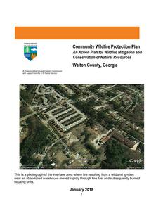
This is a photograph of the interface area where fire resulting from a wildland ignition near an abandoned warehouse moved rapidly through fine fuel and subsequently burned housing units.
January 2018
1
Includes jurisdictions of Walton County, the Cities of Monroe, Social Circle, Loganville, and Jersey, and the Towns of Walnut Grove, Good Hope, and Between. The following individuals have been involved in the creation of this document and mutually agree on its contents. County Commission Representatives Kevin Little, Chairman Signature ______________________
County Emergency Services Representative Donald McCullough, EMA Director Signature ______________________ Robert M. Moore, County Fire Chief Signature ______________________ Georgia Forestry Commission Representatives Orenthal Sanders, Chief Ranger, Morgan-Walton GFC Unit Signature ______________________ Carl Melear, CWPP Specialist Forest Protection Signature ______________________ Beryl Budd, Wildfire Prevention Specialist (2018 revision) Signature _______________________
2
PLAN CONTENTS
I. Objectives & Community Collaboration II. County information & Wildfire History III. County Base Maps IV. Wildland Urban Interface V. Community Assessments VI. Southern Wildfire Risk Assessment & Risk Hazard Maps VII. Prioritized Mitigation Recommendations VIII. Action Plan IX. Mitigation Assistance & Grant Information X. Glossary XI. Sources of Information
PAGE 4 6 12 15 18 19 23 27 30 31 33
Attachments:
Walton County Southern Wildfire Risk Assessment Summary Report (SWRA)
All information contained in this plan is electronically available from the Georgia Forestry Commission
3
I. OBJECTIVES & COMMUNITY COLLABORATION
A Community Wildfire Protection Plan (CWPP) provides a community with a road map to reduce its risk from wildfire. A CWPP is designed through collaboration between state and local fire agencies, homeowners and landowners, and other interested parties such as city councils, utilities, homeowners associations, environmental organizations, and other local stakeholders. The plan identifies strategic sites and methods for risk reduction and structural protection projects across jurisdictional boundaries.
Comprehensive plans provide long-term guidance for growth, reflecting a community's values and future expectations. The plan implements the community's values and serves to protect natural and community resources and public safety. Planning also enables communities to address their development patterns in the Wildland Urban Interface and determine how they can reduce their risk through alternative development patterns. The formal legal standing of the plan and its central role in local government decision making underscores the opportunity to use this planning process as an effective means for reducing wildfire risk.
The mission of the following plan is to set clear priorities for the implementation of wildfire mitigation in Walton County. The plan includes prioritized recommendations for the appropriate types and methods of fuel reduction and structure ignitability reduction that will protect this community and its essential infrastructure. It also includes a plan for wildfire suppression. Specifically, the plan includes community-centered actions that will:
Educate citizens on wildfire, its risks, and ways to protect lives and properties, Support fire rescue and suppression entities, Focus on collaborative decision-making and citizen participation, Develop and implement effective mitigation strategies, and Develop and implement effective community ordinances and codes.
Wildfire risk reduction strategies are most effective when approached collaboratively involving groups of residents, elected officials, community decision makers, emergency managers, and natural resource managers and when combined with effective outreach approaches. Collaborative approaches make sense as the initial focus of any community attempting to work toward wildfire risk reduction. In all Community Wildfire Protection Plan collaborations, the goal is to cooperatively identify problems and reach a consensus for mutual action. In the case of wildfire mitigation, a reduction in the wildfire risk to the community's lives, houses, and property is the desired outcome.
The collaborative core team convened on August 20, 2009 to assess risks and develop the Community Wildfire Protection Plan. The group is comprised of representatives from local government, local fire authorities, and the state agency responsible for forest management.
4
It was decided to conduct community assessments on the basis of the on high risk communities and the individual fire districts in the county. The core committee reconvened in January 2009 for the purpose of completing the following:
Risk Assessment
Assessed wildfire hazard risks and prioritized mitigation actions. The wildfire risk assessment will help homeowners, builders, developers, and emergency personnel whether the area needs attention and will help direct wildfire risk reduction practices to the areas at highest risk.
Fuels Reduction Identified strategies for coordinating fuels treatment projects.
Structure Ignitability
Identified strategies for reducing the ignitability of structures within the Wildland interface.
Emergency Management
Forged relationships among local government and fire developed/refined a pre-suppression plan.
districts and
Education and Outreach
Developed strategies for increasing citizen awareness and action and to conduct homeowner and community leader workshops. Outreach and education programs are designed to raise awareness and improve audience knowledge of wildfire risk reduction needs and practices. In the best cases, education and outreach programs will influence attitudes and opinions and result in effective action.
This plan should become a working document that is shared by local, state, and federal agencies that will use it to accomplish common goals. It is intended to become part of the County hazard mitigation plan. An agreedupon schedule for meeting to review accomplishments, solve problems, and plan for the future should extend beyond the scope of this plan. Without this follow up this plan will have limited value.
5
II. COUNTY INFORMATION & WILDFIRE HISTORY
Walton County, forty-five miles east of Atlanta in Georgia's Piedmont region, is the state's forty-third county. Comprising 329 square miles, it was created on December 15, 1818, from land originally held by both the Cherokee and Creek Indians and was named for George Walton, a signer of the Declaration of Independence and briefly a Georgia governor. (There was a previous Walton County created by the state legislature in 1803, but its location became part of what is now North Carolina when a dispute over the state line was settled in 1811.) The county seat is Monroe, where the current county courthouse (the third) was built in 1884; since that time the structure has undergone major restorations and additions.
According to the 2000 U.S. census, Walton County's population was 60,687 (83 percent white 14.4 percent black, and 1.9 percent Hispanic), an increase of 57.3 percent since 1990.
Communities
Monroe, first called Walton Court House, received its new name (honoring the fifth U.S. president, James Monroe) upon its designation as the county seat. The town was incorporated in 1821. Other incorporated communities are Between, Good Hope, Jersey, Social Circle, Walnut Grove, and part of Loganville.
Walton County Courthouse
The town of Between was incorporated in 1908, though it had been settled during the 1850s. The name was chosen for its location halfway between Monroe and Loganville. Good Hope and Jersey were incorporated in 1905. Good Hope bears the aspirations of its founders in its name. The first non-Indian residents arrived there during the 1830s, settling about a mile east of the town's current location. Jersey was first called Centerville, for its equidistance from the towns of Monroe, Covington (in Newton County), and Social Circle. During the early 1880s, when the townspeople were arranging for a post office, the discovery that another Centerville already existed prompted them to change the town's name. A local merchant and planter, T. M. Abercrombie, had recently imported a Jersey bull, which became the talk of the town, and a half-jokingly made suggestion that the community take its new name from the animal was accepted.
Loganville, incorporated as a town in 1887 and then as a city in 1914, was first called Buncombe. It was renamed in 1851 to honor an early settler, James Harvie Logan, who had arrived in 1842, bought sixty-two and a half acres, built a house, and set up shop as a shoemaker. Others soon settled nearby. Loganville is now one of the fastest-growing communities in Georgia, its population having increased by more than 70 percent between 1990 and 2000.
6
Social Circle was founded in 1820 by several men who obtained the
land by lottery. It was centered at the junction of two Indian trails
known today as Cherokee Road and Hightower Trail (perhaps a
corruption of Etowah). Incorporated in 1832 as a village and in 1869
as a town, Social Circle, situated at the highest point of the Georgia
Railroad, was a transportation hub for the area before the Civil War (1861-65). Its lines were destroyed during the war by Union general
Social Circle, 1898
William T. Sherman's troops on their March to the Sea, but the town recovered and prospered
after the war was over. Walnut Grove was incorporated in 1905 and has been the site of a U.S.
post office since 1850.
Economy
The first settlers in Walton County were almost all farmers, along with an occasional doctor or lawyer. But merchants soon arrived to do business in the area as well. Cotton, various grains, potatoes, and some tobacco were the main cash crops.
Cotton mills were the first industry to be established in the county, beginning in
the 1840s. These were soon followed by gristmills. Steam mills were
established just before the Civil War, but factory work did not become a
standard option for employment in the county until after the war. Despite the
postwar rise of industry in the county, many of the area's freed slaves became
sharecroppers. The 1890s saw a boom in the number of textile mills, leading
to prosperity and growth until the devastation wrought by the boll weevil, soil
McDaniel-
erosion, and the Great Depression of the 1930s caused an economic
Tichenor House downturn. The conversion from agriculture to industry picked up again during
World War II (1941-45), and the county recovered its economic strength by
embracing a diversified manufacturing base.
Points of Interest
There are twenty-seven sites in Walton County on the National Register of Historic Places. Nineteen of them are in Monroe, including nine historic districts, while the others are shared among some of the smaller towns. The McDaniel-Tichenor House in Monroe was restored as a house museum by the Georgia Trust.
The Briscoe House and Mill Site in Between (added to the register in 2000) now serves as a private dwelling. Also in Between, the James Berrien
Upshaw House was added in 1986. The William Harris Family Farmstead (added in 1982) is located in Campton, an unincorporated community.
Harris Farmstead
7
Good Hope has two registered sites: the Walter Jones "Rock House" (added in 1993) and the Casulon Plantation (added in 1975), dating from the early nineteenth century; the latter now serves as a museum as well as a dwelling. Jersey's "Bank of Jersey" (added in 1984) on Main Street is now in private hands. Social Circle boasts an entire historic district between Georgia 11 and Georgia 229, which was added to the register in 1980. Not on the register but worth noting in Social Circle is the Nebhut-Akridge-Gunter House (ca. 1840-55), also known as Gunter Hall, which serves as the headquarters of the Historic Preservation Society of Social Circle. Notable Residents Besides George Walton, six other Georgia governors had ties to Walton County, some by birth, some by residence. Alfred H. Colquitt, Henry McDaniel, and Clifford Walker were born in Walton County. Howell Cobb, Wilson Lumpkin--his daughter, Martha Wilson Lumpkin, for whom Atlanta was originally named "Marthasville," was born in Monroe--and Richard B. Russell Jr. resided in the county for a time. Mary Ethel Creswell, who in 1919 became the first woman to receive a baccalaureate degree from the University of Georgia, began her teaching career in Walton County in 1901. She worked for a time in Washington, D.C., as a field agent for the U.S. Department of Agriculture, becoming the department's first female supervisor. Creswell also became the first dean of the University of Georgia's School of Home Economics in 1933; she retired in 1945. Moina B. Michael, teacher, school and college administrator at the University of Georgia, and the originator of "Poppy Day," was born near Good Hope and did her first teaching in a log cabin on her father's plantation there. Michael, known as the "Poppy Lady," initiated the production and sale of paper poppies around 1915 to fund the rehabilitation of wounded soldiers, raising millions of dollars for the cause. (The paper poppies were sold and worn every Memorial Day in the United States and Europe for decades.) Poppies are still sold in Britain for Remembrance Day (Armistice Day), held on the second Sunday in November.
Poppy Day Stamp
8
Wildfire History
Wildland Fire is not a serious problem in Walton County when contrasted to other counties in Georgia. This is attributed to rapid response and excellent cooperation between local response stations and the Georgia Forestry Commission. The implementation and adoption of the burn permit system greatly reduced the number of wildland fires. The table below outlines fire numbers, acreages, and causes for the past complete fiscal year (2017) which ended on June 30, 2017. As is shown, residential debris burning was the leading cause of these wildfires during these past 5 fiscal years.
County = Walton
Cause
Fires
Campfire
Campfire
1
Children
Children
0
Debris: Ag Fields, Pastures, Orchards, Debris: Ag Fields, Pastures, Orchards,
Etc
Etc
0
Debris: Escaped Prescribed Burn
Debris: Escaped Prescribed Burn
2
Debris: Household Garbage
Debris: Household Garbage
1
Debris: Residential, Leafpiles, Yard, Etc
Debris: Residential, Leafpiles, Yard, Etc
6
Debris: Site Prep - Forestry Related Debris: Site Prep - Forestry Related
0
Incendiary
Incendiary
0
Lightning
Lightning
1
Machine Use
Machine Use
2
Miscellaneous: Fireworks/Explosives Miscellaneous: Fireworks/Explosives
0
Miscellaneous: Power lines/Electric fences
Miscellaneous: Power lines/Electric fences
0
Miscellaneous: Structure/Vehicle Fires Miscellaneous: Structure/Vehicle Fires
1
Smoking
Smoking
1
Undetermined
Undetermined
4
Totals for County: Walton Year: 2017
19
Acres
0.16 0.00 0.00 1.50 0.92 19.94 0.00 0.00 1.00 1.07 0.00 0.00 3.50 3.27 10.94 42.30
Fires 5 Yr Avg 1.00 1.20
0.60
1.40 0.80
2.40
0.20 1.80 0.20 0.80 0.20 0.40
0.20 0.20 1.60
13.00
Acres 5 Yr Avg 6.01 2.65
2.29
2.96 2.00
6.00
0.62 10.04 0.20 2.05 0.02 0.06
0.70 0.65 3.63
39.88
9
The table below reflects numbers, size, and average sizes for the past ten complete fiscal years (2007 2016) for Walton County. Average size is contrasted to the average size for all counties in Georgia.
Fiscal Year
2007 2008 2009 2010 2011 2012 2013 2014 2015 2016
Acreage Burned /Number of Fires For Walton County For FY 2007-2016
Acreage Burned Number of Fires Average Size
87.54
30
2.92
75.44
30
2.51
44.11
21
2.10
34.85
11
3.17
29.30
13
2.25
34.57
13
2.66
29.27
14
2.09
97.40
16
6.09
22.08
13
1.70
8.34
3
2.78
Statewide Average Size
18.64 4.56 3.90 3.93 17.56 5.08 4.53 5.02 4.42 6.29
Number of Fires by Cause for Walton County for FY 2007 to 2016
Year
Campfire Children
Debris Burning
Incendiary
Lightning
Machine Use
Misc.
Railroad Smoking
2007
1
3
9
4
2
8 0
3
0
2008
0
0
8
7
3
8 3
1
0
2009
0
4
6
1
3
4 1
1
1
2010
0
0
4
1
1
2 1
1
1
2011
1
2
5
3
1
1 0
0
0
2012
0
2
3
3
1
3 1
0
0
2013
1
3
5
2
0
0 3
0
0
2014
2
1
7
3
0
2 1
0
0
2015
1
1
5
4
0
0 2
0
0
2016
0
1
1
0
0
0 1
0
0
10
11
III. COUNTY BASE MAPS
12
13
14
IV. WILDLAND URBAN INTERFACE
There are many definitions of the Wildland-Urban Interface (WUI), however from a fire management perspective it is commonly defined as an area where structures and other human development meet or intermingles with undeveloped wildland or vegetative fuels. As fire is dependent on a certain set of conditions, the National Wildfire Coordinating Group has defined the wildland-urban interface as a set of conditions that exists in or near areas of wildland fuels, regardless of ownership. This set of conditions includes type of vegetation, building construction, accessibility, lot size, topography and other factors such as weather and humidity. When these conditions are present in certain combinations, they make some communities more vulnerable to wildfire damage than others. This "set of conditions" method is perhaps the best way to define wildland-urban interface areas when planning for wildfire prevention, mitigation, and protection activities.
There are three major categories of wildland-urban interface. Depending on the set of conditions present, any of these areas may be at risk from wildfire. A wildfire risk assessment can determine the level of risk.
1. "Boundary" wildland-urban interface is characterized by areas of development where homes, especially new subdivisions, press against public and private wildlands, such as private or commercial forest land or public forests or parks. This is the classic type of wildland-urban interface, with a clearly defined boundary between the suburban fringe and the rural countryside.
2. "Intermix" wildland-urban interface areas are places where improved property and/or structures are scattered and interspersed in wildland areas. These may be isolated rural homes or an area that is just beginning to go through the transition from rural to urban land use.
3. "Island" wildland-urban interface, also called occluded interface, are areas of wildland within predominately urban or suburban areas. As cities or subdivisions grow, islands of undeveloped land may remain, creating remnant forests. Sometimes these remnants exist as parks, or as land that cannot be developed due to site limitations, such as wetlands. (Courtesy Fire Ecology and Wildfire Mitigation in Florida 2004)
Walton County is typical of a county that is undergoing a rapid transition from an isolated rural county to one that is more developed. This is due in large part to the influence of the Athens Clarke County and Atlanta metropolitan areas. It contains mixtures of both boundary and intermix interface.
15
Wildland Urban Interface Hazards Firefighters in the wildland urban interface may encounter hazards other than the fire itself, such as hazardous materials, utility lines and poor access.
Hazardous Materials Common chemicals used around the home may be a direct hazard to firefighters from flammability, explosion potential and/or vapors or off-gassing. Such chemicals include paint, varnish and other flammable liquids; fertilizer; pesticides; cleansers; aerosol cans, fireworks, batteries and ammunition. In addition, some common household products such as plastics may give off very toxic fumes when they burn. Stay OUT of the smoke from burning structures and any unknown sources such as trash piles.
Illicit Activities Marijuana plantations or drug production labs may be found in wildland urban interface areas. Extremely hazardous materials such as propane tanks and flammable/toxic chemicals may be encountered, as well as booby traps.
Propane tanks Both large (household size) and small (gas grill size) liquefied propane gas (LPG) tanks can present hazards to firefighters, including explosion. See the "LPG Tank Hazards" discussion for details.
Utility lines Utility lines may be located above and below ground and may be cut or damaged by tools or equipment. Don't spray water on utility lines or boxes.
Septic tanks and fields Below-ground structures may not be readily apparent and may not support the weight of engines or other apparatus.
16
New construction materials Many new construction materials have comparatively low melting points and may "off-gas" extremely hazardous vapors. Plastic decking materials that resemble wood are becoming more common and may begin softening and losing structural strength at 180 F, though they normally do not sustain combustion once direct flame is removed. However, if they continue to burn they exhibit the characteristics of flammable liquids.
Pets and livestock Pets and livestock may be left when residents evacuate and will likely be highly stressed, making them more inclined to bite and kick. Firefighters should not put themselves at risk to rescue pets or livestock.
Evacuation occurring Firefighters may be taking structural protection actions while evacuations of residents are occurring. Be very cautious of people driving erratically. Distraught residents may refuse to leave their property, and firefighters may need to disengage from fighting fire to contact law enforcement officers for assistance. In most jurisdictions firefighters do not have the authority to force evacuations. Firefighters should not put themselves at risk trying to protect someone who will not evacuate!
Limited access Narrow one-lane roads with no turnaround room, inadequate or poorly maintained bridges and culverts are frequently found in wildland urban interface areas. Access should be sized-up and an evacuation plan for all emergency personnel should be developed.
17
V. COMMUNITY ASSESSMENTS
Personnel of the Morgan Walton office of the Georgia Forestry Commission conducted assessments of selected communities during late 2010 and early 2011. In all, 5 areas were assessed utilizing the Woodland Community Wildfire Hazard Assessment form 140. This form calculates community risk from wildland fire based on numerical scores in four hazard rating areas Subdivision design, Site hazard, Building Construction, and Additional factors. Communities are classified as being at extreme, high, moderate, or low risk. The following table contains information for the communities that were assessed. The locations of these communities are shown on the Wildland Fire Susceptibility Index map located in the appendix. Opportunities for community assessment still exist in Walton County. The original assessment forms are retained by the Morgan Walton Unit of the Georgia Forestry Commission. There are still numerous opportunities for assessment in Walton County.
Community Name or Location Clearwater Estates Appalachee Falls Windfield Chickadee Old Mill
Latitude 33 47' 47" 33 54' 07" 33 47' 55" 33 42' 37" 33 53' 13"
Longitude 83 39' 15" 83 40' 45" 83 39' 53" 83 41' 21" 83 38' 28"
Homes 120 +/90 +/90 +/-
18 37
score 115 82 75 75 72
Risk Category Moderate Moderate
Low Low Low
Jurisdiction Station 7 Station 9 Station 7 Station 11 Station 9
Wildland Urban Interface (WUI) is described as the area where structures and other human improvements meet and intermingle with undeveloped wildland or vegetative fuels
18
VI. SOUTHERN WILDFIRE RISK ASSESSMENT & RISK HAZARDS MAPS
The Southern Wildfire Risk Assessment tool, developed by the Southern Group of State Foresters, was released to the public in July 2014. This tool allows users of the Professional Viewer application of the Southern Wildfire Risk Assessment (SWRA) web Portal (SouthWRAP) to define a specific project area and summarize wildfire related information for this area. A detailed risk summary report is generated using a set of predefined map products developed by the Southern Wildfire Risk Assessment project which have been summarized explicitly for the user defined project area. A risk assessment summary was generated for Walton County. The SouthWRAP (SWRA) products included in this report are designed to provide the information needed to support the following key priorities:
Identify areas that are most prone to wildfire
Identify areas that may require additional tactical planning, specifically related to mitigation projects and Community Wildfire Protection Planning
Provide the information necessary to justify resource, budget and funding requests
Allow agencies to work together to better define priorities and improve emergency response, particularly across jurisdictional boundaries
Define wildland communities and identify the risk to those communities
Increase communication and outreach with local residents and the public to create awareness and address community priorities and needs
Plan for response and suppression resource needs
Plan and prioritize hazardous fuel treatment
Community Protection Zones map from the Walton County SWRA report
19
Wildland Urban Interface (WUI) map (above) WUI acres (bottom left) and population (bottom right) graphs
20
Wildland Urban Interface (WUI) Risk map (above) and WUI Risk Index Acres graph (below)
21
Fire Intensity map (above) and Flame Length map (below) 22
VII. PRIORITIZED MITIGATION RECOMMENDATIONS
Executive Summary
As North Georgia continues to see increased growth from other areas seeking less crowded and warmer climes, new development will occur more frequently on forest and wildland areas. Walton County will have an opportunity to significantly influence the wildland fire safety of new developments. It is important that new development be planned and constructed to provide for public safety in the event of a wildland fire emergency.
Over the past 20 years, much has been learned about how and why homes burn during wildland fire emergencies. Perhaps most importantly, case histories and research have shown that even in the most severe circumstances, wildland fire disasters can be avoided. Homes can be designed, built and maintained to withstand a wildfire even in the absence of fire services on the scene. The National Firewise Communities Program is a national awareness initiative to help people understand that they don't have to be victims in a wildfire emergency. The National Fire Protection Association has produced two standards for reference: NFPA 1144 Standard for Reducing Structure Ignition Hazards from Wildland Fire. 2008 Edition and NFPA 1141 Standard for Fire Protection Infrastructure for Land Development in Suburban and Rural Areas.
When new developments are built in the Wildland/Urban Interface, a number of public safety challenges may be created for the local fire services: (1) the water supply in the immediate areas may be inadequate for fire suppression; (2) if the Development is in an outlying area, there may be a longer response time for emergency services; (3) in a wildfire emergency, the access road(s) may need to simultaneously support evacuation of residents and the arrival of emergency vehicles; and (4) when wildland fire disasters strike, many structures may be involved simultaneously, quickly exceeding the capability of even the best equipped fire departments. In 2012 the International Code Council created the International Wildland Urban Interface Code to help reduce structure loss in high risk areas. The Code was adopted by Georgia State Legislature for use by Georgia counties to help reduce risk in the State.
The following recommendations were developed by the Walton County CWPP Core team as a result of surveying and assessing fuels and structures and by conducting meetings and interviews with county and city officials. A priority order was determined based on which mitigation projects would best reduce the hazard of wildfire in the assessment area.
23
Proposed Community Hazard and Structural Ignitability Reduction Priorities
Primary Protection for Community and Its Essential Infrastructure
Treatment Area
Treatment Types
Treatment Method(s)
1. All Structures
Create minimum of 30feet of defensible space**
Trim shrubs and vines to 30 feet from structures, trim overhanging limbs, replace flammable plants near homes with less flammable varieties, remove vegetation around chimneys.
2. Applicable Structures
Reduce structural ignitability**
Clean flammable vegetative material from roofs and gutters, store firewood appropriately, install skirting around raised structures, store water hoses for ready access, and replace pine straw and mulch around plantings with less flammable landscaping materials.
3. Community Clean-up Day Cutting, mowing, pruning**
Cut, prune, and mow vegetation in shared community spaces.
4. Driveway Access 5. Road Access
Culvert installation
Identify needed road improvements
See that adequate lengths of culverts are installed to allow emergency vehicle access.
As roads are upgraded, widen to minimum standards with at least 50 foot diameter cul-de-sacs or turnarounds.
Proposed Community Wildland Fuel Reduction Priorities
Treatment Area
Treatment Types
Treatment Method(s)
1. Adjacent WUI Lands
Reduce hazardous fuels
Encourage prescribed burning and understory mowing for private landowners and industrial timberlands particularly adjacent to residential areas.
Seek FEMA Pre-Disaster Mitigation Grants for WUI fuel reduction work around at-risk communities and infrastructure.
2. Railroad Corridors
Reduce hazardous fuels
24
Encourage railroads to better maintain their ROW eliminating brush and grass through herbicide and mowing. Maintain firebreaks along ROW adjacent to residential areas.
3. Existing Fire Lines
Reduce hazardous fuels
Work with the local Georgia Forestry Commission office to clean and reharrow existing fire lines.
Proposed Improved Community Wildland Fire Response Priorities
1. Water Sources
Dry Hydrants
Inspect, maintain and improve access to existing dry hydrants. Add signage along road to mark the hydrants.
Locate additional dry hydrants as needed.
2. Fire Stations
Equipment
Wildland hand tools. Lightweight Wildland PPE Gear. Investigate need for "brush" trucks near communities at risk.
3. Water Sources
Drafting equipment
Investigate need for additional drafting pumps.
4. Personnel
Training
Obtain Wildland Fire Suppression training for fire personnel to include S130, S190, and S215.
Ready Set Go training
**Actions to be taken by homeowners and community stakeholders
Proposed Education and Outreach Priorities
1. Conduct "How to Have a Firewise Home" Workshops for Communities-at-Risk Set up and conduct a workshop for homeowners that teach the principles of making homes and properties safe from wildfire. Topics for discussion include defensible space, landscaping, building construction, etc. Workshop will be scheduled for evenings or weekends when most homeowners are available and advertised through local media outlets.
Distribute materials promoting Firewise practices and planning through local community and governmental meetings.
25
2. Conduct "Firewise" Workshop for Community Leaders Arrange for GFC Firewise Coordinator to work with local community leaders and governmental officials on the importance of "Firewise Planning" in developing ordinances and codes as the county as the need arises. Utilize the International Wildland Urban Interface Code for developments in high risk areas. Identified "communities-at-risk", such as Clearwater Estates subdivision, should be sought after for inclusion in the National Firewise Communities Program.
3. Spring Clean-up Event
Conduct clean-up event every spring involving the Georgia Forestry Commission, Walton County Fire Departments, Cities, Homeowner Associations, homeowners, and landowners should be invited to attend. Set up information table with educational materials and refreshments. Initiate the event with a morning briefing by GFC Firewise coordinator and local fire officials detailing plans for the day and safety precautions. The National Wildfire Preparedness Day, sponsored by the National Fire Protection Association (NFPA) is held annually on the first Saturday in May. This would be an excellent time to hold an event. Activities may include the following:
Clean flammable vegetative material from roofs and gutters Trim shrubs and vines to 30 feet away from structures Trim overhanging limbs Clean hazardous or flammable debris from adjacent properties
4. Informational Packets Develop and distribute informational packets to be distributed by realtors and insurance agents. Included in the packets are the following:
Be Firewise Around Your Home Firewise Guide to Landscape and Construction Firewise Communities USA materials Fire Adapted Community materials Ready Set Go materials
5. Wildfire Protection Display
Create and exhibit a display for the general public at the local events. Display can be independent or combined with the Georgia Forestry Commission display.
6. Media Invite the local and regional news media to community "Firewise" functions for news coverage and regularly submit press releases documenting wildfire risk improvements in Walton County.
26
VIII. ACTION PLAN
Roles and Responsibilities The following roles and responsibilities have been developed to implement the action plan:
Role
Responsibility
Hazardous Fuels and Structural Ignitability Reduction
Walton County WUI Fire Council
Create this informal team or council comprised of residents, GFC officials, County Fire Department officials, a representative from the city and county government and the EMA Director for Walton County. Meet periodically to review progress towards mitigation goals, appoint and delegate special activities, work with federal, state, and local officials to assess progress and develop future goals and action plans. Work with residents to implement projects and Firewise activities.
Key Messages to focus on
1 Defensible Space and Firewise Landscaping 2 Debris Burning Safety 3 Firewise information for homeowners 4 Prescribed burning benefits
Communications objectives
Target Audiences
Methods
1 Create public awareness for fire danger and defensible space issues 2 Identify most significant human cause fire issues 3 Enlist public support to help prevent these causes 4 Encourage people to employ fire prevention and defensible spaces in their communities.
1 Homeowners 2 Forest Landowners and users 3 Civic Groups 4 School Groups 5 Homeowner Associations
1 News Releases 2 Personal Contacts 3 Key messages and prevention tips 4 Visuals such as signs, brochures and posters 5 Social media
27
Spring Clean-up Day (National Wildfire Preparedness Day, 1st Saturday in May)
Event Coordinator
Coordinate day's events and schedule, catering for cookout, guest attendance, and moderate activities the day of the event.
Event Treasurer
Collect funds from residents to cover food, equipment rentals, and supplies.
Publicity Coordinator
Advertise event through neighborhood newsletter, letters to officials, and public service announcements (PSAs) for local media outlets. Publicize post-event through local paper and radio PSAs.
Work Supervisor
Develop volunteer labor force of community residents; develop labor/advisory force from Georgia Forestry Commission, Walton County Fire Departments, and Emergency Management Agency. Procure needed equipment and supplies. In cooperation with local city and county officials, develop safety protocol. Supervise work and monitor activities for safety the day of the event.
Funding Needs
The following funding is needed to implement the action plan:
Project
Estimated Cost
Potential Funding Source(s)
1. Create a minimum of 30 feet of defensible space around structures
Varies
Residents will supply labor and fund required work on their own properties.
2. Reduce structural ignitability by cleaning flammable vegetation from roofs and gutters; appropriately storing firewood, installing skirting around raised structures, storing water hoses for ready access, replacing pine needles and mulch around plantings with less flammable material.
Varies
Residents will supply labor and fund required work on their own properties.
3. Amend codes and ordinances to provide better driveway access, increased visibility of house numbers, properly stored firewood, minimum defensible space brush clearance, required Class A roofing materials and skirting around raised structures, planned maintenance of community lots.
No Cost
To be adopted by city and county government. Utilize the International Wildland Urban Interface Code (IWUIC)
4. Spring Cleanup Day (National Wildfire Preparedness Day, 1st Saturday in May)
Varies
Community Business Donations.
5. Fuel Reduction Activities
$15 / acre FEMA & USFS Grants
28
Assessment Strategy
To accurately assess progress and effectiveness for the action plan, the Walton County WUI Fire Council will implement the following:
Annual wildfire risk assessment will be conducted to re-assess wildfire hazards and prioritize needed actions.
Mitigation efforts that are recurring (such as mowing, burning, and clearing of defensible space) will be incorporated into an annual renewal of the original action plan.
Mitigation efforts that could not be funded in the requested year will be incorporated into the annual renewal of the original action plan.
Continuing educational and outreach programs will be conducted and assessed for effectiveness. Workshops will be evaluated based on attendance and post surveys that are distributed by mail 1month and 6 months following workshop date.
The Walton County WUI Council will publish an annual report detailing mitigation projects initiated and completed, progress for ongoing actions, funds received, funds spent, and in-kind services utilized. The report will include a "state of the community" section that critically evaluates mitigation progress and identifies areas for improvement. Recommendations will be incorporated into the annual renewal of the action plan.
An annual survey will be distributed to residents soliciting information on individual mitigation efforts on their own property (e.g., defensible space). Responses will be tallied and reviewed at the next Walton County WUI Council meeting. Needed actions will be discussed and delegated.
This plan should become a working document that is shared by local, state, and federal agencies that will use it to accomplish common goals. An agreed-upon schedule for meeting to review accomplishments, solve problems, and plan for the future should extend beyond the scope of this plan. Without this follow up this plan will have limited value.
29
IX. MITIGATION ASSISTANCE & GRANT FUNDING
Community Protection Grant: US Forest Service sponsored prescribed fire program. Communities with "at-risk" properties that lie within ten miles of a National Forest, National Park Service or Bureau of Land Management tracts may apply with the Georgia Forestry Commission to have their land prescribe burned free-of-charge. Forest mastication, where it is practical with Georgia Forestry Commission equipment, is also available under this grant program.
FEMA Mitigation Policy MRR-2-08-01: through GEMA Hazard Mitigation Grant Program (HMGP) and Pre-Disaster Mitigation Program (PDM).
1. To provide technical and financial assistance to local governments to assist in the implementation of long term, cost effective hazard mitigation accomplishments.
2. This policy addresses wildfire mitigation for the purpose of reducing the threat to all-risk structures through creating defensible space, structural protection through the application of ignition resistant construction and limited hazardous fuel reduction to protect life and property.
3. With a completed registered plan (addendum to the State Plan) counties can apply for pre-mitigation funding. They will also be eligible for HMGP funding if the county is declared under a wildfire disaster.
Georgia Forestry Commission: Plowing and prescribed burning assistance, as well as forest mastication, can be obtained from the GFC as a low-cost option for mitigation efforts.
The Georgia Forestry Commission Firewise Community Mitigation Assistance Grants Nationally recognized Firewise Communities can receive up to $5000 grants to help address potential wildfire risk reduction projects. Grant submission can be made through local Georgia Forestry Commission offices or your Regional Wildfire Prevention Specialist.
The International Association of Fire Chiefs (IAFC) and American International Group, Inc. (AIG) offer grants to assist local fire departments in establishing or enhancing their community fuels mitigation programs while educating members of the community about community wildfire readiness and encouraging personal action.
30
X. GLOSSARY
Community-At-Risk A group of two or more structures whose proximity to forested or wildland areas places homes and residents at some degree of risk.
Critical Facilities Buildings, structures or other parts of the community infrastructure that require special protection from an approaching wildfire.
CWPP The Community Wildfire Protection Plan.
Defensible Space The immediate landscaped area around a structure (usually a minimum of 30 ft.) kept "lean, clean and green" to prevent an approaching wildfire from igniting the structure.
Dry Hydrant - A non-pressurized pipe system permanently installed in existing lakes, ponds and streams that provides a suction supply of water to a fire department tank truck.
FEMA The Federal Emergency Management Agency whose mission is to support our citizens and first responders to ensure that as a nation we work together to build, sustain, and improve our capability to prepare for, protect against, respond to, recover from, and mitigate all hazards.
Fire Adapted Community A community fully prepared for its wildfire risk by taking actions to address safety, homes, neighborhoods, businesses and infrastructure, forest, parks, open spaces, and other community assets.
Firewise Program A national initiative with a purpose to reduce structural losses from wildland fires.
Firewise Community/USA A national recognition program for communities that take action to protect themselves from wildland fire. To qualify a community must have a wildfire risk assessment by the Georgia Forestry Commission, develop a mitigation action plan, have an annual firewise mitigation/education event, have dedicated firewise leadership, and complete the certification application.
Fuels All combustible materials within the wildland/urban interface or intermix including, but not limited to, vegetation and structures.
Fuel Modification Any manipulation or removal of fuels to reduce the likelihood of ignition or the resistance to fire control.
Hazard & Wildfire Risk Assessment An evaluation to determine an area's (community's) potential to be impacted by an approaching wildland fire.
31
Healthy Forests Initiative - Launched in August 2002 by President Bush (following passage of the Healthy Forests Restoration Act by Congress) with the intent to reduce the risks severe wildfires pose to people, communities, and the environment.
Home Ignition Zone (Structure Ignition Zone) - Treatment area for wildfire protection. The "zone" includes the structure(s) and their immediate surroundings from 0-200 ft. Mitigation An action that moderates the severity of a fire hazard or risk.
National Fire Plan National initiative, passed by Congress in the year 2000, following a landmark wildland fire season, with the intent of actively responding to severe wildland fires and their impacts to communities while ensuring sufficient firefighting capacity for the future.
National Fire Protection Association (NFPA) - An international nonprofit organization established in 1896, whose mission is to reduce the worldwide burden of fire and other hazards on the quality of life by providing and advocating consensus codes and standards, research, training, and education.
National Wildfire Preparedness Day Started in 2014 by the National Fire Protection Association as a day for communities to work together to prepare for the approaching wildfire season. It is held annually on the first Saturday in May.
Prescribed Burning (prescribed fire) The use of planned fire that is deliberately set under specific fuel and weather condition to accomplish a variety of management objectives and is under control until it burns out or is extinguished.
Ready, Set, Go - A program fire services use to help homeowners understand wildfire preparedness, awareness, and planning procedures for evacuation.
Southern Group of State Foresters Organization whose members are the agency heads of the forestry agencies of the 13 southern states, Puerto Rico and the Virgin Islands.
Stakeholders Individuals, groups, organizations, businesses or others who have an interest in wildland fire protection and may wish to review and/or contribute to the CWPP content.
Wildfire or Wildland Fire An unplanned and uncontrolled fire spreading through vegetative fuels.
Wildland/Urban Interface - The presence of structures in locations in which the authority having jurisdiction (AHJ) determines that topographical features, vegetation, fuel types, local weather conditions and prevailing winds result in the potential for ignition of the structures within the area from flames and firebrands from a wildland fire (NFPA 1144, 2008 edition.
32
XI. SOURCES OF INFORMATION
Publications/Brochures/Websites: FIREWISE materials can be ordered at www.firewise.org Georgia Forestry Commission www.georgiafirewise.org Examples of successful wildfire mitigation programs can be viewed at the website for National Database of State and Local wildfire Hazard Mitigation Programs sponsored by the U.S. Forest Service and the Southern Group of State Foresters www.wildfireprograms.com Information about a variety of interface issues (including wildfire) can be found at the USFS website for Interface South: www.interfacesouth.org Information on codes and standards for emergency services including wildfire can be found at www.nfpa.org Information on FEMA Assistance to Firefighters Grants (AFG) can be found at www.firegrantsupport.com Information on National Fire Plan grants can be found at http://www.federalgrantswire.com/national-fire-plan--rural-fire-assistance.html Southern Wildfire Risk Assessment website SouthWRAP www.SouthernWildfireRisk.com Fire Adapted Communities www.fireadapted.org Ready, Set, Go www.wildlandfirersg.org National Wildfire Preparedness Day www.wildfireprepday.org
Appended Documents:
Walton County Southern Wildfire Risk Assessment Summary Report (SWRA)
All files that make up this plan are available in an electronic format from the Georgia Forestry Commission.
33
Georgia Forestry Commission 5645 Riggins Mill Rd. Dry Branch, GA 31020 1-800-GA-TREES www.GaTrees.org
The Georgia Forestry Commission provides leadership, service, and education in the protection and conservation of Georgia's forest resources. An Equal Opportunity Employer and Service Provider
34