


- Collection:
- Georgia Government Publications
- Title:
- DNR outdoor report, vol. 4, no. 4 (Fall 1989)
- Creator:
- Georgia. Department of Natural Resources. Communications Office
- Contributor to Resource:
- Georgia. Department of Natural Resources. Communications Office
- Publisher:
- Brunswick, GA : Georgia. Department of Natural Resources. Communications Office
- Date of Original:
- 1989-10
- Subject:
- Georgia
- Location:
- United States, Georgia, 32.75042, -83.50018
- Medium:
- publications (documents)
- Type:
- Text
- Format:
- application/pdf
- Description:
- Vol. 1, no. 1 (July 1986)-v. 6, no. 2 (spring/summer 1991).
Title from cover.
Place of publication varies. - External Identifiers:
- Call Number GA N200.C6 P1 O9 4/4
- Metadata URL:
- https://dlg.galileo.usg.edu/id:dlg_ggpd_i-ga-bn200-pc6-bp1-bo9-b4-s4
- Digital Object URL:
- https://dlg.galileo.usg.edu/do:dlg_ggpd_i-ga-bn200-pc6-bp1-bo9-b4-s4
- Language:
- eng
- Holding Institution:
- University of Georgia. Map and Government Information Library
- Rights:
-

Give Wildlife
Chance
CHECK YES FOR WILDLIFE
For the fU'St time, Georgia's state income tax form will bave a checkoff for nonpme wildlife. lbere are over 1,120 species of wildlife in Georgia. Currently 66 plants and 27 species of animals are in danger of becoming extinct. You can help. O!eck yes on your state income tax form and make a contribution to tbe Georgia Nongame Wildlife Fund. The Department of Natural Resources will use your contribution to expand programs designed to protect
nongame wildlife.
Included are projects to reintroduce eagles, falcons, and ospreys to Georgia, build bl\lebird nest boxes; conduct
endangered plant surveys; protect valuable habitat; build nongame trails and observations platforms in State parks
and wildlife management areas; protect sea t\lrtle nests; and prepare educational materials for scbool children.
Your help is vital to the survival of tbe natural resources tbat are a part of tbe quality of life Georgians hope to
enjoy for years to come.
...
Support Georgia's Nongame Wildlife Fund
Georgia Department of Natural Resources
Suite 1258-East Tower 205 8\ltler Street, S.E.
Atlanta, GA 30334 ( 404)6S6-0772
DNR
Outdoor Report
Contents
Vol. 4, No.4
Fall 1989
Features
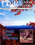
Canada geese have been restored in Georgia. Story, page 2. (Photo, Herb Cawthorne.)
2 Canada Goose Restoration
The state's successful Canada goose restoration program gives Georgia hunters their first goose hunting season, this January
6 Indian Recognition in Georgia State Parks and Historic Sites
From celebrations of the Cherokee to the Guale that once inhabited the coast, state parks offer informative, enjoyable Indian awareness progams
10 Canoe the Okefenokee
The "land of the trembling earth" isn't as formidable as it is beautiful, especially in autumn, as the weather cools.
14 Dune Stabilization
Successful beach renourishment and stabilization projects are preserving recreation on Tybee Island.
18 Finding Groundwater
DNR' s north Georgia groundwater program is yielding valuable information about water from underground, in a region dependent on lakes, rivers and streams
Departments
Calendar
20
'How To' Page 13
Naturally Delicious
5
Film & Video
17
Georgia's DNR Outdoor Report is published quarterly by the Communications Office of the Georgia Department of Natural Resources to promote a better understanding of DNR management and conservation programs. The magazine is distributed as a public service to county and municipal governments, public libraries and schools.
J. Leonard Ledbetter, Commissioner Katherine Thurber, Communications Director Deborah Dewberry Managing Editor Omar Rasheed, Graphic Production Artist. Regular contributors: Lisa Dudley Gib Johnston , Lucy Justus, Kathy Matthews, Thomas Smith , Dottie Sweat.
For information. write: DNR Outdoor Report , Georgia Department of Natural Resources, 205 Butler St. S.E . Suite 1258 , Atlanta , Ga. 30334 .
Joe Frank Harris Governor
J. Leonard Ledbetter Commissioner
The Board of Natural Resources
James (Herb) Butler Chairman, Member-at-Large
James Griffin, Jr. Vice-Chairman, Member-at-Large
Patricia C. Edwards Secretary, Third District
Dolan E. Brown, Jr. First District
J. Leonard Eubanks Second District
Linda S. Billingsley Fourth District
E.R. Mitchell, Jr. Fifth District
Felker W Ward, Jr. Sixth District
C.W (Sonny) Jackson Seventh District
Curtis Farrar Eighth District
Donald J. Carter Ninth District
C. Tom Griffith Tenth District
Glenn E. Taylor Member-at-Large
John Lanigan Member-at-Large
Will D. (Billy) Herrin Coastal District
I
Canada
Goose Restoration
:~ ~~.~- ----.!(-,~....,1_C.;,..~.~i.. . ...~~_..,..._.. II' I
The giant Canadas (right) are favorable as the basis for a
southern flock because of their high resistance to a wide variety
of climatic conditions.
2
T he very thought of goose hunting brings to mind a blustery winter day with a sky that matches the grey of the fog rising from the water. Far beyond the fog. a duck squawks and from somewhere else. a winter wren calls. In front of the blind, decoys are carefully placed. The hunters, impatiently awaiting the incoming flocks. sip hot black coffee to fend off the cold. Guns arc loaded and ready, and the retriever naps restlessly in the comer of the blind. The wind picks up. and a light. misting rain falls.
Suddenly from the fog comes the sound of geese in flight. and soon the unmistakable "V" formation appears. Cold and rain are immediately forgotten. as the hunters intently watch the birds home in on the decoys.
It is a scene unfamiliar to most Georgia hunters since, traditionally. Georgia is not on any of the major goose flyways. Goose hunting is of places named Matamuskeet, Cape Girardeau and Chesapeake, not Oconee. Clark's Hill and Juliette. That has changed. but not because of a change in the migratory patterns of geese. Making goose hunting available in Georgia took 15 years of hard work and planning on the part of the Department of Natural Resources' (DNR) Game Management section. And the result is the first hunting season specifically for Georgia geese.
By Gib Johnston
The work began in 1974 when biologists from the Tennessee Valley Authority, in cooperation with the U.S. Forest Service, the U.S. Fish and Wildlife Service and DNR, made an attempt to introduce Canada geese to the lakes of the Tennessee Valley. These included the north Georgia lakes of Chatuge. Nottely and Blue Ridge. The goal of the project was to establish a large, "localized" goose population in the Tennessee Valley.
The geese were the special Giant Canadas, the largest of the species. Giant Canadas have one peculiar trait that makes them desirable as a basis for a southern flock. These birds winter farther north and breed farther south than the other races. Their wide climatic tolerance makes them ideal for stocking in the south.
This bird suffered from the rise of agriculture in the 19th and early 20th century and was thought to be extinct until 1962. when a small flock was found in the upper midwest. Using these birds as breeding stock. federal. state and private organizations have worked to establish other flocks in other locations. The TVA project was part of this effort.
.._
Life Cycle
Canada geese reach sexual maturity in two to three years and select a mate. Geese usually mate for life but often take another mate if one or the other dies. In a nest near the
water the female lays a clutch of two to nine eggs. They prefer to nest on small islands and peninsulas since these afford a measure of protection from predators.
The eggs are incubated for 28-30 days . During incubation the gander (male) stays nearby and aggressively defends the nest. A mature Canada goose is a formidable match for all but the most determined of predators. The goslings are able to swim soon after hatching and follow their parents as they forage for food. The adults are very protective and one of them is constantly on watch as the others feed. When the group moves about on land and water, the goslings are typically accompanied by both parents. The goslings will remain with their parents until the next spring when the youngsters depart. It is common to see large flocks of predominately adolescent geese. After the adults hatch and rear a new brood, it is common for the young of the previous year to rejoin the family group and remain until they reach sexual maturity and select their own mate . All Canada geese are vegetarians and feed on grass , grain, shoots , aquatic plants and weeds.
When wildlife biologists of the Department of Natural Resources began the state's program to build a resident tlock of Canada geese in 1975, there were reports of flocks of geese in mid-Atlantic states that did not migrate . It had long been suspected that some
The state's successful Canada Goose restoration program gives Georgia hunters their first goose hunting season, this January.
of the migration habits of waterfowl are in response to the availability of winter feed. The theory was that if sufficient food and habitat were available, there would be no reason for the birds to leave . The resident tlocks in New York, New Jersey Pennsylvania, Maryland and Virginia gave some validity to these suspicions.
In these mid-Atlantic states , the status of the goose is quite different. There , geese have taken to city parks, state parks , private lakes and golf courses. They have lost their fear of humans to the extent that they have taken over the small pond on the grounds of one of Philadelphia' s major medical centers. They foul the fairways and greens of the finest country clubs. A majority of the nuisance wildlife complaints made to conservation departments in these states concern Canada geese.
Restoring the Birds
In 1975, 20 pairs of Giant Canada geese were pinioned and placed in a large fenced area on Clark's Hill Reservoir to see if the birds would breed and nest there. They did, but since most of the nests were on the shore
of the lake, the spring and early summer rains flooded most of them. The project failed that year but as a result , biologists learned that the geese would nest and rear young in Georgia and that the use of floating nesting structures was imperative.
During 1976-1977 additional attempts were made , this time being mindful of water fluctuations and predation on nests and goslings. There was no doubt in anyone ' s mind that the restoration would work. All that was needed was a large supply of geese to bring to Georgia as a basis for the resident tlock.
New Jersey and Pennsylvania conservation authorities were contacted by DNR, with an offer to remove some of the nuisance geese . The offer was greeted with hearty acceptance. An ideal agreement for both states was made, by which one party was relieved of a problem and the other was provided with a very desirable commodity
Each June for the next I0 years, tlatbed trucks loaded with turkey crates and manned by DNR Game Management personnel would make the long trek north to return with as many geese as could safely be loaded on the trucks. These were not the Giant Can-
3
The hunt will be carefully studied in 1989 to determine the future of goose hunting in Georgia.
ada race, but probabl y an intergrade of the Atlantic and Interior races. But. these flock s were not migratory and were deemed suitable for stocking in Georgia.
Game bio logists from the host state willingly ass isted the Georgia group. They had selected the fl ock to be captured and the traps were ready to be placed when the caravan arrived from the south. However the warmest welcome was from the golfers , who were often anxio us to help with the catching and loading of the geese.
Trapping the fli ghtless geese is a rather si mple matter During the early summer just after the nesting season. geese begin the process of repl aci ng all their feathers , including the primaries. or fli ght feathers . of the ir wings. Hence. for a three-to-four-week period they cannot fl y During thi s fli ghtless peri od , geese congregate in large groups or remain ncar water to protect themselves from predators.
An area is se lected where the birds are plentiful. Two long fences of chicken wire or netting arc erected side by side. as much as 200 yards apart at one end . and narrowing to a few feet at the other The geese are driven much like cattle or sheep toward the wide mouth of the trap . They move between the ever narrowi ng fences. through the small opening and into a holding pen. From there. they are caught by hand. and transferred to the turkey crates stacked o n the trucks. To avo id undue heat stress on the birds , the
4
trapping is done late in the day and most of the drive back to Georgia is made at night. The birds seem to do well during the 18hour drive home.
Mid-mornin g, the next day the birds arc unloaded and pl aced in large encl osures on the shores of Lakes West Po int and Clark's Hill. They re main in these enc losures for a few days to recover from the ri gorous trip. While there, the sex is determined and they are marked with numbered leg bands, and di vided into gro ups for distribution across the state.
For the first few years of the program. geese were stocked only on public waters. but it soon became evident that the geese would rather se lect their own nesting sites. Pri vate lakes and ponds near the stocking sites soon had their own small flocks of geese. and the birds continued to spread further each year
Geese were then offered to the owners of suitable pri vate ponds, and by 1988 the res ident flock of Canada geese in Georgia numbered 25 ,000 birds. They were thriving and reproduction was good . The need to import geese from the north no longer existed. A shipment of 9 10 birds from New Jersey in summer of 1988 was the last. The program had imported 12.000 birds and most suitable habitat was occupied . New habitat was being occupied by newly paired geese searchin g for nestin g sites.
As the original plan dictated. the birds
were establi shed in Georgia to offer waterfowl hunters the opportunity to hunt Canada geese and to afford others the thrill of seeing this magnificent bird in the wild. One of the goals was accomplished and the time was at hand to see to the other
Since the fl ock was well established in many parts of the state and reproduction was good, biologists reported to the Board of Natural Resources that a limited number of geese could be taken from the flock without danger to the goose popul ation in Georgia . A limited hunting season was recommended. The Board concurred with the biologist's findings and amended hunting rules and regulations to allow a very limited number of these birds to be taken during the 19891990 hunting season.
Hunters are to be selected at random by computer from those who apply to DNR' s Game and Fish Division for a permit. Hunting will not take place statew ide , but in six carefully selected hunt zones. A quota has been set for each of these zones based on the population of geese there and their relative breeding success. Only I , 150 permits will be issued and the season is onl y for the week of January 13 through January 20, 1990 . The bag limit is one Canada goose per seaso n.
Historically Georgia has never been a goose hunting area because we are off the major goose flyways. A few geese have always wintered in Georgia but they are what birders call accidentals those that are here due to some abnormal environmental conditions elsewhere. Some years they come in , others they do not. Although a few of these have been taken by hunters in the past, goose hunting in Georgia depends on the success or failure of o ur resident Canada goose flock.
The hunt this season will be carefully studied . Each bird killed will be carefully examined by waterfowl bio logists. From the data gathered. the future of goose hunting in Georgia will be determined.
A Successful Program
The program 's success comes as no surpri se to bio logists. Four years ago, biologists knew the program would succeed when the Game and Fish Divi sion received a call from a country club on the outskirts of Atlanta. The grce nskeeper called to complain about the nuisance geese on hi s golf course and to ask how to get rid of them. However complaints have been few and most landowners who have geese on their property guard them jealously They revel in the knowledg~that geese are nesting and rearing young on their pond and they carefully watch the progress of the goslings.
The Canada goose restoration program has been almost textbook perfect, and is a tribute to modern wildlife manage ment , of which all Georgians should be proud .
Holiday Recipes From the Vann House & Traveler's Rest
The historic Vann House in Spring Place, Ga., near Chatsworth, was built in 1804 and was home to two of the most prominent Cherokee nation leaders --James Vann and his son Joseph Vann. The Vann House offers the following traditional recipe to cheer your holiday table:
Vann House State Historic Site
1 c. sugar 1 1/4 tsp. cinnamon 118 tsp. ground cloves 114 tsp. ginger
Old Fashioned Pumpkin Pie
114 tsp. nutmeg
3/4 c. milk
1 tsp. salt
3 egg whites
3 egg yolks
1 unbaked pie shell
1 1/2 c. pumpkin
Mix sugar, spices and salt. Add beaten yolks to pumpkin. Mix with spices and milk. Fold in stiffly-beaten egg whites and pour into unbaked pie shell. Bake 10 minutes at 450 degrees F, then reduce heat to 350 degrees and bake until filling is firm. Test with knife.
-Dixie Jones, Chatsworth-Murray County Chamber of Commerce
Traveler's Rest, also known as Jarrett Manor, in Toccoa, was a frontier fort and stagecoach inn, post office and plantation home in its day. Built in 1784, it is believed to be the oldest building still standing in Northeast Georgia. This national historic landmark offers a recipe as unique as its history:
1 c. butter or margarine 2 tsp. vanilla 2 c. sugar 3 large eggs 3 c. self-rising flour
Granny's Tea Cakes
Cream sugar and butter, add eggs one at a time, mixing well each time. Add vanilla and flour, mixing well. Divide into three parts, taking one part at a time and placing on heavy floured board. Knead in just enough flour to roll out, cut and bake in 375 degree oven until light brown. --Frances Wilbanks, Traveler's Rest
5
Indian Recognition
In Georgia State Parks & Historic Sites
F or thousands of years before European settlers arrived, Indian tribes such as the Etowah, Creek, Yuchi , Guale , Shawnee and the well-known Cherokee , occupied Georgia. Visitors who wish to experience and understand the traditions of these native Americans are encouraged to explore historic sites where these remarkable people once flourished .
Each October, Georgia ' s state parks and historic sites sponsor events and host celebrations in recognition of the diverse cultures of the native American Indian. " The public has shown more interest in the role native Americans have played in Georgia in recent years, " says Ed Reed, historic interpretive specialist for the Department of Natural Resources ' State Parks and Historic Sites Division. "People are looking for ways to study Indian heritage. The observance of the sequincentennial (I 50th) anniversary of the Cherokee Trail of Tears sparked heightened interest in"'lative American culture not only in Georgia, but nationally as well.
Programs offered yearly that teach the native American way of life include Indian cultural festivals and pow-wows, activities like blow-gun and flint-knapping demonstrations, atl-atl throwing competitions and native American games. Special indian foods such as fry bread, tacos and corn soup are popu-
6
Ceremonial dancing and hoop dancing are popular at Indian cultural festivals in state parks. Above an effigy at Etowah's Museum .
From celebrations of the Northwest Georgia Cherokee, to the Guale that once inhabited the coast, state parks offer
informative, enjoyable Indian awareness programs.
By Lisa Dudley
lar during celebrations. According to Chuck Gregory, chief interpretive naturalist
for DNR, the Department's programs are wonderful teaching vehicles in that they present numerous natural awareness concepts that DNR wants to promote among the public, including conservation, recycling , and the use of materials from the land.
Indian Recognition Month programs began, statewide , about five years ago. According to Reed, festivals were usually held during October ' DNR is committed to hosting authentic Indian celebrations, so we felt it was necessary to perform and carry out traditions the way native American predecessors did. ''
Parks and Sites Rich in Indian Culture
Several parks and historic sites are especially steeped in Indian culture and awareness. Georgia's 15 public native American sites are open to the public, and seven of these are owned and operated by DNR's Parks, Recreation & Historic Sites Division. These sites include: Chief Vann House and Fort Mountain State Park , in Chatsworth; New Echota in Calhoun; Etowah Indian Mounds in Cartersville; Kolomoki Mounds State Park in Blakely; Indian Springs State Park
in Jackson; and Fort King George Historic Site in Darien. Other Indian cultural centers in Georgia include the John
Ross Home in Rossville , Eatonton ' s Rock Eagle Effigy Mound, Track Rock Gap in Union County, Rood Creek Mounds on Lake Walter F George in South Georgia , the Museum of Arts and Sciences in Columbus , the Chieftains Museum in Rome, the Georgia State Museum in Atlanta , and Macon ' s Ocmulgee National Monument.
New Echota Historic Site
In 1838, the small northwest Georgia community of New Echota , national capital of the Cherokee nation , was uninhabited. The Cherokee people, once considered the primary tribe in this area, had been disbanded and removed west to Oklahoma. But today, there is a new feeling of hope and rejuvenation regarding the Cherokee here.
In September, a huge celebration and reflection of Cherokee traditions took place as people gathered at New Echola for the annual Cherokee Indian Day program and festivities. This special 'homecoming" day is an educational experience for all who attend and is one of the largest, mostattended Indian culture festivals sponsored by DNR. This year's Cherokee Indian Homecoming Day drew over 2,000
7
The interior of a teepee invokes the traditional Cherokee way of life
participants, according to Frankie Mewborn , superintendent of New Echota.
Cherokee Indian Day festivities include demonstrations of traditional and fancy dancing , basketweaving , pottery and beadmaking. Visitors may also experience activities such as fingerweaving, woodcarving, and blow-gun shooting.
New Echota once served as the national headquarters for the Cherokee nation. The vast lands the Cherokee called home covered present-day northwest Georgia, western North Carolina , eastern Tennessee and northeastern Alabama. Five historic buildings along with a museum are located on the site. Visitors can tour reconstructed structures such as the 1827 Cherokee Phoenix printing press office and 1829 Cherokee National Supreme Court building. The 1828 mission station , an 1830' s log dwelling house and an 1805 Vann Tavern are some of the original buildings present at New Echota.
On December 16, New Echota will host its annual New England Christmas. Visitors will take part in a traditional Colonial Christmas, with decorations , food, carols and a yule log ceremony at the 1828 home of the New England missionary Samuel Worcester There is a small admission fee for the event.
Indian Springs State Park
While traveling south on Interstate 75 , Indian enthusiasts will be delighted with one of Georgia's . and the nation ' s,
8
oldest recreational parks, Indian Springs . An 1825 treaty between the Creek Indians and the United States established Indian Springs as a place for public recreation. Located in Jackson , Ga. , this 523-acre park hosted over 580,000 visitors during fiscal 1989. One of Indian Springs ' more distinctive features is the park's water, which is rich in minerals and nutrients. This water was very important to the Creek Indians who lived in the region , and used it for centuries to heal the sick and impart extra vigor to those who were well. The park also features a I05-acre lake, named after Creek Chief Mcintosh , as well as a beach , miniature golf, pedal and fishing boat rental. Overnight accommodations include 90 tent and trailers sites and 10 cottages. Indian Springs' museum depicts the Creek way of life and tells the story of the Civilian Conservation Corps ' involvement in the park.
Kolomoki Mounds Historic Park
Just six miles north of Blakely off U.S. 27 seven picturesque mounds stand starkly against the landscape , representing the history of cultures kmg past . Kolomoki Mounds State Park , designated by the U.S. Department of the Interior as a National Historic Landmark , is located on I ,293 acres of land inhabited during the 12th and 13th centuries by the Swift Creek and Weeden Island Indians. These mounds house the oldest great temple mounds in the state , two burial mounds and four ceremonial mounds.
Visitors will have the opportunity to choose from two lakes-Lakes Yahola and Kolomoki are both located in the park. Outdoor activities include picnicking, swimming and fishing . Nature trails, miniature golf and boating may also be enjoyed at the park. Indian Artifact Identification Day , usually held in October, is a native American program featuring artifact identification , flintknapping , and weapon demonstrations, along with a tour 6'f the mounds .
Fort King George Historic Site
For travelers visiting Georgia's barrier islands to experience the traditions of coastal native Americans, Fort King George Historic Site provides the perfect get-away excursion . Fort King George, located in Darien, is a popular spot for learning about the Guale (pronounced , " Wally") Indians that lived in the region . Fort King George is situated on the Altamaha Bluff, and was famous for its Indian and Spanish occupation. Visitors to this historic site will learn about the Indian village that thrived from approximately 3,000 B.C . through the late 1600's. Between 1721 and 1732, however, Fort King George was the southernmost outpost of the British Empire in North America.
The site features a museum that chronicles the Guale Indians, Spanish Missions, the construction of Fort King George , the Scots of Darien, and the 19th century sawmilling period during which Darien was a major seaport. A special event hosted by Fort King George as part of the Indian Recognition month is the Night at Old Fort King George, held this year in early October 'This program is popular because it gives visitors a picture window into the past, says Ken Akins, site superintendent. 'It also gives a glimpse of what the first inhabitants in coastal Georgia were like ."
Living history programs presented to school groups teach the traditions of the Guale more as shell gatherers than hunters . These people spoke a language separate from that used by most Muscogan tribes, such as the Creek.
The blockhouse at Fort King George
Burial mounds at Kolomoki are accessible to visitors
" Early settlers owe their survival in the colonies in north America to the Indians, ' says Akins. 'They were taught how to grow foods , and learned about protection from outsiders from the Guale. During 1989, pub! ic attendance at Fort King George increased 67 percent over the previous year, partly because of reconstruction of the fascinating 1725 blockhouse. According to Akins , the building is a typical 1700' s British frontier fortification , and made it difficult for the area to be stormed by land.
Annual special events at Fort King George include living history demonstrations and guided tours of the site's reconstructed fort . Several canoe trips offered by the historic site are excellent for teaching native American heritage. Visitors travel down the scenic Altamaha River and explore the lush vegetation and natural beauty of the area. Canoeists during the 1989 season experienced history-in-the-making as excavations of several Indian mounds dating 600 to 800 years old were revealed. 'It is important during these canoe trips that the DNR staff interpret native American life and explain the major role the river played in the lives of the Guale," says Akins.
For more information about Indian Recognition Month and native American programs offered in Georgia state parks , contact your nearest park or historic site or call the Communications Office at (404) 656-3530 ; or call tollfree inside Georgia at I-800-3GA-PARK, outside Georgia , dial I-8005GA-PARK.
9
Take a Hike!
Or a Canoe
Through the Okefenokee
By Kathy L. Matthews
B lack water reflects the deep blue autumn sky Spanish moss bows low as if to salute neighboring birch and blackgum trees. Cypress trees appear to be on fire with leaves of brilliant orange. From the sandy shore of a nearby island an alligator bellows . A lone canoe glides through the placid waters leaving only the occasional bubble of peat floating to the water's surface in its wake.
Stephen C. Foster State Park is located on 80 acres inside the 396,000 acre Okefenokee Wildlife Refuge. One of the few State Parks located within the boundaries of a National Natural Landmark , the park offers a perfect base for wildlife observation and outdoor recreation. The park is named after well-known songwriter Stephen Foster, and is located
10
on Jones Island , one of the prime entrances to the fabled Okefenokee Swamp.
Visitors to Stephen C. Foster State Park can take a hike on the park's elevated boardwalk or they can take a canoe along 25 miles of p~blic day use waterways accessible from the park. Overnight permits are available through the National Wildlife Refuge so that"4:anoeists and campers can explore the 125 miles of marked canoe trails and camp on one of the islands or outdoor platforms located throughout the reserve area . Rental canoes and motor boats are available through the park . Private boats with no more than I0 horsepower are permitted and may launch at the park's launch ramp.
The diverse wildlife in the Okefenokee is of special interest. Raccoons and alligators are plentiful. hut seldom approach people.
Sightseeing tours led by park interpretive naturalists are offered when water levels permit. April through Labor Day tours depart four times daily From Labor Day through March , tours are offered at 10:00 a.m . and 2:00 p.m. and on weekends at 9:00a.m ., Noon , and 3:00p.m .
Abundant Wildlife and Unspoiled Beauty
Lush vegetation, abundant wildlife and the pristine beauty of the area will inspire amateur and professional photographers. Birders will enjoy the chance to see many of the 234 species of birds indigenous to the area, ranging from the Florida Sandhill Crane to the endangered Red-Cockaded Woodpecker. Fall marks the beginning of the migration season, bringing even more varieties of birds to the area . Hikers can discover historic and wild areas of the swamp's islands.
" Most people envision a swamp as a dark , spooky, overgrown area dotted with quicksand , and writhing with snakes and man-eating alligators, " says David Wallace, park superintendent. " When visitors get to the park, they often ask where the swamp is . It isn ' t as wild as they thought it would be .
Estimated to be over 7,000 years old, the 438 ,000-acre Okefenokee Swamp consists of wetland forest, shallow water-
ways and lakes and sandy islands dispersed throughout. The islands are speculated to once have been sandbars created by ocean waves. No quicksand ex ists within the area.
The bottom of the swamp is covered with decaying plant debris, or peat. With an accumulation rate of about one inch per year, the peat varies in thickness from a few inches to 14 feet. As the peat decays, carbon dioxide methane , commonly called 'swamp gas ," is released. The rising bubbles of gas break the peat , which floats to the surface of the water to form " blowups. " The accumulated debris soon begins to sustain plant life. These fl oating patches are called " batteries" when covered with grass and small shrubs. As peat continues to float to the surface and amass, the buildup begins to take on the appearance of an island . When trees, plants and animal s begin to inhabit the amassed peat , the area becomes known as a " house. ' These " houses " appear to be stable islands but are not , often undulating underfoot. It is the soft surface of these " houses " for which the swamp is named. Indians named thi s fl oating peat they mistook for land " okwa fenagua,' translated, " land of the terrible , or trembling , earth. '
The continual succession of peat leaves waterways progressively more shallow and narrow Waterways currently include
11
A canoe trip through the swamp affords a good view of blooming water fillies
only one percent of the total area of the Okefenokee and average in depth only three to five feet. Lakes contained in the swamp average 9 to 12 feet deep. As 'houses" claim much of the wetland in the natural progression of peat, the area begins to dry In nature , fires started by lightning clear the swamp so that the area may continue as a wetland. This natural check on succession returns peat to cover the bottom of the waterways. Cypress trees , fire-tolerant members of the giant redwood family , most often survive and remain as wetland forest. The last fire big enough to digress the swamp to peat occurred in 1844, consuming 80 percent of the swamp. In 1962 a sil, or dam, was built to control drainage of the swamp. Since that time , fires have been controlled, changing the true ecosystem of the area from swamp to marsh , bog and swamp.
The Okefenokee Wildlife Refuge harbors a wide variety of life. The wetlands are home to 49 varieties of mammals , 60 species of amphibians, and 54 species of reptiles. The alligator population is estimated to be between 9,000 and 12,000. While alligators as large as 14 feet have been seen, alligators are usually not to be feared. There is no historical evidence of an unprovoked alligator attack. Small dogs , however should not be taken into the swamp area .
Visit in the Autumn
The best time to visit Stephen C. Foster State Park is in the fall. Mosquitoes and yellow flies enter dormant periods during cooler weather though in open areas year-round, insects are not much of a bother Few alligators are seen during winter months. With alligators not a danger, playful otters entertain visitors in the swamp. Visitors to the park may enjoy the one-and-a-half mile canoe trip to Billy 's Island to explore the remains of a 1900's cypress harvesting town . More ambitious canoeists may prefer the four-and-one-half mile trip to
the sil, controlling swamp drainage into the Suanee River Birding is excellent from this five-and-one-half mile dam area. The sil can also be reached by automobile.
Fishermen may want to note that war mouth perch (stunt knockers) and chain pickerel (jackfish) fishing is best during the months of September, October, November, April and May
The park plays host to a number of special events yearround. Okefenokee birding and Reptile Weekends are fun for visitors of all ages. The park's Man in the Swamp program is planned for November 23-26 this year Participants will learn about the impact that man has had on the great and beautiful Okefenokee Swamp. Using anthropology and history , park staff and guest speakers will interpret ways the land and water have been used over the years. The topics will reach back in time to touch the Indian tribes that lived in and around the area as well as Spanish sailors and merchants who drank the pure , acidic swampwater on trans-Atlantic trips to their homeland . Speakers will recount life on Billy's Island in the middle of the swamp in the early 1900's and even describe the construction of a railroad across the swamp to haul harvested cypress trees. A discussion of life in the Okefenokee today will conclude the program.
Overnight accommodations at Stephen C. Foster State Park include 68 tent & trailer sites with water and electrical hookups , picnic tables, and grills. Each camping area has a comfort station with hot showers, restroom facilities and a laundry room. There are nine air-cQ_nditioned , heated cottages, each with two bedrooms and fully equipped with linens, cooking and serving utensils. Reservations can be made by contacting the park at 912/637-5274. Park hours through February 28 are 7:00a.m. to 5:00p .m . Access gates located 6.5 miles from the park automatically open and close according to park hours.
12
. - - --- -----------------..,.------------
'How To' Page
Help Protect Georgia's
Environment
By Thomas Smith
G eorgians want to drink clean water, breathe unpolluted air and have land that is not tainted by improperly disposed wastes . DNR's Environmental Protection Division enforces environmental laws that protect 20,000 miles of streams and rivers as well as the state' s groundwater and issues permits that govern 195 sanitary landfills, 2,500 sources of emissions to the air and 2,758 drinking water systems. The public can also play an important role in protecting the environment.
Here's what you can do: Become more aware of local and state environmental affairs by attending public meetings and hearings held by DNR and voice or write your opinion. DNR holds public meetings in local communities to obtain public input before making decisions on environmental permits. Report illegal or accidental chemical or hazardous spills and dumpings to the DNR's Emergency Operations Center, 1-800-241-4113. If left unchecked, illegal dumping of dangerous materials or toxic spills could cause severe environmental damage . Have your car inspected regularly, especially for engine tune-up. Improved engine performance results in longer engine life, lower fuel consumption , which will save you money, and lower emissions of air pollutants. Use only unleaded gasoline for vehicles equipped with catalytic converters. Unleaded fuel significantly reduces the amount of lead emitted. When changing your vehicle's oil, or even the oil from household equipment such as lawnmowers , collect the oil in a plastic container and deliver it to a service station or collection center. Project PETRO is a DNR program developed to promote the recycling and reuse of waste oil; call DNR at 1-800-33-GA-EPD to find out the location of your local used oil collection point. Buy paper picnic plates , cups and bowls instead of styrofoam products made with chloroflurocarbons (CFCs). CFCs damage the earth's protective ozone layer. Buy eggs, meat and poultry in paper trays instead of polystyrene foam containers, many of which are made with CFCs , that last up to 185 years in the atmosphere. Make sure your hot water heater temperature is set no higher than 120 degrees Fahrenheit. Less energy use and less carbon dioxide emissions will result. Insulate your home with fiberglass or cellulose fiber insulation instead of rigid urethane foams made with CFCs. Energy-efficient buildings could save enough energy in 50 years to avoid building the equivalent of 85 new power plants and two Alaska pipelines.
Take used motor oil to a collection point for recycling!
Use low-wattage fluorescent light bulbs. Fluorescent bulbs give off the same light as incandescent bulbs but could save 400 pounds of coal and prevent the release of 287 pounds of carbon dioxide every year. Scientists have determined that carbon dioxide emissions make up 50 percent of the manmade substances contributing to the Greenhouse Effect, a global warming trend that scientists attest could have wide-ranging adverse affects.
Recycle glass, aluminum and paper products . If your community does not have a recycling program for these materials, ask local government or civic leaders to begin one. DNR supports recycling as a major alternative for reducing the amount of solid waste generated in Georgia.
Cut down on trash . When grocery shopping, ask for paper bags , not plastic. Use mugs, instead of paper cups; rags, instead of paper towels; cloth, instead of paper napkins .
Don't send yard waste to a sanitary landfill or bum it. Put grass clippings, leaves and pine needles and even household vegetable waste into a compost heap. The compost can help fertilize your lawn or garden, and it deteriorates naturally.
Repair leaky faucets inside your home. A steady drip can waste over 22 gallons of water per day or 7,800 gallons a year. Fixing leaks will also reduce your water bill.
Use a flow-restricting device in the shower head to reduce water flow and conserve water. These devices are fairly inexpensive and can be purchased at local hardware stores .
Take shorter showers. Five minutes or less for a shower is probably adequate.
Never pour grease or oil down a drain . Besides clogging the drain , you waste water washing it down.
Xeriscape or contour your lawn to take advantage of rainfall and so that watering can provide adequate amounts of water for plants and gardens.
A clean environment is a healthy environment. Every individual can make a difference in both local and global environmental problems by becoming environmentally aware and changing some habits that adversely affect our natural resources.
13
ne Stabilization
Beach eroszon once threatened to cost coastal Georgza mzllions. Now, successful beach renourzshment and stabzlzzatzon proJects are
preservzng recreatzon on Tybee Island.
By Dottie Sweat
E ach year Tybee Island 's sun-k issed beaches and gently ro lling surf attract an estimated tw o million visitors. Armed with children , buckets, shovels . sunsc reen , and an appetite for good food and entertai nment, these visitors , and trave lers to Glynn County ' s beaches. bring an estimated $ 1 billion into Georgia 's coastal economy
As touri sts fl ock to the coast, new hotels. restaurants and industries follow qui ck ly behind look ing for an opportunity to reap a share in the man y bene fit s bestowed on Georgia by its coastal vacationers.
An Age-Old Problem
However an age-old proble m is placing greater and greater pressure on the barri er island beaches. The problem is beach eros ion.
For eons, Georgia ' s beaches , and other beaches throu ghout the world , have been flu ctu atin g back and forth du e to changes in the world 's sea level. Beac h erosion onl y became a prob lem when it began to threaten man' s property much of which is built very close to the ex isting , but ever-chang ing, shoreline.
During the past several centuries, Georgia 's beaches have been changing due to a gradual increase in the world ' s sea level Each winter northeasters as the locals call them , batter Georgia's beaches. As these storms buffet the beach , they
14
drag mass ive quantities of beach sand off the shore and into the ocean. Although some of thi s sand is carried down current and deposited on other beaches , the vast majority is transported into the shipping channel or far offshore where the waves cannot reach down and carry the valuable beac h materi al back onto the starved coastline. Channel dredg ing in the Savannah River has also had an adverse effect on the Tybee Island beach , though the possibility of pumping suitable materi al onto the beach and sandbars rather than carrying it out to sea is being ex plored .
In an effort to reverse nature 's effects on Tybee Island. the Georgia Department of Natural Reso urces and U.S Army Corps of Engineers successfull y completed a beach rcnourishment project on Tybee in May 1987 A groin, constructed of large granite rocks placed perpendicular to the shore , was constructed at the southern tip of Tybee's shore to serve as a holding structure for the sand . Over 1.3 million cubic yards of sand was pumped on to the beach at a cost of over $2.2 million .
But th e proble m with rcnourishment projects , such as the one completed on T ybee Island , is that the forces of nature usuall y carry the sand off the beach again in a matter o f a few years , says Fred Marland , chief of DNR 's Coastal Resources Division Marsh and Beach Section . " We wanted to fi gure out a way to keep the sand on the beach.
Followi ng renourishment in 1987 there was a terri fie prob-
lem with blow ing sand . The sand from the beach was bei ng blown off the beach and into the south end parking lot so quickly th at a backhoe was kept in the parking lot all summer long, according to Rowena Fripp , T ybee Island Administrator
Though barrier islands usuall y erode on the north end and forn1 a tear-drop shape that traps sand on the south end , Tybee Island has done just the opposite. On Tybee , the north beach has held sand fairl y well , while the south beach has suffered the most dramati c erosion. Since there are no eco logical or geo log ical reasons for this pattern , the problem with blowing sand on the south end of the island probably accounts for the pheno me no n .
A New Solution
It was obvious to DNR and Tybee official s that something needed to be done to keep the beach from eroding aga in. And when the rcnourishment project came in under budget, th anks to T.L. James Co. contrac tors , the chance to try and hold some of the sand on the beach became an economic rea lity
No one had ever tried a dune stabilizati on project befo re. says Fripp . 'The whole idea was to try and hold the sand on the beach to see if we could lengthen the time between necessary renourishments. Most of the sand fro m the 1975 rcnouri shme nt had been was hed out to sea by 1978, and we did not want the same thing to happen with the 1987 rcnourishment.
With a new purpose in mind. Jay Avrictt , the Je kyll Island Authority's landscape architect , and DNR offici als began pl annin g a pilot dune stabilization project th at would utilize the surplus fro m both the state and federa l budgets. Unfortunately the Corps of Engineers was unable to participate in the stabili zati on part of the project and th e fe deral money was withdrawn.
Des pite this obstacle , pl annin g continued , using remaining State funds and a large amount of 'in-kind services" from the C it y of Tybee Island.
The C ity of Tybee Island pl aced more th an 3 ,400 ya rds of snow fe nc ing to trap the blow ing sand and to channe l pedestrian traffi c from the south end parking lot to the beach. Eight dune crossover stru ctures five in the 7th to 13th Street areas and three in the north beach parking lot were also erected to prevent beachgoe rs from trampling the sensiti ve dune vege tati on.
On the north end beach , a $5, 000 fence , ca lled a ball ard fence , was built around th e parking lot to channel pedestri-
The effects of beach erosion are dep icted in this prerenourishment shot. on St. Simon's Island. Opposite page snow fencing , designed to trap blowing sand and protect the dune and its vegetation.
ans over the crossover structures rath er than th rough th e new ly constru cted dune system. Showers were also installed at the bottoms of th e crossovers , and an ex istin g crossover structure was altered to prov ide a land bridge that would allow Pub lic Works and emergency services ve hicles to drive onto the beach.
The City of Tybee Island the n used laborers from the Coastal Correct ional Institute (CC I) to plant more than 80,000
15
A crossover structure on the north end of Tybee Beach .
plants that would extend their roots deep into the soil and hold the sand in place.
Three species of plants sea oats, panic grass and a patens grass were obtained from the Jekyll Island Authority and other commercial sources. Don Surrency from the Soil Conservation Service and UGA Marine Extension Fertilization expert Dr Butch Feree played a tremendous role in the successful sprigging of these plants.
Tybee City Water and Sewer workers installed an irrigation system on the north end of the beach to give the young plants a chance to become established. The plants on the south end had to be watered by truck until they could survive on their own.
The project suffered several incidences of vandalism at first , including broken slats in the bollard fence and several areas of torn down snow fencing. ' We made the mistake of
16
not fixing three broken slats in the bollard fence at once, says Fripp. ' Within three weeks, more than 80 slats had been broken. We learned the hard way that vandalism begets vandalism. ''
Repairs were made and four large lights were installed in the north end parking lot. (The lights were turned away from the beach so as not to confuse sea turtle hatchlings as they head for the ocean.) Police patrols of the area were also stepped up , and there has not been a problem since .
There have been huge crowds on Tybee this summer and very few problems, says Fripp. 'I really believe the public has respected this project and done their best to cooperate .
A Successful Project
The dune stabilization project is working too, as evidenced by the three-to-four foot sand dunes that are forming around the snow fencing on both the north and south ends of the beach. Morning glory vines , or railroad vines, and sandspurs have also moved into the area on their own, adding additional vegetation to the dune fields.
'It' s amazing how fast the dune line has grown," says Fripp. 'The snow fencing and planting have helped tremendously and we have not put the back hoe in the parking lot at all this summer "
The dune field is really quite an achievement , says Marland. 'To our knowledge, this is the only Corps/State renourishment project that has ever stabilized the soil with dune plants once the sand was pumped on to the beach."
The main attraction of this project is that it is not only beautiful , but it will also store sand and save the beach from further erosion, says Marland. It should make this beach renourishment project last a lot longer
DNR and Tybee Island officials hope other counties and states considering renourishment projects will look to the Tybee dune stabilization project as an example of how to protect the renourishment investment.
And aside from holding the sand on the beach , the dune stabilization project has created tremendous benefits for Tybee ' s visitors. On the north end of the beach , there is now a 240 space parking lot , a shower a snack bar in front of the battery and lighthouse , and two 200-foot boardwalks . There is also about 225 feet of dry sand beach in front of the high tide mark that makes an excellent recreation area for frisbee and volleyball. Even the army comes down to the north beach from time to time to practice maneuvers.
The Department of Natural Resources ' main role in this project has been to help design and monitor it, and see that it is carried out properly so that the expenditure of state money is justified.
The success of the Tybee Island project has shed hopeful light on Georgia ' s beach erosion problems. " A beach renourishment and stabilization project is a major undertaking , but we seem to have found a good method of preserving the investment , says Marland. A give and take system has been created from the dunes to the sea and back. Even if Tybee Island has a very bad storm , much of the sand that is lost should still come back to the beach."
Withstanding the Wind
The Tybee Island Dune Stabilization Project withstood the test of Hurricane Hugo in September 1989. In several areas , part of the snowfencing was blown over, but that was the only damage. In fact , Marland noted , there was even a small buildup of sand on the dunes as a result of the high winds that Hugo carried.
DNRF~~A~. &Video
Catalogue Now Available!
By Kathy Matthews
Department of Natural Resources
FILM&VIDEO
1989-90 Catalogue
T he 1989-90 Film & Video Catalogue from the Georgia Department of Natural Resources invites you to explore many of Georgia ' s natural treasures from the comfort of your own home.
DNR's films and videotapes reflect a wide range of interests . Learn about historic places and wildlife management , study the habits of your favorite game animal , or just enjoy the scenic beauty of Georgia. These awardwinning productions deal with important conservation issues and encourage a better understanding and appreciation of the environment. The exceptional quality of these shows has merited national and international recognition in film competitions . Many of the titles have been featured on Georgia Public Television, as well as on commercial stations throughout the state and national cable networks . Now you can borrow these productions on a free-loan basis or begin your own library of these Georgia documentaries .
New Films
This year's catalogue introduces two new films. Underwater Oases: Georgia's Artificial Reefs takes viewers beneath the Atlantic Ocean to discover a new system of manmade reefs off Georgia's coast. The film
explores both man-made and natural underwater habitat and viewers will be quickly ' hooked" on the state's great saltwater fishing. Give Wildlife a Chance discusses reasons why wildlife habitat and natural areas in Georgia need to be preserved. Whether the species are ordinary backyard animals or the more unusual , endangered bald eagles and pitcherplants, the film reminds us that the future of many species is in our hands.
Responsible game management allows Georgia several hunting seasons. The two most requested videotapes of the past year highlighted Georgia's official gamebird and the state's most popular game animal the bobwhite quail and the whitetail deer Prince of Game Birds: The Bobwhite Quail combines rarely-seen footage of the bobwhite quail with scenes of spectacular dog work and hunting activities . Outstanding wildlife
Bobwhite quail . photography traces the life cycle of this special gamebird and examines techniques landowners can use to attract more quail to their property Whitetails: Creatures of the Woods offers an unusual look at Georgia' s
White-tail deer
most popular game animal. The film documents behavior patterns, courtship and mating habits of this fascinating animal. With an examination of the species ' population history in Georgia , the film offers the first, and only comprehensive look at Georgia's deer herd.
Historians are sure to enjoy Patterns of Change: Historic Preservation in Georgia. This much-heralded film tells the story of Georgia' s past and looks at ways that growth in the state may incorporate historic preservation . Shot on location throughout Georgia, the film explores the beauty and value of historic houses , shops and offices, and examines the commitment of communities to preserving these links with the past. Featured communities include Atlanta , Rome, Savannah , Thomasville and the Sautee and Nacoochee Valleys.
All DNR productions are available on 16mm film, %" videotape, and 1/z'' VHS videotape. Films are loaned at no charge or can be purchased for $20, plus $2.50 postage and handling. To receive a catalogue of all 22 titles or to reserve a film write to the Georgia Department of Natural Resources , Film & Video Unit, 205 Butler Street , S .E. Suite 1258 , Atlanta , Georgia 30334.
17
Solar Energy
. .Rain , ,
' ~
' '
' '
' '
t' '
Evaporation
t
Ocean
' \ ', Rain''.
' '
' \
\
'' '
~ Snow
Transpiration
'
The Hydrologic Cycle
Water is stored in underground 'reservoirs' as groundwater after precipitation seeps into the earth
as part of the hydrologic cycle, above
18
T he 1986 drought demonstrated that existing water supplies from streams , rivers and lakes in north Georgia are being pushed to their limit to support current water use. Through the early and mid-1980s , dry weather conditions resulted in a rainfall deficit of 70 inches in the region over one year's average. Many north Georgia towns had to issue water-use restrictions.
In north Georgia , municipalities rely on streams , rivers and lakes as their primary sources of water Unfortunately , Georgia's extensive network of waterways in this region contains few rivers, or very large streams. Those that are present are already heavily used for water supply and as a discharge medium for treated wastewater
The Department of Natural Resources established a program in 1987 to evaluate groundwater as a potential drinking water supply for north Georgia. In addition to its groundwater search activities , the program also provides assistance to many communities in locating groundwater to supplement their existing water supply
After urgent calls for.help from communities in north Georgia during and after the 1986 drought , DNR realized that many towns had to have assistance in finding groundwater, says Robert Atkins , a DNR
geologist assigned to the north Georgia groundwater program. 'From the results of preliminary groundwater studies, we were able to locate wells for several communities that were in critical need of an alternate water supply '
Locust Grove , a community of 2 ,200 in Henry County had seen its water supply diminish from 350,000 gallons per day (gpd) to less than 150,000 gpd by 1987 , due to below average rainfall for several years in a row Such a drastic reduction in water threatened the community economically
" We were in critical need of additional water when we called on the Department of Natural Resources, " says Locust Grove Mayor Jerry M. Elkins . 'The agency immediately sent staff members from the Geologic Survey to talk with us. DNR located a well that doubled our normal water supply
The Department also sited three wells for Barnesville, in Lamar County With a population of 4 ,887 the city ' s water supplies had been depleted by nearly 30 percent because of low rainfall and low stream flows in 1987
The wells that DNR located helped bring the city out of a water shortage crisis ,'' says James R. Matthews, mayor of Barnesville and president of the Georgia Rural Water
Finding GroUndwater
By Thomas Smith
Association. "The DNR staffs professionalism and tchnical assistance were exceptional. The city was truly grateful for the assistance DNR provided when it was most needed."
Barnesville now has a backup water supply system. In case of future droughts , the city will be able to furnish sufficient water to residents.
Locating Groundwater
What accounts for this kind of success in an area that has a reputation for groundwater scarcity? Some communities with highyielding wells have relied on groundwater for years. Proper investigation , siting and location have been the reasons for their success.
Why do some wells produce more water than others and can a method be developed to locate these high yielding wells consistently? According to Atkins , ' From the beginning , we realized there was a misconception about the availability of groundwater in north Georgia. Our information revealed that most wells are drilled for the sake of convenience, near existing water lines and power sources, or for household purposes. These wells produced very little water but were adequate for domestic use. Wells drilled at locations selected on the basis of their geologic features , however, can produce much more water , as much as 100,000 gallons per day That ' s water to supply the needs of a small community
Geologic makeup, or characteristic , also plays a major role in groundwater availability and accessibility Complex layers of metamorphic and igneous rock divided into many formations lie beneath north Georgia. These rock units range in thickness from less than 10 feet to possibly more than 10,000 feet .
DNR located wells in north Georgia with a total yield capacity of3.3 million gallons per day during the first three years of the north Georgia groundwater program.
''The key to providing groundwater in north Georgia is understanding which rocks and geologic features can be linked with higher yielding wells," says William McLemore , State Geologist and chief of DNR's Geologic Survey Branch. ' Unfortunately until 1987 there had been relatively few studies on the occurrence and predictability of groundwater in this region . During the late 1970s and early 1980 , the state concentrated its efforts on understanding the occurrence of groundwater in south Georgia , where most of the state ' s aquifers are found. The north Georgia study will provide significant information that can be used to scientifically determine where large quantities of groundwater exist . '
Program Results
During the program ' s first three years , the Geologic Survey located wells in north Georgia with a total capacity yield of 3.3
million gallons per day (mgd). Well sites were chosen for 40 north Georgia communities. Eighteen of these communities drilled at the sites recommended by DNR. The average yield for the wells that were drilled is more than 100,000 gallons per day
Georgia continues to experience population growth , and more water will be needed to supply north Georgia residents and industries. Studies completed so far by DNR 's Geologic Survey indicate that the region has the potential for a large number of wells with yields of I 00 ,000 gallons per day or more .
The siting of groundwater supplies will play a vital role in DNR's plans to make north Georgia drought resistant. As the groundwater program nears its planned 1991 completion date , DNR ' s Geologic Survey anticipates that groundwater in sufficient quantities for most of the region will have been found , to be used as alternate or emergency water supplies.
19
Calendar
Traveler's Rest in Toccoa is one of many historic sites that will feature holiday decor
NOVEMBER
THANKSGIVING CAMPER REUNION November 23, 6 p.m. until Bobby Brown State Park, Elberton 404/283-33 13.
MAN IN THE SWAMP November 23-26, 7 a.m. 6 p.m. Stephen C. Foster State Park, Fargo 9 12/637-5274.
DECEMBER
CHRISTMAS DECORATIONS NATURALLY December 1, 9 a.m. - Noon Little Ocmulgee State Park, McRae 912/868-2832.
PLANTATION CHRISTMAS December 2, 7 9 p.m. Hofwyi-Broadfield Plantation Historic Site, Brunswick 912/264-9263 .
CHRISTMAS ON THE FLINT December 2, Noon - 7 p.m. Georgia Veterans Memorial State Park, Cordele 9 12/273-2190.
RESEARCHING NATIVE AMERICAN HISTORY December 2, 2 p.m.
20
Etowah Indian Mounds State Historic Site, Cartersville 404/387-3747
LOG CAB IN CHRISTMAS December 2, 6 9 p.m. Elijah Clark State Park, Lincolnton 404/359-3458.
DECORATIONS OF A CHRISTMAS NATURE December 8, 9 a.m. - Noon & 6:30 9:30 p.m. Crooked River State Park, St. Mary's 912/882-5256.
CHRISTMAS AT FORT KING GEORGE December 9, 7 - 9 p.m. Fort King George Historic Site , Darien 9 12/437-4770.
CHRISTMAS AT HIGH FALLS December 9, 4:30 p.m. High Falls State Park , Jackson 91 2/994-5080.
CHRISTMAS ON THE MOUNTAIN December 9, 11 a.m. 9 p.m. F.D. Roosevelt State Park, Pine Mountain 404/663-4858.
CHRISTMAS IN GEORGIA December 9, 7 9 p.m. John Tanner Sta te Park, Carrollton 404/832-7545
CHRISTMAS ON THE LAWN December 9, 7:30 8:30 p.m. Watson Mill Bridge State Park, Comer 4041783 -5349
TIS' THE SEASON December 9, 8 p.m. Unicoi State Park, Helen 404/878-220 1 ext . 283.
HOLIDAY WONDERLAND FOR WILDLIFE December 9, 10 a.m. - Noon Panola Mountain State Conservation Park, Stockbridge 404/474-2914.
HOLIDAY TREATS FOR WILDLIFE December 10, 2 - 4 p.m. Sweetwater Creek State Park, Lithia Springs 404/944-1700 .
ANNUAL WINTER MUSTER December 9 - 10, 11 a.m. - 5 p.m. Ft. McAllister Historic Park, Richmond Hill 9 121727 -2339
A CHRISTMAS FOR TRAVELERS December 10, 2- 5:30p.m. Travelers Rest Historic Site, Toccoa 404/886-2256.
A VICTORIAN CHRISTMAS VIGNETTE December 12 Lapham-Patterson House Historic Site, Thomasville 9 12/226-0405.
CHRISTMAS AT LITTLE OCMULGEE December 14, 7 - 8 p.m. Little Ocmulgee State Park, McRae 9 12/868-2832.
CHRISTMAS CANDLELIGHT TOURS December 15 & 16, 6 - 8 p.m. Jarrell Plantation Historic Site, Juliette 9 12/986-5 172 .
YULETIDE HAYRIDE AND FESTIVITIES December 16, 6 - 8 p.m. Florence Marina State Park, Omaha 9 12/838-4244.
CHRISTMAS DECORATION WORKSHOP December 16, I - 5 p.m. Indian Springs State Park, Jackson 4041775-7241
.....
A WARM SPRINGS CHRISTMAS, 1930 ' s December 16, 10 a.m. - 4 p.m. Little White House Historic Site, Warm Springs 404/655-35 11
CHRISTMAS IN THE COLONIES December 16, 2 - 7 p.m. Sunbury Historic Site, Midway
912/856-2256 .
NEW ENGLAND CHRISTMAS
December 16, I - 4 p.m.
New Echota Historic Site, Calhoun
404/629-815 I
,
SOUTHERN CHRISTMAS December 17, 2- 5 p.m. A.H. Stephens Historic Site, Crawfordville
404/456-2602.
CHRISTMAS AT COLONIAL WORMSLOE December 17, 2- 5 p.m. Wormsloe Historic Site, Savannah
91 2/352-2548 .
Colonial Wormsloe in Sa vannah will host a Christmas program.
To Our Readers
Help us Update our Records
0Address Changes: I have moved. Please note my new address on your mailing list. I have enclosed my most recent mailing label as well as my new address.
0 Subscriptions: My county or municipal government office, public library or school would like to receive the DNR Outdoor Report. * My title and organization are indicated below. 0 I would like to receive the DNR Outdoor Report at home. I have enclosed a check made payable to the DNR Outdoor Report for $5.00 for one year.
Name and title* (if applicable):
Organization* (if applicable):
Address:
City:
State:
------------------------~
- Zip:
-----~
-
-
-
-
-
-
-
-
-
-
-
-
-
-
-
Please return to: Georgia Department of Natural Resources, Communications Office: DNR Outdoor Report Circulation, 205 Butler Street, S.E., Suite 1258, Atlanta, Georgia 30334.
a r\-\~nce
vl. )..\.oV--=
Help protect Georgia's nongame wildlife by wearing a T-shirt with one of these designs! The shirts are being sold to support the Department of Natural Resources' Nongame Wildlife Program, "Give Wildlife a Chance!" They are available at most Georgia State Parks -- for information on the park nearest you call 1-800-3GAPARK. Shirts are available in white or teal blue.
DNR Outdoor Report Georgia Department of Natural Resources 205 Butler St., S.E. Suite 1258 Atlanta, GA 30334
BULK RATE U.S. POSTAGE
PAID Permit No. 1043 Atlanta, Ga. 30334
l (W$5109