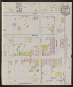
- No9
Sanborn fire insurance maps for Georgia towns and cities, 1884-1941

Fire insurance maps of Georgia cities and towns dating from 1884 to 1941.
More About This Collection
Creator
Sanborn Map Company
Date of Original
1884/1941
Subject
Cities and towns--Georgia--Maps
Fire risk assessment--Maps
Location
United States, Georgia, Baldwin County, 33.06928, -83.24959
United States, Georgia, Barrow County, 33.9932, -83.71276
United States, Georgia, Bartow County, 34.23786, -84.8405
United States, Georgia, Ben Hill County, 31.75978, -83.22046
United States, Georgia, Bibb County, 32.80659, -83.69776
United States, Georgia, Bleckley County, 32.43444, -83.32784
United States, Georgia, Brooks County, 30.84197, -83.58021
United States, Georgia, Bulloch County, 32.39681, -81.74318
United States, Georgia, Burke County, 33.06115, -82.00078
United States, Georgia, Butts County, 33.28785, -83.95717
United States, Georgia, Calhoun County, 31.5292, -84.62451
United States, Georgia, Carroll County, 33.58282, -85.07974
United States, Georgia, Chatham County, 31.97402, -81.09243
United States, Georgia, Cherokee County, 34.24393, -84.4762
United States, Georgia, Clarke County, 33.95117, -83.36733
United States, Georgia, Clay County, 31.62628, -84.9801
United States, Georgia, Clayton County, 33.54189, -84.35769
United States, Georgia, Cobb County, 33.94147, -84.57667
United States, Georgia, Coffee County, 31.54927, -82.8492
United States, Georgia, Colquitt County, 31.18839, -83.76885
United States, Georgia, Cook County, 31.15399, -83.43047
United States, Georgia, Coweta County, 33.35346, -84.76337
United States, Georgia, Crisp County, 31.92293, -83.7681
United States, Georgia, Decatur County, 30.87834, -84.57907
United States, Georgia, DeKalb County, 33.77153, -84.22641
United States, Georgia, Dodge County, 32.17218, -83.1684
United States, Georgia, Dooly County, 32.15718, -83.79875
United States, Georgia, Dougherty County, 31.53337, -84.21625
United States, Georgia, Douglas County, 33.70182, -84.76793
United States, Georgia, Early County, 31.32283, -84.90364
United States, Georgia, Elbert County, 34.11679, -82.8401
United States, Georgia, Emanuel County, 32.58976, -82.30171
United States, Georgia, Evans County, 32.15676, -81.88688
United States, Georgia, Fannin County, 34.86411, -84.31985
United States, Georgia, Floyd County, 34.26316, -85.21428
United States, Georgia, Franklin County, 34.37544, -83.22918
United States, Georgia, Fulton County, 33.79025, -84.46702
United States, Georgia, Glynn County, 31.21324, -81.4937
United States, Georgia, Gordon County, 34.50336, -84.87575
United States, Georgia, Grady County, 30.87467, -84.23443
United States, Georgia, Greene County, 33.57878, -83.16666
United States, Georgia, Gwinnett County, 33.96173, -84.02363
United States, Georgia, Habersham County, 34.63102, -83.53112
United States, Georgia, Hall County, 34.31689, -83.81968
United States, Georgia, Hancock County, 33.27043, -83.00069
United States, Georgia, Haralson County, 33.79423, -85.21103
United States, Georgia, Hart County, 34.3509, -82.96425
United States, Georgia, Henry County, 33.453, -84.1542
United States, Georgia, Irwin County, 31.60228, -83.27638
United States, Georgia, Jackson County, 34.13388, -83.56635
United States, Georgia, Jasper County, 33.31643, -83.68809
United States, Georgia, Jefferson County, 33.05484, -82.41815
United States, Georgia, Jenkins County, 32.79247, -81.96353
United States, Georgia, Johnson County, 32.70146, -82.66008
United States, Georgia, Lamar County, 33.07654, -84.13946
United States, Georgia, Laurens County, 32.46366, -82.92224
United States, Georgia, Lowndes County, 30.83386, -83.26771
United States, Georgia, Macon County, 32.35839, -84.04248
United States, Georgia, Marion County, 32.35338, -84.52464
United States, Georgia, McDuffie County, 33.48285, -82.48137
United States, Georgia, McIntosh County, 31.48381, -81.37557
United States, Georgia, Meriwether County, 33.04066, -84.68831
United States, Georgia, Miller County, 31.16399, -84.73072
United States, Georgia, Mitchell County, 31.22532, -84.19431
United States, Georgia, Monroe County, 33.01408, -83.91872
United States, Georgia, Montgomery County, 32.17336, -82.53482
United States, Georgia, Morgan County, 33.59083, -83.49238
United States, Georgia, Muscogee County, 32.50996, -84.87704
United States, Georgia, Newton County, 33.55505, -83.85019
United States, Georgia, Oglethorpe County, 33.88065, -83.0807
United States, Georgia, Paulding County, 33.92055, -84.86729
United States, Georgia, Peach County, 32.56878, -83.82688
United States, Georgia, Pierce County, 31.35876, -82.21274
United States, Georgia, Polk County, 34.00178, -85.18815
United States, Georgia, Pulaski County, 32.2323, -83.47596
United States, Georgia, Putnam County, 33.32177, -83.37284
United States, Georgia, Randolph County, 31.76262, -84.75419
United States, Georgia, Richmond County, 33.35963, -82.07355
United States, Georgia, Rockdale County, 33.65424, -84.02661
United States, Georgia, Spalding County, 33.26087, -84.28416
United States, Georgia, Stephens County, 34.55394, -83.29343
United States, Georgia, Stewart County, 32.07846, -84.8352
United States, Georgia, Sumter County, 32.03997, -84.19704
United States, Georgia, Talbot County, 32.69949, -84.53301
United States, Georgia, Telfair County, 31.9298, -82.93899
United States, Georgia, Terrell County, 31.77688, -84.43692
United States, Georgia, Thomas County, 30.86368, -83.91931
United States, Georgia, Tift County, 31.45744, -83.52659
United States, Georgia, Toombs County, 32.12172, -82.33129
United States, Georgia, Troup County, 33.03351, -85.02834
United States, Georgia, Turner County, 31.71638, -83.62409
United States, Georgia, Upson County, 32.88127, -84.29934
United States, Georgia, Walker County, 34.73566, -85.30098
United States, Georgia, Walton County, 33.78156, -83.73385
United States, Georgia, Ware County, 31.05363, -82.42368
United States, Georgia, Warren County, 33.40896, -82.67676
United States, Georgia, Washington County, 32.96954, -82.7959
United States, Georgia, Wayne County, 31.55143, -81.91676
United States, Georgia, Whitfield County, 34.80561, -84.96722
United States, Georgia, Wilcox County, 31.9729, -83.43236
United States, Georgia, Wilkes County, 33.78195, -82.74323
United States, Georgia, Worth County, 31.55151, -83.85088
Medium
fire insurance maps
Type
Still Image
Description
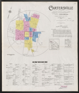
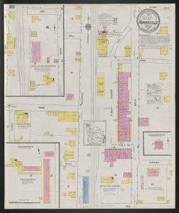
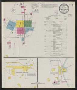
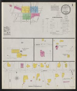
The online collection consists of 4,445 maps by the Sanborn Map Company depicting commercial, industrial, and residential areas for 133 municipalities. Originally designed for fire insurance assessment, the color-coded maps relate the location and use of buildings, as well as the materials employed in their construction. The maps indicate which city utilities--such as water and fire service--were available.
Fire insurance maps which show building construction by hand coloring, locations of elevators, windows and doors, and available water facilities.
Shows commercial and religious occupancy of buildings, dwellings with property boundaries, and house and block numbers.
Includes notes on population, water facilities, fire department, and prevailing winds.
Scales vary.
The Sanborn Maps database is a project of the Digital Library of Georgia as part of Georgia HomePLACE. The project is supported with federal LSTA funds administered by the Institute of Museum and Library Services through the Georgia Public Library Service, a unit of the Board of Regents of the University System of Georgia. The maps represented are from the University of Georgia Libraries Map Collection.
Language
eng
Original Collection
Sanborn Map Collection. University of Georgia Libraries Map Collection, Athens, Ga.
Holding Institution
University of Georgia. Map and Government Information Library
