- Collection:
- New Georgia Encyclopedia
- Title:
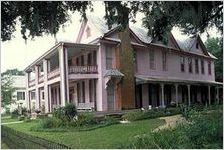
- Clay County
- Creator:
- Turn, Jean O.
- Date of Original:
- 2004-09-08
- Subject:
- Clay County (Ga.)
Counties--Georgia - Location:
- United States, Georgia, 32.75042, -83.50018
- Medium:
- articles
- Type:
- Text
- Format:
- text/html
- Description:
- Encyclopedia article about Clay County, Georgia. Clay County, in southwest Georgia, was once on the western frontier of the United States. Named for Senator Henry Clay of Kentucky, Clay County at a Glance the county was created in 1854 from parts of Randolph and Early counties. The county seat, Fort Gaines, was established in 1816 around a fort overlooking the Chattahoochee River. The fort was built by General Edmund Pendleton Gaines at the direction of General Andrew Jackson to protect settlers during the Creek Indian wars. The site also served as a Confederate fort in 1863. The point where nearby Cemochechobee Creek meets the Chattahoochee River was at one time a defining boundary between the United States and Indian Territory.
- Metadata URL:
- https://www.georgiaencyclopedia.org/articles/counties-cities-neighborhoods/clay-county/
- Language:
- eng
- Additional Rights Information:
- If you wish to use content from the NGE site for commercial use, publication, or any purpose other than fair use as defined by law, you must request and receive written permission from the NGE. Such requests may be directed to: Permissions/NGE, University of Georgia Press, 330 Research Drive, Athens, GA 30602.
- Bibliographic Citation (Cite As):
- Cite as: "Clay County," New Georgia Encyclopedia. Retrieved [date]: http://www.georgiaencyclopedia.org.
- Original Collection:
- Forms part of the New Georgia Encyclopedia.
- Holding Institution:
- New Georgia Encyclopedia (Project)
- Rights:
-
