- Collection:
- County Maps
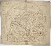
- Title:
- "Map of Walton County," circa 1866
- Date of Original:
- 1866
- Subject:
- Walton County (Ga.)--Maps
- Location:
- United States, Georgia, Walton County, 33.78156, -83.73385
- Medium:
- maps (documents)
- Type:
- Still Image
- Format:
- image/jpeg
- External Identifiers:
- Metadata URL:
- http://vault.georgiaarchives.org/cdm/ref/collection/cmf/id/120
- Language:
- eng
- Extent:
- 23.75 inches x 21.5 inches
- Original Collection:
- County Maps, Surveyor General, RG 3-9-66, Georgia Archives
- Holding Institution:
- Georgia Archives
- Rights:
-
