- Collection:
- Georgia Historic Books
- Title:
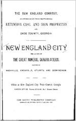
- New England City: the center of the great mineral quadrilateral formed by Nashville, Knoxville, Atlanta and Birmingham / the New England Company.
- Creator:
- Company for Propagation of the Gospel in New England and the Parts Adjacent in America.
- Date of Original:
- 1890
- Subject:
- New England City (Ga.)--Industries
- Location:
- United States, Georgia, Dade County, New England, 34.91036, -85.48024
- Medium:
- books
- Type:
- Text
- Format:
- application/pdf
- External Identifiers:
- Metadata URL:
- https://dlg.galileo.usg.edu/id:dlg_zlgb_gb5184
- Digital Object URL:
- https://dlg.galileo.usg.edu/georgiabooks/do-pdf:gb5184
- Language:
- eng
- Extent:
- 48 p. : ill., 1 col. map (fold.) ; 23 cm
- Holding Institution:
- Hargrett Library
- Rights:
-

THE NEW ENGLAND COMPANY,
FOURTEEN MILES FROM CHATTANOOGA.
EXTENSIVE COAL AND IRON PROPERTIES
--IN-
DADE COUNTY, GEORGIA.
ENGLAND GITV
THE CENTER OF
THE GREAT MINERAL QUADRILATERAL
FORMED BY
NASHVILLE, KNOXVILLE, ATLANTA AND BIRMINGHAM.
Office at New England City, Dade County, Georgia.
BOSTON OFFICE: Rooms 43 & 44, No. 1 Beacon Street.
THE SOUTH PUBLISHING COMPANY,
ENQRAVERS AND PRINTERS, 76 PARK PLACE, NEW YORK.
PROPOSED SITE OF NEW ENGLAND CJTY, LOOKING NORTH PEOM TAYLOB 1'AHK. LOOKOUT MOUNTAIN ON" THE EAST, SAND MOUNTAIN ON THE WEST.
.-J _/
LOOKOUT
HIS favored locality has all the salient, pict uresque beauty of the fair country that "Charles Egbert Craddock" (Miss Murfree) has painted in such fadeless tints in her unequaled stories and novels of the Tennessee mountains. Nowhere else is there such a real picture-land framed in so balmy and bracing a climate, a happy mid-region between the rig ors of the North and the languors of the South. The bounding streams as clear as beryl are never stilled to icy death, but sing their sibilant songs all the year through. Fertile valleys glow, amber and green, in the sunshine. Far, dim, majestic blue spurs tower into the heavens; still more distant shadowy pur ple ridges, misty and somber, seem to rim in the region from the outer world. No one who has lived near these grand primeval tem ples is ever content away from them. There is an exaltation and se renity born of the mountains. Every other prospect is in contrast flat and monotonous. How well " Craddock" describes the home sickness of the exiled mountaineer, his longing for the repose and peacefulness of the everlasting hills. " Did he yearn for the mountains ? Could he see them in spirit? Surely in his dreams, surely in some kindly illusion, he might still behold the fair land which touched the sky; the golden splendors of the sunshine sifting through the pines; flying shadows of clouds as fleet, racing above the distant ranges; untrodden woodland nooks be side singing cascades; or some lonely pool, whence the grey deer bounded away through the red sumach leaves." This might have been written of the site of New England City for the aspects are the same the picturesque features as wild and as beautiful and above all stands grand old Lookout, with its archives of tradition, remote history, and civil war records, written on its indestructible and au thoritative tables of stone. The noble Tennessee flows at its base a stately river that the vanished Cherokees called the tranquil waters. To them it was a tranquil stream, echoing only to the soft splash of indolent oars, but soon, with the vast improvements about completed by the Government, it will be a crowded, busy commercial highway, one that will open the mineral, agricultural and timber wealth of this section to the markets of the world.
LOOKOUT MOUNTAIN, LOOKING EAST FROM THE SITE OF NEW ENGLAND CITY.
THE NeW ENGLAND
COAL AND IRON PROPERTY,
Dade County, Ga.
NEW ENGLAND GITY.
THE NEW SOUTH.
The destruction of slavery led the people of the South to look about them, and the necessities born of poverty forced them to meet new conditions with new methods. Agriculture, which had been al most the only pursuit, provided only a moderate living. In this state of things active and brainy men began to call the attention of the country to the great wealth of coal and iron and other minerals that lay in the mountains of Georgia, Alabama and Tennessee.
THE MINERAL BELT.
The extent and magnitude of the great Southern mineral belt be gan to slowly dawn on the world, and with the opening of the Ala-" bama Great Southern Railroad, running from Chattanooga to Bir mingham, the manufacture of iron in the Chattanooga district was fairly launched.
CHATTANOOGA DISTRICT.
Soon after the war the most sagacious men of the South sought the best place to manufacture iron. Mr. George Hazelhurst (de ceased), an eminent railroad builder and a pioneer in the iron industry of this section, selected the Lookout Valley, and located the Wills Valley Railroad through the property now owned by the New Eng land Company. The Rising Fawn Furnace, near Trenton, on the Alabama Great Southern Railroad, was operated by the Hon. Joseph E. Brown, of Georgia, Mr. Warner and other well-known and success ful coal and iron men.
DADE COAL MINES.
These coal mines are operated in connection with the Rising Fawn Furnace, and it is an unquestioned statement that Hon. Joseph
5
E. Brown, TJ. S- Senator from Georgia, Mr. Warner, L. S. Colyar and
several other men have made large fortunes out of the iron and coal that abound in this part of Lookout Valley.
BADE COU5TY.
This county is known to Georgians as " The State of Dade." It
is cut off from the State by Lookout Mountain, but is connected by
railroad via Chattanooga, the county lying in the extreme northwest corner of Georgia and only seven miles from Chattanooga. The
State of Tennessee is on the nozih and Alabama on the west The Alabama Great Southern Bailroad (a link of the great Queen and
Crescent system from Cincinnati to New Orleans) runs along the
Lookout Valley, traversing this county northeast and southwest, as the geological formations run. The Nashville, Chattanooga and
St. Louis Bailroad touches and parallels the northern borders of the
county.
THE NEW EXGLANT) COMPACT.
This company of New England men, in casting about for the best
location for a great mining and manufacturing property, as well as a healthful and beautiful location for a city, wisely followed in the foot
steps of scientific and practical suggestion. The pioneers in iron
manufacture in this section, the most successful and sagacious men, had for many years shown by actual results that this was the best lo
cality in which to manufacture iron. The report of Prof. James Hall, State Geologist of New York, and an eminent authority, was
made in 1866. It was verified by the Empire State Iron and Coal
Company of Georgia, and is sustained by such learned men as Prof. James M. Safford, State Geologist of Tennessee ; Dr. George Little,
recently State Geologist of Georgia, and Prof. C. H. Hitchcock, State Geologist of New Hampshire. These reports are submitted in full in
this pamphlet.
THE COAL AXD IKOS PROPEKTY.
This magnificent property consists of over 10,000 acres of iron lands and 6,000 acres of coal lands, and includes a beautiful town site
of 1,400 acres. The lands lie on both sides of the Alabama Great
Southern Eailxoad, and extend seventeen miles, at a mean distance of only fourteen miles from Chattanooga. The extreme northern portion
lies in the State of Tennessee, near Wauhatchie, the junction of the Nash ville, Chattanooga and St. Louis Railroad, Alabama Great Southern
Bailroad, and Memphis and Charleston Bailroad, all of these lines
6
going into Chattanooga on the same track that -winds around the base of Lookout Mountain. This part of the property is within two miles of the Tennessee river, the Hudson of the South. The extreme southern portion is sis miles below Trenton, the shire town of Dade County. Iron ore has been mined by the people oh this territory for years and sold to the Rising Fawn Furnace Company. And that company has mined largely on its own account. The coal property lies in Sand Mountain, and is in three distinct veins, which will be described in detail. One of the veins has been successfully worked for many years at Cole City by Governor Brown of Georgia, with a force of 500 men, raising 800 tons per day. It is known as the Dade Vein. This vein has been uncovered for many miles on this Com pany's land, and shows at least six feet of workable coal.
NEW ENGLAND CITY.
The city site comprises fourteen hundred acres of land beauti fully located in the center of the great mineral quadrilateral formed by Nashville, Kuoxville, Atlanta and Birmingham. The site is on rolling land, drained by Squirrel Ci'eek, which crosses it at a point most convenient for drainage and for supplying water for manufac turing purposes. A large poi-tion of New England City slopes grad ually towards the creek, while the more distant portions rise into rounded hills, which afford lovely locations for residences. About five hundred acres have already been surveyed and laid out into town lots. The avenues, which run north and south, are eighty feet in width, while the streets, which run east and west, are sixty feet wide. The blocks are 500 feet long and 300 feet deep. The business lots are 25 feet by 144 feet, while the residence lots are 50 by 144. A narrow alley runs between the lots at their rear. The streets which run east and west descend to Squirrel Creek and give fine nat ural sewerage. The fall from the center of Massachusetts avenue, at the Hotel State of Dade, now nearly completed, to the surface of the water in Squirrel Creek, a distance of 1,200 feet, is 23| feet. The principal avenues and streets have already been graded, and the work is progressing rapidly. Lookout Creek flows to the east of New England City, and it is well watered by bold and gushing springs which flash out from the hillsides and valleys.
WATEB WOEKS.
Surveys ascertaining elevations have been made, and the point near three springs has been selected below which the reservoir will be
7
COLE SPKING, BUBBLING AND BOILING ABOVE THE SUBFA.OE AND POUBING FOHTH AN IMMENBE VOLUME OF WATER. TO BE UTILIZED FOB NEW ENGLAND CITY.
placed, and the water forced from it by a pump to a stand pipe on the hill, at such a height as will carry the water into the upper stories of all the buildings in the city. ' The springs referred to are at such an elevation as to be available for discharging water into the principal streets by natural flow. Squirrel Creek, as will be seen by the map of the city site, flows through the town. Good water and plenty of it is necessary to the health and happiness of a city. New England City has it splendid springs, bold branches and clear creeks all within her borders.
SEWERAGE.
The location of New England City offers perfect natural sewerage, but it is the intention of the Company to put in a complete system as soon as the waterworks are erected.
ALTITUDE AND LATITUDE.
New England City is 720 feet above the level of the Gulf of Mex ico, and lies in the 35th degree of north latitude. This location is 55 feet higher than the depot of the Alabama Great Southern Bailroad on Market street in Chattanooga.
DUMMY LIXE, ELECTRIC LIGHT.
A charter has been obtained for connection to 'Wauhatchie and Chattanooga for a dummy line and electric light.
TELEPHONE AND TELEGRAPH.
There will also be a telephone line put in by the same company that operates the dummy line and electric light. A telegraph office will be opened before the date fixed for the sale of city lots.
POST OFFICE AND EXPRESS OFFICE.
The post office and express office are already established where the New England Company has its spacious quarters in their build ing just completed.
Mr. C. P. Day, the postmaster of New England City, has built a large dwelling two stories high, and painted it with the mineral paint made from the ore such as abounds on the property of the New Eng land Company. This " dyestone" abounds on this property and has been used in the manufacture of paint for yeai-s. The paint made from it is said to be almost fire-proof.
GRADING.
The principal avenues and streets are already graded, and the Company will continue the work as rapidly as they can, and to meet the wants of the coming city.
9
HOTELS.
The Stevens House, already completed, has twenty-five rooms and can accommodate all visitors for the present.
The Hotel State of Dade is in process of erection and will ac commodate comfortably one hundred guests. It will be fitted up with all the modern improvements, and furnished especially with the view of entertaining parties who visit New England City for the pur pose of purchasing lots or investing in manufacturing enterprises.
Plans are being prepared for a large and handsome hotel to go on the splendid site reserved for that purpose west of Vermont avenue. This hotel will be on a grand scale and equal in its appoint ments to metropolitan hotels.
The Hotel State of Dade will be supplied with water from a spring on the hill opposite New England City. This spring has ca pacity sufficient to supply water for all purposes, including sewerage. This hotel is three stories high and is 32x120 feet.
MORRISOX'S HOUSE.
This is a handsome house, recently built, belonging to Mr. Horrison, who has lived here for a long time. The station was formerly called by his name. His home is west of Lookout avenue.
TAYLOR PARK.
Every new city ought to arrange for a park, and let it become a part of the original plan. On a fine elevation south of Mr. H. V. Taylor's house, is a large tract covered with the original forest growth. It can be made a beautiful park, and the New England Com pany has wisely reserved it for that purpose.
PCBLIC BUILDINGS.
Eligible locations have been set apart for the erection of public buildings, and as soon as the population wan-ants it the company will provide for a city hall.
CHURCHES AND SCHOOLS.
Following in the footsteps of the Pilgrim Fathers, New England always provides for the preacher and the pupil. Beautiful sites for churches and schools will be donated, and this is a rare chance for one of the leading denominations to get on the ground first.
BUTJLDIXG MATEBLiL.
Lumber.--Morrison <fc Taylor have a steam saw mill completed and running and are prepared to fill orders for building material at low prices. There are a number of saw mills in the valley, and Chat-
10
tanooga is so near that parties desiring to build can rely on obtaining all they require.
Building Stone.--The lime rock which abounds here, can be easily quarried in blocks suitable for building purposes, and affords a ma terial, durable and of a beautiful color.
Brick.--A. brick yard can be established at twenty or more points in the valley and worked with profit, as the clay is of good quality. There is a bed of grey clay within the limits of New England City which is different from the ordinary red and yellow clay. Expert manufacturers of brick from the North pronounce this grey clay as first-class brick clay in every respect. It will not only make strong and firm brick but it gives the bright and lively color which makes it so superior to the ordinary red and yellow clay.
Lime and Sa.nd.--There is any quantity of the best limestone for making lime for building purposes, and for use as flux in reducing iron ore. There is on the property, and near New England City, a bed of sand that will supply all the demands for making mortar for a large city.
PAINT.
Red, brown and yellow ochre abound on the property of the New England Company, and many tons of it have already been shipped and its quality fully tested. These ochres make beautiful paints, and the dyestone ore makes a mineral paint that has been made and sold in Chattanooga for many years.
SUMMARY.
It will be seen that New England City has everything necessary, not only for good health and the foundations of wealth, but she has within her borders all that is required to build houses, from the rock in the foundations to the paint on the outside.
Fort Payne, Attalla and other points farther down this valley, and according to the best authority, with less to build on, are on a boom. Fort Payne has grown from a village to a city in less than twelve months. New England City is more favorably located than any of the new towns on the railroads running north and northeast from Chattanooga, on account of its being so closely allied to the Tennes see river, two great lines of railway and to Chattanooga. Anything that helps Chattanooga must aid in building up this city founded by able and strong men from New England.
11
IRON QBE.
The iron ore tenitory has been selected with a view to its actual value as ore bearing land, and extends along both sides of the Ala bama Great Southern Railroad, which is a portion of the Queen and Crescent route between Cincinnati and New Orleans. The ore is cal careous, usually fossiliferous, iron ore and is known as the red or dyestone ore. It is a valuable, well-known and widely disseminated ore, occurring in regular beds. All these formations lie like the leaves of a book, flat bedded upon each other, and generally tilted up and broken into high ridges or eroded anticlinal valleys, exposing the edges of the ore beds, making it easy to find, ready to mine, abund ant in quantity, always accessible.
The sections and lots of land, and iron, and coal, owned by the Company include the foot hills at the base of Lookout Mountain on the east, and Sand Mountain on the west, as well as portions of the mountains themselves. These hills are traversed by three veins of iron ore from two to three and a half feet in thickness each, aggrega ting from six to seven and a half feet thick.
Prof. Rogers, State Geologist of Pennsylvania, in his report men tions it as "the somewhat noted and much prized calcareous iron ore," and speaking of the same in the neighborhood of Dansville, he says, " the bed varies in thickness from six inches to two feet." It is well known and extensively used in the iron furnaces of Tennessee and Alabama.
Dr. Geo. Little, State Geologist of Georgia, and the best informed man in America on the geology of Georgia, says: " There are three distinct beds of ore. The lower bed, where exposed, varies from two feet to three feet in thickness, and the upper bed is about eighteen inches. The intermediate spaces consist of greenish olive shales with thin bands of impure limestone or argillaceous sandstone. In the actual position of the furnace and its relation to the outcrop, the ore can for a long time be mined, or rather quarried, and delivered at the furnace for fifty to seventy-five cents a ton. The expense of transportation (which in many other cases amounts to one to three dollars or more per ton on the coal and iron ore) will, comparatively speaking, not form an item of cost after the construction of the works. The ore will be mined along the face of the hill, and the cost of min ing and delivering at the furnace will be no more than it would be to deliver it at the depot for transportation. The coal will be mined and
12
MORHISON'S WORKINGS ON THE THIBTY-I-OUB INCH IKON OME VEIN HALE MILE EAST oi1 THE ALABAMA QBEAT SOUTHERN
HAILKOAD, AND LESS THAN THKEE-FOUBTHB OP MILE VKOM THE DEPOT AT NEW ENGLAND CITY.
sent down a chute or inclined plane to the coking ground, passing thus far only through the same process as for delivering at a railroad depot, and incurring only the cost of mining, etc., which in other places would precede that of transportation."
Dr. Little can only verify by examination and scientific research the truth, and Prof. Hall had in 1866 mentioned in his report the same facts that he (Little) states in his report after careful examina tions in 1889-90. Prof. Hitchcock, State Geologist of New Hamp shire, fully sustains Dr. Little, who corroborated Prof. Hall. All the Doctors agree, and the practical tests show that the New England Company have an unlimited supply of the same splendid iron ore that is now being mined at "Whitwell, Inman and Victoria, in Sequachee Talley, and smelted at South Pittsburg in the fine furnaces of the Tennessee Coal, Iron and Railroad Co. It is claimed at South Pitts burg that this ore works without limestone. Reference to the reports of all the scientific men will satisfy the scholarly reader, a visit to the property will convince the doubting Thomas. The New England Company seek visitors and investigation.
IRON* AXD COAL.
Before leaving the iron field attention is called to the connection of the coal field with the iron ore field. Take the map of this prop erty and see how near these two great products of God's creation, necessary the one to the other, are here so wedded together, so closely united and made to do service in producing pig iron, from which come the numberless necessary articles for man's comfort and support. This is the iron age, but coking coal is necessary to make iron, and the place where good iron ore and coking coal are close together, free of transportation, is indeperclent of outside conditions, and no decline in the price of iron can affect the section that is on bed-rock. Coking coal of excellent quality, not tentative but proven by years of actual use (See reports as to Dacle Coal seam), iron ore endorsed by experts and proven in practice by the largest and most successful mining and manufacturing corporation in the South through years of work in the mine and furnace, these in juxtaposition so close that one can be quar ried and the other shot through a chute into the furnace located where it can receive the crude product, turn on the blast, and from its fierce fires deliver the reduced product on the cars or the great river which will bear it to the markets of the world at lower rates than can be had from any iron or coal district in America. New Eng-
14
land City and the New England Company's iron and coal ore are so
near to Chattanooga that what is true of one is true of the other.
Bead further on the opinions of thinking men, and the facts that go
to show that Chattanooga is the coming city of the South. Remem ber that New England City has the same advantages, and is only fif
teen miles from Chattanooga.
COAL SEAMS.
The reports of all the experts, geologists, mining engineers, etc.,
agree in stating that there are three distinct and valuable coal seams,
the lower one called the Dade vein, the next the Castle Rock, and the
upper the Pennington vein. The Dade seam has been worked for many years by the Dade Coal Company, with great success. The
company named now employ over five hundred men, and use over
two hundred and fifty coke ovens. The Dade mines are only about
two miles from the property of the New England Company, and they
are mining on the same vein that was disclosed on the east side of
the Richmond Gulf, with a thickness of three feet and three inches.
Since then the vein has been uncovered for many feet on the west
side of the Gulf, and shows at least seventy-two inches, or six feet.
This point can be reached by a good road one and a half miles over Sand Mountain by carriage, is easy of access, and has been visited by
hundreds from all parts of the Union. The outcrop is so situated,
and the vein lies in such a position, that coal can easily be taken from the mine into Richmond Gulf and down to New England City.
At the point where the low land is reached there is an abundance of
water, and the whole situation is adapted to the erection of coke
ovens. An analysis of the able reports of Dr. Little and others, all
of which agree with Professor Safford's published statements as to
the geology of this section, shows beyond doubt that the New Eng land Company has a practically inexhaustible supply of good coal;
that this coal is identical with that used at other points in the same
section under the same physical conditions, and that it is an excel
lent coking coal.
QUALITY OF THE COAL.
The quality of the coal is referred to in all the reports on this
valley as excellent. Pro! James Hall, in his report made in 1866 on
a property adjoining the New England Company's property, says :
" The coal is of excellent quality, as evidenced from the use of similar
coal in furnace operations at Chattanooga, and is free from any inju-
15
rious amount of sulphuret of iron, judging from an effect of weather ing upon an exposed mass for two years, as well as from an examina tion of specimens taken from the mine." Again he says: " I placed some of the coal taken from the opening in the hands of Prof. T. Sterry Hunt, the chemist of the geological survey of Canada, who has given the following results of analysis :
" ' The coal is a rich bituminous coking coal, and yields a hard, brilliant coke. In composition it is between the free-burning and the highly bituminous coals. The analysis gave :
Fixed carbon ................ 63.9 Volatile carbon ........ ...... 26.8 Ash (reddish) ................ 9.3
It thus gives 73.2 per cent, of coke.' "
100.0
Dr. Little says in his report recently made : "The analysis and
practical tests have shown all three of these seams to be suited for coking. The Etna mines, five miles north from New England City,
on the Nashville, Chattanooga and St. Louis Railroad, near Whiteside and Hooker stations (the latter named for the hero of the ' Bat tle Above the Clouds'), have 200 ovens making coke, which is in con
stant demand. The Coal City mines, in Dade County, whose lands join the New England Company, have 340 ovens, in which the fire
never dies out, except for repairs. This coke goes almost entirely past New England City to the Rising Fawn Furnace (whose lands join the New England Company's on the south), which makes an iron
well known in the Boston market."
The New England Company have the same veins of coal and iron, and the exposures and analyses prove it beyond the shadow of
a doubt.
QUANTITY OF COAL.
Mr. 31. T. Singleton, civil and mining engineer, is regarded high
authority; he says : " Three workable seams of coal underlie your coal lands. They vary in thickness, ranging from one to seventeen feet. At the lowest estimate the seams will average three feet each, giving an aggregate thickness of nine feet. This will give 60,000,000 tons of
coal."
QUANTITY OF IKOX ORE.
The same authority says : " There are three veins of iron ore, one 16
a few feet above the other. The main vein is three feet thick, and the three will aggregate fully six feet. I estimate the available amount of ore on the property at 150,000,000 tons, which will make 75,000,000 tons of pig iron. . If you attempt to exhaust your iron ore in 100 years by making 2,000 tons per day, and mine your coal ac cordingly, your coal will give out in about ninety years. Or if you only make 200 tons per day your coal will last 900 years.
COST OF MAKING PIG IRON.
The Hon. Abram Hewitt, of New York, has said that pig iron can be made in the South for $7.50 per ton. Mr. Singleton says: " In estimating the cost of ore and coke delivered at furnaces, 25 cents per ton is allowed as a mining profit; that is, furnace companies who own iron and coal properties have an advantage of 25 cents per ton on the raw material over those who have their material to purchase. At this rate the profits in mining the material on your own property would amount to 52,500,000. The freight on this material, allowing only 10 cents per ton, would amount to 21,000,000. There are va rious estimates as to the cost of manufacturing pig iron, but it is con ceded on all sides that the South can beat the world.
The following item shows that the South is sending iron to Pittsburg, Penn., the iron center of the North. What is true of Shef field is true of New England City, as Muscle Shoals will be formally opened May 18th of this year.
SHIPPING BY WATER. AX I3IPOKTAXT EVENT AT SHEFFIELD, ALA., TO-DAY.
"The representatives of the leading newspapers of Tennessee, North Alabama and Georgia were invited to Sheffield, Alabama, (1) to partake of a generous banquet provided by the hospitable people of that enterprising city, given last night, and (2) most Important of all to witness the shipment of a fleet of barges on the waters of the Tennessee, carrying 5,000 tons of pig iron to be taken to Pittsburg.
" Chattanooga is not much farther from the market than Shef field, and when the Muscle Shoals canal is opened Chattanooga pro poses to give a banquet and invite the leading newspapers of the whole country to witness the shipping, not only of pig iron, but of lumber, merchant iron, merchandise, and the product of more than 200 manufacturing concerns, to the markets of the world, and supply the growing prosperous towns along the banks of the great river.
" The Times is informed by the Tennessee Eiver Transportation
17
DADB COAL VEIN, SIX 1'EBT IN THICKNESS, ONE MILS AND A HALF WEST OF NEW ENGLAND CITY.
Company that their company will stand ready to carry the commerce of Chattanooga just as far as the shipper may want it sent.
"The scene at Sheffield to-day is therefore significant of great things in the future." Chattanooga Times, Feb. IS, 1890.
AN UNDEVELOPED COUNTKY.
Is seems difficult to convince that part of the world which has failed to visit this favored section that there is so much valuable coal and iron land so near Chattanooga. It is easy to understand if one will investigate and reflect. It has been within ten years that Birm ingham boomed and that Chattanooga forged to the front. It has been stated that the Atlanta Cotton Exposition in 1881, was the beginning of things in this section. The opening of the Georgia Pacific Bailroad was in fact the beginning. There has been so much that was great to do and so little to do it with. Take the history of the past two years, and in it you cover the major part of the development. The coal and iron region is being rapidly taken up. Capital, once convinced, comes in eager pursuit of what it has neglected the New England Company's property adjoins that of the Rising Fawn Fur nace Company, and it may be asked why that corporation did not take it. They had more than enough, and so long as there were no buyers, why load themselves down with additional property? It was understood that Gov. Brown had it all, and that the " State of Dade" was his. The New England Company are fortunate in getting a splen did property adjoining and of the same character as that owned by the successful millionaire, Senator Brown, of Georgia.
ACCESSIBILITY.
At New England City the iron ore is about one-fourth of a mile off, and the coal is two miles from the railroad depot, while limestone is found in the same hills with the iron, and the railroad passes through it at the depot, and again it is several feet thick in the same mountain with the coal. Eeport of Dr. George Little, Geologist.
TBAXSPORTATION'.
The New England Company's property is located near the junc tion of the Alabama Great Southern Bailroad (Queen and Cresent line) which passes through the property, and the Nashville, Chat tanooga and St. Louis Railroad and the Memphis and Charleston Railroad, and is only two miles from the wonderful Tennessee river. At comparatively small cost this Company can reach the Tennessee river independently of any railway line, and control its own frontage
19
on the liver. Xo property that has been offered on the market has such a combination of advantages. The Tennessee river is soon to figure in the transportation question in a way that will astonish the world, and only such men as Col. MacGowau, of the Chattanooga Times, Col. Tomlinson Fort and a few earnest men have realized it. Mr. -Joseph M. Brown, of Atlanta, has written a pamphlet on the opening of Muscle Shoals, that commends itself to all who propose to invest in this section. The following extract from the Chattanooga Times explains itself. Remember the Xew England Company's prop erty is within two miles of the Tennessee river, and that the opening of Muscle Shoals means a free water way to the Mississippi river and the world.
OPENING OF MUSCLE SHOALS CANAL.--THE LOCKS BEING PUT IN ORDER
AND THE FORMAL OPENING TO BE ABOUT THE 1STH OF MAY.
" The work on the Muscle Shoals canal has been completed so far as the opening and dredging of the channel is concerned, and nothing remains to be done on that part of the system. The only delay now is in the finishing of the locks and draws. A number of them do not work as smoothly as they should, and they are being overhauled and placed in good eonditiou, so when the canal is thrown open for the passage of boats, there will be no temporary closing up for repairs. The lock gates and wickets are all being thoroughly tested prepara tory to the formal opening of the canal.
"It is expected to have all the work finished and the canal opened by the 18th day of May.
"In anticipation of this event the Tennessee Transportation Com pany, of this city, are making arrangements for the billing of river freight through to Ohio and Mississippi river points, and if the pat ronage will support it, they will run a line of boats over the entire length of the river." Chattanooga Times, Feb. 18, 1890.
A NEW PROPERTY.
The New England Company have a property that is theirs to de velop the town site is beautiful and well located, the iron and coal are there in inexhaustible quantities and in unequaled proximity, available to mine and accessible to transportation the cheapest on the continent. It is a small kingdom in the most salubrious and genial climate on earth, and within a few minutes' ride of Chattanooga, which is the great and growing city of the South.
20
TIMBER.
Almost every variety of hard-wood timber abounds on this prop erty. The leading kinds are: White oak, black oak, chestnut oak, yellow pine, and also in smaller quantities but of superior quality, are satinwood, ash and hickory. There is also a quantity of red cedar. This timber, like all that on the South Appalachian Mountains, is dense, large, and of excellent quality. The second growth hickory is greatly prized, and commands a high price. There is some fine wal nut on the land. Dr. Koenig, of Pennsylvania, in speaking of Walden's Ridge, which is in all respects like this property, says : " The aspect of forest land, looking more like a park than a wilderness, is very pleasing indeed." It would weary the reader to describe in de tail the different woods and their uses. Suffice it to say that the lands of this Company are well timbered, and that all the varieties of hard and soft wood are daily growing in favor in this section as well as throughout the United States.
FARM LANDS.
The farm lauds of the Lookout and Wills Valleys are very fer tile, and are held at high prices. The valley is wide and the lands particularly good near New England City. These lands produce corn, wheat, oats, rye, potatoes, etc. The fruit on the mountain sides is a certain crop, and when a late frost nips the fruit in the valleys and lower sections of Georgia it is abundant here. The farm lands are held at from $50 to $80 per acre. Most of the population of this valley have prospered on the field products rather than on the mineral wealth of the lands. The New England Company have many beautiful farm sites sheltered from the blasts of winter.
FIRE BRICK CLAY.
There is an immense quantity of a very supeidor fire-brick clay on this property. The same kind of clay has been mined in this im mediate neighborhood and taken to Chattanooga, and Mr. Montague and others have made fire brick of good standing in the market.
HALOYSITE.
This most valuable and beautiful mineral has been found on the Company's property. This material has been successfully used in making alum, and Philadelphia parties have shipped it from adjoin ing tracts and made alum of it. It is also good for pottery clay.
21
LOOKOUT OBEEK, NEAB NEW ENGLAND CITY, AND MOBBISON AND TAYLOB'S STEAM SAW MILL AND BBIDGE.
WATER.
Lookout Creek flows along the east of the Company's property. It is a broad, clear stream, more than forty miles long. It is thirty miles from its source at Valley Head to New England City. The water of this river can be utilized for manufacturing and other pur poses in the lower part of the town. It is quite a rapid stream, and has several mills on its banks above New England City. The en graving will give an idea of its size and current.
Squirrel Creek flows through the city, and the engraving will show that it is a stream of considerable size, and will furnish an abundant supply of water for domestic use and manufacturing pur poses.
In addition to these streams the Company have the water of three large springs within a few rods of each other, which combined will discharge water enough for thousands of people. The engrav ing will give an idea of the size of one of these springs.
RAILROADS.
In addition to the Louisville and Nashville Railroad, the Ala bama Great Southern Railroad and the Memphis and Charleston Railroad, already mentioned, the Stevenson, Sand Mountain and Dalton Railroad is chartered to extend from Stevenson, Ala., across Sand Mountain to Dalton, Ga., passing throxigh New England City. In crossing Sand Mountain this road will run through Richmond Gulf, where the six-foot vein of coal lies. It is also authorized to run a branch line from New England City to intersect the Louisville, Nashville and Chattanooga Railroad at Hooker, a distance of about six miles. The incorporators in Alabama have had their first meet ing, subscribed and paid the amount of stock required by law, elect ed officers, and within a few days will have an engineer upon the ground to locate the road to the State line. The charter also pro vides for a branch extending south upon the extensive table land forming the top of Sand Mountain to Walnut Grove, seventy miles southwest of New England City.
3IAN-UFACTUHES.
It is the purpose of the Company to establish coking ovens, smelting furnaces, rolling mills and other industries. Manufacturing sites have been reserved on Squirrel Creek, affording ample water and railroad frontage. The stock for an iron furnace, 100-tons capacity, is
23
about subscribed. The rolling mill stock is also being taken and es timates are being made. A wood working plant is in prospective; a foundry has been arranged for -with Eastern parties; other important industries are in contemplation.
Hon. W. D. Kelly, of Pennsylvania, said: "The South is the El dorado of the world."
Hon. Abram Hewitt says that iron can be manufactured in the South cheaper than any where on this continent.
THE CLIMATE.
The climate is salubrious, and the statement as to Chattanooga applies to Xew England City, only fifteen miles distant. An ex haustive report of the Signal Service Bureau at Chattanooga, extend ing over a period of ten years, shows that the mean annual tempera ture is about fifty-nine degrees.
The record has been kept of New England City for the mouth of February, and is printed herewith:
Temperature of Xew England City, Ga., from Feb. 4th through the mouth. The record was begun as soon as a thermometer was procured.
AM. M.
AM. M.
Feb. 4, .......... 67 78 Feb. 17, .......... 69 72
5. .......... 68 79 " 18, . ........ 64 74
6. .......... 49 50 " 19, .......... 60 75
7. .......... 42 5-2 " 20, ... ...... 50 59
8. .......... 31 47 " 21, .......... 36 45
9. .......... 35 45 " 22, .......... 37 46
10. .......... 34 46 23, .......... 58 76
11, .......... 42 50 " 24, .......... 66 79
1-2, .. ....... 50 56 " 25. .......... 69 75
13, ....... . . 47 54 " 26, .......... 60 66
15. .......... 60 70 " 27, .......... 60 68
16. .......... 72 76 " 28, .......... 58 62
THE ILLUSTRATIONS.
1'he illustrations herewith given are engravings made from pho tographs taken on the property, and fairly represent the appearance of the subjects presented.
LAND SALES.
The Xew England Company will soon place a limited number of lots on the market, at reasonable prices, aurl invite correspondence and investigation.
24
REPORT OF DR. GEORGE LITTLE,
(Late State Geologist of Georgia.)
NEW EXGLAXD CITY, Dade Co., Ga. )
February llth, 1890. j
GOT. ROSWELL FAKNHAM, President New England Company.
Dear Sir:--At your request I have made the following notes on
the location, geological position, coal, iron, limestone, water, soil and
climate of your property, with references to the opinions of the very
highest authorities corroborating my own observations during many
years, which led me, when called upon to recommend a place for found
ing a city which should combine all the essential requisites, to choose
this from the many inviting fields.
I know of no site in the South having so great advantages, so
compactly united.
From all the visitors from all sections of the North there has
been but one expression of views as to the extent, variety and attrac
tiveness of JOIIT purchase; and all predict a grand success for your
enterprise.
Very respectfully yours,
GEORGE LITTLE, Formerly State Geologist of Georgia.
NEW ENGLAXD CITY, Dade Co., Ga. { February llth, 1890. j
Lookout Mountain is known throughout the United States, from its prominent position, overlooking the Tennessee river, and the city of Chattanooga, for which Hon. A. Hewitt has predicted a population of one hundred thousand in ten years. But few people outside of Georgia know of Lookout Valley and Lookout Creek, which borders it on the west, and still fewer know the little triangular county of Dade.
This, though the smallest, is perhaps the richest in the State of
Georgia in its mineral wealth. Touching Tennessee on the northern side and Alabama on the
western, it is the keystone to the three great mineral States of the
South. Shell Mound Station, on the Nashville and Chattanooga Railroad 25
and the famous Nickajack Cave, are at the point where these three States unite their sovereignties. The heaps of muscle shells bear witness to the occupancy of this section by the Cherokee Indians, from whom Northwest Georgia is known as Cherokee Georgia.
This portion of the State, long before the Louisiana lottery was thought of, was divided, and surveyed by the State, into sections, and districts, and lots; and these lots were distributed by the Georgia Lottery one each to eveiy white male in the State.
There are four of these sections, the first beginning at the corner of South Carolina and Georgia where they join North Carolina. The second joins it on the west and then the third and fourth, extending across to the Alabama line.
Cherokee Georgia embraces nearly all the State north of the Richmond and Atlanta, and Georgia Pacific Railroads, north of Atlanta and Rome.
The fourth section is divided into nineteen districts, and the nine teenth is in the northwest corner of the State and is subdivided into 173 lots of 160 acres each; being a fractional district, while the tenth lying east of the nineteenth, is nine miles square and contains 324 lots.
The New England Company has purchased more than 100 of these lots or the mineral interest in them; of these about forty, or ten square miles, are underlaid by coal, and sixty, or fifteen square miles, contain iron ore.
These lands lie alongside of the Great Southern Railroad system which extends from the Ohio river at Cincinnati to the Mississippi at New Orleans.
The cities of Chattanooga, Rising Fawn, Fort Payne, Attalla, Birmingham, Bessemer and Tuscaloosa are all passed within a six hours' ride on the Alabama Great Southern Railroad,
Through this little county of Dade also cross the great system of railroads known as the L. & N., or Louisville and Nashville, the East Tennessee, Virginia and Geoi'gia system (E. T. Va. & Ga.)and the Cin cinnati Southern (Alabama Great Southern). Thus it appears that the New England Company has secured twenty-five square miles of prop erty at the central point of the three great Southern systems of rail roads as well as at the union of the three great progressive mineral States of the undeveloped South.
This they have done just as the United States Government has opened the Muscle Shoals, giving free navigation from the headwaters
26
of the Tennessee near the Virginia line, through Tennessee, Alabama and Kentucky to the Ohio river and the Mississippi.
The selection of this location combines in this way the greatest facilities of transportation both by river and by railroads.
Now what does the geological structure of the country show may be expected beneath the surface, to be mined, manufactured and trans ported to the markets of the country?
The Tennessee river, ages before the red man inhabited this country, had been at work, to cut through the great Cumberland Mountains, and reveal their internal structure and contents.
When Wm. H. Seward, as Governor of New York, the Empire State of the North, approved the bill establishing the geological sur vey of that State, and Prof. James Hall, with his associates, named and identified the rocks corresponding to the Silurian in Wales, the De vonian in England, and gave the local names from the Trenton Falls and Niagara to the limestone and Clinton to the red fossiliferous iron ore group, he scarcely foresaw that the New York geologist would find the identical rock formations in Georgia, the Empire State of the South, bound in one continuous chain that no "irrepressible conflict"
could break Yet such is the truth of history, and as soon as the smoke of bat
tle had disappeared from Chickamauga and Mission Ridge and Look out Mountain, Prof. Hall came down into this Lookout Valley, and for the Empire Iron Company examined the geological structure, and at Trenton, Ga., found the Trenton Falls limestone, and in the foot hills, which border the valley, he found the Clinton iron ore that he had known in New York. (See extracts from his report).
This valley is about 700 feet above the level of the sea; on the east rise the precipitous walls of the Lookout Mountain and on the west the sandstone cliffs of Sand Mountain. This is known as the cliff sandstone or conglomerate. Above it on high ridges is found an other sandstone separated by fifty feet of shales, in which is found a vein two to five feet in thickness of excellent coking coal.
Below the cliff is another seam of three or four feet in thickness, known as the Castle Rock seam, and in the shales, which are 100 to 200 feet thick, below the sandstone we find the famous Bade seam on this property, three to six feet in thickness. The analysis and practical tests have shown all three of these seams to be suited for coking.
The Etna Mines, five miles from New England City, north on the
27
Memphis and Charleston Railroad, near "Whitesides and Hooker Sta tions, (the latter named for the hero of the "Battle above the Clouds") have 200 ovens making coke which is in constant demand. The Cole City mines in Dade County, whose lands join the New England Com- |j pany, have 340 ovens in which the fire never dies out, except for re- | pairs. This coke goes almost entirely past New England City to the * Rising Fawn Furnace, (whose lands join this Company's on the South) which makes an iron well known in the Boston market. This iron is made from the Clinton fossiliferous ores, which extend through and beneath the hills bordering the valley for seventeen miles, and at New England City, in one seam, are three to six feet in thickness and yield from thirty-five to sixty per cent, of metallic iron, together with the limestone as a flux, found hundreds of feet in thickness below the coal measures.
Between the coal and the iron beds, are found in many places along the Lookout valley beds of clay one to thirty feet in thickness, from which in Chattanooga for fifteen years have been made fire brick by thousands, and sewer pipes enough to supply that,'city. The Lookout Creek and its tributary, Squirrel Ci'eek, which runs through the site of New England City, afford an abundant supply of water not only for furnaces but for all manufactories which can be built along the banks.
Magnificent springs burst out from the hills and valleys around to supply drinking water for a city of fifty thousand inhabitants.
Prof. J. M. Safford, in his report on Tennessee, calls the portion of the Cumberland Mountains cut in two by the river from this sec tion in Georgia, the Cumbei-land Table Land, and divides that into the upper coal measures and the lower coal measures, separated by the conglomerate. He distinguishes in Southern Tennesse (a) the Sewanee Division, and (ft) the Raccoon and Walden's Ridge Division. His description corresponds so closely with that of the section under consideration, that I copy from this distinguished, accurate and re liable observer as follows:
TYPICAL TOPOGRAPHY JiSD STRATA.
"The surface of the table-land may in general be described as a great plain or floor, upon which rests, at a greater or less distance from the bluff margin overhanging the slopes, an upper plateau, or on narrow sections of the table-land, plateau ridges from two hun dred to three hundred feet in height, and usually forming a promi-
28
ueut back bench. The plain or floor is underlaid by a heavy stratum, often full of small quartz pebbles, which geologists call technically the conglomerate. This rock usually appears in the'cliff's around the crested edges of the table-laud. The upper measures, containing
Main Sewa: lee seam, 4 to 5 feet of coal, are 220 feet thick. Upper conglomerate. ............... 75 " Shales with two seams of coal. ........ .170 " " Lower conglomerate. ........... .70 to 100 " " Lower measure, containing main Etna seam
(3 feet). .................. .288 "
The main Sewanee seam at Tracy City (now worked by the Tennessee
Coal and Iron Company) is of good quality, semi-bituminous, and
contains but little pyrite. Perhaps no purer coal is brought to the
Nashville market it may be regarded as a four or five foot bed. The
main Sewauee is a valuable bed of coal, and the most reliable one
west of the Sequatchee Valley."
In another place he says :
" Lower conglomerate, Cliff Rock, becomes a well characterized
conglomerate over the upper coal (Main Etna or Cliff vein) at Gor
don's mines in Georgia."
This is the Castle Rock Mine of the Dade Coal and Coke Com
pany, whose lauds adjoin those of the New England Company, and
was first opened by the father of Governor John B. Gordon.
The main Etna or Cliff vein, which he calls the most important
bed in the Raccoon Mountain, and has been mined at numerous
points by different parties, will average three feet, and makes good
coke. Below this he reports another seam (Alley's), at first six, then
nine, but soon fell to three feet.
According to this authority, we find three distinct seams averag
ing three feet or more in thickness on the Tennessee side of the river,
and in Georgia (Dade County) we know that two seams have been for
many years successfully worked on laud adjoining that of the New
England Compauv.
SOILS.
In the report of the Department of Agriculture we find the fol
lowing description of the farming lands of this section : "First. The Cliazy and Trenton rocks. The lauds are highly
calcareous, and are perhaps the richest uplands in the State. The 29
timber is large, and consists principally of red, Spanish and white oak, hickory, poplar, sugar maple, post oak and cedar, with an admixture of other varieties common to the country.
" The lands generally lie well, but when hilly are inclined to wash. Where the limestones are nearly horizontal, these are some times exposed, or else lie in close proximity to the surface. Such lands are usually covered with a growth of cedar and red haw, and are known as cedar glades; but there are no very extensive areas of this kind. When the limestones lie unexposed near the surface, this fact is usually indicated by a growth of post oaks. The soil is a brown calcareous loam, and varies in color from a light to a dark brown and almost black, a dark or chocolate brown being the most characteristic color, with a subsoil approaching to red. Lands that have been in cultivation for thirty or more years will often produce from thirty to fifty bushels of corn per acre.
"Second. The Sttbcarboniferous brown loam lands are decidedly the best cotton uplands in this part of the State, yielding often, without fertilizers, from one thousand to twelve hundred pounds of seed cot ton to the acre. They seem to be especially adapted to the cotton crop, but corn, wheat and oats do well.
"Third. The Cincinnati Group,a,n& the lower portion of the Clin ton Group, in Dade County, consist of green calcareous shales that weather to a yellow or orange color. The rocks outcrop in the hills or on the slopes of the ridges, and the lands to which they give rise are rich, and are very generally under cultivation. The soil is yellow or orange-colored, and rather argillaceous in character, though there is an admixture of fine sand and gravel that renders it easy of tillage. These lands are well adapted to corn and wheat."
CLIMATE.
Colonel Samuel Barnett, of Washington, Ga., who has made a special study of the climate of Georgia, says:
" Climate is perhaps the most important condition in the envi ronment of a people. It embraces in its scope health and comfort, spirits, brain force, muscular force, and vigor; in a word, nearly all our enjoyments and all our faculties.
" It affects profoundly our mode of living, our indoor and out door life, and comes home to us in a thousand ways. And climate, moreover, is a gift of nature, not a product of art. It is peculiarly a
30
datum, a bestowment. We can deal with a poor soil we can ferti lize it but it is hard to deal with a bad climate. We must submit to it.
"Not less marked are its effects on productions; on all that grows from the ground. Climate is a controlling condition on all vegeta tion, on trees and grasses and natural products, and not less so on cultivated crops, vegetables and fruits; equally so on animal life on its vigor, its diet, its needs and its supply of food.
" Climate, therefore, is the inexorable and indispensable condi tion of comfortable life. Says Sydney Smith : ' With the thermome ter under 20 or over 98, all human affections cease; one is occupied solely with his own misery.'
" The great ocean of air, with its enormous mobility, rising above the mountains, not only equalizes the temperaiure, but is the medium of nearly all other weather phenomena. It bears up the clouds; its movements are the winds; it generates the storm, the lightning and the thunder. Besides its local and variable current, grand earth cur rents are forever in motion; these are laden for us with good or ill they bring us dry weather or rain. Evaporation and distribution both depend on this all-pervading atmosphere.
"Very dependent are we also on its purity. It is the medium of health and sickness; it is essential to our breathing, yet it may bear miasma into our lungs a thousand times an hour. Some writer speaks well the praises of pure air, calling it ' that gaseous food of which we partake every minute of our lives, and without which we cannot live as manv minutes as without any other food we mav live days.'"
No one can ride over the coal lands on Sand Mountain of the New England Company and fail to note the purity of the atmosphere, and New England and New York carpenters, builders, painters, etc., who have been here from December 1st to February 25th have felt no cold weather.
The annual average temperature for North Georgia, and rainfall are:
Temperature. Spring, 58.8; summer, 75.3; autumn, 59.9; win ter, 42.8. Average for the year, 59.2.
Rainfall Inches, spring, 15.5; summer, 13.6; autumn, 12.7; winter, 18.4. Average for the year, 60.2.
31
ALTITUDE AND DISTANCE* OF STATION'S OX ALABAMA GREAT SOUTHERN
RAILROAD.
FEET. DISTANCES
(MILES).
Chattanooga, Tenu., 665 0 Porterville,
Wauhatchie, " 671 6 Collinsville,
New Encrland, Ga. , 720 15 Greenwood,
Trenton,"
720 18 Reese,
Dademont, " 813 23 Attala,
Rising Fawn, ' 778 26 Steele's,
Cloverdale,
28 Whitney,
Sulphur Spr'gs, ' ; 888 32
Eureka, Ala.,
960 34
Valley Head, Ala., 1,012 40
Springville, Trussville, Irondale,
Hollinaus, " 918 46 Birmingham,
Fort Payue " 864 51 Tuscaloosa,
Braudou,
' 877 56
FEET. DISTANCES (MILES). 61
719 65
672 74
580 82 583 87 591 95 594 102 708 115 683 131
137 577 143 162 198
SCHEDULE OF GEOLOGICAL FORMAT
Ages. Carboniferous.
Devonian. Silurian (Upper'i.
(Lower).
Formations. Coal Measures. Mountain Limestone. Siliceous Group.
Niagara. Hudson. Treutou. Potsdam.
Groups.
Genesee (Black Shale). Clinton (Dyestone). (Cincinnati or 1STashville). (Kuos. Dolomite).
Sir I. Lowthian Bell, one of the best authorities in England, in his " Notes of a visit to Coal and Iron Mines and Iron Works in the United States," during which visit he stopped in this County, remarks that, " In the manufacture of an article like iron, requiring so large a weight of raw materials, the distances which separate the latter, the means of bringing them together, as well as the conveyance of the product to market, constitute important subjects of investigation."
At New England City, the iron ore is about one-fourth of a mile off and the cosJ is two miles from the railroad depot, while limestone is found in the same hills with the iron, and the railroad passes through it at the depot, and again it is several hundred feet thick in the same mountain with the coal.
No location certainly furnishes the three essential materials more conveniently situated.
32
OUTOKOP OF IKON OKE VEIN HALF MILE WEST OF NEW ENGLAND CITY, ON THE GUMMING PBOPEBTr,
Again he speaks of "the comparatively undeveloped resources of Tennessee, Georgia and Alabama, which will prove a match for any part of the world in the production of cheap iron."
New England City is near the junction of these three states. Prof. J. M. Safibrd, State Geologist of Tennessee, describes
THE DYESTOXE GROUP.
"It is a series of variegated shales and thin sandstones for the most part, the rocks presenting a variety of colors, among which red, brown and green are predominant. It holds from one to three or more lay ers of fossiliferous iron-rock which is generally available as an iron ore. Much of the mass either is or has been quite calcarerous.
"At some points thin beds of limestone occur with the shales; at others, the mass is pretty thoroughly leached, so far as its outcrop is concerned, and indeed for many feet within. The sandstones are gen erally fine grained, thin, and smoothly bedded. Sometimes thick, heavy layers occur. Occasionally they appear to be wholly absent, the group being mostly shales and limestone, with but little sandstone.
" The iron ore (often called dyestone, being sometimes used as such and hence the name of the group) is in stratified layers. It is highly fossiliferous, abounding in casts of crinoidal buttons, small corals and bryozoa. It contains also, shells and fragments of trilobites. In addition, the ore abounds in small, flattened oolitic bodies, in conse quence of which it is called both oolitic and lenticular ore.
" Fragments long exposed to the surface have externally a dark brown, or reddish brown appearance, but the ore when freshly quar ried, has a more or less bright reddish, and at certain points, nearly a scarlet color. At some localities it is more or less calcarerous, while at .others it appears to be thoroughly leached. It is highly esteemed as an iron ore, and is the main dependence of all the furnaces and forges in the western part of the valley." (East Tennessee).
Below is a section taken on the Nashville and Chattanooga Bailroad above Lookout Station. The locality is on or very near the Ten nessee and Georgia line, and embraces the places known as Love's and Cross's Hollows. In this region the Siliceous group, the Black Shale, and the Dyestone group outcrop from beneath overlying strata near the base of one of the spurs of Raccoon Mountain. The strata dip to the northwest at a low angle running under the mountain. This locality corresponds to a point near the right hand base of the mountain, E in the diagram.
3L
Section across Sequatchee valley, Sand Mountain, etc., to Look out Mountain.
The following are the formations represented: IV. Knox Dolo
mite (Potsdam). V. Trenton and Nashville. VL Dyestone Group.
VII. Black Shale. VOX Siliceous. IX. Mountain Limestone. X.
Coal Measures.
The shaded portions between the lines represent the formations as
now found; the blank portions between broken lines the parts of forma
tions removed by denudation. Two restored folds are represented,
the larger A. B. C., the Sequachee fold; the smaller E. F. L., that of
the valley of Lookout Creek.
The depression in the shaded part between A and C, is Sequa
chee Valley.
A. Is the edge of the table-land on the northwest side of the
valley.
C. The edge on the opposite side.
The portion of the table-land between C and D, is Walden's
Eidge.
D. Is the narrow valley of the Tennessee River.
The section crosses a few miles above Kelly's Ferry.
E. Is a portion of Raccoon Mountain.
Depression between E and L, is Lookout Valley.
L. Is Lookout Mountain.
The formations are mentioned in ascending order.
4 Siliceous group. Grey crinoidal limestone charged with layers
of chert. Contains Agaricocrinus. Seen at base about 100 feet.
3. Black Shale, with a bituminous sandstone at base, averaging
about one foot in thickness, in all twelve feet.
.
2. Dyestone group. Thickness of entire group, 136^ feet. i. Green
ish shale twenty-two feet. h. Dyestone ore with shale interstratified,
one and one-half feet. g. Fine sandstone, somewhat ferruginous, in 35
part inclining to be shaly. Contains individuals of Pentamerus oblongus, sis feet. Greenish shale, with occasionally thin seams of ferruginous layers, approaching dyestone; some layers more or less calcareous, sixty-seven feet. e. Calcarerous dyestone, alternating
GESEBIL SECTION FKO3T SASD MOUNTAIN TO LOOKOCT MOCSTAIS, ACBOSS LOOKOCT VALLEY. HORIZONTAL DISTANCE, 6 1TILES. VEBTICAL DISTANCE, 750 FEET.
Conglomerate............... 1 Coal.......................... 2 Shale........................ 3 Sandstone................ .. 4 Coal......................... 5 Shale........................ C Coal......................... 1
Shale........................ 8 Limestone................... 9 Chert........................10 Clay......................... 11 Blacfe Shale.................12 Green Shale................. 13 Iron ore, a. b. c............. 14
Sandy Shale.... ............15 Limestone...... ............16 New England City........... 17 Squirrel Creek..............18 Lookout Creek...... .......19 Lookout lit..................90 Sand 311......................21
with shale, fresh. The dyestone has the aspect of deep red limestone, is fossiliferous, and much of it oolitic, weathers into a rather open iron ore; one layer twelve inches thick, in all four feet. d. Greenish shale, much like f above; contains one or two thin seams of calcare ous dyestone; in its lowest part are Strophomena profunda. s. Depressa, orthis elegantali, etc., twenty-one feet. c. Dyestone calcareous, six inches, b. Shale and thin limestone alternating, fourteen feet. a. Dyestone like c above, three to six. inches. L Transition beds and be low these reddish limestones of Nashville group.
Prof. Hall says, "The northwestern portion of the State of Georgia, together with the adjacent parts of Tennessee and Alabama. consist of a seiies of nearly parallel though broken mountain ranges, - with abrupt slopes, and separated by deep vallleys. These valleys in their principal range and extent are parallel to the great mountain.
36
chains; while there are numerous lateral smaller valleys and inden tations of the mountain sides, which communicate with the main val leys. In geological language these are anticlinical valleys, being along the line of anticlinical axes in which the strata dip in opposite directions from the center of the mountain, so that the highest beds of the formation are upon the summits of the hills or mountain tops.
This general geological structure once ascertained and under stood, the topographical features become a guide in searches for the ores and minerals of the successive formations. It has been found that the higher portions of the mountain ranges consist of the coal measures; while the formations of the deeper valleys are of the older Silurian age. This structure gives a great range of geological formations within a short distance; and it happens that by traveling for two or three miles (and often in less distance, ascending the mountain slopes) we pass from lower Silurian strata to the upper members of the coal formation of the district. The region of country especially examined is a portion lying between the summit of Look out Mountain on the east, and the summit of Baccoon or Sand Moun tain on the west, embracing the entire width of Lookout Valley, and including the entire series of the formations on the two sides. The descriptions which follow will be better understood by a diagram giving a section across the valley between the two mountains, and showing the order of succession among the strata.
The letters a a mark the outcrops of the lower Silurian lime stones, known as Trenton, Black Biver, and Birdseye limestone; a' a' mark a reddish or brownish and varigated limestone and shale which represents the Hudson river group, and this is a representative of the great mass of blue and greenish blue shales and limestones of Cin cinnati and other localities on the Ohio river.
The letter b indicates the outcropping edges of the limestones and successive beds of iron of the age of the Clinton group. This is suc ceeded by a band of black shale, c, and the whole is surmounted by a belt of solid cherb rock, d, which is often thirty feet thick.
Above the last are the limestones, e, which extend sometimes half way up the mountain slopes. The coal measures, f, consisting of shales, sandstones and beds of coal, lie above the limestones, and form the upper portion of the mountains. The strata dip as represented in the section on. each side away from the center of the valley and towards the center of the mountain.
37
The valley is entirely one of denudation, and the low hills on either side are portions of a once continuous formation, and which have been preserved by reason of the unyielding nature of the cherty rock. Nevertheless, as the mountain face has operated as a barrier to limit the denuding force in a lateral direction, it has often cut through the chert and subjacent strata along the line. It generally happens indeed that on one side of the valley or in one of the lateral val leys, the denudation has been much deeper than on the other side and below the central part of the valley, so that the streams rising on one side flow through the lateral gaps in the lower outlying hills across the central valley, and through the second range of hills to gain the main stream in the deeper lateral valley. This gives a sort of triple valley, composed of the main central valley and a narrow lateral val ley, one on each side separated by low hills.
These with minor variations, are the general features of the val ley which I explored for a distance of thirty miles; and I have knowledge of its further extent to the southward.
It is a portion of this valley having the same physical and geo logical structure, that is embraced in the property of the New Eng land Iron and Coal Company.
CHARACTER AND QUALITY OF THE ORE.
This ore is a calcareous, usually fossiliferous iron ore, and is known as the Red or Dyestone ore. It is sometimes called oolitic or lenticular iron ore, from the rounded or flattened grains of which it is composed. It is a valuable, well known and widely disseminated ore, occurring in regular beds interstratified with shale, and some times with thin bands of limestone. Although unequally developed in different portions of the country, it is coextensive with the geologi cal formation to which it belongs, and is everywhere highly appreci ated. It is the same ore which occurs at Dansville, Bloomsburg, and other places in Pennsylvania, and is so highly prized for the manufac ture of iron that in many places it is worked when in beds of only a few inches in thickness.
Prof. Rogers, in his Geological Eeport of Pennsylvania, mentions it as " the somewhat noted and much prized calcareous iron ore," and speaking of the same in the neighborhood of Dansville, he says " the bed varies in thickness from six inches to two feet." It is well known and extensively used in the iron furnaces of Tennessee and Alabama.
38
OUTOB0F Of IBQS O#E VEIN NORTH OF NSW EJSfGlAJfD OIT, SIX FEET JN THICKNESS, NOT WORKED.
A bed of the same kind of ore is worked in Oneida county, New York, and transported a distance of eigMy miles to the coal regions of Pennsylvania to be converted into iron. This ore varies from a soft, pulverulent mass with a soapy feel, to a compact and more or less cal careous and sometimes silico calcareous rock. The soft ores are usually along the outcrop, where the percolating surface water has dissolved and carried away the larger part of the calcareous matter; while as the bed is followed beneath the superincumbent rock, the calcare ous matter remains and we have a harder ore.
The analyses given by Prof. Rogers in his report upon Pennsyl vania, (as well as derived from other sources) show that the ore con tains from forty to sixty per cent of metallic iron; while the propor tions of carbonate of lime, and of the silica and insoluble matter, are in very variable proportions. He remarks that "the siliceous and ar gillaceous ingredients rarely amount to more than fifteen per cent of the mass, while the carbonate of lime can scarcely be regarded as an impurity."
It is well known from experience everywhere that this intimate diffusion of calcareous matter in the ore facilitates its reduction in the furnaces, and by a judicious admixture of the varieties of ore, there is a sufficient amount of lime to serve as a flux in their reduction.
From a greater depth below the surface, where the ore contains its normal proportion of carbonate of lime, it will of course yield a less percentage of metallic iron than the surface ore, from which the car bonate of lime has been to a veiy great extent removed by the perco lation of water.
There are three distinct beds of ore. The lower beds where ex posed vary from two to three feet in thickness, and the upper bed is about eighteen inches. The intermediate spaces consist of greenish or olive shales with thin bands of impure limestone or argillaceous sandstone.
In the actual position of the furnace, and its relation to the out crop, the ore can for a long time be mined or rather quarried, and de livered at the furnace for fifty to seventy-five cents per ton. The ex pense of transportation (which in many other cases amounts to one to three dollars or more per ton on the coal and iron ore) will, compara tively speaking, not form an item of cost after the construction of the works.
The ore will be mined along the face of the hill, and the cost of
40
mining and delivering at the furnace will be no more than it \vould be to deliver it at the depot for transportation. The coal will be mined and sent down a chute or inclined plane to the coking ground, passing thus far only through the same process as for delivering at a railroad depot, and incurring only the cost of mining, etc., -which in other places would precede that of transportation.
It is quite unnecessary to dwell upon these important advantages, arising from the proximity of the coal, iron and limestone. It results in the constant and continued profit, upon every ton of iron manufac tured, of the amount which the transportation of coal and iron costs in less favored localities.
For the manufacture of iron in all its forms, your property lies at that convenient distance from Chattanooga (fifteen miles) which en ables you to send to this market daily, or to receive orders which may be supplied on the same or succeeding day. In all these respects, so far as regards proximity to a constant and reliable market, your posi tion could not be better. It would be superfluous to say anything fur ther of the advantages of your position, t/iey cannot be overstated. I have never seen in such proximity and abundance the coal and iron ore in any region of country.
All that is needed to insure your success is to complete your furnace stack, open your coal mine, and begin the manufacture of iron. The rest will follow.
OF PROF, . H.
of Dartmouth College, and State Geologist of
New Hampshire.
HANOVER, N. H., July 11, 1889. Gentlemen: At your request I have visited the iron and coal lands situated near Morrison station in Georgia, and the neighbor hood, partly in Alabama, and submit the following report: The examinations were made April 25, 26, and 27, 1889, in com pany with Mr. George Little and Major M. T. Singleton. These ger-
41
BELIC3 OF PRIMITIVE IBON FUBNAOE OP ANTE-BELLUM DAYS.
tlemen, having spent weeks and mouths ill studying this section of the country, have given you full details of the several tracts of land embraced in your purchase. So far as I can judge, their statements are entirely reliable, and I can indorse their conclusions.
At first our party went over the veins of red hematite on the east side of the valley at Morrison. For more than a mile the outcrop has been exposed to view, showing from thirty-six to forty-two inches thickness of ore in the principal vein, which carries usually over 50 per cent, of metallic iron, the minimum being 40 and the maximum 60 per cent. Fragments of fossil animals scattered through it may explain why lime is reported in the analyses. The pitch of the vein is easterly into the hill, and there is a tram-road which has been used to transport the ore to a convenient place for loading into wagons. The map shows that you have blocks of land carrying this bed of iron ore for a distance of seventeen miles, parallel to and near the Alabama Great Southern Kailroad.
The same is true of the iron ore on the west side of the valley, where the veins dip in the opposite direction. Excavations here show the presence of three veins, just as you found on the east side of the valley, and they extend for the same distance northeast and south west. Other companies have worked these same veins from lands al ternating with yours.
After satisfying ourselves of the correctness of the representa tions made about the iron, we next traversed the coal lauds, and found outcrops of three different beds of coal, each one being three feet or more in thickness where best developed. At least a dozen different openings showing these beds were examined, both upon your lauds and those adjacent.
The lowest one is represented at the Dade mine or colliery, where over five hundred convicts from the Georgia penitentiary are employed to mine and transport the coal to the railroad. This bed has been worked for several years, and is coked successfully. It prob ably underlies nearly the whole of your territory. A bed of red ash coal, sixty feet below the Dade seam, not now utilized, proved to be over two feet thick.
The Castle Rock bed was examined, and found to be three feet thick where mining is now being carried on. It is not so valuable as the others.
The uppermost bed is named the Pennington, and may be re-
43
membered as the opening seen in the bottom of a well. This is more than three feet thick beneath the well Recent trials have pioved this to be a very valuable coal for coking.
Plenty of coal suitable for use in smelting the iron ores can be made available -within the distance of two or three miles from the iron outcrop. The best locations can be selected by mining engi neers upon new ground, convenient to the vehicles of transporta tion. A railroad from Stevenson to Morrison is projected, which will render the transportation of the coal and iron ore a simple matter.
Of the existing iron and coal mines in this section of country,
some raise their products for sale to the smelters.
The ores at Morrison, as raised by one company, amounted to
2,000 carloads, each holding 17 tons, or 34,000 tons, selling at from
$1,25 to $1.40 per ton, the cost of mining and taking to the railroad
being about seventy cents.
The country about Morrison is admirably adapted for a town
site, convenient to smelting furnaces. Not the least recommendation
is the abundant supply of pure water from springs. The soil of the
valley is very productive; that upon the coal plateau is sandy and
less valuable.
These lands can be reached by the Louisville and Nashville rail
road systems, the Alabama Great Southern and the Tennessee River,
the last being less than two miles distant.
"Without further details, it is very clear that these lands, espe
cially at their present low valuation, can be highly recommended for
profitable investment.
Respectfully submitted,
(Signed)
C. H. HITCHCOCK,
State Geologist of Neic Hampshire.
REPORT OF !\. T. $INGLET0N,
Civil and Mining Engineer.
, Ala., July 1, 1889. Gentlemen:--In regard to your coal and iron property situated in Dade County, Georgia, and Jackson County, Alabama, I submit the following report: The property lies southwest of Chattanooga, at a mean distance of about fourteen miles. It is on the Alabama Great Southern Bailroad, or the Queen and Crescent route.
The above section shows the relative position of the iron ore, coal and limestone.
The iron ore has two lines of outcrop on opposite sides of the anticlinical axis at C, the two outcrops being on an average about one mile apart. The intermediate or underlying rocks are limestones. The coal seams occur near the top of the mountain, as shown at B. The coal lies from 500 to 800 feet above the iron ore, and dis tant from one to three miles. The subcarboniferous or "Mountain" limestone forms the base of the mountain lying between the iron and coal, and is from 200 to 400 feet thick. The above shows the close proximity of the coal, iron and limestone.
The limestone is easily quarried, and is not only of the very best quality for fluxing purposes, but is also most excellent as a building material.
There are three veins of iron ore, one a few feet above the other. 45
The main vein is three feet thick and the three \vill aggregate fully six feet.
I estimate the available amount of ore on the property at 150,000,000 tons, which \rill make 75,000,000 tons of pig iron. In order to exhaust this ore in one hundred years, you will have to make 2,054 tons of iron per day. Or if you make 200 tons per day, the supply will last over 1,000 years.
Three workable seams of coal underlie your coal lands. They vary in thickness, ranging from one to seventeen feet. At the lowest estimate the seams will average three feet each, giving an aggregate thickness of nine feet. This will give you 60,000,000 tons of coal. If you attempt to exhaust your iron ore in one hundred years by making 2,000 tons per day and mine your coal accordingly your coal will give out in about ninety years. Or if you only make 200 tons per day your coal will last 900 years.
In estimating the cost of ore and coke delivered at furnaces twenty-five cents per ton is allowed as a mining profit; that is furnace companies who own iron and coal properties have an advantage of twenty-five cents per ton on the raw material over those who have their material to purchase.
At this rate, the profits in mining the material on your property would amount to 52,500,000.
The freight on this material, allowing only ten cents per ton would amount to $21,000,000.
The iron ore is a typical red fossiliferous ore of high grade. It is the same class of ore now being used by some forty furnaces in Ala bama and Tennessee. Analyses of Prof. Latham are attached. I think it is safe to say that the ore will average fifty per cent metallic iron. The coal has been mined and coked on properties adjacent to yours and the coke has been proven to be the very best in Alabama. The conditions for mining the coal, iron ore and limestone cheaply are more favorable here than at any locality I know of.
All mining can be done by drifts and above water level, so that no pumping will be required. All materials can be earned from the mines and delivered at the furnaces by gravity, so that not only the cost of mining but the cost of handling mil be a minimum.
The proposed site for a manufacturing town is well selected. The water is good and abundant. Bold springs gush from the moun tain side at an elevation of from fifty to one hundred feet above the
46
A KAILBOAD TRESTLE WITHIN THE LIMITS OP NEW ENGLAND CITY, OVEB SQUIBEEL CBEEK. THIS AFFOHDS AMPLE WATEB AND DBAINACtE FOB THE CITY SITE. THE KAILBOAD EXTENDS TO THE MOBBISON. MINE.
valley, and the quantity is sufficient to supply a town of 50,000 inhabi tants. Besides the springs, a large creek flows through the valley, and
the topography of the country is such as to insure good drainage and
perfect sewerage. In addition to the iron and coal you have beds of very fine fire
clay on your property. These clays have been practically tested and
the brick pronounced excellent. The country is well timbered in pine, cedar and the various hard
woods.
The facilities for transportation are good. The "Alabama Great Southern Railroad, along both sides of which the property lies, is part
of one of the main systems of the country. Should this company fail at any time to give satisfactory" rates, a road about tfive or six miles long would reach the Nashville, Chattanooga and St. Louis Eail-
road. This line could be built very cheaply, as it would run through a smooth, level valley the entire distance. A road twenty-three miles
long from Momston to Stevenson, Alabama, would connect at the lat ter point with two systems, the Nashville, Chattanooga and St. Louis and the Memphis and Charleston. By building an equal distance in
the other direction two other systems can be reached. So that the
expenditure of a comparatively nominal sum will give all the railroad
competition desirable.
Very respectfully,
(signed) M. T. SES'GLETOX,
Civil and Mining Engineer.
Report of Analyses of iron ore near New England City, Geor gia, for G. J. Hall, made by Prof. TV. Latham, University of Miss., July 7th, 1887. Of several samples analyzed the two below are the highest and lowest.
SAMPLE XO. 2. MOBRISOX.
SAMPLE NO. 2. MCMAHAN.
Iron .............. 62.00 Iron .............. 40.00
Silica ............. 10.00 Silica ............. 5.70
Sulphur ............ .45 Sulphur............ .55
Phosphorus. ......... .34 Phosphorus. ......... .06
Copied from Pro! Latham's Report, April 26th, 1888.
GEOBGE LITTLE,
Oxford, Miss.
43
SECTIOMAL MAP
REPORT WADE IN 1866 BY Pftop. eJAMEJ HALL, STATE GEOLOGIST OF NEW YbBK.~
T:
tMXf COAL MMt
. CMLMUO
D A D C.
A
>4
IPOROUT MOUNTAIN
EOL6lST OF NEW
MAP
Extensive Coal & Iron Properties
G-E-O-R-G-IA
AND
howinj its iflsfioiYj to The IMPORTANT CITIES ft
NEW ENGLAND CITY
*
IS THE CENTRE OF
THE GREAT MINERAL QUADRILATERAL
FORMED BY
NASHVILLE KNOXVILL&- ATLANTA an4 BIRMINGHAM:
COWMfM
ALABA
RGLY
NEW ENGLAND Go's Cal # lrn Property
IMDE COUNTY
GEORGIA
Tftf. ftD INDICATES'THE. IKON LANDS- IO.QOO ACf>$. TH BLACK INDtCKTfS THf. COAL tMHD5 9OQO ACftKS.
IS THE CENTRE OF
THE 6REAT MINERAL QUADRILATERAL
FORMED BY
NASHVILLE KNOXVILLE: ATLANTA an4 BIRMIN&HAM
RGIA
TENNESSEE ,
/k
NEW ENGLAND Go's Q>al $ |fon property
I>ADE COUNTY
GEORGIA
TMf. flC IMOICATK'THC. IKON LANDS- IO.OOO
me. BLACK VD/C*T*S rt COALLMHDS eooo
J________4
tff mum tcr.tm.imK
.,.,,
u .^im^iS^t. fttit.wL^rt- i-^k /.. i, yJi' .^.'
JL
S
16 IT 19
JI
It r ML
14 n r 73
II LOOKOUT
\
i* it u 14 <o 6 4- i
ir I* *? T * i 7
t p1 U U * It /C
TO * 4- *
91 V I* IT tv r) // t 7 * S 1
>J\ IT A BAMA
in
ON N.ECTICUT
110
JL
RHODE.
ISLAND
109
VERMONT
si ECTICUT
VERMONT
\
tm
91VI
1
6
91
* * * B W *' PJ it 01
\ si 9}
3 AV
z
MAP OF
NE W EJV GLAJVD
,e
MASSACHUSETTS
MASSACHUSET
GEORGIA
MPNT
MASSACHUSETTS
G E O RG I A TENNESS
LUII
n
J llimiimilimilli mimmmumm L| i ,,,,,,
B
A V E: **
JU-
X^
1 ^ *,
5 \ ' ' i
', II
1
t
1
M
ii
-
<L 2
i.
, g r
i
1 t
1 1
P
i Tn
9
9
1 f
1
* 1
tn P
AC f
74 IT
r
J3
. Hrafi|uH5.
A
T
. f
4 5
ft l
AVE
ir
Tr