- Collection:
- Georgia Government Publications
- Serial:
- Georgia ... sport fishing regulations.
- Title:
- Georgia 2005-2006 sport fishing regulations
- Creator:
- Georgia. Wildlife Resources Division
- Contributor to Resource:
- Georgia. Coastal Resources Division
- Publisher:
- [Social Circle, GA] : Dept. of Natural Resources, Wildlife Resources Division, Coastal Resources Division, Mar. 2005
- Date of Original:
- 2005/2006
- Subject:
- Fishery law and legislation--Georgia
Fishing--Georgia - Location:
- United States, Georgia, 32.75042, -83.50018
- Medium:
- state government records
- Type:
- Text
- Format:
- application/pdf
- Description:
- 1999/2000-
Title from cover.
Continues a monograph with the title: Georgia saltwater fishing regulations, which is classed as: GA N200.G2 S1 S2 1998.
2004/2005. - External Identifiers:
- Call Number GA N200.G2 S1 F5 2005-2006
- Metadata URL:
- https://dlg.galileo.usg.edu/id:dlg_ggpd_y-ga-bn200-pg2-bs1-bf5-b2005-h2006-belec-p-btext
- Digital Object URL:
- https://dlg.galileo.usg.edu/do:dlg_ggpd_y-ga-bn200-pg2-bs1-bf5-b2005-h2006-belec-p-btext
- Language:
- eng
- Holding Institution:
- University of Georgia. Map and Government Information Library
- Rights:
-

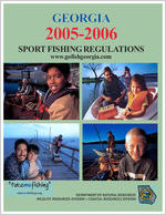
GEORGIA
2005-2006
SPORT FISHING REGULATIONS
www.gofishgeorgia.com
DEPARTMENT OF NATURAL RESOURCES
WILDLIFE RESOURCES DIVISION COASTAL RESOURCES DIVISION
2005-2006 Sport Fishing Regulations
www.gofishgeorgia.com
Page 1
TABLE OF CONTENTS
FRESHWATER SECTION (Alphabetical listing)
Agreements with Bordering States ............ 17-18 Angler Award Program ............................... 7 Boating Regulations ................................. 16 Buying Licenses ....................................... 5 Commercial Fishing ................................. 13 Daily Limits ............................................ 6 Definitions ............................................ 18 Fish Identification ............................... 19-20 Fish Kill Reporting .................................... 3 Fisheries Section Offices & PFAs ................... 3 Fishing Methods ...................................... 8 Free Fishing Days ..................................... 2 Guidelines for Eating Fish ...................... 21-24 Handling & Releasing Fish ........................... 8 How To Use This Guide .............................. 4 Length Limits ......................................... 7 License Requirements ................................ 5
Protected Species .................................... 10 Public Fishing Areas ............................. 14-15 Recent Changes Summary ........................... 4 Sale of Fish ........................................... 13 Seasons ................................................. 6 State Freshwater Record Fish ..................... 15 Trout Fishing ....................................... 9-13 Turn in Poachers contact number ................. 21
SALTWATER SECTION
Bait Minnows ......................................... 30 Crabs .............................................. 29-30 Deflating Your Fish .................................. 30 Finfish ............................................. 26-27 Measuring Saltwater Finfish ....................... 27 Shellfish ............................................... 30 Sport Bait Shrimping ................................ 29 State Saltwater Record Fish ........................ 28
2005-2006 FRESHWATER AND SALTWATER SPORT FISHING REGULATIONS
Sonny Perdue, Governor Noel Holcomb, Commissioner, Department of Natural Resources
Dan Forster, Director - Wildlife Resources Division Susan Shipman, Director - Coastal Resources Division
The Wildlife Resources Division designed this guide to help you quickly find and understand regulations for fishing in Georgia. The Game and Fish Code and Department of Natural Resources rules are the final authority on questions of law. This publication was paid for by the sale of advertising. The Georgia Dept. of Natural Resources does not necessarily endorse products or services listed. Editor: Ted Hendrickx (GADNR), Advertising: C.Sean Alibrando (Liberty Press).
BOARD OF NATURAL RESOURCES
Loyce W. Turner - Chair Walter A. Hudson - Vice Chair Phyllis T. Johnson - Secretary Earl D. Barrs Sally S. Bethea Jenny Lynn Bradley Ralph W. Callaway William A. Carruth Sara S. Clark Cadar Cox Mabel C. Jenkins
James M. Reynolds III Robert J. Rutland Glenn E. Taylor James W. Tysinger James A. Walters
Thomas W. Wheeler, Jr.
Discover Fishing on Georgia's Free Fishing Days!
June 4, June 11 and September 24, 2005
No fishing or trout license required All waters of the state Must be a Georgia resident Does not include fees at private lakes No WMA license required to fish on a Public Fishing
Area or Waters Creek trophy trout stream All other Fishing Regulations apply
A Lifetime of Fishing and Hunting!
Infants under age 2: $200 Youth ages 2 - 15: $350 Adult ages 16 - 65: $500 Senior (60 and up): $95 Non-resident under 16 years of age (see page 4): $1000
For a one-time price, you can enjoy a lifetime of great Georgia fishing & hunting opportunities! Go to www.georgiawildlife.com or call 770-414-3333 for more information on purchasing a Lifetime License.
See Page 4 For a Summary of Recent Fishing Related
Changes
Cover Photo: "Take me fishing". How could you resist this request from a child or a loved one? There is no better way to spend time together. Our cover photos are part of the "Take Me Fishing" campaign sponsored by the Recreational Boating and Fishing Foundation. To learn more about this program and ways that you and your family can share the joys of fishing visit:
www.takemefishing.org or www.rbff.org
Page 2 1-888-748-6887 for licenses
Wildlife Resources Division & Coastal Resources Division
Contact Information and Offices
Fisheries Offices, Hatcheries & Public Fishing Areas (PFAs)
1 Northwest Regional Office (Calhoun)
706-624-1161
2 Rocky Mountain Rec. & PFA
706-802-5087
3 Summerville Office & Hatchery
706-857-3394
4 Buford Trout Hatchery
770-781-6888
5 Burton Office & Trout Hatchery
706-947-3112
6 Northeast Regional Office (Gainesville)
770-535-5498
7 East Central Regional Office &
Walton Hatchery (Social Circle)
770-918-6418
8 McDuffie PFA & Hatchery
706-595-1684
9 Thomson District Office
706-595-1619
10 Wildlife Resources Division Headquarters
770-918-6400
11 Big Lazer Creek PFA
706-845-4180
12 Charlie Elliott Wildlife Center/Marben PFA 770-784-3059
13 West Central Regional Office (Fort Valley) 478-825-6151
14 West Point District Office
706-845-4180
15 Cordele Hatchery
229-276-2362
16 Dawson Office & Steve Cocke Hatchery
229-995-4486
17 Southwest Regional Office (Albany)
229-430-4256
18 Bowens Mill Office & Hatchery
229-426-5272
19 Dodge County PFA
478-374-6765
20 Evans County PFA
912-739-1139
21 Hugh M. Gillis PFA
478-296-6192
22 Metter District Office
912-685-6424
23 Paradise PFA
229-533-4792
24 South Central Regional Office (Waycross)
912-285-6094
25 Coastal Regional Office (Demeries Creek)
912-727-2112
26 Coastal Resources Division HQ
912-264-7218
27 Richmond Hill Hatchery
912-756-3691
%
!
$
"
#
&
&
!
'
(
!
!
%
)
'
&
&
!
'
0
'
1
2
3
$
!
'
4
!
0
!
)
#
5
If you have questions or comments regarding fishing laws or regulations, or any other fisheries matter, please contact the Fisheries office nearest you.
LAW ENFORCEMENT OFFICES
FISHERIES MANAGEMENT REGIONAL OFFICES
FRESHWATER
Telephone numbers are listed above, #'s refer to locations on the map above.
Northwest Region (#1) Wildlife Resources Division 312 N. River St., N.W. Post Office Box 519 Calhoun, Georgia 30703-0519
South Central Region (#24) Wildlife Resources Division 108 Darling Ave. Post Office Box 2089 Waycross, Georgia 31502-2089
Boating Safety ......... 770-784-3068 Albany ................... 229-430-4252 Brunswick ............... 912-264-7237 Calhoun (Atlanta #) .... 770-769-9680 Calhoun ................. 706-624-1367 Gainesville ............. 770-535-5499 Macon ................... 478-751-6415 Metter ................... 912-685-2145 Social Circle (Atlanta #)..770-918-6414
Northeast Region (#6) Wildlife Resources Division 2150 Dawsonville Hwy. Gainesville, Georgia 30501-1006
Coastal Region (#25) Wildlife Resources Division 22814 Highway 144 Richmond Hill, Georgia 31324-5804
Social Circle ............ 706-557-3034 Thomson ................ 706-595-4211 Thomson (Augusta #) .. 706-737-1480 LE Headquarters ...... 770-918-6408
East Central Region (#7) Wildlife Resources Division 2123 U.S. Hwy. 278, S.E. Social Circle, Georgia 30025-4714
WILDLIFE RESOURCES DIVISION State Headquarters Office (#10) 2070 U.S. Hwy. 278, S.E. Social Circle, Georgia 30025-4711
Turn in Poachers .... 1-800-241-4113
REPORT FISH KILLS
Help protect our valuable fish resources.
West Central Region (#13) Wildlife Resources Division 1014 Martin Luther King Blvd. Fort Valley, Georgia 31030-6246
SALTWATER FISHING INFO Coastal Resources Division (#26) One Conservation Way, Suite 300 Brunswick, Georgia 31520-8687 912-264-7218
Report fish kills as quickly as possible. CALL TOLL FREE 1-800-241-4113 (24 hrs a day, seven days a week).
Southwest Region (#17) Wildlife Resources Division 2024 Newton Road Albany, Georgia 31701-3576
For more fishing information visit us on the internet at: www.gofishgeorgia.com
2005-2006 Sport Fishing Regulations
www.gofishgeorgia.com
Page 3
2005-2006 Changes & How to Use This Guide
Lifetime License Changes: In 2004 a law was passed establishing a Senior Discount Lifetime License for Georgia residents 60 years old and older for $95.00. Additionally, a Non-resident Lifetime License is now available for any non-resident under 16 years of age who is a grandchild of a Georgia resident who holds a valid lifetime license. Visit www.georgiawildlife.com for more information.
Saltwater Fishing Changes: There have been changes in the way that recreational crab traps must be marked which take effect April 1, 2005 (see pg. 30). Contact the Coastal Resources Division of DNR at 912-264-7218 for current information. Saltwater regulations begin on page 26.
Northwest Georgia Lake Sturgeon Sighting Alert
Four long "whiskers"
Mouth
Bony plates
"Shark-like" tail
These fish have been reintroduced by DNR into the Coosa River system in Northwest Georgia. These fish cannot be harvested and must be released unharmed as soon as possible. If hooked deeply, cut the line close to the hook and release the sturgeon.
Your help is needed. If you see a lake sturgeon please call 706-624-1161. Note the location of your sighting and leave your name and telephone number. Additional information is also at www.gofishgeorgia.com PLEASE NOTE: Lake sturgeon are only ONE species of sturgeon that live in Georgia. In middle and south Georgia or in coastal locations you may encounter Atlantic sturgeon or shortnose sturgeon. These fish should not be confused with lake sturgeon stocked in NW Georgia. Find out more about Georgia's sturgeon at www.gofishgeorgia.com
How to Use This Guide
Enjoy your fishing but be sure you know the freshwater and saltwater rules for Georgia before you go. Regulations may vary on different bodies of water. To use this guide follow these steps:
1. Be familiar with fishing license requirements and know who needs a license. See pg.5 (freshwater) & pg. 26 (saltwater).
2. Know the daily limits and seasons on pg. 6 (freshwater) & pgs. 26-30 (saltwater) and note any exceptions. See freshwater fish length limits on pg. 7 and legal freshwater fishing methods on pg. 8.
3. Are you trout fishing or fishing on Public Fishing Areas? See pgs. 9-13 (trout) and pgs. 14-15 (PFAs).
4. Are you from out of state or fishing border waters? See "Agreements with Bordering States" on pgs. 17-18.
As an angler, it is your responsibility to know what regulations apply to the body of water you are fishing.
You Give. They Live. Buy A Tag.
www.georgiawildlife.com
Lost Your License? For licenses purchased from the
internet, log in and print out a replacement license at
www.georgiawildlife.com.
For licenses purchased by
telephone, call 1-888-748-6887 for a replacement.
For licenses purchased at a
license dealer, obtain a "Request for Replacement/Refund" form
from a license dealer and mail it to the License Unit. There is a $3 replacement fee for each form submitted.
NOTE: To fish immediately, you must purchase a new license and request a refund for the second license by submitting the refund form.
Celebrate
and plan to attend a 2005 Georgia DNR Outdoor Adventure Day event!
NATIONAL HUNTING & FISHING DAY is
SATURDAY, SEPTEMBER 24, 2005
The U.S. Congress and President Nixon established National Hunting & Fishing (NHF) Day 33 years ago to recognize hunters and anglers for the time and money, more than a
billion dollars each year, they donate to wildlife conservation
programs.
NHF Day events provide opportunities for outdoor-oriented people and urbanites alike to learn more
about outdoor skills and activities.
To find out about Georgia events visit www.georgiawildlife.com
Page 4 1-888-748-6887 for licenses
Wildlife Resources Division & Coastal Resources Division
License Requirements
Where to Buy a Fishing License
At 1,000+ license dealers statewide including WRD offices, marinas, major retailers, sporting goods, bait & tackle, and hardware stores.
Telephone 1-888-748-6887 Internet: www.gofishgeorgia.com Telephone and Internet available 24 hours, 7 days a week. NOTE: Social Security Number is required for the purchase of all licenses.
WHO NEEDS A FISHING LICENSE
Anglers age 16 and older must have a current Georgia fishing license in their possession while fishing in fresh or salt water in Georgia. Conservation Rangers may require identification when checking fishing licenses. EXCEPTION:A fishing license is not required to fish in private ponds (does not include ponds owned by governments-city, county, state, or federal) nor by a landowner and their immediate family when fishing on their land.
RESIDENTS: Proof of residence, such as a Georgia
driver's license, is required to purchase a resident fishing license.
Residents 65 years of age or older: May fish with the Senior (65+) Lifetime License. This license can be obtained free from license dealers by furnishing proof of age (driver's lic., birth certificate, etc.).
Permanently and totally disabled: Residents may obtain a Disability Honorary Combination Hunting and Fishing License by applying to the License Unit. Proof of disability must accompany the application. Proof of disability may come from the
U.S. Dept. of Veterans Affairs, Social Security Admin., Railroad Retirement System or other government agency.
Persons that are blind: May apply for a Lifetime Honorary Fishing License and must provide a Physician's Certification of Blindness with the application.
NONRESIDENTS:
Nonresidents 16 or older, regardless of physical condition, must have a valid nonresident Georgia fishing license to fish in Georgia, except in private ponds.
Nonresidents under 16 do not require a fishing license or trout license.
Florida residents 65 years of age or olderSee "Agreement with Florida" on page 18.
College students (US citizens) enrolled full-time who are residing within the state may purchase a resident fishing license. A current student I.D. must be shown when purchasing a resident fishing license.
Military persons on active status stationed at a military base in Georgia and their immediate family members may purchase a resident fishing license. This includes fulltime military personnel on active duty who list Georgia as their home of record in their official military file (with documented proof). A current military I.D. and verifiable proof of being stationed at a Georgia military installation must be shown when purchasing a resident fishing license.
Any violation of Georgia fishing laws or regulations can cause revocation of license.
2005-2006 RECREATIONAL FISHING LICENSE FEES
Licenses are valid for one full year from date of purchase
RESIDENT LICENSES:
NONRESIDENT LICENSES:
Sportsman's ................ $60.00 Annual Fishing .............. $24.00
Fishing .......................... 9.00 One-Day Fishing .............. 3.50
One-Day Fishing .............. 3.50
Trout ............................ 5.00 7-Day Fishing .................. 7.00
Combination Hunting and Fishing .................. 17.00
Trout ........................... 13.00
Wildlife Management Area . 19.00 Wildlife Management Area .. 73.00
See page 2 for information on Lifetime License prices.
LIFETIME & ANNUAL SPORTSMAN'S LICENSES
Lifetime licenses are available for anglers of all ages. See page 2 for full details. The Lifetime license satisfies all state license requirements for the life of the purchaser. Senior (age 65+) lifetime licenses are free ($10 for a plastic, permanent card). Annual Sportsman's license is a single license that covers all sport hunting & fishing licenses (except Federal Duck Stamp). Includes; Regular Hunting Lic., Primitive Weapons Lic., Big Game Lic., WMA Lic., GA Waterfowl Lic., Fishing Lic., Trout Lic. and H.I.P. permit.
PUBLIC FISHING AREAS See page 14 for license requirements.
RECIPROCAL AGREEMENTS for BORDERING STATES
Georgia DNR has Agreements with Alabama, Florida, North Carolina, and South Carolina allowing holders of Georgia fishing licenses to fish in the waters covered without obtaining a fishing license from the bordering state. See Agreements with Bordering States on pages 17-18.
TROUT LICENSE
All resident anglers ages 16 to 64 must have a trout license and a Georgia fishing license to fish in designated trout waters and to fish for or to possess trout.
Resident Senior (65+) lifetime and honorary license holders are not required to have a trout license.
Landowners and their immediate families may fish on their premises without a trout license.
All nonresident anglers, 16 or older, regardless of physical condition, must possess a nonresident fishing license and nonresident trout license to fish for or possess trout or to fish in designated trout waters.
Florida residents, 16 or older, must possess a nonresident trout license to fish for or possess trout or to fish in designated trout waters.
STATE PARK VISITORS are not required to have a trout license to fish in the impounded waters of the State Park.
2005-2006 Sport Fishing Regulations
www.gofishgeorgia.com
Page 5
Freshwater Game Species Daily Limits
It is unlawful to take in one day or to possess at any one time, except at a residence or commercial storage facility, more than the daily limit for each species. It is unlawful to possess more than a total of 50 individuals of all the game fish listed in this section, except channel and flathead catfish.
Once the daily limit for a particular species is taken, it is unlawful to continue to fish for that species.
Exception: Daily limits differ on certain waters shared by Georgia & South Carolina. See "Agreements w/ Bordering States Section" (pg 17).
BASS ................................. 10 Largemouth, Redeye (Coosa),
Shoal, Smallmouth, Spotted (Kentucky), and/or Suwanee bass
CATFISH ...................... No Limit Channel and/or Flathead
CRAPPIE ............................. 30 Black and/or White
PICKEREL ............................ 15 Chain, Grass and/or Redfin
SAUGER ............................... 8
SHAD ................................... 8 American and/or Hickory
STRIPED BASS, WHITE BASS and/or HYBRID WHITE-STRIPED BASS (see Note & Exception #1)....15
Only two of which can be 22 inches or longer (there is no length restriction in waters covered in South Carolina agreement).
Note: The season for taking striped bass and hybrid white-striped bass from the Savannah River and its tributaries downstream of New Savannah Bluff Lock and Dam is closed.
SUNFISH or BREAM (see exception #2) ............. 50
Bluegill, Flier, Redbreast, Redear, Rock bass, Spotted, Warmouth and/ or Shadow bass
TROUT (see exception #3) ........ 8 Brook, Rainbow, and/or Brown trout
WALLEYE (see exception #4) ..... 8
STURGEON may not be taken in fresh or saltwater in Georgia.
Seasons
EXCEPTIONS:
#1: STRIPED BASS, WHITE BASS and/ or HYBRID WHITE-STRIPED BASS:
Limit taken from the North Newport River, Medway River including Mount Hope Creek, Little Ogeechee River, Ogeechee River, Oconee River downstream of GA Hwy 22 in Milledgeville, Ocmulgee River downstream of the GA Hwy 96 bridge between Houston & Twiggs counties, Altamaha River, St. Mary's River, Satilla River, and the tributaries to these river sections; and from saltwater is a two fish limit, both must be 22 inches in length or longer.
See South Carolina Agreement on page 17.
#2: BREAM: see South Carolina Agreement on page 17.
#3: TROUT: See Amicalola Creek, Chattahoochee River, Chattooga River, Smithgall Woods, Smith Creek, and Waters Creek on pages 9-10.
#4: WALLEYE: Limit on Blue Ridge Reservoir is 15.
There is no closed season for fishing in freshwater in Georgia except for the following:
TROUT SEASON: Trout streams that are designated as seasonal trout streams are OPEN to fishing for any species from MARCH 26 - OCTOBER 31, 2005. Seasonal trout streams are CLOSED to fishing for all fish species at all other times. See pgs. 9-13 for trout stream designations.
FLINT, CHATTAHOOCHEE & SPRING CRK: The Flint River and its tributaries from the Georgia Power Co. dams at Albany to the US Hwy. 84 bridge; the Chattahoochee River
and its tributaries from the Columbia Lock & Dam to the GA Hwy. 91 bridge; and Spring Creek and its tributaries downstream to GA Hwy. 253 are CLOSED to striped bass fishing and spear fishing from May 1 - October 31 each year.
LAKES SEMINOLE and BLACKSHEAR: All fishing, including spear fishing, for any species in the marked areas around five fish refuges in Lake Seminole and in three fish refuges in Lake Blackshear is prohibited from May 1 - October 31 each yr.
SAVANNAH RIVER: The season for taking striped bass and hybrid
FISHING WITHOUT PERMISSION
It is unlawful to fish on someone else's property without permission. Conservation Rangers and other law enforcement officers are charged with enforcing this law. Fishing rights are often privately held on nonnavigable streams. Always ask permission before entering private land. Permission is not required to fish in the Chattahoochee or Oconee National Forests, on Public Fishing Areas (PFAs) or Wildlife Management Areas (WMAs) of the Wildlife Resources Division, or in Georgia State Parks.
white-striped bass from the Savannah River and its tributaries downstream of New Savannah Bluff Lock and Dam is CLOSED.
COOSA RIVER: The season for taking
lake sturgeon from the Coosa River and its tributaries is CLOSED. See page 4 for more information on this closure and how to identify this fish.
Creel and Possession Note to Anglers:
Creel and possession limits are per person. In order for Conservation Rangers to correctly determine compliance with these limits, each individual should keep trout or other fish on separate stringers or in separate creels. It is unlawful for one individual to possess more than the legal limit of any fish species.
Page 6 1-888-748-6887 for licenses
Wildlife Resources Division & Coastal Resources Division
Length Limits
NOTE: There are no minimum length limits on freshwater game fish unless they are listed below. You must release all fish shorter than the minimum length indicated for that species.
Largemouth bass 12 inches statewide except: Bear Creek Reservoir (Jackson
County) - bass between 16 and 22 inches must be released immediately. All others may be kept. Lake Blackshear-14 inches Lake Blue Ridge-no minimum (0 in.) Lake Burton-no minimum (0 in.) Lake Juliette-no minimum (0 in.) Lake Lanier-14 inches Lake Oconeebass between 11 and 14 inches must be released immediately. All others may be kept. Ocmulgee River from the Spring Street bridge crossing in Macon downstream to the confluence of the Ocmulgee River and the Oconee River-14 inches.
Lake Walter F. George-14 inches West Point Reservoir-14 inches Public Fishing Area lakes operated
by the Department of Natural Resources-14 inches. This limit will not apply to lakes which have been posted as having a different length limit for largemouth bass.
Shoal bass: Lake Lanier-14 inches Flint River and its tributaries-
12 inches
Spotted bass: Lake Lanier-14 inches
Striped bass, White bass, Hybrid white-striped bassYou may only keep two fish that are 22 inches or longer, except the minimum length is 22
How to Measure a Freshwater Fish
inches on the North Newport River, Medway River including Mount Hope Creek, Little Ogeechee River, Ogeechee River; Oconee River downstream of GA Hwy 22 in Milledgeville; Ocmulgee River downstream of GA Hwy 96 bridge between Houston and Twiggs counties; Altamaha River, Saint Mary's River, Satilla River, and the tributaries to these river sections; and from saltwater.
Trout - No minimum length limit for trout other than: Waters Creek-brown and rainbow
trout-22 inches; brook trout-18 inches Noontootla Creek and its tributaries
on Blue Ridge WMA-16 inches for all trout.
1. Place the fish on its side with the jaw closed
2. Squeeze the tail fin lobes together
3. Measure in a straight line from the tip of the snout to the extreme tip of the tail
4. You must release all fish shorter than the minimum length indicated for that species.
Georgia Angler Recognition / State Record Catches
Catching a big fish is always a thrill and usually requires exceptional fishing skill. Each year DNR recognizes the achievement of anglers who catch "trophy" fish by presenting them with an Angler Award. Fish do not have to be a new state record to qualify. Angler Award applications and minimum weights for species are available at any Fisheries Section office and at www.gofishgeorgia.com. To qualify you must:
Catch your fish by legal sport fishing methods in Georgia (see page 8).
Weigh the fish as soon as possible on scales certified accurate by the Georgia Dept. of Agriculture (at Fisheries Section offices & businesses that sell products by weight) in the presence of two witnesses over the age of 18.
Witnesses cannot be members of the immediate family. The fish must meet the minimum weight requirements for that species.
Take the fish to a DNR Fisheries Office and have it positively identified. In some cases a clear side view photo of the fish can be used for identification (check with DNR office before submitting application). Please call before you come to an office to make sure that someone will be available to identify your fish
Complete an application and submit it with a clear side view photo of the whole fish to the address listed on the form.
If you think you, or someone you know, have caught a new state freshwater record, follow these steps:
Do not clean or freeze the fish.
Keep the fish cool, preferably on ice.
Weigh the fish to the nearest ounce as soon as possible (see left for weighing details). Estimated weights are not accepted.
Take the fish to a DNR Fisheries Office as soon as possible and have it positively identified by a DNR fisheries biologist or technician. Please call the office before you come.
Complete an application and submit with a clear side view photo of the whole fish within 90 days of the catch.
Georgia Freshwater Fish Records are on page 15 Georgia Saltwater Fish Records are on page 28
2005-2006 Sport Fishing Regulations
www.gofishgeorgia.com
Page 7
Fishing Methods
IT IS UNLAWFUL TO:
Possess or use live blueback herring for bait in all freshwaters except the following: Lakes Chatuge, Juliette, Lanier, and Nottely; and the Altamaha River watershed downstream of the following: Juliette dam on the Ocmulgee River, Lake Juliette dam on Rum Creek, Lake Tobesofkee dam on Tobesofkee Creek, Lake Sinclair dam on the Oconee River; and watersheds of all other streams that flow directly into the Atlantic Ocean. For maps of restricted waters go to www.gofishgeorgia.com & see "Freshwater Regulations" section.
Fish for game fish, except American shad, hickory shad, channel catfish, or flathead catfish, by any means other than pole and line.
Take any fish from public freshwater by any method other than the methods listed on this page. Snagging fish is illegal.
Use electronic devices, explosives, poisons, or firearms to take fish. Stock or release fish or bait into any public waters except the water from which it was taken.
HOOK AND LINE
Game fish may be used as live bait (where live bait is legal) if they are taken legally and you do not exceed daily creel and possession limits.
There is no restriction on the number of poles and lines to fish for game fish except: fishing for trout - one pole; fishing on Public Fishing Areas - two poles; and sport shad fishing two poles.
Anglers using more than two poles and lines to fish for shad must abide by commercial shad regulations.
Landing nets may be used to land fish legally caught.
SPORT TROTLINES Sport trotline is one line or a
combination of lines using less than 51 hooks. Sport trotlines must be: 1. marked with the owner's name
and address and with visible buoys 2. submerged at least three (3) feet
below the surface of the water 3. attended regularly and removed
after the completed fishing trip.
Unmarked or unattended trotlines will be confiscated by DNR. It is unlawful to use any sport trotline within one-half mile below any lock or dam.
Only catfish and nongame fish (yearround) and American and Hickory shad during shad season may be taken with trotlines.
Trotlines and jugs are not permitted on Lake Tobesofkee or any State Park lake.
SPEAR FISHING "Spearing" is the use of a handheld
spear or similar device and the use of a weapon, other than a firearm, which propels the spear to which a wire, rope, line, etc. is attached and secured to the weapon or the person using the weapon. Only nongame fish may be speared
in freshwater and are not to be sold or used for commercial purposes. It is illegal to spear game fish and all species of catfish. A sport fishing license is required to spear fish in Georgia. The person spearing fish must be completely submerged.
NOTE: See SEASONS on page 6
SEINES, CAST NETS, BOW NETS Only nongame fish less than 5 inches
in length may be taken using a minnow seine and are not to be sold or used for commercial purposes. All other fish and eels taken in minnow seines must be released immediately unharmed into the water. A minnow seine must be less than 20 feet in length and have a 3/8 inch or less mesh (square or diameter). Minnow seines may not be used in designated trout waters. Dip nets and cast nets may be used to take threadfin shad, gizzard shad, and blueback herring for bait except in State Park lakes. Bow nets are considered sport shad fishing gear and shall have a minimum legal size of 31/2 inches stretched mesh.
BOW FISHING Nongame fish may be taken by bow and arrow from freshwater under the following conditions:
Possession of a sport fishing license is required to bow fish in Georgia.
Arrows must be equipped with barbs or similar devices for recovering fish and must be attached to the person or bow by a line sufficient for recovering the arrow and fish.
Poisonous or exploding arrowheads are illegal.
Arrows cannot be discharged into the water closer than 150 feet to
anyone engaged in any other means of recreation.
Legal hours for fishing with bow and arrow are from sunrise to sunset, except nongame fish may be taken at night while using a light in reservoirs over 500 acres in size.
Any game fish with an open wound possessed by a person bow fishing will be considered evidence of taking fish illegally.
Catfish (channel & flathead) may be
taken in the Savannah Riv. & its tributaries and impoundments in the Savannah Riv. basin by bow & arrow any time during the day or at night by the use of a light.
Handling & Releasing Fish
When releasing a fish, you can give the fish a better chance of survival by following these guidelines:
Play and release the fish as rapidly as possible.
Try not take the fish out of water.
Handle the fish gently with bare, wet hands. Do not squeeze the fish, put your fingers in the gills or cause scale loss.
Remove the hook quickly using needlenose pliers. If the fish is hooked in the stomach or throat, cut the line and leave the hook. The hook will dissolve without harming the fish.
Wet your measuring board before measuring the fish.
Hold the fish in an upright position and move it gently back and forth so water runs over the gills. Release the fish when it is able to swim.
Operate live well aerators continuously when holding fish that you plan to release.
Page 8 1-888-748-6887 for licenses
Wildlife Resources Division & Coastal Resources Division
Trout Fishing in Georgia
The Wildlife Resources Division uses special regulations (see below) and stocking to provide quality trout fishing in Georgia. More than one million rainbow trout and brown trout are stocked each year from March through mid-September. The number of trout stocked and the stocking frequency depend on a stream's fishing pressure, public access, and water conditions. Streams with greater public access are stocked more often with more trout.
General information about trout stocking and the Trout Streams of Georgia Map are available from WRD offices and at www.gofishgeorgia.com. The map includes Georgia's trout streams, roads, and a list of recommended streams.
Trout need clean, cold water to survive. Georgians can be good trout managers by using proper land use practices. Trees and other vegetation left along
stream banks provide shade to keep water cold and help prevent soil from washing into the stream.
Many trout streams are located on private property. The landowner controls access to, and fishing rights in, such streams. It is your responsibility to know when you cross a property line. Obtain permission from the landowner before fishing on private property.
Trout Stream Regulations
Note: While fishing any specially regulated waters with a minimum size limit, it is unlawful to possess a trout which is less than the specified minimum size regardless of where the fish was caught.
TROUT SEASON Trout season on seasonal streams is from March 26- October 31, 2005. Many trout streams are open to fishing year-round (see pages 11-13 for stream listings).
TROUT FISHING HOURS
Fishing hours on seasonal trout streams, except Waters Creek (page 10), are 30 minutes before sunrise to 30 minutes after sunset. Night fishing is not allowed.
Fishing 24 hours a day is allowed on year-round trout streams, except those in next paragraph, and on all impoundments on trout streams, except Dockery and Rock Creek lakes.
Fishing hours on the Chattahoochee River from Buford Dam to Peachtree Creek, the Conasauga River watershed upstream of the GeorgiaTennessee state line and Smith Creek downstream of Unicoi dam are 30 minutes before sunrise until 30 minutes after sunset. Night fishing is not allowed.
TROUT FISHING RULES Trout anglers are restricted to the
use of one pole and line which must be hand held. No other type of gear may be used in trout streams. Live bait-fish may not be used in any trout stream, except live baitfish may be used on the Chattahoochee River downstream of the Roswell Road bridge (GA Hwy 9). Seining bait-fish is not allowed in any trout stream.
It is unlawful to fish for any fish species in a seasonal trout stream when the season is closed.
IMPOUNDMENTS ON TROUT STREAMS
ANGLERS CAN: Fish for fish species other than trout
without a trout license, except on Dockery and Rock Creek lakes.
Fish year-round, except on Dockery Lake.
Fish at night, except on Dockery and Rock Creek lakes.
Impoundment Notes:
If you fish for or possess trout, you must possess a trout license. If you catch a trout and do not possess a trout license you must release the trout immediately.
Visitors fishing impoundments on State Parks can fish for & possess trout without a trout license. State Park visitors fishing trout streams must possess a trout license.
DELAYED HARVEST STREAMS Anglers fishing delayed harvest streams must release all trout immediately and use and possess only artificial lures with one single hook per lure from Nov. 1-May 14 annually. The use of additional "dropper" lures on one line is permitted as long as each lure contains one single hook. These restrictions do not apply from May 15-Oct. 31 of each year. The following streams are delayed harvest streams: AMICALOLA CREEK from County Road 192 (Steele Bridge Road) downstream to GA Hwy 53. CHATTAHOOCHEE RIVER from Sope Creek (off Columns Drive) downstream to US Hwy 41 (Cobb Parkway). CHATTOOGA RIVER from GA Hwy 28 bridge upstream to the mouth of Reed Creek. SMITH CREEK on Unicoi State Park from Unicoi Dam downstream to the Unicoi State Park property boundary.
Visit www.gofishgeorgia.com to see maps of Delayed Harvest Streams.
ARTIFICIAL LURES ONLY In streams listed here only artificial
lures may be used. It is unlawful to possess any other type bait on an
"artificial lures only" stream (see definitions on page 18). CHATTAHOOCHEE RIVER from GA Hwy 20 to the boat ramp at the National Park Service Medlock Bridge Park immediately upstream of GA Hwy 141. COLEMAN RIVER and its tributaries from its junction with the Tallulah River upstream to Forest Service Bridge No. 54. CONASAUGA RIVER and its tributaries (except Jacks River watershed) upstream of the Georgia-Tennessee state line are restricted to using only artificial lures from Nov. 1 through the last Saturday in March of each year. Natural baits may be used during trout season. HOODS CREEK and its tributaries on the Warwoman WMA. JONES CREEK and its tributaries on the Blue Ridge WMA. MOUNTAINTOWN CREEK and its tributaries upstream of Mountaintown Creek Watershed Structure No. 2 (Hills Lake). NOONTOOTLA CREEK and its tributaries on Blue Ridge WMA. NOTE: All trout less than 16 inches in length caught from this section of Noontootla Creek must be released immediately. STANLEY CREEK and its tributaries on the Rich Mountain WMA. WALNUT FORK CREEK and its tributaries on the Warwoman WMA.
OTHER REGULATIONS MOCCASIN CREEK. That portion of Moccasin Creek between Lake Burton Hatchery water intake and a sign marking the approximate normal pool level of Lake Burton is restricted to anglers under 12 years of age and
holders of Honorary Licenses.
("Other Regulations" cont. next pg.)
2005-2006 Sport Fishing Regulations
www.gofishgeorgia.com
Page 9
Trout Stream Regulations (continued)
SMITHGALL WOODS-DUKES CREEK No trout may be possessed while License Requirements for
CONSERVATION AREA. Dukes Creek fishing on any stream on the Waters Creek:
and its tributaries within the Dukes Creek Conservation Area are open to fishing year round by reservation only. To make a reservation call 706-8783087.
Conservation Area or the GA Hwy 75 Alternate right-of-way.
WATERS CREEK located on the Chestatee WMA is managed for trophy trout. Waters Creek and its tributaries are open during the trout season on
Residents: Georgia resident fishing license, trout license, and WMA license. Senior (65+) Lifetime, Honorary and Sportsman's license holders do not need a WMA license. Nonresidents: Nonresident Georgia
Only artificial lures with barbless Wednesdays, Saturdays, and Sundays fishing license, nonresident trout
hooks may be used or possessed on only between 6:30 a.m. and 6:30 p.m. license and nonresident WMA
the portion of Dukes Creek and its tributaries in White County on the Conservation Area, including the GA Hwy 75 Alternate right-of-way.
Eastern Standard Time (7:30 p.m. Eastern Daylight Saving Time) with the following restrictions: Artificial lures with a single barbless
hook no larger than a #6 must be
license. Florida residents more than 65 years must possess nonresident trout and WMA licenses. Size limits: 22 inches for brown and
Possession of any bait, lure, or gear used. Only one lure can be used at a rainbow trout and 18 inches for brook
Trout Stream Regulations not legal for use on the stream is
unlawful.
time. You cannot possess lures that do not meet these criteria while on
trout. It is a violation to possess a trout smaller than these limits while
All fish caught from Dukes Creek and its tributaries in White County
the area. Landing nets may not exceed two
(2) feet in length.
fishing on Waters creek. Possession limit: One (1) trout may
be possessed daily. No person may
on the Conservation Area, including Possession of any bait, lure, landing take more than three (3) trout per
the GA Hwy 75 Alternate right-of- nets or gear not legal for use on the season.
way, must be immediately released stream is unlawful.
where caught.
No night fishing.
PROTECTED SPECIES MAY BE ENCOUNTERED WHILE FISHING
Many rare and protected species that live in or near water and may be encountered while fishing. There are currently 55 fish, 7 salamanders, 14 mussels, and 12 turtles on Georgia's protected species list. It is unlawful to capture, kill, or harm any protected species. If you accidentally capture a protected species while fishing, release it unharmed immediately. For more information, please contact the Nongame Wildlife and Natural Heritage section at 770-918-6411 or visit the website www.georgiawildlife.com.
Page 10 1-888-748-6887 for licenses
Wildlife Resources Division & Coastal Resources Division
GEORGIA'S TROUT STREAMS BY COUNTY
Seasonal Trout Streams (S) are open March 26 -- October 31, 2005 Year-round Streams (YR) are open to fishing throughout the year and are designated in dark blue type.
Watershed = the stream and all its tributaries (streams flowing into that stream).
Abbreviations used throughout this section: Cr. = Creek and R. = River
NOTE: The following trout streams have special regulations (see pages 9-10 before fishing): Amicalola Cr., Chattahoochee R., Chattooga R., Coleman R., Conasauga R., Hoods Cr., Jones Cr., Moccasin Cr., Mountaintown Cr., Noontootla Cr., Smithgall Woods-Dukes Cr., Smith Cr., Stanley Cr., Walnut Fork Cr., and Waters Cr.
BARTOW COUNTY SBoston Cr. watershed upstream from GA Hwy 20. YRConnesena Cr. watershed; Dykes Cr. watershed; PineLog Cr. watershed; Pyle Cr. watershed; Salacoa Cr. watershed; Spring Cr. watershed; Stamp Cr. watershed upstream from Bartow Co Rd 269; Toms Cr. watershed upstream from Bartow Co Rd 82; Two Run Cr. watershed; Ward Cr. watershed.
CARROLL COUNTY YRTallapoosa R. watershed north of I-20, not including Little Tallapoosa R. watershed.
CATOOSA COUNTY SHurricane Cr. watershed upstream from Peters Branch. YRDry Cr. watershed (part of East Chickamauga Cr. watershed) upstream of Catoosa Co Rd 257; Little Chickamauga Cr. watershed upstream from Catoosa Co Rd 387; Tiger Cr. watershed upstream from GA Hwy 2.
CHATTOOGA COUNTY YRAllgood Branch watershed; Chappel Cr. watershed; Chelsea Cr. watershed; East Fork Little R. watershed including Gilreath Cr.; Hinton Cr. watershed; Kings Cr. watershed; Little Armuchee Cr. watershed upstream from Co Rd 326; Mt. Hope Cr. (Coon Cr.) watershed; Perennial Spring watershed; Raccoon Cr. watershed upstream from GA Hwy 48; Ruff Creek watershed; Storey Mill Cr. watershed; Taliaferro Cr. watershed.
CHEROKEE COUNTY SBoston Cr. watershed. YRBluff Cr. watershed upstream of Cherokee Co Rd 114; Pine Log Cr. watershed; Salacoa Cr. watershed; Soap Cr. watershed upstream of Cherokee Co Rd 116; Stamp Cr. watershed; Wiley Cr. watershed.
COBB COUNTY YRChattahoochee R. downstream to the mouth of Peachtree Cr. DADE COUNTY SEast Fork Little R. watershed; Rock Cr. watershed. YR- Allison Cr. watershed; Lookout Cr. watershed upstream from Dade Co Rd 197.
DAWSON COUNTY SAmicalola Cr. watershed upstream from Dawson Co Rd 192 (Steele Bridge Rd) which is first bridge upstream from GA Hwy 53; Amicalola Cr. tributaries from GA Hwy 53 upstream to Dawson Co Rd 192 (Steele Bridge Rd); Nimblewill Cr. watershed; Shoal Cr. watershed upstream from the mouth of Burt Cr.; Sweetwater Cr. watershed. YRAmicalola Cr. from Dawson Co Rd 192 (Steele Bridge Rd) downstream to GA Hwy 53; Anderson Cr. watershed; Long Swamp Cr. watershed. FANNIN COUNTY SCharlie Cr. watershed; Etowah R. watershed; Jacks R. watershed; Owenby Cr. watershed; Persimmon Cr. watershed; South Fork Rapier Mill Cr. watershed; Star Cr. watershed; Toccoa R. tributary watersheds entering the river downstream from Blue Ridge Reservoir to the GA-Tennessee state line & upstream from the mouth of Stanley Cr. except those listed as yearround; Tumbling Cr. watershed; Wilscot Cr. watershed. YRConasauga R. watershed (except Jacks R. watershed); Ellijay R. watershed; Fightingtown Cr. watershed; Mountaintown Cr. watershed; Noontootla Cr. watershed; Rock Cr. watershed; Rock Cr. Lake; Toccoa R. downstream from Lake Blue Ridge to the GA-Tennessee state line & upstream from the mouth of Stanley Cr. (does not include tributaries unless listed). FLOYD COUNTY SJohns Cr. watershed upstream from Floyd Co Rd 212. YRDykes Cr. watershed; Kings Cr. watershed; Lavender Cr. watershed upstream from Floyd Co Rd 893; Little Cedar Cr. watershed; Mt. Hope Cr. watershed; Silver Cr. watershed upstream of GA Hwy 1E (Floyd Co Rd 631); Spring Cr. watershed (flows into Etowah R.) Toms Cr. watershed. FORSYTH COUNTY YRChattahoochee R. FULTON COUNTY YRChattahoochee R. downstream to the mouth of Peachtree Cr.
GILMER COUNTY
SHarris Cr. watershed; Johnson Cr.
watershed; Tails Cr. watershed; and all
other streams or parts of streams not
listed as year-round except:
Coosawattee R. downstream from Old
GA Hwy 5 (Gilmer Co Rd 239); Talking
Rock Cr.; and tributaries to Carters
Reservoir not listed as year-round (these
may be fished year-round without a
trout license).
YRBall Cr. watershed; Cartecay R.
watershed; Conasauga R. watershed
(except Jacks R. watershed);
Coosawatee R. from confluence of
Cartecay & Ellijay rivs. downstream
to old GA Hwy 5 bridge (Gilmer Co Rd
239); Ellijay R. watershed;
Fightingtown Cr. watershed;
Mountaintown
Cr.
wa-
ter shed; Noontootla Cr. watershed;
Sevenmile Cr. watershed; Town Cr.
watershed; Wildcat Cr. watershed.
GORDON COUNTY SJohns Cr. watershed; Pin Hook Cr. watershed upstream from Gordon Co Rd 275. YRPine Log Cr. watershed upstream from GA Hwy 53; Rocky Cr. watershed upstream from Gordon Co Rd 210; Salacoa Cr. watershed upstream from US Hwy 411; Snake Cr. watershed.
GWINNETT COUNTY YRChattahoochee R.
HABERSHAM COUNTY SAmy's Cr. watershed upstream from GA Hwy 17; Chattahoochee R. tributaries downstream to GA Hwy 255 (except Amy's Cr. downstream from GA Hwy 17 & Sautee Cr. downstream from GA Hwy 255 Alternate bridge); Left Fork Soque R. upstream of GA Hwy 356 & all tributaries to the entire Left Fork Soque R.; Nancytown Cr. watershed upstream from Nancytown Lake; Right Fork Soque R. upstream of Wilson Falls &tributaries to the entire Right Fork Soque R.; Soque R. tributaries that enter the river from the confluence of the Left Fork & Right Fork Soque rivs. downstream to the mouth of Deep Cr.
YRChattahoochee R.downstream to GA Hwy 255; Left Fork Soque R. downstream of GA Hwy 356 except tributaries; Liberty Cr. watershed;
(Continues on next page)
2005-2006 Sport Fishing Regulations
www.gofishgeorgia.com
Page 11
S - SEASONAL STREAMS; YR - YEAR-ROUND STREAMS
HABERSHAM COUNTY (cont) Middle Fork Broad R. watershed; North Fork Broad R. watershed; Panther Cr. watershed; Right Fork Soque R. downstream of Wilson Falls except tributaries; Roberts Branch watershed; Sautee Cr. downstream from GA Hwy 255 Alternate bridge; Soque R., except tributaries downstream from the confluence of Left Fork & Right Fork Soque rivs., to the mouth of Deep Cr.; Toccoa Cr. watershed.
HARALSON COUNTY YRFlatwood Cr. watershed; Lassetter Cr. watershed; Mann Cr. watershed upstream from Haralson Co Rd 162; Tallapoosa Cr. watershed; Tallapoosa R. watershed upstream from Co Rd 222.
HART COUNTY YRSavannah R. from Hartwell Dam downstream to Richard B. Russell Reservoir.
LUMPKIN COUNTY SAmicalola Cr. watershed; Bryant Cr. watershed; Cane Cr. watershed upstream from GA Hwy 9-52 bridge; Cavender Cr. watershed; Chestatee R. tributaries upstream from the mouth of Tesnatee Cr., except for the Frogtown Cr. watershed; Dockery Lake; Etowah R. watershed upstream from Hightower Church Road (County Road 72) Bridge; Etowah R. tributaries from Castleberry Bridge upstream to Hightower Church Road (County Road 72) Bridge; Shoal Creek watershed; Yahoola Creek watershed upstream from the mouth of Bryant Cr. YRChestatee R. upstream from the mouth of Tesnatee Cr.; Etowah R. from Castleberry Bridge upstream to Hightower Church Road (County Road 72); Frogtown Cr. watershed; Yahoola Cr. watershed from the mouth of Bryant Cr. downstream to GA Hwy 52.
MURRAY COUNTY SJacks R. watershed upstream from Georgia-Tennessee state line; North Prong Sumac Cr. watershed; Rock Cr. watershed upstream from Murray Co Rd
4 (most southern of two Rock Crs. which are in the Holly Cr. watershed);
Sugar Cr. watershed upstream from
Murray Co Rd 4; Sumac Cr. watershed
upstream from Coffey Lake.
YRConasauga R. watershed upstream
from the GA-Tennessee state line
(except Jacks R. watershed); Dill Cr.
watershed; Holly Cr. watershed
upstream from Dill Cr.; Mill Cr.
watershed upstream from Murray Co
Rd 27; Mill Cr. (Hasslers Mill Cr.)
watershed that is in the Holly Cr.
watershed; Rock Cr. watershed (most
northern of two Rock Crs. within Holly
Cr. watershed) upstream from Murray
Co Rd 301.
PAULDING COUNTY
SPumpkinvine Cr. watershed upstream
from Paulding Co Rd 231; Raccoon Cr.
watershed upstream from SR 2299
(Paulding Co Rd 471).
YRPossum Cr. watershed upstream
from Paulding Co Rd 64; Powder Cr.
watershed; Thompson Cr. watershed;
Ward Cr. watershed.
PICKENS COUNTY
SAmicalola Cr. watershed upstream from
Dawson Co Rd 192; Cove Cr. watershed
upstream from Pickens Co Rd 294; Fisher
Cr. watershed; Pin Hook Cr. watershed.
YR- Ball Cr. watershed; Bluff Cr.
watershed; Cartecay R. watershed;
Darnell Cr. watershed; Hobson Cr. watershed; Little Scarecorn Cr. watershed; Long Swamp Cr. watershed upstream from Cove Cr.; Mud Cr. watershed; Rock Cr. watershed; Salacoa Cr. watershed; Scarecorn Cr. watershed upstream from GA Hwy 53; Sevenmile Cr. watershed; Sharp Mountain Cr. watershed; Soap Cr. watershed; Talking Rock Cr. watershed upstream from S1011 (GA Hwy 136); Town Cr. watershed; Wildcat Cr. watershed.
POLK COUNTY SLassetter Cr. watershed; Pumpkinpile Cr. watershed upstream from Polk Co Rd 437. YRCedar Cr. watershed upstream from Polk Co Rd 121; Little Cedar Cr. watershed; Silver Cr. watershed; Spring Cr. watershed; Swinney Cr. watershed; Thomasson Cr. watershed; Thompson Cr. watershed upstream of Polk Co Rd 441.
RABUN COUNTY SBad Branch watershed (flows into Lake Seed); Bad Cr. watershed (flows into Tugaloo); Bridge Cr. watershed; Crow Cr. watershed (flows into Seed); Dickenson Branch (flows into Burton); Dicks Cr. watershed (flows into Burton); Falls Branch watershed (flows into Rabun); Flat Cr. watershed; Joe Cr. watershed (flows into Rabun); LaCounts Cr. watershed (flows into Seed); Moccasin Cr. watershed, except Moccasin Cr. from the Lake Burton hatchery water intake downstream to the sign marking the approximate normal pool level of Lake Burton; Popcorn Cr. watershed; Seals Cr. watershed (flows into Seed); Slick Shoal Cr. (flows into Seed); Timpson Cr. watershed; Wildcat Cr. watershed; Worse Cr. watershed (flows into Tugaloo); and all other streams or parts of streams not listed as
year-round except: Tallulah R. downstream from Lake Burton Dam & tributaries to Burton, Seed, Rabun, Tallulah Falls, Tugaloo & Yonah lakes not listed as year-round (may be fished year-round without a trout license). YRChattooga R. upstream from the mouth of Warwoman Cr.; Little Tennessee R. downstream from US Hwy 23-441 bridge; Moccasin Cr. from the Lake Burton hatchery water intake downstream to the sign marking the approximate normal pool level of Lake Burton; Overflow Cr. watershed; Stekoa Cr. watershed; Tallulah R. downstream to Lake Burton; Warwoman Cr.; West Fork Chattooga R.
STEPHENS COUNTY
YR- Little Toccoa Cr. watershed; North Fork Broad R. watershed upstream from NRCS flood control structure No. 1; Middle Fork Broad R. watershed upstream from NRCS flood control structure No. 44.; Panther Cr. watershed; Toccoa Cr. watershed upstream from Toccoa Falls.
TOWNS COUNTY
SBearmeat Cr. watershed; Bell Cr.
watershed; Bugshuffle Branch
watershed (Allen Mill Cr.); Burch Branch
watershed; Fodder Cr. watershed; Hog
Cr. watershed; Shake Rag Branch
watershed; and all other streams or
parts of streams not listed as year-
round except: Hightower Cr.
downstream from Towns Co Rd 88;
Hiwassee R. downstream from Towns Co
Rd 87; and tributaries to Chatuge
Reservoir not listed below as year-round
(may be fished year-round without a
trout
license).
YR- Brasstown Cr. watershed
downstream from US Hwy 76 bridge;
Charlies Cr. watershed; Hightower Cr.
downstream from US Hwy 76 bridge to
Towns Co Rd 88; Hiwassee R.
downstream to Towns Co Rd 87;
Tallulah R.
UNION COUNTY
SArkaqua Cr. watershed; Bracket Cr.
watershed; Butler Cr. watershed; Camp
Cr. watershed; Conley Cr. watershed;
Kiutuestia Cr. watershed; Low Cr.
watershed; and all other streams or
parts of streams not listed below as
year-round except: Butternut Cr.
watershed; Nottely R. downstream from
Nottely Dam & tributaries to Nottely
Reservoir not listed as year-round (these
may be fished year-round without a
trout license).
YRBrasstown Cr. watershed
downstream from US Hwy 76 bridge;
(Continues on next page)
Page 12 1-888-748-6887 for licenses
Wildlife Resources Division & Coastal Resources Division
S - SEASONAL STREAMS; YR - YEAR-ROUND STREAMS
UNION COUNTY (cont) Coosa Cr. watershed; Ivylog Cr. watershed; Noontootla Cr. watershed; Nottely R. from US Hwy 129-19 bridge downstream to Nottely Reservoir; Rock Cr. watershed; Toccoa R. (does not include tributaries unless listed); Youngcane Cr. watershed.
WALKER COUNTY SFurnace Cr. watershed; Johns Cr. watershed; Rock Cr. watershed upstream from Sawmill Branch; Sawmill Branch; YRAllen Cr. watershed; Chappel Cr. watershed; Chattanooga Cr. watershed upstream from Walker Co Rd 235; Concord Cr. watershed; Dougherty Cr. watershed; Dry Cr. watershed (tributary to East Armuchee Cr.); Duck Cr. watershed; East Fork Little R. watershed (flows into Dade County); East Fork Little R. watershed (flows into Chattooga County); Gilreath Cr.; Gulf Cr. watershed; Harrisburg Cr. watershed upstream from Dougherty Cr.; Left Fork Coulter Branch watershed; Little Chickamauga Cr. watershed; Ruff Cr. watershed; Snake Cr. watershed; West Armuchee Cr. watershed; West Chickamauga Cr. watershed upstream from Walker Co Rd 107.
WHITE COUNTY SChattahoochee R. watershed upstream from GA Hwy 75 Alternate bridge; Chattahoochee R. tributaries from GA Hwy 75 Alternate bridge downstream to GA Hwy 255 bridge except Dukes Cr. watershed downstream from the US Forest Service property boundary, Sautee Cr., and Smith Cr. watershed downstream from Unicoi dam; Town Cr. watershed upstream from the mouth of Jenny Cr. YRChattahoochee R. downstream from the GA Hwy 75 Alternate bridge to the GA Hwy 255 bridge; Dukes Cr. watershed downstream from the US Forest Service property boundary; Little Tesnatee Cr. watershed upstream from the mouth of Turner Cr.; Sautee Cr.; Smith Cr. downstream of Unicoi dam; Turner Cr. watershed (one nearest to Cleveland City limits).
Sale of Fish/Aquaculture
GAME FISH
It is unlawful for any person to sell or purchase any game fish except under the following conditions:
Game fish may be sold by properly licensed commercial fish hatcheries, wholesale and retail fish dealers, and pond owners (see
resold provided each person in possession of said game fish has an authentic bill of sale or lading which details the source of the fish and the species, number and pounds of the fish.
DOMESTIC FISH
following paragraph) who conform to the Game and Fish Code.
Game fish may be sold from a pond when the owner has obtained a valid permit from DNR Law Enforcement Section (2 weeks required to process). NOTE: the permit must be displayed at the pond & the fish must be packaged & labeled for transport from the pond with the
Aquaculturists (fish farmers) must register with the Department of Natural Resources in order to sell domestic fish. Registration applications are available from any Fisheries Section office, at www.gofishgeorgia.com, or by calling 770-761-3044.
Domestic fish are lawfully obtained farmed fish which are held in confinement in private ponds, but only if they are fish species which are
permit number and the number and either indigenous to Georgia or have
pounds of each species contained in been recognized prior to 1992 as
the package. Fish must remain so having an established population in
packaged until processed or released public waters in Georgia. The White
into another pond.
NOTE: A permit will be issued only once annually and limits the time for taking fish from the pond to 15 days. Game fish shipped into Georgia may
Perch is not recognized as a domestic fish. Persons in possession of domestic fish from registered aquaculturists must have an authentic bill of sale or lading which identifies the seller, the date of transaction and at least two of the following for each fish species:
be lawfully transported, sold, and number, weight, or average length.
Don't release live bait fish, move live fish, aquatic plants, or mussels!
* It is unlawful to stock or release fish into waters within the state without a permit from DNR, except for lawfully obtained fish of legal species stocked in private ponds.
* Never release live bait fish, aquarium fish, or aquatic plants into our waters.
* Dispose of bait fish after fishing so that they cannot enter a lake, river, or stream.
* Remove all plant fragments and mussels from your boat, motor, trailer, live well, and nets before leaving the launch site and clean your boat and equipment thoroughly before launching into new waters.
Learn more about Aquatic Nuisance Species at www.gofishgeorgia.com
WHITFIELD COUNTY YRCoahulla Cr. watershed upstream from Whitfield Co Rd 183; Dry Cr. watershed (part of East Chickamauga Cr. watershed); Spring Cr. (Deep Spring Cr.) watershed; Swamp Cr. watershed upstream from Whitfield Co Rd 9; Tiger Cr. watershed.
COMMERCIAL FISHING
American shad, hickory shad, channel catfish, and flathead catfish taken while commercial fishing may be sold as described in the Game and Fish Code. For a complete copy of the freshwater commercial fishing regulations, contact the nearest Fisheries Section office or see the website www.gofishgeorgia.com. For saltwater commercial fishing information
End of "Trout Streams by County" list contact the Coastal Resources Division or visit http://crd.dnr.state.ga.us
2005-2006 Sport Fishing Regulations
www.gofishgeorgia.com
Page 13
Public Fishing Areas
Public Fishing Areas (PFAs) are great places for family outings. You can fish from the bank
or a boat, picnic, hike, watch wildlife, and enjoy the outdoors. Good bank fishing
opportunities are available at all PFAs and many of them have special kids fishing areas for
young anglers. Please call each PFA for details.
CHARLIE ELLIOTT WILDLIFE
On Public Fishing Areas IT IS UNLAWFUL TO:
CENTER/MARBEN PFA (Jasper & Newton Counties) (#12)
Operate boats on ponds or lakes posted as closed to boats. Operate gas outboard motors unless lake is posted as being open
to the use of outboard motors. NOTE: Gas motors, if allowed, must be operated at idle speed only.
Consume alcoholic beverages except at campsites on the area.
(770-784-3059)
Fish Species: Largemouth bass, Bluegill, Redear sunfish, Crappie, Channel catfish. Water: 22 ponds totaling 295 acres. Ponds range in size from 1 to 95 acres.
No alcoholic beverages are allowed on Rocky Mountain PFA.
Facilities: Kids only ponds, concrete
Fish at night. Fish in a pond or lake that has been posted "closed". Fish with any gear other than pole and line.
boat ramps (6 lakes), boat docks, restrooms, fishing piers, picnic areas, primitive camping, some fishing areas accessible to persons with disabilities.
Fish with more than two poles and lines.
NOTE: Sign in at information board
Use or possess live fish (minnows) for bait, unless otherwise posted.
Operate personal watercraft (jet skis), sailboats, or sailboards. Drive on any closed road or block any gate.
and check for lakes that are open for fishing when you visit. DIRECTIONS FROM MANSFIELD: South on GA Hwy 11 for 2.7 mi.; left on Marben Farm Rd. (Co. Rd. 229), follow
Camp any place other than designated camping areas. NOTE: signs.
Contact the PFA before visiting for regulations regarding camping. Swim, except at Rocky Mountain Recreation & PFA beach.
DODGE COUNTY (#19) (478-374-6765 or 229-426-5272)
To allow children under 14 years of age to be on PFA without adult
Fish Species: Largemouth bass,
supervision.
Bluegill, Redear sunfish, Channel
To ride horses in restricted areas or areas not designated as open to equestrian use.
catfish, Crappie. Water: 104 acre lake. Facilities: concrete boat ramps,
PLEASE READ THE FOLLOWING BEFORE FISHING AT A PFA
Licenses:
Anglers 16 years of age and older must possess a valid Wildlife
Grass carp must be released immediately.
Hours of Operation: PFAs are open year round, seven days a week from sunrise to sunset.
fishing pier, restrooms, picnic tables, nature trail, some facilities accessible to persons with disabilities. DIRECTIONS FROM EASTMAN: South on US Hwy 23/341 for 3 mi.; left on County Road 49 for 0.6 mi. to lake.
Management Area (WMA) license and a current fishing license to fish, except a WMA license is not required to fish at Rocky Mountain Recreation and PFA.
If you have a Sportsman's license, One Day Fishing license, Senior Lifetime license or Honorary license, you are not required to have a WMA license to fish.
Length and Daily Limits: Unless a pond or lake has been posted as having a different length limit or daily limit the following apply:
Length limit:
Largemouth bass -14 inches minimum
Daily Limits: Largemouth bass....................5 Bream or sunfish (of any one or a combination).................15 Channel catfish.....................5 All other species see page 6
PFA LISTINGS
To find the location of a PFA near you refer to the map on page 3. Find the location of each of the following PFAs by the numbers
indicated in parentheses (#).
BIG LAZER CREEK (#11) (Talbot County) (706-845-4180) Fish Species: Largemouth bass, Bluegill & Redear sunfish, Channel catfish, Crappie Water: 195 acre lake. Facilities: concrete two-lane boat ramp, fishing pier, restrooms, picnic tables, primitive camping, some facilities accessible to persons with disabilities.
DIRECTIONS FROM TALBOTTON: East on US Hwy 80 for 4 mi.; left on Po Biddy Road for 6.4 mi.; left on Bunkham Road; left into area.
EVANS COUNTY (#20) (912-739-1139 or 912-685-6424) Fish Species: Largemouth bass, Bluegill, Redear sunfish, Channel catfish, Crappie, Brown bullhead. Water: three ponds encompassing 122 acres (8, 30, 84 acres). Facilities: concrete boat ramps, fishing piers, restrooms, picnic tables, primitive camping, some facilities accessible to persons with disabilities DIRECTIONS FROM CLAXTON: East on US Hwy 280 for 8.5 miles; right on Old Reidsville-Savannah Road for 1 mile; left on Old Sunbury Road (dirt), PFA 0.3 miles on right marked by Wildlife Resources sign.
HUGH M. GILLIS
(Laurens County) (#21)
(478-296-6192 or 912-685-6424)
Fish Species: Largemouth bass, Blue-
gill, Redear sunfish, Channel catfish,
Crappie.
(cont. next page)
Page 14 1-888-748-6887 for licenses
Wildlife Resources Division & Coastal Resources Division
Water: 109-acre lake and two one-
acre KFE ponds.
Facilities: concrete boat ramps, fishing pier, restrooms, picnic tables, some facilities accessible to persons
with disabilities.
DIRECTIONS FROM EAST DUBLIN: East
on US Hwy 80 for 10 mi.; left on Keens
Crossing Rd. for 1.4 mi., entrance on
right.
McDUFFIE (McDuffie County) (#8) (706-595-1684) Fish Species: Largemouth bass, Bluegill, Redear sunfish, Channel catfish.
Water: 12 ponds varying in size from 1 to 30 acres. Facilities: concrete boat ramps, restrooms, picnic tables, tent and RV camping in designated areas (fee is $10 per site per night). DIRECTIONS FROM THOMSON: South on Hwy 17 to US Hwy 278; left (east) for 5.6 mi.; right on Ellington Airline Road for 2.8 mi.; right on Fish Hatchery Road for 0.8 mi.
PARADISE (Berrien County) (#23) (229-533-4792 or 912-285-6094) Fish Species: Largemouth bass, Bluegill, Redear sunfish, Channel catfish, Crappie, Brown bullhead. Water: 68 lakes encompassing 525 acres of water. Facilities: Restrooms, picnic area, concrete boat ramps, primitive camping, fishing pier, boat dock, some facilities accessible to persons with disabilities. DIRECTIONS FROM TIFTON: East on US Hwy 82 for 8 mi. to Whitley Road near Brookfield; follow signs from US Hwy 82 to the area.
ROCKY MOUNTAIN RECREATION & PUBLIC FISHING AREA (Floyd County) (#2) (706-802-5087) Fish Species: Largemouth bass, Bluegill, Redear sunfish, Channel catfish, Black crappie, Hybrid whitestriped bass Water: two lakes (202 & 357 acres). Facilities: concrete boat ramps, fishing jetties, restrooms, picnic shelters, scenic overlooks, hiking trails, tent & RV camping, group primitive camping (reservation only), group picnic area (reservation only), some facilities accessible to persons with disabilities Fee: Daily or annual Rocky Mtn. PFA parking permit required (one per vehicle) WMA license not required.
Restrictions: It is illegal to possess alcoholic beverages. No one may rappel, rock climb or hang glide. DIRECTIONS FROM ROME: North on US Hwy 27 for 10.4 mi.; left on Sike Storey Road 0.4 mi.; left on Big Texas Valley Road 5.4 mi. to entrance.
HUNTING ON PFAs There are hunting opportunities available at several PFAs located around the state. Refer to the Hunting Regulations Guide for a complete list of PFA hunting opportunities and regulations or visit www.gohuntgeorgia.com.
FISHING ON WILDLIFE MANAGEMENT AREAS
Unless otherwise posted, fishing is allowed on WMAs according to state- wide regulations. Alcohol use is prohibited on WMAs except in designated camping areas. Refer to the Hunting Regulations Guide
for a complete list of WMA regulations.
Georgia's Freshwater Fish Records
Species
Weight Angler
Location
Date
Bass, Hybrid ...... 25 lbs. 8 oz. David Hobby ....... Lake Chatuge ............. 5/95
Bass, Largemouth.. 22 lbs. 4 oz. George Perry ..... Montgomery Lake ........ 6/32
Bass, Redeye ..... 3 lbs. 7 oz. .. Steve Williams ... Lake Hartwell ............. 4/04
Bass, Shoal ........ 8 lbs. 3 oz. .. David Hubbard .... Flint River ................. 10/77
Bass, Smallmouth.. 7 lbs. 2 oz. .. Jack Hall ........... Lake Chatuge ............. 3/73
Bass, Spotted ..... 8 lbs. 0.5 oz. Patrick Bankston . Lake Lanier ................ 5/85
Bass, Striped ...... 63 lbs. ....... Kelly Ward ........ Oconee River ............. 5/67
Bass, Suwanee .... 3 lbs. 9 oz. .. Laverne Norton .. Ochlocknee River ........ 10/84
Bass, White ....... 5 lbs. 1 oz. .. J.M. Hobbins ..... Lake Lanier ................ 6/71
Bowfin ............. 16 lbs. ....... Charles Conley .... Stephen Foster State Pk.. 5/76
Bullhead, Brown . 5 lbs. 8 oz. .. James Andrews ... O.F. Veal pond .......... 5/78
Bullhead, Yellow . 4 lbs. 15 oz. Glenn Settles..... Ogeechee River......... 10/03
Carp, Common .... 35 lbs. 12 oz. Donald Clark ...... Lake Jackson ............. 1972
Catfish, Blue ...... 62 lbs. ....... Ralph Barbee Jr . . Clarks Hill Reservoir ...... 9/79
Catfish, Channel.... 44 lbs. 12 oz. Bobby Smithwick . Altamaha River ............ 5/72
Catfish, Flathead... 67 lbs. 8 oz. Gene Middleton .. Altamaha River ............ 5/00
Catfish, White .... 8 lbs. 10 oz. James Sanders .... Savannah River ............ 6/96
Crappie, Black (tie).. 4 lbs. 4 oz. .. Shirley Lavender .. Acree's Lake .............. 6/71
Crappie, Black (tie).. 4 lbs. 4 oz. .. Steve Cheek ...... Lake Spivey ................ 3/75
Crappie, White ... 5 lbs. ........ Theresa Kemp .... Bibb Co. pond ............ 4/84
Gar, Longnose .... 28 lbs. 6 oz. Richard Johnson . Flint River ................. 1/95
Muskellunge ...... 38 lbs. ....... Rube Golden ...... Blue Ridge Lake .......... 6/57
Perch, Yellow .... 2 lbs. 8 oz. .. Charles Poole ..... Lake Burton ............... 2/80
Pickerel, Chain ... 9 lbs. 6 oz. .. Baxley McQuaig Jr...Homerville ................. 2/61
Pickerel, Redfin .. 2 lbs. 10 oz. Gene Brantley .... Lewis' pond ............... 7/82
Pike, Northern ... 18 lbs. 2 oz. Keith Gragg ....... Lake Rabun ............... 6/82
Sauger ............. 4 lbs. 3 oz. .. Stuart Bowers .... Clarks Hill Reservoir ...... 4/86
Shad, American .. 8 lbs. 3 oz. .. Henry Baxley ..... Savannah River ............ 4/86
Shad, Hickory ..... 1 lb. 15 oz. .. Mark Bowers ...... Ogeechee River .......... 4/95
Sunfish, Bluegill .. 3 lbs. 5 oz. .. P.F. Gumm ........ Shamrock Lake ........... 7/77
Sunfish, Flier ...... 1 lb. 4 oz. ... Curt Brooks ....... Lowndes Co. pond ....... 2/96
Sunfish, Green ... 1 lb. 4 oz. .. James Beals ...... private pond ............. 4/04
Sunfish, Redbreast.. 1 lb. 11 oz. .. Emory Walden .... Coweta Co. pond ........ 4/98
Sunfish, Redear .. 4 lbs. 2 oz. .. Pat Lawrence ..... Richmond Co. pond ...... 6/95
Sunfish, Warmouth.. 2 lbs. ........ Carlton Robbins .. private pond .............. 5/74
Sunfish, Spotted... 10 oz. ....... Mike Markovcic . Brier Creek .............. 9/03
Trout, Brook ..... 5 lbs. 10 oz. Russell Braden .... Waters Creek ............. 3/86
Trout, Brown ..... 18 lbs. 6 oz. Charles Ford ..... Chattahoochee R. ...... 11/01
Trout, Rainbow .. 17 lbs. 8 oz. Mark Cochran ... Soque River .............. 5/04
Walleye ............ 11 lbs. 6 oz. Neal Watson ....... Richard B. Russell Lk. .... 9/95
(cont. next column)
2005-2006 Sport Fishing Regulations
www.gofishgeorgia.com
Page 15
Boating
Boat Registration
All boats that carry any means of mechanical propulsion and all sailboats 12 feet and longer must be registered.
A Boat Registration Application can be obtained from any office of the Wildlife Resources Division, or from most marine dealers and marinas or by writing to: Georgia Dept. of Natural Resources, License & Boat Registration Unit, 2189 Northlake Parkway, Building 10, Suite108, Tucker, Georgia 30084. You may also register your boat online at www.goboatgeorgia.com.
For more information, call the Boat Registration Unit at 770-414-3337.
Georgia honors all other states' registrations, provided the boat is not used in excess of 60 consecutive days in Georgia.
Personal Flotation Devices A wearable personal flotation device
(PFD) is required for each person aboard a vessel. PFDs must be readily accessible to all occupants, in good and serviceable condition, legibly marked with the US Coast Guard approved number, and of appropriate size for the occupants. One Type IV throwable device must also be on board all vessels except Class A vessels (which includes personalwatercraft, canoes and kayaks). Children under age 10 must wear a PFD when the vessel is under way, unless the child is within a fully enclosed cabin. PFDs must be worn by each person aboard a vessel in an area marked as "hazardous area".
Outboard Motor Restrictions No motor in excess of 9.9 hp may be
operated on the Ogeechee River upstream of State Hwy 119. No motor in excess of 25 hp may be operated on Lake Juliette or Lake Tugalo. Georgia State Park lakes often have boat and motor restrictions. Check with the Park Office at each park for details.
Boating Safety
No vessel may be operated over idle speed within 100 feet of any moored or anchored vessel, vessel adrift, or any wharf, pier, piling, or persons in the water, or shoreline next to a fulltime or part-time residence, public park, public beach, public swimming area, marina, restaurant, or other public use area.
Booze and boats do not mix! It is unlawful to operate a boat while under the influence of alcohol or drugs.
To learn requirements for operating your boat obtain the Handbook of Georgia Boating Laws from any WRD Law Enforcement Office.
Tolearnaboutaboatingsafetycourse, contact the Boating Safety Coordinator at 770-784-3068 or any WRD Law Enforcement Office (see page 3 for contact information).
See www.goboatgeorgia.com for complete boating regulations.
The Georgia Department of Natural Resources Wildlife Resources
Division proudly honors the 2004 Forestry for
Wildlife Partners for their outstanding
accomplishments in incorporating fish and wildlife conservation practices as an integral
part of their overall land management goals.
The Georgia Dept. of Natural Resources receives Federal Aid in Sport Fish & Wildlife Restoration funds. Under Title VI of the 1964 Civil Rights Act, Section 504 of the Rehabilitation Act of 1973, Title II of the Americans with Disabilities Act of 1990, the Age Discrimination Act of 1975, & Title IX of the Education Amendments of 1972, the U.S. Department of the Interior prohibits discrimination on the basis of race, color, national origin, age, sex, or disability. If you believe that you have been discriminated against in any program, activity, or facility as described above, or if you desire further information please write:
Office for Human Resources, U.S. Fish and Wildlife Service, 4040 N. Fairfax Drive, Room 300 Arlington, VA 22203.
Page 16 1-888-748-6887 for licenses
Wildlife Resources Division & Coastal Resources Division
Agreements with Bordering States
Agreements with bordering states allow holders of Georgia fishing licenses to fish in the waters covered without obtaining a fishing license from the bordering state. NOTE: Regulations under these agreements may differ from Georgia's general laws and regulations. If this is the case, the laws and regulations of the agreement explained in this section are to be followed.
AGREEMENT WITH ALABAMA
Waters Covered:
reservoir. The waters covered by
The banks and waters of only this agreement do not include other
that portion of the Chattahoochee River forming the boundary between Georgia and Alabama and Lakes Bartletts Ferry (Harding), George W. Andrews, Goat Rock, Oliver, Seminole, Walter F. George
streams or tributaries which flow into the Chattahoochee River or its impoundments or the portion of Lake Seminole covered by the agreement with Florida or Lake Weiss.
(Eufaula) and West Point; Creel and Possession Limits:
however, this agreement does not All creel and possession limits on
include that portion of West Point waters covered by this agreement
Reservoir lying upstream (north) of are the same as Georgia's statewide
Georgia Hwy. 109 bridge on the limits.
Chattahoochee River arm of the
Minimum Length Limits: Largemouth bass:
Lake West Point - 14 inches Lake Walter F. George - 14 inches All other fishing laws and regulations of the State of Georgia apply in Georgia waters covered by this agreement.
Licenses: All persons meeting the sport fishing
requirements of Georgia or Alabama may fish from the banks and in the waters covered without having to obtain any other license.
AGREEMENT WITH SOUTH CAROLINA
This agreement does not apply to commercial fishing or saltwater sport fishing.
A South Carolina saltwater fishing license is required when fishing from a boat on the SC side of the Savannah River downstream of where the CSX Railroad trestle crosses the Back River.
Any person using baskets, jugs, minnow seines, or trot lines in the waters covered must comply with the laws, rules and regulations of the state in which the baskets, jugs, minnow seines, or trot lines are fished, regardless of their residence.
No person may carry to either state
or possess in such state more fish than the laws of that state or those of this agreement permit, even though the fish were caught in the waters of the other state.
No person may have a rifle in their
possession or in a boat on South Carolina waters.
Waters Covered:
On the banks and in the waters of all channels of the Savannah River from its mouth to the junction of the Tugaloo (Toogaloo) and Seneca Rivers; the Tugaloo River from its mouth to the junction of the Tugaloo and Chattooga Rivers; and the
Chattooga River to the North Carolina state line (35th parallel of North latitude at Ellicott's Rock). This agreement also applies to all the waters and banks of Clarks Hill Reservoir (Strom Thurmond), Richard B. Russell Reservoir, Hartwell Reservoir, Yonah Lake, Tugaloo (Toogaloo) Lake, the New Savannah Bluff Lock and Dam (see NOTE), and Stevens Creek Lake (except that portion on the Stevens Creek arm upstream of South Carolina Hwy 53). The agreement does not apply to any flowing portions of tributary streams to these impoundments nor to tributary streams of the Savannah, Tugaloo and Chattooga Rivers.
Licenses:
All persons meeting the freshwater license requirements of Georgia or South Carolina may fish from the banks and in the waters covered without having to obtain any other license.
Length Limits:
Largemouth bass caught in the Georgia portion of the waters covered by this agreement that are shorter than 12 inches in length
must be released immediately.
All other laws and regulations of Georgia apply in the Georgia portion of waters covered by this agreement.
There is no length limit for striped bass and hybrid bass taken from the waters covered by this agreement.
NOTE: The season for taking striped bass and hybrid white-striped bass from the Savannah River and its tributaries downstream of New Savannah Bluff Lock and Dam is closed.
Creel and Possession Limits: Limits for taking fish from the
waters covered by this agreement are:
Largemouth bass, Spotted bass, and/or Redeye (Coosa) bass ...... 10 Trout ................................... 8 Bream (all species) ................. 30 Walleye ................................ 8 Sauger ................................. 8 Crappie (Black and/or White) .... 30 White bass ........................... 30 Striped bass and/or Hybrid white-striped bass ......... 10 It is unlawful to possess a total of
more than forty (40) of all species listed above.
2005-2006 Sport Fishing Regulations
www.gofishgeorgia.com
Page 17
AGREEMENT WITH FLORIDA
Definitions
Waters covered:
Licenses:
The waters and the banks of the St. Any person who has a valid fishing
MarysRiver,notincludingitstributaries. license and properly issued permits or
The waters and banks of Lake Seminole, bounded on the west by
licenses, or both, required by Georgia or Florida in their possession may sport fish for freshwater fish in the
Florida State Road No. 271; on the waters covered.
south by the Jim Woodruff Dam; on A Florida saltwater fishing license is
the east by the line immediately east required to fish for or to possess
of the Chattahoochee Marina (also saltwater fish on the Florida side of
known as the Booster Club) running the St. Marys River.
northwest across the reservoir to the The Georgia Honorary Disability
tip of land at the junction of the Flint License is not recognized by Florida and Chattahoochee Rivers, west of under this agreement.
Spring Creek; and on the north by Georgia Senior Citizens:
the Herman Talmadge Bridge across Georgia Senior (65+) Lifetime
the Chattahoochee River.
License holders may fish in the freshwaters in Florida without charge.
Creel and Possession Limits:
A Florida saltwater fishing license is
The limit for striped bass, white required to fish for or to possess
bass, and hybrid white-striped bass saltwater fish on the Florida side of
on the St. Mary's River is two fish the St. Marys River.
Artificial lure - any lure which is made completely of natural or colored wood, cork, feathers, hair, rubber, metal, plastic, tinsel, styrofoam, sponge, or string, or any combination of such materials, in imitation of or as a substitute for natural bait. This does not include any item sprayed with or containing scented or chemical attractants.
Daily limit - means the number of fish that may be taken, caught, or killed during any one day.
Fishing - catching, capturing, taking, or killing fish, mussels and all seafood and includes all lesser acts such as attempting to catch, capture, or kill by any device or method and directly assisting any person in catching or attempting to catch fish or seafood.
which must be 22 inches or longer. Florida Senior Citizens:
For all other species in the waters Florida residents more than 65 years
covered, Georgia's statewide creel of age (proof of age required) may
and possession limits (page 6) apply. All other fishing regulations of the
State of Georgia apply on the Georgia side of the St. Mary's River and the
fish in fresh waters in Georgia without charge, except a nonresident trout license is required to fish in designated trout waters and to fish for or possess mountain trout. A
Georgia portion of Lake Seminole. nonresident WMA license is also
Florida laws and regulations apply on required in Waters Creek.
the Florida side of the St. Mary's River A nonresident fishing license is
and the Florida portion of Lake required to fish, castnet, seine, crab,
Seminole.
gig, sport bait trawl, or harvest shell fish in saltwater in Georgia.
Game fish - fish that are listed under Daily Limits. (page 6)
Immediate Family - all persons living in one household under one head of household and bearing a blood or dependent relationship to the head of household.
Non-game fish - any fish not designated as game fish under Daily Limits. (page 6)
Public Fishing Area - designated areas owned and/or operated by the Dept. of Natural Resources, Wildlife
AGREEMENT WITH NORTH CAROLINA
Resources Division, Fisheries Section for the primary purpose of
Waters covered: Lake Chatuge and all tributary
branches lying in Georgia or North Carolina which are accessible by boat from the main body of the reservoir.
Licenses:
Holders of a valid Georgia or North
All other laws and regulations of Georgia apply to the Georgia portion of Lake Chatuge. All other laws and regulations of North Carolina apply to the North Carolina portion of Lake Chatuge
fishing and are open to the public. These are listed on pages 14-15.
Resident - any citizen of the United States who has maintained a legal residence in Georgia for a period of at least three months prior to purchasing a fishing license.
Carolina fishing license may fish with hook and line in Lake Chatuge only from boats. Boats may not be anchored to the shore or to a pier or boat dock connecting to the shore.
TAGGED FISH
The Dept. of Natural Resources (DNR) periodically tags fish for research purposes. Anglers who catch tagged fish are encouraged to return the tag to DNR. In past years, some individuals have placed their own personal tags on fish which were then released. This activity has created confusion among
Senior citizen and youth license anglers over the purpose for the tagging and the organization responsible for
exemptions authorized by either it. Tagging by an inexperienced person can result in the needless death of
state are honored by both states on the fish. For these reasons, DNR urges anglers not to tag fish in public waters
Lake Chatuge.
unless they are cooperating in a recognized scientific tagging program.
Visit www.gofishgeorgia.com for more information about DNR-sponsored
tagging studies.
Page 18 1-888-748-6887 for licenses
Wildlife Resources Division & Coastal Resources Division
LARGEMOUTH BASS
upper jaw extends beyond eye
spiny & soft dorsal fin separate or nearly so
WHITE BASS (seldom exceeds 3 pounds)
tongue with one tooth patch
stripes often faint
tongue normally smooth, tooth patch rare
SMALLMOUTH BASS
upper jaw extends to about middle of eye
usually has vertical stripes along body
2nd anal spine 2/3 or more the length of 3rd anal spine
HYBRID WHITE STRIPED BASS
back arched body deep
stripes distinct & usually broken
SPOTTED BASS
upper jaw not past rear of eye
3 short spines on anal fin
spiny & soft dorsal fin clearly connected
tongue with two tooth patches
STRIPED BASS body slender
2nd anal spine 2/3 or more the length of 3rd anal spine
stripes distinct occassionally broken
tooth patch on tongue
SHOAL BASS - found in Chattahoochee, Flint, and Ocmulgee Rivers vertical bars on fish of all sizes
tongue with two tooth patches
FLATHEAD CATFISH head wide & flat
2nd anal spine 1/2 or less the length of 3rd anal spine
body dark in color
no tooth patch on tongue
CHAIN PICKEREL (JACKFISH)
elongated body with chain-like markings
light golden color
large mouth; lower jaw extends past upper jaw
tail not forked
WALLEYE
eyes with milky cornea
no spots on dorsal fin dark area at base of dorsal fin
sharp needle like teeth
2005-2006 Sport Fishing Regulations
sharp teeth
white spot at bottom of tail
www.gofishgeorgia.com
Page 19
BLACK CRAPPIE 7-8 dorsal spines
body color pattern irregular arranged spots BLUEGILL
RAINBOW TROUT
small black dots throughout the body that extend into the tail
black spot on soft dorsal fin
red stripe along side on silvery body
BROWN TROUT black & red-orange spots inside light circles on brown body
vertical bars on body
REDEAR SUNFISH (SHELLCRACKER) red edge on operculum ear flap
caudal fin (tail) square
BROOK TROUT light, wormlike markings on dark upper body
REDBREAST SUNFISH long, dark ear flap
spotted body
white leading edge on lower fins (pectoral, pelvic & anal)
GIZZARD SHAD
elongated dorsal fin ray
mouth below end of snout
blue lines on head
ear flap (operculum) not wider than eye
BLUEBACK HERRING pointed snout
small dorsal fin
blunt snout THREADFIN SHAD
mouth at end of snout
deep body elongated dorsal fin ray
lower jaw sloped upward
body not as deep as gizzard shad
Page 20 1-888-748-6887 for licenses
pointed snout
yellow tail fin
Wildlife Resources Division & Coastal Resources Division
Guidelines for Eating Fish from Georgia Waters
The Health Benefits of Eating Fish
Sport fish caught in Georgia are generally good quality and safe to eat. Fish provide a high protein, low fat diet which is low in saturated fats. Fish may have substantial health benefits when they replace a high fat source of protein in the diet.
What are the Guidelines?
Georgia DNR samples fish from water bodies each year to test for contaminants such as PCBs, chlordane, and mercury. Many of the fish tested have few or no contaminants and are safe to eat. Waters where fish have been tested and found clean are listed at the top of the tables. Fish from waters listed in the tables had some level of contaminants so you should restrict the amount of fish you eat from these waters. Recommendations are made to limit how often you eat a meal of fish to either once per week or month. A meal of fish is about 4 to 8 ounces. These guidelines are based on eating fish from a listed area for at least 30 years. That is because it would take months or years of regularly eating
contaminated food to accumulate levels in your body that would affect your health.
One meal per week means eating a 4 to 8 ounce serving no more than once per week should cause no significant health risks.
Special Notice for Pregnant Women, Nursing
Mothers, and Children If you are pregnant or a nursing mother, or plan to become pregnant soon, you and children under 6 years of age are sensitive to the effects of some contaminants. Women and children in these categories may wish to eat fish less often than recommended in the tables.
How to Reduce Your Health Risk Eat smaller fish and vary the kind of fish you eat. Contaminants build up in top predators (bass), bottomfeeders (catfish), and older (larger) fish to a greater extent than panfish, such as bream and crappie.
Clean and Cook Fish Properly Some chemicals have a tendency to concentrate in the fatty tissues of fish. By removing the fish's skin and trimming the fat, you can substantially reduce contaminants.
Cook fish so fat drips away. Broil, bake, or grill fish and do not use the drippings. Deep-fat frying removes some contaminants, but discard the oil once you have cooked the fish. Pan frying removes few contaminants.
Guidelines for Georgia The following tables list the current guidelines for eating fish for lakes and rivers in Georgia. Please note: Lakes and rivers listed at the top of each table have been tested and the fish found to contain little or no contamination. If the lake or stream where you fish is listed in the table, it is safe to eat the amount listed for a given species from that body of water.
"These guidelines are non-binding recommendations EPD determines based on the body of water a fish comes from, the species of fish and the amount of fish a person consumes. The purpose of these guidelines is to provide detailed information in an understandable format for people who eat fish. Waters listed in the fish consumption guidelines are not necessarily assessed as impaired using USEPA guidelines for Section 303(d) of the Clean Water Act."
TURN IN POACHERS
TIP Hotline:
1-800-241-4113
or *DNR (Cellular for BellSouth Mobility Customers)
(7 days a week / 24 hours a day)
A poacher is a thief who steals fish and wildlife that belongs to all Georgians. Poachers rob you of recreational opportunities that you pay for through license fees. You can be paid for turning in a poacher! If your tip leads to an arrest, you will receive reward money - even if you wish to remain anonymous. If you see or learn of a violation, try to write down: a description of the violator and their vehicle; the location and type of violation.
Turn In Poacher, Inc. (TIP) is a nonprofit Georgia conservation organization whose mission is to protect wildlife by increasing public support for wildlife law enforcement. Contributions to the TIP
reward program are greatly needed and appreciated. Donations (made payable to TIP) are tax deductible and can be sent to: Turn In Poachers, Inc., 3423 Piedmont Road, N.E., Suite 110, Atlanta, Georgia 30305.
More details on fish contaminant testing are available
in the publication "Guidelines for Eating Fish
from Georgia Waters". Also available on the Internet at www.dnr.state.ga.us/dnr/environ/
Call the following offices for a copy or more information:
Environmental Protection Division
404-656-4713
Coastal Resources Division 912-264-7218
Wildlife Resources Division 770-918-6418
2005-2006 Sport Fishing Regulations
www.gofishgeorgia.com
Page 21
Guidelines for Limiting the Fish You Eat from Lakes
LAKES: Fish tested from the following water bodies have NO RESTRICTIONS are recommended: City of Adairsville pond, Dodge Co. PFA, Fort Yargo State Park, Hard Labor Cr. State Park (Rutledge), Juliette, Ken Garden, Mayer, McDuffie PFA (East), Olmstead, Paradise PFA (Patrick & Horseshoe 4), Sinclair, Shepherd (CEWC), Varner, Seed, Walter F. George, Brasstown Valley Kid Fish Pond, Clayton Co. Water Auth. lakes, Carters, Allen Creek WMA Ponds A & B, Bowles C. Ford Lake (Savannah), Payton Park Pond (Valdosta), Nancy Town Lake, Lake Oconee, High Falls Lake, and Hugh M. Gillis PFA.
LAKES
NO RESTRICTIONS
1 MEAL PER WEEK
1 MEAL PER MONTH
Albany By-Pass Pond Acworth
Allatoona
Andrews
Redear
Bluegill, LMB < 16" Carp, Crappie, Spotted bass< 16", LMB 12-16", CCF, White bass < 12", G. redhorse
CCF
LMB, Catfish
LMB > 16" Spotted bass > 16", LMB > 16",
HB >16" LMB > 12"
Carp
Banks
Bluegill
LMB > 12"
Bartlett's Ferry
Blk crappie <12", LMB <16", Spotted bass <12"
HB & Striped bass & LMB > 16", CCF, Blk crappie & Spotted bass >12"
Bear Cr. Reservoir
Sunfish
LMB < 12", CCF >12"
Bennett CEWC PFA
LMB > 12"
Black Shoals (Randy Poynter)
CCF < 12", Redear
LMB 12-16", CCF >12", Blk crappie
Blackshear
CCF < 12"
CCF > 12", LMB > 12"
Big Lazer PFA
LMB 12-16", CCF
LMB > 16"
Blue Ridge
CCF < 16", LMB < 12"
White bass & LMB 12-16", CCF > 16"
Burton
LMB <16", CCF, Bluegill, White catfish
LMB > 16", Spotted bass 12-16"
Pond N. Bush Field, Augusta
Bluegill, LMB < 12"
LMB 12-16"
Chatuge
LMB >12", CCF >12"
Spotted bass 12-16"
Clarks Hill
CCF, Black crappie, Redear, White perch, Striped bass, Spotted sucker, HB, LMB <16"
LMB > 16"
Evans County PFA
CCF, LMB 12-16"
LMB > 16"
Goat Rock
Blk crappie, LMB 12-16", Spotted sucker, Bluegill
HB < 12", CCF 12-16"
CCF & LMB > 16", HB >12", White bass
Hartwell (Tugaloo Arm)
Black crappie, Hybrid/Striped bass < 12", CCF < 16"
LMB < 16", Carp > 16"
DO NOT EAT Hybrid and Striped bass > 16 inches in length
HB/Striped bass 12-16" CCF & LMB > 16"
Hartwell - main body of lake
DO NOT EAT Hybrid and Striped bass (S C Dept. Health and Environmental Control 1-888-849-7241)
LMB, CCF
Jackson
Black crappie, Redear sunfish, Catfish < 16"
Catfish > 16", LMB
Lanier
CCF & Striped bass < 16", Bluegill, Black crappie Striped bass, Carp & CCF > 16",
White catfish
LMB, Spotted bass
L. Ocmulgee St. Pk.
Brown bullhead 12-16"
LMB > 16"
McDuffie PFA, West
CCF
LMB
Nottely
CCF, Black crappie
LMB > 12", Striped bass > 16"
Oliver
Hybrid bass < 12", CCF < 16", Redear, Bluegill
LMB > 12"
CCF > 16"
Rabun
LMB 12-16", Bluegill, White catfish < 16"
White catfish & LMB > 16"
Reed Bingham S.P.
LMB > 12"Catfish > 16"
Richard B. Russell
Crappie, Bluegill, White perch, Catfish
LMB > 12"
Seminole
CCF, Spotted sucker, Blk crappie, Redear
LMB > 12"
Stone Mountain
Catfish
LMB > 16"
Tobesofkee
CCF, LMB 12-16"
LMB > 16"
Tugalo
White catfish 12-16", Bluegill
LMB > 12"
Tribble Mill Park
Pond Gwinnett
Black Crappie, Bluegill, LMB < 12"
LMB 12-16"
County
West Point
LMB, Carp, Spotted bass, Crappie, CCF & HB < 16"
CCF & Hybrid bass (HB) > 16"
Worth
CCF > 12"
LMB > 12"
Yonah
Bluegill
LMB 12-16", catfish 12-16"
Abbreviations: < means less than, > means more than, LMB = largemouth bass, HB = Hybrid bass, CCF = Channel catfish, Blk =
Black
Page 22 1-888-748-6887 for licenses
Wildlife Resources Division & Coastal Resources Division
Guidelines for Limiting the Fish You Eat from Rivers and Creeks
RIVERS AND CREEKS: There are NO RESTRICTIONS on the following: Alcovy River, Boen Creek (Rabun Co.),
Brasstown Creek (Towns Co.), Broad River, Buffalo Creek (Carroll Co.), Butternut Creek (Union Co.), Cane Creek (Lumpkin Co.), Chattahoochee River (Chattahoochee, Early, & Stewart cos.), Chattanooga Creek, Chattooga River (NW Ga.), Dukes Creek, Flint River (Dougherty, Baker & Mitchell cos.), Daniels Creek (Cloudland Canyon State Park), East/South Chickamauga Creek, Goldmine Branch, Jacks River, Jones Creek, Little Dry Creek (Floyd Co.), Little Tallapoosa River, Mill Creek (Whitfield Co.), Moccasin Creek (Lake Burton Trout Hatchery), Noonday Creek (Cobb Co.), Ocmulgee River (Butts, Monroe, Houston & Pulaski cos.), Oconee River (below Barnett Shoals to Lake Oconee, Laurens Co. & Milledgeville to Dublin), Ogeechee River (Ft. McAllister), Ponder Branch (Walker Co.), Slab Camp Creek (Oconee Co.), Stamp Creek (Pine Log WMA), Stekoa Creek, Yahoola Creek, Yellow River, Little Tennessee River, North & Middle Oconee Rivers, Conasauga River in Cohutta Forest, Chickasawhatchee Creek, Coleman River, Mud Creek (Cobb Co.), Nickajack Creek, Olley Creek, Proctor Creek (Cobb Co.), Sewell Mill Creek (Cobb Co), Tallulah River, Upatoi Creek, South River (Hwy. 36, Butts Co.), and Spirit Creek.
RIVERS/CREEKS
Alapaha River
Alapahoochee River
Allatoona Creek, Cobb Co.
Altamaha River
Apalachee River
Beaver Creek (Taylor Co.)
Brier Creek (Burke Co.)
Canoochee River
Casey Canal
Chatooga River (NE Ga., Rabun County)
Chattahoochee River (Helen to Lanier) Chattahoochee River (Buford Dam to Morgan Falls Dam) Chattahoochee River (Morgan Falls Dam to Peachtree Creek) Chattahoochee River (Peachtree Creek to Pea Creek) Chattahoochee River (Pea Creek to West Point Lake, below Franklin) Chattahoochee River (Oliver Dam to Upatoi Creek) Chattahoochee River (West Point dam to I-85)
Chickamauga Creek (West)
Conasauga River (below Stateline)
NO RESTRICTIONS
1 MEAL PER WEEK
Redbreast sunfish
Spotted sucker
Bullhead
Spotted bass, Alabama Hog Sucker
Bluegill (US 1), CCF (below US 25)
Flathead catfish, LMB, CCF
CCF
LMB
LMB, Bluegill
CCF Brown trout, Carp,
Rainbow trout Brown trout, LMB, Bluegill
CCF, White sucker CCF
LMB, Bullheads Redbreast sunfish
Spotted sucker Redbreast
Striped mullet Northern Hog Sucker, Silver
Redhorse Redeye bass, Bullhead, Redhorse
LMB
Jumprock sucker
Bluegill
LMB, Spotted bass
Bullhead catfish Spotted bass Spotted bass Spotted bass
Coosa River (Rome to Hwy 100, Floyd Co.)
Spotted bass DO NOT EAT SMALLMOUTH BUFFALO
1 MEAL PER MONTH LMB, Bullhead
Yellow bullhead LMB
LMB, CCF
LMB
Carp, Striped bass Striped bass, Carp
Striped bass LMB
White bass, Buffalo LMB, Striped bass, Blue
catfish
Coosa River (Hwy 100 to State line, Floyd Co.) Etowah River (Dawson County) Etowah River (above Lake Allatoona) Etowah River (below Lake Allatoona) Flint River (Spalding/Fayette cos.) Flint River (Meriwether/Upson/Pike cos.) Flint River (Taylor co.) Flint River (Macon/Dooly/Worth/Lee cos.) Gum Creek (Crisp Co.) Ichawaynochaway Creek Kinchafoonee Creek (above Albany) Little River (above Clarks Hill Lake) Little River, (above Ga. Hwy 133, Valdosta) Muckalee Creek (above Albany) Ochlockonee River (near Thomasville) Ocmulgee River (below Macon, Bibb co.) Ocmulgee River (Telfair/Wheeler cos.) Oconee River (above Barnett Shoals)
Spotted bass
Golden redhorse CCF, Striped bass, Bluegill
Spotted sucker CCF, Flathead catfish
CCF, Shoal bass CCF Carp
Spotted Sucker
Spotted sucker, Silver Redhorse Spotted sucker
Redbreast sunfish CCF CCF
LMB Blacktail Redhorse
Spotted bass Spotted bass, LMB
LMB Shoal bass
LMB LMB LMB LMB LMB, Spotted sucker LMB LMB LMB, Spotted sucker Spotted sucker, White catfish LMB Flathead catfish, LMB Silver redhorse, LMB
Striped bass, CCF, Buffalo Smallmouth buffalo
LMB Flathead catfish
2005-2006 Sport Fishing Regulations
www.gofishgeorgia.com
Page 23
Guidelines for Limiting the Fish You Eat from Rivers and Creeks (continued)
RIVERS / CREEKS
Ogeechee River (all to Ft. McAllister)
Ohoopee River (Emanuel/Toombs cos.) Okefenokee Swamp (Billy's Lake) Oostanaula River, Hwy. 156, Calhoun Oostanaula River, Hwy 140, to Coosa River Patsiliga Creek (Taylor Co.) Pipemaker Canal Satilla River (Waycross, Ware/Pierce cos.) Satilla River (near Folkston, Camden Co.) Savannah River (above & below New Savannah Bluff Lock & Dam) Savannah River (Chatham/Screven cos.) Savannah River (Effingham Co.) Savannah River (Tidal Gate) Short Creek (Warren Co.) South River (Henry Co., Snapping Shoals) Spring Creek (Seminole/Decatur/Miller cos) St. Marys River (Camden Co.) St. Marys River (Charlton Co.) Suwannee River Swamp Creek (Redwine Cove Road) Talking Rock Creek Tallapoosa River Trib. To Hudson River, Alto, Banks Co. Withlacoochee River (Berrien/Lowndes cos.)
NO RESTRICTIONS
Bluegill Bluegill
Redear, Redbreast CCF, Redear sunfish CCF, Redbreast sunfish
Red drum Silver redhorse, CCF
Spotted sucker Redbreast, Striped mullet
Redbreast sunfish
Bluegill Brown bullhead
1 MEAL PER WEEK Redbreast sunfish, CCF, Spotted sucker, Snail bullhead Spotted sucker, Redbreast
Flier Smallmouth buffalo LMB, CCF, Spotted bass, Buffalo Suckers, Chain Pickerel
LMB Redbreast sunfish, CCF
Spotted sucker, LMB
LMB White catfish White catfish
Sunfish LMB LMB
Bullhead, Chain pickerel Redeye bass Redeye bass
Blacktail Redhorse Redeye bass
Redbreast sunfish
1 MEAL PER MONTH LMB LMB
Bowfin
Bass LMB LMB, Redbreast
LMB, Bowfin
LMB LMB LMB
LMB
COASTAL RIVERS & CREEKS
NO RESTRICTIONS
1 MEAL PER WEEK
1 MEAL PER MONTH
DO NOT EAT
Turtle River System (Purvis, Gibson Cr.s)
Black & Red drum, Flounder
Shrimp, Blue crab, SST, SKF, Sheepshead, Spot
STM, ACR, Bivalves*
Turtle & Buffalo Rivers (upriver Hwy 303)
White Shrimp
Turtle River (Hwy 303 - Channel Marker 9)
White Shrimp
Turtle River (C. Marker 9 & So. Brunswick River to Dubignons & Parsons creeks)
White Shrimp, Flounder
Terry Creek South of Torras Causeway to Spot, STM, Shrimp, ACR,
Lanier Basin
SST, SKF, Blue crab
Terry and Dupree Creeks North of Torras Causeway to Confluence w/ Back River
Blue crab, Shrimp
Back River One mile above Terry Creek to STM, Shrimp, ACR, SST,
Confluence with Torras Causeway
SKF, Blue crab
Back River South of Torras Causeway to Spot, STM, Shrimp, ACR,
St. Simons Sound
SST, SKF, Blue crab
Floyd Creek
Blue crab, Southern kingfish
Red drum, Blue crab, Flounder, SST
Red drum, Flounder
Blue crab, BDR, RDR, SST, Sheepshead
Yellowtail (Silver perch)
SKF, BDR, ACR, Spot, Sheepshead
Blue crab, ACR, BDR, SST, SKF, Sheepshead
ACR, STM,SKF, Spot
Striped Mullet, Bivalves * Spot, STM, Bivalves *
Bivalves *
Bivalves *
STM, ACR, SST, SKF Spot, Bivalves *
Spot
Bivalves *
Bivalves *
Academy Creek
Blue crab
* Bivalves are all clams, mussels and oysters; Shellfish ban under National Shellfish Sanitation Program; Species codes used above are: SST = Spotted Seatrout; ACR = Atlantic Croaker; SKF = Southern Kingfish (whiting); STM = Striped Mullet; BDR = Black Drum; RDR = Red Drum; SHH = Sheepshead
King Mackerel Special Joint State Guidance Issued by Georgia, North Carolina, South Carolina and Florida For South Atlantic Ocean
Size Range (Fork Length, Inches) 24 To Less Than 33 Inches
33 To 39 Inches
Recommendations for Meal Consumption of King Mackerel Caught Offshore Georgia Coast No Restrictions
1 meal per month for pregnant women, nursing mothers and children age 12 and younger meal per week for other adults
Over 39 Inches
Do Not Eat
Page 24 1-888-748-6887 for licenses
Wildlife Resources Division & Coastal Resources Division
Black Drum (young)
Notch
Barbels
2 Spines Loses vertical bars with age
Weakfish (Summer Trout)
no spots on fins
large flat incisor teeth
Sheepshead
no barbels
3 spines keeps vertical bars
throughout life
Spotted Seatrout
spots on fins
lacks black patch
indistinct dark freckles on upper body
King Mackerel
black patch
distinct dark spots on upper body
Spanish Mackerel
up to 60 lbs.
dull gold spots in small fish
lateral line drops sharply
Atlantic Sharpnose
scattered white spots on body
averages 2-4 lbs.
gradually sloping lateral line
bright gold spots
Spiny Dogfish
spine
spine
white on rear edge
second dorsal fin begins above middle of anal fin
white spots
no anal fin
well developed folds underside of head
can reach lengths can reach lengths
up to 48" TL.
up to 48" TL.
offshore in winter
Bonnethead Shark
shovel or bonnetshaped head
Sand Tiger Shark
pointed snout
similar in size
can reach lengths up to 48" TL.
evenly rounded edge with no indentations
underside of head
sharp, pointed
young often with
irregular teeth
yellow-brown
spots
underside of head
up to 10' TL.
Saltwater fish identification pictures credit: Duane Raver
2005-2006 Sport Fishing Regulations
www.gofishgeorgia.com
Page 25
Georgia Recreational Saltwater Fishing
Fishing License
Resident and nonresident anglers (age 16 & older) who fish in fresh or saltwaters of Georgia must possess a Georgia Fishing license. This license is required for hook & line fishing, castnetting, seining, crabbing, gigging, sport bait trawling, and harvesting shellfish. A Georgia Fishing license is required for anglers returning to Georgia ports or transiting Georgia waters with recreational catches from federal waters beyond the state's 3-mile territorial sea. Reciprocal agreements with Alabama, South Carolina, and Florida currently do not apply to saltwaters.
Charter captains may or may not choose to purchase an annual license that covers all of their clients. For this reason, anglers booking a charter should inquire whether they will need a Georgia Fishing license or if they will be covered under the charter fishing license. See page 5 for information on license requirements.
Saltwater Fishing Information
Information and updates on licenses, regulations, and fishing in Georgia's inshore and offshore saltwaters may be obtained by contacting:
Georgia DNR Coastal Law Enforcement One Conservation Way, Suite 201 Brunswick, GA 31520-8687 912-264-7237 or fax 912-262-3166
Coastal Resources Division Marine Fisheries Section One Conservation Way, Suite 300 Brunswick, GA 31520-8687 912-264-7218 or fax 912-262-2318 http://crd.dnr.state.ga.us/
Federal Saltwater Fishing Regulations For information and updates on recreational fishing regulations in federal waters (3-200 miles offshore), contact:
South Atlantic Fishery Management Council One Southpark Circle, Suite 306, Charleston, SC 29407 843-571-4366 or 866-SAMFC-10 www.safmc.net For information and updates on Federal regulations and required permitting for tunas, billfish, and sharks, contact:
National Marine Fisheries Service HMS Management Division 1315 East-West Hwy Silver Spring, MD 20910 (301) 713-2347 www.nmfs.noaa.gov/sfa/hms/ For information on the Gray's Reef National Marine Sanctuary contact:
Gray's Reef Sanctuary Program 10 Ocean Science Circle Savannah, GA 31411 912-598-2345 www.graysreef.nos.noaa.gov
Wanton Waste
Sort or cull your catch on the water. Return undersized or unwanted
wildlifeto the water alive. When you throw away wildlife, you are not only wasting valuable resources, but you are also breaking the law!
Offshore Artificial Reefs
Georgia has 22 artificial reefs located from 3-80 miles offshore. Most are designated as Special Management Zones (SMZ) by the Federal government. Within these zones, only handheld hook-and-line and spear-fishing gear may be used. For further information, coordinates, and updates on Georgia's offshore artificial reefs, contact the
Coastal Resources Division.
Boating Safety Zones
Boating safety zones have been established off Jekyll, Tybee, St. Simons, and Sea islands. These zones extend from the northernmost point to the southernmost point of each of these islands and from the highwater mark to a distance 1,000 feet seaward. From May 1 through September 30, power boats, jet skis, and other motorized craft are prohibited in these zones.
SALTWATER FINFISH Landing Requirements/Transfer
Prohibition All saltwater finfish (including sharks) under state or federal regulation must be landed with head and fins intact. Anglers must make catches available for inspection by government officials. Saltwater finfish subject to size and bag limits cannot be transferred to another person or vessel on the water. Commercial licenses are required to sell recreationally caught finfish.
Gear
A seine may not be used as a gill net (a net constructed of single webbing attached to a float line and lead line and fished in a stationary manner to ensnare or entangle fish in the meshes). A modified castnet or castnet with greater than 8 feet radius is allowed for taking fish for bait. Only flounder may be taken with a gig (any handheld
shaft with single or multiple points, barbed or barbless). All seasons, hours, creel limits, minimum size limits, and other regulations applicable to saltwater finfish apply regardless of the gear used.
Definitions
Minimum Size: the specific size in length below which it is unlawful to take that finfish species. Open Season: that specified period of time during which one may take certain finfish species from any waters of the state. Daily Creel Limit: the lawful amount of a species of finfish that a person may take in one day. Possession Limit: the lawful amount of a species of finfish that a person can legally have at any one time.
Sea Turtles
It is unlawful to harm, harass, or disturb any sea turtle adult, hatchling, eggs, nest, carcass, or skeletal remains under both State and Federal law. It is also unlawful to offer for sale, sell, or possess any sea turtle, or sea turtle parts. If any accidental capture occurs, release immediately either by direct release or by cutting any hook and line as close to the turtle as possible. Report any dead or injured sea turtle to the Georgia DNR, Nongame Wildlife/ Natural Heritage Section, Endangered Wildlife Program 1-800-2-SAVE-ME.
Marine Mammals
It is unlawful for any person to display, feed, net, trap, harpoon, molest or otherwise interfere with the well-being or normal activity of marine mammals including bottlenose & spotted dolphin, manatee, and any species of whale. Report sightings of dead or injured marine mammals to 1-800-2-SAVE-ME.
Page 26 1-888-748-6887 for licenses
Wildlife Resources Division & Coastal Resources Division
Saltwater Finfish Per Person Unless Specified
Species
Open Season
Daily Limit
Possession Limit Minimum Size (in.)
Blue marlin
Catch and Release Only
White marlin
Catch and Release Only
Sailfish
Catch and Release Only
Tarpon* ................... 3/16-11/30 ....................... 1 ...................... 1 ............................. 68 FL
Amberjack ............... 3/16-12/31 ....................... 1 ...................... 1 ............................. 28 FL
(No Sale April 1 - April 30)
Cobia ..................... 3/16-11/30 ....................... 2 ...................... 2 ............................... 33 FL
Dolphin ................... All year ............................ 10 10 a ................................... a .................................................. 20 FL
King mackerel ........... All year ............................. 3 ...................... 3 ............................... 24 FL
Spanish mackerel ....... 3/16-11/30 ...................... 15 ..................... 15 .............................. 12 FL
Sheepshead .............. All year ............................ 15 ..................... 15 .............................. 10 FL
Atlantic sturgeon ....... no harvest allowed ............................ no harvest allowed .......................
Bluefish ................... 3/16-11/30 ...................... 15 ..................... 15 .............................. 12 FL
Black sea bass ........... All year ............................ 20 ..................... 20 .............................. 10 TL
Gag grouper ............. All year ............................. 2 ...................... 2 ............................... 24 TL
(No Sale March 1 - April 30)
Red drum ................. All year ............................. 5 ...................... 5 ............................. 14 TL
(spottail bass, redfish, or channel bass)
(None longer than 23 in.)
Black drum ............... All year ............................ 15 ..................... 15 ........................... 10 TL Weakfish ................. All year ............................. 6 ...................... 6 ............................ 13 TL Flounder .................. All year ............................ 15 ..................... 15 ........................... 12 TL Whiting ................... All year ................ no possession limit ........ no possession limit .............. 10 TL Spot ....................... All year ............................ 25 ..................... 25 ........................... 8 TL Atlantic croaker ......... All year ............................ 25 ..................... 25 ........................... 8 TL Tripletail ................. All year ............................. 5 ...................... 5 ............................ 18 TL Red snapper ............. All year ............................. 2 ...................... 2 ............................ 20 TL Spotted seatrout ........ All year ............................ 15 ..................... 15 ........................... 13 TL Striped bassb ..................... All year ............................. 2 ...................... 2 ............................ 22 TL Sand tiger shark ........ no harvest allowed ............................ no harvest allowed ....................... Small shark composite** . All year ............................. 2 ...................... 2 ............................ 30 TL Sharks*** ................. All year ............................. 2**** .................. 2**** ....................... 48 TL
(limit may include only one longer than 84 in.) Red Porgy ................ All year ............................. 1 ...................... 1 ............................. 14 TL
(No sale Jan. 1 - April 30)
* Gamefish or no sale status ** Consists of Atlantic sharpnose, bonnethead, & spiny dogfish
*** Consists of all sharks other than sand tiger shark & small shark composite
**** Two per person or boat, whichever is less
FL = fork length TL = total length.
a Not to exceed 60 per boat, except for headboats which are allowed 10 dolphin per paying customer.
b See Seasons Closure in Savannah River page 6.
Measuring Saltwater Finfish
Total Length
Fork Length
Minimum sizes for saltwater finfish are measured in two ways: Total Length (TL) is the overall length of the fish and is measured in the same manner as a largemouth bass; (see page 7 for fish measuring tips). Fork Length (FL) is used to measure fish with deeply forked tails and is the distance from the tip of the snout to the fork of the tail.
2005-2006 Sport Fishing Regulations
www.gofishgeorgia.com
Page 27
Georgia's Saltwater Gamefish Records
Species
Weight
Angler
Location
Date
Amberjack ........... 92lbs, 1oz .......... Ben Key, Jr. ................ Artificial Reef J ..................... 6/75
Barracuda ............ 54lbs, 8oz .......... Wayne Hall ................. East of R2 Tower ................... 6/99
Black Sea Bass ....... 5lbs, 11oz .......... J. C. Hadden, Jr. .......... Navy Tower R2 ..................... 4/94
Bluefish ............... 17lbs, 12oz ......... Gary Altman ................ Artificial Reef G .................... 4/80
Cobia .................. 88lbs, 12oz ......... Jeff Clark ................... A Buoy ................................ 5/85
Croaker ............... 5lbs, 12oz .......... David Flynt ................. Lanier Bridge ........................ 3/77
Dolphinfish ........... 67lbs, 6oz .......... Michael Sheppard .......... East of Navy Tower R8 ............. 5/97
Drum, Black .......... 86lbs, 8oz .......... Timothy Belcher ........... Cumberland Sound .................. 4/98
Drum, Red ............ 47lbs, 7oz .......... Richard Price ............... Artificial Reef KC .................. 11/86
Flounder .............. 15lbs, 10oz ......... Janice Youmans ............ Jekyll Pier ........................... 11/90
Grouper, Gag ........ 38lbs ................ David Sapp ................. E of Navy Tower R2 ................ 7/02
Jack, Crevalle ....... 38lbs, 8oz .......... Lex Bazemore .............. Off Little Tybee Is .................. 8/01
Ladyfish .............. 5lbs .................. Marjorie Nighbert ......... Cumberland Island .................. 8/78
Mackerel, King ....... 75lbs, 12oz ......... Joe Bell ...................... Grays Reef ........................... 6/04
Mackerel, Spanish ... 8lbs, 4oz ............ James Geiger .............. 5mi E of Buoy YS .................... 5/91
Marlin, Blue .......... 491lbs, 8oz ......... John Howard, Jr. .......... Gulfstream, off Brunswick ........ 6/85
Marlin, White ........ 49lbs, 12oz ......... Thomas Hester ............ Gulfstream east of St. Catherines . 6/86
Mullet, Striped ....... 9lbs, 3oz ............ Steve Middleton ........... Darien River ........................12/94
Pompano, Florida ... 5lbs, 4oz ............ Bill Knight ................... 2 mi E of Sapelo Sound ............ 8/02
Porgies ................ 15lbs, 14 oz ........ Louis Jiran .................. Savannah Snapper Banks .........10/84
Porgy, Red ........... 5lbs, 6oz ............ Jimmy Ginn ................. Triple Ledges ....................... 5/80
Runner, Rainbow .... 17lbs, 12oz ......... Tyler Bond .................. Savannah Snapper Banks .........10/84
Sailfish ................ 65lbs ................ Vann Downs ................. NOAA Buoy ........................... 6/81
Scamp ................. 26lbs ................ Wayne Hall ................. East of R2 Tower .................. 11/95
Spotted Seatrout .... 9lbs, 7oz ............ Tommy Hall ................. Christmas Creek .................... 7/76
Shark, Black Tip ..... 131lbs ............... Albert Boyd ................. Wassaw Channel .................... 5/78
Shark, Bull ............ 455lbs ............... Mark Noble ................. STS Buoy ............................. 7/78
Shark, Dusky ......... 272lbs, 8oz ......... Bill Hunter .................. STS Buoy ............................10/78
Shark, Hammerhead .. 770lbs ............... Charlie Marshall ............ Little Cumberland .................. 8/73
Shark, Lemon ........ 375lbs ............... Thomas Winslow ........... St. Andrew Sound ................... 7/74
Shark, Mako ......... 228lbs, 8oz ......... Harry Woolley .............. Off Savannah ....................... 5/75
Shark, Nurse ......... 244lbs ............... Bill Watson ................. Sapelo Channel ...................... 8/81
Shark, Sandbar ...... 158lbs, 8oz ......... Chet Lee Kirby ............. Jekyll Pier ............................ 4/79
Shark, Sand Tiger ... 290lbs ............... Billy Castle .................. Ossabaw Island ..................... 5/77
Shark, Thresher ..... 116lbs ............... Mark Noble ................. Artificial Reef C .................... 3/76
Shark, Tiger ......... 794lbs ............... Chuck Hall .................. STS Buoy ............................. 9/75
Sheepshead .......... 14lbs, 14oz ......... Ralph V. White ............. Delegal Creek ....................... 3/02
Snapper, Red ........ 37lbs, 8oz .......... Bill Shearin, Jr. ............ Savannah Snapper Banks .......... 9/88
Snook ................. 10lbs, 2oz .......... Lester Rooks ............... Kings Creek .......................... 3/90
Spadefish ............. 13lbs, 2oz .......... Shahram Zare .............. Artificial Reef KC ................... 7/04
Swordfish ............. 86lbs ................ W.H. Lippitt ................ Gulfstream, E. of Savannah ...... 5/80
Tarpon ................ 161lbs ............... Christopher Edwards ...... Buttermilk Sound ................... 7/95
Triggerfish ........... 11lbs, 5oz .......... Elizabeth Zeagler .......... Savannah Snapper Banks .........11/87
Tripletail ............. 28lbs, 7oz .......... Jeff Anderson .............. S. Brunswick River ................. 7/93
Tuna, Blackfin ....... 36lbs,6oz ........... John Willoughby, Jr. ...... South Ledges ........................ 5/04
Tuna, Yellowfin ...... 249lbs, 2oz ......... Ken Cooper ................. Gulfstream .......................... 5/80
Tunny, Little ......... 20lbs ................ Sister Mary Clarice ........ East of St. Catherines ............. 7/73
Wahoo ................ 123lbs, 3oz ......... Michael Stefanick .......... Triple Ledges ....................... 6/00
Weakfish ............. 6lbs, 8oz ............ Frank Taylor ................ Troupe Creek ....................... 3/76
Whiting ............... 2lbs, 12oz .......... Harold Guinn ............... Mackay River ........................ 2/75
For more information on Saltwater Gamefish Records contact the Coastal Resources Division.
Page 28 1-888-748-6887 for licenses
Wildlife Resources Division & Coastal Resources Division
Shrimp and Crabs
Baiting Shrimp It is unlawful to place, deposit, distribute, or scatter any bait of any kind in, on, or over any waters so as to lure, attract, or entice shrimp toward the bait or to cause shrimp to congregate in the area where bait is placed. It is illegal to knowingly fish for shrimp in baited waters.
Disposition and Sale of Shrimp
It is unlawful for any person to sell or otherwise dispose of, for human consumption, any shrimp taken as bait. Shrimp recreationally harvested for personal consumption may not be sold.
SPORT BAIT SHRIMPING WITH POWER-DRAWN NETS
A Georgia Fishing license is required for taking shrimp for live bait with power-drawn nets 10 feet or smaller. Information on the specific net dimensions is available from DNR offices in Brunswick and Demeries Creek.
Areas, Seasons, and Hours A 10 foot sport bait trawl may be used to take shrimp only in rivers and creeks or portions thereof which have been opened to bait shrimping by DNR. Charts of established "Bait Zones" are available at DNR offices in Brunswick and Demeries Creek (Richmond Hill). Unless otherwise designated, bait zones are open year-round for sport bait shrimping. Sport bait shrimping is legal only between the hours of 1/2 hour before official sunrise to 1/2 hour after official sunset.
Catch Limits - Sport Bait Trawls A sport bait shrimper may not possess at any time more than two (2) quarts of shrimp, no more than 1/2 pint of which may be dead, and may not take more than four (4) quarts of shrimp within a 24-hour period. When two or more persons occupy the same boat, there may be no more than four (4) quarts of shrimp on board the boat at any time, no more than one pint of which may be dead, and no more than eight (8) quarts of shrimp may be taken within a 24-hour period.
SEINES A Georgia Fishing license is required to use a seine for non-commercial purposes in the state's saltwaters. The shrimping season for seines is the same as that established for other food shrimping season. The Commissioner of DNR can open the food shrimping season from May 15 through
the end of February. During the open season, seines may be used at any time of day in authorized areas.
Seine Sizes & Areas Seines equal to or smaller than 12 feet long, with a maximum depth of four feet, and a maximum stretch mesh of 1 inch may be used throughout the year and throughout Georgia's saltwaters. Seines up to 100 feet long and with a minimum stretch mesh of 11/4 inches may be used on sand beaches of any barrier island in Georgia. Seines from 100-300 feet long and with a minimum mesh size of 21/2 inches may be used only on the ocean-front sides of beaches. The use of seines over 12 feet long in any inlets or tidal sloughs is prohibited. Seines over 300 feet long are also prohibited. It is unlawful to use any seine in saltwaters such that it blocks more than 1/2 of the entrance of any tidal river, creek, slough, or inlet to the ocean.
Seine Catch Limits No one person taking shrimp solely by means of a seine, whether such person is acting alone or in a group of persons, may possess more than 24 quarts of shrimp with heads on or 15 quarts of tails taken by such seine in any 24-hour period. If any person or group of persons occupying the same boat are in possession of a castnet and a seine, such person or persons shall be subject to the limits imposed for shrimp taken by castnet.
CASTNETTING FOR FOOD SHRIMP A Georgia Fishing license is required to use castnets non-commercially to take shrimp for personal consumption. The season for castnetting for food shrimp is the same as that established for other commercial shrimping seasons. The Commissioner of DNR can open the season from May 15 through the end of February. During the open season, castnetting for personal consumption may be conducted at any time of day in all the state's saltwaters.
Castnet Construction Castnets used recreationally to take food shrimp are restricted to a maximum net size of eight feet in radius with a minimum 1/2 inch bar-mesh webbing and shall be constructed of uniform material from horn (thimble) to the lead line. All modifications,
including duct tape, lawn chair webbing, and bubble wrap are prohibited. The lead line must have a minimum of 3/4 pound of weight per radius-foot attached.
Food Shrimp Catch Limits No person taking shrimp for personal consumption with a castnet may possess more than 48 quarts of heads-on shrimp or 30 quarts of shrimp tails in any day. When one or more persons occupy the same boat, there may be no more then 48 quarts of heads-on shrimp or 30 quarts of shrimp tails on board at any time. No vessel owner shall allow the vessel to be used to take more than the allowable catch limits in any day.
CASTNETTING FOR BAIT SHRIMP A Georgia Fishing license is required to use castnets non-commercially to take shrimp for bait. There is no closed season for castnetting for bait. Castnetting for bait may be conducted at any time of day in all of Georgia's saltwaters.
Castnet Construction Bait shrimp castnets must be constructed of a minimum of 3/8 inch mesh webbing with a radius not greater than eight feet. Modifications are prohibited in castnets intended for taking bait shrimp. Bait shrimp castnets cannot be used to take shrimp for personal consumption. Castnets constructed to take shrimp for personal consumption may be used to take bait. However, at no time shall there be both a bait shrimp castnet and a food shrimp castnet aboard the same vessel.
Bait Shrimp Castnet Limits Recreational castnetters collecting bait shrimp are limited to two quarts per person at any time, provided that person may take a maximum of four quarts of bait shrimp per day. When two or more persons occupy the same boat, there may be no more than four quarts of bait on board the boat at any time, and the persons occupying the boat may take no more than eight quarts of bait shrimp per day. Bait shrimp taken with a castnet may be live or dead.
CRABS Contact Coastal Resources Division for current blue crab information. A Georgia Fishing license is required to harvest crabs for non-commercial purposes. Unless otherwise designated, saltwaters are open year-round for recreational crabbing. Recreationally caught crabs may not be sold.
2005-2006 Sport Fishing Regulations
www.gofishgeorgia.com
Page 29
Gear Up to six standard size crab traps (2X2 feet or smaller) may be used recreationally. Two unobstructed escapement rings (23/8 in. inside diameter) must be installed on an outside vertical wall. Effective 4/1/2005, each trap must be marked with a fluorescent or lime green float bearing the owner's name and address. Traps should be sufficiently weighted to prevent loss in strong tidal currents. It is unlawful to place or set crab traps in the channel of any stream with a lawfully established system of waterway markers. Disposal of crab traps in public waters is a violation of State and Federal laws. Subject to specific gear design criteria, sizes, time-of-day, and area restrictions outlined in these regulations, legal crabs may be taken recreationally yearround in seines and castnets.
Crab Catch Limits It is unlawful to take or possess any crab less than 5 inches from spike to spike across the back (other than a "peeler" or a "mature adult female" crab). Peelers must measure at least 3 inches from spike to spike across the back. No sponge crabs allowed. Other than licensed commercial crabbers, no person may take or possess more than one bushel of crabs during any 24-hour period. No more than two bushels may be taken recreationally or possessed during a 24-hour period on a boat with more than one person aboard.
SHELLFISH A Georgia Fishing license is required to take shellfish (oysters, clams) for non-commercial purposes. Saltwaters may be opened for taking oysters or clams between January 1 and
December 31. Shellfish must be harvested between the hours of 1/2 hour before official sunrise and 1/2 hour after official sunset. Shellfish may only be taken with handheld implements. Recreationally harvested shellfish may not be sold.
Areas Updated charts of approved public picking areas for shellfish should be obtained from Coastal Resources Division's Ecological Services Section. It is illegal to recreationally harvest shellfish except in designated public picking areas, unless authorized in writing by a private property owner with legal harvest rights to an area. Private property owners wishing to harvest recreational quantities of shellfish or to issue permission to others must notify and provide DNR with specific information. It is unlawful to give permission to take shellfish from a closed area. Harvesters taking shellfish from private property must have on their person proof of ownership or permission.
Shellfish Limits Oysters must measure no less than three inches from hinge to mouth, unless the oyster cannot be removed from a legal-sized oyster without destroying it. For clams, the maximum depth from one shell half to the other must be at least one inch thick. Recreational quantity limits are up to two bushels of oysters and one bushel of clams per person per day, with a maximum limit of six bushels of oysters and one bushel of clams per boat per day.
BAIT MINNOWS A Georgia Fishing license is required to harvest bait minnows for non-commercial purposes. Bait minnows may
be harvested year-round. Recreationally harvested bait minnows may not be sold. Bait minnows may not be trapped in freshwater.
Gear No more than two traps may be used recreationally, except that a United States Coast Guard licensed captain may use a maximum of four traps. Maximum dimensions for rectangular traps may not exceed 24"x18"x9". Cylindrical traps may not exceed 24" in length and 30" in circumference. Recreational bait minnow traps shall have a mesh size of no smaller than 1/4" bar mesh. The throat opening of the funnel shall not exceed 3/4" in diameter. Each trap must have attached a tag or float bearing the name and address of the person using the trap. Subject to specific gear design criteria, sizes, time of day, and area restrictions outlined in these regulations, bait minnows may also be taken recreationally year-round in seines and castnets.
Possession Limits No individual recreationally harvesting bait minnows may possess more than two quarts of bait minnows at any given time. A United States Coast Guard licensed captain may possess not more than 10 quarts at any given time.
REPORTING VIOLATIONS To report violations, contact DNR Law Enforcement in Brunswick 912-2647237 or call the Toll-Free 24-hour Hot Line 800-241-4113. To report violations in Federal waters contact U.S. Coast Guard stations in Brunswick 912-267-7999 and Tybee Island 912786-5440, NOAA's toll-free, 24-hour Fisheries Enforcement hotline 800853-1964, or DNR LE 800-241-4113.
Swim Bladder
Everted Stomach
Deflating Your Fish
Underneath a Scale
credit: Florida Sea Grant, 1995
Distended Intestines
Deflated Stomach
Many marine reef fish have gas-filled organs called swim bladders. These organs control buoyancy and allow the fish to
maintain a certain depth in the water column. When some fish are brought quickly to the surface, the gas in the swim bladder
can over-expand and rupture the bladder. Escaping gas fills the gut cavity. If released in this buoyant condition, the fish
cannot descend and may float away and die. Swim bladder over-expansion can cause everted stomachs or intestines, as
shown here. If a fish is unable to submerge, be prepared to vent the fish's gut cavity and get the fish back into the water
as quickly as possible if you wish to release it. Venting helps the gas escape, allows the fish to descend, and improves
survival.
Use wet gloves to handle the fish and have a deflating tool on hand. A simple deflating tool can be made by mounting a sharpened football needle in a 1"x3" dowel rod. A center hole is drilled lengthwise through the rod to allow gas to pass from the needle through the rod. Hold the fish gently on its side. Insert the needle through the thin lower body wall below the rear end of the pectoral fin. Insert the needle only as far as needed to allow the gas to escape. Squeeze gently to help push the gas out. Do not try to push the stomach back into the throat. Revive the fish in the water and release it when it can swim upright.
Page 30 1-888-748-6887 for licenses
Wildlife Resources Division & Coastal Resources Division