- Collection:
- Georgia Government Publications
- Serial:
- Section 319(h) FY ... grant, nonpoint source implementation grant.
- Title:
- General guidelines, Section 319(h) FY05 Grant, Nonpoint Source Implementation Grant
- Creator:
- Georgia. Dept. of Natural Resources. Environmental Protection Division
- Contributor to Resource:
- Georgia. Environmental Protection Division.
- Publisher:
- Atlanta, Ga. : Georgia Department of Natural Resources, Environmental Protection Division, 2004
- Date of Original:
- 2004/2005
- Subject:
- Nonpoint source pollution--Georgia
- Location:
- United States, Georgia, 32.75042, -83.50018
- Medium:
- state government records
- Type:
- Text
- Format:
- application/pdf
- Description:
- 1996; title from cover.
- External Identifiers:
- Call Number GA N200.E5 S1 N65 2005
- Metadata URL:
- https://dlg.galileo.usg.edu/id:dlg_ggpd_y-ga-bn200-pe5-bs1-bn65-b2005-belec-p-btext
- Digital Object URL:
- https://dlg.galileo.usg.edu/do:dlg_ggpd_y-ga-bn200-pe5-bs1-bn65-b2005-belec-p-btext
- Language:
- eng
- Holding Institution:
- University of Georgia. Map and Government Information Library
- Rights:
-

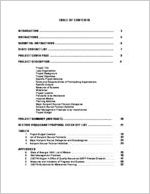
TABLE OF CONTENTS
INTRODUCTION .................................................................................... 3
INSTRUCTIONS ....................................................................................
5
SUBMITTAL INSTRUCTIONS ..................................................................
6
STATE CONTACT LIST ..........................................................................
7
PROJECT COVER PAGE .......................................................................
8
PROJECT DESCRIPTION .......................................................................
9
Project Title Lead Organization Project Background Project Objectives Specific Project Activities Roles and Responsibilities of Participating Organizations Specific Outputs Measures of Success Milestones Project Location Pollutants to be Addressed Impaired Waters Planning Activities Major Nonpoint Source Pollution Categories Nonpoint Source Pollution Activities Best Management Practices to be Implemented Project Budget
PROJECT SUMMARY (ABSTRACT) .......................................................
20
SECTION 319(h) GRANT PROPOSAL CHECK OFF LIST ...........................
21
TABLES
1. Project Budget Example ......................................................................
19
2. List of Nonpoint Source Pollutants .........................................................
22
3. Major Nonpoint Source Categories and Subcategories ..............................
23
4. Nonpoint Source Pollution Activities .......................................................
24
APPENDICES
A. State of Georgia TMDL List of Waters ............... ......................................
25
B. Best Management Practices ..................................................................
46
C. USEPA Region 4 Office of Quality Assurance QAPP Review Checklist ...........
47
D. Measures and Indicators of Progress and Success ..................................... 50
E. USEPA Guidelines for Watershed Planning .......................................................
52
The preparation of these guidelines was financed through a grant from the U.S. Environmental Protection Agency under provisions of Section 319(h) of the Clean Water Act of 1987, as amended.
2
Section 319(h) FY05 Guidelines
INTRODUCTION
Section 319(h) FY05 Grant funds for the prevention, control and/or abatement of nonpoint sources of pollution are currently available to public agencies in Georgia (e.g., cities, counties, local authorities operating local government delivery programs, regional development centers, local school systems, State colleges and universities, and State agencies). State law currently prohibits non-governmental organizations from receiving Section 319(h) Grant funds directly; however, non-governmental organizations are encouraged to develop partnerships with public agencies to develop eligible projects.
Under Section 319(h) of the Clean Water Act, the U. S. Environmental Protection Agency (USEPA) awards a Nonpoint Source Implementation Grant to the Georgia Environmental Protection Division (GAEPD) to fund eligible projects, which support the implementation of the Georgia Nonpoint Source Management Program. Section 319(h) Grant funds are limited. Therefore, the GAEPD uses a competitive process to ensure that the most appropriate projects are selected for funding.
The State is scheduled to receive approximately $4.6 million to fund nonpoint source management projects, which is allocated to the following:
BASE: $2.3 million for nonpoint source management projects throughout the State.
INCREMENTAL: $2.3 million to develop, revise, and/or implement TMDL Implementation Plans.
ELIGIBLE PROJECTS
Types of activities which are eligible include: regulatory or non-regulatory programs for enforcement, technical assistance, financial assistance, education, training, technology transfer, TMDL implementation projects, watershed restoration projects, demonstration projects, update and refinement of nonpoint source programs and assessments, monitoring to assess the success of specific nonpoint source implementation projects, ground water activities, and certain urban stormwater control activities. Lake protection and restoration activities are eligible provided that they are not used for "in-lake" work such as aquatic macrophyte harvesting or dredging unless the nonpoint sources of pollution will be remediated.
Section 319(h) Grant project proposals should specifically identify the nonpoint sources of pollution being addressed and the activities proposed to prevent, control and/or abate these nonpoint sources of pollution. Priority will be given to project proposals that implement the nonpoint source components of Total Maximum Daily Loads (TMDLs) that have been finalized as of May 31, 2004 under Section 303(d) of the Clean Water Act. In addition, priority will be
3
Section 319(h) FY05 Guidelines
given to project proposals that develop, revise and/or implement TMDL Implementation Plans and/or Watershed Management Plans to alleviate the criterion violations identified in the Section 305(b) and Section 303(d) lists of waters which are partially or not supporting beneficial uses due to nonpoint sources of pollution.
NPDES Permits
(Phase I and II MS4 Stormwater Management Programs, CAFOs)
Section 319(h) FY05 Grant monies are NOT available to implement Phase I and II MS4 Stormwater Management Programs. However, Phase I and II communities are still eligible to receive grant funds, provided they are not using project funds or match to satisfy permit requirements.
As per USEPA guidance, Concentrated Animal Feeding Operations (CAFOs) subject to NPDES permits are NOT eligible to receive Section 319(h) funds. However, off-site management activities of waste transported to an off-site facility not subject to NPDES permit requirements are eligible for grant funds.
Maximum Federal reimbursement for a Nonpoint Source Implementation Grant project is 60 percent of the total project cost. Therefore, each project must provide non-Federal matching funds or in-kind services for a minimum 40 percent of the total project cost.
Sample Calculation: Federal funds requested X 40% = non-Federal matching funds 60%
Thus, for a total project cost of $250,000, the maximum Federal reimbursement would total $150,000 and the non-Federal matching funds or in-kind services would total $100,000.
Proposals for the Section 319(h) FY05 Grant application must be submitted to the Georgia Environmental Protection Division by May 31, 2004. Any proposal postmarked (or received, if not mailed) after this date will not be considered for funding under the Section 319(h) FY05 Grant.
Applicants will be notified by September 30, 2004 if their Section 319(h) FY05 Grant proposals have been reviewed and approved by the GAEPD and the USEPA and are eligible for funding. Contingent upon review and approval by the USEPA and funding by Congress, the GAEPD should receive the Section 319(h) FY05 Grant funds by March 31, 2005.
Helpful 319(h) Hints!
DEADLINE: Submitted proposals must be postmarked by May 31, 2004.
4
Section 319(h) FY05 Guidelines
GENERAL INSTRUCTIONS
A successful project proposal is one that is thoughtfully planned, well prepared, and concisely packaged. All activities and project information should be consistent throughout the project proposal. Please follow the instructions and fill out all sections completely. If you feel a section of the project proposal does not pertain to your project, then use a not applicable (N/A) response. Do not leave any sections blank. Incomplete project proposals will not be considered for funding. Use the check off list provided on page 21 to verify that all sections of the project proposal have been completed. Please number pages and include the project name on each page. The cover page should be the only item before the proposal. Please include appendices or attachments at the end. If you do not understand a section or if you have any questions, call the personnel listed on page 7 for assistance.
Project proposals will receive higher priority by encompassing one or more of the following:
Project proposals implementing the nonpoint source components of TMDLs that have been finalized as of May 31, 2004 under Section 303(d) of the Clean Water Act. Project proposals implementing actions to alleviate the "criterion violated" identified in Section 303(d) and Section 305(b) lists of waters which are partially or not supporting designated or beneficial uses due to nonpoint sources of pollution or documented as being threatened or its uses impaired from nonpoint sources of pollution. Project proposals developing, revising and/or implementing TMDL Implementation Plans and/or Watershed Management Plans to prevent, control and/or abate nonpoint sources of pollution. Project proposals resulting in measurable (quantitative) improvements in water quality. Project proposals implementing structural best management practices to prevent, control and/or abate nonpoint sources of pollution.
Project proposals will also be evaluated for realistic goals and measures of success, costeffectiveness, and quantitative improvements in water quality.
Additional information about Section 319(h) Nonpoint Source Implementation Grants may be accessed through the USEPA webpage at:
http://www.epa.gov/owow/nps/
Throughout the guidelines, Helpful 319(h) Hints! have been placed in boxes to assist you with your application. If you have any questions about a section, please contact us!
Helpful 319(h) Hints!
Successful Section 319(h) Projects range in scope, size, and mission, and may be 1-5 years in duration. Example projects may be found at:
www.epa.gov/nps/Section319III/index.htm
5
Section 319(h) FY05 Guidelines
~
SUBMITTAL INSTRUCTIONS
Proposals for the Section 319(h) FY05 Grant application must be submitted to the Georgia Environmental Protection Division (GAEPD) by May 31, 2004. Any proposal postmarked (or received, if not mailed) after this date will not be considered for funding under the Section 319(h) FY05 Grant.
Effective October 1, 2003: The lead organization must meet (or conference call) with the GAEPD NonPoint Source Program staff to discuss the project before a proposal is submitted. Project partners, non-governmental organizations, consultants, or other affiliated groups or parties are welcome to attend, but the lead organization must be present. Please contact Ms. Amber Greer at (404) 675-1642 to schedule meetings.
Please include two (2) printed copies and one (1) electronic copy on a 3.5 diskette or CD in Microsoft Word format. Applicants MUST use the required application format (MS Word) available for download here:
http://www.dnr.state.ga.us/dnr/environ/outreach_files/outreach.htm#nonpoint
FAXES WILL NOT BE ACCEPTED.
Organizations should send Section 319(h) FY05 Grant proposals to:
Section 319(h) FY05 Grant ATTN Amber N. Greer Water Protection Branch
NonPoint Source Program 4220 International Parkway
Suite 101 Atlanta, GA 30354
(404) 675-1642
6
Section 319(h) FY05 Guidelines
STATE CONTACT LIST
Georgia Environmental Protection Division Water Protection Branch NonPoint Source Program
4220 International Parkway, Suite 101 Atlanta, Georgia 30354
Frank Carubba (404) 675-1634 Environmental Project Administrator frank_carubba@mail.dnr.state.ga.us
Amber Greer (404) 675-1642 Environmental Project Administrator amber_greer@mail.dnr.state.ga.us
Michelle Huffman (404) 675-1641 Environmental Project Administrator michelle_huffman@mail.dnr.state.ga.us
Jamie Lewis (404) 675-1640 Environmental Project Administrator james_lewis@mail.dnr.state.ga.us
Jeff Linzer (404) 675-1643 Environmental Project Administrator jeffrey_linzer@mail.dnr.state.ga.us
7
Section 319(h) FY05 Guidelines
Section 319(h) FY05 Grant Proposal Project Cover Page
Project Title:
Lead Organization: _________________________________
Lead Contact:
_________________________________
Date met with GAEPD NonPoint Source Program Staff: ____________
1. Is this project developing a new or revising an existing TMDL Implementation Plan? YES ____ NO _____
2. Is this project developing a new or revising an existing Watershed Management Plan or Watershed Restoration Action Strategy? YES ____ NO _____
3. Is this project implementing an existing TMDL Implementation Plan? YES ____ NO _____
4. Is this project implementing an existing Watershed Management Plan or Watershed
Restoration Action Strategy?
YES ____ NO _____
5. Please indicate which category BEST fits the primary objectives and activities of the project:
BMP Demonstration Restoration/Protection/Prevention Education/Information Technical Assistance Regulatory/Enforcement Activities Planning Activities Water Quality Assessment/Monitoring
5. If a local government, does the lead organization have Qualified Local Government Status in compliance with the requirements of the Georgia Planning Act of 1989 and Service Delivery Strategy Law of 1997? YES ____ NO _____
Helpful 319(h) Hints!
The Project Cover Page MUST be submitted with all Section 319(h) Grant Proposals. Please follow all instructions and fill out all sections completely.
8
Section 319(h) FY05 Guidelines
Project Description
Please follow the instructions and fill out all sections completely. If you feel a section of the project proposal does not pertain to your project, then use a Not Applicable (N/A) response. Do not leave any sections blank. Incomplete project proposals will not be considered for funding. If you do not understand a section or if you have any questions, call the personnel listed on page 7 for assistance.
Helpful 319(h) Hints!
The project description describes the specific activities that will take place to achieve the objectives. It is a detailed description of what will occur from the time the project begins until completion. The project description enables the reader to visualize the implementation of the project. It should establish the credibility and competence of the lead organization. The project description should specifically identify the nonpoint sources of pollution being addressed and the activities proposed to prevent, control and/or abate these nonpoint sources of pollution.
1. Project Title:
The project title should uniquely identify and describe the project. Limit the length of the title to two lines. The project title should identify the type of project (e.g., watershed restoration, TMDL implementation) and the name of the watershed, if applicable.
2. Lead Organization and Primary Contact:
The lead organization will be responsible for managing the proposed project. The primary contact will be the individual responsible for all correspondence and communications between the lead organization and the Georgia Environmental Protection Division. Please include the name, address, telephone number, fax number and e-mail of the lead organization and primary contact.
3. Project Background:
The project background section is the opportunity to state why this particular project should be prioritized for funding. Include relevant background information. State existing problems and please be clear, concise and to the point. In addition, if the proposed project is part of a continuing or multi-phase project, please provide all relevant background information.
9
Section 319(h) FY05 Guidelines
4. Project Objectives:
The project objectives specifically identify the nonpoint sources of pollution being addressed and the activities proposed to prevent, control and/or abate these nonpoint sources of pollution. The project objectives are a key element of a project proposal. They should be clear, concise, well-supported statements of the problem to be addressed using the grant funding. The information provided should be both factual and directly related to the project proposal. Project objectives should be well-organized in narrative or bulleted form.
Priority will be given to project proposals that encompass or support a watershed management approach and result in measurable improvements in water quality. The project objectives should relate to the water quality problems identified in the project background, be quantitative, and result in progress towards implementation of technologybased measures or achieve and/or maintain State water quality standards.
5. Specific Project Activities:
The specific project activities should be clearly delineated in narrative form, and explain how each will be accomplished with the available resources. The project description should clearly describe the activities (workshops, training, etc.), tangible products (brochures, videos, displays, manuals, etc.), distribution of materials, and target audiences (K-12, adults, local officials, etc.).
6. Roles and Responsibilities of Participating Organizations:
Identify and include all Federal, State, regional and local organizations that are actively participating in the design and implementation of the proposed project. The roles and responsibilities of each organization participating in the proposed project must be identified, regardless of the funding source, and one organization must be identified as the lead organization responsible for managing the proposed project.
Helpful 319(h) Hints!
A description of the roles and responsibilities for all participating organizations allows for a clear delineation of duties and will help maintain a sense of accountability for project partners. Each project participant should be identified by group name. Roles and responsibilities may be described in narrative or list form, and may be organized in a table or chart for clarity, if desired.
10
Section 319(h) FY05 Guidelines
7. Specific Outputs:
The specific output section of the project proposal should include a list of all quantifiable outputs (e.g., number of educational materials developed and distributed, number of BMP's implemented, number of training workshops and reports, etc). Make sure that the specific outputs are clearly indicated. For example, use numbers or bullets to denote the specific outputs in the text. Please be realistic and do not promise what the project can't deliver.
Best Management Practices: For projects implementing structural Best Management Practices, the following outputs should be included. Please note that all management practices implemented with Section 319(h) Federal or non-Federal matching funds must be properly operated and maintained for at least 5-10 years.
a. Description: Type and description of BMPs. General geo-locational information will be required for all installed BMPs (i.e., stream reach, county, drainage area).
b. Installation: Number of BMPs implemented should be included in the project outputs.
c. Load Reductions: If a project proposal is implementing Best Management Practices (BMPs) to alleviate nutrients and/or sediment, one output of the project must be estimates of load reductions achieved by the project for nitrogen, phosphorous, and/or sediment. Please indicate if the Load Reduction figures will be based on monitoring or modeling. If modeling will be used, indicate the name or type used.
d. Wetlands: Indicate acres to be restored or protected. e. Streambank Stabilization: Indicate linear feet to be restored or protected.
Monitoring: For project proposals that include water quality monitoring, a detailed Quality Assurance Program Plan (QAPP) procedure is required. The QAPP procedures must be submitted to the GAEPD and the USEPA for review and approval prior to receiving grant funds for monitoring, but need not be included with the project proposal (See Appendix C USEPA Region 4 Office of Quality Assurance QAPP Review Checklist).
For Specific Outputs that include monitoring, please check those that apply:
a. Monitoring Program Elements:
Biological Chemical/Physical Habitat Sediment
b. Monitoring Design:
Paired Watersheds: Upstream - Downstream: Single Downstream: Other:
11
Section 319(h) FY05 Guidelines
Products: Products are all materials produced by the project, and may include maps, reports, manuals, monitoring data, brochures, videos or other project documents. Upon completion of project outputs, the lead organization must submit two hardcopies and one electronic copy to the GAEPD and the USEPA for review and approval prior to distribution to ensure consistency with Federal and State regulations and guidelines. The actual submission of project products must be included as a specific output.
Semi-Annual Reports: The lead organization is responsible for submitting semi-annual progress reports to the GAEPD for inclusion in the USEPA Grants Reporting Tracking System (GRTS) by February 28th and August 31st of each year. These reports must be listed as outputs in the specific output section of the project proposal.
Final Close-Out Report: Upon completion of the proposed project, the lead organization is responsible for submitting two (2) copies of a Final Project Close-Out Report to the GAEPD and the USEPA for review and approval. Also include the report preparation and submittal as a specific output in the project proposal.
8. Measures of Success:
The measures of success of the project proposal should include an appropriate evaluation component to determine the effectiveness of the project.
The measures of success section should develop evaluation criteria to evaluate progress towards meeting project objectives. It is important to define carefully and exactly how success will be determined and what will be different once the project is complete. The project proposal should describe how the evaluation information will be collected and how the data will be analyzed.
Measures of success should not be considered only after the project is over; they should be built into the project. Including measures of success in the project proposal indicates that the project objectives are taken seriously. Measures of success can often be the best means to learn from the experiences in the project. If a project proposal is implementing Best Management Practices (BMPs), the project must provide an annual estimate of load reductions achieved by the project for nitrogen, phosphorous, and/or sediment and the linear feet of streambank or acres of wetlands protected or restored.
For additional information on measures of success and specific examples, see Appendix D: Measures and Indicators of Progress and Success, in the Nonpoint Source Program and Grants Guidance for Fiscal Year 1997 and Future Years.
12
Section 319(h) FY05 Guidelines
9. Milestones:
All project proposals must include a schedule of milestones, the significant events or tasks that occur throughout the implementation of the proposed project. Include starting and completion dates for each entry.
Milestones also include all outputs listed in the specific output section of the project proposal. The schedule of milestones will be used to track the progress of the approved projects.
Milestones should include the execution of contracts/interagency agreements, submission of QAPP procedures, specific outputs, submission of semi-annual reports for GRTS updates and final project close-out reports, etc. as shown:
Example: Project Schedule of Milestones
MILESTONES
Execute contract/interagency agreement with the Georgia Environmental Protection Division. Submit monitoring plan with QAPP procedures to the GAEPD and the USEPA for review and approval.
Develop and prepare Farm-A-Syst assessment worksheets. Submit all draft copies to the GAEPD and the USEPA for review and approval.
Conduct water quality monitoring.
STARTING DATES 04/05
05/05
07/05
07/05
COMPLETION DATES 04/05
06/05
06/06
12/08
Submit semi-annual report for GRTS update.
Install Waste Management System Best Management Practices.
Submit final project close-out report to the GAEPD and the USEPA for review and approval.
08/05 09/05 01/09
08/08 03/08 02/09
NOTE: The Schedule of Milestones must be prepared using the example format.
Milestones must be listed in chronological order according to the proposed starting date. Organizations should not plan on initiating projects before April 2005. Please note that project activities eligible for Federal reimbursement or non-Federal matching funds or in-kind services can not begin until after the grant has been awarded, all terms and conditions of the grant have been satisfied, and the contract/interagency agreement between the Georgia Environmental Protection Division and the lead organization has been executed.
The USEPA adds special terms and conditions to the Section 319(h) Grants, which may be applicable to the proposed projects. The Section 319(h) FY05 Grant expiration date cannot be extended beyond September 2011. Therefore, all proposed projects must be completed and all funding must be expended by September 2011.
13
Section 319(h) FY05 Guidelines
10. Project Location:
a) Project Area(s) and Map: The approximate size and location of the project area(s) to be treated must be identified on a map and quantified. The project area(s) should be of an appropriate size to ensure that the measures implemented will have a significant impact on restoring or protecting designated beneficial uses within the watersheds.
b) Watershed or project area size (acres):
c) List the following for the watershed or project area: Stream Miles Lake Acreage Wetland Acreage
d) Land Uses within the watershed or project area (percentages):
Agricultural
_______
Commercial Forestry _______
Urban/Residential _______
Mining/Extraction
_______
Forests/Natural Areas _______
Water/Wetlands
_______
100%
e) 8-digit Hydrologic Unit Code(s) and Watershed Name(s): Please list the watershed names and 8-digit HUCs that comprise the project area.
Additional information about watersheds (e.g., 8-digit hydrological unit codes, rivers and streams in the watershed, land characteristics, river corridor and wetlands restoration efforts, index of watershed indicators, etc.) may be accessed through the USEPA webpage at:
http://www.epa.gov/surf/
The USGS 8-digit hydrological cataloging unit map for Georgia may be ordered from the USGS Earth Science Information Center (ESIC) at 1-888-ASK-USGS (1-888-2758747) or at:
http://www.usgs.gov/
f) County or Counties: List the counties within the watershed or project area.
11. Pollutants to be Addressed: Please list the NPS pollutants to be addressed (See Table 2).
14
Section 319(h) FY05 Guidelines
12. Impaired Waters
a) Section 303(d) and Section 305(b) lists of waters: Please list all waterbodies in the watershed or project area listed on the State's 303(d) and 305(b) lists, including the length of each segment. For each waterbody, fill in the appropriate response. Do not leave any sections blank. Answer "YES" to the question in the final column ONLY if the project will result in the listed waterbody meeting water quality standards and subsequently being delisted. If you do not have enough information to determine if the project's activities will delist the waterbody, please answer "NO".
Sample Table:
Waterbody (Miles/Acreage)
Location (County)
Criterion Violated
Has a TMDL been developed for this
segment?
Etowah River (12 miles)
Dry Branch (5 miles)
Beaver Creek (4 miles)
Goat Rock Lake (573 acres)
Bartow County Burke County
Dissolved Oxygen
Bio-Habitat
Macon County Fecal Coliform
Harris County
FCG
YES NO YES YES
Is the project implementing actions to alleviate the
"criterion violated" for this segment?
The April 2002, Final Georgia 2002 305(b)/303(d) and the January 2004, Draft Georgia 2004 305(b)/303(d) List Documents are available at the GAEPD website, www.dnr.state.ga.us/dnr/environ, under the Table of Contents section, Georgia's Environment, Water Quality - Watershed Information.
b) Other Known Impairments (only if applicable): List segment impaired, criterion violated, and source of documentation. Attach relevant sections of documentation of impairment.
Helpful 319(h) Hints!
What is a TMDL?
A TMDL (Total Maximum Daily Load) is a calculation of the maximum amount of a pollutant that a river, stream or lake can receive and still meet water quality standards. For a list of the State of Georgia TMDL Lists of Waters, see Appendix A. For more information see the USEPA website:
www.epa.gov/owow/tmdl/
15
Section 319(h) FY05 Guidelines
13. Planning Activities:
If your project proposes to develop or revise a TMDL Implementation Plan or Watershed Management Plan, you must follow USEPA Guidelines (See Appendix E: USEPA GUIDELINES FOR WATERSHED PLANNING).
a) Total Maximum Daily Load Implementation Plans:
Is the project proposal developing a new or revising an existing TMDL Implementation Plan? Yes____ No____
Is the project proposal implementing a TMDL Implementation Plan? Yes____ No ____ (If checking yes, please identify document and attach relevant section.)
b) Watershed Management Plans:
Is the project proposal developing a new or revising an existing Watershed Management Plan? Yes____ No____
Is the project proposal implementing a Watershed Management Plan? Yes____ No ____ (If checking yes, please identify document and attach relevant section.)
Helpful 319(h) Hints!
USEPA Requirements If your project proposes to develop or revise a TMDL Implementation Plan or Watershed Management Plan, USEPA Guidelines require all plans to include the following elements:
a. Identification of the sources contributing to NPS pollution b. Description of the NPS management measures to be implemented c. Estimate of the pollutant load reductions of the management measures d. Estimate of funding sources e. An information/education component f. Schedule for implementation g. Measurable milestones h. Criteria to determine progress and measures of success i. Monitoring to evaluate effectiveness
16
Section 319(h) FY05 Guidelines
14. Major Nonpoint Source Pollution Categories and Subcategories:
List all Major Nonpoint Source Pollution Categories and Subcategories that pertain to the project proposal. See Table 3 for a selection list.
15. Nonpoint Source Pollution Activities:
List all Nonpoint Source Pollution Activities being addressed by the project proposal. See Table 4 for a selection list.
16. Best Management Practices to be Implemented:
The project description should list all Best Management Practices being addressed in the project proposal. See Appendix B for a list of Best Management Practices.
17. Project Budget:
The project budget must delineate proposed Federal and non-Federal matching expenditures by object class categories as shown in Table 1. The project proposal must provide sufficient detail to justify all project costs (i.e., Federal reimbursement and non-Federal matching funds or in-kind services). All proposed budget items must tie back to activities in the project proposal.
Helpful 319(h) Hints!
All proposed budget items must be justified in the project proposal, and must correspond directly to activities in the project proposal. For example, if a turbidity meter is listed as an equipment budget item, sufficient details about specific project activities are required to justify the purchase of a turbidity meter.
Maximum Federal reimbursement for a Nonpoint Source Implementation Grant project is 60 percent of the total project cost. Therefore, each project must provide non-Federal matching funds or in-kind services for a minimum 40 percent of the project cost. Thus, for a total project cost of $250,000, the maximum Federal reimbursement would total $150,000 and the nonFederal matching funds or in-kind services would total $100,000.
Helpful 319(h) Hints!
Local Match: Section 319(h) projects are required to show substantial commitment at the local level by providing 40% of the total project cost in local funds or in-kind services. Federal funds may be used for up to 60% of the total project cost.
Sample Calculation: Federal funds requested X 40% = non-Federal matching funds
60%
17
Section 319(h) FY05 Guidelines
Object Class Categories:
Personnel: Personnel budget items should include position titles, salary rates, full time equivalent (FTE) (i.e., if staff puts 100% of their time into the project, then they are 1.0 FTE), work years, and specific project activities.
Fringe benefits: Fringe benefits budget items should include the position title, FTE, percentage of fringe benefit charges, work years and specific project activities.
Travel: Travel budget items should identify the personnel traveling by position title, the specific project activities to be conducted, and the type and purpose of travel. Out of state travel will not be approved.
Equipment: All equipment budget items and costs must be itemized separately. For equipment costs over $5,000, please include brief descriptions, specifications, or actual quotes.
Supply: If supply budget items and costs are less then $2,000, they may be collectively described as monitoring supplies, administrative supplies, printing supplies, etc. If supply budget items and costs are more then $2,000, they must be itemized separately.
Contractual: Contractual budget items must identify the types of subcontractors and
specific project activities. For large sub-contracts ($30,000), a detailed budget breakdown
should be attached using the same object class categories.
Other: Other budget items and costs must be itemized separately.
Indirect charges: If indirect charges are appropriate for the lead organization, the Federally approved indirect rate percentage and costs should be included. (If project is selected for funding, the lead organization will be required to provide GAEPD with a copy of the Federal approved indirect rate agreement.)
Helpful 319(h) Hints!
When procuring property and services under a grant, the lead organization must follow the procurement policies and procedures as delineated in 40 CFR Part 31.36. Copies are available upon request, or at:
http://www.access.gpo.gov/nara/cfr/cfr-retrieve.html#page1
Allowable costs will be determined in accordance with the cost principles in "OMB Circular A-87." Copies are available upon request or at:
www.whitehouse.gov/omb/circulars
18
Section 319(h) FY05 Guidelines
TABLE 1
Project Budget Example
Item
Object Class Category
A
Personnel:
One (1) Engineer 0.5 FTE ($40,000/Year) for 1 year (Technology Transfer and Project Management)
One (1) Coordinator 0.5 FTE ($40,000/Year) for 1 year (Public Education and Involvement)
One (1) Technician 0.5 FTE ($18,000/Year) for 1 year (Water Quality Monitoring)
319(h) Grant Funds
(60% Maximum)
Non Federal Matching Funds (40% Minimum)
20,000 9,000
20,000
B
Fringe Benefits:
One (1) Engineer 0.5 FTE 35% for 1 year (Technology Transfer and Project Management)
One (1) Coordinator 0.5 FTE 35% (Public Education and Involvement) for 1 year
C
Travel:
One (1) Technician for field monitoring (Water Quality Monitoring)
7,000 1,000
7,000 0
D
Equipment:
Two (2) Portable Turbidity Meters (Water Quality Monitoring)
E
Supplies:
Monitoring Supplies (Water Quality Monitoring)
F
Contractual:
ABC Engineering, INC. (BMP Implementation Demonstration Project)
2,000 600
30,000
0 0 19,400
G
Construction1:
N/A
N/A
H
Other:
I
Total Direct Charges:
(Sum of A-H)
Indirect Charges: J
Indirect Charge Rate
0 69,600
0
0 46,400
0
K
Total:
(Sum of I and J)
69,600
46,400
Total 20,000 20,000 9,000
7,000 7,000
1,000
2,000
600
49,400 N/A 0
116,000 0
116,000
The project budget must be prepared in this required format and using these object class categories. PLEASE: Double check all budget calculations!
1 This object class category does not apply to Section 319(h) Grants.
19
Section 319(h) FY05 Guidelines
PROJECT SUMMARY
(ABSTRACT)
A separate Project Summary must be submitted with all Section 319(h) FY03 Grant proposals. The project summary should specifically identify the nonpoint sources of pollution being addressed and the activities proposed to prevent, control and/or abate these nonpoint sources of pollution. The summary should be brief, no longer than two pages, and should include all key points necessary to communicate the objectives of the project proposal. It may be helpful to prepare the project summary after the project proposal has been developed. All of the following items must be included:
1. Project Title: The project title should uniquely identify and describe the project. Limit the length of the title to two lines. The project title should identify the type of project and the name of the watershed, if applicable.
2. Lead Organization and Primary Contact: Please include the name, address, telephone number, fax number and e-mail of the lead organization and primary contact.
3. Funding: Funding should be listed as Federal funds requested, non-Federal matching funds contributed, and total project funds.
4. Project Start Date and Completion Date: List starting and completion dates (month/year).
5. Project Location: For watershed projects, list the watershed name and appropriate hydrological unit code (e.g., 8-, 10-, 12-digit HUC). For statewide and regional projects delineate the areas being addressed.
6. Project Background: Specifically identify the nonpoint source(s) of pollution being addressed by this project and give a brief explanation on the activities in the project area that contribute to this/these nonpoint source(s) of pollution.
7. Objectives: List the major objectives of the project. What the project should accomplish in regards to preventing, controlling, and/or abating the nonpoint source(s) of pollution.
8. Activities: Specifically identify and describe the activities that will prevent, control, and/or abate the nonpoint source(s) of pollution.
9. Outputs: BMPs, TMDL Implementation Plan, water quality monitoring data, workshops, field days, manuals, and all other project documents.
10. Expected Outcome: Anticipated project success (e.g., estimates of pollutant load reductions, linear feet or acres of wetlands protected or restored).
11. Budget Summary:
NPS Pollution Activities (See Table 4)
BMP Demonstration Projects Restoration/Protection/Prevention Education/Information Technical Assistance Regulatory/Enforcement Activities Planning Activities Water Quality Assessment/Monitoring
319(h) Grant Funds
TOTALS:
Non-Federal Matching Funds
20
Section 319(h) FY05 Guidelines
SECTION 319(h) GRANT PROPOSAL CHECK OFF LIST
Use this outline and check off sheet to make sure that your project proposal meets the General Guidelines requirements. All items are required to be included with the appropriate information and in the proper format required by the Section 319(h) FY05 Grant.
When did the Lead Organization meet or conference-call with GAEPD NPS Program staff? Date: _____________
I Grant Application Cover Page
___
Project Title
___
Lead Organization
___
1-4 TMDL Implementation Plans and Watershed Management Plans
___
5 Primary Objective
___
6 - Qualified Local Government Status
II Project Description
___
1 Project Title
___
2 Lead Organization & Primary Contact
___
3 Project Background
___
4 Project Objectives
___
5 Specific Project Activities
___
6 Roles and Responsibilities of Participating Organizations
___
7 Specific Outputs
___
8 Measures of Success
___
9 Milestones
___
10 Project Location
___
a Project Area(s) and Map
___
b Watershed or Project Area Size
___
c Stream Miles and Lake Acreage
___
d Land Uses
___
e 8-digit Hydrologic Unit Code(s) and Name(s)
___
f County or Counties
___
11 Pollutants to be Addressed
___
12 Impaired Waters
___
a Section 303(d) and Section 305(b) lists of waters
___
b Other Known Impairments
___
13 Planning Activities
___
a Total Maximum Daily Load Implementation Plans
___
b Watershed Management Plans
___
14 Major Nonpoint Source Pollution Categories and Subcategories
___
15 Nonpoint Source Pollution Activities
___
16 Best Management Practices to be implemented
___
17 Project Budget
___ III Project Summary (Abstract)
___
1 Project Title
___
2 Lead Organization & Primary Contact
___
3 Funding
___
4 Project Start Date & Completion Date
___
5 Project Location
___
6 Introduction
___
7 Objectives
___
8 Activities
___
9 Outputs
___
10 Expected Outcome
___
11 Budget Summary
21
Section 319(h) FY05 Guidelines
TABLE 2
Nonpoint Source Pollutants
Algal Growth/Chlorophyll
Alteration Flow Habitat--other than flow
Ammonia
Organics
Pathogens Coliform E. coli Other
Chlorine
PCBs
Cyanide
Dioxins/Furans
Dissolved Oxygen (Low)
Ethylene Glycol
Exotic Species
Herbicides Atrazine Alachlor Other
Pesticides DDT Chlordane Dieldrin Dianzinon Other
pH
Phosphorus
Plants (Noxious Aquatic)
Propylene Glycol
Inorganics (Other)
Radiation
Metals Aluminum Arsenic Cadmium Copper Chromium Iron Lead Mercury Selenium Zinc Other
Methyl Tertiary-Butyl Ether
Nitrate
Nitrogen
Total Kjeldahl Nitrogen
Oil and Grease
Salinity/TDS/Chlorides Sedimentation/Siltation (habitat and/or morphological) Sulfates Suspended Solids
Taste and Odor Temperature Toxics (Total) Trash, Debris, Floatables Tributyltin Turbidity
22
Section 319(h) FY05 Guidelines
TABLE 3 Major Nonpoint Source Pollution Categories and Subcategories:
Agriculture Non-irrigated Crop Production Irrigated Crop Production Specialty Crop Production Grazing-Related Sources Pasture Grazing Range Grazing Animal Feeding Operations (NPS) Aquaculture
Silviculture Harvesting/Residue Management Reforestation Forest Management Road Construction/Maintenance
Construction Highways/Roads/Bridges Land Development or Redevelopment
Urban Runoff/Stormwater Municipal Commercial Residential Illicit Connects/Illegal Hook-ups Dry Weather Flow Highway/Road/Bridge Runoff Post-Development Erosion and
Sedimentation Salt Storage Sites
Resource Extraction Surface Mining Subsurface Mining Open Pit Mining Placer Mining Dredge Mining Petroleum Activities Mill Tailings Mine Tailings Abandoned Mine Drainage Sand/Gravel Mining
Land Disposal/Storage/Treatment Wastewater Landfills Inappropriate Waste Disposal Industrial Land Management On-site/Decentralized Wastewater
Treatment
Hazardous Waste Septage Disposal Waste Storage/Storage Tank Leaks
(above ground) Leaking Underground Storage Tanks
Hydromodification Channelization Channel Erosion/Incision Dredging Dam Construction Upstream Impoundment Flow Regulations/Modification Other Habitat Modification Removal of Riparian Vegetation Streambank Modification/Destabilization Drainage/Filling of Wetlands Groundwater Withdrawal
Marinas and Recreational Boating Pumpouts Sanitary On-Vessel Discharges Other On-Vessel Discharges Boat Construction Boat Maintenance Shoreline Erosion Fueling Dredging
Turf Management Golf Courses Yard Maintenance Other Turf Management
Historical Pollutants Contaminated Sediments Clean Sediments Other Historical Pollutants
Other NPS Pollution Erosion from Derelict Land Atmospheric Deposition Spills Natural Sources Recreation/Tourism Activities (non-boat) Groundwater Loadings Wildlife
Source Unknown
23
Section 319(h) FY03 Guidelines
TABLE 4
Nonpoint Source Pollution Activities
BMP Demonstration Projects
Restoration/Protection/Prevention BMP Design/Implementation Activities BMP Performance/Assessment Animal Manure/Litter Management Projects Livestock Control Projects Vegetation Management/Revegetation Stream Bank Stabilization Grade Stabilization Sediment Control Stormwater Discharge Design/Control Erosion Control Projects Acquisition of Wetland Resources Wetland Restoration/Protection Acquisition of Riparian Resources Riparian Projects Fisheries Projects Other Restoration/Protection/Prevention
Activities
Education/Information Activities Statewide Education/Information Programs Local (Specific target) Education/Information
Programs
Technical Assistance Technical Assistance to State/Local Government Nonpoint Source Program Overall
Coordination/Management Nonpoint Source Project Staffing Technology Transfer to State/Local Government Other Technical Assistance Activity
Regulatory / Enforcement Activities Certification Activities Program Development Activities Inspection Activities Ordinance Development Enforcement Activities
Planning Activities Nutrient Management Planning Watershed Modeling Planning Stormwater Management Planning Watershed Planning Geographic Information Systems Develop/Revise Basin Plans TMDLs Nonstructural Planning (for new
development) Livestock Grazing System Planning Other Planning Activities
Water Quality Assessment/Monitoring Instream Flow Assessments Assessments for Compliance with Water
Quality Standards Wetland Assessment/Monitoring Riparian Assessment/Monitoring TMDL Assessments Water Quality Trend Assessment Water Quality Problem Identification Other Water Quality
Assessment/Monitoring BMP Effectiveness Monitoring Biological Monitoring Watershed Assessments 319(h) National Monitoring Project
Other Activities Groundwater (all groundwater activities) Antidegradation Activities and Analyses Soil Analyses
24
Section 319(h) FY03 Guidelines
Basin
Waterbody
Altamaha Basin
Altamaha Altamaha Altamaha
Alex Creek Altamaha River Altamaha River
Altamaha Altamaha Altamaha Altamaha Altamaha Altamaha Altamaha Altamaha Altamaha Altamaha Altamaha Altamaha Altamaha Altamaha Altamaha Altamaha
Big Cedar Creek Cobb Creek Doctors Creek Goose Creek Gum Swamp Creek Jacks Creek Jones Creek Little Ohoopee River Little Ohoopee River Little Ohoopee River Milligan Creek Oconee Creek Ohoopee River Ohoopee River Ohoopee River Ohoopee River
Altamaha
Ohoopee River
Altamaha
Ohoopee River
Altamaha
Ohoopee River
Altamaha
Pendleton Creek
Altamaha
Pendleton Creek
Altamaha
Penholoway Creek
Altamaha
Rocky Creek
Altamaha
Rocky Creek
Altamaha
Sand Hill Lake
Altamaha
Swift Creek
Altamaha
Ten Mile Creek
Altamaha
Thomas Creek
Altamaha
Tiger Creek
Altamaha
Tobesofkee Creek
Altamaha
Yam Grandy Creek
Chattahoochee Basin
Chattahoochee Chattahoochee Chattahoochee Chattahoochee Chattahoochee Chattahoochee Chattahoochee Chattahoochee
Acorn Creek Anneewakee Creek Arrow Creek Baldwin Creek Ball Mill Creek Balus Creek Bear Creek Big Creek
Appendix A
Segment
TMDL LIST
Pollutant(s)
Year
Mason Cowpen Branch to Altamaha River (Wayne Co) Confluence of Oconee and Ocmulgee Rivers ITT Rayonier to Penholoway Creek
DO FCG/Hg FCG/Hg
Little Cedar Creek to Ohoopee River (Johnson Co)
DO, FC
Oconee Creek to Altamaha River (Toombs)
DO
U/S Jones Creek (Long Co)
DO, FC
U/S Rd. S1922 to Little Goose Creek (Wayne Co)
FC
Little Ocmulgee State Park Lake
FCG/Hg
US Hwy 1 to Ohoopee River (Emanuel Co)
DO, FC
Still Creek to Doctors Creek (Long Co)
DO
Gully Branch to Neeley Creek (Washington Co)
DO
Sardis Creek to Ohoopee River (Emanuel Co)
DO, FC
Neels Creek to Sardis Creek (Johnson Co)
DO
Uvalda to Altamaha river (Montgomery/Toombs)
DO, FC
Headwaters to Cobb Creek (Mongomery/Toombs)
DO, FC
Dyers Creek to Big Cedar Creek (Washington/Johnson Co)
FC
GA Hwy 147 to confluence with Altamaha River (Tattnall Co) FCG/Hg
Hwy 292 to Hwy 147 (Tattnall Co)
FCG/Hg
Little Ohoopee River to US Hwy 292 (Emanuel/Candler/Tattanall FCG/Hg
Co)
Little Ohoopee River to US Hwy 292 (Emanuel/Candler/Tattanall DO, FC
Co)
Neels Creek to Little Ohoopee River (Johnson/Emanuel Co)
DO, FC
Neels Creek to Little Ohoopee River (Johnson/Emanuel Co)
FCG/Hg
Sand Hill Lake to Reedy Creek (Treutlen Co)
DO, FC
Wildwood Lake to Tiger Creek (Treutlen/Toombs Co)
DO, FC
Little Creek to Altahama River (Wayne Co)
DO
Ga. Hwy. 130 to Little Rocky Creek (Toombs Co)
DO, FC
Little Rocky Creek to Ohoopee River (Toombs/Tattanall Co)
DO
Treultlen County PFA
FCG/Hg
Old Normantown Rd. to Pendleton Creek (Toombs)
DO, FC
Little Ten Mile Creek to Altamaha River (Appling Co)
DO
D/S CR203 to Ohoopee River (Tattnall Co)
DO
Little Creek to Pendleton Creek (Montgomery/Toombs)
DO, FC
Monroe, Bibb and Lamar
Biota
D/S Crooked Creek (Emanuel Co)
DO, FC
2001 2001(DL 2002)
2001 (DL 2002) 2001 2001 2001 2001 2001 2001 2001 2001 2001 2001 2001 2001 2001 2001 2001 2001
2001
2001 2001 2001 2001 2001 2001 2001 2001 2001 2001 2001 2001 2001 2001
Carroll County House Creek to Lake Monroe (Douglas Co) Atlanta (Fulton Co) Douglas County Fulton/DeKalb Counties Gainesville (Hall Co) Dorsett Shoals Rd to Little Bear Creek (Douglas Creek) Hall County
FC BIO, FC FC FC FC FC FC FC
1998 2002 2002 1998 2002 2002 1998 1998
25
Section 319(h) FY03 Guidelines
Chattahoochee Chattahoochee Chattahoochee Chattahoochee Chattahoochee Chattahoochee Chattahoochee Chattahoochee Chattahoochee Chattahoochee
Big Creek Big Creek Big Creek Bishop Creek Black Creek Blue John Creek Bubbling Creek Bull Creek Burnt Fork Creek Bustahatchee Creek
Chattahoochee Chattahoochee Chattahoochee Chattahoochee
Buttermilk Creek Camp Creek Cavender Creek Cedar Creek
Chattahoochee Chattahoochee Chattahoochee Chattahoochee
Cedar Creek Centralhatchee Creek Chattahoochee River Chattahoochee River
Chattahoochee Chattahoochee Chattahoochee Chattahoochee Chattahoochee Chattahoochee Chattahoochee Chattahoochee Chattahoochee Chattahoochee Chattahoochee Chattahoochee Chattahoochee Chattahoochee Chattahoochee Chattahoochee Chattahoochee Chattahoochee Chattahoochee Chattahoochee
Chattahoochee River Chattahoochee River Chattahoochee River Chattahoochee River Chattahoochee River Chattahoochee River Chattahoochee River Chattahoochee River Chattahoochee River Chattahoochee River Chattahoochee River Chattahoochee River Chattahoochee River Chattahoochee River Chattahoochee River Chattahoochee River Chattahoochee River Chattahoochee River Chattahoochee River Chestatee River
Chattahoochee Chattahoochee Chattahoochee Chattahoochee Chattahoochee Chattahoochee Chattahoochee Chattahoochee Chattahoochee Chattahoochee Chattahoochee Chattahoochee Chattahoochee
Clear Creek Coheelee Creek Cracker Creek Crawfish Creek Crooked Creek Day Creek Dixie Creek Drag Nasty Creek East Fork Little River Etta Vista Creek Flat Creek Flat Shoals Creek Flowery Branch
Headwaters to Cheatham Creek (Forsyth Co) Headwaters to Cheatham Creek (Forsyth Co) Hwy 400 to Chattahoochee River (Fulton Co) Cobb County Headwaters to Hannahatchee Creek (Stewart Co) LaGrange (Troup Co) DeKalb County Columbus (Muscogee Co) DeKalb County Confluence with North Fork to Lake Walter F. George (Quitman Co) Cobb County Fulton County Carroll County Coweta County
Metals/Cu FC FC FC BIO FC FC FC FC BIO
FC FC BIO FC
Coweta County Heard County Wahoo Creek to Franklin (Coweta/Carroll/Heard Co) D/S West Point Dam to Johnson Island
DO FC FCG/PCBs DO - low
D/S WF George Dam (Clay Co) Morgan Falls Dam to Peachtree Creek (Fulton/Cobb Co) North Highland Dam to Upatoi Creek (Muscogee Co) Oliver Dam to North Highland Dam Pea Creek to Wahoo Creek (Fulton/Douglas/Coweta/Carroll Co) Peachtree Creek to Utoy Creek (Fulton/Cobb Co) Peachtree Creek to Utoy Creek (Fulton/Cobb Co) Soque River to Lake Lanier (Habersham/White Co) Sr 255 to Soque River (White/Habersham Co) Utoy Creek to Pea Creek (Fulton/Douglas Co) Downstream WF George Dam (Clay Co) GA Hwy 17, Helen to SR255 (White/Habersham Co) Morgan Falls Dam to Peachtree Creek (Fulton/Cobb Co) N. Highland Dam to Upatoi Creek (Muscogee Co) Pea Creek to Wahoo Creek (Fulton/Douglas/Coweta/Carroll) Peachtree Creek to Utoy Creek (Fulton/Cobb Co) Upatoi Creek to Railroad at Omaha (Chattahoochee/Stewart) Utoy Creek to Pea Creek (Fulton/Douglas Co) Wahoo Creek to Franklin (Coweta/Carroll/Heard Co) Dahlonega (Lumpkin/Hall Co)
DO - low FCG/PCBs FCG/PCBs FCG/PCBs FCG/PCBs FCG/PCBs Temperature FCG/Hg FC FCG/PCBs FC FC FC FC FC FC FC FC FC FC
Atlanta (Fulton Co) Chancy Mill Creek to Chattahoochee River (Early Co) Douglas County Douglas County Tributary to Chattahoochee River (Gwinnett Co) Bluff Springs Branch to Hodchodkee Ck (Stewart Co) LaGrange (Troup Co) Tributary to W.F. George (Quitman/Clay Co) D/S Hwy 52 to Lake Lanier (Hall Co) Gainesville (Hall Co) Headwaters, Gainesville to Lake Lanier (Hall Co) West Point (Troup/Harris Co) Hall County
DO, FC BIO FC FC FC BIO FC FC FC FC FC FC FC
2002 2002 2002 2002 2002 2002 2002 2002 2002 2002
2002 2002 2002 1998 (DL 2002) 2002 1998 2002 1999 (DL 2002) 1999 2002 2002 2002 2002 2002 2002 2002 1998 2002 2002 2002 2002 2002 2002 2002 2002 2002 2002 1998 (DL 2002) 2002 2002 2002 2002 2002 2002 1998 1998 1998 1998 2002 1998 1998
26
Section 319(h) FY03 Guidelines
Chattahoochee Chattahoochee Chattahoochee Chattahoochee Chattahoochee Chattahoochee Chattahoochee Chattahoochee Chattahoochee Chattahoochee Chattahoochee Chattahoochee Chattahoochee Chattahoochee Chattahoochee Chattahoochee Chattahoochee Chattahoochee Chattahoochee
Foe Killer Creek Four Mile Creek Foxwood Branch Goat Rock Lake Hannahatchee Creek Hazel Creek Hilly Mill Creek Hitchitee Creek Hodchodkee Creek Hodchodkee Creek Hog Creek Hog Waller Creek House Creek James Creek Johns Creek Kelly Mill Branch Lake Harding Lake Oliver Lake Seminole
Chattahoochee Lake Seminole Chattahoochee Lake Walter F. George
Chattahoochee Lake Walter F. George
Chattahoochee Chattahoochee Chattahoochee Chattahoochee Chattahoochee
Lee Branch Level Creek Limestone Creek Limestone Creek Little Bear Creek
Chattahoochee Chattahoochee Chattahoochee Chattahoochee Chattahoochee
Little Hitchitee Creek Little Juniper Creek Little Pine Knot Creek Long Branch Long Cane Creek
Chattahoochee Chattahoochee Chattahoochee Chattahoochee Chattahoochee Chattahoochee Chattahoochee Chattahoochee
Long Island Creek Longwood Park Creek Lullwater Creek Marsh Creek Mineral Springs Branch Mineral Springs Branch Mobley Creek Mossy Creek
Chattahoochee Chattahoochee Chattahoochee Chattahoochee Chattahoochee
Mountain Oak Creek Mt. Hope Branch Mud Creek Mud Creek Mulberry Creek
Chattahoochee Nancy Creek Chattahoochee Nancy Long Creek
Chattahoochee New River
Fulton County Lake Lanier Tibutary (Forsyth Co) Tributary to Rottenwood Creek (Cobb Co) Harris County US Hwy 27 to Lake WF George (Stewart Co) Habersham County Heard/Coweta Counties Cany Cr to Sand Branch (Chattahoochee/Stewart Co) Day Creek To Foreman Mill Branch (Stewart Co) SR 27 to Wimberly Mill Branch (Stewart Co) Headwaters to Cemochechobee Creek (Randolph/Clay Co) Roswell (Fulton Co) Douglas County Forsyth County Headwaters to Chattahoochee River (Fulton Co) Headwaters to Orr Creek (Forsyth Co) Harris County Near Columbus, GA Semiole and Decatur Co
Semiole and Decatur Co Stewart, Quitman, and Clay Co
FC FC FC FCG/PCBs FC Biota/Sediment BIO, FC BIO BIO BIO BIO FC FC FC FC FC FCG/PCBs FCG/PCBs FCG/Chloroda ne FCG/PCBs FCG/PCBs
Upstream Highway 82
FCG/PCBs
LaGrange (Troup Co)
FC
Headwaters to Chattahoochee River (Gwinnett Co)
FC
D/S Brenau Lake (Hall Co)
FC
U/S Brenau Lake (Hall Co)
FC
Douglas County
FC
Headwaters to Hitchitee Creek (Chattahoochee Co) Headwaters to Kings Mill Pond (Marion/Chattahoochee Co) Headwaters to Pine Knot Creek (Chattahoochee Co) Coweta County Panther, Blue John & Long Cane Creeks, D/S LaGrange to Chattahoochee River (Troup Co)
BIO BIO BIO BIO FC, BIO
Headwaters to Chattahoochee River (Fulton Co)
FC
Gainesville (Hall Co)
FC
DeKalb County
FC
Fulton County
FC
Newnan downstream from Bonnell (Coweta Co)
Toxicity/BIO
Newnan upstream from Bonnell (Coweta Co)
BIO
Douglas County
FC
Totherow Rd near Ckermont to Chattahoochee River (White/Hall FC
Co)
Hamilton (Harris Co)
FC
Meriwether County
BIO
Ga Hwy 120 to Noses Creek (Cobb Co)
FC
Hall County
FC
Ossahatchie Cr to Five Points Branch W, Mulberry Grove (Harris FC
Co)
Headwaters to Peachtree Creek, Atlanta (DeKalb/Fulton Co)
FC
Douglas County
FC
Corinth (Heard Co)
FC
2002 1998 2002 1998 1998 2002 2002 2002 2002 2002 2002 2002 1998 1998 2002 2002 1998 1998 1998
1998 1998 (DL
2002) 1998 (DL
2002) 1998 2002 1998 1998 1998 (DL 2002) 2002 2002 2002 2002 2002
2002 1998 2002 2002 2002 2002 2002 1998
2002 2002 2002 2002 2002
2002 1998 (DL
2002) 1998
27
Section 319(h) FY03 Guidelines
Chattahoochee Chattahoochee Chattahoochee Chattahoochee Chattahoochee Chattahoochee Chattahoochee Chattahoochee Chattahoochee Chattahoochee Chattahoochee Chattahoochee Chattahoochee Chattahoochee Chattahoochee Chattahoochee Chattahoochee Chattahoochee Chattahoochee Chattahoochee Chattahoochee Chattahoochee Chattahoochee Chattahoochee Chattahoochee Chattahoochee Chattahoochee Chattahoochee Chattahoochee
New River Nickajack Creek North Fork Balus Creek North Fork Peachtree Creek North Utoy Creek Olley Creek Ollie Creek Orr Creek Panther Creek Park Branch Pataula Creek Pataula Creek Pea Creek Peachtree Creek Peavine Creek Pepperell Creek Pine Knot Creek Piney Woods Branch Proctor Creek Richland Creek Roaring Branch Rock Creek Rocky Branch Rottenwood Creek Sandy Creek Sawnee Creek Sewell Mill Creek Shoal Creek Six Mile Creek
Heard/Coweta Counties
FC
Headwaters to Chattahoochee River (Cobb Co)
FC
Gainesville (Hall Co)
FC
Headwaters to Peachtree Creek (Gwinnett/DeKalb/Fulton)
FC
Atlanta (Fulton Co)
FC
Cobb County
FC
Meriweather County
DO, BIO
U/S Castleberry Rd (Tyson Foods) to Big Creek (Forsyth Co) FC, Metals/Cu
Coweta Co
FC
LaGrange (Troup Co)
FC, Metals/Cu
Headwaters to Clear Creek (Stewart Co)
BIO
Hodchodkee Creek to W. F. George Lake (Quitman/Clay Co) FC
Fulton County
FC
I-85 to Chattahoochee River, Atlanta (Fulton Co)
FC
DeKalb County
FC
LaGrange (Troup Co)
FC
Parkers Mill Cr to Little Pine Knot Cr (Marion/Chattahoochee Co) BIO
Headwaters to Tom Keith Rd (Meriwether Co)
BIO
Headwaters to Chattahoochee River, Atlanta (Fulton Co)
FC
Headwaters to Chattahoochee River (Gwinnett Co)
FC
Headwaters to Chattahoochee River (Clay Co)
BIO
Gainesville (Hall Co)
FC
Columbus (Muscogee Co)
FC
Headwaters to Chattahoochee River (Cobb Co)
FC
I-285 to Chattahoochee River (Fulton Co)
FC
Lake Lanier Tibutary (Forsyth Co)
FC
Cobb County
FC
Headwaters (Mountville) to I-85/Ga Hwy 403 (Troup Co)
BIO
Forsyth County
FC
Chattahoochee Slaughterhouse Creek
Gainesville (Hall Co)
FC
Chattahoochee Snake Creek
Carroll County
FC
Chattahoochee Snake Creek
Coweta County
BIO
Chattahoochee Sope Creek
Headwaters to Chattahoochee River (Cobb Co)
FC
Chattahoochee Soque River
Goshen Creek to SR 17, Clarkesville (Habersham Co)
FC
Chattahoochee South Fork Balus Creek
Gainesville (Hall Co)
FC
Chattahoochee South Fork Limestone Creek Gainesville (Hall Co)
FC
Chattahoochee South Fork Peachtree Creek Atlanta (Fulton Co)
FC
Chattahoochee South Utoy Creek
Headwaters to Fairburn Rd, Atlanta (Fulton Co)
FC
Chattahoochee Suwanee Creek
Mill Creek to Chattahoochee River (Gwinnett Co)
FC
Chattahoochee Sweetwater Creek
U/S Pine Valley Rd To Noses Creek (Paulding/CobbCo)
FC
Chattahoochee Sweetwater Creek
Noses to Chattahoochee River (Cobb/Douglas Co)
FC
Chattahoochee Tanyard Branch
Atlanta (Fulton Co)
FC
Chattahoochee Tanyard Creek
LaGrange (Troup Co)
FC
Chattahoochee Taylor Creek
Dawson/Forsyth Co
FC
Chattahoochee Testnatee Creek
Cleveland (White Co)
FC
Chattahoochee Testnatee Creek
Town Creek to Chestatee River (White/Lumpkin Co)
FC
Chattahoochee Tiger Creek
Headwaters to Upatoi Creek, Columbus (Muscogee Co)
BIO
Chattahoochee Toto Creek
Dawson County
FC
Chattahoochee Town Creek
Headwaters to Little Creek (Heard Co)
BIO
Chattahoochee Trib to Flat Shoal Creek
Headwaters to Flat Shoal Creek (Meriwether Co)
BIO
Chattahoochee Tributary to Mud Creek
Cobb County
FC
Chattahoochee Tributary to W Fork Little Hall County
FC
River
2002 2002 2002 2002 2002 2002 2002 2002 1998 2002 2002 2002 2002 2002 2002 1998 2002 2002 2002 2002 2002 1998 2002 2002 2002 1998 2002 2002 1998 (DL 2002) 1998 1998 (DL 2002) 2002 2002 2002 1998 1998 2002 2002 2002 2002 2002 2002 2002 1998 2002 2002 2002 1998 2002 2002 2002 1998
28
Section 319(h) FY03 Guidelines
Chattahoochee Chattahoochee Chattahoochee
Troup Branch Two Mile Creek Utoy Creek
Chattahoochee Chattahoochee Chattahoochee Chattahoochee Chattahoochee Chattahoochee Chattahoochee Chattahoochee Chattahoochee Chattahoochee Chattahoochee Chattahoochee Chattahoochee Chattahoochee Chattahoochee
Wahoo Creek Wahoo Creek Wahoo Creek Ward Creek Weaver Creek Weracoba Creek West Fork Little River West Point Lake White Creek White Oak Creek Whooping Creek Willeo Creek Wolf Creek Woodall Creek Yellow Jacket Creek
Coosa Basin
Coosa Coosa Coosa Coosa Coosa Coosa
Coosa Coosa Coosa Coosa Coosa Coosa Coosa Coosa Coosa Coosa Coosa Coosa Coosa
Coosa Coosa Coosa
Coosa
Coosa Coosa Coosa Coosa
Coosa Coosa
Acworth Creek Allatoona Creek Amicalola Creek Armuchee Creek Beech Creek Big Cedar Creek/Cedar Creek
Big Dry Creek Burwell Creek Butler Creek Cane Creek Cartecay River Chappell Creek Chastain Branch Chattooga River Chattooga River Coahulla Creek Conasauga River Conasauga River Conasauga River
Connesenna Creek Coosa River Coosa River
Coosa River
Coosawattee River Cox Creek Dozier Creek Dykes and Conasenna Creeks Ellijay River Etowah River
LaGrange (Troup Co) Forsyth County Atlanta (Fulton Co)
Upstream Arnco Mills Lake (Coweta Co) D/S Arnco Mills Lake (Coweta Co) SR 52 to Lake Lanier (Lumpkin/Hall Co) Cobb County Atlanta (Fulton Co) Columbus (Muscogee Co) Headwaters to above Lake Lanier (White/Hall Co) Troup and Heard County White County Fulton County Carroll County Cobb/Fulton Counties Headwaters to Chattahoochee River (Douglas/Carroll Co) Atlanta (Fulton Co) LaGrange (Troup Co)
FC FC FC, Metals/Cu, Zn BIO FC FC FC BIO FC FC FCG/PCBs Biota/Sediment FC FC FC FC FC FC
1998 1998 2002
2002 1998 1998 2002 2002 2002 1998 1998 2002 2002 1998 2002 1998 2002 1998 (DL 2002)
Tributary to Lake Acworth (Cobb Co) Cobb County Headwaters near Hwy 52 to Etowah River (Dawson Co) Oostanaula River Tributary (Floyd Co) Downstream Hicks Lake, near Rome (Floyd Co) Cedar Creek Headwaters, Cedartown to Coosa River, Lake Weiss (Polk/Floyd Co)
FC FC FC FC, CFB-PCBs FC, CFB-PCBs FC, CFB-PCBs
Rome (Floyd Co)
FC, CFB-PCBs
Rome
CFB-PCBs
Cobb County
FC
Dry Creek to Chattooga River (Walker/Chattooga Co)
FC
Owltown Creek to Coosawattee River (Gilmer Co)
FC
Trion (Chattooga Co)
FC
Tributary to Noonday Creek (Cobb Co)
FC
Cane Creek, Trion to Henry Branch (Chattooga Co)
FC
Henry Branch to Lyerly (Chattooga Co)
FC
Below 728 Rad to Mill Creek (Whitfiled Co)
FC
Holly Creek to Oostanaula River (Murray/Gordon Co)
FC, CFB-PCBs
Hwy 286 to Holly Creek
FC
Hwy 286 to Holly Creek (Whitfield/Murray Co) Etowah River Tributary (Bartow Co)
FC, FCG/PCBs CFB-PCBs
Hwy 100 to Stateline (Floyd Co)
CFB-PCBs
Hwy 100 to Stateline (Floyd Co)
DO,
FCG/PCBs
Rome to Hwy 100 (Floyd Co)
FC,
FCG/PCBs
Confluence with Ellijay River to Mountaintown Creek (Gilmer Co) FC
Ellijay (Gilmer Co)
FC
Oostanaula River Tributary (Floyd Co)
CFB-PCBs
Bartow and Floyd Co Upstream Coosawattee River (Gilmer Co)
Habitat/Sedim ent FC
Clear Creek to Forsyth Co. Line (Dawson Co)
FC
2003 2003 2003 2003 2003 2003
2003 2003 2003 2003 2003 1998 1998 2003 2003 2003 2003 1998 2003
2003 2003 2003
2003
2003 1998 2003 2003
2003 2003
29
Section 319(h) FY03 Guidelines
Coosa
Coosa Coosa
Coosa
Coosa
Coosa Coosa Coosa Coosa Coosa Coosa Coosa Coosa Coosa Coosa
Coosa Coosa Coosa Coosa Coosa Coosa Coosa Coosa Coosa Coosa Coosa Coosa Coosa Coosa Coosa Coosa Coosa Coosa Coosa
Coosa
Coosa
Coosa Coosa Coosa Coosa Coosa Coosa Coosa Coosa Coosa Coosa Coosa Coosa
Etowah River
Etowah River Etowah River
Etowah River
Etowah River
Etowah River Etowah River Etowah River Euharlee Creek Euharlee Creek Flat Creek Hamilton Creek Holly Creek Horseleg Creek Kellogg Creek
Kings Creek Lake Acworth Lake Allatoona Lake Allatoona Lake Allatoona Lake Allatoona Lake Allatoona Lake Allatoona Lake Allatoona Lavender Creek Little Allatoona Creek Little Dry Creek Little Noonday Creek Long Swamp Creek Mountaintown Creek Mt. Hope Creek Oostanaula River Oostanaula River Oostanaula River
Oostanaula River
Oostanaula River
Oothklooga Creek Owl Creek Pine Log Creek Pinelog Creek Proctor Creek Pumpkinvine Creek RaCooon Creek RaCooon Creek Rocky Creek Rowland Springs Creek Rubes Creek Sallacoa Creek
Euharlee Creek to US Hwy 411 (Bartow Co) Hwy. 411 to Coosa River (Bartow/Floyd Co) Hwy. 411 to Coosa River (Bartow/Floyd Co) Lake Allatoona to Richland Creek (Bartow Co) Lake Attatoona to Richland Creek
FC, FCG/PCBs CFB-PCBs
FC, FCG/PCBs FC, FCG/PCBs DO - low
Richland Creek to Euharlee Creek (Bartow Co) Settingdown Creek to Long Swamp Creek (Cherokee Co) Clear Creek to Forsyth County Line Hills Creek to upstream Plant Bowen (Bartow Co) Polk and Bartow Co Upstream Coosawattee River (Gilmer Co) Coosa River Tributary (Floyd Co) Rock Creek to Conasauga River (Murray Co) Rome (Floyd Co) Lake Allatoona Tributary (Cobb Co)
FCG/PCBs FC FCG/Hg FC Biota FC CFB-PCBs FC CFB-PCBs FC
Coosa River Tributary (Floyd Co) Upper/Mid-Lake (Cobb County) Cherokee, Cobb and Bartow Counties Little River Embayment Tanyard Creek Embayment Carter's Creek Embayment (Bartow Co) Little River Embayment (Cherokee Co) Little River Embayment (Cherokee Co) Tanyard Creek Embayment Rocky Mountain Project (Floyd Co) Cobb County Rome (Floyd Co) Cobb County Hwy 53 to Etowah River Near Call Ground (Pickens/Gilmer Co) Hwy 282 to Coosawattee River (Gilmer Co) Coosa River Tributary (Floyd Co) Conasauga/Coosawattee to Oothkalooga Creek (Gordon Co) Hwy 140 to Coosa River (Floyd Co) Hwy 140 to Coosa River (Floyd Co)
Hwy 156 to Hwy 140 (Gordon/Floyd Co)
Oothkalooga Creek to Hwy 156 (Gordon Co)
Gordon and Bartow Counties Lake Allatoona Tributary (Cherokee Co) Cedar Creek to Salacoa Creek (Gordon Co) Bartow and Gordon Co Cobb County Little Pumpkinvine Creek to Etowah River (Paulding/Bartow Co) Pegamore Lake to Etowah River (Paulding/Bartow Co) U/S Chattooga River, Berryton (Chattooga Co) Fulton County Lake Allatoona Tributary (Bartow Co) Cobb/Cherokee Counties Pickens and Gordon Co
CFB-PCBs FC FCG/PCBs FCG/PCBs FCG/PCBs FC Chlorophyll a FC FC FC FC CFB-PCBs FC FC FC CFB-PCBs FCG/PCBs CFB-PCBs FC, FCG/PCBs FC, FCG/PCBs FC, FCG/PCBs Biota/Sediment FC FC Biota/Sediment FC FC FC FC FC FC FC Biota/Habitat
2003
2003 2003
2003
1999 (DL 2002) 2003 2003 2003 2003 2003 2003 2003 2003 2003
1998 (DL 2002) 2003 2003 1998 1998 1998 2003 2003 2003 2003 1998 2003 2003 2003 2003 2003 2003 2003 2003 2003
2003
2003
2003 2003 2003 2003 2003 2003 2003 2003 2003 1998 2003 2003
30
Section 319(h) FY03 Guidelines
Coosa
Coosa Coosa
Coosa Coosa
Coosa Coosa Coosa Coosa Coosa Coosa Coosa Coosa Coosa Coosa
Coosa Coosa Coosa Coosa
Flint Basin
Flint Flint
Flint Flint Flint Flint Flint Flint Flint Flint Flint Flint Flint Flint Flint Flint Flint
Flint
Flint Flint Flint Flint Flint Flint Flint
Flint Flint
Settingdown and Bannister Creek
Sharp Mountain Creek Shoal Creek
Dawson and Forsyth Co
Rock Creek to Etowah River (Cherokee Co) Highway 140 to Lake Allatoona
Silver Creek Smith Creek/Cabin Creek
Spring Creek Spring Creek Spring Creek Stamp Creek Tails Creek Talking Rock Creek Tanyard Creek Tom's Creek Tributary to Allatoona Creek Tributary to Oothkalooga Creek Tributary to Pettit Creek Two Run Creek Webb Creek Woodward Creek
Rome (Floyd Co) Smitih Creek Headwaters to Coosa River, Lake Weiss (Floyd Co) Etowah River Tributary (Floyd Co) Etowah River Tributary (Floyd Co) Walker/Chattooga County Lake Allatoona Tributary (Bartow Co) Hwy 282 to Carters Lake (Gilmer Co) GA Hwy 136 to Pickens/Gilmer County Line (Pickens Co) White Lake to Lake Allatoona (Cobb Co) Etowah River Tributary (Bartow Co) Cobb County (Midway Road) Peters Street to Oothkalooga Creek, Calhoun (Gordon Co)
Cartersville (Bartow Co) Clear Creek to Etowah River (Bartow Co) Coosa River Tributary (Floyd Co) Oostanaula River Tributary (Floyd Co)
Biota/Habitat
FC FC
FC, CFB-PCBs CFB-PCBs
FC, CFB-PCBs Metals/Hg FC FC FC FC, FCG/Hg FC CFB-PCBs FC FC
FC FC, CFB-PCBs FC, CFB-PCBs FC, CFB-PCBs
2003
2003 1998 (DL
2002) 2003 2003
2003 2003 2003 1998 2003 2003 2003 2003 2003 2003
2003 2003 2003 2003
Albany By Pass Angelica Creek
Avera Creek Aycocks Creek Bailey Branch Baptist Branch Basin Creek Beaver Creek Beaver Creek Beaver Creek Beaver Creek Beaver Creek Bell Creek Big Slough Buck Creek Camp Creek Chickasawhatchee Creek
Cooleewahee Creek
Dry Creek Elkins Creek Fish Pond Drain Flat Creek Flint River Flint River Flint River
Flint River Flint River
Dougherty Coubty Unnamed Tributary 1.9 miles U/S Hwy 19 to Lake Collins (Sumter Co) Headwaters to Beaver Creek (Crawford Co) Kaney Head Creek to Spring Creek (Miller Co) Headwaters to Little Lime Creek (Sumter Co) Downstream Blakely (Early Co) Upson County Headwaters to Patsilga Creek, Butler (Taylor Co) Headwaters to Spring Creek (Crawford Co) Spring Hill Creek to Flint River (Macon Co) Upstream Spring Hill Creek, SW Marshallville (Macon Co) Headwaters to Spring Creek (Crawford Co) Headwaters, D/S Thomaston, to Potato Creek (Upson Co) Near Pelham (Mitchell Co) Fox Branch to Flint River near Oglethorpe (Schley/Macon Co) Headwaters to Flint River (Clayton Co) Dougherty Co
Piney Woods Branch to Flint River near Newton (Dougherty/Baker Co) Headwaters, D/S Blakely to Spring Creek (Early Co) Bull Creek to Flint River near Molena (Pike/Upson Co) US Hwy 84 Donalsonville to Wash Pond (Seminole Co) Lake Peachtree to Line Creek, Peachtree City (Fayette Co) Hartsfield Airport to Hwy 138 (Clayton Co) Hwy 138 to N. Hampton Road (Clayton Co) Road S1058/Woolsey to Horton Creek (Clayton/Fayette/Spalding Co) Upstream Hartsfield Airport (Clayton Co) Upstream Hartsfield Airport (Clayton Co)
DDE BIO
BIO, pH FC BIO BIO BIO FCG/Hg DO FC FC BIO FC FC, DO FC FC FC
FC, BIO
DO FC DO, FC DO FC FC FC
Metals/Zn, Cu FC
2002 2002
2002 1998 2002 2002 2002 2002 2002 2002 1998 2002 2002 2002 1998 2002 1998 (DL 2002) 2002
2002 2002 2002 2002 2002 2002 2002
2002 2002
31
Section 319(h) FY03 Guidelines
Flint
Fowltown Creek
D/S Armena Rd To Kinchafoonee Creek (Lee Co)
FC
2002
Flint
Gulley Creek
Upstream Lake Blackshear (Crisp Co)
DO
2002
Flint
Gum Creek
Downstream Cordele to Lake Blackshear (Crisp Co)
FC, BIO
2002
Flint
Heads Creek
D/S Griffin Reservoir to Wildcat Creek (Spalding Co)
BIO
2002
Flint
Kinchafoonee Creek
GA Hwy 45 (Webster Co Line) to Lake Chehaw/Worth
FCG/Hg
2002
(Terrell/Sumter/Lee/Dougherty Co)
Flint
Kinchafoonee Creek
GA Hwy 45 (Webster Co. Line) to Lake Chehaw/Worth
FC
Flint
Lanahassee Creek
W Fork Lanahassee Creek to Kinchafoonee Creek (Webster
FC
Co.)
Flint
Lazar Creek
Little Lime Creek to Lake Blackshear
FC
Flint
Lee Creek
D/S Lake Henry to Beaver Creek (Crawford Co)
BIO
1998 (DL 2002) 2002
1998 (DL 2002) 2002
Flint
Lewis Creek
Pike County
BIO
2002
Flint
Lime Creek
Lime Creek to Lake Blackshear (Sumter Co)
FC
2002
Flint
Little Whitewater Creek
Black Creek to Whitewater Creek (Taylor Co)
BIO
2002
Flint
Mercer Mill Creek (Mill Ck) Boy Scout Road to Flint River (Worth Co)
BIO
2002
Flint
Middle Creek
Headwaters to Kinchafoonee Creek (Terrell Co)
BIO
2002
Flint
Muckalee Creek
Upstream Americus
FC
Flint
Muckaloochee Creek
Little Muckaloochee Creek to Smithville Pond (Sumter Co)
BIO
1998 (DL 2002) 2002
Flint
Muckaloochee Creek
Smithville Pond (aka Wells Mill Pond) to Muckalee Creek (Lee FC
2002
Co)
Flint
Mud Creek
Downstream Hapeville (Fulton/Clayton Co)
Metals/Cu, Zn
2002
Flint
Mud Creek
Downstream Hapeville (Fulton/Clayton Co)
FC
2002
Flint
North Branch
Crawford County
BIO
2002
Flint
Patsiliga Creek
Beaver Cr. to Flint River, Butler (Taylor Co)
FC, FCG/Hg
2002
Flint
Patsiliga Creek
Headwaters to McCants Mill Pond (Talbot/Taylor Co)
BIO
2002
Flint
Pessell Creek
Headwaters to Kinchafoonee Creek (Sumter Co)
BIO
2002
Flint
Potato Creek
Headwaters to US Hwy 333 (Spalding/Lamar Co)
BIO
2002
Flint
Potato Creek
Flint
Potato Creek
Thomaston US Hwy 333 to Upson Co Line (Lamar Co)
FC
1998 (DL
2002)
FC
2002
Flint
Rambulette Creek
Headwaters to Whitewater Creek (Taylor Co)
BIO
2002
Flint
Red Oak Creek
Little Red Oak Creek to Flint River near Imlac (Meriwether Co) FC
2002
Flint
Red Oak Creek
Flint
Shoal Creek
Meriwether County Little Shoal Creek to Little Creek (Marion Co)
Habitat/Sedim ent BIO
2002 2002
Flint
Spring Creek
SR 62 near Arlington to Aycocks Creek (Early/Miller Co)
BIO
2002
Flint
Spring Creek
Lake Blackshear (Sumter Co)
Metals/Zn, Pb
2002
Flint
Spring Creek
SR 62 near Arlington to Aycocks Creek (Early/Miller Co)
Biota/Sediment
2002
Flint
Spring Creek
SR 62 near Arlington to Aycocks Creek (Early/Miller Co)
DO
2002
Flint
Sullivan Creek
Clayton County
FC, Metals/Cu
2002
Flint
Sweetwater Creek
Headwaters to Flint River, Andersonville (Sumter/Macon Co) pH, BIO
2002
Flint
Swift Creek
Tobler Creek to Flint River (Upson Co)
FC
2002
Flint
Swift Creek
U/S Lake Blackshear (Turner/Crisp Co)
FC
2002
Flint
Town Branch
Thomaston (Upson Co)
BIO
2002
Flint
Tributary to Flint River
River College Park (Clayton Co)
FC
2002
Flint
Tributary to Nash Creek
Fayetteville (Fayette Co)
FC
1998
Flint
Turkey Creek
Newnan to Reese Lake (Coweta Co)
FC
2002
Flint
Turkey Creek
Pennahatchee Creek, NW Cordele to Flint River (Dooly Co)
FC
1998
Flint
Ulcohatchee Creek
Headwaters to Auchumpkee Creek (Crawford Co)
FC
2002
Flint
Upper Chickasawhatchee Terrell County
Biota/Sediment
2002
Creek
Flint
White Oak Creek
Chandlers Creek to Bear Creek (Coweta/Meriwether Co)
DO
2002
Flint
White Oak Creek
near Alvaton
FC
1998 (DL
2002)
32
Section 319(h) FY03 Guidelines
Flint
White Oak Creek
Flint
Whitewater Creek
Flint
Whitewater Creek
Flint
Whitewater Creek
Flint
Whitewater Creek
Flint
Whitewater Creek
Flint
Whitewater Creek
Flint
Wildcat Creek
Flint
Willingham Spring Creek
Flint
Wolf Creek
Ochlockonee Basin
Ochlockonee Ochlockonee
Ochlockonee
Ochlockonee Ochlockonee
Ochlockonee Ochlockonee
Ochlockonee Ochlockonee Ochlockonee
Ochlockonee Ochlockonee
Ochlockonee Ochlockonee
Attapulgus Creek Aucilla River
Barnetts Creek
Big Creek Big Creek
Bridge Creek Bridge Creek
E. Br. Barnetts Creek Little Attapulgus Creek Little Creek
Little Ochlockonee River Little Ochlockonee River
Little Tired Creek Lost Creek
Ochlockonee Ochlockonee
Ochlockonee
Ochlockonee River Ochlockonee River
Ochlockonee River
Ochlockonee Ochlockonee
Ochlockonee River Ochlockonee River
Ochlockonee Olive Creek
Ochlockonee Oquina Creek
Ochlockonee Parkers Mill Creek
Ochlockonee Swamp Creek
Ochlockonee Tired Creek
Ochlockonee Tired Creek
Ocmulgee
Wards Creek
Ocmulgee Basin
Ocmulgee Ocmulgee Ocmulgee Ocmulgee Ocmulgee Ocmulgee Ocmulgee
Alcovy River Alligator Creek Almand Branch Bay Creek Beaver Ruin Creek Big Cotton Indian Creek Big Creek
Newnan - I-85 to Chandlers Creek (Coweta Co)
FC
Big Whitewater Creek to Cedar Creek (Taylor/Macon Co)
pH
Cedar Creek to Flint River (Macon Co)
pH
Cedar Creek to Flint River (Macon Co)
FC
Headwaters to Little Whitewater Creek (Taylor Co)
BIO
Upstream Lee Lake (Fayette Co)
BIO
Big Whitewater Creek to Cedar Creek (Taylor/Macon Co)
FC
Heads Creek to Flint River (Spalding Co)
FC
Upson County
BIO
Headwaters to Ichawaynochaway Creek (Terrell Co)
BIO
Callahan Bridge to Little Attapulgus Creek (Decatur Co)
Masse Branch to Brooks County line near Boston (Thomas County) W Branch to Ochlockonee River, Thomasville (Thomas/Grady Co) Headwaters to Little Creek near Meigs (Mitchell/Thomas Co)
Woodhaven Rd. E. of Coolidge to Ochlockonee River (Thomas Co) Mill Creek to U/S GA Hwy 111 near Moultrie (Colquitt Co)
U/S GA Hwy 111 to Ochlockonee River, Moultrie(Colquitt/Thomas Co) Horse Cr. to Barnetts Cr. near Ochlocknee (Thomas Co)
D/S Cresent Lake to Attapulgus Creek (Decatur Co)
Georgia Hwy 37 to Ochlockonee River near Moultrie (Colquitt Co) Big Cr. to Ochlockonee River near Ochlocknee (Thomas Co)
Slocumb Branch to downstream SR 111 near Moultrie (Colquitt Co) SR188 downstream Cairo to Tired Cr. (Grady Co)
U/S GA Hwy 93 NE of Cotton to Little Ochlockonee River (Mitchell/Colquitt Co)
FC DO, FC
DO
DO, FC DO, FC
DO, FC DO
DO FC DO
DO, FC DO, FC
DO, FC DO, FC
Bridge Cr. to Oquina Creek (Thomas Co)
D/S GA Hwy 270 to Wolf Pit Branch (d/s Giles Millpond) (Colquitt Co) Headwaters, U/S GA Hwy 112 near Sylvester to Bay Branch, E. of Bridgeboro (Worth Co)
DO, FCG/Hg DO
DO, FC
Oquina Creek to Stateline (Thomas/Grady Co) SR 37 downstream Moultrie to Bridge Creek (Colquitt/Thomas Co) Headwaters to upstream US Hwy 19, Thomasville (Thomas Co) Bruces Branch to Cassidy Rd Thomasville (Thomas Co) Headwaters to Tired Creek, Cairo (Grady Co) SR 262 to Stateline (Decatur County) Near Cairo, GA Turkey Creek to Ochlockonee River (Grady Co) Pine Cr. to McKeever Slough E of Metcalf (Thomas County)
FCG/Hg FC, DO, FCG/Hg DO, FC FC FC DO, FC Bio/Cl FC DO
Cedar Creek to Bay Creek Batson Creek to Lime Sink Creek Tanyard Branch to Snapping Shoals Headwaters to Beaver Creek Gwinnett County Panther Creek to Brush Creek located Lower Ocmulgee River (listed by EPA)
FC DO, FC FC BIO, FC FC FC DO
1998 2002 2002 2002 2002 2002 2002 2002 2002 2002
2000 2000
2000
2000 2000
2000 2000
2000 2000 2000
2000 2000
2000 2000
2000 2000
2000
2000 2000
2000 2000 2000 2000 2000 2000 2000
2001 2001 2001 2001 2001 2001 2001
33
Section 319(h) FY03 Guidelines
Ocmulgee Ocmulgee Ocmulgee Ocmulgee Ocmulgee Ocmulgee Ocmulgee Ocmulgee Ocmulgee Ocmulgee Ocmulgee Ocmulgee Ocmulgee Ocmulgee Ocmulgee Ocmulgee Ocmulgee Ocmulgee Ocmulgee Ocmulgee Ocmulgee Ocmulgee Ocmulgee Ocmulgee Ocmulgee Ocmulgee Ocmulgee Ocmulgee Ocmulgee Ocmulgee Ocmulgee Ocmulgee Ocmulgee Ocmulgee Ocmulgee Ocmulgee Ocmulgee Ocmulgee Ocmulgee Ocmulgee
Ocmulgee Ocmulgee
Ocmulgee Ocmulgee Ocmulgee Ocmulgee Ocmulgee Ocmulgee Ocmulgee Ocmulgee
Ocmulgee Ocmulgee
Big Flat Creek Big Haynes Creek Big Haynes Creek Big Haynes Creek Big Haynes Reservoir Big Horse Creek Big Indian Creek Big Sandy Creek Big Sandy Creek Boar Tusk Creek Bromolow Creek Brown Branch Brushy Fork Creek Butlers Creek Cabin Creek Cabin Creek Calaparchee Creek Camp Creek Cedar Creek Cobbs Creek Cole Creek Conley Creek Doless Creek Doolittle Creek Eightmile Creek Falling Creek Gladesville Creek Gum Swamp Creek Hansford Branch Harmon Pye Branch Hartley Branch Herds Creek High Falls Lake Honey Creek Hopkins Creek House Creek Intrenchment Creek Jacks Creek Jackson Creek Jackson Lake
Headwaters to Flat Creek Brushy Creek to Little Panther Creek (Rockdale Co) Headwaters to Brushy Creek (Gwinnett Co) Little Haynes Creek to Yellow River (Rockdale Co) Rockdale County Alligator Creek to Ocmulgee River (Telfair Co) Mossy Creek to Ocmulgee River (Houston Co) Aboothlacoosta Creek to Ocmulgee River Upstream Indian Springs (Butts Co) Headwaters to Yellow River (Rockdale Co) Headwaters to Beaver Ruin Creek (Gwinnett Co) Headwaters to Wolf Creek (Henry Co) Lake Charlton to Big Haynes Creek Tributary to Ocmulgee River (Jones Co) Headwaters Griffin to Towaliga River Headwaters Griffin to Towaliga River Upstream Lake Wildwood (Monroe/Bibb Co) Headwaters to Jackson Creek Headwaters to Alcovy River (Gwinnett Co) Headwaters to Shoal Creek Tributary to Tobesofkee Creek (Lamar/Monroe Co) Headwaters to South River Headwaters to Dolittle Creek (DeKalb Co) Headwaters to South River Tributary to Towaliga River (Monroe Co) Little Falling Creek to Ocmulgee River Headwaters to Little Falling Creek (Jasper Co) Hwy 257 to Little Creek Monroe County Tributary to Wise Creek (Jasper Co) Tributary to Deep Creek (Crawford Co) D/S GA Hwy 212 to Ocmulgee River (Jasper Co) Monroe County Headwaters to South River Headwaters to Alcovy River Ball Creek to Little House Creek Headwaters to South River Headwaters to Yellow River Gwinnett County Newton, Butts and Jasper Counties
Jackson Lake Lake Bennett
Newton, Butts and Jasper Counties Charlie Elliott Public Fishing area
Lake Jackson Limestone Creek Little Chehaw Creek Little Deer Creek Tributary Little Deer Creek Little Haynes Creek Little Ocmulgee River Little Shellstone Creek
Newton, Butts, and Jasper Counties Headwaters to Ocmulgee River (Pulaski Co) Headwaters to Chehaw Creek (Jones Co) Headwaters to Little Deer Creek (Monroe Co) Headwaters to Deer Creek (Monroe Co) Hwy 20 to Big Haynes Creek Wilcox Creek to Alligator Creek (Wheeler Co) Bleckley County
Little Stone Mountain Little Suwannee Creek
Headwaters to Stone Mountain Lake Tributary to Yellow River
FC, Toxicity FC FC FC FCG/Hg DO FC FC BIO FC, pH FC BIO FC BIO DO, FC, BIO Toxicity BIO FC FC FC BIO FC DO, FC FC BIO FC BIO DO BIO BIO BIO BIO FCG/PCBs FC FC DO, FC, pH FC FC FC FCG/Chloroda ne FCG/PCBs FCG/Hg
FC DO BIO BIO BIO FC DO BIO
FC FC
2001 2001 2001 2001 2001 2001 2001 2001 2001 1998 2001 2001 1998 2001 2001 2001 2001 2001 2001 2001 2001 2001 2001 2001 2001 2001 2001 2001 2001 2001 2001 2001 1998 2001 2001 2001 2001 2001 2001 1998
1998 2001 (DL
2002) 2001 2001 2001 2001 2001 2001 2001 2001 (DL 2000) 2001 2001
34
Section 319(h) FY03 Guidelines
Ocmulgee Ocmulgee Ocmulgee Ocmulgee Ocmulgee Ocmulgee Ocmulgee
Ocmulgee Ocmulgee
Ocmulgee
Ocmulgee
Ocmulgee Ocmulgee Ocmulgee Ocmulgee Ocmulgee Ocmulgee Ocmulgee Ocmulgee Ocmulgee Ocmulgee Ocmulgee Ocmulgee Ocmulgee Ocmulgee
Ocmulgee Ocmulgee Ocmulgee Ocmulgee Ocmulgee Ocmulgee Ocmulgee
Ocmulgee Ocmulgee
Ocmulgee
Ocmulgee Ocmulgee
Ocmulgee Ocmulgee Ocmulgee
Ocmulgee Ocmulgee Ocmulgee Ocmulgee Ocmulgee Ocmulgee Ocmulgee
Long Branch Malholms Creek MColain Branch Mill Dam Creek No Business Creek North Branch South River Ocmulgee River
Ocmulgee River Ocmulgee River
Ocmulgee River
Ocmulgee River
Ocmulgee River Pew Creek Phinazee Creek Red Creek Rock Creek Rocky Creek Rocky Creek Rocky Creek Rocky Creek Rocky Creek Rum Creek Sand Branch Scoggins Creek Shellstone Creek
Shetley Creek Shoal Creek Shoal Creek Snapfinger Creek Snapping Shoals Creek South River South River
South River South River
South River
South River South River
South River Stone Mountain Creek Stone Mountain Lake
Sugar Creek Sugar Creek Sweetwater Creek Swift Creek Third Branch Tobesofkee Creek Tobesofkee Creek
Tributary to Ocmulgee River (Jasper Co)
BIO
Headwaters to Tussahaw Creek (Butts Co)
BIO
Headwaters to Honey Creek
FC
Monroe County
BIO
Headwaters to Norris Lake (Gwinnett Co)
FC
Atlanta (Fulton Co)
FC
Beaverdam Creek to Walnut Creek
FC
Cedar Creek to House Creek (Wilcox/Dodge/Telfair Co) House Creek to Altamaha River
Metals/Hg FCG/Hg
Pulaski/Wilcox County Line to House Creek
FCG/Hg
Sandy Run Creek to Big Indian Creek (Houston/Twiggs/Bleckley FC
Co)
Tobesofkee Creek to Echeconnee Creek (Bibb/Twiggs Co)
FC
Gwinnett County
FC
Lamar/Monroe Counties
BIO
Tributary to Rocky Creek (Monroe Co)
BIO
Upstream Lite N Tie Rd (Jones Co)
BIO
1 mile U/S Rocky Creek Road to Tobesofkee Creek (Bibb Co) FC
D/S English Rd to Towaliga River (Monroe Co)
BIO
Jasper County
BIO
Upstream Big Sandy Creek (Monroe/Bibb Co)
BIO
Upstream Lake Wildwood (Monroe/Bibb Co)
BIO
Rum and Town Creeks u/s Lake Juliette (Monroe Co)
BIO
Tributary to Towaliga River (Monroe Co)
BIO
Tributary to Ocmulgee River (Jones Co)
BIO
US Hwy 23 to Ocmulgee River
BIO
Headwaters to Bromolow Creek Headwaters to Alcovy River Headwaters to South River Dekalb County Almand Branch to South River Atlanta to Flakes Mill Road Atlanta to Flakes Mill Road
FC FC FC FC FC FC FCG/PCBs
Flakes Mill Road to Pole Bridge Creek Flakes Mill Road to Pole Bridge Creek
FC FCG/PCBs
Hwy 20 to Snapping Shoals Creek (Henry/Newton Co)
Pole Bridge Creek to Hwy 20 Pole Bridge Creek to Hwy 20
FC, FCG/PCBs FC
FCG/PCBs
Snapping Shoals to Jackson Lake (Newton Co) Headwaters to Stone Mountain Lake Stone Mountain Park
FC FC FCG/Hg
Turnpike Creek to Little Ocmulgee River U/s Memorial Drive to South River Lee Daniel Creek to Yellow River Headwaters to Yellow River Tributary to Ocmulgee River (Jones Co) Barnesville to Cole Creek (Lamar/Monroe) Cole Creek to Todd Creek
DO, pH FC FC FC BIO BIO FC
2001 2001 2001 2001 2001 2001 2001 (DL 2000) 2001 2001 (DL 2002) 2001 (DL 2002) 2001
2001 2001 2001 2001 2001 2001 2001 2001 2001 2001 2001 2001 2001 2001 (DL 2002) 2001 2001 2001 2001 2001 2001 2001 (DL 2002) 2001 2001 (DL 2002) 2001
2001 2001 (DL
2002) 2001 2001 2001 (DL 2002) 2001 2001 2001 2001 2001 2001 2001
35
Section 319(h) FY03 Guidelines
Ocmulgee Ocmulgee
Tobesofkee Creek Tobesofkee Creek
Ocmulgee
Tobler Creek
Ocmulgee
Town Branch
Ocmulgee Ocmulgee Ocmulgee
Tributary to Tobesofkee Creek Tributary to Tobesofkee Creek Turkey Creek
Ocmulgee
Turnpike Creek
Ocmulgee
Turnpike Creek
Ocmulgee
Tussahaw Creek
Ocmulgee
Walnut Creek
Ocmulgee
Walnut Creek
Ocmulgee
Watson Creek
Ocmulgee
White Creek
Ocmulgee
Wise Creek
Ocmulgee
Wood Creek
Ocmulgee
Yellow River
Ocmulgee
Yellow River
Ocmulgee
Yellow River
Ocmulgee
Yellow Water Creek
Oconee Basin
Lake Tobesofkee to Rocky Creek (Bibb Co) Monroe, Bibb and Lamar
Tributary to Ocmulgee River (Monroe Co) Downstream Jackson South WPCP to Aboothlacoosta Creek Barnesville
Barnesville (Lamar Co)
Headwaters to Yellow River Hwy 280 to Sugar Creek Hwy 280 to Sugar Creek Wolf Creek to Lake Jackson Downstream Hwy 42 (Crawford Co) Headwaters to Ocmulgee River Headwaters to Yellow River Lamar/Monroe Counties Headwaters to Kinnard Creek Headwaters to D/S GA Hwy 83 (Lamar/Monroe Co) Big Haynes Creek to Jackson Lake Hammock Creek to Big Haynes Creek (Rockdale Co) Sweetwater Creek to Hwy 124 1 mile D/S Stark Road
Oconee Oconee Oconee Oconee Oconee
Oconee Oconee Oconee Oconee Oconee Oconee
Oconee Oconee Oconee Oconee Oconee Oconee
Oconee
Oconee Oconee Oconee
Oconee Oconee Oconee Oconee Oconee
Allen Creek Alligator Creek Anne Court Branch Apalachee River Apalachee River
Monroe Driver to 1 mile D/S GA Hwy 11 Twiggs County Athens (Clarke Co) Marburg Creek to Lake Oconee Marburg Creek to Lake Oconee
Apalachee River Beaverdam Creek Big Cedar Creek Big Indian Creek Big Sandy Creek Black Creek
Williamson Creek to Marburg Creek Oliver creek to Lake Oconee Hog Creek to Lake Sinclair I-20 to Little Indian Creek Porter Creek to Oconee River Baldwin County
Bluff Creek Bottoms Branch Brooklyn Creek Buffalo Creek Carr Creek Carter's Mill Creek
D/S Wiggins Road to Oconee River Tributary 5 to North Walnut Creek Athens (Clarke Co) Keg Creek to Oconee River Headwaters to North Oconee River Washington County
Carver Branch (Tributary to Trial Creek)
Cedar Creek Cedar Creek Cedar Creek
Athens (Clarke Co)
Headwaters to Oconee River Headwaters to Winder Reservoir Winder Reservoir to confluence with Mulberry River
Cloverhurst Branch Commissioner Creek Crooked Creek E.T. Creek East Fork Trail Creek
Athens (Clarke Co) Little Commissioner Creek to u/s Oconee River Putnam County Gainesville (Hall Co) Headwaters to West Fork Trail Creek
FC Habitat/Sedim ent BIO BIO, FC Toxicity
BIO
FC DO, FC pH FC BIO BIO, FC FC BIO BIO, FC BIO FC FC FC FC
FC BIO FC FC FCG/Hg
FC FC FC FC FC BIO
DO, pH DO FC pH, Metals/Zn BIO, FC, pH BIO
FC
FC FC Metals/Pb
FC pH BIO FC FC
2001 2001
2001 2001 2001 (DL 2002) 2001
2001 2001 2001 2001 2001 2001 2001 2001 2001 2001 2001 2001 2001 2001
2001 2001 1998 2001 2001 (DL 2002) 2001 2001 2001 2001 2001 2001 (DL 2002) 2001 2001 1998 2001 2001 2001 (DL 2002) 1998
2001 2001 2001 (DL 2002) 1998 2001 2001 1998 2001
36
Section 319(h) FY03 Guidelines
Oconee Oconee
Oconee Oconee
Oconee
Oconee
Oconee Oconee Oconee Oconee Oconee Oconee
Oconee Oconee Oconee Oconee
Oconee Oconee
Oconee Oconee Oconee
Oconee Oconee
Oconee Oconee Oconee
Oconee Oconee
Oconee Oconee Oconee Oconee Oconee Oconee Oconee
Oconee Oconee
Oconee Oconee
Oconee Oconee Oconee Oconee Oconee
Fishing Creek Greenbriar Creek
McWhorter Branch to Lake Oconee Salem Scull Shoals Raod to Lake Oconee
Kingswood Branch Kingswood Branch (Tributary to McNutt Creek)
Lake Brantley
Tributary to McNutt Creek Athens (Clarke Co)
Hard Labor State Park
Lake Oconee
Morgan Greene and Putnam Counties
Lake Sinclair Limestone Creek Little Commissioner Creek Little Fishing Creek Little River Little River
Putnam, Baldwin, and Hancock Counties Washington County GA Hwy 18 to Commissioner Creek Baldwin County Glady Creek to Lake Sinclair Morgan and Putnam Counties
Little River Little River Little Sugar Creek Lower Middle Oconee River
Shoal Creek to Gap Creek Social Circle to Nelson Creek Headwaters to Lake Oconee Barrow, Clarke, and Jackson
Marburg Creek Middle Mulberry River
Masseys Lake to Apalachee River Barrow and Jackson Counties
Middle Oconee River Middle Oconee River Mitchell Bridge Branch (Hunicutt Cr)
Mulberry River North Bypass Branch (Trib. to N. Oconee River)
North Oconee River North Oconee River North Oconee River
Big Bear Creek to McNutt Creek Mulberry River to Big Bear Creek Athens (Clarke Co)
Little Mulberry River to Middle Oconee Richland Creek
Bordens Creek to Curry Creek Chandler Creek to Bordens Creek Hall and Jackson Counties
North Oconee River North Oconee River
Jackson County to Sandy Creek Jackson County to Sandy Creek
North Oconee River North Oconee River North Walnut Creek North Walnut Creek Ochwalkee Creek Oconee River Oconee River
Sandy Creek to Trail Creek Trail Creek to Oconee River Gainesville D/S Hall County Camp Gainesville U/S Hall County Camp U/S Little New York Rd to Oconee River Barnett Shoals to Lake Oconee Barnett Shoals to Lake Oconee
Oconee River Oconee River
Confluence of North and Middle Oconee Rivers Confluence of North and Middle Oconee Rivers
Oconee River Porter Creek
Long Branch to Turkey Creek Wilkinson County
Pughes Creek Richland Creek Richland Creek Rooty Creek Sandy Creek
Indian Branch to Oconee River Greensboro Interstate 20 to Beaverdam Creek Rd S926 Eatonton to Little Creek Jones County
37
FC FC
pH FC
DO
FCG/Hg
Temperature BIO FC, BIO BIO FC Habitat/Sedim ent FC FC FC unknown/sedi ment FC, Toxicity Habitat/Sedim ent FC FC FC
FC FC
FC FC Habitat/Sedim ent FC Metals/Cu
FC FC FC FC DO, pH FC FCG/Hg
FC FCG/Hg
FC BIO
DO FC FC BIO, FC BIO
1998 1998 (DL
1998) 2001 1998
2001 (DL 2002)
2001 (DL 2002) 2001 2001 2001 2001 2001 2001
2001 2001 2001 2001
2001 2001
2001 2001 1998
2001 1998
2001 2001 2001
2001 2001 (DL
2002) 2001 2001 2001 2001 2001 2001 2001 (DL 2002) 2001 2001 (DL 2002) 2001 2001 (DL 2002) 2001 1998 2001 2001 2001
Section 319(h) FY03 Guidelines
Oconee
Sandy Hill Creek
Washington County
Oconee Oconee Oconee Oconee Oconee Oconee Oconee Oconee Oconee Oconee Oconee Oconee Oconee Oconee Oconee Oconee Oconee
Sandy Run Creek
Hancock County
Sugar Creek
Upstream Lake Oconee
Tanyard Creek
U/S North Oconee River
Tobler Creek
Baldwin County
Town Creek
Hwy 15 to Richland Creek
Town Creek
Peavy Branch to Oconee River
Towns Creek
Penfield to Lake Oconee
Trail Creek
Athens (Clarke Co)
Tributary 2 to Allen Creek Gainesville D/S Old Landfill (Hall Co)
Tributary 5 to Allen Creek Gainesville (Hall Co)
Tributary 7 to Allen Creek Gainesville West side of New Landfill (Hall Co)
Tributary 8 to Allen Creek Gainesville East Side of New Landfill (Hall Co)
Tributary to Little River
Eatonton to Little River
Tributary to N. Walnut Creek Gainesville (Hall Co)
Turkey Creek
Horse Branch to Rocky Creek
Turkey Creek
Rocky Creek to Oconee River
Upper Mulberry River
Hull, Barrow, and Jackson Counties
Oconee Oconee
Walnut Creek Walnut Creek
Caney Fork to Middle Oconee River Hall and Jackson Counties
Oconee
West Trail Creek
Oconee
Zoie Brown Creek
Ogeechee Basin
Athens (Clarke Co) Tributary to Buffalo Creek
BIO
BIO FC FC BIO FC FC FC FC FC FC FC FC Toxicity FC FC FC Habitat/Sedim ent FC Habitat/Sedim ent FC BIO
Ogeechee Ogeechee Ogeechee
Ogeechee Ogeechee
Ogeechee Ogeechee Ogeechee Ogeechee Ogeechee Ogeechee
Ogeechee Ogeechee Ogeechee
Ogeechee Ogeechee Ogeechee Ogeechee Ogeechee
Ogeechee
Ogeechee
Ogeechee
Big Creek Black Creek Black Creek
Buckhead Creek Bull and Creek Creeks
Bull Creek Canoochee Creek Canoochee Creek Canoochee River Canoochee River Canoochee River
Canoochee River Canoochee River Casey Canal
Casey Canal Cedar Creek Dry Branch Eightmile Creek Fifteenmile Creek
Fifteenmile Creek
Hayners Creek (Known upstream as Casey Canal) Hayners Creek (Known upstream as Casey Canal)
Kelly's Pond to Ogeechee River, Louisville (Jefferson Co) Ash Branch to Mill Creek near Blitchton (Bulloch/Bryan Co) Bulloch Co
D/S Spring Mill Branch to Ogeechee River, Millen (Jenkins Co) Evans/Tattnall Co
Strickland Pond to Canoochee River near Daisy (Evans Co) Taylors Creek to Canoochee River, Fort Stewart (Liberty Co) U/S SR 119, Ft Stewart (Liberty Co) Cedar Creek to Lotts Creek (Evans Co) Fifteen Mile Creek to Cedar Cr (Candler/Evans Co) GA Hwy 192 to Fifteen Mile Creek near Metter (Emanuel/Candler Co) Lotts Creek to Savage Creek (Bryan/Evans/Liberty Co) Savage Creek to Ogeechee River (Bryan/Liberty Co) DeRenne Ave to Montgomery Crossroad, Savannah (Chatham Co) Head of Canal to DeRenne Ave., Savannah (Chatham Co) Water Hole Creek to Canoochee River Claxton (Evans Co) GA Hwy 24 to Rocky Creek (Burke Co) Headwaters to Buckhead Creek (Burke Co) Emanuel/Candler Counties
Stocking Head Branch to Canoochee River near Metter (Chandler Co) Casey Canal (Montgomery Crossroad) to Vernon River (Chatham Co)
Casey Canal (Montgomery Crossroad) to Vernon River (Chatham Co)
FC DO Biota/Habitat Count FC Biota/Habitat Count DO DO DO DO, TWG/Hg TWG/Hg FC, DO, TWG/Hg TWG/Hg DO, TWG/Hg FC, DO, Dieldrin DO, FC DO, FC BIO BIO Biota/Habitat Count DO, FC
Dieldrin
DO, FC
2001 (DL 2002) 2001 1998 2001 2001 2001 2001 1998 1998 2001 2001 2001 2001 2001 2001 2001 2001 2001
2001 2001
1998 2001
2004 2004 2004
2004 2004
2004 2004 2004 2004 2004 2004
2004 2004 2004
2004 2004 2004 2004 2004
2004
2004
2004
38
Section 319(h) FY03 Guidelines
Ogeechee Ogeechee Ogeechee Ogeechee
Ogeechee
Ogeechee Ogeechee Ogeechee Ogeechee Ogeechee Ogeechee Ogeechee Ogeechee
Ogeechee Ogeechee Ogeechee
Horse Creek Jackson Branch Jackson Branch Little Ogeechee River
Little Ogeechee River
Lotts Creek Lotts Creek Mill Creek Nevills Creek North Fork Ogeechee River Ogeechee Creek Ogeechee River Ogeechee River
Ogeechee River Ogeechee River Ogeechee River
Little Horse Creek to Ogeechee River near Rocky Ford (Screven FC, DO
Co)
D/S King Finishing to SR 17 to Ogeechee River, Dover (Screven FC
Co)
Upstream King Finishing
FC
Little Ogeechee River Pond to below US Hwy 17 near Burroughs (Chatham Co)
FC, DO
Two Mile Creek to Hamburg Mill Pond near Culverton
FC
(Hancock/Washington Co)
Bulloch County
US Hwy 301 to Little Lotts Creek near Register (Bulloch Co)
Newsome Branch to Ogeechee River near Statesboro (Bulloch Co) Bay Gull Creek to Ogeechee River near Rocky Ford (Bulloch Co) Hwy 77 to Ogeechee River near Crawfordville (Greene/Taliaferro Co) Rd S2178 to Ogeechee River near Oliver (Screven)
Black Creek to Richmond Hill (Bryan/Effingham/Chatham Co)
Hwy 102 to Us Hwy 301 (Wahsington/Glascock/Jefferson/Jenkins/Emanuel/Burke/Bulloc h Co) Powell Creek to Beaver dam Creek near Powelton (Hancock Co) US Hwy 301 to Black Creek (Bulloch/Burke Co)
US Hwy 301 to Hwy 119
Biota/Habitat Count DO DO
DO, FC
FC
DO TWG/Hg TWG/Hg
FC
TWG/Hg DO
Ogeechee Ogeechee Ogeechee
Peacock Creek Rocky Comfort Creek Rocky Comfort Creek
Ogeechee
Sculls Creek
Ogeechee Ogeechee Ogeechee
South Newport River Taylors Creek Taylors Creek trib
Ogeechee Ogeechee
Tenmile Creek Williamson Swamp Creek
Ogeechee
Williamson Swamp Creek
Satilla Basin
Hwy 144 to North Newport River near McIntosh (Liberty) Duhart Creek to Ogeechee River, Louisville (Jefferson Co) Joes Creek to Ivey Branch near Edgehill (Glascock/Jefferson Co) Richardson Creek to Ogeechee River near Scarboro (Jenkins Co) Upstream US Hwy 17, South Newport (Libery/McIntosh Co) Downstream WPCP Discharge to Drainage Canal, Fort Stewart Downstream WPCP discharge to Drainage Canal, Fort Stewart
Upstream Canoochee River, Excelsior (Candler Co) Hwy 24 to Limestone Creek, Davisboro (Washington/Jefferson Co) Mill Creek to Ogeechee River, Wadley (Jefferson Co)
DO, FC FC FC
DO, FC
DO DO Metals/Cu, Hg, Pb DO, FC FC
DO, FC
Satilla Satilla Satilla
Satilla Satilla Satilla Satilla Satilla Satilla
Satilla
Satilla Satilla
Big Creek Big Satilla Creek Big Satilla Creek
Boggy Creek Broxton Creek Brunswick River Buffalo Creek City Drainage Canal Colemans Creek
Colemans Creek
Dupree Creek Dupree Creek
S Prong Big Cr. To Satilla River (Brantley Co.)
DO
Bishop Creek to Sweetwater Creek near Baxley, GA
FC
Headwaters near Hazlehurst to Sweetwater Cr, near Baxley
DO
(Jeff Davis/Appling Co)
Dry Creek to Little Satilla Cr. N. of Screven (Wayne Co.) Seven Creek to Seventeen Mile River near Broxton (Coffee Co.) Brunswick (Glynn Co) Little Buffalo Creek to Satilla River Brantley Co. Waycross Dry Branch S of Surrency to Big Satilla Creek near Screven (Appling/Wayne Co)
FC, DO FC, DO DO DO FC DO
Dry Branch south of Surrency to Big Satilla Creek near Screven, GA Brunswick (Glynn Co)
Brunswick (Glynn Co)
FC
FCG/Hg FCG/Toxaphe ne
2004
2004
1998 2004
2004
2004
2004 2004
2004
2004
2004 2004 2004
2004
2004 1999 (DL
2000) 2004 2004 2004
2004
2004 1999 1999 (DL 2000) 2004 2004
2004
2000 2000 2000
2000 2000 2000 2000 1998 2000
2000
2000 2000
39
Section 319(h) FY03 Guidelines
Satilla Satilla Satilla
Satilla
Satilla
Satilla Satilla Satilla Satilla Satilla Satilla Satilla Satilla Satilla Satilla
Satilla
Satilla Satilla Satilla Satilla Satilla Satilla Satilla Satilla
Gibson Creek Gibson Creek Hog Creek
Hog Creek
Hurricane Creek
Little Hurricane Creek Little Satilla Creek Little Satilla Creek Little Satilla River Pudding Creek Purvis Creek Purvis Creek Purvis Creek Red Bluff Creek Reedy Creek
Roses Creek
Satilla Creek Satilla Creek Satilla River Satilla River Satilla River Satilla River Satilla River Seventeen Mile River
Satilla Satilla Satilla Satilla Satilla Satilla
Seventeen Mile River St Simons Sound Sweetwater Creek Terry Creek Terry Creek Terry Creek
Satilla
Turtle River System
Satilla
Turtle River System
Savannah Basin
Savannah Savannah
Bear Creek Beaverdam
Savannah Savannah Savannah
Savannah Savannah Savannah Savannah
Savannah Savannah
Savannah
Beaverdam Creek Biger Creek Brier Creek
Brier Creek Brier Creek Broad River Broad River
Broad River Brushy Creek
Buck Creek
Brunswick (Glynn Co)
CFB/PCBs
Brunswick (Glynn Co)
FCG/Hg
Downstream County Road 185 to Hurricane Creek near
FC
Nicholls, GA
Hurricane Cr to Satilla River S of Nicholls, Brickley (Coffee/Ware FC, DO
Co)
Downstream Little Creek to Ten Mile Creek near Alma (Bacon DO, FC
Co)
GA Hwy 32 to Hurricane Creek (Bacon/Ware/Prierce Co)
DO, FC
Boggy Cr. To Little Satilla River near Screven (Wayne Co)
DO
Keene Bay Branch to Dry Branch near Odum (Wayne Co)
FC, DO
Big Satilla Cr. To Sixty Foot Branch (Pierce/Wayne/Brantley Co) DO, FC
Park Bay to Satill River N. of Pearson (Atkinson Co)
DO
Brunswick (Glynn Co)
CFB/PCBs
Brunswick (Glynn Co)
FCG/PCBs, Hg
Near Brunswick, Ga (Glynn Co)
Metals/Cd
Little Red Bluff Creek to Satilla River E of Pearson (Atkinson Co) DO
Headwaters to Big Satilla Creek near Screven (Appling/Wayne Co) Upstream GA Hwy 206 to Seventeen Mile River, Broxton (Coffee Co) Hunters Creek E of Ocilla to Satilla River (Irwin/Coffee Co)
DO, FC DO, FC DO
Hunters Creek to Satilla River
FC
6 miles downstream of GA Hwy 15 to Bullhead Bluff
FCG/Hg
Pudding Creek To Smut Branch Near Pearson (Atkinson Co) DO
Rose Creek To White Oak Creek (Camden Co)
DO
Satilla Creek To Reedy Creek near Douglas (Coffee Co)
DO
US Hwy 84/Ga Hwy 38 to 6 miles downstream of Hwy 51/121 FCG/Hg
Twenty Mile Creek N of Douglas to Otter Creek D/S Gen Coffee FC, DO St Prk (Coffee Co)
Twentynine Mile Creek to Satilla River (Coffee Co) Brunswick (Glynn Co) Black Water Cr. To Big Satilla Cr. Near Baxley (Appling Co.) Brunswick (Glynn Co) Brunswick (Glynn Co) Brunswick (Glynn Co)
Brunswick (Glynn Co) Brunswick (Glynn Co)
FC, DO DO DO, FC CFB/PCBs FCG/Hg FCG/Toxaphe ne CFB/PCBs FCG/Hg
2000 2000 2000
2000
2000
2000 2000 2000 2000 2000 2000 2000 2000 2000 2000
2000
2000 2000 2000 2000 2000 2000 2000 2000
2000 2000 2000 2000 2000 2000
2000 2000
Downstream Lavonia WPCP (Franklin Co) Confluence of North & South Beaverdam Creeks to Savannah River near Elberton (Elbert Co)
Downstream Commerce (Jackson Co) Madison County Big Brier Creek to Sweetwater Creek near Thomson (McDuffie Co) Hwy 305 to McIntosh Co (Burke Co) McIntosh to Savannah River (Burke/Screven Co) Hwy 77 to Clarks Hill Lake (Elbert Co) Madison County
SR 281 to Scull Shoal Creek near Danielsville (Madison Co) SR 80 (Rd S1571) west Wrens to Brier Creek (Jefferson/Burke Co) Downstream Sylanvia WPCP to Savannah River (Screven Co)
DO FC
DO Biota FC
FC, TWG/Hg TWG/Hg FC Biota/Habitat Count FC FC
DO, FC
1999 2004
1999 2004 2004
2004 2004 2004 2004
2004 2004
2004
40
Section 319(h) FY03 Guidelines
Savannah
Savannah
Savannah
Savannah Savannah
Savannah Savannah Savannah Savannah
Savannah Savannah Savannah Savannah Savannah Savannah Savannah Savannah Savannah
Savannah Savannah
Savannah Savannah Savannah Savannah Savannah
Savannah Savannah Savannah Savannah
Savannah Savannah
Savannah Savannah Savannah Savannah Savannah Savannah
Savannah Savannah Savannah Savannah Savannah Savannah
Savannah Savannah
Buck Creek
Buck Creek
Butler Creek
Butler Creek Cedar Creek
Chechero Creek Clark Creek Cold Water Creek Crawford Creek
Crawford Creek Eastanollee Creek Eastanollee Creek Eastonollee Creek Ebenezer Creek Ebenezer Creek Falling Creek Fortson's Creek Hartwell Reservoir
Headstall Creek Hudson River
Hudson River Jones Creek Lake Hartwell Law Ground Creek Little River
Little River Little Shoal Creek Long Creek Lower North Fork Broad River McBean Creek Middle Creek
Middle Fork Broad River Middle Fork Broad River North Fork Broad River North Fork Broad River Panther Creek Phinizy Ditch
Pool Creek Reed Creek Reed Creek Reed Creek Reedy Creek Roach Mill Creek
Roach Mill Creek Rocky Creek
Downstream Sylvania
Metals/CN, Zn
Downstream Sylvania
Toxicity
Phinizy Ditch to Savannah River
Metals/Pb
Phinizy Ditch to Savannah River (Richmond Co) Little Cedar Creek to Savannah River near Montevideo (Hart Co) Rabun County Greensboro Branch to Long Creek near Tignall (Wilkes Co) SR 77 to Little Cold Water Creek near Ruckersville (Elbert Co) Columbia County
DO, FC FC
Sediment FC FC Toxicity
Upstream Lake Hartwell near Lavonia (Franklin Co) Toccoa to Lake Hartwell (Stephens Co) Toccoa to Lake Hartwell (Stephens Co) Toccoa to Lake Hartwell (Stephens Co) Long Bridge to Savannah River (Effingham Co) Long Bridge to Savannah River near Springfield (Effingham Co) Dry Fork Creek to Broad River near Fortsonia (Elbert Co) Elberton to Beaverdam Creek (Elbert Co) Tugaloo Arm - Hartwell
FC FC Metals/Cu, Zn Toxicity DO pH FC FC Metals/Cu
U/S Tudor Road to Brier Creek (McDuffie Co) Black Creek to Nails Creek near Fort Lamar (Franklin/Madison Co) Mountain Creek to Webb Creek near Homer (Banks Co) Columbia County Hartwell County Rabun County Confluence to North & South Forks to Kettle Creek near Washington (Taliaferro/Wilkes Co)
Rocky Creek to Clarks Hill Lake (Wilkes Co) Middle Fork of the Broad River Tributary to Broad River Wilkes County Franklin County
Poorly Branch to Savannah River (Richmond/Burke Co) Childers Creek to Big Creek (trib to Clark Hill Lake), near Wrights boro (McDuffie Co)
Nancy Town Creek to Hunters Creek (Banks/Franklin Co) Little Shoal Creek Tributary to Chattooga River Unawatti Creek to Broad River near Carnesville (Franklin Co) North Fork of the Broad River Tributary to Broad River U/S Lake Yonah (Habersham/Stephens Co) Augusta
BIO FC
FC FC FCG/PCBs Sediment FC
FC Sediment FC Biota/Habitat Count FC DO
FC Sediment FC Sediment FC Metals/Pb
Rabun County Bowen Pond to Savannah River (Columbia Co) RS S1727 to Bowen Pond near Martinez (Columbia Co) Upstream Lake Hartwell (Hart Co) Warren Co line to Brier Creek near Wrens (Jefferson Co) Rabun County
Rabun County Downstream Washington WPCP
Sediment FC FC FC FC Biota/Habitat Count Sediment Metals/Cu
1999 (DL 2000)
1999 (DL 2000)
1999 (DL 2000) 1999 2004
1999 2004 2004 1999 (DL 2000) 2004 1999 1999 2004 1999 2004 2004 1998 1999 (DL 2000) 2004 2004
2004 1998 1998 1999 2004
1999 1999 2004 2004
2004 2004
2004 1999 2004 1999 2004 1999 (DL 2000) 1999 1999 2004 2004 2004 2004
1999 1999 (DL
2000)
41
Section 319(h) FY03 Guidelines
Savannah
Rocky Creek
Savannah Savannah Savannah
Savannah Savannah Savannah Savannah
Rocky Creek Rocky Creek Runs Branch (Ebenezer Creek) Saddle Gap Creek Savanah Harbor Savannah Harbor Savannah River
Savannah
Savannah River
Savannah
Savannah River
Savannah
Savannah River
Savannah Savannah
Savannah River Savannah River
Savannah Savannah
Savannah River Savannah River
Savannah
Savannah River
Savannah
Savannah River
Savannah Savannah Savannah Savannah Savannah
Scott Creek Shoal Creek South Creek South Fork Broad River South Fork Broad River
Savannah Savannah
South Fork of the Broad River Spirit Creek
Savannah
Stekoa Creek
Savannah
Stekoa Creek
Savannah
Stekoa Creek Watershed
Savannah
Tallulah River
Savannah
Toccoa Creek
Savannah
Toccoa Creek
Savannah
Uchee Creeek
Savannah
Upper Warwoman Creek
Savannah
Warwoman Creek
Savannah
Whites Creek
St. Marys Basin
Downstream Washington WPCP
Toxicity
SR 56 to below New Savahhag Road, Augusta (Richmond Co) Washington to Little River (Wilkes Co) Cowpen Cr. to Little Ebenezer Creek near Clyo (Effingham Co)
FC BIO DO, FC
Rabun County SR 25 (Old Hwy 17) to Elba Island Cut SR 25 (old US 17) to Elba Island Cut (Chatham Co) Between Brier Creek and Ebenezer Creek
Sediment FC DO Metals/Pb, Zn
Between Bulter and McBean Creek
Metals/Pb
Brier Creek to the Tide Gate
FCG/Hg
Clarks Hill Lake to Stevens Creek Dam
FCG/Hg
Clarks Hill Lake to Stevens Creek Dam (Columbia Co) Johnsons Landing to Brier Creek
DO - low FCG/Hg
Lake Hartwell to Lake Russell (Hart/Elbert Co) Stevens Creek Dam to US Hwy 78/278
DO - low FCG/Hg
Stevens Creek Dam to US Hwy 78/278 (Columbia/Richmond Co) US Hwy 78/278 to Johnsons Landing
DO - low FCG/Hg
Rabun County Pooles Creek to Lake Hartwell, Parkertown (Hart Co) Madison County Brush Creek to Beaverdam Creek near Comer (Madison Co) Clouds Creek to Fork Creek near Carlton (Madison/Oglethorpe Co) South Fork - Tributary to Broad River
Sediment FC Biota FC FC
Sediment
McDade Pond to Savannah River (Richmond Co) Clayton to Chattooga River (Rabun Co) Upstream of Clayton, GA to Chattoga River Stekoa Creek Tributary to Chattooga River U/S Lake Burton (Rabun Co) Little Toccoa Creek to Lake Hartwill (Stephens Co) Toccoa Creek Tributary to Chattooga River Tudor Branch to U/S Little River Evans (Columbia Co) Headwaters to Black Diamond Road Sarah's Creek to Chattooga River (Rabun Co) Downstream Thomson WPCP (McDuffie Co)
FC FC Sediment Sediment FC FC Sediment FC Sediment FC Toxicity
St. Marys St. Marys St. Marys St. Marys St. Marys St. Marys St. Marys St. Marys St. Marys St. Marys
Boone Creek Corn House Creek Horsepen Creek N. Prong St. Marys River North Prong St. Marys River North Prong St. Marys River Spanish Creek St. Marys River St. Marys River St. Marys Tributary 5
Upstream St. Marys River (Charlton Co) Upstream St. Marys River (Charlton Co) Headwaters to St. Marys River (Camden Co) Headwaters to Cedar Cr. (Charlton Co) Cedar Creek to South Prong Headwaters to Cedar Creek Long Branch to St. Marys River South Prong St. Marys River to St. Marys Cut Upstream Cabbage Bend to Catfish Cr. (Camden Co) Upstream St. Marys River (Charlton Co)
DO DO DO, FC DO FCG/Hg FCG/Hg FC, DO FCG/Hg DO DO
1999 (DL 2000) 1999 2004 2004
1999 1999 2004 1999 (DL 2000) 1999 (DL 2000) 1999 (DL 2002) 1999 (DL 2002) 1999 1999 (DL 2000) 1999 1999 (DL 2002) 1999
1999 (DL 2002) 1999 2004 2004 2004 2004
1999
2004 1999 1999 1999 2004 2004 1999 2004 1999 2004 1999
2000 2000 2000 2000 2000 2000 2000 2000 2000 2000
42
Section 319(h) FY03 Guidelines
Suwanee Basin
Suwannee Suwannee Suwannee
Suwannee Suwannee Suwannee Suwannee Suwannee Suwannee
Suwannee
Alapaha River Alapaha River Alapahoochee River
Alapha River Banks Lake Bear Creek Bear Creek Big Creek Cane Creek
Cat Creek
Suwannee Suwannee Suwannee Suwannee Suwannee Suwannee Suwannee Suwannee Suwannee Suwannee Suwannee Suwannee
Suwannee
Suwannee Suwannee Suwannee Suwannee Suwannee Suwannee Suwannee
Suwannee Suwannee Suwannee Suwannee Suwannee Suwannee
Cow Creek Deep Creek Double Run Creek Fivemile Creek Franks Creek Giddens Mills Creek Greasy Branch Hardy Mill Creek Horse Creek Indian Creek Little Brushy Creek Little River
Little River
Mill Creek Morrison Creek Mud Swamp Creek Mule Creek Negro Branch Negro Branch New River
New River New River Okapilco Creek Okapilco Creek Okapilco Creek Piscola River
Suwannee
Suwannee Suwannee Suwannee
Suwannee Suwannee Suwannee Suwannee Suwannee
Reedy Creek
Sand Creek Southside Branch Suwanee Creek
Suwanee River Suwanne Canal Suwannochee Creek Suwannoochee Creek Tatum Creek
Sand Creek to US Hwy 129/GA Hwy 11 (Irwin/Tift/Berrien Co) DO, FCG/Hg
US Hwy 129/GA Hwy 11 to State Line
FCG/Hg
Confluence of Mud and Grand Bay Creek to Stateline (Echols Co) US Hwy 280 to Sand Creek (Wilcox/BenHill/Turner/Irwin Co)
FCG/Hg DO
Lanier County
FCG/Hg
City of Adel Lake to Withlacoochee River (Cook Co)
DO, FC
Reedy Cr to Indian Cr near Berlin (Colquitt Co)
DO
SR107 to Alapaha River near Irwinville (Irwin Co)
DO
Rooty Branch to Okeefenokee Swamp near Homerville (Clinch DO Co)
Beaverdam Cr D/S SR 37 to Withlacoochee River, near Ray City DO (Berrien/Lowndes Co)
Headwaters to Alapaha River (Clinch/Lanier/Echols Co)
DO
W Fork Deep Cr to Lake Cr, E of Ashburn (Turner Co)
DO
Upstream SR 90 to Alapaha River near Rebecca (Turner Co) DO, FCG/Hg
D/S Gaskins Pond to Big Cr. near Nashville (Berrien/Lanier Co) DO
SR S1780 to Little River near Hahira (Lowndes Co)
DO, FC
U/S US Hwy 41/SR 7 to Bear Cr, Adel (Cook Co)
DO
US Hwy 84/SR38 to Okeefenokee Swamp (Ware Co)
DO
US Hwy 319, S of Tifton to Withlacoochee River (Tift/Berrien Co) DO
Headwaters near Sylvester to Warrior Cr. (Worth Co.)
DO
Upstream Little River near Berlin (Colquitt Co)
DO
Stump Creek to Reedy Creek S of Ocilla (Irwin Co)
DO, FC
Ashburn Branch, W of Sycamore to Warrior Cr
DO
(Turner/Tift/Colquitt)
Newell Branch, D/S Hwy 32 to Ashburn Branch, Sycamore
DO
(Turner Co)
Reynolds Cr. to Alapaha River (Wilcox Co)
DO
Near Adel, Georgia
DO
Downstream of Valdosta to Alapahoochee River
FC
Headwaters to Reedy Cr. near Pavo (Thomas/Brooks Co)
DO
Headwaters to Piscola Cr., Quitman (Brooks Co)
DO
Quitman
FC
Brushy Cr. to Withlacoochee River, E. of Sparks (Berrien/Cook Co) Reedy Cr. to Gum Branch near Lenox (Cook Co)
DO DO, FC
Westside Branch to Gum Creek D/S Tifton (Tift Co)
DO, FC
SR 37 to Hog Cr., S. of Moultrie (Colquitt Co)
DO
SR 76, Quitman to Withlacoochee River (Brooks Co)
DO
Upstream SR S1540 to US Hwy 319, Moultrie (Colquitt Co)
DO
D/S Whitlock Branch, Ozell Rd to Okapilco Cr, Boston
DO
(Thomas/Brooks Co)
Little Cr (U/S Hwy 319/SR 35) to Little Brushy Cr, S of Ocilla (Irwin Co) Headwaters E. of Sycamore to Alapaha River (Turner/Irwin Co.)
Tifton - Tributary to New River
Headwaters to Little Suwannee Cr. near Manor (Clinch/Ware Co.) Mainstem - Suwannee Canal to Stateline
Okefenokee Swamp
Bear Branch to Lees Bay (Clinch Co.)
Lee Bay to Suwannee River (Clinch Co)
Tower Rd. to Jones Cr. (Clinch Co)
DO
DO, FC FC DO
FCG/Hg FCG/Hg DO DO, Metals/Cd DO
2000 2000 2000 (DL 2002) 2000 2000 2000 2000 2000 2000
2000
2000 2000 2000 2000 2000 2000 2000 2000 2000 2000 2000 2000
2000
2000 2000 2000 2000 2000 1998 2000
2000 2000 2000 2000 2000 2000
2000
2000 1998 2000
2000 2000 2000 2000 2000
43
Section 319(h) FY03 Guidelines
Suwannee Suwannee Suwannee Suwannee Suwannee
Suwannee Suwannee Suwannee Suwannee Suwannee Suwannee Suwannee Suwannee Suwannee Suwannee Suwannee Suwannee
Tenmile Creek Toms Creek Town Creek Tributary to Withlacoochee Turkey Branch
Turkey Branch Turkey Branch Turkey Branch Two Mile Branch Ty Ty Creek Ty Ty Creek Warrior Creek Warrior Creek West Fork Deep Creek Westside Branch Willacoochee River Willacoochee River
Suwannee
Withlacoochee River
Suwannee
Withlacoochee River
Suwannee
Withlacoochee River
Suwannee
Withlacoochee River
Suwannee
Withlacoochee River
Tallapoosa Basin
Averys Millpond to Big Cr. near Nashville (Berrien/Lanier Co) Headwaters to Stateline (Echols Co) Headwaters to Warrior Cr. near Sylvester (Worth Co) Upstream Morris Pond, Nashville (Berrien Co) Headwaters to Willacoochee River, D/S Fitzgerald (Ben Hill Co)
Headwaters to Willacoochee River, D/S Fitzgerald (Ben Hill Co) Headwaters to Willacoochee River, D/S Fitzgerald (Ben Hill Co) Headwaters to Willacoochee River, D/S Fitzgerald (Ben Hill Co) Valdosta Little Cr. near Ty Ty to Tucker Cr. near Omega (Worth/Tift Co) Tucker Cr. to Warrior Cr. near Omega (Colquitt Co) Horse Cr. to Rock Cr. near Norman Park (Worth/Colquitt Co) Rock Cr. to Ty Ty Cr. near Norman Park (Colquitt Co) D/S SR S1798 to D/S SR 159 N. of Ashburn (Turner Co) Tifton - Tributary to Little River SR 158 to Alapaha River (Berrien Co) Turkey Branch, U/S SR90/Hwy 319 N of Ocilla to SR 90, SE of Ocilla (Irwin Co)
Bay Branch to Little River Headwaters (Hardy Mill Creek) to New River (Berrien Co) Headwaters to New River Little River to Stateline New River to Bay Branch
DO DO DO DO FC, DO, FCG/Hg Metals/Cd, Cu Metals/Pb, Zn Toxicity FC DO, FC DO DO DO DO FC DO DO
FC, FCG/Hg DO FCG/Hg FCG/Hg FCG/Hg
Tallapoosa Tallapoosa Tallapoosa Tallapoosa
Buffalo Creek Buffalo Creek Little Tallapoosa River Little Tallapoosa River
Tallapoosa Tallapoosa
Lower Little Tallapoosa River Tallapoosa River
Tallapoosa
Tallapoosa River
Tallapoosa
Trib to Buffalo Creek
Tallapoosa
Tributary to Baxter Creek
Tallapoosa
Tributary to Buck Creek
Tennessee Basin
Downstream of Southwire (Carroll Co) Upstream Little Tallapoosa River (Carroll Co) Buffalo Creek to Stateline (Carroll Co) Carroll County
Carroll County
Hwy 100 to Stateline (Haralson Co) Water Mill Creek to Beach Creek (Haralson Co) Carroll County Bremen Bremen
Metals/Cu FC, Metals/Cu FC Habitat/Sedim ent Habitat/Sedim ent FC FC Metals/Cu FC FC
Tennessee Tennessee Tennessee Tennessee Tennessee Tennessee Tennessee Tennessee Tennessee Tennessee Tennessee Tennessee Tennessee Tennessee Tennessee
Bearmeat Creek Brasstown Creek Butternut Creek Chattanooga Creek Chattanooga Creek Corn Creek Dry Creek Dry Creek East Chickamauga Creek Fightingtown Creek Hemptown Creek Little Tennessee River Lookout Creek Lower Youngcane Creek McFarland Branch
Tributary to Hiawassee River (Towns Co) Little Bald Cove to Stateline (Walker Co) Blairsville (Union Co) Flintstone to Stateline (Walker Co) High Point to Flintstone (Walker Co) Young Harris Headwaters to State Line, Chattanooga Creek (Walker Co) Upstream East Chickamauga Creek (Catoosa Co) Tanyard Creek to Dry Creek (Catoosa Co) CR 159 to Stateline (Fannin Co) Mitchell Branch to Young Stone Creek (Fannin Co) Dillard to Stateline (Rabun Co) Trenton to Stateline (Dade Co) Union County Rossville to Stateline (Walker Co)
Bio FC FC, BIO FC FC, BIO FC FC Bio FC FC FC FC FC Bio FC, DO
2000 2000 2000 2000 2000
2000 2000 2000 1998 2000 2000 2000 2000 2000 1998 2000 2000
2000 2000 2000 2000 2000
2003 2003 2003 2003
2003
2003 2003 2003 1998 1998
2003 1998 2003 2003 2003 1998 2003 2003 2003 2003 2003 2003 2003 2003 2003
44
Section 319(h) FY03 Guidelines
Tennessee Tennessee Tennessee Tennessee Tennessee Tennessee Tennessee Tennessee Tennessee Tennessee Tennessee Tennessee Tennessee Tennessee
Mill Creek Nottely River Nottely River Nottely River Peavine Creek Rock Creek South Chickamauga Creek Tiger Creek ToCooa River Weaver Creek West Chickamauga Creek West Chickamauga Creek Yewell Branch Youngcane Creek
Towns County Downstream Lake Nottely (Union Co) Right/Left Forks to US Hwy 19 (Union Co) US Hwy 19 to Lake Nottely (Union Co) Upstream South Chickamauga Creek (Catoosa Co) Tributary to Chattooga Creek (Dade/Walker Co) Ringold to Stateline (Catoosa Co) Catoosa/Whitfield Counties Downstream Lake Blue Ridge (Fannin Co) Fannin County Hwy 2 to Stateline (Catoosa Co) Mill Creek to Crawfish Creek (Walker Co) Carr Cover to Brasstown Creek Little Youngcane Creek to Nottely Lake (Union Co)
Key to Abbreviations Bio Cd CFB CN Cr Cu DDT/DDE/DDD DO FC FCG PCBs Pb Hg Ni Se Tox TWG Zn
Biohabitat Cadmium Commercial Fishing Ban Cyanide Chromium Copper Organochlorine Insecticides Dissolved Oxygen Fecal Coliform Bacteria Fish Consumption Guidelines PolyChlorinated Biphenyls Lead Mercury Nickel Selenium Toxicity Trophic Weighted Residue (Mercury in Fish Tissue) Zinc
DL = DELISTED U/S, D/S = Upstream, Downstream
FC DO - low FC FC FC, BIO Bio FC FC FC, DO - low Bio FC FC FC FC
1998 1999 2003 2003 2003 2003 2003 2003 1999 2003 2003 2003 1998 2003
45
Section 319(h) FY03 Guidelines
Appendix B
BEST MANAGEMENT PRACTICES
0310 0312 0313 0314 0317 0320 0322 0324 0326 0327 0328
0329 0330 0331 0335 0338 0340 0342 0344 0348 0349 0350 0352 0354 0356 0359 0362 0378 0380 0382 0386 0388 0392 0393 0394 0395 0397 0398 0399 0400 0402 0404 0408 0409 0410 0411 0412 0422 0423 0425 0428
Bedding
0430
Waste Management System 0436
Waste Storage Structure
0441
Brush Management
0442
Compost Facility
0443
Irrigation Canal/Lateral
0447
Channel Vegetation
0449
Chiseling and Subsoiling
0451
Clearing and Snagging
0452
Conservation Cover
0453
Conservation Cropping
0454
Sequence
0455
Conservation Tillage
0456
Contour Farming
0460
Contour Orchard/Other Fruit 0462
Controlled Drainage
0464
Prescribed Burning
0466
Cover/Green Manure Crop 0468
Critical Area Planting
0472
Crop Residue Use
0482
Dam-Diversion
0484
Dam-Multiple Purpose
0490
Sediment Basin
0500
Deferred Grazing
0510
Delayed Seedbed Preparation
Dike
0512
Waste Treatment Lagoon
0516
Diversion
0521
Pond
0528
Farm and Feedlock Windbreak 0530
Fencing
0532
Field Border
0533
Irrigation Field Ditch
0543
Field Windbreak
Filter Strip
0544
Firebreak
Fish Stream Improvement
0548
Commercial Fishponds
Fish Raceway or Tank
0550
Fishpond Management
0552
Floodwater Diversion
0554
Dam-Floodwater Retarding 0555
Floodway
0556
Forest and Erosion Control 0557
Forest Land Management
0558
Grade Stabilization Structure 0560
Grasses/Legumes Rotation 0561
Grassed Waterway
0562
Hedgerow Planting
0566
Hillside Ditch
0568
Waste Storage Pond
0570
Irrigation Ditch/Canal
0571
Irrigation Pipeline Irrigation Storage Reservoir Irrigation Trickle Irrigation Sprinkler Irrigation Surface and Below Irrigation Tailwater Recover Irrigation Water Management Land Fire Control Land Shaft and Adit Closing Land Landslide Treatment Land Subsidence Treatment Land Toxic Discharge Control Land Highwall Treatment Land Clearing Precision Land Forming Irrigation Land Leveling Land Smoothing Lined Waterway or Outlet Livestock Exclusion Mole Drain Mulching Woodland Site Preparation Obstruction Removal Pasture and Hayland Management Pasture/Hayland Planting Pipeline Pond Sealing or Lining Proper Grazing Use Proper Woodland Grazing Pumped Well Drain Pumping Plant-Water Control Land Reconstruction Abandoned Mine Land Reconstruction Current Mine Grazing Land Mechanical Treatment Range Seeding Irrigation Pit/Reservoir Regulate Water-Drain System Rock Barrier Planned Grazing Systems Row Arrangement Roof Runoff Management Access Road Heavy Use Area Protection Recreation Area Improvement Recreation Land Grading Recreation Trail/Walkway Runoff Management System Soil Salinity Management
0572 0574 0575 0580 0582 0584 0585 0586 0587 0589 0590 0595 0600 0606 0607 0608 0609 0610 0612 0614 0620 0630 0633 0636 0638 0640 0641 0642 0644 0645
0648 0650 0652 0654 0657 0660 0666 0901 0902 0903 0904 0905
0906 0907 0908 0908 0910 0911 0912 0913
Spoil Spreading Spring Development Stock Trails/Walkways Stream/Shoreline Protect Open Channel Stream Channel Stability Stripcropping-Contour Stripcropping-Field Structure for Water Control Stripcropping-Wind Nutrient Management Pest Management Terrace Subsurface Drain Surface Drain Field Ditch Surface Drain Maintenance Surface Roughening Toxic Salt Reduction Tree Planting Trough or Tank Underground Outlet Vertical Drain Waste Utilization Water Harvest Catchment Water/Sediment Control Basin Waterspreading Water Table Control Well Wildlife Wetland Management Wildlife Upland Area Management Wildlife Watering Windbreak Renovation Woodland Direct Seeding Woodland Improved Harvest Wetland Restoration Woodland Pruning Woodland Improvement Urban Catch Basin Urban Catch Basin Oil Urban Catch Basin Sand Urban Concrete Grid Urban Extension Detention Pond Urban Filtration Basin Urban Grassed Swale Urban Infiltration Basin Urban Infiltration Trench Urban Porous Pavement Urban Stormwater Wetland Urban Vegetated Filter Urban Wet Pond
46
Section 319(h) FY03 Guidelines
Appendix C
USEPA REGION 4 OFFICE of QUALITY ASSURANCE
QAPP REVIEW CHECKLIST
P = Present & Acceptable; NP = Not Present; I = Incomplete; NA = Not Applicable ELEMENT
A1. Title and Approval Sheet Title Organization's name Dated signature of project manager Dated signature of quality assurance officer Other signatures, as needed
A2. Table of Contents A3. Distribution List A4. Project/Task Organization
Identifies key individuals, with their responsibilities (data users, decisionmakers, project QA manager, subcontractors, etc.) Organization chart shows lines of authority and reporting responsibilities
A5. Problem Definition/Background Clearly states problem or decision to be resolved Provides historical and background information
A6. Project/Task Description Lists measurements to be made Cites applicable technical, regulatory, or program-specific quality standards, criteria, or objectives Notes special personnel or equipment requirements Provides work schedule Notes required project and QA records and reports
A7. Quality Objectives and Criteria for Measurement Data States project objectives and limits, both qualitatively and quantitatively States and characterizes measurement quality objectives as to applicable action levels or criteria
A8. Special Training Requirements/Certification Listed States how provided, documented, and assured
A9. Documentation and Records List information and records to be included in data report (e.g., raw data, field logs, results of QC checks, problems encountered) States requested lab turn around time Gives retention time and location for records and reports
B1. Sampling Process Design (Experimental Design) States the following: Type and number of samples required
Sampling design and rationale
Sampling locations and frequency
COMMENTS
47
Section 319(h) FY03 Guidelines
Sample matrices
Classification of each measurement parameter as either critical or needed for information only Appropriate validation study information, for nonstandard situations
B2. Sampling Methods Requirements Identifies sample collection procedures and methods
List equipment needs
Identifies support facilities
Identifies individuals responsible for corrective action
Describes process for preparation and decontamination of sampling equipment Describes selection and preparation of sample containers and sample volumes Describes Preservation methods and maximum holding times
B3. Sample Handling and Custody Requirements Notes sample handling requirements
Notes chain-of-custody procedures, if required
B4. Analytical Methods Requirements Identifies analytical methods to be followed (with all options) and required equipment Provides validation information fro nonstandard methods
Identifies individuals responsible for corrective action
Specifies needed laboratory turnaround time
B5. Quality Control Requirements Identifies QC procedures and frequency for each sampling, analysis, or measurement technique, as well as associated acceptance criteria and corrective action References procedures used to calculate QC statistics including precision and bias/accuracy
B6. Instrument/Equipment Testing, Inspection, and Maintenance Requirements Identifies acceptance testing of sampling and measurement systems
Describes equipment preventive and corrective maintenance
Notes availability and location of spare parts
B7. Instrument Calibration and Frequency Identifies equipment needing calibration and frequency for such calibration Notes required calibration standards and/or equipment
Cites calibration records and manner traceable to equipment
B8. Inspection/Acceptance Requirements for Supplies and Consumables States acceptance criteria for supplies and consumables
Notes responsible individuals
48
Section 319(h) FY03 Guidelines
B9. Data Acquisition Requirements for Nondirect Measurements Identifies type of data needed from nonmeasurement sources (e.g., computer databases and literature files), along with acceptance criteria for their use Describes any limitations of such data
Documents rationale for original collection of data and relevance to project B10. Data Management Describes standard record-keeping and data storage and retrieval requirements Checklists or standard forms attached to QAPP
Describes data handling equipment and procedures used to process, compile, and analyze data (e.g., required computer hardware and software) Describes process for assuring that applicable Office of Information Resource Management requirements are satisfied C1. Assessments and Response Actions List required number, frequency, and type of assessments, with approximate dates and names of responsible personnel (assessments include but are not limited to peer reviews, management systems reviews, technical systems audits, performance evaluations, and audits of data quality) Identifies individuals responsible for corrective action
C2. Reports to Management Identifies frequency and distribution of reports for: Project status
Results of performance evaluations and audits
Results of periodic data quality assessments
Any significant QA problems
Preparers and recipients of reports
D1. Data Review, Validation, and Verification States criteria for accepting, rejecting, or qualifying data
Includes project-specific calculations or algorithms
D2. Validation and Verification methods Describes process for data validation and verification
Identifies issue resolution procedure and responsible individuals
Identifies method for conveying these results to data users
D3. Reconciliation with User Requirements Describes process for reconciling project results with DQOs and reporting limitations on use of data.
References
EPA/600/R-98/018, Guidance for Quality Assurance Project Plans, EPA QA/G-5, February 1998 (Available from EPA's Website: http://www.epa.gov/quality)
49
Section 319(h) FY03 Guidelines
Appendix D
MEASURES AND INDICATORS OF PROGRESS AND SUCCESS
To measure the progress and success of their nonpoint source programs, States will generally need to use at least three sets of measures. These include measures to indicate progress towards (1) the State's overall water quality vision of achieving and maintaining beneficial uses of water, (2) the long-term goals set by the State in its program (e.g., installing appropriate technology at all animal waste facilities that need to be upgraded, or implementing particular watershed projects) and (3) the shorter-term goals and objectives set by the State (e.g., successfully implementing a particular technology).
The following list illustrates measures and indicators, which States may choose from or add that will help the States measure the progress and success of their programs. States may identify and use other measures and indicators that are most relevant to their nonpoint source problems, programs, and projects. However, States must at least use the three measures of progress that are identified in Section 319(h)(11), (i.e., implementation milestones, available information on reductions in nonpoint source pollutant loadings, and available information on improvements in water quality).
Further, well-designed State programs will usually include several appropriate measures and indicators from each of the categories set forth below for each of their projects or program activities. For overall program status and trends, States will generally include measure 1.a. below as part of their Section 305(b) reports.
EPA and its State, Federal and other public and private partners have adopted core indicators to report nationally to measure attainment of five specific objectives. These five objectives are preserving and enhancing public health; preserving and enhancing ecosystem health; supporting uses designated by States and Tribes in their water quality standards; conserving or improving ambient conditions; and reducing or preventing pollutants loadings and other stresses. For nonpoint source pollution control, these five objectives are characterized by the measures and indicators presented below.
The categories below are approaches, which have been successfully used as water-quality and implementation measures and indicators, as well as measures of enhanced public education, awareness and action. They are presented as examples, not requirements, and should be used as starting points for discussion.
1. Water Quality Improvement from Nonpoint Source Controls
a. Number (or percentage) of river/stream miles, lake acres, and estuarine and coastal square miles that fully support all designated beneficial uses.
b. Number (or percentage) of river/stream miles, lake acres, and estuarine and coastal square miles that come into compliance with one or more designated uses (e.g., a river segment that is neither fishable nor swimmable becomes fishable), or with one or more numeric water quality criteria (e.g., achieves a criterion for phosphorus while continuing to exceed a criterion for nitrogen).
c. Demonstrable improvements in relevant surface and ground water quality parameters.
50
Section 319(h) FY03 Guidelines
d. Demonstrable improvements in biological or physical parameters (e.g., increase in diverse fish or macroinvertebrate populations, or improved riparian areas or other measures of habitat).
e. Opening of previously closed shellfish beds. f. Lifting of fish consumption advisories. g. Prevention of new impairments (e.g., number of river miles removed from the
"threatened" lists, or number of miles of high-quality waters protected).
2. Nonpoint Source Pollutant Load Reduction
a. Reductions in pollutant loadings (e.g., by pounds or percentage) from nonpoint sources in impaired/threatened watersheds.
b. Reductions in pollutant loadings (e.g., by pounds or percentage) from nonpoint sources in priority watersheds identified by the State.
c. State-wide reduction in pollutant loadings from nonpoint sources. d. In the case of nonpoint source pollution which may result from activities conducted in the
future, prevention or minimization of new loadings, and/or offset of new loadings by reductions from existing sources. e. Reductions in frequencies, or prevention of increases, of peak flows in developing or developed areas.
3. Implementation of Nonpoint Source Controls
a. Number of measures implemented in watersheds of impaired/threatened waters (e.g., number of on-the-ground practices implemented that reflect, for example, the "best practicable" approach to solve the identified problem).
b. Percentages of "needed" measures implemented in watersheds of impaired/threatened waters (e.g., where watershed analysis has shown the need to implement measures at 20 sites, annual progress in implementing a watershed project can be shown by the number of BMPs installed).
c. Combination of 2.b. and 3.b. d. Number of approved or certified plans written to address erosion and sediment control,
storm water, nutrient management, or pest management. e. Percent of watershed covered by plans described in 3.d. f. Percent of facilities covered by plans described in 3.d. g. Statistically-based survey of implementation rates (e.g., results of State-approved BMP
use and effectiveness surveys). h. Percent of priority ground water addressed by nonpoint source controls.
4. Public Education, Awareness, and Action
a. Participation rates in education programs specifically directed to solving particular nonpoint source pollution problems.
b. Statistically-based survey of public awareness, knowledge, and action to measure changes in attitudes and action over time.
c. Participation rates in various nonpoint source activities, such as citizen monitoring and watershed resource restoration activities.
d. Participation rates in various public awareness and education efforts.
51
Section 319(h) FY03 Guidelines
Appendix E
USEPA GUIDELINES FOR WATERSHED PLANNING
If your project proposes to develop or revise a TMDL Implementation Plan or Watershed Management Plan, USEPA Guidelines require all plans to include the following elements:
a. An identification of the sources or groups of similar sources contributing to nonpoint source pollution to be controlled to implement load allocations or achieve water quality standards. Sources should be identified at the subcategory level (See Table 3) with estimates of the extent to which they are present in the watershed (e.g., X numbers of cattle feedlots needing upgrading, Y acres of row crops needing improved sediment control, or Z linear miles of eroded streambank needing remediation);
b. An estimate of the load reductions expected for the management measures described under paragraph (c) below;
c. A description of the NPS management measures that will need to be implemented to achieve the load reductions established in the TMDL or to achieve water quality standards;
d. An estimate of the sources of funding needed, and/or authorities that will be relied upon, to implement the plan;
e. An information/education component that will be used to enhance public understanding of and participation in implementing the plan;
f. A schedule for implementing the management measures that is reasonably expeditious;
g. A description of interim, measurable milestones (e.g., amount of load reductions, improvement in biological or habitat parameters) for determining whether management measures or other control actions are being implemented;
h. A set of criteria that can be used to determined whether substantial progress is being made towards attaining water quality standards and, if not, the criteria for determining whether the plan needs to be revised; and;
i. A monitoring component to evaluate the effectiveness of the implementation efforts, measured against the criteria established under item (h).
52
Section 319(h) FY03 Guidelines
Watershed Plan Checklist
Adapted from a document prepared by the Indiana Department of Environmental Management (IDEM) Watershed Management Section. These requirements are consistent with USEPA guidance.
1. INTRODUCING THE PROJECT: Describe the process the community and stakeholders went through when developing the plan, list the parties involved, and summarize any important issues that influenced how the plan emerged.
Briefly "introduce" the watershed, so readers will understand the scope of the plan. Include the mission, vision, or purpose statement of the stakeholders. Include a map near the beginning of the introduction.
Building partnerships: Describe the structure of the group that made decisions in the plan and the roles of any sub-committees. Describe method of discourse (at meetings, through conversations, in surveys or interviews) and list the major concerns recorded. List partners that developed the actual plan and include their roles and responsibilities. List the major community groups (stakeholders) engaged in the planning process, including how the groups became involved.
2. DESCRIBING THE WATERSHED: Describe features of the watershed, including geology, soil types, topographic features, hydrology, natural history, land use and any other information needed to understand the plan.
Include maps clearly showing watershed boundaries, streams, lakes, towns, counties, and/or other features. Show the location of the project watershed within its larger river basin. Identify watersheds using hydrologic unit code (HUC) as well as geographic name.
Land use should include historical events and current land use information that may help in understanding the watershed and related water quality issues.
3. ESTABLISHING BENCHMARKS: Identify waterbody impairments, water quality threats, and baseline data for water quality and biological community parameters.
Reference any studies and reports, and briefly summarize the information. For collected data, include the source of the data, who collected it, the sampling dates
and locations, and the testing methods if known. Summarize and interpret the data. Include the raw data in an appendix. Indicate any listing in 305(b) and 303(d) reports and note State water quality standards not being met.
4. IDENTIFYING PROBLEM CAUSES and STRESSORS: Identify known or probable causes of water quality impairments and threats. Stressors may include specific pollutants, changes in land use, hydrologic changes, and other factors.
Review all gathered information. Discuss findings with stakeholders and local agencies. Compare original stakeholder concerns with documented impairments and threats. Confirm existing issues, and include new concerns in the plan. Discard those found to be groundless, if appropriate.
53
Section 319(h) FY03 Guidelines
Develop concise problem statements concerning impairments, threats, and stressors. State the problem clearly, followed by the probable cause, location of the problem, and extent. Tie concerns, benchmarks, and stressors together so there is a clear thought process throughout the plan.
5. IDENTIFYING SOURCES: Identify the source of the stressors and threats.
Identify specific sources for each pollutant or condition that is acting as a stressor or threat. Explain and document the reasoning behind each identification. Identify all areas of the watershed -- specific subwatersheds, specific land uses, or other defined areas such as "all subdivisions without stormwater control" -- where each source exists.
Describe the sources in detail, and map specific geographic areas or identify the land uses where these activities are likely to occur. Include enough information to explain the magnitude of the source.
6. IDENTIFYING CRITICAL AREAS: Target areas within the watershed where the sources/stressors are causing the greatest damage, and where applying treatment measures will have the greatest effect.
Select the areas to be addressed for each stressor/source, and indicate areas on a map. When prioritizing critical areas, in addition to existing pollution loads, consider funding
possibilities, participation rates, level of impact on a stressor and whether the impact of treatment can be measured.
7. SETTING GOALS and SELECTING INDICATORS: State the water quality improvement or protection goals that were agreed on by the group. Goals must include specific, realistic targets for reducing pollutants or mitigating impacts, and identify time frames for accomplishment.
Craft goals that describe specific issues, locations, targets, and timelines. For each goal, determine indicators measurable parameters to track progress toward the goal.
Indicators may be water quality standards, or indicators that will show change in the aquatic ecosystem, such as benthic macroinvertebrate indices, fish community indices, or habitat evaluations. For indicators other than water quality (such as rate of tillage adoption, miles of riparian forest, or indicators of behavior change) describe the measuring methods.
Goals should incorporate a problem, pollutant or condition; the present condition, the target (desired future) load, level, or value; and when the target is expected to be met.
8. CHOOSING MEASURES TO APPLY: Describe what needs to be implemented or changed to achieve the goals of the watershed plan. Select an array of measures or alternatives to accomplish this.
Work with State, Federal, local, or private specialists as needed to determine measures that will effectively address each goal. Include a discussion of how and why these measures were selected. A "measure" may be a practice, program, or process.
Measures must be feasible, and must be acceptable to the community and not cause undue economic distress. Describe the potential impacts of the measures, both positive and negative. Include economic and social impacts as well as environmental impacts.
54
Section 319(h) FY03 Guidelines
9. CALCULATING LOAD REDUCTIONS: Using methods appropriate to your situation, calculate estimated load reductions for the management measures identified.
Identify the measures for which a load calculation makes sense. Load reduction from agricultural and urban practices can usually be calculated. For agricultural practices, calculate sediment yields and nutrient loads. For non-agricultural land, calculate impervious area, runoff, and any pollutant loads for which there is adequate information.
Determine a reasonable method to calculate the estimated pollutant load change due to implementing measures. For each calculation, state the method used and the assumptions you made.
10. IMPLEMENTING THE MEASURES: Describe the planned order of implementation, the time requirements for implementing the plan, who is responsible for carrying out tasks, and what milestones to check.
List for each goal necessary actions, completion schedules, responsible parties, and resources needed. Set dates when progress on each goal will be reported. USEPA interprets "interim measurable milestones" as practices installed, people contacted, etc., not as changes in water quality. Acknowledge long-term problems and discuss how they will be handled, i.e. through longer-range projects, follow-up monitoring, deferring to another agency, etc.
Estimate and identify sources of financial and technical assistance needed to implement the plan.
11. MONITORING INDICATORS: Describe how indicators will be monitored to evaluate the effectiveness of implementation. If water quality standards and criteria are selected as indicators, describe how water quality will be monitored. Monitoring for other goals may include spot-checking, landowner participation, adoption of practices, or other measurements.
Refer back to the indicators chosen to track progress for each goal, and develop a monitoring plan to track these indicators for at least the next 3 to 5 years. If required, develop a QAPP for monitoring. Load reduction calculations should be linked to the monitoring plan, so actual loads may be calculated as the project progresses.
12. EVALUATING & ADAPTING THE PLAN: Describe when the watershed plan will be reevaluated; who will do it; who is responsible for revisions or adaptations to the plan.
Assign responsibility for revising the plan as needed. If a TMDL is completed in the watershed after the plan has been written, the plan will need to be updated to include the provisions of the TMDL.
55
Section 319(h) FY03 Guidelines