- Collection:
- Georgia Government Publications
- Title:
- Development and implementation of Tired Creek watershed management plan, 2018
- Creator:
- Georgia. Department of Natural Resources. Environmental Protection Division
- Publisher:
- Atlanta, Ga. : Georgia. Department of Natural Resources. Environmental Protection Division
- Date of Original:
- 2018
- Subject:
- Watershed management--Georgia--Grady County
Water quality management--Georgia--Grady County
Groundwater--Pollution--Georgia--Grady County
Bar graphs
Circular graphs
Chorochromatic maps - Location:
- United States, Georgia, 32.75042, -83.50018
United States, Georgia, Grady County, 30.87467, -84.23443 - Medium:
- publications (documents)
- Type:
- Text
- Format:
- application/pdf
- External Identifiers:
- OCLC 1198160387
NZ MMS ID 9922120113602931
Call Number N200.E5 M1 2018 T5 - Metadata URL:
- https://dlg.galileo.usg.edu/id:dlg_ggpd_s-ga-bn200-pe5-bm1-b2018-bt5-belec-p-btext
- Digital Object URL:
- https://dlg.galileo.usg.edu/do:dlg_ggpd_s-ga-bn200-pe5-bm1-b2018-bt5-belec-p-btext
- Language:
- eng
- Holding Institution:
- University of Georgia. Map and Government Information Library
- Rights:
-

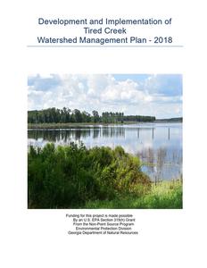
Development and Implementation of Tired Creek
Watershed Management Plan - 2018
Funding for this project is made possible By an U.S. EPA Section 319(h) Grant From the Non-Point Source Program Environmental Protection Division
Georgia Department of Natural Resources
Table of Contents Executive Summary 1.0 Introduction 2.0 Partnership 3.0 Project Assessment 4.0 Land Use and Population 5.0 Assessment and Characterization of Current Conditions 6.0 Recommened Best Management Strategies
Proposed Best Management Strategies Phase 1 Structural Non- Structural
Non-point Source/ Long Term Monitoring Load Reduction Methodology Projected BMPs and Load Reductions Total Load Reductions Phase 1 7.0 Working with the Public/ Education and Outreach
Goals Target Audience Outreach Activities 8.0 Long-Term Monitoring Plan
9.0 Financial Needs and other Funding Sources 10.0 Implementation, Evaluation and Revision
Project Activities/Milestones Phase 1 Measurement of Progress Long-Term Plan Implementation
List of Tables
JS/GTRCD
7 9 10 13 19 22 32
32 35 35 38
40 41 42
ii
Table 3.0: Potential Causes
13
Table 3.1: Threatened and Endangered
16
Table 4.1 Land Cover
19
Table 4.2 Agriculture Use
20
Table 4.4 Livestock Use
21
Table 4.5 Municipal and Industrial River Use
21
Table 5.3.1 Water Classification
23
Table 5.3.2 Pollutant List
23
Table 6.2.1 Load Reductions
34
Table 6.3.1 BMP Types and reduction
35
Table 6.3.2 BMP cost
35
Table 6.3.3 Summary Chart
36
Table 6.3.4 Proposed Implementation Schedule
37
Table 8.1 Long Term Water Monitoring
40
Table 8.2 Long Term Monitoring Milestones
41
Table 9-1: Implementation Schedule for Activities/Milestones/Cost
42
Appendices and Maps
A
Watershed Map Tired Creek
42
B
Population by County
45
C NOAA Temperature and Rainfall Data
46
D Land Cover /Land Use
47
E
Ground Water Permits
48
F
Groundwater Map
49
G Wetland Map Masse Branch
50
H Wetland Map Tired Creek
51
I
FEMA Flood Plain Masse Branch
52
J
FEMA Flood Plain Tired Creek
53
K
Original TDML Map
55
L
Original Point Source Map
56
M Original TMDL DO listing
57
N Original TMDL Loads by Segment
58
O Original Contributing Sub-watershed segments
59
U Original Contributing Sub-watershed Map
59
V
Original TMDL Reduction Load Allocations
59
JS/GTRCD
iii
ACRONYM GLOSSARY
319 (H) Clean Water Act (CWA) 319(h) Non-Point Source (NPS) Grant Program AAS- Georgia Adopt-A-Stream ARCWP-Tired Creek Watershed Partnership BMP Best Management Practice BOD Biochemical Oxygen Demand CBOD Carbonaceous Biochemical Oxygen Demand CFU/ML- Colony Forming Unit per miller liter CWA Clean Water Act CWP Clean Water Partnership DO Dissolved Oxygen E- Endangered Species EPA- Environmental Protection Agency FC- Fecal Coliform FSA- Farm Services Agency GAEPD- Georgia Environmental Protection Division GFC-Georgia Forestry Commission GWPPC-Georgia Water Planning and Policy Center at Albany State University HUC Hydrologic Unit Code NBOD Nitrogenous Biochemical Oxygen Demand NLCD National Land and Cover Database NOAA National Oceanic and Atmospheric Administration NPDES National Pollutant Discharge Elimination System NPS Nonpoint Source NRCS Natural Resource and Conservation Service NTU Nephelometric Turbidity Units
JS/GTRCD
iv
PPM- Parts per million PS- Point Source PS/NPS- Point and Nonpoint Source RC&D -Resource Conservation and Development Region 5 Model 5- Excel workbook that provides a gross estimate of sediment and nutrient load reductions RUSLE- Revised Universal Soil Loss Equation SOD Sediment Oxygen Demand STEPL- Spreadsheet Tool for Estimating Pollutant Load T- Threatened Species TDS Total Dissolved Solids TMDL Total Maximum Daily Load TN Total Nitrogen TP Total Phosphorous TSS Total Suspended Solids USDA- United State of Department of Agriculture USEPA United States Environmental Protection Agency USFWS- United States Fish and Wildlife Services USGS- US Geology Survey WMP- Watershed Management Plan
JS/GTRCD
v
Tired Creek Watershed Management Plan
Executive Summary
Through a competitive application process, the Georgia Environmental Protection Division (GAEPD) executed a FY2012 Section 319(h) Contract with the Golden Triangle Resource Conservation and Development (RC&D) Council to provide technical assistance for the development of a 9-Element Watershed Management Plan (WMP) by collecting water quality monitoring data, existing water and land use data, education and outreach in the form of establishing an advisory committee, hosting public meetings, creating a website, identifying landowners for BMP cost-share projects, and distribution of educational materials for the Tired Creek Watershed. The GAEPD 2002 Total Maximum Daily Load (TMDL) Implementation Plan did not meet the U.S. Environmental Protection Agency's guidelines for 9-Element watershed planning and the local community's interest in the watershed, it was necessary to develop a new watershed management plan. The components of this plan were prepared using USEPA Handbook for Developing Watershed Plans to Restore and Protect Our Waters, which provide guidelines for a watershed approach to restore impaired waters. The 9-Element criteria are:
1. Identification of causes and sources of pollution that need to be controlled. 2. Estimate pollutant load reductions needed. 3. Develop management measures needed to achieve goals, including restoration and
protection measures, future impacts in the watershed, etc. 4. A schedule for implementing the management measures identified in the plan. 5. Interim milestones for determining whether nonpoint source management measures or
other management control actions are being implemented. 6. A set of criteria, including water quality monitoring, that can be used to determine
whether pollutant load reductions are being achieved over time. 7. A monitoring component that can be used to track the effectiveness of implementing the
watershed management plan over time. 8. An information and education component that will be used to enhance public
understanding of the project. 9. An estimate of the amount of technical and financial assistance needed to implement the
plan.
6
Golden Triangle RC&D Council derived from stakeholder and community concerns, results of targeted water quality monitoring, current land use data, the 2002 and 2006 TMDL Implementation Plan to make the following recommendations on Best Management Practices installations and the potential causes which include:
o Non-Point Source Urban runoff o Municipal Sewage spills o Historic Spray field issues/spills o Maintenance/Repair/Establishment of Riparian/Streamside Buffers o Ensuring land use/erosion control practices are being utilized by city and county o Reduction of dumping and trash from bridges o Continued Watershed Education on importance of protecting water resources Installation of adaptive BMPs practices should lead to a reduction in Fecal Coliform of 25% for Tired Creek, 85% for Parkers Mill, and 65% for Little Tired Creek. Dissolved oxygen reductions are stated at 0% for Little Tired Creek. This is due to historical discharge issues with a now closed plant in Grady County. The estimated load reductions will be accomplished through the use of watershed management strategies, site specific location opportunities, and customized BMP installations using National Resources Conservation Services (NRCS) and Department of Forestry Conservation Practices.
Key measures that will lead to the success of this WMP will be the number of participants (landowners, the City of Cairo and Whigham, Grady County Road and Bridge department and local business willing to install appropriate BMPs for the listed impairment. Also, educational and outreach components will continue to play a key role in implementing this WMP, as was done prior to its completion through encouraging landowner participation and informing the public about the negative impacts of nonpoint source pollution and the importance of stewardship for water quality improvement. Education and outreach will continue to be carried out by:
o Holding Public Meetings o Educational Workshops and Field Days o Developing and Distributing Brochures o Updates on Golden Triangle RC&D Website and Facebook page
7
1.0 Introduction
The purpose of developing this WMP is to provide a tool that demonstrates a holistic approach to water quality management by actively engaging stakeholders within the watershed and the selection of highly effective water quality management strategies that will be implemented to correct the problems. Golden Triangle RC&D established the Tired Creek Watershed Partnership, which includes: Ochlocknee River Water Trail, Bird Song Nature Center, Keep Grady County Beautiful, Thomas University U.S. Fish and Wildlife Service, Natural Resource Conservation Service, and the Water Policy and Planning Center. Additional stakeholders participated through public community meetings and events held in Grady County. These sessions brought together local landowners, business, other concerned local organizations and local government officials to discuss issues and gather community participation. A community survey was created and distributed at public meetings, paddle events, University events, local businesses, public libraries, and was placed on Golden Triangle's website. A total of 100 surveys were distributed and 28 people responded to the survey that either live, work, or both within the watershed area. The survey included multiple choice options, along with a fill-in the blank section with questions inquiring about what the public sees as the biggest problems facing the Tired Creek. The following are responses the public sees as concerns and/or potential stressors:
Creek/Streamside Erosion Leaking Sewage septic Unpaved Dirt Roads Urban Storm Runoff Sedimentation Flow Obstruction Lack of Education Pollution Illegal Dumping
Of these responses, the top four concerns are flow obstruction, pollution, illegal dumping and lack of education. Golden Triangle addresses these primarily through evaluating water quality monitoring, evaluation of land use and characterization of physical features and habitats. Through interaction with the Tired Creek Watershed Partnership a combination of adaptive on the ground approaches were recommended, including long term management measures for the most effective BMPs to improve water quality in the Tired Creek Watershed.
8
The recommended BMPs described in this WMP would effectively reduce the amounts of Fecal Coliform bacteria and increase the levels of Dissolved Oxygen. The implementation and/or installation sites will be selected based upon the greatest potential effectiveness of the proposed BMP for the impairment.
During the first phase of implementing the WMP, Golden Triangle RC&D will administer and track the progress of the recommended management measures, monitor the effectiveness of BMPs and associated load reductions, and oversee the completion of tasks and milestones. The targeted BMP completion number for each type may be altered depending upon the type and number in a landowner's application. BMP completion is also greatly dependent on landowner and shareholder participation. Load reduction data will be made available to the Tired Creek Watershed Partnership. If the numbers of acreage for each BMP type is changed then the estimated load reduction numbers will be adjusted accordingly. Any changes to the BMP implementation schedule will be reported to GAEPD and the Tired Creek Watershed Partnership.
2.0 Partnership/Stakeholder Committee
The Tired Creek Watershed Partnership was formed in June 2015. The partnership/advisory board is comprised of local organizations and business, city planners, and public citizens. Four advisory meetings and three public town hall meeting. During the formation of the partnership it was important to identify individuals and/or groups that were and/or would be able to:
o make decisions on the Watershed Management Plan o provide and/or gather data regarding the watershed o partner by providing technical and financial assistance o develop and conduct public outreach strategy o develop web page on the existing Golden Triangle R&D website to list
updates and events regarding the Watershed
Golden Triangle would like to acknowledge the Ochlockonee River Water Trail and Grady City Planning and Zoning Department for assistance in data gathering information, Advisory meeting input and participation. Their input allowed confirmation of City regulations and ordnance's and BMP practices are still being followed as per the 2002 TDML plan. The full list of stakeholders, community partners, local landowners, and other organization contributions are listed in table 2.0 below.
9
Table 2.0 Organization
Thomas University
Name Dr. Christine Ambrose
Ochlocknee River Water Trail
Bird Song Nature Center
Margaret Tyson Vickie Redden Kathleen Brady
Keep Grady County Beautiful
Grady County Road Department
Georgia Forestry Commission
US Fish and Wildlife Service Panama City Field Office
US Fish and Wildlife Service Fort Benning Field Office
National Resource Conservation Service (NRCS) Individual Citizen Participation
Water Policy and Planning Center
Celeste Taylor Stanley Elkin Chuck Norvell Chris Metcalf
Jim Bates
Beth Grant Ruthie Pfaff Alton Brown Marty McKimmey
Participation Watershed Partnership, Technical Assistance, Community Outreach, GIS Mapping Stakeholder, Watershed Partnership, Community Outreach
Stakeholder, Watershed Partnership, Community Outreach Watershed Partnership, Community Outreach Stakeholder
Watershed Partner, Technical Assistance Watershed Partner, Technical Assistance
Watershed Partner, Technical Assistance
Technical Assistance
Community Outreach
Technical Assistance
10
A community survey was created and distributed at the (2) two public meetings, local businesses, public libraries, and on the Golden Triangle website A total of 100 surveys were distributed and 28 people responded to the survey that either live, work, or both within the watershed area. The survey included multiple choice options, along with a fill-in the blank section with questions inquiring about what the public sees as the biggest problems facing the Tired Creek. The following are responses the public sees as concerns and/or potential stressors:
Creek/Streamside Erosion Leaking Sewage septic Unpaved Dirt Roads Urban Storm Runoff Sedimentation Flow Obstruction Lack of Education Pollution Illegal Dumping
The top concerns and/or issues from survey where Sedimentation, Flow Obstruction, Pollution, and Illegal dumping. The results of the Community Survey were shared with the partnership/stakeholders, along with the visual survey and report that was completed of 2016. The results were compiled into 2 categories; A) those we can affect with the implementation of a Watershed Management Plan B) those we cannot affect due to time or cost constraints. The following are the top ranked issues/watershed stressors that the Partnership/Stakeholders/Community has identified within the Tired Creek. Figure 1 Community Survey
30 25 20 15 10
5 0
.
11
Project Area Assessment
3.0 Physical Features
Geographic Location
The Ochlockonee River Basin, from the headwaters in Worth County to the Gulf of Mexico, covers an area of approximately 2,448 square miles. The basin is divided into the Upper and Lower Ochlockonee. The Tired Creek Watershed (HUC (10) 0311010301) and corresponding impaired waterbodies lie within the basin. The Tired Creek watershed is approximately 136.99 square miles and covers the southern part of Grady County, Georgia. The Georgia Environmental Protection Division (GAEPD)'s Draft 2014 Integrated 305(b)/303(d) List of Streams Not Supporting Designated Uses includes 17 miles in Grady County as not meeting its designated use (fishing) because of violating criteria for Fecal Coliform and Biota Impacted Macroinvertebrate as follows:
Little Tired Creek (SR 188 downstream of Cairo to Tired Creek), 6 miles listed for Fecal Coliform violation,
Parkers Mill Creek (Headwaters to Tired Creek, Cairo), 5 miles listed for Fecal Coliform violation, and
Tired Creek (Turkey Creek to Ochlockonee River, 6 miles for Fecal Coliform, Biota Impacted Macroinvertebrate
The potential causes and sources of nonpoint source pollutants are shown in Table 3.0 with the impairment relative to the potential cause, which were derived stakeholder and community concerns, results of targeted water quality monitoring, current land use data, the 2002 TMDL Implementation Plan.
Potential Causes Table 3.0 Identified Impairment Fecal Coliform
Potential Source/Causes Urban runoff Degraded/nonexistent buffers Fecal Matter from manure spreading on agriculture fields
Low Dissolved (Historical) Oxygen
Sediment
Urban run-off (subdivisions and parks) Low Flow/High Temperatures Drought Limited Agriculture Row Crop Run-off Fecal Matter from Wildlife Non-vegetative banks Urban ditch erosion Limited Agricultural run-off
12
Topography
The Tired Creek Basin lies within the Coastal Plains region and due to the lack of riffles and shoals that dominate the Piedmont regions, create significant floodplain forest systems. This is due to the long expanse of contiguous habitat and the volume of water in the region. The Tired Creek Watershed is 91, 415 acres and contains 216 miles of stream, 294 acres of lakes and 18,852 acres of wetlands. Many of the tributary streams that feed into the river are considered alluvial with sandy bottoms. They are predominantly composed of sands, clays, and gravels. The land surrounding runs through both urban and residential neighborhoods before turning into a mixture of managed plantations, agriculture cropland, and livestock chicken farms. The Tired Creek is primarily croplands while the lower portions are forested.
Soil Types The watershed lies within the Southeastern Plain/Dougherty Plain ecoregion, which is dominated by ultisols (sandy/ loamy surface layers and clayey subsoils) this makes the soil very erosive. The soil types associated within the Tired Creek are characterized by nearly level to gently sloping, well drained upland soils that are dissected by nearly level, poorly drained soils along narrow drainage ways. Most of the soils are strongly acid, low in organic matter content, and low in natural fertility. It should also be noted that even within the same geographic land area that different soil types and slopes exist. These variables will be taken into account within the BMP recommendation process. The soil associations for the geographic area around each creek and county are broken out below: Soil Types
GoA--Goldsboro loamy sand, 0 to 2 percent slopesNatural drainage class: Moderately well drained Runoff class: Very low LnA--Lynchburg fine sandy loam, 0 to 2 percent slopes Depth to restrictive feature: More than 80 inches Natural drainage class: Somewhat poorly drained OSA--Osier and Bibb soils, 0 to 2 percent slopes, frequently flooded Depth to restrictive feature: More than 80 inches Natural drainage class: Poorly drained Runoff class: Negligible
Little Tired Soil
2%
Goldsboro Loamy
30% 40%
Lynchburg fine sandy Loamy
Osier Bibb
28%
Water
13
Fuquay loamy sand, 0 to 5 percent slopes Natural drainage class: Well drained Runoff class: Very low OSA--Osier and Bibb soils, 0 to 2 percent slopes, frequently flooded Depth to restrictive feature: More than 80 inches Natural drainage class: Poorly drained Runoff class: Frequently Floods
Parkers Mill Soil 2%
98%
Faquay Osier Bibb
BlB--Blanton loamy sand, 0 to 5 percent slopes Depth to restrictive feature: More than 80 inches Natural drainage class: Well drained NaB--Nankin loamy fine sand, 2 to 5 percent slopes Depth to restrictive feature: More than 80 inches Natural drainage class: Well drained NcD--Nankin-Cowarts complex, 8 to 12 percent slopes Depth to restrictive feature: More than 80 inches Natural drainage class: Well drained PeA--Pelham loamy fine sand, frequently flooded Depth to restrictive feature: More than 80 inches Natural drainage class: Poorly drained OSA--Osier and Bibb soils, 0 to 2 percent slopes, frequently flooded Depth to restrictive feature: More than 80 inches Natural drainage class: Poorly drained Runoff class: Frequently Floods
OSA--Osier and Bibb soils, 0 to 2 percent slopes, frequently flooded Depth to restrictive feature: More than 80 inches Natural drainage class: Poorly drained Runoff class: Frequently Floods
60%
Tired Creek Soil
2% 6% 7%
Blanton Loamy Nankin Loamy
25%
Nankin- Cowart Pelham Loamy
Osier Bibb
Turkey Creek Soil
100%
Osier Bibb
14
Climate Data from the National Oceanic and Atmospheric Administration (NOAA) shows that rainfall in Southwest Georgia has increased from the drought conditions of 2012. Table 5.1.4 Climate Data
The highest temperatures reflected are June at 85 degrees and July at 90. The largest rainfall amounts occurred in June at 2.30 inches. Habitat The Tired Creek supports a diverse and rich mix of aquatic and terrestrial communities. Wetlands and floodplains are an integral part of this system and can be impaired when a water resource is adversely affected by human activities such as land conversion, alteration and drainage due to silviculture, and fragmentation (GEPD, 2002). Aspects of urbanization, hydrologic alteration, impervious surfaces, and stream channelization can cause substantial degradation of the physical, chemical, and biological characteristics. Previous watershed surveys and the original TMDL plan approved by EPD in 2002 show that there are federally threatened and endangered flora, fauna and aquatic life present, along with USFWS Critical Habitat Areas as shown below in Table 3.1.
15
Table 3.1
Threatened (T) and Endangered (Thomas County)
Species
Bird
Wood Stork Mycteria americana
Red-cockaded woodpecker Picoides borealis
Reptile
Gopher Tortoise Gopherus polyphemus
Invertebrate
Oval Pigtoe (Pleurobema pyriforme)
Invertebrate Purple bankclimber (Elliptoideus sloatianus)
Invertebrate Ochlockonee moccasinshell (Medionidus simpsonianus)
Federal Status
E
E
No Federal Status
E
T
E
State Status
E E
T
E T
E
Habitat
Threats
Primarily feed in fresh and brackish wetlands and nest in cypress or other wooded swamps
Nest in mature pine with low understory vegetation (<1.5m); forage in pine and pine hardwood stands > 30 years of age, preferably > 10" dbh
Decline due primarily to loss of suitable feeding in south Florida. Other factors include loss of nesting habitat, prolonged drought/flooding, raccoon predation on nest, and human disturbance of rookeries.
Reduction of older age pine stands and to encroachment of hardwood mid story in older age pine stands due to fire suppression
Well-drained, sandy soils Habitat loss and conversion to closed
in forest and grassy
canopy forest. Other threats include
areas, associated with mortality on highways, and pet trade.
pine over story, open
understory with grass and
sunny areas for nesting.
River tributaries and main channels to slow to moderate currents over silty sand, muddy sand, and gravel substrates
Habitat modification, Sedimentation, and water quality degradation.
Rivers and streams;
Habitat modification, Sedimentation,
usually found in moderate and water quality degradation
currents over sand, sand
mixed with mud, or gravel
substrates, swept free of
silt by the current.
Medium to large rivers; found in slight to moderate current over sand and gravel substrates; muddy sand substrates around tree roots.
Habitat modification, Sedimentation, and water quality degradation
16
Recharge Areas The ground water resources for the Tired Creek are supplied by the Floridian aquifer system. The recharge area lies within Mitchell County. The Floridian aquifer is characterized as a thick sequence of carbonate rocks (limestone and dolomite) that is easily permeated. According to the Department of Natural Resources Groundwater Pollution Susceptibility Map (Hydrologic Atlas 20) the area in Mitchell County lies within a "High" susceptibility zone for pollutants, while only the upper portion of Grady County lies within the "Average" susceptibility zones. Pollutants can enter the re-charge areas through septic systems, agricultural waste, and run-off of fertilizers. See attachment J for Groundwater Pollution Susceptibility Map of Georgia and attachment K for Groundwater Recharge Area Map of Georgia (Hydrologic Atlas 18).
Georgia's Groundwater Recharge Areas
17
Flood Plains The Tired Creek Watershed does contain flood plain areas, but according to the Federal Emergency Management Agency (FEMA) mapping it is only a 1% flood hazard within the effected creeks. See Attachment L for FEMA Flood Plain Map. Wetlands The Tired Creek basin contains 20,287.98 acres of wetland areas within the affected areas. See Attachment K for Wetland Map. 4.0 LAND USE AND POPULATION CHARACTERISTICS Land Cover The health and stability of aquatic ecosystems is directly linked to the health and condition of the terrestrial ecosystems. Many factors can affect this balance:
Land Use Deforestation Population Size All land use has an effect on water quality, whether positive or negative. In forests and other areas with good vegetation cover and little disturbance, most rainfall soaks into the soil, collecting in recharge areas underground rather than runoff. In highly populated areas with pavement and buildings, little rainfall can soak into the soil, which can cause high runoff events. Table 4.1 Land Cover
18
19
LAND USE
The Tired Creek Watershed lies within the larger Upper Ochlockonee River basin with occupies 6,330 square miles of which 1,460 square mile are within the state of Georgia. The Tired Creek area covers 136.99 square miles and covers the southern part of Grady County. Grady counties agriculture production is predominately row crop with 345 farms. Livestock farms of either chickens, beef/dairy cows or swine make up a total of 353 farms. Residential and urban land use are contributing issues due to greater amounts of impervious surfaces and storm water systems to convey oils, heavy metals, yard and pet waste. The run off of these pollutants does have a direct impact with the sources of pollutants entering the waterways. Recommendations for control of this will be made in section 6.0.
AGRICULTURE USE
Agriculture use within the watershed is divided between livestock/poultry farms and row crops at a total of 698 farms totaling 130,258 acres with 78 farms having irrigated land of 9,230 acres. This information was used to assist with the appropriate BMP recommendations, pollutant load reductions, and ensure measureable progress is being made. (Table 4.2 shows the applications of fertilizer and chemical applications within the watershed complied from the 2012 Georgia Farm Gate Report by County and Crop) and Table 4.3 shows the number of livestock farms)
Table 4.2 Agriculture Fertilizer and Chemical Applications
200 150 100
50 0 Fertilizer Cropland Fertilzer Pasturland
Manure
# of farms
Chemicals to control insects
USDA 2012 Agricultural Cenus by County Total number of Row Crop Farms 345
20
Table 4.3 Live Stock Farms
160,000 140,000 120,000 100,000
80,000 60,000 40,000 20,000
0
Cattle
Dairy
Total number of Poultry Farms 96
Total number of Livestock Farms 257
Swine
Poultry
Table 4.4 Municipal and Industrial Uses
PERMIT_NAME PERMIT_NO COUNTY
Cairo, City of Cairo, City of (Cairo WPCP)
GAG820048 Grady GA0025771 Grady
Johnson Ranch Koyo Bearings USA LLC Pinewood Nursing Center
GAG920038 GAP050028 GAG550047
Grady Grady Grady
RIVER_BASIN PERMIT_TYPE PERMIT_SUBTYPE
General
Unknown
Pesticides
Municipal
Ochlockonee Ochlockonee
NPDES General LAS AFO (300 to 1000 AU)
Municipal Industrial
Ochlockonee Pretreatment Industrial
Ochlockonee General PID Municipal
21
LAS Facilities
Permit #
065002D(SL)
065002D(SL)
Facili ty
Nam e
Cairo - 6th Ave (SL) Cairo - 6th Ave (SL)
Facility Descriptio
n
County
Unlined Sanitary Landfill
Unlined Sanitary Landfill
Grady Grady
Domini on
Public
Public
Reportin g Year (FY)
2017
2017
Remainin g
Capacity (yd3)
377,011
51,782
Averag e Daily Tons
36
77
Rate of Fill
(yd3/day)
Years Remai ning
72
21
154
1
Estimated Waste
Fill Date
Type
8/1/2038 C&D
12/1/2018 MSWL
Water Withdrawal Permits
Permit
River
Holder
Permit Permit
Basin
(Individual) ID
Type
VAN Ochlockonee PONDER
ROBERT E Ochlockonee LEE
A100650318 A910650178
Surface Water
Surface Water
County
Grady Grady
Date Permit Issued
10/29/2010
11/16/1993
Acreage
26 100
Surface Water Source
TRIBUTARY OF LITTLE TIRED CREEK & BELDER CIRCLE POND
OCHLOCKNEE RIVER
SW Rate (GPM)
450
1000
Demographics
Population size plays an important role in the watershed, as populations increase within both urban and rural communities this can affect, degrade, displace, alter or in worse cases eliminate natural habitats. These increases can lead to the potential for more urban and agricultural runoff. Watersheds with higher populations tend to exhibit greater impacts on waterways and habitats. The July 2017 US Census Bureau data shows a .08 % decrease in overall population for Grady County. It should however be noted that new businesses within Grady County has increased by 5% from 2015 to current date. (Attachment E)
PEOPLE
Population
Population estimates, July 1, 2017, (V2017) Population estimates base, April 1, 2010, (V2017)
24,819 25,011
22
5.3 Water Body and Watershed Conditions
Water Quality Standards The Clean Water Act and USEPA's Water Quality Planning and Management Regulations (40 CFR Part 130) require states to develop total maximum daily loads (TMDLs) for their water bodies that are not meeting their designated uses due to pollutants. The TMDL process establishes the allowable loadings of pollutants or other quantifiable parameters for a water body based on the relationship between pollution sources and in- stream water quality conditions, so that states can establish water quality based controls to reduce pollution from both Point and Nonpoint Sources and restore and maintain the quality of their water resources (USEPA, 1991).
These Standards are established to provide and enhance the following: o Water quality and prevention of pollution o Protect the public health and welfare of drinking water supplies o Conservation of fish, wildlife and other beneficial aquatic life o Agricultural, industrial, recreational, and other reasonable and necessary uses to maintain and improve the biological integrity of the waters of the State
Table 5.3.1 below shows the recommended ranges approved by Georgia Environmental Protection Division (391-3-6-.03 Water Use Classifications and Water Quality Standards)
Water Quality Characteristic of Concern
Dissolved Oxygen
Ecological or Health Effect
High levels of Dissolved Oxygen are necessary for fish respiration
Standard
5.0 mg/l average 4.0 mg/l min
Notes
GA water quality standards
Temperature Fecal Coliform
Phosphorus
Fish suffer metabolic stress at high temperatures. Fecal Coliforms do not pose a health threat but serve as an indicator for bacteria that can cause illness in humans and aquatic life.
Macronutrient affects aquatic productivity and trophic state.
90 c max
200 col/100ml(MayOct) 1000 col/100 ml(Nov - April) 4000 col/100 ml(anytime) No effective standard in GA
GA water quality standards GA water quality standards
Water body specific
Total Nitrogen Macronutrient affects aquatic productivity and trophic state.
4.0 mg/l
GA water quality standards
23
Source Assessment
The Tired Creek Watershed is 136.99 acres and contains 17 miles of stream, 294 acres of lakes and 18,852 acres of wetlands. The Georgia Environmental Protection Division (GAEPD) 305(b)/303d list (2010) identifies 30 miles of impaired streams. Table 5.3.2 provides the non-point source pollutant listed for each area.
Table 5.3.2
Water Body Segment Name
County Location(s)
Little Tired - SR 188 downstream Grady of Cario to Tired Creek
Parkers Mill Headwaters to Tired Creek
Grady
Criterion Violated or Water Quality
Concern
Listing Status Category 4a, 5 or 1
FC
4a
FC
4a
Tired Creek- Turkey Creek to Ochlockonee
Grady
FC and Biota Impated macroinvertebrates
The Original TMDL Implementation Plan for Tired Creek was completed in 2002. However, the Implementation Plan does not meet the USEPA nine element criteria, which was established much later. The 2002 TMDL Implementation Plan indicated that the Fecal Coliform and Dissolved Oxygen pollutant issues where a result of failures to control run-off from storm water and urban areas, historic lift station and spray field issues, dumping and run off from bridges . The following summarizes the potential actions described in the 2002 TMDL Plan that could reduce Fecal Coliform and Dissolved Oxygen loading from nonpoint sources in the Tired Creek and.
Potential actions that could reduce the Fecal Coliform and Dissolved Oxygen Load: o Install/Maintain buffers including Bio Retention and Conservation o Use of the Georgia Best Management Practices for land disturbing activities o Identification of any malfunctioning Septic Systems o Adoption of proper unpaved road maintenance practices for sedimentation o Homeowner education- what not to dump down storm drains/bridges o Reduction of trash and dead animals on bridges and in creeks o Redesign of Wastewater Treatment Plant
24
VISUAL SURVEY A visual field survey was completed fall of 2016, summer of 2017 and summer of 2018 to aid in the identification of the possible sources of Point/Non- Point Source pollution. The results of this survey showed the following: Little Tired Creek
o Degraded /nonexistent buffers, urban run-off from business
Business- Junkyard
25
Parkers Mill City of Cairo Urban o Degraded buffers, blocked and damaged culvert pipes, stream debris, trash
Parkers Mill- Degraded/ nonexistent buffers Business Monrovia Nursery upstream of creek
26
Tired Creek- Sedimentation and degraded banks
Turkey Creek Low Flow and Sedimentation
27
Tired Creek Lake Even though Tired Creek Lake was not listed within the scope of this project, due to the location of the lake and the tributaries that feed it both upstream and downstream it is important to note the work being completed at the site and on State Park road (dirt road to Lake).
28
Spraying of duckweed at lake, and road construction on State Park Rd leading to Tired Creek 29
Water Quality Monitoring Water sampling/monitoring, and visual surveys assessments were completed from April 2016 to September 2018. Full data results are located in Attachment B.
Summary of each Creek
250
200
150
100
50
0
Air Temp
Water Temp
C
C
pH
Dissolved Oxygen Conductivity E Coli
mg/L
s/cm
cfu/100mL
Little Tired Parkers Mill Tired Creek Turkey Creek Tired Creek Lake
Average of Creeks all together
E Coli
cfu/100mL
Conductivity s/cm
Dissolved Oxygen mg/L
pH
Water Temp
C
Air Temp
C
Air Temp C 31
0
Water Temp C 22
50 pH 6
100
150
200
250
Dissolved Oxygen mg/L
6.8
Conductivity s/cm 228
E Coli cfu/100mL
204
30
6.0 Recommended Best Management Practices/Strategies
The consensus of Golden Triangle RC&D and the Tired Creek Watershed Partnership (ACWP) is that through the recent water quality monitoring, visual surveys, and research of historical data, the 2002 recommendations are still valid and required for the creation of this WMP to identify appropriate BMPs that need to be implemented within the Tired Creek Watershed to reduce the levels of Fecal Coliform, and Dissolved Oxygen. This Section discusses the proposed BMPs that were derived from Golden Triangle's investigations.
Golden Triangle RC&D and Watershed Partnership recommend implementing a combination of adaptive on the ground approaches, including long term management measures for the most effective BMPs to improve the overall water quality of the Tired Creek Watershed. The actual management measures to be implemented however are subject to modification based upon landowner participation, site specific need and opportunity, as well as future availability of funding.
The management strategies focus on environmental, programmatic and social indicators in recommending the appropriate Best Management Practices for Little Tired Creek (SR 188 downstream of Cairo, Parkers Mill (Headwaters to Tired Creek) and Tired Creek (Turkey Creek to Ochlocknee)
BMP practices approved by NRCS, DNR, USFWS specifications will include both structural and non-structural approaches for agriculture, urban pollutant controls, and public educational and outreach activities throughout the entire watershed.
Implementation of Best Management Practices (BMPs) 6.1.2 Structural BMP Recommendations to Address Fecal Coliform/Dissolved Oxygen and Sedimentation, including but not limited to the following:
o Grass Swales o Infiltration Basin o Infiltration Trench o LID/Filter/Buffer Strip o LID/Infiltration Swale o LID/Infiltration Trench o LID/Vegetated Swale o Sand Filter/Infiltration Basin o Sand Filters o Vegetated Filter Strips o Culvert Pipe o Channel Stabilization o Stormwater Runoff (combined BMP) o Critical Area planting
31
o Better Back Road Sedimentation and Transport Load of Fecal Coliform- Tired Creek Lake
Installation of better back road practices for the transport of sedimentation and fecal coliform loading into streams and creeks. *This item is being added as a place holder. Current work on State Park Road for the Tired Creek Lake project is currently under construction and permitting by EPD via the lake project.
6.1.3 Non-Structural BMPs
o Riparian Buffers- Address Sedimentation/Dissolved Oxygen- All creeks
Protect water quality by slowing nutrient, pollutants, and sediment runoff. Buffers can either be herbaceous or forested. They can provide vegetation types, water quality protection, groundwater recharge, and wildlife habitat.
o Watershed debris and trash clean-up-address habitat alteration-All Creeks
While conducting visual survey of the watershed, it was noted that illegal dumping of old furniture, tires, litter was observed within the creeks. Not only is litter in streams unsightly, but trash and other debris in streams negatively impact aquatic organisms. * It should also be noted here that there are numerous waste management dumpsters that sit up stream and in most cases at the entrance of access areas to Lil Tired, Tired, and Turkey Creek. 6.2 Load Reduction Methodology Region 5 Model 5
The Region 5 Model 5 Load Reduction model will be used to estimate the load reducing effects created by the installation of planned BMPs. The model uses the pollutants controlled calculation and documentation for Section 319 watershed training manual. The program is segmented into five different BMP categories for estimation of load reductions. These categories are gully stabilization, bank stabilization, agricultural fields, feedlots and urban runoff. Many different subcategories are listed under each category. The program only gives an estimation of load reduction and makes many assumptions in doing so. Load reduction calculations are given for sedimentation, phosphorus, and nitrogen. Monitoring is the only true way to determine actual load reductions achieved by BMP installations.
Load Reduction Methodology
The load reduction model requires the input of a soil rainfall/runoff erosive number of "R" value, for load reduction estimations. Within the three counties in the watershed there are three different soil erosive "R" values according to the RUSLE (Revised Universal Soil Loss Equation) values. Thomas has an "R" value of 400.
32
The load reduction model requires that a soil erodibility factor, or "K" factor, is used to estimate load reductions. Soils within Georgia have "K" values that range from 0.05 to 0.43. The majorities of the soils within the watershed are sandy surfaces with loamy or clayey subsoil's, and have "K" values from 0.13 to 0.15. An average "K" value of 0.14 will be used to calculate load reduction values.
A length of slope and steepness factor, or "LS" factor, is required to calculate load reduction values. The "LS" value is a site specific value that must be calculated from each BMP site. Most crop lands in Georgia have slope lengths that range from 60 to 250 feet. For load reduction calculations an average of 150 feet for slope length and an average of 3% slope will be used. This will be a "LS" factor value of 0.24.
The Region 5 Model requires a cover management factor, or "C" factor in order to calculate load reductions. The program automatically inserts a "C" value into the calculation based on the county in which the BMP is installed. "C" factor values range from 0.20 to 0.39 within the watershed. An average value of 0.33 will be used in the load reduction calculations.
The Region 5 Model requires a support practice factor, or "P" factor, to calculate load reductions. The model automatically inserts a "P" factor based on the county/counties selected. The watershed has "P" factors that range from 0.75 to 0.98. A "P" value of 0.76 will be used to calculate load reductions.
The Region 5 Model gives an estimated soil loss per year in ton/acre/yr. Each of the counties within the watershed has different soil loss estimations according to the model. The counties range from 2.56 to 4.62 tons/acre/yr for soil loss. A number of 3.79 will be used to calculate load reductions.
The BMPs to be completed are an estimate based on applications that have been filled out by Landowners and Shareholders. The BMPs installation sites are subject to Landowner participation.
Urban runoff calculations do not show estimation for sedimentation, phosphorous, and nitrogen. Urban runoff calculations are needed to calculate load reductions for rural area subdivisions and dirt roads. The Gully stabilization calculations will be used to estimate load reductions for these areas.
33
Table 6.2.1
Project Stream Name and 303(d) Location
Little Tired Creek SR 188 downstream of Cairo to Tired Creek Parkers Mill Creek Headwaters to Tired Creek
Violation
TMDL Percent Reduction
65% - 2006 (FC) FC
85% - 2006 (FC) *Historical DO FC
Tired Creek Turkey Creek to Ochlockonee
FC, Biota Impacted
25%- 2006 (FC) Biota 2001
macroinvertebrate
6.3 Recommended Best Management Strategies and Load Reductions
The following table is an estimation of the BMPs that will be completed within Phase 1 (Section 319(h) FY13 Contract). The table contains an estimated number of acres that will be affected or a number of livestock to be excluded. Completion of the BMPs will depend heavily on landowner participation and desires. Table 6.3.2 provides the type of BMP recommended and projected number for installation.
Table 6.3.1 Pollutant
BMP Type
Number of BMPs
Installed
Sediment Reduction (tons/year
Phosphorous Nitrogen Reduction Reduction (lbs/year) (lbs/year)
Fecal Coliform/
Filter Strips
10 @ .25
236
Dissolved Oxygen
acres per
Sediment
Fecal Coliform/
Riparian Buffers 25 acres
236
Dissolved Oxygen
Sediment
Fecal Coliform/
Storm Water
25 acres
236
Dissolved Oxygen Runoff (combined
Sediment
BMP)
Fecal Coliform/
Septic Tank
2 site
236
Installation
36.7
5.4
36.7
5.4
36.7
5.4
36.7
5.4
34
Table 6.3.2 Estimated Cost BMP Type
Filter Strips Riparian Buffers Storm Water Runoff
Critical Number
10 acres 25 acres 25 acres
Septic Tank Installation 2 sites
Estimated Costs
$292.00 per acre=$1,460 $946.00per acre=$23,650 $537.15 per acre = $16,114.50 $10,000
As mentioned in the Executive Summary, this project was funded in part with a Section 319(h) Grant, whereby the recommendations derived in developing the WMP would be implemented after GAEPD approved the plan. Interested landowners and business developers were identified during the public outreach and education element of the data gathering for the WMP.
As part of this planning process, an implementation summary chart was created to recap the
recommendations of this plan with project priority ranking and estimated costs. The chart is
organized by sub watershed/creek name, and identifies potential stressors, recommended BMPs
and estimated costs. Additionally, the chart identifies responsible organizations/partners to lead
on implementation activities.
Table 6.3.3_
Stream Name
Potential Stressors
Priority BMPs
Estimated Cost
Responsible Organization
Grass Swales
Parkers Mill
Urban Runoff/Fecal Coliform/Dissolved Oxygen/Sedimentation #1
Infiltration Basin Infiltration Trench
$100,000
GTRCD/FWS/ Grady County
LID/Filter/Buffer Strip LID/Infiltration Swale LID/Infiltration Trench
LID/Vegetated Swale Sand Filter/Infiltration Basin Sand Filters
Vegetated Filter Strips
Culvert Pipe
Channel Stabilization Stormwater Runoff (combined BMP) Riparian Buffers
Critical Area planting
35
Lil Tired Creek
Ag/Residential/UrbanFecal Coliform/Dissolved Oxygen/Sedimentation #1
Tired Creek
Ag - Fecal Coliform/Dissolved Oxygen/Sedimentation #1
Ag - Fecal Coliform/Dissolved Turkey Creek Oxygen/Sedimentation #1
Critical area planting Stormwater Runoff (combined BMP) Grass Swales
Vegetated Filter Strips
Riparian Buffers
$30,000
Critical area planting Vegetated Filter Strips Riparian Buffers
$20,000
Critical area planting Vegetated Filter Strips Septic systems Riparian Buffers
$25,000
GTRCD/FWS/ Grady County
GTRCD/FWS/ Grady County
GTRCD/FWS/ Grady County
36
Milestones Table _6.3.4__: Proposed Implementation Schedule for WMP
2019 Milestones/Tasks
Execute Contract
Project Activity 1: Develop criteria to identify and contact landowners/City of Thomasville for installation of BMPs
Task #2: Implement Urban BMPs Task #3: Conduct two (2) BMP field days and workshops at selected sites (1 each year) Task #5: Continue with Tired Creek Partnership for advisement on implementing the WMP Task #7: Expand Tired Creek Partnership by recruiting new members Project Activity 2: Refine Better Back Road projects with County Administrators Project Activity 2: Refine Better Back Road projects with County Administrators Project Activity 3: Develop long-term water quality monitoring plan to measure BMP effectiveness Task #8: Prepare QA/QC water quality monitoring plan for post BMPs Task #9: Conduct two(2) Adopt-A-Stream Training (1 each year) to assist with water quality monitoring Task #10: Conduct post BMP water quality monitoring according to GAEPD approved QA/QC sampling plan
Project Activity 4: Conduct public outreach and education through Rivers Alive Cleanup projects
Task #13: Conduct two (2) Rivers Alive CleanUp (1 each year) in targeted county Project Activity 5: Evaluate management strategies
Task #14: Incorporate into the 2018 WMP results of installing BMPs, water quality monitoring, public education and outreach, and assessment of future needs to improve water quality
Submit Quarterly Invoices & Status Reports
Submit Final Close-Out Report
2020
2021
37
7.0 Public Education and Outreach
Education and Outreach components are essential for this plan to reach wide and varied audiences on topics regarding Non-Point Source pollution, aquatic habitats, and the importance of protecting and improving water quality within the watershed. This will include landowner, homeowner, stakeholder, county and city administrators and workers, along with teacher and/student education.
Educating students on the value of Georgia's water resources and how they can help is pivotal in creating a sense of environmental stewardship. Environmental awareness is not meant to be shortlived, but rather when instilled at a young age, can persist throughout a lifetime. Children are the future and their knowledge of environmental impacts is pivotal to the preservation of our valuable natural resources. Education and Outreach will be completed by utilizing the following:
Education Component
Adopt A- Stream Monitoring Rivers-A-Live Clean-up Erosion and Sediment Control
BMP demonstrations/field days
Septic Tank /Dumping Awareness Volunteering
Target Audience
All All Landowners, homeowners, city and county administration and workers
Landowners, homeowners, city and county administration and workers
Landowners, homeowners
All
1) Strategy: The main strategy of the Tired Creek WMP is to eventually improve the water quality in the impaired sections of the watershed and protect the water quality in the remaining part of the watershed for the streams to become fully supporting of their designated use. This would allow the watershed to be removed from the EPD's 305(b)/303(d) lists. The education and outreach will be designed to increase the public's awareness of:
a) The ecological significance of the Tired Creek Creek Watershed b) Appropriate BMPs and how they are used to reduce nonpoint source pollutants. c) How urban and storm water runoff, farming and other land use practices affect the watershed d) The endangered and protected species located with the Tired Creek Watershed
38
2) Implementation: Outlined below are the actions that will be taken to implement the education and outreach strategies of this WMP. Many of which the NRCS uses in its EQIP Program. Therefore, Golden Triangle RC&D will work closely with NRCS, Georgia DNR, Georgia Forestry Commission and USFWS personnel to carry out the following actions:
a) Promote the implementation of BMPs concerning type, cost, and effectiveness b) Hold erosion and sedimentation control workshops c) Educate a wide range of ages and audiences concerning water quality d) Educate individuals about the urban runoff issues within the watershed e) Erect signs to educate the public about the watershed and about water protection f) Educate the public on how septic tanks, dumping of yard clippings, and oil and grease
can affect the Tired Creek Watershed's water quality. These educational and outreach actions will be implemented in the watershed through the following strategies:
Nine (9) Partnership meetings will be held. These meetings will be rotated between the counties involved in order to get more participation from each county. During these meetings, the Partnership will be updated about the plan and water quality protection efforts. Individuals will also have the opportunity to express any specific areas of concern within the watershed.
a) Conduct two (2) BMP field days where BMP projects will be reviewed and the importance of the BMPs and water quality will be discussed. Discussions could also include any ecological or endangered species concerns.
b) Produce Public Service Announcements through local newspapers and Golden Triangle website and Facebook page to promote activities and events related to the watershed.
c) Partner with school science teachers, County extension offices, local water trail organizations, Girl and Boy Scout troops, and other organizations to bring awareness, education, and the importance of the watershed to the community.
d) Erect two (3) watershed education signs which will be posted on the major highways and roads entering the Tired Creek Watershed area. See Figure 7-1 for a picture of the watershed signs.
e) Conduct two (2) Adopt-A-Stream training workshops. f) Conduct two (2) Rivers Alive clean-up events. g) Creation of brochure on Septic Tanks (what to dump what not to dump) for homeowners h) Storm drain markers
39
Table 7.1
YOU ARE ENTERING THE LILTTLE TIRED CREEK WATERSHED Please Protect Our Waters
Paid for in part through a grant from the USEPA in partnership with Georgia Environmental Protection Division under the Provisions of Section 319(h) of the
Clean Water Act.
40
8.0 Long Term Monitoring of the WMP and Water Quality As shown in the Proposed Implementation Schedule, the WMP was written to cover a 10-year time period and interim milestones and measures of success of the plan are broken down into three phases; short-term, mid-term, and long-term. A summary of each interim milestones and success criteria for each phase of the WMP is included in Table 8.2
One of the elements of a 9-element plan is to include a process for long-term monitoring of water quality as well as the Plan itself. Golden Triangle RC&D personnel and volunteers with QA/QC certification from Georgia Adopt-A-Stream will conduct water quality monitoring over the next 3 years and recorded within the Adopt-A-Stream database.
The water quality monitoring will be designed to collect biological, chemical, and bacteriological data
following the implementation of the recommended BMPs. Table 8.1 shows the type of monitoring
and the parameter assessed.
Table 8.1 Water Quality Monitoring Type Biological Chemical
Bacteriological
Parameter Assessed Habitat Temperature
Ph Turbidity Conductivity Fecal Coliform
BMP Monitoring For all structural BMPs implemented, a post construction inspection should be conducted. Post construction should occur immediately following installation of the BMPs and should include water quality monitoring of the targeted pollutant soon after and if possible over several years.
The long term monitoring data will be used to assess and measure the effectiveness of the BMPs by:
Showing removal of material over the entire time period Showing relational periods for significant storms or dry periods and
imports/exports of pollutants Accurately representing the entire total loads (pre and post) BMP implementation
41
Table 8.2 Phase Short-term
Mid-term
After Implementation 3 months to 2 years
3 months to 2 years
2 to 5 years
Milestones Implement management measures in WMP Post BMP Success Monitoring
Measure of Success List BMPs for this time period
List measures
Long-term 5 to 10 years
Future Revisions and Plan Success Public reviews should be conducted by the local stakeholder group of the implementation schedule, accomplishments, and monitoring results to determine whether or not the goals of the WMP are being met. The WMP is a "living" document, meaning the goals and objectives contained within can be modified, strengthened, and/or removed based upon water quality results and the needs of the stakeholders in the watershed. For long term success of the plan, it is recommended that the WMP be reviewed and evaluated on an annual basis to determine if milestones and associated success criteria are being accomplished. After the annual review, revisions should be made to the WMP.
9.0 Financial and Technical Assistance Technical and financial assistance will be sought from many different organizations to protect water quality in the watershed. As previously discussed Golden Triangle RC&D has developed a very diverse partnership/stakeholder committee, which will be instrumental in providing technical assistance and financial support through their agency and/or government programs.
GAEPD's approval of this WMP will provide Golden Triangle RC&D with Section 319(h) grant funds to coordinate with landowners in the watershed for cost-share BMP projects during the implementation of the project. The NRCS also accepts landowner applications for installation of BMPs through its EQIP program, USFWS through their Partners for Fish and Wildlife Program, and CSP through Farm Service Agency). Golden Triangle RC&D will evaluate each land owner's request to find the most beneficial program to improve the water quality and reduce pollutants within the affected creeks. Listed below are the programs available through NRCS that are being utilized in the watershed.
42
The Farm Service Agency's Conservation Stewardship Program (CSP) a voluntary conservation program that encourages producers to improve resource conditions such as soil quality, water quality, water quantity, air quality, habitat quality and energy in a comprehensive manner by:
Undertaking and installing additional conservation activities Improving, maintaining, and managing existing conservation activities. Taking land in environmentally sensitive areas out of agriculture production and plant
native vegetation, such as Long Leaf Pine, Honey Bee pollinator habitats, wildlife habitat, etc. CSP offers participants two possible types of payments: Annual payment for installing and adopting additional activities, and improving, maintaining, and managing existing activities Supplemental payment for the adoption of resource-conserving crop rotations
Environmental Quality Incentives Program (EQIP) a voluntary program that provides financial and technical assistance to agricultural producers to plan and implement conservation practices to improve soil, water, plant, animal, air and related natural resources on agricultural land and nonindustrial private forestland.
Financial assistance payments through EQIP are made to eligible producers, to implement approved conservation practices on eligible land or to help producers develop Conservation Activity Plans (CAP) to address specific land use issues. Payments are made on completed practices or activities identified in an EQIP contract that meet NRCS standards. Payment rates are set each fiscal year and are attached to the EQIP contract when it is approved.
NRCS, DNR, or US Fish and Wildlife services will oversee the BMP projects to be certain that they
are completed using the certified guidelines. An NRCS, DNR, or US Fish and Wildlife
representative will provide a final approval after projects are completed.
Costs estimates for implementation during the Phase 1 of this WMP are shown in Table 9.1
below.
Table 9.1 Estimated Cost BMP Type
Filter Strips Riparian Buffers Storm Water Runoff Septic Tank Installation
Critical Number 10 acres 25 acres 25 acres 2 sites
Estimated Costs
$292.00 per acre=$1,460 $946.00per acre=$23,650 $537.15 per acre = $16,114.50 $10,000
43
10.0 Implementation Milestones, Evaluation and Revision Schedule and Milestones for Implementing Management Strategies
2019
2020
Select identified high risk priority 1/19
1/20
areas for BMPs
Contract with landowners for
3/19
3/20
installation of BMPs
Install BMPs
4/19
4/20
Hold quarterly Tired Creek Watershed Partnership meetings
Conduct field days
1/19, 4/19, 6/19,8/19 12/19
1/20, 4/20 6/20,8/20 12/20
3/20
Work with school groups and other 2/19
8/20
organizations
Conduct water sampling USFWS surveys
Once BMP installed
6/19
Once BMP installed 6/20
Calculate load reductions for each Once BMP
completed BMP
installed
Once BMP installed
Hold Adopt-A-Stream training
6/19
1/20
courses
Conduct Rivers Alive cleanups
10/19
10/20
Continue with updates to the
6/19
6/20
OCWP website
2021 1/21-6/21
1/21-6/21
1/21-6/21 1/21, 4/21, 6/21,8/21 12/21 3/21 Through May 2021 Once BMP installed
Once BMP installed
6/21
44
The effectiveness of the recommended BMPs for the Tired Creek Watershed Management Plan
will be tracked by qualitative and quantitative measures.
Qualitative Measures Individual/Group
Participation Partnership Meeting Workshops BMP Field Days Adopt-A-Stream Training Clean-up Events Education and Outreach
Effectiveness Pre-Post Surveys
Quantitative Measures
Watershed Monitoring Results
Adopt-A-Stream testing (including US Fish and Wildlife biological monitoring/chemical testing)
Load Reduction Reporting (monitoring for BMP effectiveness
Golden Triangle RC&D final recommendations for this Watershed Management Plan is for additional funding and phases for BMP installations within the Tired Creek basin to effectively reduce source pollutant loads into Tired Creek.
45
Appendix A Watershed Boundary and Impairment 46
Appendix B Population of within Tired Creek Watershed
PEOPLE Population
Population estimates, July 1, 2017, (V2017) Population estimates base, April 1, 2010, (V2017)
GEOGRAPHY Geography
Population per square mile, 2010 Land area in square miles, 2010
44,779 44,719
82.1 544
Attachment D
Land Use/Cover Changes through MRLC
Source: National Land Cover Database 2011 (NLCD 2011) produced by Federal Multi-Resolution Land Characteristics (MRLC)
47
Attachment E
PERMIT_NAME
Cairo, City of Cairo, City of (Cairo WPCP) Grady Aggregates Corporation (Cairo Quarry)
Johnson Ranch Koyo Bearings USA LLC Pinewood Nursing Center
PERMIT_NO GAG820048 GA0025771
GA0036731
GAG920038 GAP050028 GAG550047
COUNTY Grady Grady
Grady
Grady Grady Grady
RIVER_BASIN Unknown Ochlockonee
Flint
Ochlockonee Ochlockonee Ochlockonee
PERMIT_TYPE General Pesticides
NPDES
NPDES General LAS AFO (300 to 1000 AU)
Pretreatment
General PID
PERMIT_SUBTYPE Municipal Municipal
Industrial
Industrial Industrial Municipal
Water Withdrawal Permits
Permit
River
Holder
Permit
Basin
(Individual) ID
VAN Ochlockonee PONDER
ROBERT E Ochlockonee LEE
A100650318 A910650178
Permit Type
Surface Water Surface Water
County
Grady Grady
Date Permit Issued
10/29/2010
11/16/1993
Acreage
26 100
Surface Water Source
TRIBUTARY OF LITTLE TIRED CREEK & BELDER CIRCLE POND
OCHLOCKNEE RIVER
SW Rate (GPM)
450
1000
LAS Facilities
Permit #
Facili ty
Name
Facility Descripti
on
065002D(S L)
065002D(S L)
Cairo - 6th Ave (SL) Cairo - 6th Ave (SL)
Unlined Sanitary Landfill
Unlined Sanitary Landfill
Count y
Grady
Grady
Domin ion
Public
Public
Reporti ng Year
(FY)
2017
2017
Remaini ng
Capacit y
(yd3)
377,011
51,782
Avera ge
Daily Tons
36
77
Rate of Fill
(yd3/da y)
72
154
Years Remaini
ng
21
1
Estimat ed Fill Date
Waste Type
8/1/2038 C&D
12/1/201 8
MSWL
48
Enforcement Orders EPD- Grady County Water Quality Issues
Facility
Order
Status/Date
Pinewood Healthcare & Rehab, LLC Grady County
EPD-WP-8422 Water Quality Control Act (including Surface Water Allocation)
Executed On 6-Feb-2018
View
Koyo Bearings USA LLC Grady County
EPD-WQ-8214 Water Quality Control Act (including Surface Water Allocation)
Executed On 10-Jan-2017
View
Chicken Houses Agricultural Developement-Construction Activity; order issued to Mrs. Vy Dao Grady County
EPD-WQ-7001 Water Quality Control Act (including Surface Water Allocation)
Executed On 23-Jul-2015
View
Graco Fertilizer Company/Cairo Grady County
EPD-WQ-5160 Water Quality Control Act (including Surface Water Allocation)
Executed On 4-Jan-2010
View
DOT #BR000-0003-00 (842) 01project site/Joyner Road; order issued to GA Department of Transportation Grady County
EPD-WQ-5101 Water Quality Control Act (including Surface Water Allocation)
Executed On 16-Jun-2009
View
Graco Fertilizer Company; order
EPD-WQ-5059
issued to Graco Fertilizer Company, Water Quality
Mr. Tom K. LeGette, Jr., and Mr.
Control Act
49
Executed On 9-Feb-2009
View
Enforcement Orders EPD- Grady County Water Quality Issues
Facility
Robert T. LeGette Grady County
Order
Status/Date
(including Surface
Water Allocation)
EPD-WQ-SDO-05-
Motorcross track-pond
011
construction/Cairo; order issued to Ms. Water Quality
Colleen Millsaps
Control Act
Executed On 29-Jun-2005
View
Grady County
(including Surface
Water Allocation)
City of Cairo sewer system Grady County
EPD-WQ-4447 Water Quality Control Act (including Surface Water Allocation)
Executed On 29-Jun-2005
View
EPD-PCEP-03-435
City of Cairo wastewater treatment Water Quality
facility and Seventh Avenue lift station Control Act
Grady County
(including Surface
Executed On 5-Jan-2004
View
Water Allocation)
City of Cairo sewer system and wastewater treatment facility Grady County
EPD-WQ-4171 Water Quality Control Act (including Surface Water Allocation)
Executed On 21-Aug-2003
View
EPD-PCEP-03-395
City of Cairo/7th Street lift station and Water Quality
wastewater treatment plant
Control Act
Grady County
(including Surface
Executed On 8-May-2003
View
Water Allocation)
City of Cairo land application system EPD-PCEP-02-320 Executed On View
50
Enforcement Orders EPD- Grady County Water Quality Issues
Facility Grady County
Order
Water Quality Control Act (including Surface Water Allocation)
Status/Date 12-Mar-2002
City of Cairo land application system Grady County
EPD-PCEP-01-269
Water Quality Control Act (including Surface
Executed On 23-Jul-2001
View
Water Allocation)
City of Cairo wastewater treatment plant Grady County
EPD-PCEP-01-256
Water Quality Control Act (including Surface
Executed On 18-May-2001
View
Water Allocation)
City of Cairo wastewater treatment plant and sewer system Grady County
EPD-WQ-3749 Water Quality Control Act (including Surface Water Allocation)
Executed On 15-Jun-2000
View
51
Attachment F
Groundwater Map
52
Attachment G
Tired Creek Wetland Map
53
Attachment I Little Tired
FEMA Map
Parkers Mill
54
Tired Creek 55
Attachment J Ochlockone FC Orginal TMDL Watershed Basin Map
Ochlockonee River Basin Fecal Coliform TMDLs
Final
56
Attachment K Tired Creek 303d Listed Orginal TMDL Map
Ochlockonee River Basin Dissolved Oxygen TMDLs
Final
Figure 2-2. 303(d) Listed Segments for Dissolved Oxygen in the Tired Creek Basin 57
Attachment L Ochlockone FC Orginal TMDL Segment
Ochlockonee River Basin Fecal Coliform TMDLs
Final
58
Attachment M Ochlockone DO Orginal TMDL Reduction Requirements by Creek
WB Roddenberry is historical discharge. Plant has been closed.
59
References USFWS 2015 Threatened and Endangered Species Grady County Georgia Department of Natural Resources Rare Species Grady County USDA 2013 Farmers Bureau Crop Report USDA/NRC Soil Report Grady County 2001 DNR Georgia Ecoregion Descriptions GEPD Watershed Protection Plan Development Guidebook National Oceanic and Atmospheric Administration (NOAA) Climate Data USGS Thomas University, Georgia Federal Emergency Management Agency (FEMA) Total Maximum Daily Load Ochlockoknee River Fecal Coliform 2006 Total Maximum Daily Load Ochlockoknee River Dissolved Oxygen 2001 USFWS IPAC Data USFWS Wetland Inventory Map GAP 2012 Land Data
60