- Collection:
- Georgia Government Publications
- Title:
- Community wildfire protection plan, White County : an action plan for wildfire mitigation and conservation of natural resources
- Creator:
- Georgia. Forestry Commission
- Publisher:
- Atlanta, Ga. : Georgia. Forestry Commission
- Date of Original:
- 2018-01
- Subject:
- Wildfires--Georgia--White County--Prevention and control
Fire management--Georgia--White County - Location:
- United States, Georgia, 32.75042, -83.50018
United States, Georgia, White County, 34.64636, -83.74711 - Medium:
- plans (reports)
- Type:
- Text
- Format:
- application/pdf
- External Identifiers:
- OCLC 1200842731
NZ MMS ID 9922172728602931
Call Number F600 .M1 2018 W5 W45 - Metadata URL:
- https://dlg.galileo.usg.edu/id:dlg_ggpd_s-ga-bf600-b-pm1-b2018-bw5-bw45-belec-p-btext
- Digital Object URL:
- https://dlg.galileo.usg.edu/do:dlg_ggpd_s-ga-bf600-b-pm1-b2018-bw5-bw45-belec-p-btext
- Language:
- eng
- Holding Institution:
- University of Georgia. Map and Government Information Library
- Rights:
-

A Program of the Georgia Forestry Commission with support from the U.S. Forest Service
Community Wildfire Protection Plan
An Action Plan for Wildfire Mitigation and Conservation of Natural Resources
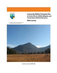
White County
J a n u a r y 2 0 1 8
The following report is a collaborative effort between various entities. The representatives listed below comprise the core decision-making team responsible for this report and mutually agree on the plan's contents.
Community Representative(s): Name Travis Turner Chairman White County Commission
Address 59 South Main St. Cleveland, GA 30528 Phone Number (706) 865-2225
Signature
Name Address Phone Number Signature
Terry Goodger White County Commission District 1 59 South Main St. Cleveland, GA 30528 (706) 865-2225
Name Address Phone Number Signature
Lyn Holcomb White County Commission District 2 ____________________ 59 South Main St. Cleveland, GA 30528_____________________ (706) 865-2225_________________________________________ ________________________________________________________________
Name Address Phone Number Signature
Edwin Nix White County Commission District 3 ____________________ 59 South Main St. Cleveland, GA 30528_____________________ (706) 865-2225_________________________________________ ________________________________________________________________
Name Address Phone Number Signature
Craig Bryant White County Commission District 4 ____________________ 59 South Main St. Cleveland, GA 30528_____________________ (706) 865-2225_________________________________________ ________________________________________________________________
Local Emergency Services Representative(s): Name Norman Alexander Fire Chief
Address 1241 Helen Hwy.,Suite 140 , Cleveland,Ga.30528 Phone Number 706-865-3855
Signature
Name Address Phone Number Signature
David L Murphy Jr. Emergency Management / 911 Director 1241 Helen Hwy. Suite 160 Cleveland, Georgia 30528 (706) 865-4855 Office (706) 219-2079 Fax
Local Georgia Forestry Commission Representative(s): Name Michael Wood, Chief Ranger Habersham Rabun White
Address 3997 Toccoa Hwy. Clarkesville, GA 30523 Phone Number (706) 754- 2354 Office (706) 754-9058 Fax Other Contact Information mwood@gfc.state.ga.us
Signature
Local USDA Forest Service Representative: Name Mike Davis Fire Management Officer
Address Chattahoochee-Oconee NF Gainesville, GA 30501 Phone Number 770-297-3080 Other Contact Information madavis@fs.fed.us
Signature
The following individuals were consulted and involved in the initial preparation of this report.
Name Chris Ernst Cyndy Johannsen Ken Masten Shawn Alexander Dan Yeargin Mark Wiles
Organization White County GIS White County EMA
Georgia Forestry Commission Georgia Forestry Commission GEMA 1-800-879-4362 Georgia Forestry Commission
PLAN CONTENTS
1. Objectives and Goals 2. County Background, Existing Situation, Interface information 3. Risk Summary 4. Prioritized Mitigation Recommendations 5. Action Plan, Timetables, and Assessment Strategy 6. Wildfire Pre-Suppression Plan 7. County Base and Hazards Maps 8. Appendix
1) OBJECTIVES AND GOALS
The mission of the following report is to set clear priorities for the implementation of wildfire mitigation in White County. The plan includes prioritized recommendations for the appropriate types and methods of fuel reduction and structure ignitability reduction that will protect this county and its essential infrastructure. Prioritized activities to educate the public are included. It also includes a plan for wildfire suppression. Specifically, the plan includes community-centered actions that will:
Educate citizens on wildfire, its risks, and ways to protect lives and
properties,
Support fire rescue and suppression entities,
Focus on collaborative decision-making and citizen participation,
Develop and implement effective mitigation strategies, and
Develop and implement effective community ordinances and codes.
This plan should become a working document that is shared by local, state, and federal agencies that will use it to accomplish common goals. An agreed-upon schedule for meeting to review accomplishments, solve problems, and plan for the future should extend beyond the scope of this plan. Without this follow up this plan will have limited value.
2) COUNTY BACKGROUND AND EXISTING SITUATION
White County
White County, covering 242 square miles, is located on the eastern flank of the Appalachian Mountain chain approximately eighty miles northeast of Atlanta. It encompasses most of the headwater streams of the Chattahoochee River and is thus a major source of Atlanta's water supply. Georgia's 123rd county, carved out of Habersham County by an act of the state legislature in 1857, was named for David White, a legislator from Newton County. He helped pass the bill that created White County.
The first white settlers
who came to the area, which once belonged to the Cherokee Indians, emigrated from nearby Georgia counties and from North Carolina, South Carolina, and Tennessee. Most settlers engaged in subsistence farming, as the mountainous terrain made it unsuitable for large-scale agricultural enterprises. In 1828 gold was discovered in the area of Duke's Creek (now the Nacoochee River), launching a gold rush. Nine gold mines operated in the county, and gold mining continued for more than 100 years.
Helen Mine
Cleveland was chosen for the county seat and named in honor of General Benjamin Cleveland, an early
settler and a veteran of the War of 1812. A new courthouse of brick molded on the premises was constructed by slaves in 1859-60. Today the structure houses the White County Historical Society, a small museum, and a gift shop. The current courthouse was constructed in 1964. TruettMcConnell College, a four-year liberal arts institution affiliated with the Georgia Baptist Convention, was established in Cleveland in 1946. Cleveland is also home to Babyland General Hospital, the whimsical birthplace of the dolls known as Cabbage Patch Kids.
White County Courthouse
White County's second town, grew up around a lumber mill established on
the banks of the Chattahoochee River in 1911. The only railroad ever to
serve White County, the Gainesville and Northwestern Railroad, was built
to transport mill products. The railroad went out of business in the early
1930s. Following a long decline, Helen experienced a renewal in 1969
Helen
when a group of local entrepreneurs transformed it into a look-alike Bavarian village. Since that time Helen has become one of the largest
tourist attractions in the state. Helen is also the site of one of the nation's largest Oktoberfest
celebrations.
Other tourist sites in White County include the Chattahoochee National Forest, through which the Appalachian Trail runs; Unicoi State Park; Smithgall Woods Conservation Area, which offers educational
Mount Yonah
programs and which houses the remnants of Georgia's earliest gold mines; and the Sautee Nacoochee Community Association in Nacoochee Valley, which features an art school, an art gallery, a theater program, an environmental concerns group, and a history museum. It also sponsors the annual Echota Performing Arts Festival.
According to the 2000 U.S. census, the population of the county was 19,994 (95.2 percent white, 2.2 percent black, and 1.6 percent Hispanic), an increase of 53 percent since 1990. Retirees make up a large part of the increase
The above material is courtesy of the New Georgia Encyclopedia
Fire History and Existing Situation
Wildland Fire has not been a serious problem in White County when compared to counties in the rest of the state. In 2016 there have were 8 fires that burned 15.79 acres. The average size fire for this period is 1.97 acres. This low number falls in line with typically low numbers statewide during this year of normal to above average rainfall. During this same period the statewide average size was 3.58 acres. The following outlines fire activity in White County for the past five complete fiscal years (July June).
County = White
Cause
Fires
Campfire
Campfire
0
Children
Children
1
Debris: Ag Fields, Pastures, Orchards, Etc
Debris: Ag Fields, Pastures, Orchards, Etc
0
Debris: Construction Land Clearing
Debris: Construction Land Clearing
1
Debris: Household Garbage
Debris: Household Garbage
0
Debris: Other
Debris: Other
0
Debris: Residential, Leafpiles, Yard, Etc
Debris: Residential, Leafpiles, Yard, Etc
4
Incendiary
Incendiary
0
Machine Use
Machine Use
0
Miscellaneous: Power lines/Electric fences
Miscellaneous: Power lines/Electric fences
0
Miscellaneous: Structure/Vehicle Miscellaneous: Structure/Vehicle
Fires
Fires
0
Miscellaneous: Woodstove Ashes Miscellaneous: Woodstove Ashes
0
Undetermined
Undetermined
2
Totals for County: White Year: 2016
8
Acres 0.00 1.09 0.00
Fires 5 Yr Avg
0.20
0.40
Acres 5 Yr Avg
0.27
0.24
0.20 0.12
1.10 0.00 0.00 13.13 0.00 0.00 0.00
0.20 0.22 0.40 0.16 0.20 0.04 3.60 19.15 0.60 0.87 0.60 0.65 0.20 0.07
0.00 0.00 0.47 15.79
0.20 0.80 1.00 2.30 1.60 9.82 9.40 34.71
Fiscal Year
2012 2013 2014 2015 2016
Number of Fires
6 9 8 16 8
Acres
4.63 42.80 77.39 33.76 15.79
Average size
.77 4.75 9.67 2.11 1.97
Statewide average size 4.98 4.75 5.02 4.50 4.13
It should be noted that in 2012 there were two wildfires out of six that burned the bulk of the acreage as a result of incendiary fires. During fiscal 2015 there were 10 debris burning caused fires that burned 25.17 acres, out of a total of 33.76 acres for the year. This was not typical of fire activity in White County. It should be noted that debris burning continues to be the #1 cause of wildfire in the state of Georgia.
The Wildland-Urban Interface
There are many definitions of the Wildland-Urban Interface (WUI), however from a fire management perspective it is commonly defined as an area where structures and other human development meet or intermingles with undeveloped wildland or vegetative fuels. As fire is dependent on a certain set of conditions, the National Wildfire Coordinating Group has defined the wildland-urban interface as a set of conditions that exists in or near areas of wildland fuels, regardless of ownership. This set of conditions includes type of vegetation, building construction, accessibility, lot size, topography and other factors such as weather and humidity. When these conditions are present in certain combinations, they make some communities more vulnerable to wildfire damage than others. This "set of conditions" method is perhaps the best way to define wildland-urban interface areas when planning for wildfire prevention, mitigation, and protection activities.
There are three major categories of wildland-urban interface. Depending on the set of conditions present, any of these areas may be at risk from wildfire. A wildfire risk assessment can determine the level of risk.
1. "Boundary" wildland-urban interface is characterized by areas of development where homes, especially new subdivisions, press against
public and private wildlands, such as private or commercial forest land or public forests or parks. This is the classic type of wildland-urban interface, with a clearly defined boundary between the suburban fringe and the rural countryside.
2. "Intermix" wildland-urban interface areas are places where improved property and/or structures are scattered and interspersed in wildland areas. These may be isolated rural homes or an area that is just beginning to go through the transition from rural to urban land use.
3. "Island" wildland-urban interface, also called occluded interface, are areas of wildland within predominately urban or suburban areas. As cities or subdivisions grow, islands of undeveloped land may remain, creating remnant forests. Sometimes these remnants exist as parks, or as land that cannot be developed due to site limitations, such as wetlands. (courtesy Fire Ecology and Wildfire Mitigation in Florida 2004)
White County is typical of a county that is undergoing a rapid transition from an isolated rural county to a highly desirable recreational and retirement destination. It contains mixtures of both boundary and intermix interface.
Wildland Urban Interface Hazards
Firefighters in the wildland urban interface may encounter hazards other than the fire itself, such as hazardous materials, utility lines and poor access.
Hazardous Materials Common chemicals used around the home may be a direct hazard to firefighters from flammability, explosion potential and/or vapors or off-gassing. Such chemicals include paint, varnish and other flammable liquids; fertilizer; pesticides; cleansers; aerosol cans, fireworks, batteries and ammunition. In addition, some common household products such as plastics may give off very toxic fumes when they burn. Stay OUT of the smoke from burning structures and any unknown sources such as trash piles.
Illicit Activities Marijuana plantations or drug production labs may be found in wildland urban interface areas. Extremely hazardous materials such as propane tanks and flammable/toxic chemicals may be encountered, as well as booby traps.
Propane tanks Both large (household size) and small (gas grill size) liquefied propane gas (LPG) tanks can present hazards to firefighters, including explosion. See the "LPG Tank Hazards" discussion for details.
Utility lines Utility lines may be located above and below ground and may be cut or damaged by tools or equipment. Don't spray water on utility lines or boxes.
Septic tanks and fields Below-ground structures may not be readily apparent and may not support the weight of engines or other apparatus.
New construction materials Many new construction materials have comparatively low melting points and may "off-gas" extremely hazardous vapors. Plastic decking materials that resemble wood are becoming more common and may begin softening and losing structural strength at 180 F, though they normally do not sustain combustion once direct flame is removed. However, if they continue to burn they exhibit the characteristics of flammable liquids.
Pets and livestock Pets and livestock may be left when residents evacuate and will likely be highly stressed, making them more inclined to bite and kick. Firefighters should not put themselves at risk to rescue pets or livestock.
Evacuation occurring Firefighters may be taking structural protection actions while evacuations of residents are occurring. Be very cautious of people driving erratically. Distraught residents may refuse to leave their property, and firefighters may need to disengage from fighting fire to contact law enforcement officers for assistance. In most jurisdictions firefighters do not have the authority to force evacuations. Firefighters should not put themselves at risk trying to protect someone who will not evacuate!
Limited access Narrow one-lane roads with no turn-around room, inadequate or poorly maintained bridges and culverts are frequently found in wildland urban interface areas. Access should be sized-up and an evacuation plan for all emergency personnel should be developed.
3) Risk Summary
The initial assessment of White County took place in 2009, where all communities within White County were assessed and rated according to their "risk" of being impacted by a wildfire. These assessments were conducted by the White County Fire Department, and the Georgia Forestry Commission. Due to the downturn in the economy since that time, there has been very little development within White County and the initial assessment still provides a fairly accurate reflection of the current conditions in the county. This CWPP has been updated in 2017 to expose any changes and provide updated information.
Following the initial meeting of personnel of White County Emergency services and the Georgia Forestry Commission on August 27, 2009, assessments of communities at risk from wildland fire was undertaken by White County Fire department personnel. In all 65 wildland communities were assessed using the Georgia Forestry Commission Form 140 for Woodland Community Wildfire Hazard Assessment. This document determines risk based on four criteria, Subdivision design, Site Hazard, Building Construction, and Additional Factors. From this analysis sites are rated as being in one of four risk categories, extreme, high, moderate, or low. Eight (8) communities were classified as at extreme risk, nine (9) were high, thirty eight (38) were moderate, and ten (10) were low. Information from these assessments is displayed in two spreadsheets which are included in the appendix. Communities at risk were organized by the Fire District or station having jurisdiction. Stations 1 through 4 are on one document and Stations 5 - 8 are included on the other. The communities are also represented on the base maps included in the appendix. Original copies of the assessments are retained by White County Emergency Services and are stored in electronic form on media provided by White County. This disc is stored with hard copies of the plans retained by the Georgia Forestry Commission and White County.
4) Prioritized Mitigation Recommendations
The following recommendations were developed during follow-up meetings with County and State fire response agencies. A priority order was determined based on which mitigation projects would best reduce the hazard of wildland fire to communities and infrastructure. The following priorities were considered. It was acknowledged that in light of incendiary fire being a common cause in the county, protocol for investigation needs to be standard practice. Community Hazard and Structural Ignitability Reduction Wildland Fuel reduction or modification Improvements to capabilities of Wildland response agencies Public Education regarding risk of wildland fire
Proposed Community Hazard and Structural Ignitability Reduction Priorities
Hazard Incendiarism
Mitigation Standardized investigation
Lack of defensible space
Access problems for initial attack
Improve defensible space around structures in communities at risk
Improve access problems
Method Utilizing state and federal fire reports, investigations should be conducted on all fires determined to be caused by incendiarism on each jurisdiction. Coordination across agency and possibly geographic boundaries should be common practice. All departments should examine structures in communities at risk in their response areas. Improvements to defensible space as referenced in Firewise guidelines should be conveyed to residents through media or direct contact. All County response agencies and the Georgia Forestry Commission should closely examine access in all communities identified to be at risk. When problems are identified corrective measures should be made.
Proposed Community Hazard and Structural Ignitability Reduction Priorities
Hazard or Opportunity Structural Ignitability
Mitigation
Reduce structural ignitability
Local Codes and Ordinances
Improve and amend to codes and ordinances pertaining to infrastructure and community protection from wildland fire.
Method
Citizens in communities at risk should be educated regarding methods to reduce structural ignitability as referenced in Firewise guidelines. This can be accomplished through media or direct contact. Examine all existing codes and ordinances for problems regarding direct conflicts to wildland safety or lack of needed codes or enforcement.
Proposed Wildland Fuel Reduction or modification Priorities
Hazard Fuel Hazards near Communities at risk
Fuel Hazard in public or shared spaces
Mitigation Prescribed Burning and presuppression firebreaks
Fuel Modification or reduction
Method Determine Communities at risk where Prescribed burning would be appropriate to use. Seek cooperation from adjacent landowners. Find funding to cover cost of burning. Prioritize burn compartments and execute. Should burning be inappropriate or undesirable install permanent or semi-permanent firebreaks Determine where hazards exist. Determine appropriate method for modification or reduction. Chipping, raking and piling, County pick-up, Organized Community Clean-up days could be beneficial. Organized burning could be conducted on these days supported by local fire department personnel.
Proposed Improvements to capabilities of Wildland Response Agencies Priorities
Problem or need Lack of qualification or training
Improvement or solution Provide training opportunities
Equipment needs
Improve or acquire Wildland fire equipment
Details
Examine training records of all wildland responders to insure training and qualifications match expected duties. Insure that all wildland responders have Basic Wildland Certification. Locate and secure funding for enhanced training from state and federal agencies. Determine specific equipment needs to bring all wildland response equipment to NWCG Standards. Provide appropriate PPE to all County wildland responders. Provide wildland hand tools to County departments. Investigate needs for improvements to all wildland water handing and supply (dry hydrants, brush trucks, hose, etc.)
Proposed Public Education Priorities
Educational Priority Increase public awareness concerning Firewise principles and fire prevention through direct contact
Increase public awareness concerning Firewise principles and fire prevention through use of media
Responsible party Federal, State, County,and municipal governments
County, State, and municipal governments
Method
Conduct Firewise meetings by each fire response jurisdiction assisted by Georgia Forestry Commission (state) and USDA Forest Service (federal). Conduct a door to door campaign in particularly hazardous communities Use PSA's in local newspapers and local radio stations. Utilize Firewise displays in local post offices and banks. Seek use of local EMC newsletter for Firewise message. Create poster sized notices for use in common public places (stores, post offices, etc. adjacent to high hazard areas advising residents about the hazard and how to protect themselves and their property. Distribute public notices concerning Firewise at local sporting events and other public gatherings.
Proposed Public Education Priorities
Educational Priority Increase public awareness concerning Firewise principles and fire prevention through formal certification and recognition
Responsible party Federal, State, County, and municipal governments
Method
Supported by the USFS and the Georgia Forestry Commission each local fire station should set a goal of achieving Firewise status for at least one extreme or high risk category community before the end of calendar year 2017. The goal of adding at least one community annually should extend beyond this initial goal.
5) Action Plan, Timetables, and Assessment Strategy
POTENTIAL FUNDING SOURCES:
As funding is questionable in these times of tight government budgets and economic uncertainty, unconventional means should be identified whereby the need for funding can be reduced or eliminated.
GRANT FUNDING AND MITIGATION ASSISTANCE
Georgia Firewise Community Hazard Mitigation Grant: Georgia Forestry Commission grant designed to assist Firewise communities in the mitigation of fire hazards within their community. The grant is designed to provide financial assistance in helping the community to carry out the recommendations of their Firewise Action Plan.
Community Protection Grant: U.S.F.S. sponsored prescribed fire program. Communities with "at-risk" properties that lie within ten miles of a national forest, National Park Service or Bureau of Land Management tracts may apply with the Georgia Forestry Commission to have their land prescribe burned free-of-charge.
FEMA Mitigation Policy MRR-2-08-01: through GEMA Hazard Mitigation Grant Program (HMGP) and Pre-Disaster Mitigation Program (PDM).
1. To provide technical and financial assistance to local governments to assist in the implementation of long term, cost effective hazard mitigation accomplishments.
2. This policy addresses wildfire mitigation for the purpose of reducing the threat to all-risk structures through creating defensible space, structural protection through the application of ignition resistant construction and limited hazardous fuel reduction to protect life and property.
3. With a complete a registered plan (addendum to the State Plan) counties can apply for pre-mitigation funding. They will also be eligible for HMGP funding if the county is declared under a wildfire disaster.
FEMA Assistance to Firefighters Grant Program
1. Assistance to Firefighters Grants (AFG). The purpose of AFG's is to award one-year grants directly to fire departments and emergency medical services (EMS) organizations of a state to enhance their abilities with respect to fire and related hazards.
2. Fire Prevention and Safety Grants. The purpose of these grants is to assist state, regional, national or local organizations to address fire prevention and safety. Emphasis of the program is on prevention of fire-related injuries to children.
3. Staffing for Adequate Fire and Emergency Response (SAFER). The purpose of SAFER is to award grants directly to volunteer; combination and career fire departments to help the departments increase their cadre of firefighters (enhance their ability for 24-hour response).
Georgia Forestry Commission: Plowing and prescribed burning assistance, as well as forest mastication can be obtained from the GFC as a low-cost option for mitigation efforts.
Individual Homeowners:
1. The elimination of hazardous conditions around a structure must ultimately be the responsibility of the community and the homeowner. They will bear the cost and reap the benefit from properly implemented mitigation efforts.
2. GEMA: Pre-Disaster Mitigation Grant Program
Ultimately it is our goal to help the communities by identifying the communities threatened with a high risk to wildfire and educate those communities on methods to implement on reducing those risks.
5) Action Plan
In addition to the steps listed below each station should utilize individual community assessments for their response area to change individual line items to lessen the score of that line whenever possible. For example, if street signs are missing or marked with less than 4 inch letters or non reflective, the score could be reduced should steps be taken to improve street signage.
Steps to implement Community Hazard and Structural Ignitability Priorities
Hazard Incendiarism
Lack of Defensible Space
Access problems
Structural Ignitability
Codes and Ordinances
Specific Action and Responsible Party The Georgia Forestry Commission and USDA Forest Service should conduct investigations on all fires determined to be caused by incendiarism on their jurisdictions. Cooperation and resource sharing (investigators) should be made standard practice. The use of local law enforcement should be standard practice especially when arson is identified as a problem in a specific area. The use of reward based incentives to locate arsonists should be considered. Using the risk summaries referenced in section 3, each department should conduct inspections of communities at risk in their jurisdiction or area of response for lack of defensible space. Findings will be conveyed to residents and treatment methods will be recommended in accordance with Firewise principles. This would probably be best accomplished by approaching homeowners associations or organizations. Ultimately, the message should reach individual homeowners in each community. Should local organizations not exist, the builder or developer could be contacted. Such contacts would also influence future projects or developments Using individual Communities at Risk maps for each station, the Georgia Forestry Commission and White County Fire officials should visit all identified communities at risk for the purpose of locating and resolving access difficulties. This inspection should extend into the wildland adjacent to the communities at risk looking for hindrances and most effective approaches to suppression tactics White County Fire officials should examine structures for structural ignitability concerns at the time when the communities at risk are inspected for lack of defensible space. Using firewise guidelines for reducing structural ignitability, (a checklist could be formulated and used), structures should be assessed and findings conveyed to residents. This could be through use of media or by direct contact with residents or homeowners associations. White County and municipal Fire Marshalls should closely examine all codes and ordinances for gaps and oversights which could cause problems in the wildland fire arena. Examples include proximity of propane tanks to structures, accumulations of debris, lack of proper identification pertaining address or street names, set back distances from wildland fuels, road widths in new developments.
In regard to priority, the above steps should first extend to the higher numbers in the extreme category from the risk summary as these communities are at a higher degree of risk.
5) Action Plan
Steps to implement Fuel Reduction or Modification Priorities
Hazard Hazardous Wildland Fuel Accumulations
Fuel Continuity between Federal Wildland and Woodland Communities
Hazardous Fuel Accumulations in communities and hindrances to suppression
Specific Action and Responsible Party The Georgia Forestry Commission will prioritize prescribed burning projects adjacent to Communities at risk where burning is determined to be appropriate. Prescribed burn goals set by the U S Forest Service should also take fuel reduction near communities at risk into consideration as part of the prescription. Both agencies should work toward planning to see any proposed burn projects could be done concurrently. This will require changes in how these burns are carried out as regards logistics and technique. In areas where the need exists and fuel reduction by burning is determined to be inappropriate, permanent or semi-permanent fuel breaks could be established. These breaks should be maintained annually prior to the arrival of prime burning times. Their locations should be mapped and made known to local, state, and federal response personnel. Residents of the Communities adjacent to these breaks should be advised of their purpose and their cooperation in protecting them should be gained. These breaks could be installed by the USDA Forest Service in cooperation with and assisted by the Georgia Forestry Commission. Using the risk summary in section 3, Fire departments could conduct community clean up days in communities at risk in their respective jurisdictions aimed at reducing hazardous fuels and hindrances to suppression in shared community space. Residents would be provided with guidance and access to disposal alternatives for materials removed.
Steps to implement improvements to wildland response capability
Improvement needed Improve training and qualification of White County Wildland firefighters
Improve or acquire wildland fire fighting equipment
Responsible Party and specific action The White County Chief Ranger, Gainesville Assistant District Manager of the Georgia Forestry Commission and White County Fire Chief should examine all training records for personnel under their supervision. All current or potential wildland personnel should be certified Georgia Basic Wildland Firefighters or higher in qualification. Additional training and qualification should be sought for personnel identified in the White County Fire plan who are assigned specific Incident Command System (ICS) functions. Sources for available funds for training should be sought at State and Federal levels. All stations for White County Fire Departments should inventory their present equipment relating to their wildland capability. Funding sources should be investigated from available grants or other sources. Needs for job specific wildland responsibilities should be examined by the GFC Chief Ranger and the White County Fire Chief. Specific needs are listed in the appendix.
5) Action Plan Steps to educate or inform the Public regarding wildland fire prevention and responsibilities
Opportunity Improve Public Education through direct contact
Improve Public Education through use of media
Improve Public Education through formal certification
Responsible Party and Specific Action Prior to the onset of fire season(s) rangers of the Georgia Forestry Commission and White County Fire personnel should conduct Firewise meetings in conjunction with normally scheduled fire department meetings. People living in or near extreme and high risk communities should be invited to these meetings by use of door to door campaigns or by mailbox flyers. Notices regarding these meetings could be placed in local post offices or stores near communities at risk. A Firewise display should be acquired and utilized at this meeting. This display would be retained by the Habersham County unit of the Georgia Forestry Commission and used for all Firewise meetings in White County. Local news media should be invited to these meetings. Goals for potential Firewise certified communities in White County could be considered after these meetings are completed. Prior to the onset of fire season(s) or during periods of particularly high fire danger use of the media should be stepped up by personnel of the Georgia Forestry Commission. This should include use of all available media in the County. PSA's should be run weekly during periods of high to extreme fire danger. Signs or poster boards could be developed for display in pubic spaces near communities at risk advising residents that they live in areas that are susceptible to wildland fire and directing them to sources of information regarding wildland fire and their role in improving their own personal safety. Before the end of each calendar year White County should seek and acquire Firewise certification for at least one community in the extreme to high risk category. Should lack of interest or other problems prevent certification of any community an effort should be made with similar communities.
5) Action Plan
Timetables for Actions
Steps to implement Community Hazard and Structural Ignitability Priorities
Steps to standardize and coordinate investigation practices should begin as soon as possible between agencies involved.
Steps to examine communities at risk for defensible space and structural ignitability should take place as manpower and scheduling permits.
Pre-planning to examine access and suppression problems should take place at any time during the current burning season.
Codes and Ordinances should be examined as soon as possible in order for the legal workings of changes to take place.
Steps to implement Fuel Reduction or Modification Priorities
Any identified prescribed burn projects should take place in late winter to early spring. Any other priority burn projects or installation of pre suppression fuel breaks should take place during this same window.
Steps to reduce fuels in communities at risk should coincide with steps to improve defensible space and reduce structural ignitability. Timing of these actions would be dependent upon Fire station availability during the late winter to early spring.
Steps to implement improvements to wildland response capability
Cooperation between state and local wildland suppression forces regarding improvements to training and equipment should begin immediately.
Steps to educate or inform the Public regarding wildland fire prevention and responsibilities
Direct contact with residents in Communities at risk should take place as soon as possible during early calendar year 2017
The use of media should coincide with the above action. Certification of Firewise communities should follow the timetable associated with the
action plan
5) Action Plan
Assessment of Actions
Reduction of Community hazard and structural ignitability
. Direct measurement of the number of communities assessed would be the appropriate
measure of success Any meetings that result in cooperation between wildland departments should be logged
along with minutes of those meetings. Goals should be set and reviewed after each meeting. Any changes to or additions to codes and ordinances would be an obvious measure of success. Steps to achieve cooperation across law enforcement agencies would be the most obvious measure of success as regards incendiarism reduction. .
Steps to implement Fuel Reduction or Modification Priorities
Acres burned would be the appropriate measure for fuel reduction. A direct measure of linear feet of firebreaks would be an appropriate measure for pre suppression breaks.
Fuel reduction in communities at risk would be measured by the number of communities affected and number of projects completed.
Steps to implement improvements to wildland response capability
A direct measure of the number of capabilities or qualifications gained would be the appropriate measure of success.
Any equipment acquired or any equipment brought up to national standards would be the appropriate measure of success.
Steps to educate or inform the Public regarding wildland fire prevention and responsibilities
Direct measurement of the number of persons contacted, literature distributed, public notices posted, news articles published, radio programs aired, etc. would be the best measure of success. The number of communities that achieve Firewise status would be an obvious measure of success.
6) Wildfire Pre-Suppression Plan
This document is located in the appendix of this plan
7) County Base and Hazards Maps
8) Appendix
Risk Summary tables organized by station County maps of surface fuels, level of concern, historical fire occurrence, and
communities at risk (overview map and maps by station jurisdiction) White County Pre-Suppression plan. Equipment needs identified
5645 Riggins Mill Road Dry Branch, Georgia 31020 1-800-GA-TREES GaTrees.org
The Georgia Forestry Commission provides leadership, service, and education in the protection and conservation of Georgia's forest resources.
An Equal Opportunity Employer and Service Provider