- Collection:
- Georgia Government Publications
- Title:
- Community wildfire protection plan, Ware County, Georgia: an action plan for wildfire mitigation and conservation of natural resources
- Creator:
- Banks, Tommy
Budd, Beryl
Fell, Will
Chesser, Bo - Contributor to Resource:
- Georgia. Forestry Commission
- Publisher:
- Dry Branch, Ga. : Georgia. Forestry Commission
- Date of Original:
- 2018-09
- Subject:
- Wildfires--Georgia--Ware County--Prevention and control
Fire management--Georgia--Ware County
Chorochromatic maps
Bar graphs
Transportation maps
Circular graphs - Location:
- United States, Georgia, 32.75042, -83.50018
United States, Georgia, Ware County, 31.05363, -82.42368 - Medium:
- plans (reports)
- Type:
- Text
- Format:
- application/pdf
- External Identifiers:
- OCLC 1157316980
NZ MMS ID 9921978851702931
Call Number F600 .M1 2018 W5 W37 - Metadata URL:
- https://dlg.galileo.usg.edu/id:dlg_ggpd_s-ga-bf600-b-pm1-b2018-bw5-bw37-belec-p-btext
- Digital Object URL:
- https://dlg.galileo.usg.edu/do:dlg_ggpd_s-ga-bf600-b-pm1-b2018-bw5-bw37-belec-p-btext
- Language:
- eng
- Holding Institution:
- University of Georgia. Map and Government Information Library
- Rights:
-

A Program of the Georgia Forestry Commission with support from the U.S. Forest Service
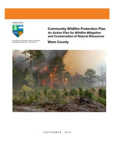
Community Wildfire Protection Plan
An Action Plan for Wildfire Mitigation and Conservation of Natural Resources
Ware County
SEPTEMBER 2018
Prepared by; Tommy Banks, Chief Ranger, Ware County Bo Chesser, FMO, Southern Zone Will Fell, CWPP Specialist (Initial Plan 2010) Beryl Budd, Wildfire Prevention Specialist (Revised plan 2018) Georgia Forestry Commission 2999 Forest Rd Waycross GA 31503
The following report is a collaborative effort among various entities; the representatives listed
below comprise the core decision-making team responsible for this report and mutually agree on
the plan's contents:
Scott Moye
Terri Jenkins
County Manager, Ware County
Fire Management Specialist
(912) 287-4300
Okefenokee NWR
smoye@warecounty.com
Office: (912) 496-1134
terri_jenkins@fws.gov
Dee Meadows
Chief, Ware County Fire & Rescue
(912) 287-4460
dmeadows@warecounty.com
Jonathan Daniell Director, Ware County EMA (912) 287-4394 jdaniell@warecounty.com
Bill Parham Director, Ware County EMS (912) 287-4454 bparham@warecounty.com
Diane May GA Emergency Management (912) 266-5421 diane.may@gema.ga.gov
Tommy Banks Chief Ranger, Ware County Forestry Unit (912) 338-5967 tbanks@gfc.state.ga.us
Bo Chesser FMO, Southern Zone, Georgia Forestry Commission (912) 287-4915 bchesser@gfc.state.ga.us
PLAN CONTENTS
I. Objectives ............................................................................................................................. 1 II. Community Collaboration .................................................................................................... 1 III. Community & Wildfire History............................................................................................. 2 IV. Community Base Maps ......................................................................................................... 9 V. Community Wildfire Risk Assessment ............................................................................... 12 VI. Southern Wildfire Risk Assessment & Risk Hazard Maps ................................................ 15 VII. Prioritized Mitigation Recommendations ........................................................................... 22 VIII. Action Plan .......................................................................................................................... 27 IX. Mitigation Assistance & Grant Information.......................................................31 X. Glossary................................................................................................32 XI. Sources of Information...............................................................................34 Appended Documents: Ware County Southern Wildfire Risk Assessment Summary Report (SWRA) Ware County Wildfire Pre-suppression Plan NFPA 1141 Standard for Fire Protection Infrastructure for Land Development in Suburban and Rural Areas.
WILDFIRE PROTECTION PLAN: AN ACTION PLAN FOR WILDFIRE MITIGATION
I. OBJECTIVES
The mission of the following report is to set clear priorities for the implementation of wildfire mitigation in Ware County. The plan includes prioritized recommendations for the appropriate types and methods of fuel reduction and structure ignitability reduction that will protect this community and its essential infrastructure. It also includes a plan for wildfire suppression. Specifically, the plan includes community-centered actions that will:
Educate citizens on wildfire, its risks, and ways to protect lives and properties, Support fire rescue and suppression entities, Focus on collaborative decision-making and citizen participation, Develop and implement effective mitigation strategies, and Develop and implement effective community ordinances and codes.
II. COMMUNITY COLLABORATION
The core team convened in November of 2008 to assess risks and develop the Community Wildfire Protection Plan. The group is comprised of representatives from local government, local fire authorities, and the state agency responsible for forest management. Below are the groups included in the task force:
Ware County Government Fire Rescue Emergency Management Board of County Commissioners
City Of Waycross Public Safety Department
Georgia Forestry Commission US Fish & Wildlife Service
It was decided to conduct community assessments on the basis of selected communities within the county. The chiefs and captains of Ware County Fire And Rescue assessed their districts and reconvened in April of 2009 for the purpose of completing the following:
Risk Assessment
Assessed wildfire hazard risks and prioritized mitigation actions.
Fuels Reduction
Identified strategies for coordinating fuels treatment projects.
Structure Ignitability
Identified strategies for reducing the ignitability of structures within the Wildland interface.
Emergency Management Forged relationships among local government and fire districts and developed/refined a pre-suppression plan.
Education and Outreach Developed strategies for increasing citizen awareness and action and to conduct homeowner and community leader workshops.
Page 1
WILDFIRE PROTECTION PLAN: AN ACTION PLAN FOR WILDFIRE MITIGATION
III. COMMUNITY & WILDFIRE HISTORY
Ware County, in extreme southeast Georgia, was formed when Appling County was divided by the state legislature on December 15, 1824. It was named for a man who never visited the area, Nicholas Ware, an active politician known for his flamboyant lifestyle. The lower portion of the county forms a major part of the Okefenokee Swamp. Waycross, the county seat, is about 100 miles northwest of Jacksonville, Florida.
The defining of county lines did not stop conflict with the Native Americans, who resented the crossing of old borders, regardless of any treaties. The Wildes Massacre, the last slaughter by the Indians in Georgia, occurred in Ware County in 1838, during the Second Seminole War. Nine people were killed by a group of Creek warriors, who escaped into the vast Okefenokee Swamp.
One of Ware County's borders is the Satilla River, which in the mid- to late 1800s became a busy locale for rafting yellow longleaf pine to sawmills on the coast. The Okefenokee Swamp offered cypress trees, and the famed Hebardville Cypress Mill, considered the largest such operation in the world at its peak period, also underscored this area as a timber cutter's paradise. Unique here at the turn of the century was the narrow-gauge railroad that snaked its way from Ware County's Hebardville to Billys Island in the Okefenokee, transporting cut cypress to the mill.
Ware County was known as a place where trails and roads met, the reason for Waycross's name.
The Indian paths along which many early roads were cut headed toward Trader's Hill, Coleraine, and Camp Pinckney on the St. Marys River, or to Burnt Fort on the Satilla. Later, the stagecoach would find one of its major relay stations at Peter Bedford's Tavern in the county seat of Waresboro. The county's position as a transportation hub continued to strengthen with the coming of the railroad and the 1874 formation of Waycross, which became the new county seat.
Contributing to the county's educational growth are Waycross College and Okefenokee Technical College, which offer, besides their regular curricula, various programs beneficial to everyone in the community. Southern Forest World, the Okefenokee Heritage Center, the Okefenokee Swamp Park, and Obediah's Okefenok also offer both educational programs and entertainment for the public and tourists.
The Downtown Waycross Development Authority has successfully encouraged new businesses to come into the once flourishing downtown.
Phase I of the new Trembling Earth Recreation Complex has turned into Phase II, with Phase III of the Ware County plan waiting in the wings. Ware County is known as southeast Georgia's regional retail center, and many buyers come daily from the surrounding counties to make purchases. With this growth in both the city and county, new buildings and plants are on the drawing boards for expansion in what is still called "This Magic Wilderness."
According to the U.S. census the county population in 2000 was 35,483, with 69.7 percent of its residents white, 28 percent black, and 1.9 percent Hispanic. The county encompasses 903 square miles.
(Courtesy New Georgia Encyclopedia)
Page 2
WILDFIRE PROTECTION PLAN: AN ACTION PLAN FOR WILDFIRE MITIGATION
Wildfire History Ware County is the largest county in land area in Georgia. Forestland covers approximately 89% of the county's land area. While about one third of the county, mostly south of the city of Waycross, is located within the confines of the Okefenokee National Wildlife Refuge and the Dixon State Forest, there are still significant large expanses of timber and wildlands to the immediate southwest and southeast of town along with major stretches of pine flatwoods with high fuel loadings to the west and northwest of Waycross including many smaller communities such as Manor, Dixie Union, Millwood, Waresboro, Pebble Hill, Bickley and Jamestown.
Ware County outside of Waycross is protected by the Ware County Fire and Rescue. The Main Station located in the Industrial Park northwest of Waycross is staffed full time with paid firefighters while the nine outlying stations, well distributed around the county are staffed with volunteer responders. The City of Waycross is covered by three stations staffed with full time firefighters. The Georgia Forestry Commission maintains and staffs a county protection unit located in the Industrial Park just northwest of the city to respond to wildland fires. This station is centrally located to cover the private timberlands and wildlands within Ware County.
The City of Waycross is serviced with a modern pressurized water system with hydrants along with adjacent areas of the county around the Industrial Park, Emerson Park area and the area off US 1 southeast of the city.
Over the past fifty years, Ware County has averaged around 127 reported wildfires a year with almost 50% of these occurring during February, March April and May. These fires have burned an average of 746 acres a year over the same period (excluding the large fire of 2007), though generally there has been some slight decrease since the advent of burning permits the past 20 years. However the seasonality of both the numbers of fires and acres burned has evened out somewhat over this period. The leading cause of fires in Ware County has been debris burning accounting for about 35% of the fires and about 25% of the acres lost. The second and third leading causes of fires were incendiary or arson and railroads accounting for 16% and 15% respectively of the fires reported and 19% and 20% of the acres lost.
More recently over the last 10 years, fiscal years 2008-2017, Ware County has averaged 54 wildfires and 4234 acres burned annually. During this the time the leading cause was debris burning causing 43% of the fires and burning 2% of the acres. Lightning was the 2nd leading cause accounting for 15% of the fires and 1% of the acreage burned. Machine use was the 3rd major cause with 10% of the fires and 46% of the acreage burned. Miscellanous causes such as powerlines, fireworks, etc. accounted for 11% of the fires and 50% (21,047 acres) of the acreage burned. Incendiary (arson) caused fires, while lower in the most recent years, is still of concern causing 7% of the fires during these years and about 1% of the acreage burned.
Page 3
WILDFIRE PROTECTION PLAN: AN ACTION PLAN FOR WILDFIRE MITIGATION
Ware County fire information for the most recent 2018 fiscal year, July 1, 1017 June 30, 2018.
County = Ware
Cause
Fires
Campfire
Campfire
4
Children
Children
1
Debris: Ag Fields, Pastures, Orchards, Etc
Debris: Ag Fields, Pastures, Orchards, Etc
1
Debris: Construction Land Clearing
Debris: Construction Land Clearing
1
Debris: Escaped Prescribed Burn Debris: Escaped Prescribed Burn
2
Debris: Household Garbage
Debris: Household Garbage
0
Debris: Other
Debris: Other
2
Debris: Residential, Leafpiles, Yard, Etc
Debris: Residential, Leafpiles, Yard, Etc
7
Debris: Site Prep - Forestry Related
Debris: Site Prep - Forestry Related
1
Incendiary
Incendiary
0
Lightning
Lightning
5
Machine Use
Machine Use
1
Miscellaneous: Firearms/Ammunition
Miscellaneous: Firearms/Ammunition
0
Miscellaneous: Other
Miscellaneous: Other
1
Miscellaneous: Power lines/Electric fences
Miscellaneous: Power lines/Electric fences
1
Miscellaneous: Structure/Vehicle Miscellaneous: Structure/Vehicle
Fires
Fires
0
Miscellaneous: Woodstove Ashes Miscellaneous: Woodstove Ashes
0
Railroad
Railroad
6
Smoking
Smoking
0
Undetermined
Undetermined
12
Totals for County: Ware Year: 2018
45
Acres
19.80 0.26 6.30
Fires 5 Yr Avg
1.40
1.00
0.20
Acres 5 Yr Avg
5.32
0.35
1.26
4.60 17.20 0.00 1.05 8.00
0.60 0.98 3.00 15.88 1.00 2.46 0.80 0.24 6.80 12.43
0.25 0.00 31.44 20.00 0.00 2.00 1.00
2.20 10.63
4.00 41.36 5.80 36.88 2.60 14.48
0.20 2.00
0.40 0.57
1.20
1.02
0.00
1.20
0.91
0.00 41.10 0.00 60.24
0.20
0.60
3.80 16.52
0.20
0.06
7.00 26.18
213.24 43.60 190.13
Page 4
WILDFIRE PROTECTION PLAN: AN ACTION PLAN FOR WILDFIRE MITIGATION
Year
2008 2009 2010 2011 2012 2013 2014 2015 2016 2017
Acreage Burned /Number of Fires For Ware County For FY 2008-2017
Acreage Burned Number of Fires
Average Size
Statewide Average Size
163.97
48
3.42
4.56
201.85
59
3.42
3.90
78.84
64
1.23
3.93
40,679.32
99
410.90
17.56
238.74
51
4.68
5.08
237.17
49
4.84
4.53
101.45
30
3.38
5.02
177.43
46
3.86
4.42
238.20
40
5.96
6.29
220.33
57
3.87
11.60
Acreage Burned /Number of Fires by Fire Cause For Ware County For FY 2008-2017
Fire Cause
Acreage Burned Number of Fires
Campfire
29.56
19
Children
3.55
11
Debris Burning
806.19
204
Incendiary
370.19
34
Lightning
580.89
73
MachineUse
19,294.97
49
Miscellaneous
21,046.68
52
Railroad
0.00
0
Smoking
26.02
7
Undetermined
93.25
26
Total
42,251.30
475
Page 5
WILDFIRE PROTECTION PLAN: AN ACTION PLAN FOR WILDFIRE MITIGATION Page 6
WILDFIRE PROTECTION PLAN: AN ACTION PLAN FOR WILDFIRE MITIGATION Page 7
WILDFIRE PROTECTION PLAN: AN ACTION PLAN FOR WILDFIRE MITIGATION Page 8
WILDFIRE PROTECTION PLAN: AN ACTION PLAN FOR WILDFIRE MITIGATION
IV. COMMUNITY BASE MAPS
Page 9
WILDFIRE PROTECTION PLAN: AN ACTION PLAN FOR WILDFIRE MITIGATION Page 10
WILDFIRE PROTECTION PLAN: AN ACTION PLAN FOR WILDFIRE MITIGATION Page 11
WILDFIRE PROTECTION PLAN: AN ACTION PLAN FOR WILDFIRE MITIGATION
V. COMMUNITY WILDFIRE RISK ASSESSMENT
The Wildland-Urban Interface
There are many definitions of the Wildland-Urban Interface (WUI), however from a fire management perspective it is commonly defined as an area where structures and other human development meet or intermingles with undeveloped wildland or vegetative fuels. As fire is dependent on a certain set of conditions, the National Wildfire Coordinating Group has defined the wildland-urban interface as a set of conditions that exists in or near areas of wildland fuels, regardless of ownership. This set of conditions includes type of vegetation, building construction, accessibility, lot size, topography and other factors such as weather and humidity. When these conditions are present in certain combinations, they make some communities more vulnerable to wildfire damage than others. This "set of conditions" method is perhaps the best way to define wildland-urban interface areas when planning for wildfire prevention, mitigation, and protection activities.
There are three major categories of wildland-urban interface. Depending on the set of conditions present, any of these areas may be at risk from wildfire. A wildfire risk assessment can determine the level of risk.
1. "Boundary" wildland-urban interface is characterized by areas of development where homes, especially new subdivisions, press against public and private wildlands, such as private or commercial forest land or public forests or parks. This is the classic type of wildland-urban interface, with a clearly defined boundary between the suburban fringe and the rural countryside.
2. "Intermix" wildland-urban interface areas are places where improved property and/or structures are scattered and interspersed in wildland areas. These may be isolated rural homes or an area that is just beginning to go through the transition from rural to urban land use.
3. "Island" wildland-urban interface, also called occluded interface, are areas of wildland within predominately urban or suburban areas. As cities or subdivisions grow, islands of undeveloped land may remain, creating remnant forests. Sometimes these remnants exist as parks, or as land that cannot be developed due to site limitations, such as wetlands.
Page 12
WILDFIRE PROTECTION PLAN: AN ACTION PLAN FOR WILDFIRE MITIGATION
Wildland Urban Interface Hazards
Firefighters in the wildland urban interface may encounter hazards other than the fire itself, such as hazardous materials, utility lines and poor access.
Hazardous Materials
Common chemicals used around the home may be a direct hazard to firefighters from a flammability, explosion potential and/or vapors or off gassing. Such chemicals include paint, varnish and other flammable liquids, fertilizer, pesticides, cleansers, aerosol cans, fireworks, batteries and ammunition. In addition, some common household products such as plastics may give off very toxic fumes when they burn. Stay out of smoke from burning structures and any unknown sources such as trash piles.
Illicit Activities
Marijuana plantations or drug production labs may be found in the wildland urban interface areas. Extremely hazardous materials such as propane tanks and flammable/toxic chemicals may be encountered.
Propane Tanks
Both large (household size) and small (gas grill size) liquefied propane gas (LPG) tanks can present hazards to firefighters, including explosion. See the "LPG Tank Hazards" discussion for details
Utility Lines
Utility Lines may be located above and below ground and may be cut or damaged by tools or equipment. Don't spray water on utility lines or boxes. Underground Natural Gas lines are extremely hazardous.
Septic Tanks and Fields
Below ground structures may not be readily apparent and may not support the weight of engines or other equipment.
New Construction Materials
Many new construction materials have comparatively low melting points and may "off- gas" extremely hazardous vapors. Plastic decking materials that resemble wood are becoming more common and may begin softening and losing structural strength at 180 degrees F, though they normally do not sustain combustion once direct flame is removed. However if they continue to burn they exhibit the characteristics of flammable liquid.
Page 13
WILDFIRE PROTECTION PLAN: AN ACTION PLAN FOR WILDFIRE MITIGATION
Pets and Livestock
Pets and livestock may be left when residents evacuate and will likely be highly stressed making them more inclined to bite and kick. Firefighters should not put themselves at risk to rescue pets or livestock.
Evacuation Occurring
Firefighters may be taking structural protect actions while evacuations of residents are occurring. Be very cautious of people driving erratically. Distraught residents may refuse to leave their property and firefighters may need to disengage from fighting fire to contact law enforcement officers for assistance. In most jurisdictions firefighters do not have the authority to force evacuations. Firefighters should not put themselves at risk trying to protect someone who will not evacuate!
Limited Access
Narrow one-lane roads with no turn around room, inadequate or poorly maintained bridges and culverts are frequently found in wildland urban interface areas. Access should be sized up and an evacuation plan for all emergency personnel should be developed.
Wildland Urban Interface (WUI) is described as the area where structures and other human improvements meet and intermingle with undeveloped wildland or vegetative fuels.
Page 14
WILDFIRE PROTECTION PLAN: AN ACTION PLAN FOR WILDFIRE MITIGATION
VI. SOUTHERN WILDFIRE RISK ASSESSMENT & RISK HAZARD MAPS
The Southern Wildfire Risk Assessment tool, developed by the Southern Group of State Foresters, was released to the public in July 2014. This tool allows users of the Professional Viewer application of the Southern Wildfire Risk Assessment (SWRA) web Portal (SouthWRAP) to define a specific project area and summarize wildfire related information for this area. A detailed risk summary report is generated using a set of predefined map products developed by the Southern Wildfire Risk Assessment project which have been summarized explicitly for the user defined project area. A risk assessment summary was generated for Ware County. The SouthWRAP (SWRA) products included in this report are designed to provide the information needed to support the following key priorities:
Identify areas that are most prone to wildfire.
Identify areas that may require additional tactical planning, specifically related to mitigation projects and Community Wildfire Protection Planning.
Provide the information necessary to justify resource, budget and funding requests.
Allow agencies to work together to better define priorities and improve emergency response, particularly across jurisdictional boundaries.
Define wildland communities and identify the risk to those communities.
Increase communication and outreach with local residents and the public to create awareness and address community priorities and needs.
Plan for response and suppression resource needs.
Plan and prioritize hazardous fuel treatment.
Community Protection Zones map from the Ware County SWRA
Page 15
WILDFIRE PROTECTION PLAN: AN ACTION PLAN FOR WILDFIRE MITIGATION
Above: Wildland Urban Interface (WUI) map Below: WUI Population (left) WUI Acres (right)
Page 16
WILDFIRE PROTECTION PLAN: AN ACTION PLAN FOR WILDFIRE MITIGATION
Above: Wildland Urban Interface (WUI) Risk map Below: WUI Risk Acres
Page 17
WILDFIRE PROTECTION PLAN: AN ACTION PLAN FOR WILDFIRE MITIGATION
Above: Burn Probability map Below: Flame Length map
Page 18
WILDFIRE PROTECTION PLAN: AN ACTION PLAN FOR WILDFIRE MITIGATION
Above: Rate of Spread map Below: Rate of Spread Acres
Page 19
WILDFIRE PROTECTION PLAN: AN ACTION PLAN FOR WILDFIRE MITIGATION
Above: Rate of Spread map Below: Rate of Spread Acres
Page 20
WILDFIRE PROTECTION PLAN: AN ACTION PLAN FOR WILDFIRE MITIGATION
Above: Fire Type map Below: Fire Type Acres
Page 21
WILDFIRE PROTECTION PLAN: AN ACTION PLAN FOR WILDFIRE MITIGATION
VII. PRIORITIZED MITIGATION RECOMMENDATIONS
Executive Summary As Southeast Georgia continues to see increased growth from other areas seeking less crowded and warmer climes, new development will occur more frequently on forest and wildland areas. The County will have an opportunity to significantly influence the wildland fire safety of new developments. It is important that new development be planned and constructed to provide for public safety in the event of a wildland fire emergency.
Over the past 20 years, much has been learned about how and why homes burn during wildland fire emergencies. Perhaps most importantly, case histories and research have shown that even in the most severe circumstances, wildland fire disasters can be avoided. Homes can be designed, built and maintained to withstand a wildfire even in the absence of fire services on the scene. The national Firewise Communities program is a national awareness initiative to help people understand that they don't have to be victims in a wildfire emergency. The National Fire Protection Association has produced two standards for reference: NFPA 1144 Standard for Reducing Structure Ignition Hazards from Wildland Fire. 2008 Edition and NFPA 1141 Standard for Fire Protection Infrastructure for Land Development in Suburban and Rural Areas.
When new developments are built in the Wildland/Urban Interface, a number of public safety challenges may be created for the local fire services: (1) the water supply in the immediate areas may be inadequate for fire suppression; (2) if the Development is in an outlying area, there may be a longer response time for emergency services; (3) in a wildfire emergency, the access road(s) may need to simultaneously support evacuation of residents and the arrival of emergency vehicles; and (4) when wildland fire disasters strike, many structures may be involved simultaneously, quickly exceeding the capability of even the best equipped fire departments.
In 2012 the International Code Council developed the International Wildland Urban Interface Code (IWUIC). This code was adopted by the Georgia Legislature in 2014 for Georgia counties to use with establishing building codes and zoning policies to help reduce structural loss in the wildland urban interface.
The following recommendations were developed by the Ware County CWPP Core team as a result of surveying and assessing fuels and structures and by conducting meetings and interviews with county and city officials. A priority order was determined based on which mitigation projects would best reduce the hazard of wildfire in the assessment area.
Page 22
WILDFIRE PROTECTION PLAN: AN ACTION PLAN FOR WILDFIRE MITIGATION
Proposed Community Hazard and Structural Ignitability Reduction Priorities
Primary Protection for Community and Its Essential Infrastructure
Treatment Area
Treatment Types
Treatment Method(s)
1. All Structures
2. Applicable Structures
3. Community Clean-up Day National Wildfire Preparedness Day (1st Saturday in May)
4. Road Signage
5. Road Access 6. Subdivision Access
Create minimum of 30feet of defensible space**
Reduce structural ignitability**
Cutting, mowing, pruning**
At replacement
Identify needed road improvements Alternate exits
Trim shrubs and vines to 30 feet from structures, trim overhanging limbs, replace flammable plants near homes with less flammable varieties, remove vegetation around chimneys.
Clean flammable vegetative material from roofs and gutters, store firewood appropriately, install skirting around raised structures, store water hoses for ready access, replace pine straw and mulch around plantings with less flammable landscaping materials.
Cut, prune, and mow vegetation in shared community spaces.
New road signage with minimum 4 inch reflective lettering on non flammable poles. Dead end (no outlet or turnaround) should be prominently tagged.
As roads are upgraded, widen to minimum standards with a minimum of 50 foot diameter cul-de- sacs.
Work with developers to identify and create alternate access and exits routes to subdivisions and communities with only one way in and out.
7. Codes and Ordinances
Examine existing codes and ordinances.
Utilize the International Wildland Urban Interface Code (IWUIC)
Amend and enforce existing building codes as they relate to skirting, propane tank locations, public nuisances (trash/debris on property), Property address marking standards and other relevant concerns.
At such time as the development of zoning, planning and subdivision ordinances become practical include fire department and emergency services input in the design of these.
Page 23
WILDFIRE PROTECTION PLAN: AN ACTION PLAN FOR WILDFIRE MITIGATION
8. Site Plan Review
Evaluate (assess) the WUI hazard of proposed new developments.
IWUIC
Consider the "adoption by reference" of NFPA 1144 Standard for Reducing Structural Ignition Hazards from Wildland Fire and NFPA 1141 Standard for Fire Protection Infrastructure for Land Development in Suburban and Rural Areas.
Proposed Community Wildland Fuel Reduction Priorities
Treatment Area
Treatment Types
Treatment Method(s)
1. Adjacent WUI Lands
Reduce hazardous fuels
Encourage prescribed burning for private landowners and industrial timberlands particularly adjacent to residential areas
2. Adjacent USF&W Lands
Reduce hazardous fuels
Work with USF&W land management to undertake fuel reduction strategies on Okefenokee NWR lands adjacent to WUI areas.
3. Adjacent GFC &WMA Lands
Reduce hazardous fuels
Work with GFC & DNR land management to incorporate regular prescribed burning on State managed lands adjacent to identified WUI areas.
4. Railroad Corridors 5. Existing Fire Lines
Reduce hazardous fuels
Encourage railroads to better maintain their ROW eliminating brush and grass through herbicide and mowing. Maintain firebreaks along ROW adjacent to residential areas.
Reduce hazardous fuels Encourage private landowners to clean and re-harrow existing fire lines.
Page 24
WILDFIRE PROTECTION PLAN: AN ACTION PLAN FOR WILDFIRE MITIGATION
Proposed Improved Community Wildland Fire Response Priorities
1. Water Sources
Dry Hydrants
Inspect, maintain and improve access to existing dry hydrants. Add signage along road to mark the hydrants
2. Fire Stations
Brush Trucks
Investigate need for Brush Trucks at selected stations
3. Fire Stations
Equipment
Wildland hand tools. Lightweight Wildland PPE Gear.
4. Emergency infrastructure Equipment
Obtain mobile generator to provide backup power where needed.
5. Personnel
Training
Obtain Wildland Fire Suppression training for Fire Personnel.
Ready Set Go Training.
**Actions to be taken by homeowners and community stakeholders
Proposed Education and Outreach Priorities
1. Conduct "How to Have a Firewise Home" Workshop for Ware County Residents
Set up and conduct a workshop for homeowners that teach the principles of making homes and properties safe from wildfire. Topics for discussion include defensible space, landscaping, building construction, etc. Workshop will be scheduled for evenings or weekends when most homeowners are available and advertised through local media outlets. Distribute materials promoting firewise practices and planning through local community and governmental meetings.
2. Conduct "Firewise" Workshop for Community Leaders
Arrange for GFC Firewise program to work with local community leaders and governmental officials on the importance of "Firewise Planning" in developing ordinances and codes as the county as the need arises. Identify "Communities at Risk" within the county for possible firewise community recognition.
Page 25
WILDFIRE PROTECTION PLAN: AN ACTION PLAN FOR WILDFIRE MITIGATION
3. Spring Clean-up Event (National Wildfire Preparedness Day annually 1st Saturday in May) Conduct clean-up event every spring involving the Georgia Forestry Commission, Ware County Fire and Rescue and Waycross Fire Department and community residents. Set up information table with educational materials and refreshments. Initiate the event with a morning briefing by GFC Firewise coordinator and local fire officials detailing plans for the day and safety precautions. Activities to include the following:
Clean flammable vegetative material from roofs and gutters Trim shrubs and vines to 30 feet away from structures Trim overhanging limbs Clean hazardous or flammable debris from adjacent properties Celebrate the work with a community cookout, with Community officials, GFC and Ware County Fire and Rescue and Waycross Fire Department discussing and commending the work accomplished.
4. Informational Packets Develop and distribute informational packets to be distributed by realtors and insurance agents. Included in the packets are the following:
Be Firewise Around Your Home Firewise Guide to Landscape and Construction Firewise Communities USA materials Ready Set Go materials Fire Adapted Community information
5. Wildfire Protection Display Create and exhibit a display for the general public during the several festivals in the county. The display can be independent or combined with the Georgia Forestry Commission display.
6. Media Invite the Waycross News Media and area TV and Radio to community "Firewise" functions for news coverage and regularly submit press releases documenting wildfire risk improvements in Ware County. Utilize social media to reach new audiences.
Page 26
WILDFIRE PROTECTION PLAN: AN ACTION PLAN FOR WILDFIRE MITIGATION
VIII. ACTION PLAN
Roles and Responsibilities The following roles and responsibilities have been developed to implement the action plan:
Role
Responsibility
Hazardous Fuels and Structural Ignitability Reduction
Ware County WUI Fire Council
Create this informal team or council comprised of residents, GFC officials, Ware County and Waycross fire officials, a representative from the city and county governments and the EMA Director for Ware county. Meet periodically to review progress towards mitigation goals, appoint and delegate special activities, work with federal, state, and local officials to assess progress and develop future goals and action plans. Work with residents to implement projects and firewise activities.
Key Messages to focus on
1 Defensible Space and Firewise Landscaping 2 Debris Burning Safety 3 Firewise information for homeowners 4 Prescribed burning benefits
Communications objectives
1 Create public awareness for fire danger and defensible space issues
2 Identify most significant human cause fire issues
3 Enlist public support to help prevent these causes
4 Encourage people to employ fire prevention and defensible spaces in their communities.
Target Audiences
1 Homeowners 2 Forest Landowners and users 3 Civic Groups 4 School Groups 5 County and City personnel
Methods
1 News Releases 2 Personal Contacts 3 Key messages and prevention tips 4 Visuals such as signs, brochures and posters 5 Radio, TV, Social Media
Page 27
WILDFIRE PROTECTION PLAN: AN ACTION PLAN FOR WILDFIRE MITIGATION
Spring Clean-up Day (National Wildfire Preparedness Day 1st Saturday in May annually)
Event Coordinator
Coordinate day's events and schedule, catering for cookout, guest attendance, and moderate activities the day of the day of the event.
Event Treasurer
Collect funds from residents to cover food, equipment rentals, and supplies.
Publicity Coordinator
Advertise event through neighborhood newsletter, letters to officials, and public service announcements (PSAs) for local media outlets. Publicize post-event through local paper and radio PSAs.
Work Supervisor
Develop volunteer labor force of community residents; develop labor/advisory force from Georgia Forestry Commission, County and City Fire Departments, and Ware County EMA. Procure needed equipment and supplies. In cooperation with local city and county officials, develop safety protocol. Supervise work and monitor activities for safety the day of the event.
Funding Needs The following funding is needed to implement the action plan:
Project
Estimated Cost Potential Funding Source(s)
1. Create a minimum of 30 feet of defensible space around structures
Varies
Residents will supply labor and fund required work on their own properties.
2. Reduce structural ignitability by cleaning flammable vegetation from roofs and gutters, appropriately storing firewood, installing skirting around raised structures, storing water hoses for ready access, replacing pine needles and mulch around plantings with less flammable material.
Varies
Residents will supply labor and fund required work on their own properties.
3. Amend codes and ordinances to provide
No Cost
better driveway access, increased visibility of
house numbers, properly stored firewood,
minimum defensible space brush clearance,
required Class A roofing materials and
skirting around raised structures, planned
maintenance of community lots.
To be adopted by city and county government.
IWUIC
4. Spring Cleanup Day
Varies
Community Donations.
5. Fuel Reduction Activities
35/acre
Federal Grants.
Page 28
WILDFIRE PROTECTION PLAN: AN ACTION PLAN FOR WILDFIRE MITIGATION
Prescribed burning is the most effective management practice to reduce hazardous fuels. The Georgia Forestry Commission can assist with developing a prescribed burning plan, installation of firebreaks, and can provide equipment standby and burning assistance when personnel are available. Private forestry contractors can also provide this service.
Forestry mastication equipment and brush cutters, such as pictured above, can be very effective in reducing understory fuels in areas where prescribed fire may not be practical. This practice is most effective as a management objective in areas where homes back up to the wildland urban interface. Private contractors can provide this service.
Page 29
WILDFIRE PROTECTION PLAN: AN ACTION PLAN FOR WILDFIRE MITIGATION
Assessment Strategy To accurately assess progress and effectiveness for the action plan, the Ware County WUI Fire Council will implement the following:
Annual wildfire risk assessment will be conducted to re-assess wildfire hazards and prioritize needed actions.
Mitigation efforts that are recurring (such as mowing, burning, clearing of defensible space) will be incorporated into an annual renewal of the original action plan.
Mitigation efforts that could not be funded in the requested year will be incorporated into the annual renewal of the original action plan.
Continuing educational and outreach programs will be conducted and assessed for effectiveness. Workshops will be evaluated based on attendance and post surveys that are distributed by mail 1 month and 6 months following workshop date.
The Ware County WUIFC will publish an annual report detailing mitigation projects initiated and completed, progress for ongoing actions, funds received, funds spent, and in-kind services utilized. The report will include a "state of the community" section that critically evaluates mitigation progress and identifies areas for improvement. Recommendations will be incorporated into the annual renewal of the action plan.
An annual survey will be distributed to residents soliciting information on individual mitigation efforts on their own property (e.g., defensible space). Responses will be tallied and reviewed at the next Ware County WUIFC meeting. Needed actions will be discussed and delegated.
This plan should become a working document that is shared by local, state, and federal agencies that will use it to accomplish common goals. An agreed-upon schedule for meeting to review accomplishments, solve problems, and plan for the future should extend beyond the scope of this plan. Without this follow up this plan will have limited value.
Page 30
WILDFIRE PROTECTION PLAN: AN ACTION PLAN FOR WILDFIRE MITIGATION
IX. MITIGATION ASSISTANCE & GRANT FUNDING
Community Protection Grant: US Forest Service sponsored prescribed fire program. Communities with "at-risk" properties that lie within ten miles of a National Forest, National Park Service or Bureau of Land Management tracts may apply with the Georgia Forestry Commission to have their land prescribe burned free-of-charge. Forest mastication, where it is practical with Georgia Forestry Commission equipment, is also available under this grant program. FEMA Mitigation Policy MRR-2-08-01: through GEMA Hazard Mitigation Grant Program (HMGP) and Pre-Disaster Mitigation Program (PDM).
1. To provide technical and financial assistance to local governments to assist in the implementation of long term, cost effective hazard mitigation accomplishments.
2. This policy addresses wildfire mitigation for the purpose of reducing the threat to all-risk structures through creating defensible space, structural protection through the application of ignition resistant construction and limited hazardous fuel reduction to protect life and property.
3. With a completed registered plan (addendum to the State Plan) counties can apply for pre-mitigation funding. They will also be eligible for HMGP funding if the county is declared under a wildfire disaster.
Georgia Forestry Commission: Plowing and prescribed burning assistance, as well as forest mastication, can be obtained from the GFC as a low-cost option for mitigation efforts. The Georgia Forestry Commission Firewise Community Mitigation Assistance Grants Nationally recognized Firewise Communities can receive up to $5000 grants to help address potential wildfire risk reduction projects. Grant submission can be made through local Georgia Forestry Commission offices or your Regional Wildfire Prevention Specialist. The International Association of Fire Chiefs (IAFC) and American International Group, Inc. (AIG) offer grants to assist local fire departments in establishing or enhancing their community fuels mitigation programs while educating members of the community about community wildfire readiness and encouraging personal action.
Page 31
WILDFIRE PROTECTION PLAN: AN ACTION PLAN FOR WILDFIRE MITIGATION
X. GLOSSARY
Community-At-Risk A group of two or more structures whose proximity to forested or wildland areas places homes and residents at some degree of risk.
Critical Facilities Buildings, structures or other parts of the community infrastructure that require special protection from an approaching wildfire.
CWPP The Community Wildfire Protection Plan.
Defensible Space The immediate landscaped area around a structure (usually a minimum of 30 ft.) kept "lean, clean and green" to prevent an approaching wildfire from igniting the structure.
Dry Hydrant - A non-pressurized pipe system permanently installed in existing lakes, ponds and streams that provides a suction supply of water to a fire department tank truck.
FEMA The Federal Emergency Management Agency whose mission is to support our citizens and first responders to ensure that as a nation we work together to build, sustain, and improve our capability to prepare for, protect against, respond to, recover from, and mitigate all hazards.
Fire Adapted Community A community fully prepared for its wildfire risk by taking actions to address safety, homes, neighborhoods, businesses and infrastructure, forest, parks, open spaces, and other community assets.
Firewise Program A national initiative with a purpose to reduce structural losses from wildland fires.
Firewise Community/USA A national recognition program for communities that take action to protect themselves from wildland fire. To qualify a community must have a wildfire risk assessment by the Georgia Forestry Commission, develop a mitigation action plan, have an annual firewise mitigation/education event, have dedicated firewise leadership, and complete the certification application.
Fuels All combustible materials within the wildland/urban interface or intermix including, but not limited to, vegetation and structures.
Fuel Modification Any manipulation or removal of fuels to reduce the likelihood of ignition or the resistance to fire control.
Hazard & Wildfire Risk Assessment An evaluation to determine an area's (community's) potential to be impacted by an approaching wildland fire.
Page 32
WILDFIRE PROTECTION PLAN: AN ACTION PLAN FOR WILDFIRE MITIGATION
Healthy Forests Initiative - Launched in August 2002 by President Bush (following passage of the Healthy Forests Restoration Act by Congress) with the intent to reduce the risks severe wildfires pose to people, communities, and the environment.
Home Ignition Zone (Structure Ignition Zone) - Treatment area for wildfire protection. The "zone" includes the structure(s) and their immediate surroundings from 0-200 ft.
Mitigation An action that moderates the severity of a fire hazard or risk.
National Fire Plan National initiative, passed by Congress in the year 2000, following a landmark wildland fire season, with the intent of actively responding to severe wildland fires and their impacts to communities while ensuring sufficient firefighting capacity for the future.
National Fire Protection Association (NFPA) - An international nonprofit organization established in 1896, whose mission is to reduce the worldwide burden of fire and other hazards on the quality of life by providing and advocating consensus codes and standards, research, training, and education.
National Wildfire Preparedness Day Started in 2014 by the National Fire Protection Association as a day for communities to work together to prepare for the approaching wildfire season. It is held annually on the first Saturday in May.
Prescribed Burning (prescribed fire) The use of planned fire that is deliberately set under specific fuel and weather condition to accomplish a variety of management objectives and is under control until it burns out or is extinguished.
Ready, Set, Go - A program fire services use to help homeowners understand wildfire preparedness, awareness, and planning procedures for evacuation.
Southern Group of State Foresters Organization whose members are the agency heads of the forestry agencies of the 13 southern states, Puerto Rico and the Virgin Islands.
Stakeholders Individuals, groups, organizations, businesses or others who have an interest in wildland fire protection and may wish to review and/or contribute to the CWPP content.
Wildfire or Wildland Fire An unplanned and uncontrolled fire spreading through vegetative fuels.
Wildland/Urban Interface - The presence of structures in locations in which the authority having jurisdiction (AHJ) determines that topographical features, vegetation, fuel types, local weather conditions and prevailing winds result in the potential for ignition of the structures within the area from flames and firebrands from a wildland fire (NFPA 1144, 2008).
Page 33
WILDFIRE PROTECTION PLAN: AN ACTION PLAN FOR WILDFIRE MITIGATION
XI. SOURCES OF INFORMATION
Publications/Brochures/Websites: FIREWISE materials can be ordered at www.firewise.org. Georgia Forestry Commission www.georgiafirewise.org. Examples of successful wildfire mitigation programs can be viewed at the website for National Database of State and Local wildfire Hazard Mitigation Programs sponsored by the U.S. Forest Service and the Southern Group of State Foresters www.wildfireprograms.com. Information about a variety of interface issues (including wildfire) can be found at the USFS website for Interface South: www.interfacesouth.org. Information on codes and standards for emergency services including wildfire can be found at www.nfpa.org. Information on FEMA Assistance to Firefighters Grants (AFG) can be found at www.firegrantsupport.com. Information on National Fire Plan grants can be found at http://www.federalgrantswire.com/national-fire-plan--rural-fire-assistance.html. Southern Wildfire Risk Assessment website SouthWRAP www.SouthernWildfireRisk.com. Fire Adapted Communities www.fireadapted.org. Ready, Set, Go www.wildlandfirersg.org. National Wildfire Preparedness Day www.wildfireprepday.org.
Appended Documents:
Ware County Southern Wildfire Risk Assessment Summary Report (SWRA)
Ware County Wildfire assessment scoresheets All files that make up this plan are available in an electronic format from the Georgia Forestry Commission.
Page 34
WILDFIRE PROTECTION PLAN: AN ACTION PLAN FOR WILDFIRE MITIGATION
Georgia Forestry Commission 5645 Riggins Mill Rd. Dry Branch, Ga. 31020 1-800-GA-TREES GaTrees.org
The Georgia Forestry Commission provides leadership, service, and education in the protection and conservation of Georgia's forest resources. An Equal Opportunity Employer and Service Provider.
Page 35