- Collection:
- Georgia Government Publications
- Title:
- Community wildfire protection plan, Dooly County, Georgia: an action plan for wildfire mitigation and conservation of natural resources
- Creator:
- Georgia. Forestry Commission
- Publisher:
- Dry Branch, Ga. : Georgia. Forestry Commission
- Date of Original:
- 2017-10
- Subject:
- Wildfires--Georgia--Dooly County--Prevention and control
Fire management--Georgia--Dooly County
Chorochromatic maps
Bar graphs
Transportation maps
Circular graphs - Location:
- United States, Georgia, 32.75042, -83.50018
United States, Georgia, Dooly County, 32.15718, -83.79875 - Medium:
- plans (reports)
- Type:
- Text
- Format:
- application/pdf
- External Identifiers:
- OCLC 1159899170
NZ MMS ID 9921988550202931
Call Number F600 .M1 2017 W5 D66 - Metadata URL:
- https://dlg.galileo.usg.edu/id:dlg_ggpd_s-ga-bf600-b-pm1-b2017-bw5-bd66-belec-p-btext
- Digital Object URL:
- https://dlg.galileo.usg.edu/do:dlg_ggpd_s-ga-bf600-b-pm1-b2017-bw5-bd66-belec-p-btext
- Language:
- eng
- Holding Institution:
- University of Georgia. Map and Government Information Library
- Rights:
-

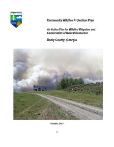
Community Wildfire Protection Plan
An Action Plan for Wildfire Mitigation and Conservation of Natural Resources
Dooly County, Georgia
October, 2017 1
CONTENTS
I. Signature Page.......................................................................................................................................3 II. Wildland/Urban Interface Disasters...................................................................................................4 III. The CWPP Core Committee & Stakeholders....................................................................................4 IV. Objective of the CWPP........................................................................................................................6 V. History of Dooly County and County Base Maps.........................................................................7 VI. Wildfire History...................................................................................................................................12 VII. What are "Communities-at-Risk"?........................................................................................16 VIII. Southern Wildfire Risk Assessment .............................................................................................17 IX. Dooly County Hazard Risk Assessments..........................................................................................20 X. Mitigation and Action Plan.................................................................................................................21 XI. Grant Funding and Mitigation Assistance......................................................................................28 XII. Glossary..............................................................................................................................................29 XIII. Sources of Information....................................................................................................................31 XIV. Assessment of Accomplishments...................................................................................................32
Appendix: Dooly County Southern Wildfire Risk Assessment Summary (SouthWRAP)
2
I. SIGNATURE PAGE
__________________________________ Honorable Terrell Hudson Chairman Dooly County Commission
______________________ Date
_________________________________ Kenny Calhoun Dooly County Fire Coordinator EMA Director
______________________ Date
_______________________________ Marty E. Fore Chief Ranger Georgia Forestry Commission
_______________________ Date
3
II. WILDLAND/URBAN INTERFACE FIRE DISASTERS
Fire influenced and defined the landscape we call the United States, well before the arrival of the first Europeans. Scientists, in fact, think that fires started by lightning or Native Americans occurred over most of the Southeast every 3 to 7 years. These were typically low intensity fires (because of their frequency) which kept the forests open and "park-like" in appearance and prevented heavy accumulations of dense underbrush. When communities became well established across the South, wildfires began to impact public safety. State forestry agencies became established between 1915 and 1928 to control wildfires and the landscape was generally segregated into communities (or human habitations) and natural or wildland areas.
In the mid 1980's, following a new wave of development in what was previously forest or wildland areas, agencies across the country became aware of an increasingly common phenomena wildfires were more and more frequently impacting communities . In 1985, a milestone year, over 1400 homes nationwide were lost to wildfire. The catastrophes became known as wildland/urban interface fires and occur when the fuel feeding the fire changes from natural vegetation (trees, shrubs and herbs) and begins to include manmade structures (homes, outbuildings and vehicles). Wildland/urban interface fires can occur anywhere in the United States and can become major disasters when associated with extremes in weather (extended droughts, high winds, low relative humidity, etc.)
The public does not have to fall victim to this type of disaster. Homes (and communities) can be designed, built and maintained to withstand a wildfire even in the absence of fire engines and firefighters on the scene, but it takes planning and commitment at the community level BEFORE the wildfire disaster occurs.
III. CWPP CORE COMMITTEE & STAKEHOLDERS
The development of this plan was a collaborative effort for the people of Dooly County. The individuals listed below made up the "CWPP Core Committee" and are responsible for much of the plan content.
CWPP Core Committee Kenny Calhoun EMA Director Chief Ranger Marty E. Fore
Georgia Forestry Commission Representatives CWPP Program Specialist Jim Harrell Chief Ranger Marty E. Fore Beryl Budd, Wildfire Prevention Specialist (Updated 2017)
4
Meeting Dates Initial Core Committee Meeting: Tuesday, February 23, 2010 Follow-Up Meeting #1: July 14, 2010 Follow-Up Meeting #2: August 13, 2010
The CWPP Core Committee contributed to the CWPP development by:
Initiation
Agreed on the need to develop a CWPP
Risk Assessment
Assessed the wildfire hazard of "communities-at-risk"
Fuels Reduction
Identified and prioritized areas for fuel treatment projects
Structure Ignitability
Identified strategies for reducing the ignitability of structures within the wildland/urban interface
Emergency Response
Updated and improved strategies for coordinated wildland fire response
Education and Outreach Public education initiative to increase citizen awareness of wildfire
OTHER STAKEHOLDERS
It is important that a collaborative approach be taken in the development of a successful Community Wildfire Protection Plan. This means allowing for the involvement of multiple interested parties in the Core CWPP Committee that develops the CWPP and providing the opportunity for other interested stakeholders in the community (county) to review and comment on the CWPP. Collaboration is a requirement of the Healthy Forests Restoration Act.
During development of the Dooly County CWPP, opportunities for collaboration were provided by:
Major stakeholders were invited to participate as members of the CWPP Core Committee.
A news release was placed in the local papers (The Vienna News Observer) explaining the objectives of the Dooly County CWPP, the planning process and the procedure for obtaining a draft copy for review and/or comment.
5
IV. OBJECTIVE OF THE CWPP
The objective of this Community Wildfire Protection Plan (CWPP) is to improve public safety and reduce structural losses from wildfire in wildland/urban interface areas of Dooly County.
The Wildland/Urban Interface is the presence of structures in locations in which the authority having jurisdiction (AHJ) determines that topographical features, vegetation, fuel types, local weather conditions and prevailing winds result in the potential for ignition of the structures within the area from flames and firebrands from a wildland fire(NFPA 1144, 2008 edition).
There are three generally accepted types of interface areas:
1. "Boundary" wildland/urban interface areas are characterized by development where groups of homes, subdivisions or other structures create a distinct and easily identified border with public or private wildlands, forests or parks.
2. "Intermix" wildland/urban interface areas are places where parcels of improved property and/or structures are scattered and interspersed within wildlands, forests or parks. Frequently, this is a subdivision that is not yet "built-out" with many undeveloped lots interspersed among occupied homes.
3. "Island" wildland/urban interface (also called "occluded interface") are typically very small pockets of wildland or natural areas surrounded by development or even situated within an incorporated area. A park or greenspace within a city is an example of an island interface area.
This CWPP will provide Dooly County with an evaluation of the wildland fire susceptibility of wildland/urban interface "communities-at-risk" and can be a valuable guide and action plan to address the increasing threat of wildfire. The plan will:
Enhance public safety Improve community sustainability Protect ecosystem health Raise public awareness of wildfire hazards and wildfire risk Educate landowners on how to reduce home ignitability Build and improve collaboration at multiple levels
This Community Wildfire Protection Plan will be very important to County applications for hazard mitigation grants through the National Fire Plan, FEMA mitigation grants and Homeland Security. Under the Healthy Forest Restoration Act (HFRA) of 2003, communities (counties) that seek grants from the federal government for hazardous fuels reduction work are required to prepare a Community Wildfire Protection Plan.
6
The minimum requirements for a Community Wildfire Protection Plan as described in the HFRA are:
Collaboration: A Community Wildfire Protection Plan must be collaboratively developed by local and state government representatives, in consultation with federal agencies and other interested parties.
Prioritized Fuel Reduction: A Community Wildfire Protection Plan must identify and prioritize areas for hazardous fuel reduction treatments and recommend the types and methods of treatment that will protect one or more at-risk communities and essential infrastructure.
Treatment of Structural ignitability: A Community Wildfire Protection Plan must recommend measures that homeowners and communities can take to reduce the ignitability of structures throughout the area addressed by the plan.
This plan should be looked at as a working document (i.e.; a guide) for local, state and federal agencies to reach common wildfire protection goals. A CWPP committee should meet on a continuing basis from year to year to review accomplishments, discuss impediments, revise outdated portions of the CWPP and develop new, meaningful wildfire protection goals for Dooly County.
V. HISTORY OF DOOLY COUNTY AND COUNTY BASE MAPS
Dooly County, in central Georgia, is one of the state's original counties, created in 1821 by the Georgia Land Lottery Act. It was named for John Dooly, a regimental commander in the American Revolution (1775-83) who was killed by loyalists to the British crown in his own home, following the restoration of the Colonial Assembly and the enforcement of the Disqualifying Act, which imposed penalties and restrictions on American patriot leaders.
The original inhabitants of the area were Creek Indians, who lost their land in 1821 in the first Treaty of Indian Springs. The first white settlers came from neighboring counties and states. The county, today 393 square miles, lost some of its original territory to Crisp, Macon, Pulaski, Turner, Wilcox, and Worth counties.
Vienna, the county seat, was settled decades before the adoption of its current name (after the capital of Austria) in 1841 and incorporation in 1854. The current courthouse, built in 1892, replaces several earlier courthouses. In addition to Vienna, there are five other towns: Byromville, first called Friendship, incorporated in 1905; Dooling, incorporated in 1907 with reactivation in 1989; Lilly, originally called Midway, incorporated in 1907; Pinehurst, first called Fullington, incorporated in 1895; and Unadilla, incorporated in 1890. The county also includes the communities of Findlay and Richwood.
7
Two major rail lines built tracks through Dooly County, leading to the formation of many of the county's towns, each of which lies along one of the lines. The Atlanta, Birmingham, and Atlantic Railroad (eventually part of CSX Transportation) ran from the southern border through Vienna and on to Dooling and points north, and the Georgia Southern and Florida Railway Line (later a subsidiary of Norfolk Southern), ran from Richwood to Unadilla. Vienna is strategically located on the CSX line but is also close to the Norfolk Southern line.
Byromville Post Office
Dooly County's major economic focus has been agriculture; it currently claims to be the largest cotton producer in Georgia, as well as a leader in peanut production. A nursery operated by the Georgia Forestry Commission in the county produces about 80 million seedlings annually on 832 acres.
The Crisp Dooly Enterprise Center in Vienna is a business incubator intended to encourage both workforce training and new business development. This is one example of the efforts being made to help the county grow. Others are aimed at cultivating tourism, with such events as the "Big Pig Jig," an annual barbecue cooking championship aimed at a national audience, as well as a number of museums and historic home tours.
Big Pig Jig
Notable Dooly County residents include former governor George Busbee; former U.S. senator Walter F. George; Jody Powell, press secretary and aide to Jimmy Carter during his governorship and U.S. presidency; and Roger Kingdom, an Olympic gold medalist in track and field. Among the county's places of interest are the Lilly Historic District, which includes the historic Lilly School, home of the Dooly County Arts Council; and the William H. Byrom House, built by the founder of Byromville in 1859 with slave labor.
According to the 2010 U.S. census, the county's population is 14,918, an increase from the 2000 population of 11,525.
8
COUNTY BASE MAPS
9
10
11
VII. WILDFIRE HISTORY
The Georgia Forestry Commission (GFC) is the state agency responsible for providing leadership, service, and education in the protection and conservation of Georgia's forest resources. Commission professionals provide a wide variety of services including fire detection, issuing burn permits, wildfire suppression and prevention services, emergency and incident command system expertise, rural fire department assistance, forest management assistance to landowners and communities, the marketing and utilization of forest resources, and growing and selling quality tree seedlings for reforestation.
Vision: Healthy sustainable forests providing clean air, clean water and abundant products for future generations.
Mission: To provide leadership, service and education in protection and conservation of Georgia's forest resources.
The Georgia Forestry Commission office serving Crisp-Dooly Counties is located at U.S. 259 Highway 41, Vienna, Georgia. Telephone: 229-268-4466.
Personnel Marty E. Fore, Chief Ranger Roger D. Pollock, Ranger / Forest Technician Willie Perry, Ranger Tyler Hobbs, Ranger
Wildland Firefighting Equipment Sterling road tractor/low-boy with JD 550J crawler tractor (2) International transports with JD 450G 130 gallon Type VII engine (Chief Ranger's truck) Water buffalo (400 gallon capacity)
Year
2011 2012 2013 2014 2015 2016
Number of Fires
55 29 28 13 28 8
Acreage Burned
467.65 171.20 550.24 37.88 198.88 10.71
Average Size
8.50 5.90 19.65 2.91 7.10 1.34
12
Statewide Average
17.56 5.08 4.53 5.02 4.42 6.29
County = Dooly
Cause
Campfire
Campfire
Children
Children
Debris: Ag Fields, Pastures, Debris: Ag Fields,
Orchards, Etc
Pastures, Orchards, Etc
Debris: Construction Land Debris: Construction
Clearing
Land Clearing
Debris: Escaped Prescribed Debris: Escaped
Burn
Prescribed Burn
Debris: Household Garbage
Debris: Household Garbage
Debris: Other
Debris: Other
Debris: Residential, Leafpiles, Yard, Etc
Debris: Residential, Leafpiles, Yard, Etc
Debris: Site Prep - Forestry Debris: Site Prep -
Related
Forestry Related
Incendiary
Incendiary
Lightning
Lightning
Machine Use
Machine Use
Miscellaneous: Cutting/Welding/Grinding
Miscellaneous: Firearms/Ammunition
Miscellaneous: Cutting/Welding/Grinding
Miscellaneous: Firearms/Ammunition
Miscellaneous: Other
Miscellaneous: Other
Miscellaneous: Power lines/Electric fences
Miscellaneous: Power lines/Electric fences
Miscellaneous: Spontaneous Heating/Combustion
Miscellaneous: Spontaneous Heating/Combustion
Miscellaneous: Structure/Vehicle Fires
Miscellaneous: Structure/Vehicle Fires
Railroad
Railroad
Smoking
Smoking
Undetermined
Totals for County: Dooly Year: 2017
Undetermined
13
Fires
2 0 2 1 2 0 1 1 1 0 0 3 0 0 3 1
Acres
Fires 5 Yr Avg
0.03
0.60
0.00
0.20
Acres 5 Yr Avg
0.24
0.32
13.33
1.40 5.60
5.17
0.80 3.13
1.10
3.40 30.31
0.00
0.60 0.72
0.25
1.00 4.55
5.30
1.20 6.95
0.41
1.80 4.88
0.00
0.40 0.57
0.00
1.20 44.18
6.98
2.40 10.71
0.00
0.40 2.30
0.00
0.20 0.09
4.11
0.80 1.18
0.24
0.60 0.37
1
4.87
0.40 1.16
0
0.00
0.20 0.02
0
0.00
0.40 1.65
1
2.52
0.20 0.50
12
56.48
3.40 60.27
31
100.79
21.60 179.70
Careless Debris Burning is the major cause accounting for 55% of wildfires during fiscal years 2007-2016. Machine Use is the second leading cause accounting for 21% during the period.
14
15
VII. WHAT ARE "COMMUNITIES-AT-RISK"?
Communities-at-risk are locations where a group of two or more structures are in close proximity to a forested or wildland area and this places homes and residents at some degree of risk from wildfire. Other characteristics of the "community" such as the closeness of structures, building materials, accumulated debris near the structures, access in and out and the distance from the nearest fire station or a permanent water source (pond or dry hydrant) may contribute to the risk.
While there may be relatively few "communities" that fit the above description in Dooly County that does not mean there is not a significant risk of structural damage during the severe weather conditions that are conducive to a disastrous wildfire (severe drought, low relative humidity and high winds).
Improvements to the community infrastructure (roads, utilities, etc.) may be beyond the capabilities of the homeowners. However, if access by emergency vehicles can be improved by widening the entrance right-of-way(s), creating "hammerhead-T's" or other ways for fire trucks to operate safely and identifying residences with reflective "911 addresses", wildfire protection can be greatly enhanced.
Modifications in and around individual residences may need to be budgeted by the residents over time (for example, making a roof more fire resistant may have to wait a few years until it is time to replace the current roof covering). Moving firewood away from the home, skirting raised decks and keeping roofs free of accumulated flammable debris, however, are improvements most families can make in the shortrun.
In most instances, communities-at-risk will benefit from (vegetative) fuel reduction within 100 feet of homes and outbuildings through prescribed burning or by mechanical means. Fuel management within the home ignition zone (within 100 feet of the home) either by removing highly flammable vegetation or by replacing the vegetation with fire resistant plant species will significantly improve wildfire safety.
In Dooly County, there are many individual (isolated) homes and outbuildings on farms and small properties that could be damaged or destroyed by a wildfire. On these properties, the owners must be educated so they can assume a greater responsibility for wildfire protection - - by making improvements to the landscape and structures that will provide some wildfire protection until the fire department can arrive. This can only be accomplished if rural residents know how to make their homes and properties "Firewise".
16
VIII. Southern Wildfire Risk Assessment & Risk Hazard Maps
The Southern Wildfire Risk Assessment tool, developed by the Southern Group of State Foresters, was released to the public in July 2014. This tool allows users of the Professional Viewer application of the Southern Wildfire Risk Assessment (SWRA) web Portal (SouthWRAP) to define a specific project area and summarize wildfire related information for this area. A detailed risk summary report is generated using a set of predefined map products developed by the Southern Wildfire Risk Assessment project which have been summarized explicitly for the user defined project area. A risk assessment summary was generated for Dooly County. The SouthWRAP (SWRA) products included in this report are designed to provide the information needed to support the following key priorities:
Identify areas that are most prone to wildfire
Identify areas that may require additional tactical planning, specifically related to mitigation projects and Community Wildfire Protection Planning
Provide the information necessary to justify resource, budget and funding requests
Allow agencies to work together to better define priorities and improve emergency response, particularly across jurisdictional boundaries
Define wildland communities and identify the risk to those communities
Increase communication and outreach with local residents and the public to create awareness and address community priorities and needs
Plan for response and suppression resource needs
Plan and prioritize hazardous fuel treatment
Wildland Urban Interface Map from the Dooly County SWRA Report
17
Wildland Urban Interface Risk map (above) and Wildland Urban Interface acres graph (below) from the Dooly County SWRA report.
18
Community Protection Zones map (above) and Fire Intensity Scale map (below) 19
IX. DOOLY COUNTY COMMUNITY HAZARD RISK ASSESSMENTS
1. Camper's Haven 2. Yellow Fly 3. Megan Road
4. Lewis Mill Lake North 5. Lewis Mill Lake South 6. Cool Water Estate
7. Holt-Walton Exp. Forest 8. Creekside 9. Lamb Town
HAZARD RATINGS FOR COMMUNITIES AT RISK
Community
Score
Lamb Town
127
Holt-Walton Exp. Forest 215-257
127
Megan Road
110
Creekside
105
Camper's Haven
100
Yellow Fly
92
Lewis Mill Lake North
72
Lewis Mill Lake South
69
Cool Water Estate
47
Hazard Rating Extreme Hazard Extreme Hazard Very High Hazard Very High Hazard Very High Hazard
High Hazard Moderate Hazard Moderate Hazard
Low Hazard
These hazard ratings were completed by Chief Ranger Carl Lowell and Ranger I Marty E. Fore during the month of May, 2010. The Georgia Forestry Commission's Hazard and Wildfire Risk Assessment Scoresheet was used. This document evaluates communities (groups of homes) based upon six criteria: community access, surrounding vegetation, building construction, fire protection, utilities and additional rating factors. The quantitative wildfire hazard ratings range from a low hazard rating of 0 to 50 points to an extreme hazard rating with over 120 points.
20
X. MITIGATION AND ACTION PLAN
The following recommendations were developed by the Dooly County CWPP Core team as a result of surveying and assessing fuels and structures and by conducting meetings and interviews with county and city officials.
Proposed Community Hazard and Structural Ignitability Reduction Priorities
Primary Protection for Community and Its Essential Infrastructure
Treatment Area
Treatment Types
Treatment Method(s)
All Structures Applicable Structures
Community Clean-up Day Road Signage Road Access Subdivision Access
Create minimum of 30-feet of defensible space**
Reduce structural ignitability**
Cutting, mowing, pruning** At Replacement
Identify needed road improvements Alternate exits
21
Trim shrubs and vines to 30 feet from structures, trim overhanging limbs, replace flammable plants near homes with less flammable varieties, remove vegetation around chimneys.
Clean flammable vegetative material from roofs and gutters, store firewood appropriately, install skirting around raised structures, store water hoses for ready access, replace pine straw and mulch around plantings with less flammable landscaping materials.
Cut, prune, and mow vegetation in shared community spaces.
New road signage with minimum 4 inch reflective lettering on non flammable poles. Dead end (no outlet or turn-around) should be prominently tagged.
As roads are upgraded, widen to minimum standards with at least 50 foot diameter cul de sacs.
Work with developers to identify and create alternate access and exits routes to subdivisions and communities with only one way in and out.
Water Supply Codes and Ordinances
Ordinance
Require new developments to install and maintain water systems and hydrants.
Examine existing codes and ordinances.
International Wildland Urban Interface Code has been adopted for use in Georgia. (IWUIC)
Amend and enforce existing building codes as they relate to skirting, propane tank locations, public nuisances (trash/debris on property), Property address marking standards and other concerns. Include fire department and emergency services input in the design of these.
Proposed Community Wildland Fuel Reduction Priorities
Treatment Area
Treatment Types
Treatment Method(s)
1. Adjacent WUI Lands
Reduce hazardous fuels
Encourage prescribed burning for private landowners and industrial timberlands particularly adjacent to residential areas.
2. Existing Fire Lines
Reduce hazardous fuels
Clean and re-harrow existing lines.
Proposed Improved Community Wildland Fire Response Priorities
1. Water Sources
Dry Hydrants
Inspect, maintain and improve access to existing dry hydrants. Add signage along road to mark the hydrants.
2. Fire Stations
Equipment
Wildland hand tools. Lightweight Wildland PPE Gear. Larger capacity hose. Investigate need for "brush" trucks.
3. Personnel
Training
Obtain Wildland Fire Suppression training for Fire Personnel.
**Actions to be taken by homeowners and community stakeholders
22
Critical Facilities
Critical facilities are unique structures which require special consideration in the event of an emergency such as a wildland/urban interface fire. Every county will have some critical facilities and some more urbanized counties will have many. Critical facilities include: a nursing home that may need special consideration because the smoke accompanying a wildfire may be hazardous to the health of elderly residents, a law enforcement dispatch center is a critical facility that will need special consideration to insure there is no disruption of emergency communications in the event of a disastrous wildfire. Other examples of critical facilities are ethanol plants, auto salvage yards and facilities that produce chemicals that could be hazardous to the local population if released into the atmosphere. Owner/operators of critical facilities need to be aware of the hazards that an approaching wildfire could present. There may be immediate action that could be taken by owner/operators to lessen the impact of a wildfire in the immediate area (such as the elimination of encroaching wildland vegetation in and around the critical facility.
List of Critical Facilities:
Dooly County High School Byromville Senior Citizen Center Dooly County Sheriff's Dept. (Pinehurst) Interstate Highway 75 corridor
Dooly County Elementary/Middle School Fullington Private School Southern States Fertilizer
RECOMMENDATION: Contact owner/operators of Critical Facilities in person or by letter to provide an evaluation of any hazards and suggest what owner/operators might do to mitigate the hazards and improve wildfire protection.
Public Education Needs "Firewise" structures are homes and other buildings in the wildland/urban interface that have been built, designed or maintained to survive a wildfire event even in the absence of firefighters on the scene. Over the past fifty years, many Georgia residents have left the city or the suburbs to build homes in or adjacent to forested areas with a desire to be "close to nature". Unfortunately, this has resulted in neighborhoods or single-family dwellings with one way in and out, with long narrow driveways, no pressurized hydrants or draft source for water and so close to wildland fuel that even the best equipped fire department could not be successful in a severe wildfire event. Most of these homeowners don't understand the risk associated with living in the wildland/urban interface and expect to be rescued by the fire department in the event of a wildfire emergency.
The key to the reduction of structural losses in the wildland/urban interface cannot rest solely with improved response by the local fire services. There will never be enough fire trucks and firefighters to adequately protect homes in the wildland/urban interface. A major part of the
23
solution to this problem lies with the homeowner homeowners in the wildland/urban interface must become "partners" with the fire services and assume some responsibility for maintaining their home (structure) and landscape (yard) so that ignitions in and around the home are less likely should a wildfire occur in the immediate area. This means a home with no debris on the roof and in the gutters, wood decks that are skirted underneath, chunky bark or lava rock mulch near the house instead of pine straw or cypress mulch and a "lean, clean and green" landscape of less-flammable plants within 30 feet of the structure.
RECOMMENDATIONS: Initiate a community public education program for Dooly County residents
Hold Firewise education programs at a centrally-located facility in areas designated as "communities-at-risk".
Make Firewise Communities brochures available to the public at central locations such as: Farm Services Agency, Chamber of Commerce and the County Courthouse.
Encourage neighborhoods/communities in high risk areas to apply for recognition as a Firewise Community/ USA.
Reduction of Hazardous Fuels Because approximately 41 percent of Dooly County is forested, the accumulation of brush and other (mostly ground) vegetation can create conditions over extensive areas that could fuel a disastrous wildfire. Treatment of forested areas with prescribed fire can significantly reduce this hazard while improving pulpwood and sawtimber production and enhancing wildlife habitat. Prescribed burning, however, must be conducted by experienced personnel when weather conditions are conducive to a safe burn and when an authorization has been obtained from the local office of the Georgia Forestry Commission. Other ways to reduce wildland fuel include:
Chemical treatment (herbicides) Mechanical treatment Livestock grazing The above alternatives to prescribed burning are more intensive and hence, more costly and generally suitable only for smaller acreages.
The goal for structural protection should be a "Firewise" landscape. A Firewise landscape is characterized by trees, shrubs and grasses that are carefully managed within 100 feet of structures - an area referred to as the Home Ignition Zone (HIZ). Most critical is the space within 30 feet of a structure which is usually called the area of Defensible Space. The Defensible Space should be landscaped with less flammable plants, coarse bark or lava rock as mulch adjacent the structure, tree limbs should be trimmed away from the structure and any decks skirted so leaves and other debris cannot accumulate underneath. The idea is to create a landscape that will prevent flames or fire brands (aerial borne embers) from igniting the structure.
24
RECOMMENDATION: Promote prescribed burning in Dooly County. Help landowners understand how to prescribe burn legally and safely. Educate the general public on the benefits of prescribed burning. Work with the Georgia State Patrol and local law enforcement to ensure motorists are alerted to smoke hazards on local roadways.
NEW DEVELOPMENT IN THE COUNTY
Site Plan Review If farm and ranch land is to be conserved as a mainstay of the County's rural economy, new development will, by necessity, occur more frequently on forest and wildland areas. The County Planning and Zoning Board has the opportunity to significantly influence the wildland fire safety of new developments. It is important that new development be planned and constructed to provide for public safety in the event of a wildland fire emergency. Over the past 20 years, much has been learned about how and why homes burn during wildland fire emergencies. Perhaps most importantly, case histories and research have shown that even in the most severe circumstances, wildland fire disasters can be avoided. Homes can be designed, built and maintained to withstand a wildfire even in the absence of fire services on the scene. The Firewise Communities program is a national awareness initiative to help people understand that they don't have to be victims in a wildfire emergency. The National Fire Protection Association has produced two standards for reference: NFPA 1144 Standard for Reducing Structure Ignition Hazards from Wildland Fire. 2008 Edition and NFPA 1141 Standard for Fire Protection Infrastructure for Land Development in Suburban and Rural Areas. In 2014 Georgia adopted the International Wildland Urban Interface Code (IWUIC) for use in the State. When new multi-unit subdivisions are built in rural areas (sometimes referred to as the Wildland/Urban Interface), a number of public safety challenges may be created for the local fire services: (1) the water supply in the immediate areas may be inadequate for fire suppression; (2) if the Development is in an outlying area, there may be a longer response time for emergency services; (3) in a wildfire emergency, the access road(s) may need to simultaneously support evacuation of residents and the arrival of emergency vehicles; and (4) when wildland fire disasters strike, many structures may be involved simultaneously, quickly exceeding the capability of even the best equipped fire departments,
RECOMMENDATION: Strengthen the site plan review process for multi-unit residential development in rural areas subject to wildfires.
Evaluate (assess) the wildfire hazard of proposed new development in rural areas as part of the site plan review process. Use GFC "Hazard and Wildfire Risk Assessment Scoresheet".
Consider the "adoption by reference" of NFPA 1144 Standard for Reducing Structure Ignition Hazards from Wildland Fire. 2008 Edition and NFPA 1141 Standard for Fire Protection Infrastructure for Land Development in Suburban and Rural Areas.
25
FIRE SERVICES CAPABILITY
Structural fire protection in Dooly County is provided by eight volunteer fire departments. There are typically 125 volunteer firefighters available to respond and a total of 7 Fireknockers (ICS Type 4 engines) and 8 Class A engines (ICS Type 1). Each station is equipped with a 4,000 gallon water tanker with one additional tanker located at the community of Pinehurst. On every fire call, an engine from a primary VFD is dispatched along with an engine from the next closest station.
Volunteer Fire Departments
(# of firefighters)
Brush Trucks
Vienna VFD
25
1
Drayton VFD
22
Byromville VFD
22
1
Pinehurst VFD
30
1
Unadilla VFD
16
1
Third District VFD
11
Dooly High VFD
12
Dooly Correctional Institution VFD
6
1
Equipment and Training
The County's volunteer firefighters have completed the Incident Management Training Courses, I-100 & I-700, however, none of the firefighters have had the NWCG basic wildfire training courses (S-130: Standards for Survival and S-190: Basic Wildfire Behavior). Countywide there is no wildland personal protective equipment for use by volunteer firefighters, and no fire shelters. Most engines are equipped with some wildland fire hand tools (shovels and fire flaps, but lack council rakes).
Water Availability (pressurized hydrants, dry hydrants and drafting sources)
Pressurized fire hydrants exist in all of the municipalities in Dooly County, but there are none in the unincorporated areas. There are 8 dry hydrants in unincorporated areas. Additional drafting sources near communities-at-risk would be beneficial.
Smoke on the Highway
All outdoor burning adjacent to the Interstate Highway 75 corridor is carefully monitored and regulated by the Georgia Forestry Commission to avoid smoke that might affect motorist visibility on the interstate highway
26
ACTION PLAN
Community/Area at Risk
Countywide
Project
Firefighter Training
Agency
GFC/Coun ty
Funding Needs $15,000
Priority High
Community Recommendation Standards for Survival (S-130) & Wildland Fire Behavior (S-190) Ready Set Go
Countywide
Wildland Fire PPE County & Hand Tools
$25,000
High Personal Protective Equipment & Fire Shelters (minimum of 4 sets per station)
Countywide
Wildfire Prevention Education
GFC/Coun ty
$1,500
Medium
Develop displays and training materials to conduct Firewise educational programs in communities-at-risk
Countywide Countywide
Drafting Equipment "Turbo draft" Identify & develop drafting sites near 9 communities-atrisk
County County
$9,000 Medium 3 Large "Turbo-draft" at $3,000 each
$18,000
Medium
Enhance water availability in high wildfire risk areas of unincorporated Dooly County
NOTE: The Action Plan summarizes a recommended course of action for implementation of this Community Wildfire Protection Plan. Some projects can be implemented at little or no added cost, however, the County or assigned agency will be able to implement most projects only if grant funding is available.
27
XI. GRANT FUNDING AND MITIGATION ASSISTANCE
Community Protection Grant: US Forest Service sponsored prescribed fire program. Communities with "at-risk" properties that lie within ten miles of a National Forest, National Park Service or Bureau of Land Management tracts may apply with the Georgia Forestry Commission to have their land prescribe burned free-of-charge. Forest mastication, where it is practical with Georgia Forestry Commission equipment, is also available under this grant program.
FEMA Mitigation Policy MRR-2-08-01: through GEMA Hazard Mitigation Grant Program (HMGP) and Pre-Disaster Mitigation Program (PDM).
1. To provide technical and financial assistance to local governments to assist in the implementation of long term, cost effective hazard mitigation accomplishments.
2. This policy addresses wildfire mitigation for the purpose of reducing the threat to allrisk structures through creating defensible space, structural protection through the application of ignition resistant construction and limited hazardous fuel reduction to protect life and property.
3. With a completed registered plan (addendum to the State Plan) counties can apply for pre-mitigation funding. They will also be eligible for HMGP funding if the county is declared under a wildfire disaster.
Georgia Forestry Commission: Plowing and prescribed burning assistance, as well as forest mastication, can be obtained from the GFC as a low-cost option for mitigation efforts.
The Georgia Forestry Commission Firewise Community Mitigation Assistance Grants Nationally recognized Firewise Communities can receive up to $5000 grants to help address potential wildfire risk reduction projects. Grant submission can be made through local Georgia Forestry Commission offices or your Regional Wildfire Prevention Specialist.
The International Association of Fire Chiefs (IAFC) and American International Group, Inc. (AIG) offer grants to assist local fire departments in establishing or enhancing their community fuels mitigation programs while educating members of the community about community wildfire readiness and encouraging personal action.
28
XII. GLOSSARY
Community-At-Risk A group of two or more structures whose proximity to forested or wildland areas places homes and residents at some degree of risk.
Critical Facilities Buildings, structures or other parts of the community infrastructure that require special protection from an approaching wildfire.
CWPP The Community Wildfire Protection Plan.
Defensible Space The immediate landscaped area around a structure (usually a minimum of 30 ft.) kept "lean, clean and green" to prevent an approaching wildfire from igniting the structure.
Dry Hydrant - A non-pressurized pipe system permanently installed in existing lakes, ponds and streams that provides a suction supply of water to a fire department tank truck.
FEMA The Federal Emergency Management Agency whose mission is to support our citizens and first responders to ensure that as a nation we work together to build, sustain, and improve our capability to prepare for, protect against, respond to, recover from, and mitigate all hazards.
Fire Adapted Community A community fully prepared for its wildfire risk by taking actions to address safety, homes, neighborhoods, businesses and infrastructure, forest, parks, open spaces, and other community assets.
Firewise Program A national initiative with a purpose to reduce structural losses from wildland fires.
Firewise Community/USA A national recognition program for communities that take action to protect themselves from wildland fire. To qualify a community must have a wildfire risk assessment by the Georgia Forestry Commission, develop a mitigation action plan, have an annual firewise mitigation/education event, have dedicated firewise leadership, and complete the certification application.
Fuels All combustible materials within the wildland/urban interface or intermix including, but not limited to, vegetation and structures.
Fuel Modification Any manipulation or removal of fuels to reduce the likelihood of ignition or the resistance to fire control.
29
Hazard & Wildfire Risk Assessment An evaluation to determine an area's (community's) potential to be impacted by an approaching wildland fire.
Home Ignition Zone (Structure Ignition Zone) - Treatment area for wildfire protection. The "zone" includes the structure(s) and their immediate surroundings from 0-200 ft.
Mitigation An action that moderates the severity of a fire hazard or risk.
National Fire Plan National initiative, passed by Congress in the year 2000, following a landmark wildland fire season, with the intent of actively responding to severe wildland fires and their impacts to communities while ensuring sufficient firefighting capacity for the future.
National Fire Protection Association (NFPA) - An international nonprofit organization established in 1896, whose mission is to reduce the worldwide burden of fire and other hazards on the quality of life by providing and advocating consensus codes and standards, research, training, and education.
National Wildfire Preparedness Day Started in 2014 by the National Fire Protection Association as a day for communities to work together to prepare for the fire season. It is held annually on the first Saturday in May.
Prescribed Burning (prescribed fire) The use of planned fire that is deliberately set under specific fuel and weather condition to accomplish a variety of management objectives and is under control until it burns out or is extinguished.
Ready, Set, Go - A program fire services use to help homeowners understand wildfire preparedness, awareness, and planning procedures for evacuation.
Southern Group of State Foresters Organization whose members are the agency heads of the forestry agencies of the 13 southern states, Puerto Rico and the Virgin Islands.
Stakeholders Individuals, groups, organizations, businesses or others who have an interest in wildland fire protection and may wish to review and/or contribute to the CWPP content.
Wildfire or Wildland Fire An unplanned and uncontrolled fire spreading through vegetative fuels.
Wildland/Urban Interface - The presence of structures in locations in which the authority having jurisdiction (AHJ) determines that topographical features, vegetation, fuel types, local weather conditions and prevailing winds result in the potential for ignition of the structures within the area from flames and firebrands from a wildland fire (NFPA 1144, 2008 edition)
30
XIII. SOURCES OF INFORMATION
Publications/Brochures/Websites: FIREWISE materials can be ordered at www.firewise.org Georgia Forestry Commission www.georgiafirewise.org Examples of successful wildfire mitigation programs can be viewed at the website for
National Database of State and Local wildfire Hazard Mitigation Programs sponsored by the U.S. Forest Service and the Southern Group of State Foresters www.wildfireprograms.com Information about a variety of interface issues (including wildfire) can be found at the USFS website for Interface South: www.interfacesouth.org Information on codes and standards for emergency services including wildfire can be found at www.nfpa.org Information on FEMA Assistance to Firefighters Grants (AFG) can be found at www.firegrantsupport.com Information on National Fire Plan grants can be found at http://www.federalgrantswire.com/national-fire-plan--rural-fire-assistance.html Southern Wildfire Risk Assessment website SouthWRAP www.SouthernWildfireRisk.com Fire Adapted Communities www.fireadapted.org Ready, Set, Go www.wildlandfirersg.org National Wildfire Preparedness Day www.wildfireprepday.org
Appended Documents:
Dooly County Southern Risk Assessment Summary Report (SouthWRAP)
All files that make up this plan are available in an electronic format from the Georgia Forestry Commission.
31
XIV. ASSESSMENT OF ACCOMPLISHMENTS
To accurately assess progress and effectiveness of the action plan, Dooly County will implement the following:
Wildfire risk assessments of "communities-at-risk" will be reviewed and updated annually to reassess wildfire hazards and prioritize needed actions.
Action Plan items that are recurring (such as mowing, burning or clearing of defensible space) will be incorporated into a revision of the original CWPP action plan.
Action items that could not be funded in the requested year will be incorporated into the annual revision of the original CWPP action plan.
Continuing education and outreach programs will be conducted and assessed for effectiveness. Workshops will be evaluated based upon attendance and critiques/program evaluations.
The CWPP Core Committee will continue a year-to-year focus on the wildland/urban interface fire challenges in the County. The Committee will update the Community Wildfire Protection Plan, summarizing mitigation projects initiated and completed, progress for ongoing actions, funds received, funds expended and in-kind services utilized. Recommendations will be incorporated into the Action Plan.
This plan should become a working document that is shared by local, state, and federal agencies that will use it to accomplish common goals. An agreed-upon schedule for meeting to review accomplishments, solve problems, and plan for the future should extend beyond the scope of this plan. Without this follow up this plan will have limited value.
32
Georgia Forestry Commission 5645 Riggins Mill Rd. Dry Branch, GA 31020 800-GA-TREES GaTrees.org
The Georgia Forestry Commission provides leadership, service, and education in the protection and conservation of Georgia's forest resources. An Equal Opportunity Employer and Service Provider
33