- Collection:
- Georgia Government Publications
- Title:
- Community wildfire protection plan, Decatur County: an action plan for wildfire mitigation and conservation of natural resources
- Creator:
- Heard, Rodney
Fell, Will
Budd, Beryl - Contributor to Resource:
- Georgia. Forestry Commission
- Publisher:
- Macon, Ga. : Georgia. Forestry Commission
- Date of Original:
- 2017-06
- Subject:
- Wildfires--Georgia--Decatur County--Prevention and control
Fire management--Georgia--Decatur County
Chorochromatic maps
Bar graphs
Transportation maps
Circular graphs - Location:
- United States, Georgia, 32.75042, -83.50018
United States, Georgia, Decatur County, 30.87834, -84.57907 - Medium:
- plans (reports)
- Type:
- Text
- Format:
- application/pdf
- External Identifiers:
- OCLC 1161988892
NZ MMS ID 9921988234902931
Call Number F600 .M1 2017 W5 D4 - Metadata URL:
- https://dlg.galileo.usg.edu/id:dlg_ggpd_s-ga-bf600-b-pm1-b2017-bw5-bd4-belec-p-btext
- Digital Object URL:
- https://dlg.galileo.usg.edu/do:dlg_ggpd_s-ga-bf600-b-pm1-b2017-bw5-bd4-belec-p-btext
- Language:
- eng
- Holding Institution:
- University of Georgia. Map and Government Information Library
- Rights:
-

__________________________
A Program of the Georgia Forestry Commission with support from the U.S. Forest Service
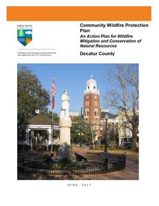
Community Wildfire Protection Plan
An Action Plan for Wildfire Mitigation and Conservation of Natural Resources
Decatur County
May 1, 2009
JUNE, 2017
Prepared by; Rodney Heard, Chief Ranger, Decatur County Will Fell, CWPP Specialist Beryl Budd, Wildfire Prevention Specialist (revised 2017)
Georgia Forestry Commission 1611 Dothan Rd Bainbridge, GA 39817
The following report is a collaborative effort among various entities; the representatives listed below comprise the core decision-making team responsible for this report and mutually agree on the plan's contents:
Alan Thomas, County Administrator Decatur County
Charlie McCann, Fire Chief/EMA Director Decatur County
Doyle Welch, Fire Chief City of Bainbridge
Rodney Heard, Chief Ranger Decatur County Forestry Unit
Jeff Kelly City of Climax Fire Chief
Kenny King Captain DCFR
Harold Bryant Captain Kendrick VFD
Tony Nix Captain DCFR
David Ingram Captain Recovery VFD
Guy Yates Captain DCFR
James Earp Captain Brinson VFD
Patrick Cofty Training Officer DCFR
Les Oberry Captain Fowlstown VFD
Sam Hughes Captain Mt Pleasant VFD
Billy Brown Captain Attapulgus VFD
Howard Author Captain Faceville VFD
Frank Kay Captain Black Jack VFD
PLAN CONTENTS
PAGE
I. Objectives ............................................................................................................................. 1 II. Community Collaboration .................................................................................................... 1 III. Community Background and Wildfire History...................................................................... 2 IV. Community Base Maps ......................................................................................................... 8 V. Community Wildfire Risk Assessment ............................................................................... 12 VI. Southern Wildfire Risk Assessment & Risk Hazards Maps ............................................... 17 VII. Prioritized Mitigation Recommendations ........................................................................... 21 VIII. Action Plan .......................................................................................................................... 25 IX. Grant Funding & Mitigation Assistance............................................................28 X. Glossary................................................................................................29 XI. Sources of Information ..............................................................................31
Appended Documents:
Decatur County Southern Wildfire Risk Assessment Summary (SouthWRAP) Decatur County Wildfire Plan
WILDFIRE PROTECTION PLAN: AN ACTION PLAN FOR WILDFIRE MITIGATION
I. OBJECTIVES
The mission of the following report is to set clear priorities for the implementation of wildfire mitigation in Decatur County. The plan includes prioritized recommendations for the appropriate types and methods of fuel reduction and structure ignitability reduction that will protect this community and its essential infrastructure. It also includes a plan for wildfire suppression. Specifically, the plan includes community-centered actions that will:
Educate citizens on wildfire, its risks, and ways to protect lives and properties, Support fire rescue and suppression entities, Focus on collaborative decision-making and citizen participation, Develop and implement effective mitigation strategies, and Develop and implement effective community ordinances and codes.
II. COMMUNITY COLLABORATION
The core team convened in December of 2008 to assess risks and develop the Community Wildfire Protection Plan. The group is comprised of representatives from local government, local fire authorities, and the state agency responsible for forest management. Below are the groups included in the task force:
Decatur County Government Fire Rescue Emergency Management Board of County Commissioners
City Of Bainbridge Public Safety Department
Georgia Forestry Commission
It was decided to conduct community assessments on the basis of the individual fire districts along with selected communities within the county. The chiefs and captains of the twelve fire departments in the county assessed their districts and reconvened in February of 2009 for the purpose of completing the following:
Risk Assessment
Assessed wildfire hazard risks and prioritized mitigation actions.
Fuels Reduction
Identified strategies for coordinating fuels treatment projects.
Structure Ignitability
Identified strategies for reducing the ignitability of structures within the Wildland interface.
Emergency Management Forged relationships among local government and fire districts and developed/refined a pre-suppression plan.
Education and Outreach Developed strategies for increasing citizen awareness and action and to conduct homeowner and community leader workshops.
Page 1
WILDFIRE PROTECTION PLAN: AN ACTION PLAN FOR WILDFIRE MITIGATION
III. COMMUNITY BACKGROUND AND WILDFIRE HISTORY
Community Background
Decatur County is located in the southwest corner of the state, adjoining Baker, Grady, Miller, Mitchell, and Seminole counties. One of the largest counties in Georgia at 596.8 square miles, Decatur shares its southern boundary with the Florida state line. There are four incorporated cities in the county: Attapulgus, Bainbridge (the county seat), Brinson, and Climax (named after the fact that it is the highest point on the railroad between Savannah and the Chattahoochee River).
Decatur County was created by an act of the state legislature on December 8, 1823, which carved all the area from Alabama to Grady County out of Early County. Later the western portion of the county was separated from Decatur to form Seminole County. Spanish explorers had visited the area as early as 1540, and settlements were founded shortly thereafter. Decatur County was named after Commodore Stephen Decatur, a War of 1812 (1812-15) naval hero who may be best remembered for his response to an 1816 toast: "Our country! In her intercourse with foreign nations may she always be in the right; but our country, right or wrong."
According to the 2000 U.S. census, the population of Decatur County was 28,240 (57.1 percent white, 39.9 percent black, and 3.2 percent Hispanic).
The governing body is a six-member board of commissioners who serve staggered four-year terms elected from individual districts. The chairman is elected by the board from among their own members. The day-to-day operations are supervised by a county administrator.
Decatur County sits atop the Floridan aquifer and is bisected by the Flint River. Lake Seminole, created by a dam at the Florida line built by the U.S. Army Corps of Engineers, forms the southwestern boundary of the county. The lake is noted for bass fishing and is the site of an annual national tournament. Jack Wingate's lodge and marina on the lake was made famous in the first Mark Trail comic strip, drawn by cartoonist Ed Dodd.
Bainbridge, the seat of Decatur County, is located in southwest Georgia approximately forty miles north of Tallahassee, Florida; sixty miles east of Dothan, Alabama; and sixty miles south of Albany, Georgia. U.S. Highway 84 and U.S. Highway 27 intersect in Bainbridge, which also boasts its own limited access highway.
Bainbridge is located on the Flint River and is one of two "inland ports" in Georgia (the other is Columbus). Native Americans occupied the area for centuries, and a settlement called Pucknawhitla stood on the site of present-day Bainbridge in 1765, when Europeans arrived. The name was changed to Burgess Town, after a European trader who set up a trading post at the settlement, and then to Fort Hughes after a nearby camp. In 1824 the legislature decided the county seat should be named for Commodore William Bainbridge, commander of the ship commonly known as "Old Ironsides," the U.S.S. Constitution, in the War of 1812. Bainbridge is nicknamed "the Oak City" because of its many large oak trees.
Page 2
WILDFIRE PROTECTION PLAN: AN ACTION PLAN FOR WILDFIRE MITIGATION
According to the 2000 U.S. census the population of Bainbridge is 11,722 (47.5 percent white, 50.3 percent African American, and 2 percent Hispanic). The major employment sectors are carpet and fiber manufacturing, agribusiness, glass press manufacturing, health, and education. Bainbridge College, which serves one Florida county and eight Georgia counties, was established in 1970 and opened to students in 1973.Enrollment
Decatur County Courthouse
in 2003 was just over 2,400.
The historic district encompasses most of downtown Bainbridge and the surrounding streets of antebellum homes. At Bainbridge College there is a nature trail on which are located two historic sites: an old turpentine mill and two rough-hewn stones probably, but not certainly, of Native American origin. The Decatur County Historical Society maintains a museum in the old city hall/fire hall/jail building, which it shares with the Decatur County Council for the Arts. A gazebo on the city square hosts musical performances at Christmas and throughout the year.
Recreational opportunities are abundant. National tennis tournaments and fishing tournaments are held in Bainbridge, and water sports facilities are available at the Earle May Boat Basin and nearby Seminole State Park. The boat basin also boasts a performing arts building, several baseball and softball fields, a beach, a petting zoo, a museum, and a riverwalk, with many landscaped holding ponds around surrounded by wooden walkways, lighting, and benches.
During World War II (1941-45) an airport was built in Bainbridge to train pilots. Toward the end of the war, the facility became a camp for German prisoners of war. In the early 1960s Bainbridge State Hospital, a residential facility for the developmentally challenged, took over the property. Today, it is a low-security drug treatment facility.
The Gilbert H. Gragg Library in Bainbridge is the headquarters for the Southwest Georgia Regional Library System, which serves Decatur, Miller, and Seminole counties. As of 2004 the library's collection included more than 163,000 volumes along with computers and audiovisual materials. Meeting facilities include satellite and computer resources as well. The Southwest Georgia Regional Library System won the National Award for Library Service in 2002.
Bainbridge has a mayor and city council/city manager form of government. It is the hometown of Georgia's former secretary of state, Cathy Cox.
(Courtesy New Georgia Encyclopedia)
Page 3
WILDFIRE PROTECTION PLAN: AN ACTION PLAN FOR WILDFIRE MITIGATION
Wildfire History
While Decatur County is a major agricultural county, 64% of the county is still forested. Large tracts of timberland are South and Southwest of Bainbridge and major landowners include Coastal Lumber Co. and International Paper. International Paper owns 10,000 acres on both sides of the Flint River, with 5000 acres in planted pines less than 15 years old. Land here is rolling, with gullies and creeks. The county is intersected by U.S. Highways 84 & 27 but both roads cross the Flint River inside the city limits, so travel across river to forested areas is difficult at times. The rest of the county is flatter with forested land interspersed with cultivated fields. The Silver Lake and Hog Farm Tracts, roughly 6,000 acres have been acquired by the state for wildlife management areas.
Decatur County is protected by Decatur County Fire & Rescue with the central station located just northwest of Bainbridge, with 10 rural fire departments well spaced throughout the county. The city of Bainbridge is protected by the Bainbridge Public Safety Department with two fire stations located in Bainbridge. The Georgia Forestry Commission maintains a county protection unit located just west of Bainbridge to respond to wildland fires within the county. The city of Bainbridge is serviced with a modern pressurized water system with hydrants throughout the city and in the industrial area just west of the city.
Over the past fifty years, Decatur County has averaged around 100 reported wildfires a year with over 60% of these occurring during January, February and March. These fires have burned an average of 626 acres a year over the same period, though generally there has been some decrease since the advent of burning permits the past 20 years. Still in the year 2004 the county lost over 1100 acres to wildfire. The following table charts wildfire activity from 2007 through 2016 indicating the number of wildfires, acreage, and average size compared to the Statewide average.
Acreage Burned /Number of Fires for Decatur County For FY 2007-2016
Year
Acreage Burned
Number of Fires
Average Size
State wide Average
2007
382.82
121
3.16
18.64
2008
279.79
72
3.86
4.56
2009
340.90
64
5.33
3.90
2010
502.85
42
11.97
3.93
2011
371.96
117
3.18
17.56
2012
96.01
42
2.29
5.08
2013
287.50
28
10.27
4.53
2014
48.44
12
4.04
5.02
2015
77.98
41
1.90
4.42
2016
75.40
44
1.71
6.29
Page 4
WILDFIRE PROTECTION PLAN: AN ACTION PLAN FOR WILDFIRE MITIGATION
The table below indicates wildfire activity for the current fiscal year ( July 1, 2016 thru June 30, 2017)
County = Decatur
Cause
Fires
Campfire
Campfire
1
Children
Children
1
Debris: Ag Fields, Pastures, Orchards, Etc
Debris: Ag Fields, Pastures, Orchards, Etc
1
Debris: Construction Land Clearing Debris: Construction Land Clearing
6
Debris: Escaped Prescribed Burn Debris: Escaped Prescribed Burn
35
Debris: Household Garbage
Debris: Household Garbage
14
Debris: Other
Debris: Other
7
Debris: Residential, Leafpiles, Yard, Etc
Debris: Residential, Leafpiles, Yard, Etc
14
Debris: Site Prep - Forestry Related Debris: Site Prep - Forestry Related
4
Incendiary
Incendiary
0
Lightning
Lightning
0
Machine Use
Machine Use
13
Miscellaneous: Cutting/Welding/Grinding
Miscellaneous: Cutting/Welding/Grinding
0
Miscellaneous: Other
Miscellaneous: Other
3
Miscellaneous: Power lines/Electric Miscellaneous: Power lines/Electric
fences
fences
2
Miscellaneous: Spontaneous Heating/Combustion
Miscellaneous: Spontaneous Heating/Combustion
3
Miscellaneous: Structure/Vehicle Fires
Miscellaneous: Structure/Vehicle Fires
1
Miscellaneous: Woodstove Ashes Miscellaneous: Woodstove Ashes
0
Railroad
Railroad
1
Smoking
Smoking
0
Undetermined
Undetermined
3
Totals for County: Decatur Year: 2017
109
Acres
0.00 0.17
Fires 5 Yr Avg
0.40
0.80
Acres 5 Yr Avg
0.02
0.57
3.82 1.60 5.94
3.15 138.49
8.23 12.71
2.60 13.60
4.00 1.40
6.91 81.82 3.20 2.54
18.69 7.20 8.70
1.77 2.60 7.74 0.00 1.20 4.51 0.00 0.20 0.84 6.31 4.40 9.37
0.00 0.20 0.32
1.07 0.60 0.21
2.53 2.20 2.83
2.80 0.60 0.56
0.18 0.20 0.04 0.00 0.20 0.22 0.10 0.20 0.02 0.00 0.80 0.74 0.15 1.80 0.80 200.17 46.80 137.90
Page 5
WILDFIRE PROTECTION PLAN: AN ACTION PLAN FOR WILDFIRE MITIGATION
During the last 10 years the leading cause of fires in Decatur County has been Debris Burning accounting for over 60% of the fires and 70% of the acres lost. The second leading cause of fires was Machine Use followed by Incendiary or Arson fires.
Acreage Burned /Number of Fires by Fire Cause For Decatur County For FY 2007-2016
Fire Cause
Campfire Children
Debris Burning
Incendiary Lightning MachineUse Miscellaneous Railroad Smoking Undetermined Total
Acreage Burned
9.06 13.86
1,752.03
292.90 91.06 264.99 17.40 0.00 18.48 3.87 2,463.65
Number of Fires
6 16
364
65 17 79 18 0 12 6 583
Page 6
WILDFIRE PROTECTION PLAN: AN ACTION PLAN FOR WILDFIRE MITIGATION Page 7
WILDFIRE PROTECTION PLAN: AN ACTION PLAN FOR WILDFIRE MITIGATION
IV. COMMUNITY BASE MAPS
Page 8
WILDFIRE PROTECTION PLAN: AN ACTION PLAN FOR WILDFIRE MITIGATION Page 9
WILDFIRE PROTECTION PLAN: AN ACTION PLAN FOR WILDFIRE MITIGATION Page 10
WILDFIRE PROTECTION PLAN: AN ACTION PLAN FOR WILDFIRE MITIGATION Page 11
WILDFIRE PROTECTION PLAN: AN ACTION PLAN FOR WILDFIRE MITIGATION
V. COMMUNITY WILDFIRE RISK ASSESSMENT
The Wildland-Urban Interface
There are many definitions of the Wildland-Urban Interface (WUI), however from a fire management perspective it is commonly defined as an area where structures and other human development meet or intermingles with undeveloped wildland or vegetative fuels. As fire is dependent on a certain set of conditions, the National Wildfire Coordinating Group has defined the wildland-urban interface as a set of conditions that exists in or near areas of wildland fuels, regardless of ownership. This set of conditions includes type of vegetation, building construction, accessibility, lot size, topography and other factors such as weather and humidity. When these conditions are present in certain combinations, they make some communities more vulnerable to wildfire damage than others. This "set of conditions" method is perhaps the best way to define wildland-urban interface areas when planning for wildfire prevention, mitigation, and protection activities.
There are three major categories of wildland-urban interface. Depending on the set of conditions present, any of these areas may be at risk from wildfire. A wildfire risk assessment can determine the level of risk.
1. "Boundary" wildland-urban interface is characterized by areas of development where homes, especially new subdivisions, press against public and private wildlands, such as private or commercial forest land or public forests or parks. This is the classic type of wildland-urban interface, with a clearly defined boundary between the suburban fringe and the rural countryside.
2. "Intermix" wildland-urban interface areas are places where improved property and/or structures are scattered and interspersed in wildland areas. These may be isolated rural homes or an area that is just beginning to go through the transition from rural to urban land use.
3. "Island" wildland-urban interface, also called occluded interface, are areas of wildland within predominately urban or suburban areas. As cities or subdivisions grow, islands of undeveloped land may remain, creating remnant forests. Sometimes these remnants exist as parks, or as land that cannot be developed due to site limitations, such as wetlands.
(courtesy Fire Ecology and Wildfire Mitigation in Florida 2004)
Page 12
WILDFIRE PROTECTION PLAN: AN ACTION PLAN FOR WILDFIRE MITIGATION
WUI is described as the area where structures and other human improvements meet and intermingle with undeveloped wildland or vegetative fuels.
Wildland Urban Interface Hazards Firefighters in the wildland urban interface may encounter hazards other than the fire itself, such as hazardous materials, utility lines and poor access.
Hazardous Materials
Common chemicals used around the home may be a direct hazard to firefighters from flammability, explosion potential and/or vapors or off-gassing. Such chemicals include paint, varnish and other flammable liquids; fertilizer; pesticides; cleansers; aerosol cans, fireworks, batteries and ammunition. In addition, some common household products such as plastics may give off very toxic fumes when they burn. Stay OUT of the smoke from burning structures and any unknown sources such as trash piles.
Illicit Activities
Marijuana plantations or drug production labs may be found in wildland urban interface areas. Extremely hazardous materials such as propane tanks and flammable/toxic chemicals may be encountered, as well as booby traps.
Propane tanks
Both large (household size) and small (gas grill size) liquefied propane gas (LPG) tanks can present hazards to firefighters, including explosion. See the "LPG Tank Hazards" discussion for details.
Page 13
WILDFIRE PROTECTION PLAN: AN ACTION PLAN FOR WILDFIRE MITIGATION
Utility lines
Utility lines may be located above and below ground and may be cut or damaged by tools or equipment. Don't spray water on utility lines or boxes.
Septic tanks and fields
Below-ground structures may not be readily apparent and may not support the weight of engines or other apparatus.
New construction materials
Many new construction materials have comparatively low melting points and may "off-gas" extremely hazardous vapors. Plastic decking materials that resemble wood are becoming more common and may begin softening and losing structural strength at 180 F, though they normally do not sustain combustion once direct flame is removed. However, if they continue to burn they exhibit the characteristics of flammable liquids.
Pets and livestock
Pets and livestock may be left when residents evacuate and will likely be highly stressed, making them more inclined to bite and kick. Firefighters should not put themselves at risk to rescue pets or livestock.
Evacuation occurring
Firefighters may be taking structural protection actions while evacuations of residents are occurring. Be very cautious of people driving erratically. Distraught residents may refuse to leave their property, and firefighters may need to disengage from fighting fire to contact law enforcement officers for assistance. In most jurisdictions firefighters do not have the authority to force evacuations. Firefighters should not put themselves at risk for those that won't evacuate!
Limited access
Narrow one-lane roads with no turn-around room, inadequate or poorly maintained bridges and culverts are frequently found in wildland urban interface areas. Access should be sized-up and an evacuation plan for all emergency personnel should be developed.
Page 14
WILDFIRE PROTECTION PLAN: AN ACTION PLAN FOR WILDFIRE MITIGATION
The wildland fire risk assessments conducted in 2009 by the Decatur County Fire Departments and the Bainbridge Department of Public Safety returned an average score of 117, placing Decatur County in the "high" moderate range. The risk assessment instrument used to evaluate wildfire hazards to Decatur County's WUI was the Woodland Community Wildfire Hazard Risk Assessment Checklist. The instrument takes into consideration accessibility, vegetation (based on fuel models), topography, roofing assembly, building construction, and availability of fire protection resources, placement of gas and electric utilities, and additional rating factors. The following factors contributed to the wildfire hazard score for Decatur County:
Dead end roads with inadequate turn arounds Narrow roads without drivable shoulders Long, narrow, and poorly labeled driveways Thick, highly flammable vegetation surrounding many homes Minimal defensible space around structures Homes with wooden siding and roofs with heavy accumulations of vegetative debris No pressurized or non-pressurized water systems available Above ground utilities Large, adjacent areas of forest or wildlands Undeveloped lots comprising half the total lots in many rural communities High occurrence of wildfires in the several locations Heavy fuel loading in forested areas
Page 15
WILDFIRE PROTECTION PLAN: AN ACTION PLAN FOR WILDFIRE MITIGATION
Summary of Decatur County Assessment Ratings
Community/VFD District
Access Site Bldg Add Total Hazard Rating
Hazard Hazard Hazard
score
Riverview / Mt Pleasant VFD
9 66 18 35 128 Moderate Risk
Mt Pleasant / Mt Pleasant VFD 8 28 20 19 75 Low Risk
Cyrene / DCFR
17 50 20 20 107 Moderate Risk
Elderendo / DCFR
21 54 25 41 141 Extreme Risk
Pinehill / DCFR
21 54 25 41 141 Extreme Risk
Cooktown / DCFR
21 47 20 40 128 Moderate Risk
Booster Club / Recovery VFD
12 59 5 44 120 Moderate Risk
Jinks Crossing / Recovery VFD 20 67 10 49 146 Extreme Risk
Recovery / Recovery VFD
11 45 5 14 75 Low Risk
Smith Landing / Kendrick VFD 22 59 35 60 174 Extreme Risk
Piney Woods / Kendrick VFD
15 25 48 44 132 High Risk
River Oaks / Kendrick VFD
14 40 5 52 111 Moderate Risk
McCrayville / Attapulgus VFD 16 44 20 58 138 High Risk
Attapulgus / Attapulgus VFD
4 27 15 36 82 Moderate Risk
Climax / Climax VFD
8 31 24 16 79 Moderate Risk
Bettsville Lndg Rd/Facevile VFD 11 47 10 42 110 Moderate Risk
Slough Loop/Blackjack VFD
8 51 15 29 103 Moderate Risk
Blackjack Comm/Blackjack VFD 10 29 0 41 80 Moderate Risk
Meadowbrook SD/Hwy 97 South 12 42 5 44 103 Moderate Risk
Dollar SD/97 South VFD
8 72 1 54 144 Extreme Risk
Brinson/Brinson VFD
21 47 20 40 128 Moderate Risk
City of Bainbridge/Bainbridge PSD 7 28 24 10 69 Low Risk
Dowdells/Fowlstown VFD
15 37 20 37 114 Moderate Risk
Fowlstown/Fowlstown VFD
8 79 30 42 159 Extreme Risk
Average
117 Moderate Risk
Page 16
WILDFIRE PROTECTION PLAN: AN ACTION PLAN FOR WILDFIRE MITIGATION
VI. SOUTHERN WILDFIRE RISK ASSESSMENT & HAZARD RISK MAPS
The Southern Wildfire Risk Assessment tool, developed by the Southern Group of State Foresters, was released to the public in July 2014. This tool allows users of the Professional Viewer application of the Southern Wildfire Risk Assessment (SWRA) web Portal (SouthWRAP) to define a specific project area and summarize wildfire related information for this area. A detailed risk summary report is generated using a set of predefined map products developed by the Southern Wildfire Risk Assessment project which have been summarized explicitly for the user defined project area. A risk assessment summary was generated for Decatur County. The SouthWRAP (SWRA) products included in this report are designed to provide the information needed to support the following key priorities:
Identify areas that are most prone to wildfire
Identify areas that may require additional tactical planning, specifically related to mitigation projects and Community Wildfire Protection Planning
Provide the information necessary to justify resource, budget and funding requests
Allow agencies to work together to better define priorities and improve emergency response, particularly across jurisdictional boundaries
Define wildland communities and identify the risk to those communities
Increase communication and outreach with local residents and the public to create awareness and address community priorities and needs
Plan for response and suppression resource needs
Plan and prioritize hazardous fuel treatment programs
Wildland Urban Interface (WUI) map from the Decatur County SWRA Summary
Page 17
WILDFIRE PROTECTION PLAN: AN ACTION PLAN FOR WILDFIRE MITIGATION
Wildland Urban Interface (WUI) Risk map (above) and WUI Acres graph (below)
Page 18
WILDFIRE PROTECTION PLAN: AN ACTION PLAN FOR WILDFIRE MITIGATION
Pictured above is a Fire Intensity Scale map and below is potential Fire Type map
Page 19
WILDFIRE PROTECTION PLAN: AN ACTION PLAN FOR WILDFIRE MITIGATION
Pictured above is a Community Protection Zones map and below is a Flame Length map
Page 20
WILDFIRE PROTECTION PLAN: AN ACTION PLAN FOR WILDFIRE MITIGATION
VII. PRIORITIZED MITIGATION RECOMMENDATIONS
Executive Summary
The following recommendations were developed by the Decatur County CWPP Core team as a result of surveying and assessing fuels and structures and by conducting meetings and interviews with county and city officials. A priority order was determined based on which mitigation projects would best reduce the hazard of wildfire in the assessment area.
Proposed Community Hazard and Structural Ignitability Reduction Priorities
Primary Protection for Community and Its Essential Infrastructure
Treatment Area
Treatment Types
Treatment Method(s)
1. All Structures
Create minimum of 30feet of defensible space**
Trim shrubs and vines to 30 feet from structures, trim overhanging limbs, replace flammable plants near homes with less flammable varieties, remove vegetation around chimneys.
2. Applicable Structures
Reduce structural ignitability**
Clean flammable vegetative material from roofs and gutters, store firewood appropriately, install skirting around raised structures, store water hoses for ready access, replace pine straw and mulch around plantings with less flammable landscaping materials.
3. Community Clean-up Day
National Wildfire Preparedness Day
Cutting, mowing, pruning**
4. Road Signage
At replacement
5. Road Access 6. Subdivision Access
Identify needed road improvements
Alternate exits
Cut, prune, and mow vegetation in shared community spaces. Firewise education to homeowners.
New road signage with minimum 4 inch reflective lettering on non flammable poles. Dead end (no outlet or turnaround) should be prominently tagged.
As roads are upgraded, widen to minimum standards with at least 50 foot diameter cul de sacs.
Work with developers to identify and create alternate access and exits routes to subdivisions and communities with only one way in and out.
Page 21
WILDFIRE PROTECTION PLAN: AN ACTION PLAN FOR WILDFIRE MITIGATION
7. Codes and Ordinances
Examine existing codes and ordinances.
International Wildland Urban Interface Code (IWUIC) was approved and adopted for use in Georgia counties in 2014.
Amend and enforce existing building codes as they relate to skirting, propane tank locations, public nuisances (trash/debris on property), Property address marking standards and other relevant concerns.
At such time as the development of zoning, planning and subdivision ordinances become practical include fire department and emergency services input in the design of these.
Proposed Community Wildland Fuel Reduction Priorities
Treatment Area
Treatment Types
Treatment Method(s)
1. Adjacent WUI Lands
Reduce hazardous fuels
Encourage prescribed burning for private landowners and industrial timberlands particularly adjacent to residential areas
2. Adjacent Corps Lands
Reduce hazardous fuels
Work with Corps land management to undertake fuel reduction strategies on Lake Seminole lands adjacent to WUI areas.
3. Adjacent WMA Lands
Reduce hazardous fuels
Work with DNR land management to incorporate regular prescribed burning on Lake Seminole WMA managed lands adjacent to identified WUI areas.
4. Railroad Corridors
Reduce hazardous fuels
Encourage railroads to better maintain their ROW eliminating brush and grass through herbicide and mowing. Maintain firebreaks along ROW adjacent to residential areas.
5. Existing Fire Lines
Reduce hazardous fuels
Encourage private landowners to clean and re-harrow existing fire lines.
Page 22
WILDFIRE PROTECTION PLAN: AN ACTION PLAN FOR WILDFIRE MITIGATION
Proposed Improved Community Wildland Fire Response Priorities
1. Water Sources
Dry Hydrants
Inspect, maintain and improve access to existing dry hydrants. Add signage along road to mark the hydrants.
2. Fire Stations
Brush Trucks
Investigate need for Brush Trucks at selected stations
3. Fire Stations
Equipment
Wildland hand tools. Lightweight Wildland PPE Gear.
4. Lakeside WUI
Fire Boat
Investigate need for fire boat equipped with pumping capability and rescue equipment for lakeside areas.
5. Emergency infrastructure Equipment
Obtain mobile generator to provide backup power where needed.
6. Personnel
Training
Obtain Wildland Fire Suppression training for Fire Personnel.
Ready Set Go training
**Actions to be taken by homeowners and community stakeholders
Proposed Education and Outreach Priorities
1. Conduct "How to Have a Firewise Home" Workshop for Decatur County Residents Set up and conduct a workshop for homeowners that teaches the principles of making homes and properties safe from wildfire. Topics for discussion include defensible space, landscaping, building construction, etc. Workshop will be scheduled for evenings or weekends when most homeowners are available and advertised through local media outlets. Distribute materials promoting firewise practices and planning through local community and governmental meetings.
2. Conduct "Firewise" Workshop for Community Leaders Arrange for GFC Firewise program to work with local community leaders and governmental officials on the importance of "Firewise Planning" in developing ordinances and codes as the county as the need arises. Identify "Communities at Risk" within the county for possible firewise community recognition.
Page 23
WILDFIRE PROTECTION PLAN: AN ACTION PLAN FOR WILDFIRE MITIGATION
3. Spring Clean-up Event (National Wildfire Preparedness Day) Conduct clean-up event every spring involving the Georgia Forestry Commission, Decatur County Fire Department, Bainbridge Department of Public Safety, and community residents. Set up information table with Firewise educational materials and refreshments. Initiate the event with a morning briefing by GFC Firewise coordinator and local fire officials detailing plans for the day and safety precautions. Since 2013 National Wildfire Preparedness Day is held annually on the 1st Saturday in May. Activities to include the following:
Clean flammable vegetative material from roofs and gutters Trim shrubs and vines to 30 feet away from structures Trim overhanging limbs Clean hazardous or flammable debris from adjacent properties Provide firewise materials to residents, homeowners, etc. Celebrate the work with a community cookout, with Community officials, GFC and Decatur County Fire Dept and Bainbridge Dept of Public Safety discussing and commending the work accomplished.
4. Informational Packets Develop and distribute informational packets to be distributed by realtors and insurance agents. Included in the packets are the following:
Be Firewise Around Your Home Firewise Guide to Landscape and Construction Firewise Communities USA materials Fire Adapted Community information Ready Set Go materials
5. Wildfire Protection Display Create and exhibit a display for the general public during the several festivals in the county. The display can be independent or combined with the Georgia Forestry Commission display.
6. Press Invite the Bainbridge News Media and area TV and Radio to community "Firewise" functions for news coverage and regularly submit press releases documenting wildfire risk improvements in Decatur County.
Page 24
WILDFIRE PROTECTION PLAN: AN ACTION PLAN FOR WILDFIRE MITIGATION
VIII. ACTION PLAN
Roles and Responsibilities The following roles and responsibilities have been developed to implement the action plan:
Role
Responsibility
Hazardous Fuels and Structural Ignitability Reduction
Decatur County WUI Fire Council
Create this informal team or council comprised of residents, GFC officials, Decatur County and Bainbridge fire officials, a representative from the city and county governments and the EMA Director for Decatur county. Meet periodically to review progress towards mitigation goals, appoint and delegate special activities, work with federal, state, and local officials to assess progress and develop future goals and action plans. Work with residents to implement projects and firewise activities.
Key Messages to focus on
1 Defensible Space and Firewise Landscaping 2 Debris Burning Safety 3 Firewise information for homeowners 4 Prescribed burning benefits
Communications objectives
1 Create public awareness for fire danger and defensible space issues
2 Identify most significant human cause fire issues
3 Enlist public support to help prevent these causes
4 Encourage people to employ fire prevention and defensible spaces in their communities.
Target Audiences
1 Homeowners 2 Forest Landowners and users 3 Civic Groups 4 School Groups
Methods
1 News Releases 2 Personal Contacts 3 Key messages and prevention tips 4 Visuals such as signs, brochures and posters
Page 25
WILDFIRE PROTECTION PLAN: AN ACTION PLAN FOR WILDFIRE MITIGATION
Spring Clean-up Day (National Wildfire Preparedness Day is held on the 1st Saturday in May)
Event Coordinator
Coordinate day's events and schedule, catering for cookout, guest attendance, and moderate activities the day of the day of the event.
Event Treasurer
Collect funds from residents to cover food, equipment rentals, and supplies.
Publicity Coordinator
Advertise event through neighborhood newsletter, letters to officials, and public service announcements (PSAs) for local media outlets. Publicize post-event through local paper and radio PSAs.
Work Supervisor
Develop volunteer labor force of community residents; develop labor/advisory force from Georgia Forestry Commission, Decatur County Fire Dept, Bainbridge Dept of Public Safety, and Decatur County Emergency Management Agency. Procure needed equipment and supplies. In cooperation with local city and county officials, develop safety protocol. Supervise work and monitor activities for safety the day of the event.
Funding Needs The following funding is needed to implement the action plan:
Project
Estimated Cost Potential Funding Source(s)
1. Create a minimum of 30 feet of defensible space around structures
Varies
Residents will supply labor and fund required work on their own properties.
2. Reduce structural ignitability by cleaning flammable vegetation from roofs and gutters, appropriately storing firewood, installing skirting around raised structures, storing water hoses for ready access, replacing pine needles and mulch around plantings with less flammable material.
Varies
3. Amend codes and ordinances to provide
No Cost
better driveway access, increased visibility of
house numbers, properly stored firewood,
minimum defensible space brush clearance,
required Class A roofing materials and
skirting around raised structures, planned
maintenance of community lots.
Residents will supply labor and fund required work on their own properties.
To be adopted by city and county government.
4. Spring Cleanup Day
Varies
Community Donations.
5. Fuel Reduction Activities
$15 / acre
FEMA & USFS Grants
Page 26
WILDFIRE PROTECTION PLAN: AN ACTION PLAN FOR WILDFIRE MITIGATION
Ultimately it is our goal to help the communities by identifying the communities threatened with a high risk to wildfire and educate those communities on methods to implement on reducing those risks.
Assessment Strategy To accurately assess progress and effectiveness for the action plan, the Decatur County WUI Fire Council will implement the following:
Annual wildfire risk assessment will be conducted to re-assess wildfire hazards and prioritize needed actions.
Mitigation efforts that are recurring (such as mowing, burning, clearing of defensible space) will be incorporated into an annual renewal of the original action plan.
Mitigation efforts that could not be funded in the requested year will be incorporated into the annual renewal of the original action plan.
Continuing educational and outreach programs will be conducted and assessed for effectiveness. Workshops will be evaluated based on attendance and post surveys that are distributed by mail 1 month and 6 months following workshop date.
The Decatur County WUIFC will publish an annual report detailing mitigation projects initiated and completed, progress for ongoing actions, funds received, funds spent, and in-kind services utilized. The report will include a "state of the community" section that critically evaluates mitigation progress and identifies areas for improvement. Recommendations will be incorporated into the annual renewal of the action plan.
An annual survey will be distributed to residents soliciting information on individual mitigation efforts on their own property (e.g., defensible space). Responses will be tallied and reviewed at the next Decatur County WUIFC meeting. Needed actions will be discussed and delegated.
This plan should become a working document that is shared by local, state, and federal agencies that will use it to accomplish common goals. An agreed-upon schedule for meeting to review accomplishments, solve problems, and plan for the future should extend beyond the scope of this plan. Without this follow up this plan will have limited value
Page 27
WILDFIRE PROTECTION PLAN: AN ACTION PLAN FOR WILDFIRE MITIGATION
IX. GRANT FUNDING AND MITIGATION ASSISTANCE
Community Protection Grant: US Forest Service sponsored prescribed fire program. Communities with "at-risk" properties that lie within ten miles of a National Forest, National Park Service or Bureau of Land Management tracts may apply with the Georgia Forestry Commission to have their land prescribe burned free-of-charge. Forest mastication, where it is practical with Georgia Forestry Commission equipment, is also available under this grant program. FEMA Mitigation Policy MRR-2-08-01: through GEMA Hazard Mitigation Grant Program (HMGP) and Pre-Disaster Mitigation Program (PDM).
1. To provide technical and financial assistance to local governments to assist in the implementation of long term, cost effective hazard mitigation accomplishments.
2. This policy addresses wildfire mitigation for the purpose of reducing the threat to allrisk structures through creating defensible space, structural protection through the application of ignition resistant construction and limited hazardous fuel reduction to protect life and property.
3. With a completed registered plan (addendum to the State Plan) counties can apply for pre-mitigation funding. They will also be eligible for HMGP funding if the county is declared under a wildfire disaster.
Georgia Forestry Commission: Plowing and prescribed burning assistance, as well as forest mastication, can be obtained from the GFC as a low-cost option for mitigation efforts. The Georgia Forestry Commission Firewise Community Mitigation Assistance Grants Nationally recognized Firewise Communities can receive up to $5000 grants to help address potential wildfire risk reduction projects. Grant submission can be made through local Georgia Forestry Commission offices or your Regional Wildfire Prevention Specialist. The International Association of Fire Chiefs (IAFC) and American International Group, Inc. (AIG) offer grants to assist local fire departments in establishing or enhancing their community fuels mitigation programs while educating members of the community about community wildfire readiness and encouraging personal action.
Page 28
WILDFIRE PROTECTION PLAN: AN ACTION PLAN FOR WILDFIRE MITIGATION
X. GLOSSARY
Community-At-Risk A group of two or more structures whose proximity to forested or wildland areas places homes and residents at some degree of risk.
Critical Facilities Buildings, structures or other parts of the community infrastructure that require special protection from an approaching wildfire.
CWPP The Community Wildfire Protection Plan.
Defensible Space The immediate landscaped area around a structure (usually a minimum of 30 ft.) kept "lean, clean and green" to prevent an approaching wildfire from igniting the structure.
Dry Hydrant - A non-pressurized pipe system permanently installed in existing lakes, ponds and streams that provides a suction supply of water to a fire department tank truck.
FEMA The Federal Emergency Management Agency whose mission is to support our citizens and first responders to ensure that as a nation we work together to build, sustain, and improve our capability to prepare for, protect against, respond to, recover from, and mitigate all hazards.
Fire Adapted Community A community fully prepared for its wildfire risk by taking actions to address safety, homes, neighborhoods, businesses and infrastructure, forest, parks, open spaces, and other community assets.
Firewise Program A national initiative with a purpose to reduce structural losses from wildland fires.
Firewise Community/USA A national recognition program for communities that take action to protect themselves from wildland fire. To qualify a community must have a wildfire risk assessment by the Georgia Forestry Commission, develop a mitigation action plan, have an annual firewise mitigation/education event, have dedicated firewise leadership, and complete the certification application.
Fuels All combustible materials within the wildland/urban interface or intermix including, but not limited to, vegetation and structures.
Fuel Modification Any manipulation or removal of fuels to reduce the likelihood of ignition or the resistance to fire control.
Hazard & Wildfire Risk Assessment An evaluation to determine an area's (community's) potential to be impacted by an approaching wildland fire.
Healthy Forests Initiative - Launched in August 2002 by President Bush (following passage of the Healthy Forests Restoration Act by Congress) with the intent to reduce the risks severe wildfires pose to people, communities, and the environment.
Page 29
WILDFIRE PROTECTION PLAN: AN ACTION PLAN FOR WILDFIRE MITIGATION
Home Ignition Zone (Structure Ignition Zone) - Treatment area for wildfire protection. The "zone" includes the structure(s) and their immediate surroundings from 0-200 ft. Mitigation An action that moderates the severity of a fire hazard or risk. National Fire Plan National initiative, passed by Congress in the year 2000, following a landmark wildland fire season, with the intent of actively responding to severe wildland fires and their impacts to communities while ensuring sufficient firefighting capacity for the future. National Fire Protection Association (NFPA) - An international nonprofit organization established in 1896, whose mission is to reduce the worldwide burden of fire and other hazards on the quality of life by providing and advocating consensus codes and standards, research, training, and education. National Wildfire Preparedness Day Started in 2014 by the National Fire Protection Association as a day for communities to work together to prepare for the fire season. It is held annually on the first Saturday in May. Prescribed Burning (prescribed fire) The use of planned fire that is deliberately set under specific fuel and weather condition to accomplish a variety of management objectives and is under control until it burns out or is extinguished. Ready, Set, Go - A program fire services use to help homeowners understand wildfire preparedness, awareness, and planning procedures for evacuation. Southern Group of State Foresters Organization whose members are the agency heads of the forestry agencies of the 13 southern states, Puerto Rico and the Virgin Islands. Stakeholders Individuals, groups, organizations, businesses or others who have an interest in wildland fire protection and may wish to review and/or contribute to the CWPP content. Wildfire or Wildland Fire An unplanned and uncontrolled fire spreading through vegetative fuels.
Wildland/Urban Interface - The presence of structures in locations in which the authority having jurisdiction (AHJ) determines that topographical features, vegetation, fuel types, local weather conditions and prevailing winds result in the potential for ignition of the structures within the area from flames and firebrands from a wildland fire (NFPA 1144, 2008 edition.
Page 30
WILDFIRE PROTECTION PLAN: AN ACTION PLAN FOR WILDFIRE MITIGATION
XI. SOURCES OF INFORMATION
Publications/Brochures/Websites: FIREWISE materials can be ordered at www.firewise.org Georgia Forestry Commission www.georgiafirewise.org Examples of successful wildfire mitigation programs can be viewed at the website for National Database of State and Local wildfire Hazard Mitigation Programs sponsored by the U.S. Forest Service and the Southern Group of State Foresters www.wildfireprograms.com Information about a variety of interface issues (including wildfire) can be found at the USFS website for Interface South: www.interfacesouth.org Information on codes and standards for emergency services including wildfire can be found at www.nfpa.org Information on FEMA Assistance to Firefighters Grants (AFG) can be found at www.firegrantsupport.com Information on National Fire Plan grants can be found at http://www.federalgrantswire.com/national-fire-plan--rural-fire-assistance.html Southern Wildfire Risk Assessment website SouthWRAP www.southernwildfirerisk.com Fire Adapted Communities www.fireadapted.org Ready, Set, Go www.wildlandfirersg.org National Wildfire Preparedness Day www.wildfireprepday.org Wildland Urban Interface Code www.iccsafe.org
Appended Documents:
Decatur County Southern Wildfire Risk Assessment Summary Report (SouthWRAP) All files that make up this plan are available in an electronic format from the Georgia Forestry Commission.
Page 31
WILDFIRE PROTECTION PLAN: AN ACTION PLAN FOR WILDFIRE MITIGATION
Georgia Forestry Commission 5645 Riggins Mill Rd. Dry Branch, GA 31020 800-GA-TREES GaTrees.org
The Georgia Forestry Commission provides leadership, service, and education in the protection and conservation of Georgia's forest resources. An Equal Opportunity Employer and Service Provider
Page 32