- Collection:
- Georgia Government Publications
- Title:
- Community wildfire protection plan, Liberty County, Georgia: an action plan for wildfire mitigation and conservation of natural resources
- Creator:
- Stone, Jeff
Duke, David
Fell, Will - Contributor to Resource:
- Georgia. Forestry Commission
- Publisher:
- Macon, Ga. : Georgia. Forestry Commission
- Date of Original:
- 2016-04-13
- Subject:
- Wildfires--Georgia--Liberty County--Prevention and control
Fire management--Georgia--Liberty County
Chorochromatic maps - Location:
- United States, Georgia, 32.75042, -83.50018
United States, Georgia, Liberty County, 31.80723, -81.45626 - Medium:
- plans (reports)
- Type:
- Text
- Format:
- application/pdf
- External Identifiers:
- OCLC 1164092658
NZ MMS ID 9922020856102931
Call Number F600 .M1 2016 W5 L5 - Metadata URL:
- https://dlg.galileo.usg.edu/id:dlg_ggpd_s-ga-bf600-b-pm1-b2016-bw5-bl5-belec-p-btext
- Digital Object URL:
- https://dlg.galileo.usg.edu/do:dlg_ggpd_s-ga-bf600-b-pm1-b2016-bw5-bl5-belec-p-btext
- Language:
- eng
- Holding Institution:
- University of Georgia. Map and Government Information Library
- Rights:
-

__________________________
A Program of the Georgia Forestry Commission with support from the U.S. Forest Service
+
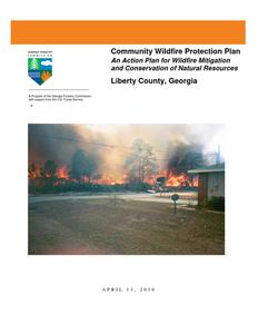
Community Wildfire Protection Plan
An Action Plan for Wildfire Mitigation and Conservation of Natural Resources
Liberty County, Georgia
APRIL 13, 2016
Prepared by; Jeff Stone, Chief Ranger Liberty County (Retired) Updated by David Duke Chief Ranger Liberty County Will Fell CWPP Specialist Georgia Forestry Commission 1203 South Coastal Hwy. Midway GA 31320
The following report is a collaborative effort among various entities; the representatives listed below comprise the core decision-making team responsible for this report and mutually agree on the plan's contents:
Joey Brown Liberty County Administrator (912) 876-2164 joey.brown@libertycountyga.com
Melinda Buchannon Liberty Co Fire Services Admin Assistant (912) 876-4511 melinda.buchannon@libertycountyga.com
Jeff Stone GFC Chief Ranger Liberty Co. (912) 884-3331 jstone@gfc.state.ga.us
David Duke GFC Ranger II Liberty Co (912) 884-3331 Libertyunit@gfc.state.ga.us
T. Lamar Cook Chief Hinesville Fire Dept (912) 876-4143 lcook@cityofhinesville.org
James Ashdown Liberty Co Fire Services Coordinator (912) 876-4509 james.ashdown@libertycountyga.com
Mike Hodges Director Liberty County Fire Services (912) 368-2201 mike.hodges@libertycountyga.com
Clark McKeever Liberty County Deputy EMA Director (912) 368-2201 clark.mckeever@libertycountyga.com
Jeff Bowen Asst Chief Midway VFD (912) 884-6151 worldsgreatestpoppy@hotmail.com
Leonard Turner Liberty Co Fire Services Training (404) 357-4362 libertycountyfireservicestraining@yahoo.com
Anthony Rubine Fire Mgt Specialist Ft Stewart (912) 435-8089 Anthony.Rubine@us.army.mil
Bob Tanner Fire Operations Ft Stewart (912) 435-8152
PLAN CONTENTS
I. Objectives ............................................................................................................................. 1 II. Community Collaboration .................................................................................................... 1 III. Community Background and Existing Situation ................................................................... 2 IV. Community Base Map .......................................................................................................... 6 V. Community Wildfire Risk Assessment ................................................................................. 7 VI. Community Hazards Maps ................................................................................................. 12 VII. Prioritized Mitigation Recommendations ........................................................................... 15 VIII. Action Plan .......................................................................................................................... 20 IX. Appended Documents..................................................................................24
Liberty County Wildfire Pre-suppression Plan NFPA 1141 Standard for Fire Protection Infrastructure for Land Development in Suburban and Rural Areas.
Preface
The extreme weather conditions that are conducive to wildfire disasters (usually a combination of extended drought, low relative humidity and high winds) can occur in this area of Georgia as infrequently as every 10-15 years. This is not a regular event, but as the number of homes that have been built in or adjacent to forested or wildland areas increases, it can turn a wildfire under these weather conditions into a major disaster. Wildfires move fast and can quickly overwhelm the resources of even the best equipped fire department. Advance planning can save lives, homes and businesses.
This Community Wildfire Protection Plan (CWPP) includes a locally assessed evaluation of the wildland urban interface areas of the county, looking at the critical issues regarding access to these areas, risk to properties from general issues such as building characteristics and "fire wise" practices and response from local fire fighting resources. It further incorporates a locally devised action plan to mitigate these risks and hazards though planning, education and other avenues that may become available to address the increasing threat of wildland fire. The CWPP does not obligate the county financially in any way, but instead lays a foundation for improved emergency response if and when grant funding is available to the county.
The Plan is provided at no cost to the county and can be very important for county applications for hazard mitigation grant funds through the National Fire Plan, FEMA mitigation grants and Homeland Security. Under the Healthy Forest Restoration Act (HFRA) of 2003, communities (counties) that seek grants form the federal government for hazardous fuels reduction work are required to prepare a Community Wildfire Protection Plan.
This plan will:
Enhance public safety Raise public awareness of wildfire hazards and risks Educate homeowners on how to reduce home ignitability Build and improve collaboration at multiple levels
The public does not have to fall victim to this type of disaster. Homes (and communities) can be designed, built and maintained to withstand a wildfire even in the absence of fire equipment and firefighters on the scene. It takes planning and commitment at the local level before the wildfire disaster occurs and that is what the Community Wildfire Protection Plan is all about.
WILDFIRE PROTECTION PLAN: AN ACTION PLAN FOR WILDFIRE MITIGATION
I. OBJECTIVES
The mission of the following report is to set clear priorities for the implementation of wildfire mitigation in Liberty County. The plan includes prioritized recommendations for the appropriate types and methods of fuel reduction and structure ignitability reduction that will protect this community and its essential infrastructure. It also includes a plan for wildfire suppression. Specifically, the plan includes community-centered actions that will:
Educate citizens on wildfire, its risks, and ways to protect lives and properties, Support fire rescue and suppression entities, Focus on collaborative decision-making and citizen participation, Develop and implement effective mitigation strategies, and Develop and implement effective community ordinances and codes.
II. COMMUNITY COLLABORATION
The core team convened on June 3rd, 2009 to assess risks and develop the Community Wildfire Protection Plan. The group is comprised of representatives from local government, local fire authorities, and the state agency responsible for forest management. Below are the groups included in the task force:
Liberty County Government Fire Services Emergency Management Board of County Commissioners
City of Hinesville Fire Department
Georgia Forestry Commission US Army, Fort Stewart.
It was decided to conduct community assessments on the basis of the on high risk communities and the individual fire districts in the county. The core team assessed the identified communities and districts and reconvened on July 15th, 2009 for the purpose of completing the following:
Risk Assessment
Assessed wildfire hazard risks and prioritized mitigation actions.
Fuels Reduction
Identified strategies for coordinating fuels treatment projects.
Structure Ignitability
Identified strategies for reducing the ignitability of structures within the Wildland interface.
Emergency Management Forged relationships among local government and fire districts and developed/refined a pre-suppression plan.
Education and Outreach Developed strategies for increasing citizen awareness and action and to conduct homeowner and community leader workshops.
Page 1
WILDFIRE PROTECTION PLAN: AN ACTION PLAN FOR WILDFIRE MITIGATION
III. COMMUNITY BACKGROUND AND EXISTING SITUATION
Background
Liberty County, located on the Georgia coast, was one of the seven Georgia counties created from the original colonial parishes. The Guale Indians inhabited that area from prehistoric times, and in the eighteenth century the tribe became a part of the Muskogee or Creek Confederation. The Spanish placed a mission on St. Catherines Island, known as Mission Santa Catalina de Guale, in the late sixteenth century among the Guale Indians. In the early 1750s English settlers, including a group of Congregationalists from Dorchester, South Carolina, located in the area between the Medway and Newport rivers.
Shortly before the American Revolution (1775-83), a number of people who later became prominent in the new state and republic settled in Liberty County, including Nathan Brownson, Mark Carr, James Dunwoody, John Elliott Sr., Button Gwinnett, Lyman Hall, Lachlan McIntosh, James Screven, and Daniel Stewart. In the 1770s William Bartram traveled through the area during his famous expedition.
In 1775 St. John's Parish, one of three parishes that would eventually make up Liberty County, was the first area in Georgia to send a representative to the Continental Congress in Philadelphia, Pennsylvania.
In that year the citizens of St. John's Parish gathered in the Congregational Church in Midway, where they elected Lyman Hall to represent them in the Continental Congress. They sent several wagonloads of rice with him to feed the Continental troops surrounding Boston, Massachusetts. Because St. John's Parish was the first in Georgia to vote for liberty, the new county created from this parish on February 5, 1777, was given the name Liberty.
The seaport of Sunbury was established in 1758 and was the county seat of Liberty until 1798. During the Revolution, Sunbury and adjacent Fort Morris were captured by the British in 1779. The British remained in control of Sunbury and the surrounding area until the end of the war. At the time of their evacuation, British troops burned both Sunbury and Fort Morris. In 1798 the seat of Liberty County moved to Riceboro and in 1836 to its present location, Hinesville.
During the antebellum period Liberty County was the site of many rice and cotton plantations. During these years, agriculturalist and journalist William Louis Jones, African American educator Susie Taylor King, and Baptist minister Patrick Hues Mell were born in the county, while prominent citizens of the time included Roswell King, Charles C. Jones Jr., and brothers John and Joseph LeConte.
During the Civil War (1861-65) Liberty County and Sunbury again became the back door to the conquest of Savannah when Union troops under General William T. Sherman arrived in December 1864 on the March to the Sea. After the war, timber and turpentine industries replaced cotton and rice plantations, and continue to be the mainstays of the economy. Educational institutions for both whites (Bradwell Institute) and former slaves (Dorchester Academy) sprang up in the county. Bradwell Institute, founded by Samuel Dowse Bradwell, remains as one of the two county high schools. Dorchester Academy operated as a school for African Americans until the World War II period (1941-45). The structure was used in 1963 by Martin Luther King Jr. and other civil rights leaders to coordinate their efforts to end segregation in Birmingham, Alabama.
Page 2
WILDFIRE PROTECTION PLAN: AN ACTION PLAN FOR WILDFIRE MITIGATION
In 1940 a large section of northern Liberty County was purchased by the U.S. government for use as a military base. Fort Stewart, home of the Army's Third Infantry Division, remains a major Liberty County employer and has a significant economic impact on this area. A lack of development in more than 200 years has left many of the county's historic structures intact. A shift in the late twentieth century from an agricultural economy to more modern development endangers these sites but brings economic opportunity. The challenge facing the county today is how to preserve its heritage while encouraging prosperity for its citizens. According to the 2000 U.S. census Liberty County had a population of 61,610, with 46.6 percent of its residents white, 42.8 percent black, and 8.2 percent Hispanic. (Courtesy New Georgia Encyclopedia)
Page 3
WILDFIRE PROTECTION PLAN: AN ACTION PLAN FOR WILDFIRE MITIGATION
Existing Situation
Liberty County, home to Fort Stewart, the largest military base east of the Mississippi River, is still heavily forested with most of the upland land area in extensive forested tracts. Even though a large portion of the eastern half of the county is tidal marsh and barrier islands there are still 124,000 acres of commercial timberland within the confines of the county outside of the Army Base. Hinesville, the county seat and the traditional population center with much of the urban growth around Fort Stewart, is located near the center of the county along with the small, but rapidly growing communities of Walthourville, Allenhurst, Gum Branch and Flemington. A handful of small communities such as Midway, Fleming, Sunbury and Riceboro are located in the eastern portion of the county as are numerous small communities and developments spread out along the waterways, primarily east of I-95 with a significant risk as from the wildland urban interface around all of them.
Liberty County is protected by organized fire departments within the cities of Hinesville, Midway and Walthourville along with six additional volunteer fire departments in Gum Branch, Fleming, Riceboro, Lake George, Sunbury, and the Eastern District areas. There is also a pumper truck privately maintained on St Catherine's Island.. The Georgia Forestry Commission maintains a county protection unit located just south of Midway on Hwy 17 to respond to wildfires throughout the county. The cities of Hinesville, Allenhurst, Walthourville, Riceboro and Midway are serviced by a pressurized water system with well placed hydrants throughout.
Over the past 52 years, Liberty County has averaged 149 reported wildland fires per year. The occurrence of these fires shows a definite peak in the months of February, March and April accounting for 59% of the fires. These fires have burned an average of 550 acres annually over the 52 year period with 67% of the acreage lost during the above mentioned three months of the year.
During the past 20 years, since the burning permit law has been in existence, the average annual acreage burned has halved, averaging 240 acres per year while the decrease is numbers is not quite as dramatic dropping to around 101 reported wildfires per year. However there is still a marked increase in numbers and acres burned during the February through April period. While the numbers and acreages of fires has noticeably declined over the past 20 plus years since the advent of the burning permit law, more homes are being built outside of traditional communities into the wildland urban interface.
Examining the causes of these fires perhaps explains some of the decrease over the past 20 years. The leading cause of these fires over the past 52 years was arson causing 47% of the fires and 53% of the acres burned. The second leading cause was debris burning accounting for 29% of the fires and 28% of the acres lost. During the past 20 years, debris burning and arson have been the leading causes of fires accounting for about 40% and 39% respectively. Almost two thirds of the fires caused from debris burning have resulted from escapes from residential debris burning.
Page 4
WILDFIRE PROTECTION PLAN: AN ACTION PLAN FOR WILDFIRE MITIGATION
Georgia Forestry Commission Wildfire Records show that in the past six years four homes have been damaged by wildfire in Liberty County resulting in estimated losses of $169,000 along with 35 outbuildings valued at $6,300. According to reports during this period 93 homes have been directly or indirectly threatened by these fires. Additionally mechanized equipment valued at $40,000 was lost. While Liberty County has been fairly lucky compared to most counties in this regard, the potential is there for significant loses to non-timber property from wildfire.
Page 5
WILDFIRE PROTECTION PLAN: AN ACTION PLAN FOR WILDFIRE MITIGATION
IV. COMMUNITY BASE MAP
Page 6
WILDFIRE PROTECTION PLAN: AN ACTION PLAN FOR WILDFIRE MITIGATION
V. COMMUNITY WILDFIRE RISK ASSESSMENT
The Wildland-Urban Interface
There are many definitions of the Wildland-Urban Interface (WUI), however from a fire management perspective it is commonly defined as an area where structures and other human development meet or intermingles with undeveloped wildland or vegetative fuels. As fire is dependent on a certain set of conditions, the National Wildfire Coordinating Group has defined the wildland-urban interface as a set of conditions that exists in or near areas of wildland fuels, regardless of ownership. This set of conditions includes type of vegetation, building construction, accessibility, lot size, topography and other factors such as weather and humidity. When these conditions are present in certain combinations, they make some communities more vulnerable to wildfire damage than others. This "set of conditions" method is perhaps the best way to define wildland-urban interface areas when planning for wildfire prevention, mitigation, and protection activities.
There are three major categories of wildland-urban interface. Depending on the set of conditions present, any of these areas may be at risk from wildfire. A wildfire risk assessment can determine the level of risk.
1. "Boundary" wildland-urban interface is characterized by areas of development where homes, especially new subdivisions, press against public and private wildlands, such as private or commercial forest land or public forests or parks. This is the classic type of wildland-urban interface, with a clearly defined boundary between the suburban fringe and the rural countryside.
2. "Intermix" wildland-urban interface areas are places where improved property and/or structures are scattered and interspersed in wildland areas. These may be isolated rural homes or an area that is just beginning to go through the transition from rural to urban land use.
3. "Island" wildland-urban interface, also called occluded interface, are areas of wildland within predominately urban or suburban areas. As cities or subdivisions grow, islands of undeveloped land may remain, creating remnant forests. Sometimes these remnants exist as parks, or as land that cannot be developed due to site limitations, such as wetlands. (courtesy Fire Ecology and Wildfire Mitigation in Florida 2004)
Page 7
WILDFIRE PROTECTION PLAN: AN ACTION PLAN FOR WILDFIRE MITIGATION
Wildland Urban Interface Hazards
Firefighters in the wildland urban interface may encounter hazards other than the fire itself, such as hazardous materials, utility lines and poor access.
Hazardous Materials
Common chemicals used around the home may be a direct hazard to firefighters from a flammability, explosion potential and/or vapors or off gassing. Such chemicals include paint, varnish and other flammable liquids, fertilizer, pesticides, cleansers, aerosol cans, fireworks, batteries and ammunition. In addition, some common household products such as plastics may give off very toxic fumes when they burn. Stay out of smoke form burning structures and any unknown sources such as trash piles.
Illicit Activities
Marijuana plantations or drug production labs may be found in the wildland urban interface areas. Extremely hazardous materials such as propane tanks and flammable/toxic chemicals may be encountered.
Propane Tanks
Both large (household size) and small (gas grill size) liquefied propane gas (LPG) tanks can present hazards to firefighters, including explosion. See the "LPG Tank Hazards" discussion for details
Utility Lines
Utility Lines may be located above and below ground and may be cut or damaged by tools or equipment. Don't spray water on utility lines or boxes.
Septic Tanks and Fields
Below ground structures may not be readily apparent and may not support the weight of engines or other equipment.
New Construction Materials
Many new construction materials have comparatively low melting points and may "offgas" extremely hazardous vapors. Plastic decking materials that resemble wood are becoming more common and may begin softening and losing structural strength at 180 degrees F, though they normally do not sustain combustion once direct flame is removed. However if the continue to burn they exhibit the characteristics of flammable liquids.
Page 8
WILDFIRE PROTECTION PLAN: AN ACTION PLAN FOR WILDFIRE MITIGATION
Pets and Livestock Pets and livestock may be left when residents evacuate and will likely be highly stressed making them more inclined to bite and kick. Firefighters should not put themselves at risk to rescue pets or livestock.
Evacuation Occurring Firefighters may be taking structural protect actions while evacuations of residents are occurring. Be very cautious of people driving erratically. Distraught residents may refuse to leave their property and firefighters may need to disengage from fighting fire to contact law enforcement officers for assistance. In most jurisdictions firefighters do not have the authority to force evacuations. Firefighters should not put themselves at risk trying to protect someone who will not evacuate!
Limited Access Narrow one-lane roads with no turn around room, inadequate or poorly maintained bridges and culverts are frequently found in wildland urban interface areas. Access should be sized up and an evacuation plan for all emergency personnel should be developed.
Page 9
WILDFIRE PROTECTION PLAN: AN ACTION PLAN FOR WILDFIRE MITIGATION
Local Wildland Fire Risk Assessments
The wildland fire risk assessments conducted in 2009 by the Liberty County Fire Departments returned an average score of 90, placing Liberty County in the "high" hazard range. The risk assessment instrument used to evaluate wildfire hazards to Liberty County's WUI was the Hazard and Wildfire Risk Assessment Scoresheet. The instrument takes into consideration accessibility, vegetation (based on fuel models), roofing assembly, building construction, and availability of fire protection resources, placement of gas and electric utilities, and additional rating factors. The following factors contributed to the wildfire hazard score for Liberty County:
Dead end roads with inadequate turn arounds Narrow roads without drivable shoulders Long, narrow, and poorly labeled driveways Limited street signs and homes not clearly addressed Thick, highly flammable vegetation surrounding many homes Minimal defensible space around structures Homes with wooden siding and roofs with heavy accumulations of vegetative debris No pressurized or non-pressurized water systems available Above ground utilities Large, adjacent areas of forest or wildlands Heavy fuel buildups in adjacent wildlands Canals and ditches hindering wildland fire suppression Undeveloped lots comprising half the total lots in many rural communities. High occurrence of wildfires in the several locations Island Communities with limited access bridges Lack of homeowner or community organizations
Summary of Liberty County Assessment Ratings
Fire District/ Community
Hinesville Walthour-
ville
Gum Branch
Midway
Fleming
Riceboro
Lake George Eastern District
Average
Access 4
10 0 21 5 5 17
22 10
Surrounding Vegetation
15
20 30 25 20 30 15
30 23
Bldg Construction
25
15 0 25 5 35 25
20 19
Fire Protection
4
7 18 20 17 15 5
12 12
Utilities 7
7 6 9 4 7 6
6 7
Additional Factors
13
Score 68
Hazard Rating
Moderate
8
77
High
5
64 Moderate
48
145 Extreme
24
75
High
19
111 Very High
10
78
High
25
115 Very High
19
90
High
Page 10
WILDFIRE PROTECTION PLAN: AN ACTION PLAN FOR WILDFIRE MITIGATION
Southern Fire Risk Assessment System Maps.
The attached maps were generated from a computerized Geographical Information System (GIS) program developed by the Sanborn Company under contract from the Southern Group of State Foresters to model the various risks to life and property within the southeastern US. The program is known as the Southern Fire Risk Assessment System ( SFRAS). It utilizes multiple layers of data developed cooperatively from the various states and the US Forest Service under the Southern Wildfire Risk Assessment (SWRA)
Wildland Urban Interface maps are developed using data from the SILVIS Lab at the University of Wisconsin at Madison. WUI is composed of both interface and intermix communities. In both interface and intermix communities, housing must meet or exceed a minimum density of one structure per 40 acres. Intermix communities are places where housing and vegetation intermingle. In intermix, wildland vegetation is continuous, more than 50 percent vegetation, in areas with more than one house per 40 acres. Interface communities are areas with housing in the vicinity of continuous vegetation. Interface areas have more than one house per 40 acres, have less than 50 percent vegetation, and are within 1.5 miles of an area (made up of one or more contiguous Census blocks) over 1,325 acres that is more than 75 percent vegetated. The minimum size limit ensures that areas surrounding small urban parks are not classified as interface WUI.
Fire Occurrence Areas maps use data from wildfire reports over the period from 1997-2002. The fire occurrence rates mapped are the probability of the number of fires occurring per 1000 acres per year base on this historic information.
Wildland Fire Susceptibility maps show an index value between 0 and 1 and are developed by a mathematical calculation process for determining the probability of an acre burning and the expected final fire size. Many layers of data are used in developing this calculation including historic fire data, wildland fuels and rate of spread, canopy attributes (closure, height and density), weather influences, topography, soils and fire suppression effectiveness.
Level of Concern maps are a complex calculation using the Wildland Fire Susceptibility Index (previously described) and the Fire Effects Index which is calculated using data layers of transportation and infrastructure, urban interface and timber values along with suppression difficulty ratings. This provides an output categorizing the expected levels of concern from low to high.
Page 11
WILDFIRE PROTECTION PLAN: AN ACTION PLAN FOR WILDFIRE MITIGATION
VI. COMMUNITY HAZARDS MAPS
Page 12
WILDFIRE PROTECTION PLAN: AN ACTION PLAN FOR WILDFIRE MITIGATION Page 13
WILDFIRE PROTECTION PLAN: AN ACTION PLAN FOR WILDFIRE MITIGATION Page 14
WILDFIRE PROTECTION PLAN: AN ACTION PLAN FOR WILDFIRE MITIGATION
VII. PRIORITIZED MITIGATION RECOMMENDATIONS
Executive Summary As Southeast Georgia continues to see increased growth from other areas seeking less crowded and warmer climes, new development will occur more frequently on forest and wildland areas. Liberty County will have an opportunity to significantly influence the wildland fire safety of new developments. It is important that new development be planned and constructed to provide for public safety in the event of a wildland fire emergency. Over the past 20 years, much has been learned about how and why homes burn during wildland fire emergencies. Perhaps most importantly, case histories and research have shown that even in the most severe circumstances, wildland fire disasters can be avoided. Homes can be designed, built and maintained to withstand a wildfire even in the absence of fire services on the scene. The national Firewise Communities program is a national awareness initiative to help people understand that they don't have to be victims in a wildfire emergency. The National Fire Protection Association has produced two standards for reference: NFPA 1144 Standard for Reducing Structure Ignition Hazards from Wildland Fire. 2008 Edition and NFPA 1141 Standard for Fire Protection Infrastructure for Land Development in Suburban and Rural Areas. When new developments are built in the Wildland/Urban Interface, a number of public safety challenges may be created for the local fire services: (1) the water supply in the immediate areas may be inadequate for fire suppression; (2) if the Development is in an outlying area, there may be a longer response time for emergency services; (3) in a wildfire emergency, the access road(s) may need to simultaneously support evacuation of residents and the arrival of emergency vehicles; and (4) when wildland fire disasters strike, many structures may be involved simultaneously, quickly exceeding the capability of even the best equipped fire departments. The following recommendations were developed by the Liberty County CWPP Core team as a result of surveying and assessing fuels and structures and by conducting meetings and interviews with county and city officials. A priority order was determined based on which mitigation projects would best reduce the hazard of wildfire in the assessment area.
Page 15
WILDFIRE PROTECTION PLAN: AN ACTION PLAN FOR WILDFIRE MITIGATION
Proposed Community Hazard and Structural Ignitability Reduction Priorities
Primary Protection for Community and Its Essential Infrastructure
Treatment Area
Treatment Types
Treatment Method(s)
1. All Structures 2. Applicable Structures
3. Community Clean-up Day 4. Driveway Access 5. Road Access 6. Codes and Ordinances
Create minimum of 30feet of defensible space**
Reduce structural ignitability**
Cutting, mowing, pruning** Culvert installation
Identify needed road improvements
Examine existing codes and ordinances.
Trim shrubs and vines to 30 feet from structures, trim overhanging limbs, replace flammable plants near homes with less flammable varieties, remove vegetation around chimneys.
Clean flammable vegetative material from roofs and gutters, store firewood appropriately, install skirting around raised structures, store water hoses for ready access, and replace pine straw and mulch around plantings with less flammable landscaping materials.
Cut, prune, and mow vegetation in shared community spaces.
See that adequate lengths of culverts are installed to allow emergency vehicle access.
As roads are upgraded, widen to minimum standards with at least 100 foot diameter cul de sacs or turn arounds.
Amend and enforce existing building codes as they relate to skirting, propane tank locations, public nuisances (trash/debris on property), Property address marking standards and other relevant concerns
Review Subdivision and development ordinances for public safety concerns.
Enforce existing addressing ordinance.
Page 16
WILDFIRE PROTECTION PLAN: AN ACTION PLAN FOR WILDFIRE MITIGATION
Proposed Community Wildland Fuel Reduction Priorities
Treatment Area
Treatment Types
Treatment Method(s)
1. Adjacent WUI Lands
Reduce hazardous fuels
Encourage prescribed burning for private landowners and industrial timberlands particularly adjacent to residential areas.
Seek grant for WUI mitigation team.
2. Public Lands 3. Existing Fire Lines
Reduce hazardous fuels Reduce hazardous fuels
Work with GA DNR and US ARMY on fuel reduction on public lands adjacent to residential areas.
Clean and re-harrow existing lines.
Proposed Improved Community Wildland Fire Response Priorities
1. Water Sources
Dry Hydrants
Inspect, maintain and improve access to existing dry hydrants. Add signage along road to mark the hydrants.
Locate additional dry hydrants as needed.
2. Fire Stations
Equipment
Wildland hand tools. Lightweight Wildland PPE Gear. Investigate need for "brush" trucks.
3. Fire Response
Planning
Develop Countywide Wildfire Disaster Plan
4. Substandard Bridges
Improve Bridges
Survey bridge access to coastal communities.
5. Water Sources
Drafting equipment
Investigate need for additional drafting pumps.
6. Personnel
Training
Obtain Wildland Fire Suppression training for Fire Personnel.
**Actions to be taken by homeowners and community stakeholders
Page 17
WILDFIRE PROTECTION PLAN: AN ACTION PLAN FOR WILDFIRE MITIGATION
Proposed Education and Outreach Priorities
1. Conduct "How to Have a Firewise Home" Workshop for Liberty County Residents Set up and conduct a workshop for homeowners that teach the principles of making homes and properties safe from wildfire. Topics for discussion include defensible space, landscaping, building construction, etc. Workshop will be scheduled for evenings or weekends when most homeowners are available and advertised through local media outlets. Distribute materials promoting firewise practices and planning through local community and governmental meetings.
2. Conduct "Firewise" Workshop for Community Leaders Arrange for GFC Firewise program to work with local community leaders and governmental officials on the importance of "Firewise Planning" in developing ordinances and codes as the county as the need arises. Identify "Communities at Risk" within the county for possible firewise community recognition.
3. Spring Clean-up Event
Conduct clean-up event every spring involving the Georgia Forestry Commission, Liberty County Fire Departments and community residents. Set up information table with educational materials and refreshments. Initiate the event with a morning briefing by GFC Firewise coordinator and local fire officials detailing plans for the day and safety precautions. Activities to include the following:
Clean flammable vegetative material from roofs and gutters Trim shrubs and vines to 30 feet away from structures Trim overhanging limbs Clean hazardous or flammable debris from adjacent properties Celebrate the work with a community cookout, with Community officials, GFC and Liberty County Fire Departments discussing and commending the work accomplished.
4. Informational Packets
Develop and distribute informational packets to be distributed by realtors and insurance agents. Included in the packets are the following:
Be Firewise Around Your Home Firewise Guide to Landscape and Construction Firewise Communities USA Bookmarks
Page 18
WILDFIRE PROTECTION PLAN: AN ACTION PLAN FOR WILDFIRE MITIGATION
5. Wildfire Protection Display Create and exhibit a display for the general public at the area festivals and fairs. Display can be independent or combined with the Georgia Forestry Commission display. 6. Press Invite the Hinesville and Savannah and local news media to community "Firewise" functions for news coverage and regularly submit press releases documenting wildfire risk improvements in Liberty County.
Page 19
WILDFIRE PROTECTION PLAN: AN ACTION PLAN FOR WILDFIRE MITIGATION
VIII. ACTION PLAN
Roles and Responsibilities The following roles and responsibilities have been developed to implement the action plan:
Role
Responsibility
Hazardous Fuels and Structural Ignitability Reduction
Liberty County WUI Fire Council
Create this informal team or council comprised of residents, GFC and DNR officials, Liberty County and Hinesville Fire Department officials, US Army official, a representative from the city and county government and the EMA Director for Liberty County. Meet periodically to review progress towards mitigation goals, appoint and delegate special activities, work with federal, state, and local officials to assess progress and develop future goals and action plans. Work with residents to implement projects and firewise activities.
Key Messages to focus on
1 Defensible Space and Firewise Landscaping 2 Debris Burning Safety 3 Firewise information for homeowners 4 Prescribed burning benefits
Communications objectives
1 Create public awareness for fire danger and defensible space issues
2 Identify most significant human cause fire issues
3 Enlist public support to help prevent these causes
4 Encourage people to employ fire prevention and defensible spaces in their communities.
Target Audiences
1 Homeowners 2 Forest Landowners and users 3 Civic Groups 4 School Groups
Methods
1 News Releases 2 Personal Contacts 3 Key messages and prevention tips 4 Visuals such as signs, brochures and posters
Page 20
WILDFIRE PROTECTION PLAN: AN ACTION PLAN FOR WILDFIRE MITIGATION
Spring Clean-up Day Event Coordinator Event Treasurer Publicity Coordinator
Work Supervisor
Coordinate day's events and schedule, catering for cookout, guest attendance, and moderate activities the day of the event.
Collect funds from residents to cover food, equipment rentals, and supplies.
Advertise event through neighborhood newsletter, letters to officials, and public service announcements (PSAs) for local media outlets. Publicize post-event through local paper and radio PSAs.
Develop volunteer labor force of community residents; develop labor/advisory force from Georgia Forestry Commission, Liberty County Fire Departments, and Emergency Management Agency. Procure needed equipment and supplies. In cooperation with local city and county officials, develop safety protocol. Supervise work and monitor activities for safety the day of the event.
Funding Needs The following funding is needed to implement the action plan:
Project
Estimated Cost Potential Funding Source(s)
1. Create a minimum of 30 feet of defensible space around structures
Varies
Residents will supply labor and fund required work on their own properties.
2. Reduce structural ignitability by cleaning flammable vegetation from roofs and gutters; appropriately storing firewood, installing skirting around raised structures, storing water hoses for ready access, replacing pine needles and mulch around plantings with less flammable material.
Varies
Residents will supply labor and fund required work on their own properties.
3. Amend codes and ordinances to provide
No Cost
better driveway access, increased visibility of
house numbers, properly stored firewood,
minimum defensible space brush clearance,
required Class A roofing materials and
skirting around raised structures, planned
maintenance of community lots.
To be adopted by city and county government.
4. Spring Cleanup Day
Varies
Community Business Donations.
5. Fuel Reduction Activities
$35 / acre
FEMA & USFS Grants
Page 21
WILDFIRE PROTECTION PLAN: AN ACTION PLAN FOR WILDFIRE MITIGATION
POTENTIAL FUNDING SOURCES:
As funding is questionable in these times of tight government budgets and economic uncertainty, unconventional means should be identified whereby the need for funding can be reduced or eliminated. Publications / Brochures
FIREWISE materials are available for cost of shipping only at www.firewise.org.
Another source of mitigation information can be found at www.nfpa.org.
Access to reduced cost or free of charge copy services should be sought whereby publications can be reproduced.
Free of charge public meeting areas should be identified where communities could gather to be educated regarding prevention and firewise principles.
Mitigation Community Protection Grant:
o USFS sponsored prescribed burn program. Communities with at risk properties that lie within 3 miles of the USFS border may apply with the GFC to have their forest land prescribed burned free of charge.
FEMA Mitigation Policy MRR-2-08-01: through GEMA - Hazard Mitigation Grant Program (HMGP) and Pre Disaster Mitigation (PDM)
o To provide technical and financial assistance to local governments to assist in the implementation of long term cost effective hazard mitigation measures.
o This policy addresses wildfire mitigation for the purpose of reducing the threat to all-risk structures through creating defensible space, structural protection through the application of ignition resistant construction, and limited hazardous fuels reduction to protect life and property.
o With a complete and registered plan (addendum to the State plan) counties can apply for premitigation funding. They will also be eligible for HMGP if the county is declared under a wildfire disaster.
GFC - Plowing and burning assistance can be provided through the Georgia Forestry Commission as a low cost option for mitigation efforts.
Individual Homeowners
In most cases of structural protection ultimately falls on the responsibility of the community and the homeowner. They will bear the cost; yet they will reap the benefit from properly implemented mitigation efforts.
GEMA Grant - PDM (See above)
Ultimately it is our goal to help the communities by identifying the communities threatened with a high risk to wildfire and educate those communities on methods to implement on reducing those risks.
Page 22
WILDFIRE PROTECTION PLAN: AN ACTION PLAN FOR WILDFIRE MITIGATION
Assessment Strategy To accurately assess progress and effectiveness for the action plan, the Liberty County WUI Fire Council will implement the following:
Annual wildfire risk assessment will be conducted to re-assess wildfire hazards and prioritize needed actions.
Mitigation efforts that are recurring (such as mowing, burning, and clearing of defensible space) will be incorporated into an annual renewal of the original action plan.
Mitigation efforts that could not be funded in the requested year will be incorporated into the annual renewal of the original action plan.
Continuing educational and outreach programs will be conducted and assessed for effectiveness. Workshops will be evaluated based on attendance and post surveys that are distributed by mail 1 month and 6 months following workshop date.
The Liberty County WUI Council will publish an annual report detailing mitigation projects initiated and completed, progress for ongoing actions, funds received, funds spent, and in-kind services utilized. The report will include a "state of the community" section that critically evaluates mitigation progress and identifies areas for improvement. Recommendations will be incorporated into the annual renewal of the action plan.
An annual survey will be distributed to residents soliciting information on individual mitigation efforts on their own property (e.g., defensible space). Responses will be tallied and reviewed at the next Liberty County WUI Council meeting. Needed actions will be discussed and delegated.
This plan should become a working document that is shared by local, state, and federal agencies that will use it to accomplish common goals. An agreed-upon schedule for meeting to review accomplishments, solve problems, and plan for the future should extend beyond the scope of this plan. Without this follow up this plan will have limited value
Page 23
WILDFIRE PROTECTION PLAN: AN ACTION PLAN FOR WILDFIRE MITIGATION
P. O. Box 819, Macon, GA 31202 1-800-GA-TREES GaTrees.org
The Georgia Forestry Commission provides leadership, service, and education in the protection and conservation of Georgia's forest resources. An Equal Opportunity Employer and Service Provider
Page 24