- Collection:
- Georgia Government Publications
- Title:
- Community wildfire protection plan, Walker County: an action plan for wildfire mitigation and conservation of natural resources
- Creator:
- Georgia. Forestry Commission
- Publisher:
- Macon, Ga. : Georgia. Forestry Commission
- Date of Original:
- 2013
- Subject:
- Wildfires--Georgia--Walker County--Prevention and control
Fire management--Georgia--Walker County
Chorochromatic maps - Location:
- United States, Georgia, 32.75042, -83.50018
United States, Georgia, Walker County, 34.73566, -85.30098 - Medium:
- plans (reports)
- Type:
- Text
- Format:
- application/pdf
- External Identifiers:
- OCLC 1164711123
NZ MMS ID 9922026355002931
Call Number F600 .M1 2013 W5 W3 - Metadata URL:
- https://dlg.galileo.usg.edu/id:dlg_ggpd_s-ga-bf600-b-pm1-b2013-bw5-bw3-belec-p-btext
- Digital Object URL:
- https://dlg.galileo.usg.edu/do:dlg_ggpd_s-ga-bf600-b-pm1-b2013-bw5-bw3-belec-p-btext
- Language:
- eng
- Holding Institution:
- University of Georgia. Map and Government Information Library
- Rights:
-

A Program of the Georgia Forestry Commission with support from the U.S. Forest Service
Community Wildfire Protection Plan
An Action Plan for Wildfire Mitigation and Conservation of Natural Resources
Walker County
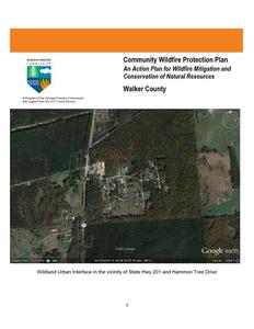
Wildland Urban Interface in the vicinity of State Hwy 201 and Hammon Tree Drive 1
The following report is a collaborative effort between various entities. The representatives listed below comprise the core decision-making team responsible for this report and mutually agree on the plan's contents.
County Representative(s):
Name Address Phone Number Signature
Bebe Heiskell Sole Commissioner P.O. Box 445 South Duke St. Lafayette, GA 30728 706-638-1437
Local Emergency Services Representatives
Name Address Phone Number Signature
Randy Camp Walker County Fire Chief P.O. Box 130 107 Alex Drive Chickamauga, GA 30707 706-539-1255
Name Address Phone Number Signature
David Ashburn Emergency Management Director P.O. Box 445 Lafayette, GA 30728 706-375-7810, 5601
Local Georgia Forestry Commission Representative(s):
Name Address Phone Number Signature
Darryl Jackson Chief Ranger Walker County 207 Foster Blvd. Lafayette, GA 30728 706-638-5556
Name Address Phone Number Signature
Carl Melear CWPP Specialist Forest Protection P.O. Box 31 Armuchee, GA 30105 (706) 232-8988
Local USDA Forest Service Representative: Name Mike Davis Assistant Fire Management Officer
Address US Forest Service Chattahoochee-Oconee NF Gainesville, GA 30501 Phone Number 770-297-3034
Signature
2
PLAN CONTENTS
1. Objectives and Goals 2. County Background, Existing Situation, Interface Information 3. Risk Summary 4. Prioritized Mitigation Recommendations 5. Action Plan, Timetables, and Assessment Strategy 6. Wildfire Pre-Suppression Plans 7. County Base and Hazards Maps 8. Appendix
1) OBJECTIVES AND GOALS
The mission of the following report is to set clear priorities for the implementation of wildfire mitigation in Walker County. The plan includes prioritized recommendations for the appropriate types and methods of fuel reduction and structure ignitability reduction that will protect this county and its essential infrastructure. Prioritized activities to educate the public are included. It also includes a plan for wildfire suppression. Specifically, the plan includes community-centered actions that will:
Educate citizens on wildfire, its risks, and ways to protect lives and properties,
Support fire rescue and suppression entities,
Focus on collaborative decision-making and citizen participation,
Develop and implement effective mitigation strategies, and
Develop and implement effective community ordinances and codes.
This plan should become a working document that is shared by local, state, and federal agencies that will use it to accomplish common goals. It is intended to become part of the master hazard mitigation plan for the County. An agreed-upon schedule for meeting to review accomplishments, solve problems, and plan for the future should extend beyond the scope of this plan. Without this follow up this plan will have limited value.
3
2) COUNTY BACKGROUND-EXISTING SITUATION-INTERFACE INFORMATION
Walker County
Walker County, in northwest Georgia, is the state's ninetieth county and comprises 447 square miles. Its northern border is shared with Tennessee. The county was created in 1833 from Murray County and named after Major Freeman Walker, an Augusta lawyer and U.S. senator. In later years Dade (1837), Chattooga (1838), and Catoosa (1853) counties were each formed from parts of Walker County. In 1859 land from Walker was transferred to Whitfield County.
History
The area's first inhabitants were part of the late Archaic and Woodland cultures, followed by Creek and Cherokee Indians. When gold was discovered in north Georgia in 1829, bringing in thousands of fortune hunters, the newcomers, backed by federal and state authorities, used force to dispossess the Cherokees of their land. The land now making up Walker County includes parcels distributed to whites in 1832 during the Cherokee land lottery. Early white settlers, primarily farmers from Virginia and the Carolinas, came to the region for its rich agricultural land. Most of the pioneers were poor people seeking their first homesteads, although some were well off enough to be slave owners.
The county seat is LaFayette, incorporated in 1835 as Chattooga. A year later the name was
changed to honor the Marquis de Lafayette. An early courthouse may have been the Cherokee-
built former council house in Crawfish Spring (later named Chickamauga). Another courthouse,
built in 1838, burned down in 1883 and was replaced that year by a new structure. The present
courthouse was built in 1919 and added to the National Register of Historic Places in 1980. Other
incorporated towns in the county are Chickamauga, incorporated in 1891; Lookout Mountain,
incorporated in 1968; and Rossville, established in 1817 and incorporated in 1905. The towns
Lula Falls
were originally part of Indian communities: Crawfish Spring was named for Chief Crawfish, who
lived there, and Rossville was established by John Ross, who was the town's first postmaster.
Walker County was the scene of battle during several major American conflicts.
In 1778, during the Revolutionary War (1775-83), colonial troops fought
successfully against the local Chickamauga Indians, who were allied with the
British. During the War of 1812 (1812-15), the Battle of Horseshoe Bend was
fought between Upper Creeks allied with the English and Andrew Jackson, who
was supported by 500 local Cherokee troops, several thousand U.S. regulars, members of the Tennessee militia, and some Lower Creek Indians. Later in the
Walker County Courthouse
century, general sentiment in Walker County was against seceding from the Union, and its representatives to the
Georgia Secession Convention of 1861 voted against it. When the Civil War (1861-65) began, however, a large
number of county men volunteered for the Confederate army and fought heartily for the Southern cause. The Battle
of Chickamauga, the bloodiest battle of the war, was fought in Walker County in 1863, the Battle of LaFayette took
place in 1864, and numerous skirmishes occurred throughout the war. The county is rife with historical markers
denoting the movements of troops.
4
In 1850 approximately 13,100 people lived in Walker County. After the Civil War, life became so difficult that people began to leave in large numbers, many resettling west of the Mississippi River. The population did not reach 1850 levels again until 1890.
Economy and Attractions
Lee and Gordon's Mills
During the twentieth century, textiles and tourism supplemented farming as primary economic mainstays for Walker County. Today manufacturing is the largest employment sector, and one of the largest employers is Shaw Industries, the world's largest carpet manufacturer.
Perhaps the best-known attraction in the county is Lookout Mountain. Shared with Tennessee and Alabama, Lookout Mountain offers miles of scenic views, opportunities for hang gliders and spelunkers, and a variety of tourist attractions, including Rock City, where natural rock formations and caves have been supplemented with man-made attractions. Garnet Carter, the inventor of miniature golf and a cofounder of the Rock City tourist attraction, lived on Lookout Mountain. Other points of interest include the Chickamauga and Chattanooga National Military Park; John B. Gordon Hall (formerly Chattooga Academy; named for Civil War general John B. Gordon), the oldest extant brick school building in Georgia, completed in 1836; the John Ross House, a two-story log house built in 1797; and Lee and Gordon's Mills, a saw- and gristmill built in the 1830s and rebuilt just after the Civil War.
Educational institutions include Covenant College, a four-year liberal arts college (also offering a master's degree in education) affiliated with the Presbyterian Church in America and located on top of Lookout Mountain, and a campus of Georgia Northwestern Technical College, located in the Rock Spring community.
Lookout Mountain
According to the 2010 U.S. census, the population was 68,756, an increase from the 2000 population of 61,053.
The above material is courtesy of the New Georgia Encyclopedia
5
Fire History and Existing Situation
Wildland fire activity in Walker County has been consistent during past years. Reported wildland fire is low in comparison to most counties in Georgia. This is due to rapid initial attack on most ignitions and excellent interagency cooperation. Examination of Georgia Forestry Commission records shows that incendiarism, machine use, and debris escapes, remains the leading causes for the past 5 years. Thus far in FY 2013, which began on July 1, 2012, there have been 15 responses by the Georgia Forestry Commission. Causes range across most cause categories recognized by the Georgia Forestry Commission.
Fiscal Year
2012 2011 2010 2009 2008
Number of Fires
27 65 29 45 26
Acres
98.70 421.03 167.12 91.24 137.10
Average Size
3.66 6.48 5.76 2.03 5.27
Statewide Average Size
4.98 16.16 3.56 3.90 4.56
The following map outlines fire occurrence for the period above. There is also a map of historical fire occurrence in the appendix. This map represents fire occurrence as documented from Georgia Forestry Commission reports during the years 1997 2002.
6
This table represents fire activity for the most complete fiscal year 2012 that began on July 1, 2011 and ended on June 30, 2012.
County = Walker
Cause
Fires
Campfire
Campfire
1
Children
Children
1
Debris: Ag Fields, Pastures, Orchards, Etc
Debris: Ag Fields, Pastures, Orchards, Etc
1
Debris: Construction Land Clearing
Debris: Construction Land Clearing
0
Debris: Escaped Prescribed Burn
Debris: Escaped Prescribed Burn
2
Debris: Household Garbage
Debris: Household Garbage
1
Debris: Other
Debris: Other
1
Debris: Residential, Leafpiles, Yard, Etc Debris: Residential, Leafpiles, Yard, Etc
5
Debris: Site Prep - Forestry Related
Debris: Site Prep - Forestry Related
0
Incendiary
Incendiary
8
Lightning
Lightning
0
Machine Use
Machine Use
4
Miscellaneous
Miscellaneous
2
Railroad
Railroad
0
Smoking
Smoking
1
Acres
0.15 0.52
4.30
0.00 3.80 1.30 0.90 29.18 0.00 28.08 0.00 24.32 3.98 0.00 2.17
Fires 5 Yr Avg
2.80
1.00
Acres 5 Yr Avg
38.16
2.05
1.00 22.83
0.60 1.40 2.60 1.00 7.40 0.20 12.40 0.60 5.00 1.80 0.40 0.20
0.64 18.82
4.57 1.43 21.41 0.26 54.97 0.51 13.80 2.21 0.95 0.43
Totals for County: Walker Year: 2012
27
98.70 38.40 183.04
7
The Wildland-Urban Interface
There are many definitions of the Wildland-Urban Interface (WUI), however from a fire management perspective it is commonly defined as an area where structures and other human development meet or intermingles with undeveloped wildland or vegetative fuels. As fire is dependent on a certain set of conditions, the National Wildfire Coordinating Group has defined the wildland-urban interface as a set of conditions that exists in or near areas of wildland fuels, regardless of ownership. This set of conditions includes type of vegetation, building construction, accessibility, lot size, topography and other factors such as weather and humidity. When these conditions are present in certain combinations, they make some communities more vulnerable to wildfire damage than others. This "set of conditions" method is perhaps the best way to define wildland-urban interface areas when planning for wildfire prevention, mitigation, and protection activities.
There are three major categories of wildland-urban interface. Depending on the set of conditions present, any of these areas may be at risk from wildfire. A wildfire risk assessment can determine the level of risk.
1. "Boundary" wildland-urban interface is characterized by areas of development where homes, especially new subdivisions, press against public and private wildlands, such as private or commercial forest land or public forests or parks. This is the classic type of wildlandurban interface, with a clearly defined boundary between the suburban fringe and the rural countryside.
2. "Intermix" wildland-urban interface areas are places where improved property and/or structures are scattered and interspersed in wildland areas. These may be isolated rural homes or an area that is just beginning to go through the transition from rural to urban land use.
3. "Island" wildland-urban interface, also called occluded interface, are areas of wildland within predominately urban or suburban areas. As cities or subdivisions grow, islands of undeveloped land may remain, creating remnant forests. Sometimes these remnants exist as parks, or as land that cannot be developed due to site limitations, such as wetlands. (courtesy Fire Ecology and Wildfire Mitigation in Florida 2004)
8
Wildland Urban Interface Hazards Firefighters in the wildland urban interface may encounter hazards other than the fire itself, such as hazardous materials, utility lines and poor access.
Hazardous Materials Common chemicals used around the home may be a direct hazard to firefighters from flammability, explosion potential and/or vapors or off-gassing. Such chemicals include paint, varnish and other flammable liquids; fertilizer; pesticides; cleansers; aerosol cans, fireworks, batteries and ammunition. In addition, some common household products such as plastics may give off very toxic fumes when they burn. Stay OUT of the smoke from burning structures and any unknown sources such as trash piles.
Illicit Activities Marijuana plantations or drug production labs may be found in wildland urban interface areas. Extremely hazardous materials such as propane tanks and flammable/toxic chemicals may be encountered, as well as booby traps.
Propane tanks Both large (household size) and small (gas grill size) liquefied propane gas (LPG) tanks can present hazards to firefighters, including explosion. See the "LPG Tank Hazards" discussion for details.
Utility lines Utility lines may be located above and below ground and may be cut or damaged by tools or equipment. Don't spray water on utility lines or boxes.
Septic tanks and fields Below-ground structures may not be readily apparent and may not support the weight of engines or other apparatus.
9
New construction materials Many new construction materials have comparatively low melting points and may "off-gas" extremely hazardous vapors. Plastic decking materials that resemble wood are becoming more common and may begin softening and losing structural strength at 180 F, though they normally do not sustain combustion once direct flame is removed. However, if they continue to burn they exhibit the characteristics of flammable liquids.
Pets and livestock Pets and livestock may be left when residents evacuate and will likely be highly stressed, making them more inclined to bite and kick. Firefighters should not put themselves at risk to rescue pets or livestock.
Evacuation occurring Firefighters may be taking structural protection actions while evacuations of residents are occurring. Be very cautious of people driving erratically. Distraught residents may refuse to leave their property, and firefighters may need to disengage from fighting fire to contact law enforcement officers for assistance. In most jurisdictions firefighters do not have the authority to force evacuations. Firefighters should not put themselves at risk trying to protect someone who will not evacuate!
Limited access Narrow one-lane roads with no turn-around room, inadequate or poorly maintained bridges and culverts are frequently found in wildland urban interface areas. Access should be sized-up and an evacuation plan for all emergency personnel should be developed.
10
11
3) Risk Summary
Following a meeting between the Georgia Forestry Commission and Walker County Fire and Rescue department personnel on January 26, 2011 assessments of communities at risk from wildland fire was undertaken. This assessment process was based on information provided by the Georgia Forestry Commission from the Southern Fire Risk Assessment supplemented by local knowledge of high risk areas. Communities were assessed using the Georgia Forestry Commissions Form 140 for Woodland Community Wildfire Hazard Assessment. This form determines risk based on four criteria subdivision design, site hazard, building construction, and additional factors. Communities are assigned a risk category based on a numerical score. Communities are designated as being at extreme, high, moderate, or low risk. Assessments were declared complete on January 15, 2013. Thirteen (13) areas were assessed. Two areas were found to be at extreme risk and eleven were classed as being at moderate risk. Results from this assessment process are summarized in a spreadsheet entitled `Risk Summary Walker County' which is included in the appendix. This document contains summary information from the assessment forms. The map numbers listed on the spreadsheet correspond to the numbers on the Wildland Fire Susceptibility Map and show the locations of the assessment areas. Opportunities for community assessment still are available in the County.
12
4) Prioritized Mitigation Recommendations
The following recommendations were developed by collaboration between the Georgia Forestry Commission and various County Fire and Emergency Services. A priority order was determined based on which mitigation projects would best reduce the hazard of wildfire in the assessment area. It is noted that as incendiary fire remains one of the leading causes in the county, all fires that
are determined to be caused by arson should be investigated as standard practice.
Community Hazard and Structural Ignitability Reduction Wildland Fuel Reduction or Modification Improvements to Capabilities of Wildland Response Agencies Public Education Regarding Risk of Wildland Fire Proposed Community and Structural Ignitability Reduction Priorities: 1. Locate lack of and improve defensible space around structures in communities at risk 2. Identify access problems that affect initial attack in communities at risk 3. Identify structural ignitability concerns in communities at risk 4. Identify and resolve problems with codes, covenants, or ordinances that negatively
influence structural ignitability Proposed Wildland Fuel Reduction or Modification Priorities: 1. Reduction or modification of wildland fuel in proximity to communities at risk 2. Reduction or modification of fuel concentrations in shared spaces inside communities at
risk Proposed Improvements to capabilities of Wildland Response agencies: 1. Identify needs and improve training and qualification of wildland response agencies 2. Identify needs and recommend equipment acquisitions for wildland response agencies Proposed Education and Outreach Priorities: 1. Improve public knowledge in communities at risk and in the general population of the
County regarding Firewise principles. 2. Notification of communities at risk regarding wildland fire hazard 3. Improvements to public notification during periods of high to extreme fire danger.
13
5) Action Plan, Timetables, and Assessment Strategy
POTENTIAL FUNDING SOURCES:
As funding is questionable in these times of tight government budgets and economic uncertainty, unconventional means should be identified whereby the need for funding can be reduced or eliminated. Publications / Brochures FIREWISE materials are available at www.firewise.org. Another source of mitigation information can be found at www.nfpa.org. Access to reduced cost or free of charge copy services should be sought whereby publications can be reproduced. Free of charge public meeting areas should be identified where communities could gather to be educated regarding prevention and firewise principles.
Mitigation Community Protection Grant: o USFS sponsored prescribed burn program. Communities with at risk properties that lie within 10 miles
of the USFS border may apply with the GFC to have their forest land prescribed burned free of charge. FEMA Mitigation Policy MRR-2-08-01: through GEMA - Hazard Mitigation Grant Program (HMGP) and
Pre Disaster Mitigation (PDM) o To provide technical and financial assistance to local governments to assist in the implementation of
long term cost effective hazard mitigation measures. o This policy addresses wildfire mitigation for the purpose of reducing the threat to all-risk structures
through creating defensible space, structural protection through the application of ignition resistant construction, and limited hazardous fuels reduction to protect life and property. o With a complete and registered plan (addendum to the State plan) counties can apply for premitigation funding. They will also be eligible for HMGP if the county is declared under a wildfire disaster. GFC - Plowing and burning assistance can be provided through the Georgia Forestry Commission as a low cost option for mitigation efforts.
Individual Homeowners In most cases of structural protection ultimately falls on the responsibility of the community and the
homeowner. They will bear the cost; yet they will reap the benefit from properly implemented mitigation efforts. GEMA Grant - PDM (See above)
Ultimately it is our goal to help the communities by identifying the communities threatened with a high risk to wildfire and educate those communities on methods to implement on reducing those risks.
14
5) Action Plan
Steps to implement Community Hazard and Structural Ignitability Priorities
Hazard Lack of Defensible Space
Access problems
Structural Ignitability
Codes and Ordinances
Specific Action and Responsible Party Using the risk summaries referenced in section 3, each department should conduct inspections of communities at risk in their jurisdiction or area of response for lack of defensible space. Findings will be conveyed to residents and treatment methods will be recommended in accordance with Firewise principles. This would probably be best accomplished by approaching homeowners associations or organizations. Ultimately, the message should reach individual homeowners in each community. Should local organizations not exist, the builder or developer could be contacted. Such contacts would also influence future projects or developments Using individual Communities at Risk maps for each station, the Georgia Forestry Commission and Walker County Fire officials should visit all identified communities at risk for the purpose of locating and resolving access difficulties. This inspection should extend into the wildland adjacent to the communities at risk looking for hindrances to suppression tactics Walker County Fire officials should examine structures for structural ignitability concerns at the time when the communities at risk are inspected for lack of defensible space. Using firewise guidelines for reducing structural ignitability, (a checklist could be formulated and used) structures should be assessed and findings conveyed to residents. This could be through use of media or by direct contact with residents or homeowners associations. Walker County and municipal Fire Marshalls should closely examine all codes and ordinances for gaps and oversights which could cause problems in the wildland fire arena. Examples include proximity of propane tanks to structures, accumulations of debris, lack of proper identification pertaining address or street names, set back distances from wildland fuels, road widths in new developments.
In regard to priority, the above steps should first extend to the higher numbers in the extreme category from the risk summary as these communities are at a higher degree of risk.
15
5) Action Plan
Steps to implement Fuel Reduction or Modification Priorities
Hazard Hazardous Wildland Fuel Accumulations
Fuel Continuity between Wildland and Woodland Communities
Hazardous Fuel Accumulations in communities and hindrances to suppression
Specific Action and Responsible Party The Georgia Forestry Commission will prioritize prescribed burning projects adjacent to Communities at risk where burning is determined to be appropriate. Due to the nature of smaller sizes holdings extensive development, burn projects may have to be small scale and carefully managed. In areas where the need exists and fuel reduction by burning is determined to be inappropriate, permanent or semi-permanent fuel breaks could be established. These breaks should be maintained annually prior to the arrival of prime burning times. Their locations should be mapped and made known to local, state, and federal response personnel. Residents of the Communities adjacent to these breaks should be advised of their purpose and their cooperation in protecting them should be gained. These breaks could be installed by the Georgia Forestry Commission. Using the risk summary in section 3, Fire departments could conduct community clean up days in communities at risk in their respective jurisdictions aimed at reducing hazardous fuels and hindrances to suppression in shared community space. Residents would be provided with guidance and access to disposal alternatives for materials removed.
Steps to implement improvements to wildland response capability
Improvement needed Improve training and qualification of Walker County Wildland firefighters
Improve or acquire wildland fire fighting equipment
Responsible Party and specific action
Chief Ranger Jackson and Walker County Fire Chief Camp should examine all training records for personnel under their supervision. All personnel assigned or anticipated to be assigned wildland response responsibilities should be certified Georgia Basic Wildland Firefighter or higher in qualification. Additional training and qualification should be sought for personnel identified in the Walker County Fire plan who are assigned specific Incident Command System (ICS) functions. Sources for available funds for training should be sought at local, state, and federal levels. All stations for Walker County Fire Departments should inventory their present equipment relating to their wildland capability. Funding sources should be investigated from available grants or other sources. Needs for job specific wildland responses should be examined by Chief Ranger Jackson and Fire Chief Camp.
16
5) Action Plan
Steps to educate or inform the Public regarding wildland fire prevention and
responsibilities
Opportunity
Responsible Party and Specific Action
Improve Public Education through direct contact
Prior to the onset of fire season(s) rangers of the Georgia Forestry Commission and Walker County Fire personnel should conduct firewise meetings in conjunction with normally scheduled fire department meetings. People living in or near high risk communities should be invited to these meetings by use of door to door campaigns or by mailbox flyers. Notices regarding these meetings could be placed in local post offices or stores near communities at risk. A Firewise display should be acquired and utilized at this meeting. This display would be retained by the Walker unit of the Georgia Forestry Commission and used for all firewise meetings in those Counties. Local news media should be invited to these meetings. Goals for potential Firewise certified communities in Walker County could be considered after these meetings are completed.
Improve Public Education through use of media
Prior to the onset of fire season(s) or during periods of particularly high fire danger use of the media should be stepped up by personnel of the Georgia Forestry Commission. This should include use of all available media in the County. PSA's should be run weekly during periods of high to extreme fire danger. Signs or poster boards could be developed for display in pubic spaces near communities at risk advising residents that they live in areas that are susceptible to wildland fire and directing them to sources of information regarding wildland fire and their role in improving their own personal safety. Signs directing residents to the firewise website could be effective. Firewise materials could be provided to the County building permit office.
17
5) Action Plan
Steps to educate or inform the Public regarding wildland fire prevention and responsibilities
Improve Public Education through formal certification
Before the end of calendar year 2013 the Georgia Forestry Commission and Walker County Fire should obtain Firewise certification for Canyon Ridge Community. Should this goal not be realistic, another community from the risk summary should be selected for certification.
18
5) Action Plan
Timetables for Actions- This timetable is a suggestion and is dependent upon other priorities and available manpower.
Steps to implement Community Hazard and Structural Ignitability Priorities
Steps to examine communities at risk for defensible space and structural ignitability should take place during the spring of 2013
Pre-planning to examine access and suppression problems should take place at any time during the current burning season.
Codes and Ordinances should be examined as soon as possible in order for the legal workings of changes to take place.
Steps to implement Fuel Reduction or Modification Priorities
Any identified prescribed burn projects should take place in late winter 2013 - 2014. Any other priority burn projects or installation of pre suppression fuel breaks should take place during this same window.
Steps to reduce fuels in communities at risk should coincide with steps to improve defensible space and reduce structural ignitability. Timing of these actions would be dependent upon Fire station availabity during the late winter of 2013 2014.
Steps to implement improvements to wildland response capability
Cooperation between state and local wildland suppression forces regarding improvements to training and equipment should begin immediately.
Steps to educate or inform the Public regarding wildland fire prevention and responsibilities
Direct contact with residents in Communities at risk should take place as soon as possible during early calendar year 2013
The use of media should coincide with the above action. Certification of Firewise communities should follow the timetable associated with the action
plan
19
5) Action Plan
Assessment of Actions
Reduction of Community hazard and structural ignitability
Direct measurement of the number of communities assessed would be the appropriate measure of success
Any meetings that result in cooperation between wildland departments should be logged along with minutes of those meetings. Goals should be set and reviewed after each meeting.
Any changes to or additions to codes and ordinances would be an obvious measure of success.
Steps to implement Fuel Reduction or Modification Priorities
Acres burned would be the appropriate measure for fuel reduction. A direct measure of linear feet of firebreaks would be an appropriate measure for pre suppression breaks.
Fuel reduction in communities at risk would be measured by the number of communities affected and number of projects completed.
Steps to implement improvements to wildland response capability
A direct measure of the number of capabilities or qualifications gained would be the appropriate measure of success.
Any equipment acquired or any equipment brought up to national standards would be the appropriate measure of success.
Steps to educate or inform the Public regarding wildland fire prevention and responsibilities
Direct measurement of the number of persons contacted, literature distributed, public notices posted, and news articles published, radio programs aired, etc. would be the best measure of success. The number of communities that achieve Firewise status would be an obvious measure of success.
6) Wildfire Pre-Suppression Plans
The 2010 update of the Georgia Forestry Commission Walker County Fire plan is included in the appendix of this plan.
20
7) County Base and Hazards Maps
Maps of the Wildland Fire Susceptibility, Surface Fuels, Aspect, and Fire Occurrence areas are included in the appendix of this plan. The Fire Occurrence,Aspect, and Surface Fuels maps contain minimum feature information to preserve continuity of what they represent. The Surface fuel map could be used to help predict spread rates from point ignitions by identifying fuels fire would move into should they escape initial attack. The Aspect map would help in identifying where fuels could be excessively dry during periods of drought and require need for extended mop up. These maps are in PDF format and are available from the Georgia Forestry Commission. When viewed in this electronic format increased magnification and resolution capabilities are realized which will make these maps more useful. File sharing is also facilitated.
8) Appendix
Risk Summary table County maps of Wildland Fire Susceptibility, surface fuels, aspect, and fire occurrence areas Walker County Pre-Suppression plan.
P. O. Box 819 Macon, GA 31202 1-800-GA-TREES GaTrees.org
The Georgia Forestry Commission provides leadership, service, and education in the protection and conservation of Georgia's forest resources. An Equal Opportunity Employer and Service Provider
21