- Collection:
- Georgia Government Publications
- Title:
- Community wildfire protection plan, Burke County, Georgia: an action plan for wildfire mitigation and conservation of natural resources
- Creator:
- Fell, Will
- Contributor to Resource:
- Georgia. Forestry Commission
- Publisher:
- Macon, Ga. : Georgia. Forestry Commission
- Date of Original:
- 2013
- Subject:
- Wildfires--Georgia--Burke County--Prevention and control
Fire management--Georgia--Burke County
Chorochromatic maps - Location:
- United States, Georgia, 32.75042, -83.50018
United States, Georgia, Burke County, 33.06115, -82.00078 - Medium:
- plans (reports)
- Type:
- Text
- Format:
- application/pdf
- External Identifiers:
- OCLC 1164712666
NZ MMS ID 9922026354302931
Call Number F600 .M1 2013 W5 B87 - Metadata URL:
- https://dlg.galileo.usg.edu/id:dlg_ggpd_s-ga-bf600-b-pm1-b2013-bw5-bb87-belec-p-btext
- Digital Object URL:
- https://dlg.galileo.usg.edu/do:dlg_ggpd_s-ga-bf600-b-pm1-b2013-bw5-bb87-belec-p-btext
- Language:
- eng
- Holding Institution:
- University of Georgia. Map and Government Information Library
- Rights:
-

__________________________
A Program of the Georgia Forestry Commission with support from the U.S. Forest Service
+
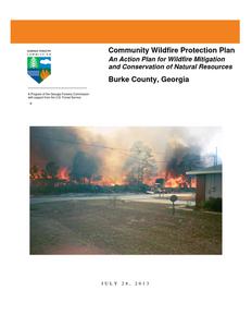
Community Wildfire Protection Plan
An Action Plan for Wildfire Mitigation and Conservation of Natural Resources
Burke County, Georgia
JULY 28, 2013
Prepared by; George Glenn, Chief Ranger Burke County Will Fell CWPP Specialist Georgia Forestry Commission 1508 US Hwy 25 South Waynesboro GA 30830
The following report is a collaborative effort among various entities; the representatives listed below comprise the core decision-making team responsible for this report and mutually agree on the plan's contents:
Rusty Sanders Chief Burke County Fire/Rescue and EMA Director (706) 554-6651 rsanders@burkecounty-ga.gov
Merv Waldrop Burke County Administrator (706) 554-2324 Wmerv.waldrop@burkecounty-ga.gov
Robert Parrish Deputy Chief Burke County Fire/Rescue (706) 554-8037 rhparrish@bellsouth.net
George Glenn Chief Ranger Burke County Georgia Forestry Commission (706) 554-2310 gglenn@gfc.state.ga.us
PLAN CONTENTS
Preface....................................................................................................4 I. Objectives ............................................................................................................................. 5 II. Community Collaboration .................................................................................................... 5 III. Community Background and Existing Situation ................................................................... 6 IV. Community Base Map .......................................................................................................... 8 V. Community Wildfire Risk Assessment ................................................................................. 9 VI. Community Hazards Map ................................................................................................... 15 VII. Prioritized Mitigation Recommendations ........................................................................... 18 VIII. Action Plan .......................................................................................................................... 23 IX. Appended Documents..................................................................................27
Burke County Wildfire Pre-suppression Plan NFPA 1141 Standard for Fire Protection Infrastructure for Land Development in Suburban and Rural Areas.
Preface
The extreme weather conditions that are conducive to wildfire disasters (usually a combination of extended drought, low relative humidity and high winds) can occur in this area of Georgia as infrequently as every 10-15 years. This is not a regular event, but as the number of homes that have been built in or adjacent to forested or wildland areas increases, it can turn a wildfire under these weather conditions into a major disaster. Wildfires move fast and can quickly overwhelm the resources of even the best equipped fire department. Advance planning can save lives, homes and businesses.
This Community Wildfire Protection Plan (CWPP) includes a locally assessed evaluation of the wildland urban interface areas of the county, looking at the critical issues regarding access to these areas, risk to properties from general issues such as building characteristics and "fire wise" practices and response from local fire fighting resources. It further incorporates a locally devised action plan to mitigate these risks and hazards though planning, education and other avenues that may become available to address the increasing threat of wildland fire. The CWPP does not obligate the county financially in any way, but instead lays a foundation for improved emergency response if and when grant funding is available to the county.
The Plan is provided at no cost to the county and can be very important for county applications for hazard mitigation grant funds through the National Fire Plan, FEMA mitigation grants and Homeland Security. Under the Healthy Forest Restoration Act (HFRA) of 2003, communities (counties) that seek grants form the federal government for hazardous fuels reduction work are required to prepare a Community Wildfire Protection Plan.
This plan will:
Enhance public safety Raise public awareness of wildfire hazards and risks Educate homeowners on how to reduce home ignitability Build and improve collaboration at multiple levels
The public does not have to fall victim to this type of disaster. Homes (and communities) can be designed, built and maintained to withstand a wildfire even in the absence of fire equipment and firefighters on the scene. It takes planning and commitment at the local level before the wildfire disaster occurs and that is what the Community Wildfire Protection Plan is all about.
WILDFIRE PROTECTION PLAN: AN ACTION PLAN FOR WILDFIRE MITIGATION
I. OBJECTIVES
The mission of the following report is to set clear priorities for the implementation of wildfire mitigation in Burke County. The plan includes prioritized recommendations for the appropriate types and methods of fuel reduction and structure ignitability reduction that will protect this community and its essential infrastructure. It also includes a plan for wildfire suppression. Specifically, the plan includes community-centered actions that will:
Educate citizens on wildfire, its risks, and ways to protect lives and properties, Support fire rescue and suppression entities, Focus on collaborative decision-making and citizen participation, Develop and implement effective mitigation strategies, and Develop and implement effective community ordinances and codes.
II. COMMUNITY COLLABORATION
The core team convened on Mar 5th, 2010 to assess risks and develop the Community Wildfire Protection Plan. The group is comprised of representatives from local government, local fire authorities, and the state agency responsible for forest management. Below are the groups included in the task force:
Burke County Government
Burke County Fire/Rescue Department Emergency Management Board of County Commissioners
Georgia Forestry Commission
It was decided to conduct community assessments on the basis selected communities in the county. The core team in Burke County assessed their districts and reconvened on April 30th,
2013 for the purpose of completing the following:
Risk Assessment
Assessed wildfire hazard risks and prioritized mitigation actions.
Fuels Reduction
Identified strategies for coordinating fuels treatment projects.
Structure Ignitability
Identified strategies for reducing the ignitability of structures within the Wildland interface.
Emergency Management Forged relationships among local government and fire districts and developed/refined a pre-suppression plan.
Education and Outreach Developed strategies for increasing citizen awareness and action and to conduct homeowner and community leader workshops.
Page 5
WILDFIRE PROTECTION PLAN: AN ACTION PLAN FOR WILDFIRE MITIGATION
III. COMMUNITY BACKGROUND AND EXISTING SITUATION
Burke County, whose eastern edge shares the border with South Carolina along the Savannah River, is one of Georgia's eight original counties. When the colony was established in 1732, the area now known as Burke County was called the Halifax District. In 1758 Georgia was divided into parishes, and the Halifax District became the parish of St. George. The county currently encompasses an area of 831 square miles after portions of it were incorporated into Screven (1793), Jefferson (1796), Richmond (1841), and Jenkins (1905) counties.
The original inhabitants of the area were Creek, Cherokee, and Catawba Indians, who lost their land when members of their leadership, often not speaking for all of them, signed treaties in 1733, 1736, and 1758 with the English. The first white settlers were "headright settlers," or those who acquired land via a system that granted parcels to the heads of families, with more land going to larger families. Almost all of the first landowners came from the older American colonies, especially after Georgia lifted its ban on slavery in 1751. The majority were farmers with small- and medium-sized operations who were attracted by the Savannah and Ogeechee rivers, which offered transportation and water for their livestock. A few other settlers came from parishes to the south, and some (mostly Scots-Irish Protestants) arrived from across the Atlantic.
In 1777 St. George Parish became one of Georgia's first counties, named for political philosopher and member of British Parliament Edmund Burke, who advocated appeasement of American colonial grievances. Many residents of Burke County remained loyal to the king, and ensuing conflicts during the Revolutionary War (1775-83) led to major property damage. Two military engagements in 1779 between the king's troops and the revolutionaries were notable: a skirmish at the Burke County Jail in January, during which the colonists defeated 400 British troops; and a British victory at the Battle of Brier (later Briar) Creek.
Waynesboro, laid out in 1783 and incorporated in 1812, is the county seat. It was named for General Anthony "Mad Anthony" Wayne. The current courthouse, built in 1857 and expanded in 1899, is one of the state's oldest brick buildings still in use. Other incorporated towns are Girard, Keysville, Midville, and Sardis.
By the end of the eighteenth century, the accrual of larger tracts of land by planters and the employment of slave labor resulted in a plantation system that replaced the county's small-farm economy, and Burke County became a prime cotton-producing area. However, many plantations did not survive the Civil War (1861-65), and the economy, still dependent on the production of cotton, moved to a system of small farms using tenant labor. Later these workers were forced to look for work in cities after being replaced by mechanized cotton pickers and row cultivators.
Former notable residents of the county include Lyman Hall, one of three Georgians who signed the Declaration of Independence and governor from 1783 to 1784; Edward Telfair, governor from 1786 to 1787; naturalist and illustrator John Abbot, who wrote The Natural History of the Rarer Lepidopterous Insects of Georgia (1797); nineteenth-century politician Herschel Johnson; and nineteenth-century historian Charles C. Jones Jr.
Page 6
WILDFIRE PROTECTION PLAN: AN ACTION PLAN FOR WILDFIRE MITIGATION
Places of interest include Bark Camp Church and Bellevue Plantation. Bark Camp Church was organized in 1788 as part of Bark Camp, which was established before the Revolution as a settlement camp for new migrants to the area. Bellevue Plantation, originally a grant to Samuel Eastlake by King George III in 1767, was damaged during Union general William T. Sherman's march to the sea nearly a century later. Both Confederate and Union soldiers were buried on the property after a skirmish there.
Augusta Technical College operates a satellite campus in Waynesboro.
According to the 2010 U.S. census, the population of Burke County is 23,316, an increase from the 2000 population of 22,243.
Courtesy Elizabeth C Cooksey, New Georgia Encyclopedia
Existing Situation
Burke County located in east central Georgia, despite its' large agricultural presence, is still over 62% forested. Perhaps with the exception of the large blocks of woodlands adjacent the Savannah River in northern Burke County, there are homes and communities scattered throughout the county. The risks and hazards from the wildland urban interface are fairly general and substantial throughout the county even on the edges of the incorporated cities.
Burke County is protected by organized fire departments within the cities of Waynesboro, along with 12 well spaced fire stations staffed 24/7 under the jurisdiction of the Burke County Fire and Rescue.. The Georgia Forestry Commission maintains a county protection unit located about three miles south of Waynesboro on US Hwy 25 to respond to wildfires throughout the county. The cities of Waynesboro, Midville, Girard and Sardis are serviced by pressurized water systems with hydrants available.
Over the past fifty six years, Burke County has averaged 106 reported wildland fires per year, burning an average of 1089 acres per years. Using more recent figures over the past 20 years, this number has declined significantly to an average of 74 fires per year burning 694 acres annually. The occurrence of these fires during this period shows a pronounced peak during the months of January, February, March and April. There is a significant decrease during the remainder of the year, particularly during the summer months.
Over the past 20 years, the leading causes of these fires, was debris burning causing 49% of the fires and 37% of the acres burned. Over the past six years records show that over 19% of the debris fires originated from residential burning.
Georgia Forestry Commission Wildfire Records show that in the past ten years, 40 homes have been lost or damaged by wildfire in Burke County resulting in estimated losses of $457,000 along with 12 outbuildings valued at $74,100. According to reports during this period 232 homes have been directly or indirectly threatened by these fires. This is a substantial loss of non timber property attributed to wildfires in Burke County.
Page 7
WILDFIRE PROTECTION PLAN: AN ACTION PLAN FOR WILDFIRE MITIGATION
IV. COMMUNITY BASE MAP
Page 8
WILDFIRE PROTECTION PLAN: AN ACTION PLAN FOR WILDFIRE MITIGATION
V. COMMUNITY WILDFIRE RISK ASSESSMENT
The Wildland-Urban Interface
There are many definitions of the Wildland-Urban Interface (WUI), however from a fire management perspective it is commonly defined as an area where structures and other human development meet or intermingles with undeveloped wildland or vegetative fuels. As fire is dependent on a certain set of conditions, the National Wildfire Coordinating Group has defined the wildland-urban interface as a set of conditions that exists in or near areas of wildland fuels, regardless of ownership. This set of conditions includes type of vegetation, building construction, accessibility, lot size, topography and other factors such as weather and humidity. When these conditions are present in certain combinations, they make some communities more vulnerable to wildfire damage than others. This "set of conditions" method is perhaps the best way to define wildland-urban interface areas when planning for wildfire prevention, mitigation, and protection activities.
There are three major categories of wildland-urban interface. Depending on the set of conditions present, any of these areas may be at risk from wildfire. A wildfire risk assessment can determine the level of risk.
1. "Boundary" wildland-urban interface is characterized by areas of development where homes, especially new subdivisions, press against public and private wildlands, such as private or commercial forest land or public forests or parks. This is the classic type of wildland-urban interface, with a clearly defined boundary between the suburban fringe and the rural countryside.
2. "Intermix" wildland-urban interface areas are places where improved property and/or structures are scattered and interspersed in wildland areas. These may be isolated rural homes or an area that is just beginning to go through the transition from rural to urban land use.
3. "Island" wildland-urban interface, also called occluded interface, are areas of wildland within predominately urban or suburban areas. As cities or subdivisions grow, islands of undeveloped land may remain, creating remnant forests. Sometimes these remnants exist as parks, or as land that cannot be developed due to site limitations, such as wetlands. (courtesy Fire Ecology and Wildfire Mitigation in Florida 2004)
Page 9
WILDFIRE PROTECTION PLAN: AN ACTION PLAN FOR WILDFIRE MITIGATION
Wildland Urban Interface Hazards
Firefighters in the wildland urban interface may encounter hazards other than the fire itself, such as hazardous materials, utility lines and poor access.
Hazardous Materials
Common chemicals used around the home may be a direct hazard to firefighters from a flammability, explosion potential and/or vapors or off gassing. Such chemicals include paint, varnish and other flammable liquids, fertilizer, pesticides, cleansers, aerosol cans, fireworks, batteries and ammunition. In addition, some common household products such as plastics may give off very toxic fumes when they burn. Stay out of smoke form burning structures and any unknown sources such as trash piles.
Illicit Activities
Marijuana plantations or drug production labs may be found in the wildland urban interface areas. Extremely hazardous materials such as propane tanks and flammable/toxic chemicals may be encountered.
Propane Tanks
Both large (household size) and small (gas grill size) liquefied propane gas (LPG) tanks can present hazards to firefighters, including explosion. See the "LPG Tank Hazards" discussion for details
Utility Lines
Utility Lines may be located above and below ground and may be cut or damaged by tools or equipment. Don't spray water on utility lines or boxes.
Septic Tanks and Fields
Below ground structures may not be readily apparent and may not support the weight of engines or other equipment.
New Construction Materials
Many new construction materials have comparatively low melting points and may "offgas" extremely hazardous vapors. Plastic decking materials that resemble wood are becoming more common and may begin softening and losing structural strength at 180 degrees F, though they normally do not sustain combustion once direct flame is removed. However if the continue to burn they exhibit the characteristics of flammable liquids.
Page 10
WILDFIRE PROTECTION PLAN: AN ACTION PLAN FOR WILDFIRE MITIGATION
Pets and Livestock Pets and livestock may be left when residents evacuate and will likely be highly stressed making them more inclined to bite and kick. Firefighters should not put themselves at risk to rescue pets or livestock.
Evacuation Occurring Firefighters may be taking structural protect actions while evacuations of residents are occurring. Be very cautious of people driving erratically. Distraught residents may refuse to leave their property and firefighters may need to disengage from fighting fire to contact law enforcement officers for assistance. In most jurisdictions firefighters do not have the authority to force evacuations. Firefighters should not put themselves at risk trying to protect someone who will not evacuate!
Limited Access Narrow one-lane roads with no turn around room, inadequate or poorly maintained bridges and culverts are frequently found in wildland urban interface areas. Access should be sized up and an evacuation plan for all emergency personnel should be developed.
Page 11
WILDFIRE PROTECTION PLAN: AN ACTION PLAN FOR WILDFIRE MITIGATION
The wildland fire risk assessments were conducted in 2013 by the Burke County CWPP assessment team. The risk assessment instrument used was the Hazard and Wildfire Risk Assessment Checklist which was developed looking at six areas of concern;
(1) Community Access looks at the number of entrances to the community, road width and condition, dead end roads, turn around areas along with road signs and address visibility. (2) Surrounding Vegetation looks at the wildland fuels adjacent to and its closeness to structures. (3) Building Construction looks at the flammability of roofing and siding materials and skirting or underpinning of structures. (4) Fire Protection looks at the distance from staffed departments and the availability of supplemental water sources from pressurized hydrants, dry hydrants and drafting places. (5) Utilities looks at hazards to fire suppression equipment, both engines and forestry plow units from electrical service lines, propane tanks and unmarked septic tanks. (6) Additional Factors consider large adjacent areas of wildlands, canal or ditch presence, closeness of structures, presence of undeveloped unmaintained lots, wildfire history in the area and the availability of homeowner associations to remediate issues.
The following factors contributed to the wildfire hazard scores for Burke County: Narrow roads without drivable shoulders Unstable sandy roads in sections of the county, particularly during drought conditions. Slick red clay roads during rainy weather. Inadequate driveway access Minimal defensible space around structures Homes with wooden siding Unmarked septic tanks in yards Lack of pressurized or non-pressurized water systems available Large, adjacent areas of forest or wildlands Heavy fuel buildup in adjacent wildlands Lack of prescribed burning in many areas of the county Undeveloped lots comprising half the total lots in many rural communities. High occurrence of wildfires in the several locations Lack of homeowner or community organizations
Page 12
WILDFIRE PROTECTION PLAN: AN ACTION PLAN FOR WILDFIRE MITIGATION
Summary of Burke County Assessments
Area/Community
Timberwood
Ridge Point
Deerwood
Northlake
Big Bend Thankful Church Rd
Harris Village
Clarke Place Rd Clarke Place Estates West
Lake Crystal Rd
Duckhead Rd Shawville at Geo. Perkins Rd Shawville at Story Mill Rd
Farmers Bridge Cir Pine Needles off Farmers Bridge
Keysville
Community Access
15 7
12 15 10
Surrounding Vegetation
20 15 15 15 15
Bldg Construction
10 0
10 0
10
Fire Protection
0 13 13 11 13
Utilities 3 3 6 4 6
Add. Factors
20 10 15 10 20
Score 65 48 71 55 74
Hazard Rating Moderate Low Moderate Moderate Moderate
12
15
5
20
2
20
5
25
7
30
94 High
10
25
8
24
92 High
10
25
5
15
77 High
9
10
9
30
10
45
0
13
3
10
45 Low
20
25
9
22 114 Very High
20
25
9
30 139 Extreme
6
20
0
13
5
30
74 Moderate
13
20
5
20
0
20
9
30
92 High
0
25
5
20
75 High
7
35
4
20
5
25
5
23
99 High
0
25
7
15
71 Moderate
Page 13
WILDFIRE PROTECTION PLAN: AN ACTION PLAN FOR WILDFIRE MITIGATION
Southern Fire Risk Assessment System Maps.
The attached maps were generated from a computerized Geographical Information System (GIS) program developed by the Sanborn Company under contract from the Southern Group of State Foresters to model the various risks to life and property within the southeastern US. The program is known as the Southern Fire Risk Assessment System ( SFRAS). It utilizes multiple layers of data developed cooperatively from the various states and the US Forest Service under the Southern Wildfire Risk Assessment (SWRA)
Wildland Urban Interface maps are developed using data from the SILVIS Lab at the University of Wisconsin at Madison. WUI is composed of both interface and intermix communities. In both interface and intermix communities, housing must meet or exceed a minimum density of one structure per 40 acres. Intermix communities are places where housing and vegetation intermingle. In intermix, wildland vegetation is continuous, more than 50 percent vegetation, in areas with more than one house per 40 acres. Interface communities are areas with housing in the vicinity of continuous vegetation. Interface areas have more than one house per 40 acres, have less than 50 percent vegetation, and are within 1.5 miles of an area (made up of one or more contiguous Census blocks) over 1,325 acres that is more than 75 percent vegetated. The minimum size limit ensures that areas surrounding small urban parks are not classified as interface WUI.
Fire Response Accessibility Index is a relative measure of how long it would take initial attack resources to drive from their station to various areas of the county. This index is derived from assigning average speeds to the various road classes in the county. For the purpose of this analysis the following speeds were assigned: 55 mph for level 1 roads, primarily interstates and four lane open highways, 50 mph for level 2 roads, primarily state and federal highways, 40 mph for level 3 roads, primarily paved two lanes collector roads and 25 mph for level 4 roads, mainly city streets and rural roads, paved and unpaved. For areas away from roads a travel speed of 3 mph is assigned as it is assumed travel will be by foot or extremely slow moving equipment.
Fire Occurrence Areas maps use data from wildfire reports over the period from 1997-2002. The fire occurrence rates mapped are the probability of the number of fires occurring per 1000 acres per year base on this historic information.
Wildland Fire Susceptibility maps show an index value between 0 and 1 and are developed by a mathematical calculation process for determining the probability of an acre burning and the expected final fire size. Many layers of data are used in developing this calculation including historic fire data, wildland fuels and rate of spread, canopy attributes (closure, height and density), weather influences, topography, soils and fire suppression effectiveness.
Level of Concern maps are a complex calculation using the Wildland Fire Susceptibility Index (previously described) and the Fire Effects Index which is calculated using data layers of transportation and infrastructure, urban interface and timber values along with suppression difficulty ratings. This provides an output categorizing the expected levels of concern from low to high.
Page 14
WILDFIRE PROTECTION PLAN: AN ACTION PLAN FOR WILDFIRE MITIGATION
VI. COMMUNITY HAZARDS MAPS
Page 15
WILDFIRE PROTECTION PLAN: AN ACTION PLAN FOR WILDFIRE MITIGATION Page 16
WILDFIRE PROTECTION PLAN: AN ACTION PLAN FOR WILDFIRE MITIGATION Page 17
WILDFIRE PROTECTION PLAN: AN ACTION PLAN FOR WILDFIRE MITIGATION
VII. PRIORITIZED MITIGATION RECOMMENDATIONS
Executive Summary As Burke County continues to see increased growth from Augusta and other areas seeking less crowded and warmer climes, new development will occur more frequently on forest and wildland areas. Burke County will have an opportunity to significantly influence the wildland fire safety of new developments. It is important that new development be planned and constructed to provide for public safety in the event of a wildland fire emergency. Over the past 20 years, much has been learned about how and why homes burn during wildland fire emergencies. Perhaps most importantly, case histories and research have shown that even in the most severe circumstances, wildland fire disasters can be avoided. Homes can be designed, built and maintained to withstand a wildfire even in the absence of fire services on the scene. The National Firewise Communities program is a national awareness initiative to help people understand that they don't have to be victims in a wildfire emergency. The National Fire Protection Association has produced two standards for reference: NFPA 1144 Standard for Reducing Structure Ignition Hazards from Wildland Fire. 2008 Edition and NFPA 1141 Standard for Fire Protection Infrastructure for Land Development in Suburban and Rural Areas. When new developments are built in the Wildland/Urban Interface, a number of public safety challenges may be created for the local fire services: (1) the water supply in the immediate areas may be inadequate for fire suppression; (2) if the Development is in an outlying area, there may be a longer response time for emergency services; (3) in a wildfire emergency, the access road(s) may need to simultaneously support evacuation of residents and the arrival of emergency vehicles; and (4) when wildland fire disasters strike, many structures may be involved simultaneously, quickly exceeding the capability of even the best equipped fire departments. The following recommendations were developed by the Burke County CWPP Core team as a result of surveying and assessing fuels and structures and by conducting meetings and interviews with county and city officials. A priority order was determined based on which mitigation projects would best reduce the hazard of wildfire in the assessment area.
Page 18
WILDFIRE PROTECTION PLAN: AN ACTION PLAN FOR WILDFIRE MITIGATION
Proposed Community Hazard and Structural Ignitability Reduction Priorities
Primary Protection for Community and Its Essential Infrastructure
Treatment Area
Treatment Types
Treatment Method(s)
1. All Structures 2. Applicable Structures
3. Community Clean-up Day 4. Driveway Access 5. Road Access 6. Codes and Ordinances
Create minimum of 30feet of defensible space**
Reduce structural ignitability**
Trim shrubs and vines to 30 feet from structures, trim overhanging limbs, replace flammable plants near homes with less flammable varieties, remove vegetation around chimneys.
Clean flammable vegetative material from roofs and gutters, store firewood appropriately, install skirting around raised structures, store water hoses for ready access, and replace pine straw and mulch around plantings with less flammable landscaping materials.
Cutting, mowing, pruning**
Cut, prune, and mow vegetation in shared community spaces.
Right of Way Clearance
Identify needed road improvements Examine existing codes and ordinances.
Maintain vertical and horizontal clearance for emergency equipment. See that adequate lengths of culverts are installed to allow emergency vehicle access.
As roads are upgraded, widen to minimum standards with at least 50 foot diameter cul de sacs or turn arounds.
Amend and enforce existing building codes as they relate to skirting, propane tank locations, public nuisances (trash/debris on property), Property address marking standards and other relevant concerns
Review Subdivision and development ordinances for public safety concerns.
Enforce uniform addressing ordinance.
7. Burn Permits
Education and Enforcement
Greater Burn Permit enforcement and education from the Georgia Forestry Commission.
Page 19
WILDFIRE PROTECTION PLAN: AN ACTION PLAN FOR WILDFIRE MITIGATION
Proposed Community Wildland Fuel Reduction Priorities
Treatment Area
Treatment Types
Treatment Method(s)
1. Adjacent WUI Lands
Reduce hazardous fuels
Encourage prescribed burning for private landowners and industrial timberlands particularly adjacent to residential areas.
Seek grant for prescribed burning in WUI areas.
Seek grant for WUI mitigation team.
2. Railroad Corridors
Reduce hazardous fuels
Encourage railroads to better maintain their ROW eliminating brush and grass through herbicide and mowing. Maintain firebreaks along ROW adjacent to residential areas.
3. Existing Fire Lines
Reduce hazardous fuels Clean and re-harrow existing lines.
Proposed Improved Community Wildland Fire Response Priorities
1. Water Sources
Dry Hydrants
Inspect, maintain and improve access to existing dry hydrants. Add signage along road to mark the hydrants.
Locate additional dry hydrants as needed.
Locate and pre-clear helicopter dip sites
2. Fire Stations
Equipment
Wildland hand tools. Lightweight Wildland PPE Gear.
3. Wildland Fire Response
GFC Office
Locate office in more central location. Pre-clear and Map Dip locations.
4. Mapping
GIS
Up to date mapping of roads and water sources.
5. Road Names
Road Signage
Improved Road Signage at Crossroads.
"Dead End" or "No Outlet" Tags on Road Signs
6. Personnel
Training
Obtain Wildland Fire Suppression training for Fire Personnel.
**Actions to be taken by homeowners and community stakeholders
Page 20
WILDFIRE PROTECTION PLAN: AN ACTION PLAN FOR WILDFIRE MITIGATION
Proposed Education and Outreach Priorities
1. Conduct "How to Have a Firewise Home" Workshop for Burke County Residents
Set up and conduct a workshop for homeowners that teach the principles of making homes and properties safe from wildfire. Topics for discussion include defensible space, landscaping, building construction, etc. Workshop will be scheduled for evenings or weekends when most homeowners are available and advertised through local media outlets. Target local schools, community groups and local senior centers. Distribute materials promoting firewise practices and planning through local community and governmental meetings.
2. Conduct "Firewise" Workshop for Community Leaders Arrange for GFC Firewise program to work with local community leaders and governmental officials on the importance of "Firewise Planning" in developing ordinances and codes as the county as the need arises. Identify "Communities at Risk" within the county for possible firewise community recognition.
3. Spring Clean-up Event
Consider conducting an annual clean-up event in a selected high risk community involving the Georgia Forestry Commission, Burke County Fire Departments and community residents. Set up information table with educational materials and refreshments. Initiate the event with a morning briefing by GFC Firewise coordinator and local fire officials detailing plans for the day and safety precautions. Activities to include the following:
Clean flammable vegetative material from roofs and gutters Trim shrubs and vines to 30 feet away from structures Trim overhanging limbs Clean hazardous or flammable debris from adjacent properties Celebrate the work with a community cookout, with Community officials, GFC and Burke County Fire Departments discussing and commending the work accomplished.
4. Informational Packets
Develop and distribute informational packets to be distributed by realtors and insurance agents. Included in the packets are the following:
Be Firewise Around Your Home Firewise Guide to Landscape and Construction Firewise Communities USA Bookmarks
Page 21
WILDFIRE PROTECTION PLAN: AN ACTION PLAN FOR WILDFIRE MITIGATION
5. Wildfire Protection Display Create and exhibit a display for the general public at community festivals and other local events. Display can be independent or combined with the Georgia Forestry Commission display. Hold Open House at individual Fire Stations to promote Community Firewise Safety and develop community support and understanding of local fire departments and current issues. 6. Press Invite the Augusta and local news media to community "Firewise" functions for news coverage and regularly submit press releases documenting wildfire risk improvements in Burke County.
Page 22
WILDFIRE PROTECTION PLAN: AN ACTION PLAN FOR WILDFIRE MITIGATION
VIII. ACTION PLAN
Roles and Responsibilities The following roles and responsibilities have been developed to implement the action plan:
Role
Responsibility
Hazardous Fuels and Structural Ignitability Reduction
Burke County WUI Fire Council
Create this informal team or council comprised of residents, GFC officials, Burke County and Waynesboro Fire Department officials, a representative from the city and county governments along with the EMA Director for Burke County. Meet periodically to review progress towards mitigation goals, appoint and delegate special activities, work with state, and local officials to assess progress and develop future goals and action plans. Work with residents to implement projects and firewise activities.
Key Messages to focus on
1 Defensible Space and Firewise Landscaping 2 Debris Burning Safety 3 Firewise information for homeowners 4 Prescribed burning benefits
Communications objectives
1 Create public awareness for fire danger and defensible space issues
2 Identify most significant human cause fire issues
3 Enlist public support to help prevent these causes
4 Encourage people to employ fire prevention and defensible spaces in their communities.
Target Audiences
1 Homeowners 2 Forest Landowners and users 3 Civic Groups 4 School Groups
Methods
1 News Releases 2 Radio and TV PSA's for area stations and cable access channels 3 Personal Contacts 4 Key messages and prevention tips 5 Visuals such as signs, brochures and posters
Page 23
WILDFIRE PROTECTION PLAN: AN ACTION PLAN FOR WILDFIRE MITIGATION
Spring Clean-up Day Event Coordinator Event Treasurer Publicity Coordinator
Work Supervisor
Coordinate day's events and schedule, catering for cookout, guest attendance, and moderate activities the day of the day of the event.
Collect funds from residents to cover food, equipment rentals, and supplies.
Advertise event through neighborhood newsletter, letters to officials, and public service announcements (PSAs) for local media outlets. Publicize post-event through local paper and radio PSAs.
Develop volunteer labor force of community residents; develop labor/advisory force from Georgia Forestry Commission, Burke County Fire Departments and Emergency Management Agency. Procure needed equipment and supplies. In cooperation with local city and county officials, develop safety protocol. Supervise work and monitor activities for safety the day of the event.
Funding Needs
The following funding is needed to implement the action plan:
Project
Estimated Cost
Potential Funding Source(s)
1. Create a minimum of 30 feet of defensible space around structures
Varies
Residents will supply labor and fund required work on their own properties.
2. Reduce structural ignitability by cleaning flammable vegetation from roofs and gutters; appropriately storing firewood, installing skirting around raised structures, storing water hoses for ready access, replacing pine needles and mulch around plantings with less flammable material.
Varies
Residents will supply labor and fund required work on their own properties.
3. Amend codes and ordinances to provide
No Cost
better driveway access, increased visibility of
house numbers, properly stored firewood,
minimum defensible space brush clearance,
required Class A roofing materials and
skirting around raised structures, planned
maintenance of community lots.
To be adopted by city and county governments.
4. Spring Cleanup Day
Varies Community Business Donations.
5. Fuel Reduction Activities
$35/acre FEMA & USFS Grants
Page 24
WILDFIRE PROTECTION PLAN: AN ACTION PLAN FOR WILDFIRE MITIGATION
POTENTIAL FUNDING SOURCES:
As funding is questionable in these times of tight government budgets and economic uncertainty, unconventional means should be identified whereby the need for funding can be reduced or eliminated. Publications / Brochures
FIREWISE materials are available for cost of shipping only at www.firewise.org.
Another source of mitigation information can be found at www.nfpa.org.
Access to reduced cost or free of charge copy services should be sought whereby publications can be reproduced.
Free of charge public meeting areas should be identified where communities could gather to be educated regarding prevention and firewise principles.
Mitigation Community Protection Grant:
o USFS sponsored prescribed burn program. Communities with at risk properties that lie within 3 miles of the USFS border may apply with the GFC to have their forest land prescribed burned free of charge.
FEMA Mitigation Policy MRR-2-08-01: through GEMA - Hazard Mitigation Grant Program (HMGP) and Pre Disaster Mitigation (PDM)
o To provide technical and financial assistance to local governments to assist in the implementation of long term cost effective hazard mitigation measures.
o This policy addresses wildfire mitigation for the purpose of reducing the threat to all-risk structures through creating defensible space, structural protection through the application of ignition resistant construction, and limited hazardous fuels reduction to protect life and property.
o With a complete and registered plan (addendum to the State plan) counties can apply for premitigation funding. They will also be eligible for HMGP if the county is declared under a wildfire disaster.
GFC - Plowing and burning assistance can be provided through the Georgia Forestry Commission as a low cost option for mitigation efforts.
Individual Homeowners
In most cases of structural protection ultimately falls on the responsibility of the community and the homeowner. They will bear the cost; yet they will reap the benefit from properly implemented mitigation efforts.
GEMA Grant - PDM (See above)
Ultimately it is our goal to help the communities by identifying the communities threatened with a high risk to wildfire and educate those communities on methods to implement on reducing those risks.
Page 25
WILDFIRE PROTECTION PLAN: AN ACTION PLAN FOR WILDFIRE MITIGATION
Assessment Strategy To accurately assess progress and effectiveness for the action plan, the Burke County WUI Fire Council will implement the following:
Annual wildfire risk assessment will be conducted to re-assess wildfire hazards and prioritize needed actions.
Mitigation efforts that are recurring (such as mowing, burning, and clearing of defensible space) will be incorporated into an annual renewal of the original action plan.
Mitigation efforts that could not be funded in the requested year will be incorporated into the annual renewal of the original action plan.
Continuing educational and outreach programs will be conducted and assessed for effectiveness. Workshops will be evaluated based on attendance and post surveys that are distributed by mail 1 month and 6 months following workshop date.
The Burke County WUI Council will publish an annual report detailing mitigation projects initiated and completed, progress for ongoing actions, funds received, funds spent, and in-kind services utilized. The report will include a "state of the community" section that critically evaluates mitigation progress and identifies areas for improvement. Recommendations will be incorporated into the annual renewal of the action plan.
An annual survey will be distributed to residents soliciting information on individual mitigation efforts on their own property (e.g., defensible space). Responses will be tallied and reviewed at the next Burke County WUI Council meeting. Needed actions will be discussed and delegated.
This plan should become a working document that is shared by local, state, and federal agencies that will use it to accomplish common goals. An agreed-upon schedule for meeting to review accomplishments, solve problems, and plan for the future should extend beyond the scope of this plan. Without this follow up this plan will have limited value
Page 26
WILDFIRE PROTECTION PLAN: AN ACTION PLAN FOR WILDFIRE MITIGATION
P. O. Box 819, Macon, GA 31202 1-800-GA-TREES GaTrees.org
The Georgia Forestry Commission provides leadership, service, and education in the protection and conservation of Georgia's forest resources. An Equal Opportunity Employer and Service Provider
Page 27