- Collection:
- Georgia Government Publications
- Title:
- Community wildfire protection plan, Madison County : an action plan for wildfire mitigation and conservation of natural resources
- Creator:
- Roberts, Gary
Moss, Wesley
Melear, Carl - Contributor to Resource:
- Georgia. Forestry Commission
- Publisher:
- Macon, Ga. : Georgia. Forestry Commission
- Date of Original:
- 2011
- Subject:
- Wildfires--Georgia--Madison County--Prevention and control
Fire management--Georgia--Madison County
Chorochromatic maps - Location:
- United States, Georgia, 32.75042, -83.50018
United States, Georgia, Madison County, 34.12778, -83.20904 - Medium:
- plans (reports)
- Type:
- Text
- Format:
- application/pdf
- External Identifiers:
- OCLC 1175596567
NZ MMS ID 9922030954302931
Call Number F600 .M1 2011 W5 M33 - Metadata URL:
- https://dlg.galileo.usg.edu/id:dlg_ggpd_s-ga-bf600-b-pm1-b2011-bw5-bm33-belec-p-btext
- Digital Object URL:
- https://dlg.galileo.usg.edu/do:dlg_ggpd_s-ga-bf600-b-pm1-b2011-bw5-bm33-belec-p-btext
- Language:
- eng
- Holding Institution:
- University of Georgia. Map and Government Information Library
- Rights:
-

_________________________
A Program of the Georgia Forestry Commission with support from the U.S. Forest Service
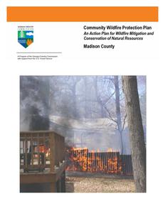
Community Wildfire Protection Plan
An Action Plan for Wildfire Mitigation and Conservation of Natural Resources
Madison County
WILDFIRE PROTECTION PLAN: AN ACTION PLAN FOR WILDFIRE MITIGATION
Prepared by: Gary Roberts, Chief Ranger Sr. Elbert Franklin Hart Madison Wesley Moss, Ranger II Elbert Franklin Hart - Madison Carl Melear, CWPP Specialist Forest Protection
The following report is a collaborative effort between various entities. The representatives listed below comprise the core decision-making team responsible for this report and mutually agree on the plan's contents.
County Representatives: Anthony Dove, Commission Chairman Signature________________________
Stanley Thomas, Commissioner District 1 Signature________________________
John Pethel Sr., Commissioner District 2 Signature________________________
Mike Youngblood, Commissioner District 3 Signature________________________
Dewitt Bond, Commissioner District 4 Signature________________________
Jim Escoe, Commissioner District 5 Signature________________________
Local Emergency Services Representatives:
Marc Perry President Madison County Fire Protection Association Signature________________________
Johnny Bridges Madison County EMA Director Signature________________________
Local Georgia Forestry Commission Representatives:
Gary Roberts Chief Ranger Sr. Georgia Forestry Commission Signature ________________________
Carl W. Melear Community Wildfire Protection Plan Specialist Georgia Forestry Commission Signature ________________________
WILDFIRE PROTECTION PLAN: AN ACTION PLAN FOR WILDFIRE MITIGATION
PLAN CONTENTS
1. Objectives and Goals 2. County Background, Existing Fire Situation, and Interface information 3. Risk Summary 4. Prioritized Mitigation Recommendations 5. Action Plan, Timetables, and Assessment Strategy 6. Wildfire Pre-Suppression Plan 7. County Base and Hazards Maps 8. Appendix
1) OBJECTIVES AND GOALS
The mission of the following report is to set clear priorities for the implementation of wildfire mitigation in Madison County. The plan includes prioritized recommendations for the appropriate types and methods of fuel reduction and structure ignitability reduction that will protect this county and its essential infrastructure. Prioritized activities to educate the public are included. It also includes a plan for wildfire suppression. Specifically, the plan includes community-centered actions that will:
Educate citizens on wildfire, its risks, and ways to protect lives and properties,
Support fire, rescue, and suppression entities,
Focus on collaborative decision-making and citizen participation,
Develop and implement effective mitigation strategies, and
Develop and implement effective community ordinances and codes.
This plan should become a working document that is shared by local, state, and federal agencies that will use it to accomplish common goals. An agreed-upon schedule for meeting to review accomplishments, solve problems, and plan for the future should extend beyond the scope of this plan. Without this follow up this plan will have limited value
WILDFIRE PROTECTION PLAN: AN ACTION PLAN FOR WILDFIRE MITIGATION
2) COUNTY BACKGROUND AND EXISTING FIRE SITUATION
Madison County
Madison County, in northeast Georgia, was created on December 5, 1811, by an act of the state legislature. Originally inhabited by Creek and Cherokee Indians, the land was gradually ceded during the colonial period to Governor James Wright of Georgia and was organized into two counties--Wilkes and Franklin. Eventually that land was divided into smaller counties, and Madison County was created from portions of Clarke, Elbert, Franklin, Jackson, and Oglethorpe counties. Georgia's thirty-eighth county was named for James Madison, who was president of the United States at the time of its creation.
According to the 2000 U.S. census, the population of Madison County was 25,730 (89 percent white, 8.5 percent black, and 2 percent Hispanic). Incorporated towns in the county are Carlton, Colbert, Comer, Danielsville, Hull, and Ila.
Danielsville, the county seat, was named for General Allen Daniel, a
Revolutionary War (1775-83) hero, who donated land for public buildings
soon after the county was established. Settlers in the area were primarily
Revolutionary War veterans who had acquired land through land grants.
Madison has been primarily an agricultural county for most of its history.
In the nineteenth century farmers grew corn, beans, pumpkins, and later
Madison County Government
cotton and oats. The latter half of the nineteenth century saw the
Complex
introduction of beef and dairy farming as well. By the 1930s
overcultivation of cotton had damaged the soil in much of the county, making it useless for crop
farming. Since 2003 agribusiness, particularly poultry production, has dominated the local economy.
Madison County's most famous native is Crawford Long. Born in Danielsville in 1815, Long was the first physician to use sulfuric ether as anesthesia during surgery. As a young doctor in Jefferson (in neighboring Jackson County) he used the gas in 1842 when he removed a tumor from the neck of James Venable for two dollars.
Besides being the birthplace of Long, Madison County is home to several other
historic landmarks. New Hope Presbyterian Church, established in 1788, is
Georgia's third oldest church.
Danielsville Hardware
The county is also the site of the longest covered bridge in the state. The
bridge, which is on the National Register of Historic Places, is located in
Watson Mill Bridge State Park, which is shared by Madison and Oglethorpe
counties. It was constructed in 1885 by Washington King, the son of a
former slave, at a cost of $3,000. Though the bridge was renovated in the
early 1970s, the original truss system still supports it. The bridge spans
Watson Mill Bridge State Park
228.6 feet over the South Fork of the Broad River and is named for Gabriel Watson, who once operated a gristmill several hundred feet
WILDFIRE PROTECTION PLAN: AN ACTION PLAN FOR WILDFIRE MITIGATION
downriver from the bridge.
The most recognizable site in Madison County is the old courthouse. Completed in 1901 for $18,314, the brick structure stands in the center of the Danielsville town square. Also listed on the National Register of Historic Places, it is one of Georgia's most ornate courthouses. It was used continuously as a courthouse and county offices from 1901 until 1996, when officials moved to a more spacious county complex.
Madison County Courthouse
Madison County is also home to Jubilee Partners, a Christian service community located near Comer.
The above information is courtesy of the New Georgia Encyclopedia
WILDFIRE PROTECTION PLAN: AN ACTION PLAN FOR WILDFIRE MITIGATION
Current Fire Situation:
Wildland fire has not been a serious problem in Madison County when compared to the rest of the state. This is due to rapid response by county and state response agencies and excellent interagency cooperation. Thus far(as of April 8, 2011) in FY 2011 which began on July 1, 2010, there have been 17 fires that burned 14.39 acres for an average size of .85 acres. During this same period the statewide county average was 9.78 acres. Causes and fire information by class is outlined in the table below.
County = Madison
Cause
Fires
Campfire
Campfire
1
Children
Children
0
Debris: Ag Fields, Pastures, Orchards, Etc
Debris: Ag Fields, Pastures, Orchards, Etc
0
Debris: Construction Land Clearing
Debris: Construction Land Clearing
1
Debris: Escaped Prescribed Burn
Debris: Escaped Prescribed Burn
0
Debris: Household Garbage Debris: Household Garbage
1
Debris: Residential, Leafpiles, Debris: Residential, Leafpiles,
Yard, Etc
Yard, Etc
7
Debris: Site Prep - Forestry Related
Debris: Site Prep - Forestry Related
0
Incendiary
Incendiary
1
Lightning
Lightning
0
Machine Use
Machine Use
4
Miscellaneous
Miscellaneous
0
Railroad
Railroad
0
Smoking
Smoking
2
Totals for County: Madison Year: 2011
17
Acres
0.22 0.00 0.00
Fires 5 Yr Avg
0.40
0.80
Acres 5 Yr Avg
0.27
0.40
0.60 0.50
0.18
0.60 0.08
0.00
0.40 0.18
0.38
1.40 1.37
5.97
4.20 5.03
0.00
1.00 6.28
4.00
7.40 8.93
0.00
0.40 0.12
2.96
4.20 7.22
0.00
1.80 5.12
0.00
0.40 0.03
0.68
0.40 0.14
14.39 24.00 35.66
WILDFIRE PROTECTION PLAN: AN ACTION PLAN FOR WILDFIRE MITIGATION
The following outlines fire activity in Madison County for the past 5 complete fiscal years. It should be remembered that the statewide average in FY 2007 was influenced by the Sweat Farm, Big Turnaround, and Bugaboo Fires that burned in the Okefenokee. These large fires caused the statewide average to be greatly increased. Overall, FY 2007 was a year of greatly increased fire activity due to prolonged drought.
Fiscal Year
2010 2009 2008 2007 2006
Number of Fires Acres
13
10.79
23
53.64
38
72.29
29
27.19
49
80.68
Average size
.83 2.33 1.90 .94 1.65
Statewide average size
3.56 3.90 4.56 18.64 3.93
The following map is a representation of fire occurrence numbers for the period FY 2006 through FY 20010. There is also a map of historical fire occurrence areas for Georgia Forestry Commission responses for the period Calendar year 1997 through 2002 in the appendix.
In general, causes of wildland fire in Madison County cover most all categories. Machine use, escaped debris burns, and incendiary fires are the most prevalent. In FY 2009, incendiary causes accounted for half of all fires that were documented (12 of 23). This cause accounted for approximately one third of all fires over the past 5 years and is the leading cause.
WILDFIRE PROTECTION PLAN: AN ACTION PLAN FOR WILDFIRE MITIGATION
The Wildland-Urban Interface
There are many definitions of the Wildland-Urban Interface (WUI), however from a fire management perspective it is commonly defined as an area where structures and other human development meet or intermingles with undeveloped wildland or vegetative fuels. As fire is dependent on a certain set of conditions, the National Wildfire Coordinating Group has defined the wildland-urban interface as a set of conditions that exists in or near areas of wildland fuels, regardless of ownership. This set of conditions includes type of vegetation, building construction, accessibility, lot size, topography and other factors such as weather and humidity. When these conditions are present in certain combinations, they make some communities more vulnerable to wildfire damage than others. This "set of conditions" method is perhaps the best way to define wildland-urban interface areas when planning for wildfire prevention, mitigation, and protection activities.
There are three major categories of wildland-urban interface. Depending on the set of conditions present, any of these areas may be at risk from wildfire. A wildfire risk assessment can determine the level of risk.
1. "Boundary" wildland-urban interface is characterized by areas of development where homes, especially new subdivisions, press against public and private wildlands, such as private or commercial forest land or public forests or parks. This is the classic type of wildland-urban interface, with a clearly defined boundary between the suburban fringe and the rural countryside.
2. "Intermix" wildland-urban interface areas are places where improved property and/or structures are scattered and interspersed in wildland areas. These may be isolated rural homes or an area that is just beginning to go through the transition from rural to urban land use.
3. "Island" wildland-urban interface, also called occluded interface, are areas of wildland within predominately urban or suburban areas. As cities or subdivisions grow, islands of undeveloped land may remain, creating remnant forests. Sometimes these remnants exist as parks, or as land that cannot be developed due to site limitations, such as wetlands. (courtesy Fire Ecology and Wildfire Mitigation in Florida 2004)
Madison County is typical of a county that is undergoing a rapid transition from an isolated rural county to an area feeling the influence of an expanding urban area (Athens Clarke County. It contains mixtures of both boundary and intermix interface.
WILDFIRE PROTECTION PLAN: AN ACTION PLAN FOR WILDFIRE MITIGATION
Wildland Urban Interface Hazards
Firefighters in the wildland urban interface may encounter hazards other than the fire itself, such as hazardous materials, utility lines and poor access.
Hazardous Materials Common chemicals used around the home may be a direct hazard to firefighters from flammability, explosion potential and/or vapors or off-gassing. Such chemicals include paint, varnish and other flammable liquids; fertilizer; pesticides; cleansers; aerosol cans, fireworks, batteries and ammunition. In addition, some common household products such as plastics may give off very toxic fumes when they burn. Stay OUT of the smoke from burning structures and any unknown sources such as trash piles.
Illicit Activities Marijuana plantations or drug production labs may be found in wildland urban interface areas. Extremely hazardous materials such as propane tanks and flammable/toxic chemicals may be encountered, as well as booby traps.
Propane tanks Both large (household size) and small (gas grill size) liquefied propane gas (LPG) tanks can present hazards to firefighters, including explosion. See the "LPG Tank Hazards" discussion for details.
Utility lines Utility lines may be located above and below ground and may be cut or damaged by tools or equipment. Don't spray water on utility lines or boxes.
Septic tanks and fields Below-ground structures may not be readily apparent and may not support the weight of engines or other apparatus.
WILDFIRE PROTECTION PLAN: AN ACTION PLAN FOR WILDFIRE MITIGATION
New construction materials Many new construction materials have comparatively low melting points and may "off-gas" extremely hazardous vapors. Plastic decking materials that resemble wood are becoming more common and may begin softening and losing structural strength at 180 F, though they normally do not sustain combustion once direct flame is removed. However, if they continue to burn they exhibit the characteristics of flammable liquids.
Pets and livestock Pets and livestock may be left when residents evacuate and will likely be highly stressed, making them more inclined to bite and kick. Firefighters should not put themselves at risk to rescue pets or livestock.
Evacuation occurring Firefighters may be taking structural protection actions while evacuations of residents are occurring. Be very cautious of people driving erratically. Distraught residents may refuse to leave their property, and firefighters may need to disengage from fighting fire to contact law enforcement officers for assistance. In most jurisdictions firefighters do not have the authority to force evacuations. Firefighters should not put themselves at risk trying to protect someone who will not evacuate!
Limited access Narrow one-lane roads with no turn-around room, inadequate or poorly maintained bridges and culverts are frequently found in wildland urban interface areas. Access should be sized-up and an evacuation plan for all emergency personnel should be developed.
3) Risk Summary
Following a meeting of County officials and representatives of the Georgia Forestry Commission on May 20, 2009, assessments were made of communities at risk within the county. Areas designated for assessment were selected using the Southern Fire Risk Assessment (SFRA) Communities at risk layer supported by local knowledge. It should be noted that not all polygons within the SFRA layer were assessed. The SFRA information was used to assist local fire departments in locating areas that could be assessed. It was not to be the sole deciding factor for determining areas that should be assessed. Fifty eight (58) areas were assessed using the Georgia Forestry Commission Form 140 for Woodland Community Wildfire Hazard Assessment. Three areas were recognized as being at extreme risk, one was designated as at high risk, twenty three were designated at moderate risk, and thirty one were classified as being low. Information on these areas is presented in tabular form in a document entitled `Risk Summary for Areas of Concern Madison County, Georgia' located in the appendix. Assessments are organized by fire department jurisdiction. The color shading in the
WILDFIRE PROTECTION PLAN: AN ACTION PLAN FOR WILDFIRE MITIGATION
spreadsheet corresponds to the colors used in the level of concern maps to show the locations of assessment areas. Some overlap occurs between jurisdictions in these maps.
4) Prioritized Mitigation Recommendations
As a significant number of fires in the County are related to incendarism, investigation of all fires deemed to be related to this cause should be standard practice.
The following recommendations were developed during follow-up meetings with County and State fire response agencies. A priority order was determined based on which mitigation projects would best reduce the hazard of wildland fire to communities and infrastructure. The following priorities were considered. Community Hazard and Structural Ignitability Reduction
Wildland Fuel reduction or modification Improvements to capabilities of Wildland response agencies Public Education regarding risk of wildland fire
Proposed Community and Structural Ignitability Reduction Priorities: 1. Locate lack of and improve defensible space around structures in communities at risk 2. Identify access problems that affect initial attack in communities at risk 3. Identify structural ignitability concerns in communities at risk 4. Identify and resolve problems with codes, covenants, or ordinances that negatively influence structural ignitability
Proposed Wildland Fuel Reduction or Modification Priorities: 1. Reduction or modification of wildland fuel in proximity to communities at risk 2. Reduction or modification of fuel concentrations in shared spaces inside communities at risk
Proposed Improvements to capabilities of Wildland Response agencies: 1. Identify needs and improve training and qualification of wildland response agencies 2. Identify needs and recommend equipment acquisitions for wildland response agencies
Proposed Education and Outreach Priorities:
1. Improve public knowledge in communities at risk and in the general population of Madison County regarding Firewise principles.
2. Identify opportunities and achieve Firewise USA certification for communities at risk. 3. Notification of communities at risk regarding wildland fire hazard 4. Improvements to public notification during periods of high to extreme fire danger.
WILDFIRE PROTECTION PLAN: AN ACTION PLAN FOR WILDFIRE MITIGATION
5) Action Plan
POTENTIAL FUNDING SOURCES:
As funding is questionable in these times of tight government budgets and economic uncertainty, unconventional means should be identified whereby the need for funding can be reduced or eliminated. Publications / Brochures
FIREWISE materials are available for cost of shipping only at www.firewise.org. Another source of mitigation information can be found at www.nfpa.org. Access to reduced cost or free of charge copy services should be sought whereby publications can be reproduced. Free of charge public meeting areas should be identified where communities could gather to be educated regarding
prevention and firewise principles.
Mitigation Community Protection Grant: o USFS sponsored prescribed burn program. Communities with at risk properties that lie within 3 miles of the USFS border may apply with the GFC to have their forest land prescribed burned free of charge. FEMA Mitigation Policy MRR-2-08-01: through GEMA - Hazard Mitigation Grant Program (HMGP) and Pre Disaster Mitigation (PDM) o To provide technical and financial assistance to local governments to assist in the implementation of long term cost effective hazard mitigation measures. o This policy addresses wildfire mitigation for the purpose of reducing the threat to all-risk structures through creating defensible space, structural protection through the application of ignition resistant construction, and limited hazardous fuels reduction to protect life and property. o With a complete and registered plan (addendum to the State plan) counties can apply for pre- mitigation funding. They will also be eligible for HMGP if the county is declared under a wildfire disaster. GFC - Plowing and burning assistance can be provided through the Georgia Forestry Commission as a low cost option for mitigation efforts.
Individual Homeowners In most cases of structural protection ultimately falls on the responsibility of the community and the homeowner. They will bear the cost; yet they will reap the benefit from properly implemented mitigation efforts. GEMA Grant - PDM (See above)
Ultimately it is our goal to help the communities by identifying the communities threatened with a high risk to wildfire and educate those communities on methods to implement on reducing those risks.
WILDFIRE PROTECTION PLAN: AN ACTION PLAN FOR WILDFIRE MITIGATION
5) Action Plan Continued
Steps to implement Community Hazard and Structural Ignitability Priorities
Hazard
Lack of Defensible Space
Access problems
Structural Ignitability
Codes and Ordinances
Specific Action and Responsible Party
Using the risk summary in section 3, each department should conduct inspections of communities at risk in their jurisdiction or area of response for lack of defensible space. Findings will be conveyed to residents and treatment methods will be recommended in accordance with Firewise principles. Using the County Base map the Georgia Forestry Commission and Madison County Fire officials should visit all identified communities at risk for the purpose of locating and resolving access difficulties. This inspection should extend into the wildland adjacent to the communities at risk looking for hindrances to suppression tactics Madison County Fire officials should examine structures for structural ignitability concerns at the time when the communities at risk are inspected for lack of defensible space. Using Firewise guidelines for reducing structural ignitability, (a checklist from the Firewise web site could be used) structures should be assessed and findings conveyed to residents. This could be through use of media or by direct contact. Madison County and municipal Fire Marshalls should closely examine all codes and ordinances for gaps and oversights which could cause problems in the wildland fire arena. Examples include proximity of propane tanks to structures, accumulations of debris, road widths in new developments, lack of proper identification pertaining address or street names etc..
In regard to priority, the above steps should first extend to the higher numbers in the extreme category from the risk summary as these communities are at a higher degree of risk. Another means of reaching homeowners would be to distribute literature on Firewise principles through the building permit office. Checklists for Homeowners are available on the Georgia Forestry Commission public website http://www.gfc.state.ga.us . Look under Forest Fire Wildland Urban Interface- Firewise
WILDFIRE PROTECTION PLAN: AN ACTION PLAN FOR WILDFIRE MITIGATION
Steps to implement Fuel Reduction or Modification Priorities
Hazard
Hazardous Wildland Fuel Accumulations
Hazardous Fuel Accumulations in communities and hindrances to suppression
Specific Action and Responsible Party
The Georgia Forestry Commission will prioritize prescribed burning projects adjacent to Communities at risk where burning is determined to be appropriate. A suggested prescribed burn project to reduce fuels near the Rural Urban interface area near the intersection of State Hwy. 98 and Rogers Mill Rd is outlined on an aerial photograph in the appendix. This project is a suggested model of action that could be conducted to protect interface or communities that are in proximity to wildland fuel. Property lines and landowner information has not been verified in regard to this suggested project. The landscape fuel break depicted in the northwest quadrant is representative of a means to reduce fuel that could involve multiple landowners or take advantage of natural breaks without burning large blocks. In communities where burning is not feasible or unfavorable to residents the use of permanent fuel breaks could be considered. These breaks could be installed by the Georgia Forestry Commission. Using the risk summary in section 3, Fire departments could conduct community clean up days in communities at risk in their respective jurisdictions aimed at reducing hazardous fuels and hindrances to suppression in shared community space. Residents would be provided with guidance and access to disposal alternatives for materials removed.
WILDFIRE PROTECTION PLAN: AN ACTION PLAN FOR WILDFIRE MITIGATION
5) Action Plan Continued
Steps to implement improvements to wildland response capability
Improvement needed
Improve training and qualification of Madison County Wildland firefighters
Improve or acquire wildland firefighting equipment
Responsible Party and specific action
Chief Ranger Gary Roberts, Assistant District Manager Shawn Alexander of the Georgia Forestry Commission and Madison Co Fire Chief(s) should examine all training records for personnel under their supervision. All personnel should be certified Georgia Basic Wildland Firefighters or higher in qualification. Additional training and qualification should be sought for personnel identified in Madison County who are assigned specific Incident Command System (ICS) functions. Sources for available funds for training should be sought at State and Federal levels. All stations for Madison County Fire Departments should inventory their present equipment relating to their wildland capability. Funding sources should be investigated from available grants or other sources. Needs for job specific wildland responses should be examined by Chief Ranger Roberts and Fire Chiefs
Steps to educate or inform the Public regarding wildland fire prevention and responsibilities
Opportunity
Improve Public Education through direct contact
Improve Public Education through use of media
Responsible Party and Specific Action
Prior to the onset of fire season(s) rangers of the Georgia Forestry Commission and Madison County Fire personnel should conduct Firewise meetings in conjunction with normally scheduled fire department meetings. People living in or near extreme and high risk communities should be invited to these meetings by use of door to door campaigns or by mailbox flyers. Notices regarding these meetings could be placed in local post offices or stores near communities at risk. A Firewise display should be acquired and utilized at this meeting. This display would be retained by the Franklin Hart Elbert Madison office of the Georgia Forestry Commission and used for all Firewise meetings in Madison County. Local news media should be invited to these meetings. Goals for potential Firewise certified communities in Madison County could be considered after these meetings are completed. Prior to the onset of fire season(s) or during periods of particularly high fire danger use of the media should be stepped up by personnel of the Georgia Forestry Commission. This should include use of all available media in the County. PSA's should be run weekly during periods of high to extreme fire danger. Signs or poster boards could be developed for display in public spaces near communities at risk advising residents that they live in areas that are susceptible to wildland fire and directing them to sources of information regarding wildland fire safety.
WILDFIRE PROTECTION PLAN: AN ACTION PLAN FOR WILDFIRE MITIGATION
Timetables for Actions
Steps to implement Community Hazard and Structural Ignitability Priorities
Steps to examine communities at risk for defensible space and structural ignitability should begin as soon as practical with existing work schedules. This should occur prior to the time when most citizens begin fall or spring cleanup projects in order for recommendations regarding improvements to defensible space and reduction of structural ignitability to coincide with these seasonal actions.
Pre-planning to examine access and suppression problems should take place as soon as possible by fire department jurisdiction.
Codes and Ordinances should be examined as soon as possible.
Steps to implement Fuel Reduction or Modification Priorities
The prescribed burn project to reduce fuels near the Rogers Mill and Hwy 98
Community should take place in late winter 2010-2011. Any other priority burn projects or installation of pre suppression fuel breaks should take place during this same window.
Steps to reduce fuels in communities at risk should coincide with steps to
improve defensible space and reduce structural ignitability fall 2010. Any actions that do not take place during this window could be undertaken during the late winter of 2010 - 2011.
Steps to implement improvements to wildland response capability
Cooperation between state and local wildland suppression forces regarding
improvements to training and equipment should begin immediately.
Steps to educate or inform the Public regarding wildland fire prevention and responsibilities
Direct contact with residents in Communities at risk should take place as soon as possible.
The use of media should coincide with the above action.
WILDFIRE PROTECTION PLAN: AN ACTION PLAN FOR WILDFIRE MITIGATION
Assessment of Actions
Reduction of Community hazard and structural ignitability
Direct measurement of the number of communities assessed would be the appropriate measure of success
Any meetings that result in cooperation between wildland departments should be logged along with minutes of those meetings. Goals should be set and reviewed after each meeting.
Any changes to or additions to codes and ordinances would be an obvious measure of success.
Steps to implement Fuel Reduction or Modification Priorities
Acres burned would be the appropriate measure for fuel reduction. A direct measure of linear feet of firebreaks would be an appropriate measure for pre suppression breaks.
Fuel reduction in communities at risk would be measured by the number of communities affected and number of projects completed.
Steps to implement improvements to wildland response capability
A direct measure of the number of capabilities or qualifications gained would be the appropriate measure of success.
Any equipment acquired or any equipment brought up to national standards would be the appropriate measure of success.
Steps to educate or inform the Public regarding wildland fire prevention and responsibilities
Direct measurement of the number of persons contacted, literature distributed, public notices posted, news articles published, radio programs aired, etc. would be the best measure of success.
WILDFIRE PROTECTION PLAN: AN ACTION PLAN FOR WILDFIRE MITIGATION
6) Wildfire Pre-Suppression Plan
This document is located in the appendix of this plan.
7) County Base and Hazards maps
The maps for Level of Concern, Surface Fuels, Wildland Fire Susceptibility, and Historical Fire Occurrence are located in the appendix of this plan.
8) Appendix Wildfire Pre-Suppression Plan County Base and Hazards maps Fuel Modification project Hwy 98 Rogers Mill Rd Photograph Risk Summary table
All files that make up this plan are available in an electronic format from the Georgia Forestry Commission. This is especially useful in regard to viewing the PDF files that make up the County Base and Hazards maps in that it will allow for increased magnification and better resolution.
WILDFIRE PROTECTION PLAN: AN ACTION PLAN FOR WILDFIRE MITIGATION
P. O. Box 819 Macon, GA 31202 1-800-GA-TREES GaTrees.org
The Georgia Forestry Commission provides leadership, service, and education in the protection and conservation of Georgia's forest resources. An Equal Opportunity Employer and Service Provider
Madison County Fire Occurrence Areas
Published Results Dataset
Roads, Level 2 - 195-Madison, GA Roads, Level 3 - 195-Madison, GA Roads, Level 4 - 195-Madison, GA County Boundaries - 195-Madison, GA Fire Occurrence Areas (fires/1000 acres/year) - 195-Madison, GA <VALUE> Non-Burnable 0 - 0.024 0.025 - 0.049 0.050 - 0.099 0.100 - 0.199 0.200 - 0.290 0.291 - 0.399 0.400 - 0.599 0.600 - 0.999 1.000 - 1,000
:
0 0.350.7 1.4 2.1 2.8 Miles
10/26/2010
Disclaimer: The user assumes the entire risk related to their use of the SFRAS application and either the published or derived maps from the application. The Southern Group of State Foresters is providing these data "as is" and disclaims any and all warranties, whether expressed or implied, including (without limitation) any implied warranties of merchantability or fitness for a particular purpose. In no event will the Southern Group of State Foresters be liable to you or to any third party for any direct, indirect, incidental, consequential, special or exemplary damages or lost profit resulting from any use or misuse of these data.
Madison County Wildland Fire Susceptibility Index
Published Results Dataset
Roads, Level 2 - 195-Madison, GA Roads, Level 3 - 195-Madison, GA Roads, Level 4 - 195-Madison, GA County Boundaries - 195-Madison, GA Wildland Fire Susceptibility Index - 195-Madison, GA <VALUE> 0 0.00001 - 0.00009 0.00010 - 0.00099 0.00100 - 0.00999 0.01000 - 0.09999 0.10000 - 0.19999 0.20000 - 0.39999 0.40000 - 0.59999 0.60000 - 0.79999 0.80000 - 1.00000
:
0 0.350.7 1.4 2.1 2.8 Miles
2/17/2011
Disclaimer: The user assumes the entire risk related to their use of the SFRAS application and either the published or derived maps from the application. The Southern Group of State Foresters is providing these data "as is" and disclaims any and all warranties, whether expressed or implied, including (without limitation) any implied warranties of merchantability or fitness for a particular purpose. In no event will the Southern Group of State Foresters be liable to you or to any third party for any direct, indirect, incidental, consequential, special or exemplary damages or lost profit resulting from any use or misuse of these data.
Madison County Surface Fuels
Published Results Dataset
Roads, Level 2 - 195-Madison, GA Roads, Level 3 - 195-Madison, GA Roads, Level 4 - 195-Madison, GA County Boundaries - 195-Madison, GA FBPS 1 - Short grass (1 ft.) FBPS 2 - Timber (grass and understory) FBPS 3 - Tall grass (2.5 ft.) FBPS 4 - Chaparral FBPS 5 - Brush FBPS 6 - Dormant brush, hardwood slash FBPS 7 - Southern rough FBPS 8 - Closed timber litter FBPS 9 - Hardwood (long-needle pine) litter FBPS 10 - Timber (litter and understory) FBPS 11 - Light slash FBPS 12 - Medium slash FBPS 96 - Urban FBPS 97 - Non-burnable agriculture FBPS 98 - Water
: FBPS 99 - Non-burnable, barren 0 0.350.7 1.4 2.1 2.8 Miles
10/26/2010
Disclaimer: The user assumes the entire risk related to their use of the SFRAS application and either the published or derived maps from the application. The Southern Group of State Foresters is providing these data "as is" and disclaims any and all warranties, whether expressed or implied, including (without limitation) any implied warranties of merchantability or fitness for a particular purpose. In no event will the Southern Group of State Foresters be liable to you or to any third party for any direct, indirect, incidental, consequential, special or exemplary damages or lost profit resulting from any use or misuse of these data.
Risk Summary for Communities at Risk Madison County Georgia
Community Name or location Development South of Hardman Morris Rd Farm Rd Covey Landing Hwy 72,172 McCarty Dodd Rd Goss Ln. Kingston Greens Saddle Ridge off Charles Hart Rd Tumbling Creek / Hwy 172 and 72 Gatewood @Colbert Danielsville Rd. Sorrow Patterson Rd Foote McClellan Rd Hwy 72 Collins Bridges Rd Rock Quarry Rd. Moon Grove Church Rd Clegborne Rd Hwy 29 Camp Kiwanas Old Wildcat Bridge Rd Oakdale / Grady Dr. / Gillespie Dr. Charlie Bolton Rd Woodland Lane Tranquility Forest Virginia Lane Chestnut Lane Spratlin Mill Dr. Millbrook Circle Hidden Falls Dr. Arthur Rd Williamson Dr. Sweetgum Alley Windsor Heights Spratlin Pond Dr. Hannah Heights South Creek Mae Drive Doe Run Circle Chandler Farm Rd Blacks Creek Church Rd Mize Rd @ County line Wesley Chapel Rd Morgan Rd Jot em down Rd Hwy 174 and Friendship Church Rd. Blacks Creek Church Rd McGinnis Chandler Rd Woodland Dr. Roger Mill Rd Lakeview Circle Miller McElrath Rd Peach Orchard Rd Michigan Trail off Cowart Toole Rd Rugg Rd (Bugg Rd) Moons Grove Church Rd Beecher Hill Rd Hwy 106 Sanford Rd Smith Rd Garnett Ward Rd Piedmont Park Area Buddy Moore Rd Strickland Cir. Diamond Hill Neese Northwood Circ. Shady Ln Griffith Rd Stone Stew. Garnett Ward Rd Glen Rd Sanders Rd Nowhere Rd Horace Elnut Circle Hwy 106 Stone Stewart Rd Griffith Rd Moons Grove Church Rd Corey Rd West of Helicon Springs Rd at County Line Amberly Drive Belhaven Lane Hwy 106 Hwy 106 Oak Circle Diamond Hill Neese Willis Glen Rds Hwy 106 Crabapple Hollow Rd off Hwy 106 Sanford Rd Dillard Rd Nowhere Rd Mason Mill Manley Martin Rd Hwy 29 Hwy 174 Hwy 29 Hudson River Church Rd Arrowhead Lane Jot Em Off New Haven Church Rd Hwy 29 east near Long Peeples Rd. Intersec. Hudson River Church Rd Hudson River Church Rd
Map #Latitude
Longitude
Score Risk Category
4 34.02940789 -83.2386715 137 High
16 34.05251355 -83.17355954
92 Moderate
20 34.03006236 -83.23937095
85 Moderate
28 34.05204245 -83.18284162
75 Low
39 34.05669968 -83.20579669
61 Low
47 34.04553919 -83.19916033
51 Low
48 34.04807594 -83.19393996
51 Low
51 34.05701537 -83.20779811
48 Low
53 34.03202467 -83.24053797
42 Low
9 34.16221517 -83.21789872 112 Moderate
14 34.09040986 -83.24223829
94 Moderate
24 34.19125443 -83.15375386
80 Moderate
22 34.02791081 -83.30983254
81 Moderate
26
34.0107897 -83.2919809
79 Moderate
29 34.02186513 -83.30577056
74 Low
32 34.02135526 -83.28430637
72 Low
34 34.02534422 -83.30727241
68 Low
35
34.0335762 -83.28360522
64 Low
36 34.02361114 -83.28711725
64 Low
37 34.01904206 -83.29667466
63 Low
42 34.02923131 -83.31248897
57 Low
44 34.02514785 -83.31052647
53 Low
56
34.0519353 -83.27425132
37 Low
57 34.03089849 -83.30533278
35 Low
58 34.02262383 -83.28736146
30 Low
1 34.14829892 -83.25277918 189 Extreme
8 34.14210776 -83.27947426 113 Moderate
11 34.18784497 -83.3995685 103 Moderate
13 34.20333658 -83.33309961
95 Moderate
25 34.19000808 -83.27374308
80 Moderate
30 34.19616493 -83.3954968
74 Low
45
34.1530727 -83.24959826
53 Low
49 34.17102601 -83.24996625
50 Low
6 34.12438676 -83.27971385 129 Moderate
2 34.03488442 -83.32491249 178 Extreme
3 34.11588201 -83.30207634 150 Extreme
5 34.06101765 -83.31989558 129 Moderate
7 34.05594346 -83.31166545 125 Moderate
10 34.06310107 -83.27842808 104 Moderate
12 34.09772115 -83.30365426
96 Moderate
17
34.0756089 -83.31446434
91 Moderate
18
34.059
-83.356
90 Moderate
19 34.10185839 -83.31043198
90 Moderate
23 34.11401105 -83.2979932
81 Moderate
40 34.05110322 -83.32925479
61 Low
41
34.0293514 -83.32714388
59 Low
43 34.07340701 -83.31743812
57 Low
46 34.07568201 -83.31441215
51 Low
50 34.07441463 -83.31707552
49 Low
54 34.09915321 -83.33143815
42 Low
15
34.1930289 -83.20057475
92 Moderate
27 34.20786637 -83.19320117
78 Moderate
38 34.22853154 -83.19218474
61 Low
21 34.23196367 -83.31398135
83 Moderate
55 34.13853085 -83.22828531
41 Low
52 34.22081963 -83.19839949
46 Low
31 34.22116266 -83.31063597
73 Low
33 34.23624563 -83.31401171
70 Low
Homes 200 23 12 25 71 20 48 16 29 10 70 18 20 55 12 40 70 15 21 31 39 73 18 51 35 6 2 18 7 15 30 10 9 4 8 7 40 22 30 30 10 60 24 14 18 68 11 12 70 30 20 20 2 12 45 8 17 20
Jurisdiction Colbert Colbert Colbert Colbert Colbert Colbert Colbert Colbert Colbert Danielsville Danielsville Danielsville Hull Hull Hull Hull Hull Hull Hull Hull Hull Hull Hull Hull Hull Ila Ila Ila Ila Ila Ila Ila Ila/Danielsville Ila/Neese/Sanford Neese/Sanford Neese/Sanford Neese/Sanford Neese/Sanford Neese/Sanford Neese/Sanford Neese/Sanford Neese/Sanford Neese/Sanford Neese/Sanford Neese/Sanford Neese/Sanford Neese/Sanford Neese/Sanford Neese/Sanford Neese/Sanford Shiloh Shiloh Shiloh Shiloh/ Ila Shiloh/ Ila Shiloh/Danielsville Shiloh/Ila Shiloh/Ila
SFRA (shading in this column indicates the community is recognized by the Southern Fire Risk Assessment
Colbert Jurisdiction Level of Concern
AOI: Hull LOC Description: Published Results Dataset for the AOI
53
20
XW XWXW 4
51 XW XW
39
Colbert FD
48
XW
XW
47
28
XW
16
XW
:
00.050.1 0.2 0.3 0.4 Miles
Community Name or location Development South of Hardman Morris Rd Farm Rd Covey Landing Hwy 72,172 McCarty Dodd Rd Goss Ln. Kingston Greens Saddle Ridge off Charles Hart Rd Tumbling Creek / Hwy 172 and 72 Gatewood @Colbert Danielsville Rd. Sorrow Patterson Rd Foote McClellan Rd Hwy 72
Map # 4 16 20 28 39 47 48 51 53
Area of Interest (AOI)
Initial Dispatch Locations
Roads, Level 2 Roads, Level 3 Roads, Level 4
Level of Concern Index
<VALUE>
0 0.00001 - 0.0004 0.00041 - 0.0024 0.00241 - 0.0458 0.04581 - 0.6429 0.64291 - 1.3593 1.35931 - 3.4268 3.42681 - 4.9999 4.99991 - 14.999 14.9991 - 100.00
12/10/2010
Disclaimer: The user assumes the entire risk related to their use of the SFRAS application and either the published or derived maps from the application. The Southern Group of State Foresters is providing these data "as is" and disclaims any and all warranties, whether expressed or implied, including (without limitation) any implied warranties of merchantability or fitness for a particular purpose. In no event will the Southern Group of State Foresters be liable to you or to any third party for any direct, indirect, incidental, consequential, special or exemplary damages or lost profit resulting from any use or misuse of these data.
Hull Jurisdiction Level of Concern
AOI: Hull LOC Description: Published Results Dataset for the AOI
56
XW
42
57
XW
22XWXW
34
XW XW 29
44
XW
XW
Hull FD
35
XW
36
XWXW
58
XW
32
37
26
XW
:
0 0.1 0.2 0.4 0.6 0.8 Miles
Oakdale / Grady Dr. / Gillespie Dr.
22
Charlie Bolton Rd
26
Woodland Lane
29
Tranquility Forest
32
Virginia Lane Chestnut Lane
34
Spratlin Mill Dr.
35
Millbrook Circle
36
Hidden Falls Dr.
37
Arthur Rd Williamson Dr. Sweetgum Alley
42
Windsor Heights
44
Spratlin Pond Dr.
56
Hannah Heights
57
South Creek
58
Area of Interest (AOI)
Initial Dispatch Locations
Roads, Level 2
Roads, Level 3
Roads, Level 4 Level of Concern Index
<VALUE>
0
0.00001 - 0.0004
0.00041 - 0.0024
0.00241 - 0.0458
0.04581 - 0.6429
0.64291 - 1.3593
1.35931 - 3.4268
3.42681 - 4.9999
4.99991 - 14.999
14.9991 - 100.00
12/9/2010
Disclaimer: The user assumes the entire risk related to their use of the SFRAS application and either the published or derived maps from the application. The Southern Group of State Foresters is providing these data "as is" and disclaims any and all warranties, whether expressed or implied, including (without limitation) any implied warranties of merchantability or fitness for a particular purpose. In no event will the Southern Group of State Foresters be liable to you or to any third party for any direct, indirect, incidental, consequential, special or exemplary damages or lost profit resulting from any use or misuse of these data.
Neese Sanford Jurisdiction Level of Concern
AOI: Hull LOC Description: Published Results Dataset for the AOI
3
XW XW 23
54
XW
19
XW 12 XW
Neese Sanford # 2 FD
18
XW
50 43
Neese Sanford # 1 FD
XWXWXW 17 46
5
XW
7
XW
40
XW
10
XW
56
XW
:
0 0.1 0.2
0.4
0.6
0.8
Miles
12/13/2010
2
XW
42
57
XW
41
XW
22XWXW
34
XW XW 29
44
XW
35
XW
36
XWXW
58
XW
32
37
Rugg Rd (Bugg Rd)
2
Moons Grove Church Rd Beecher Hill Rd
3
Hwy 106 Sanford Rd Smith Rd
5
Garnett Ward Rd Piedmont Park Area
7
Buddy Moore Rd Strickland Cir. Diamond Hill
Neese
10
Northwood Circ. Shady Ln Griffith Rd Stone Stew.
12
Garnett Ward Rd Glen Rd Sanders Rd
17
Nowhere Rd Horace Elnut Circle
18
Hwy 106 Stone Stewart Rd Griffith Rd
19
Moons Grove Church Rd Corey Rd
23
West of Helicon Springs Rd at County Line
40
Amberly Drive Belhaven Lane Hwy 106
41
Hwy 106 Oak Circle
43
Diamond Hill Neese Willis Glen Rds Hwy 106
46
Crabapple Hollow Rd off Hwy 106
50
Sanford Rd Dillard Rd Nowhere Rd
54
Area of Interest (AOI)
Initial Dispatch Locations
Roads, Level 2
Roads, Level 3
Roads, Level 4
Level of Concern Index
<VALUE>
0
0.00001 - 0.0004
0.00041 - 0.0024
0.00241 - 0.0458
0.04581 - 0.6429
0.64291 - 1.3593
1.35931 - 3.4268
3.42681 - 4.9999
4.99991 - 14.999
14.9991 - 100.00
Disclaimer: The user assumes the entire risk related to their use of the SFRAS application and either the published or derived maps from the application. The Southern Group of State Foresters is providing these data "as is" and disclaims any and all warranties, whether expressed or implied, including (without limitation) any implied warranties of merchantability or fitness for a particular purpose. In no event will the Southern Group of State Foresters be liable to you or to any third party for any direct, indirect, incidental, consequential, special or exemplary damages or lost profit resulting from any use or misuse of these data.
North Madison Jurisdictions Level of Concern
AOI: Hull LOC Description: Published Results Dataset for the AOI
30
XW
11
XW
:
0 0.2 0.4 0.8 1.2 1.6 Miles
12/13/2010
33
XW 21 XW
31
XW
Shiloh FD
38
XW
52
XW
27
XW
13
XW Poca #2 FD
Poca # 1 FD
25
XW
15
XW
Ila FD
8
XW
49
XW
45
XW 1 XW
3
XWXW
6
XW
23
9
XW
55
XW
Danielsville FD
19
XW 54 XW XW 12
14
XW
24 XW
XW 50 Nees1e7Sanford # 1 FD
Neese Sanford # 2 FD
46
Mae Drive
1
Doe Run Circle Chandler Farm Rd
8
Blacks Creek Church Rd Mize Rd @ County line
11
Wesley Chapel Rd Morgan Rd Jot em down Rd
13
Hwy 174 and Friendship Church Rd.
25
Blacks Creek Church Rd McGinnis Chandler Rd
30
Woodland Dr. Roger Mill Rd Lakeview Circle
45
Miller McElraHthaRrdrPiseaochnOFrcDhard Rd
49
Michigan Trail off Cowart Toole Rd
6
Collins Bridges Rd Rock Quarry Rd.
9
Moon Grove Church Rd Clegborne Rd Hwy 29
14
Camp Kiwanas Old Wildcat Bridge Rd
24
Mason Mill
15
Manley Martin Rd Hwy 29
27
Hwy 174 Hwy 29
38
Hudson River Church Rd Arrowhead Lane Jot Em
21
Off New Haven Church Rd
55
Hwy 29 east near Long Peeples Rd. Intersec.
52
Hudson River Church Rd
31
Hudson River Church Rd
33
Area of Interest (AOI)
Initial Dispatch Locations
Roads, Level 2 Roads, Level 3 Roads, Level 4 Level of Concern Index
<VALUE>
0 0.00001 - 0.0004 0.00041 - 0.0024 0.00241 - 0.0458 0.04581 - 0.6429 0.64291 - 1.3593 1.35931 - 3.4268
3.42681 - 4.9999
4.99991 - 14.999 14.9991 - 100.00
Disclaimer: The user assumes the entire risk related to their use of the SFRAS application and either the published or derived maps from the application. The Southern Group of State Foresters is providing these data "as is" and disclaims any and all warranties, whether expressed or implied, including (without limitation) any implied warranties of merchantability or fitness for a particular purpose. In no event will the Southern Group of State Foresters be liable to you or to any third party for any direct, indirect, incidental, consequential, special or exemplary damages or lost profit resulting from any use or misuse of these data.
Contents Information Fire Plan
County MADISON 095
Date of Latest Revision 3/11
Fire Plan Section Heading Information Contained -----------------------------------------------------------------------------------------------------------------------------------Wildfire Situation Analysis Wildfire response considerations, policies, co-operators response considerations, manning and action guides to outline detection, initial attack, fire prevention, personnel availability and equipment readiness/staging considerations.
Command Section, Incident Command functions, Safety, Liaison, Information Officer position, information and contact lists. (Law enforcement, DOT, and co-operating agencies for Staff officers.)
Operations Section, Staging areas/assigned mgrs.,div/group supervisors, ST/Task Force leaders, Air Ops., helispots, Ops. map
Plans Section, GFC, and all co-operator fire resources in the county/district SITSAT analysis of complex fire incidents, narrative describing county, locked gates/access problems, 300 ac+ plantations high hazard, SSA's, traffic, wildland/urban interface, 5 yr. fire occurrence, airports, required maps etc., Documentation, Demob. plans and Technical Specialists.
Logistics SectionService: Communications capabilities of GFC and co-operators and related information, Medical: EMT, hospitals, Dr.s, etc., Food unit suppliers, vendors, mobile kitchen capabilities, personnel etc., Support: Supply vendors, providers, equip. repair sources, fueling, equip. rentals etc., unit supplies, Facilities: Unit capability, co-operators, pre-planned C.P.'s, staging, base, motels, etc., Ground Support: mobile repairs, co-operators, personnel transportation, etc.
Finance Section, Time keeping procedures/reporting, Procurement: Vendor Contracts, lodging, food service, parts/supplies agency contracts, local vendor information etc., signed agreements for water pickup points, base camps, staging areas, etc., Compensation/Claims reporting procedures injuries/accident paperwork, GFC physicians etc. Costs, unit and reporting procedures
Page 1 of 40
Wildfire Situation Analysis Fire Plan
County MADISON 095
Date of Last Revision 3/11
The purpose of this section of the incident plan is to provide ready access to pre-planned personnel functions, assignments, and resource information for incident management. While "co-operator" personnel and agencies are listed that will be active in other types of non-fire incidents, the personnel and resources which are identified in this section have been done so for their primary knowledge, training, skills and abilities to be an interagency co-operator on wildland fires with the Georgia Forestry Commission.
All responses to wildland fire and other emergency response incidents will take place under the Incident Command System guidelines and all other polices and guidelines as outlined in the general preface of this plan. As the greatest majority of wildland fires are contained and controlled by the initial attack forces, most fire situations are not expected to reach a level of complexity requiring activation of numerous sections of the ICS organization outlined in this section. All position requirements and job responsibilities will be considered and accomplished as required during "routine" or Type 4 fire responses by the initial attack crews and in events of fire/ incident escalation or increases in complexity. ICS considerations will "start early" in order that various functions and sections of the ICS organization can be implemented as the need arises beginning at the lowest level and utilizing local resources which are pre-designated throughout this appendix. The NWCG FIRELINE HANDBOOK #3 should be available to personnel assigned to position responsibilities and the position checklists followed in the accomplishment of the assigned duties.
INITIAL ATTACK-PREVENTION-RESOURCE AVAILABILITY-EQUIPMENT STAGING
Georgia Forestry Commission response to wildland fire situations will take place as outlined in the "Proposed Manning and Action Guidelines" included elsewhere in this incident plan. Refer to the manning and action guidelines for planning purposes.
Geographic and wildfire situation information is outlined under the Plans Section - Situation Unit section of this fire plan.
Page 2 of 40
Command Section Fire Plan
County MADISON 095
Date of Last Revision 3/11
INCIDENT COMMAND Georgia Forestry Commission
All incidents of initial attack, in which the Georgia Forestry Commission has agency jurisdiction, will be under command of the highest ranking member of the GFC initial attack crew. In cases of multiagency response, the acting GFC incident commander should initiate contact and "Unified Command" with the responding fire agency. Forest rangers who will be directly involved in attack of the fire must consider the applications of ICS, fulfill the job responsibilities of ICT4 and plan accordingly. As the fire and responsibilities of incident command escalate, the GFC commander should provide as thorough a briefing as necessary to the unified commander and district dispatch to insure a smooth transition when his/her position is relieved.
In the event of an extended attack,( type III incident or larger), or whenever the chief forest ranger is on scene, the chief ranger will serve as the GFC incident commander and fulfill job responsibilities of ICT4. Unified incident command personnel will be highest ranking assisting fire agency representatives.
All personnel and available resources to fill respective ICS positions, are listed under the Plan Section; Resources Unit, section of the fire plan.
GFC INCIDENT COMMANDUNIFIED I.C. PERSONNEL AGENCY ---------------------------------------------------------------------------------------------------------------------------------------
NAME
AGENCY
POSITION
GARY ROBERTS
GEORGIA FORESTRY COMMISSION CHIEF RANGER SENIOR / E-F-H-M
MARC PERRY
MADISON CO FIRE ASSO. CHIEF
JOHNNY BRIDGES
COUNTY EMA
DIRECTOR
KIP THOMAS
MADISON CO.
SHERIFF
--------------------------------------------------------------------------------------------------------------------------------------General Comments on Command Information:
Page 3 of 40
Command Staff Fire Plan
County MADISON 095
Date of Last Revision 3/11
SAFETY OFFICER
Personnel who have been identified to be qualified to serve in the position of Safety Officer for
wildland fire incidents within this county are listed as follows:
Name
Agency
Title
Radio Freq. ICS
Certified
?
Jason Lewis
MADISON CO. EMS DIRECTOR
154-385
No
---------------------------------------------------------------------------------------------------------------------------------------
Safety officer contact list for this county:
Emergency Medical
MADISON CO. EMS 1st Responders
Phone # or Radio
how
Freq.
contacted
795-2300 154-385
911
911 154-385
Location
DANIELSVILLE,GA. Madison Co.
Type Equipment
AMBULANCE Medical
Hospitals
Name of Hospital Phone #
Location
Trauma/Burn
Center/Life Flight?
Drs. Hospital
911 Augusta, Ga.
Burn Center
Athens Reg.
911 Athens, Ga.
Trauma Center
St. Marys Hospital
911 Athens, GA
Hospital
---------------------------------------------------------------------------------------------------------------------------------------
Note: Additional information required by the safety officer may be found under the Medical Unit
section of the fire plan. GFC fireline safety policy is found on the following page.
Page 4 of 40
Command Staff Fire Plan
County MADISON 095
Date of Last Revision 3/11
LIAISON OFFICER
Personnel identified to serve as liaison officer for wildland fire incidents in this county are as follows:
Name
Agency
Position
RANDY WILSON DANIELSVILLE VFD CAPTAIN
MARC PERRY
DANIELSVILLE VFD CHIEF
Phone #
540-9242 795-2300
Radio Freq. 154-385 154-385
Assisting emergency management agencies in this county are:
Agency
Director/Supervisor
Telephone #
MADISON CO. 911 DAVID CAMP SHERIFF'S OFFICE KIP THOMAS
795-0893 795-2101
ROAD DEPARTMENT MADISON EMS
CHARLES TEMPLE 795-5664
JASON LEWIS
795-2174
Type of Jurisdictional Responsibility 911 LAW ENFORCEMENT COUNTY ROAD MAINT. EMERG. MEDICAL
--------------------------------------------------------------------------------------------------------------------------------------A Liaison Officer should be appointed in all instances of GEMA emergencies or in cases of local activation of Emergency Management Agency when GFC resources will be an assisting agency and not hold jurisdictional responsibility for incident command or control.
Page 5 of 40
Command Staff Fire Plan
County MADISON 095
Date of Last Revision 3/11
INFORMATION OFFICER
Personnel who have been identified to serve as information officer on wildland fire incidents in this county are as follows:
Name DAVID CAMP JOHNNY BRIDGES
Agency MADISON 911 MADISON EMA
Title Phone # Radio Freq. DIRECTOR 795-0893 154-385 DIRECTOR 612-5168 154-385
--------------------------------------------------------------------------------------------------------------------------------------MEDIA CONTACTS FOR THIS COUNTY and SERVING THIS AREA
Type of Media MADISON CO JOURNAL WGMG 102.1 WPUP 103.7 WNGC 106.1
Contact Person Telephone # ZACK MITCHUM 795-2765
SCOTT SMITH DON NESTER SCOTT SMITH
549-6222 549-6222 549-1340
Location DANIELSVILLE, GA.
ATHENS, GA. ATHENS, GA. ATHENS, GA.
Assisting agency Public Information Officers
--------------------------------------------------------------------------------------------------------------------------------------General Information:
OPERATIONS SECTION FIRE PLAN
County MADISON 095
Date of Last Revision 1/11
OPERATIONS CHIEF
Operations chief will usually be filled by GFC personnel but may be assigned to co-operator personnel when approved by incident command. The chief forest ranger or his designee will
Page 6 of 40
fill the ops chief position until span of control or complexity situations deem it necessary to expand the ICS organization. Usually beyond initial attack into a type III or larger incident.
STAGING AREAS
Staging areas have been pre-planned and named. (Refer to operations map for locations) Staging area managers have been identified as follows:
Name of Staging
Location
Assigned Staging Mgr. Radio Freq.
Area
of Mgr.
NEESE RFD
NEESE, GA.
154-385
INGLES
HWY-29
154-385
COLLINS RFD HWY-172
154-385
ILA RFD
HWY 98
154-385
CARLTON RFD CARLTON, GA.
154-385
All staging area communications needs will be addressed by incident communications plans, as required. When possible, use the co-operating STAM radio frequency for dispatch. Communications capabilities of resources who are ordered to report and check into a staging area will need to be considered.
DIVISION/ GROUP SUPERVISOR
Co-operator personnel who have been identified to serve as division/group supervisor on wildland fire in this county are as follows.
Name
MARC PERRY JOHNNY BRIDGES WAYNE SMITH SONNY BELK KEITH LORD TERRY KIDD TIM WYATT DONNIE EVANS JOHN SEAGRAVES JEFF SEXTON TRAVIS CHAMBERS
Agency
DANIELSVILLE VFD COMER VFD HARRISON VFD POCA VFD ILA VFD CARLTON VFD COLBERT VFD HULL VFD NEESE SANFORD SHILOH VFD COLLINS VFD
Radio Freq. ICS
Certified
154-385
No
154-385
No
154-385
No
154-385
No
154-385
No
154-385
NO
154-385
No
154-385
No
154-385
No
154-385
No
154-385
No
Page 7 of 40
OPERATIONS SECTION FIRE PLAN
County MADISON 095
Date of Last Revision 3/11
STRIKE TEAM/TASK FORCE LEADERS
Name
BRIAN KIRK WAYNE SMITH DARRELL COILE JOHNNY BRIDGES
Agency
DANIELSVILLE VFD HARRISON VFD ILA VFD COMER VFD
Radio Freq. ICS
Certified?
154-385
No
154-385
No
154-385
No
154-385
No
AIR OPERATIONS BRANCH
All air operations set up and functions will be assigned and coordinated through the district office plans section and positions will be activated as required.
Requests for Helicopter/Air Tanker support should be made by the incident command after initial request by operations section.
AIR SUPPORT
Airport Name Phone #
PATZ FIELD 283-2035
ELBERTON, GA.
EPPS FIELD
354-2916
ATHENS, GA.
JACKSON CO. 367-8639
AIR PORT
Length of runway 4,000
5500 FT.
4200 FT.
Fuels available 100 OCT.
100 OCT
100 OCT.
Nearest Pilot Facilities
JET-A Fuel
ATHENS LOUNGE AND
SNACK ROOM
ANDERSON
"
,S.C.
"
Page 8 of 40
Helispots that have been pre-identified as being easily accessible for water tank or fuel set ups are as follows:
Heli-Spot Name
GFC Block #/Location
General Information
HELISPOTS WILL BE DESIGNATED AS INCIDENT NEEDS ARE IDENTIFIED
Page 9 of 40
Plans Section Fire Plan
RESOURCES UNIT
County MADISON 095
Date of Last Revision 3/11
Georgia Forestry Commission County Unit Personnel
Name
Gary Roberts S. Wesley Moss Brannon Carey Derek Thomason Rusty Carroll Douglas M. Slay BJ Hulsey
Position
ICS
Equip. Assigned,
Qualification
Radio Call,
Other spare equip.
CR
ICT4 P/U Franklin 31
RII
ICT4 P/U Elbert-31
RII
ICT4 P/U Madison 32
RI
ICT4 TRPL, Elbert 61 & 71
RI
FFT1 TRPL, Franklin 60 & 70
RI
ICT4 TRPL, Elbert60 & 70
RI
FFT1 TRPL Franklin 61 & 71
ICS Type (Equip) VII VII VII V V VI
--------------------------------------------------------------------------------------------------------------------------------------NOTE; Highlight any unit personnel that are pre-designated strike team members. --------------------------------------------------------------------------------------------------------------------------------------District Office Personnel
Name
Ken Masten
Shawn Alexander
Joan Thomas Mark Wiles Gary White TonyStrickland Charles Bailey Jeff Kastle
Position
District Manager Asst. District Manager Admin. Asst. Sr. Forester Sr.Forester Forester Forester Forester
Equip Assigned,
ICS Qualification
Radio Call
Ford Ranger 4x4 Agency Rep.
Coosa 1
Ford Ranger 4x4 SOF, ICT3
Coosa 3
TIME,FSC3
Ford Ranger 4x4 PIO
Ford Ranger 4x4 FFT2,CRWB,FOBS
Ford Ranger 4x4 FFT2
Ford Ranger 4x4 FFT2, GISS
Ford Ranger 4x4 FFT2
General Information:
Page 10 of 40
Plans Section Fire Plan
County
Date of Last Revision
MADISON 095
3/11
RESOURCES UNIT
Fire Department Co-operators
Note: Fill out 1 of these resource lists for each co-operating department:
Department Name DANIELSVILLE VOLUNTEER FIRE DEPARTMENT
Phone # (Non-Emergency) (706) 795-2300
Station Location
DANIELSVILLE STATION, DANIELSVILLE, GA.
Type Department
[Volunteer CITY/COUNTY]
Radio Frequency
154.385
Chief's Name
MARC PERRY
Tactical Equipment
Equipment
ICS
Radio Call
Radio Freq.
Type
ENGINE
1000 gallon
I ENG1
154.385
ENGINE
1000 gallon
I ENG2
154.385
ENGINE
1000 gallon
I ENG3
154.385
BRUSH TRUCK
400 gallon
III BRUSH 3
154.385
Total Number of Personnel
24 FIRE PERSONNEL
Number of GFC compatible Hand-Held NONE
Radios
Does dept. have a hand tool cache
YES
Any Other Type of Support Equip
NONE
-------------------------------------------------------------------------------
General Information: RCCFD HAS GA MUTUAL AID FREQ.
Page 11 of 40
MADISON 095
3/11
RESOURCES UNIT Fire Department Co-operators
Note: Fill out 1 of these resource lists for each co-operating department:
Department Name HARRISON VOLUNTEER FIRE DEPARTMENT
Phone # (Non-Emergency) (706) 245-8756 STATION # 245-5666
Station Location
HARRISON STATION
Type Department
[Volunteer County]
Radio Frequency
154.385
Chief's Name
WAYNE SMITH
Tactical Equipment
Equipment
ICS
Radio Call
Radio Freq.
Type
TANKER
1250 gallon
III ENG 29
154.385
ENGINE
1000 gallon
I ENG 28
154.385
BRUSH TRUCK
300 gallon
6 BRUSH 30
154.385
TANKER3300
TANKER 28
154.385
Total Number of Personnel Number of GFC compatible Hand-Held Radios Does dept. have a hand tool cache Any Other Type of Support Equip
-------------------------------------------------------General Information: Dept has shovels no rakes
14 FIRE PERSONNEL NONE
YES NONE
Page 12 of 40
Plans Section Fire Plan
County MADISON 095
Date of Last Revision 3/11
RESOURCES UNIT Fire Department Co-operators
Note: Fill out 1 of these resource lists for each co-operating department:
Department Name COLLINS VOLUNTEER FIRE DEPARTMENT
Phone # (Non-Emergency) (706) 783-3431
Station Location
COLLINS DISTRICT
Type Department
[Volunteer County]
Radio Frequencies
154.385
Available
Chief's Name
Travis Chambers 740-6222
Tactical Equipment
Equipment
ICS
Radio Call
Type
ENGINE
1000 gallon
III ENG-32
Tanker 32
1800 gallon
TANKER 32
Tanker 31
5000 gal
TANKER 31
Radio Freq.
154.385 154.385 154.385
Total Number of Personnel
16 FIRE PERSONNEL
Number of GFC compatible Hand-Held NONE
Radios
Does dept. have a hand tool cache
YES
Any Other Type of Support Equip
NONE
---------------------------------------------------------------------------------------------------------------------------------------
General Information: RCCFD HAS GA. MUTUAL AID FREQ.
DEPT HAS RAKES AND SHOVELS
Page 13 of 40
Plans Section Fire Plan
County MADISON 095
Date of Last Revision 3/11
RESOURCES UNIT Fire Department Co-operators
Note: Fill out 1 of these resource lists for each co-operating department:
Department Name ILA VOLUNTEER FIRE DEPARTMENT
Phone # (Non-Emergency) (706) 789-3580
Station Location
ILA STATION
Type Department
[Volunteer CITY/COUNTY]
Radio Frequencies
154.385
Available
Chief's Name
Keith Lord
Tactical Equipment
Equipment
ICS
Radio Call
Radio
Type
Freq.
ENGINE
1000 gallon
I ENG-9
154.385
ENGINE
1000 gallon
I ENG-7
154.385
FIRE KNOCKER
950
III BRUSH-8
154.385
EQUIPMENT TRUCK
SERVICE-7
154.385
TANKER
3000 GALLON
TANKER 8
154.385
ENGINE
1000 GALLON
RESERVE 7
154.385
Total Number of Personnel
24
Number of GFC compatible Hand-Held NONE
Radios
Does dept. have a hand tool cache
YES
Any Other Type of Support Equip
NO
---------------------------------------------------------------------------------------------------------------------------------------
General Information: RCCFD HAS GA MUTUAL AID FREQ.
DEPT. HAS RAKES AND SHOVELS
Page 14 of 40
Plans Section Fire Plan
County MADISON 0-95
Date of Last Revision 3/11
RESOURCES UNIT Fire Department Co-operators
Note: Fill out 1 of these resource lists for each co-operating department:
Department Name HULL VOLUNTEER FIRE DEPARTMENT
Phone # (Non-Emergency) (706) 227-0404
Station Location
HULL STATION, HULL GEORGIA
Type Department
[Volunteer CITY / COUNTY]
Radio Frequencies
154.385
Available
Chief's Name
DONNY EVANS
Tactical Equipment
Equipment
ICS
Radio Call
Type
ENGINE
1000 gallon
I ENG-23
Radio Freq. 154.385
TENDER
1000 gallon
III ENG-22
154.385
TENDER
1800 gallon
III TANKER-24
154.385
Total Number of Personnel
27 FIRE PERSONNEL
Number of GFC compatible Hand-Held NONE
Radios
Does dept. have a hand tool cache
YES
Any Other Type of Support Equip
NONE
---------------------------------------------------------------------------------------------------------------------------------------
General Information: RCCFD HAS GA. MUTUAL AID FREQ.
DEPT. HAS SHOVELS AND RAKES
Page 15 of 40
Plans Section Fire Plan
County MADISON 095
Date of Last Revision 3/11
RESOURCES UNIT Fire Department Co-operators
Note: Fill out 1 of these resource lists for each co-operating department:
Department Name COLBERT VOLUNTEER FIRE DEPARTMENT
Phone # (Non-Emergency) (706) 788-9854
Station Location
COLBERT STATION, COLBERT, GA
Type Department
[Volunteer CITY /County]
Radio Frequencies
154.385
Available
Chief's Name
TIM WYATT
Tactical Equipment
Equipment
ICS
Radio Call
Type
ENGINE
1000 gallon
I ENG-12
ENGINE
1000
III ENG-11
TENDER
750 gallon
I ENG-10
BRUSH TRUCK
250 gallon
111 BRUSH 11
Radio Freq.
154.385 154.385 154.385 154.385
Total Number of Personnel
23 FIRE PERSONNEL
Number of GFC compatible Hand-Held NONE
Radios
Does dept. have a hand tool cache
YES
Any Other Type of Support Equip
NO
---------------------------------------------------------------------------------------------------------------------------------------
General Information: RCCFD HAS GA. MUTUAL AID FREQ.
DEPT. HAS SHOVELS AND RAKES
Page 16 of 40
Plans Section Fire Plan
County MADISON 095
Date of Last Revision 3/11
RESOURCES UNIT
Fire Department Co-operators
Note: Fill out 1 of these resource lists for each co-operating department:
Department Name
COMER VOLUNTEER FIRE DEPARTMENT
Phone # (Non-Emergency) 706-783-3610
Station Location
COMER STATION, COMER, GA.
Type Department
[Volunteer CITY/County]
Radio Frequencies
154.385
Available
Chief's Name
JOHNNY BRIDGES
Tactical Equipment
Equipment
ICS
Radio Call
Type
ENGINE
750 gallon
I ENG 6
ENGINE
1000 gallon
I ENG 4
BRUSH TRUCK
300 gallon
II BRUSH-5
TANKER
2000 gallon
III TANKER-4
LADDER TRUCK
400 GAL
LADDER -4
SERVICE TRUCK
SERVICE 4
Radio Freq.
154.385 154.385 154.385 154.385 154.385
Total Number of Personnel
23
Number of GFC compatible Hand-Held NONE
Radios
Does dept. have a hand tool cache
YES
Any Other Type of Support Equip
NONE
---------------------------------------------------------------------------------------------------------------------------------------
General Information: RCCFD HAS GA MUTUAL AID FREQ.
DEPT HAS SHOVELS AND RAKES
Page 17 of 40
Plans Section Fire Plan
County MADISON 095
Date of Last Revision 3/11
RESOURCES UNIT Fire Department Co-operators
Note: Fill out 1 of these resource lists for each co-operating department:
Department Name NEESE/SANFORD VOLUNTEER FIRE DEPARTMENT
Phone # (Non-Emergency) 706-227-2737
Station Location
NEESE STATION, NEESE, GA.
Type Department
[Volunteer County]
Radio Frequencies
154.385
Available
Chief's Name
John Seagraves
Tactical Equipment
Equipment
ICS
Radio Call
Radio Freq.
Type
ENGINE
1250 gallon
I eng-13
154.385
TANKER
1200 gallon
I Tanker 15
154.385
ENGINE
1000 gallon
1 eng-14
154.385
SERVICE TRUCK
SERVICE 14
Total Number of Personnel
18
Number of GFC compatible Hand-Held NONE
Radios
Does dept. have a hand tool cache
YES
Any Other Type of Support Equip
NONE
---------------------------------------------------------------------------------------------------------------------------------------
General Information: RCCFD HAS GA MUTUAL AID FREQ.
Page 18 of 40
Plans Section Fire Plan
County MADISON 095
Date of Last Revision 3/11
RESOURCES UNIT Fire Department Co-operators
Note: Fill out 1 of these resource lists for each co-operating department:
Department Name SHILOH VOLUNTEER FIRE DEPARTMENT
Phone # (Non-Emergency) 706-206-9753
Station Location
SHILOH STATION, SHILOH, GA.
Type Department
[Volunteer County]
Radio Frequencies
154.385
Available
Chief's Name
JEFF SEXTON
Tactical Equipment
Equipment
ICS
Radio Call
Type
ENGINE
1250 gallon
I ENG-26
ENGINE
750 gallon
III ENG-25
BRUSH TRUCK
250 GAL
111 BRUSH 26
LADDER SERVICE TRUCK
111 SERVICE-26
TANKER
1800 GALLON
TANKER 26
Radio Freq.
154.385 154.385 154.385 154.385
Total Number of Personnel
24
Number of GFC compatible Hand-Held NONE
Radios
Does dept. have a hand tool cache
YES
Any Other Type of Support Equip
NONE
---------------------------------------------------------------------------------------------------------------------------------------
General Information: RCCFD HAS GA MUTUAL AID FREQ.
DEPT HAS SHOVELS AND RAKES
Page 19 of 40
Plans Section Fire Plan
County MADISON 095
Date of Last Revision 3/11
RESOURCES UNIT Fire Department Co-operators
Note: Fill out 1 of these resource lists for each co-operating department:
Department Name POCA VOLUNTEER FIRE DEPARTMENT
Phone # (Non-Emergency) 706-789-2373 CHIEFS HOME #
Station Location
POCA STATION, POCATALIGO, GA.
Type Department
[Volunteer County]
Radio Frequencies
154.385
Available
Chief's Name
Sonny Belk
Tactical Equipment
Equipment
ICS
Radio Call
Type
ENGINE
1000 gallon
I ENG-19
ENGINE
1000 gallon
III ENG-20
ENGINE
1000 gallon
I ENG-21
TANKER
2500 gallon
1 TANKER-20
BRUSH TRUCK
300 gallon
111 BRUSH 20
Radio Freq.
154.385 154.385 154.385 154.385 145.385
Total Number of Personnel
22
Number of GFC compatible Hand-Held NONE
Radios
Does dept. have a hand tool cache
YES
Any Other Type of Support Equip
NONE
---------------------------------------------------------------------------------------------------------------------------------------
General Information: RCCFD HAS GA MUTUAL AID FREQ.
DEPT HAS SHOVELS
Page 20 of 40
Plans Section Fire Plan
County MADISON 095
Date of Last Revision 3/11
RESOURCES UNIT Fire Department Co-operators
Note: Fill out 1 of these resource lists for each co-operating department:
Department Name CARLTON VOLUNTEER FIRE DEPARTMENT
Phone # (Non-Emergency) 706-797-3210
Station Location
CARLTON STATION, CARLTON, GA.
Type Department
[Volunteer CITY /COUNTY]
Radio Frequencies
154.385
Available
Chief's Name
Terry Kidd
Tactical Equipment
Equipment
ICS
Radio Call
Type
ENGINE
1500 gallon
I ENG 18
ENGINE
1000 gallon
1 ENG 16
TANKER
1500 gallon
III TANKER 16
BRUSH TRUCK
300 gallon
III BRUSH 16
Radio Freq.
154.385 154.385 154.385 154.385
Total Number of Personnel
19
Number of GFC compatible Hand-Held NONE
Radios
Does dept. have a hand tool cache
YES
Any Other Type of Support Equip
NONE
---------------------------------------------------------------------------------------------------------------------------------------
General Information: RCCFD HAS GA MUTUAL AID FREQ.
DEPT HAS HAND TOOLS
Page 21 of 40
Plans Section Fire Plan
County MADISON 095
Date of Last Revision 3/11
RESOURCES UNIT Forest Industry Co-operators
Note: Fill out one of these resource lists for each individual forestry industry co-operating on fires in this county.
Company Name None Address
Office Location Telephone #
Resources Available Personnel and Equipment
Name
Company Position
ICS Position Radio Call Freq. Type Equip. Assigned or Available
--------------------------------------------------------------------------------------------------------------------------------------General Information on level of co-operation or support:
Page 22 of 40
Plans Section Fire Plan
County MADISON 095
Date of Last Revision 3/11
RESOURCES UNIT
Other Fire Assistance Co-operators
Note: Fill out one of these resource sheets for each individual other co-operating agency
Agency Name
Location
Phone # Contact Person Position
Resources Available
Resource/Personnel Available
ICS Position or Type Classification
Radio Call Freq.
General Information on this agencies level of assistance, co-operation or support:
Page 23 of 40
Plans Section Fire Plan
County MADISON 095
SITUATION UNIT
Date of Last Revision 3/11
The wildland fire situation in this county will be described in this section under the headings of: 1. General narrative describing the county with relation to roads, high
traffic areas, smoke sensitive areas, wildland / urban interface, railroads, access problems and unique situations. large plantations (300+acres) and past 5 yr. fire occurrence should be included in this section with maps. 2. Identification of potential complex fire incidents. 3. Location of locked gates or restricted access areas and contacts for access. Note: A separate page may be used for #1, #2, and #3 if informational space requirements dictate. ---------------------------------------------------------------------------------------------------------------------------------------
(1.) General Narrative State Hwy 72 runs length of county from east to west along
side CSX railway which runs through the county giving
access to fires along railroad.
State Hwy. 29 runs North and South through the County
giving access to the center of the County. State Hwy. 106 on
the West side of County runs the full length of the County
accessing the West side of the County. State Hwy. 98 runs
across the center of the County from East to West with county
routes connecting these roads giving full access to the County.
(2.) Potential Complex Fire Any fires in steep terrain areas could become extended attack
Incidents
situations because of access and terrain conditions, requiring
hand crews and specialized water delivery operations. Control
or mop-up problems in rocky terrain are intensified by
drought conditions.
(3.) Restricted Access Areas NONE
Access Contact
--------------------------------------------------------------------------------------------------------------------------------------
Maps included after this narrative: 1. Roads, high traffic areas, SSA'S, wildland/urban
interface and railroads. Access problems and unique situations.
2. Potential complex fire incidents, helispots, base camps, staging areas and fixed wing bases.
3. 5 year fire occurrence
---------------------------------------------------------------------------------------------------------------------------------------
Page 24 of 40
Plans Section Fire Plan
County MADISON 095
DOCUMENTATION UNIT
Date of Last Revision 3/11
All documentation of initial and extended attack situations will utilize existing GFC dispatch forms and an
ICS 214 Unit Log procedures. Upon need (or incident escalation) initiate the required ICS forms for later
forwarding to the documentation unit when activated. Initial incident forms should include:
1. ICS Organization chart - Type 3 fires
2. Personnel Check In/Assignment Log - Extended attack or Type 3 fires
3. Wildland Fire Incident Map - Extended attack or Type 3 fires
4. ICS Unit Logs (214) - (required on all fires)
5. ICS 201, Incident Briefing Form- Extended attack or Type 3 fires
The Incident Commander will complete these forms as required and should start early to avoid later
confusion or re-organization. The forms will be supplied to all chief rangers in "Fire Incident Management"
packets. The IC is also responsible for all other incident records required.
--------------------------------------------------------------------------------------------------------------------------------------
General Information: (Location / use/ procedures of unit records and logs, etc.)
Name of Form or Record
Stored or Location at Unit Office
Note: use additional pages as necessary.
Page 25 of 40
Plans Section Fire Plan
County MADISON 095
Date of Last Revision 3/11
DEMOBILIZATION UNIT
Demobilization of any wildland fire incident of type III or extended attack resources will take place for utmost considerations of welfare and safety of Commission and all co-operator personnel. the GFC safety policy on demobilization of personnel from incidents is as follows:
All personnel who have been "on duty" for more than 12 hours and have more than 50 miles driving distance to home unit, will be lodged overnight in order to provide for sufficient rest before demobilization from the incident.
All personnel , before release from the incident, will:
1. Check out with supervisor and await supervisory release and clearance from the incident.
2. Account for and return all incident issued equipment , non-expendable supplies and required paperwork including any incident incurred lodging, meals, supplies etc., invoices or bills or reports that were completed or required while on the incident.
3. Establish communications with off-incident home base or facility to communicate ETD from the incident and ETA at home base.
4. After return to home base, notification will be made to incident Resources Unit that the demobed personnel/equip. is "In Quarters".
A Unit Log (ICS 214) will be maintained on all demobilized resources from an incident by the demobilization unit leader.
--------------------------------------------------------------------------------------------------------------------------------------Specific County Fire Plan Instructions on Demobilization:
Page 26 of 40
Plans Section Fire Plan
County MADISON 095
TECHNICAL SPECIALISTS
Date of Last Revision 3/11
Skilled or special support personnel/agencies that may be required on a wildland fire incident.
Service or Technical Assistance Provided EMERGENCY MANAG.
TRAFFIC CONTROL FIRE ASSOCIATION EMERGENCY MEDICAL Weather Information
Agency or Vendor
GEMA
MADISON CO. SHERIFF MADISON CO. FIRE MADISON CO EMS. NOAA Weather Athens
Contact Personnel and Telephone #
JOHNNY BRIDGES 612-5168 CELL Kip Thomas795-2101 Marc PERRY 706-201-7160 JASON LEWIS 795-2174 Frequency 162.400
Page 27 of 40
Logistics Section Fire Plan
County MADISON 095
Date of Last Revision 3/11
LOGISTICS SECTION
The "Logistics", or Service and Support will be initiated as required by the complexity of wildland fire incidents. The district office will normally assign a "Logistics Chief" as needed to handle fire incident requirements upon request from incident command.
SERVICE BRANCH --------------------------------------------------------------------------------------------------------------------------------------Communications Unit
Description of county-wide communications capabilities and compatibility with GFC:
ALL FIRE DEPARTMENT EQUIPMENT HAS GA. FIRE MUTUAL AID FREQ. FIRE DEPARTMENT FIRE FREQ. 154.385. MADISON CO 911. CAN DISPATCH ALL EMERGENCY SERVICES.
Is county wide dispatch of emergency services in place: YES . How Contacted: DISPATCHED BY PAGERS FROM MADISON CO. 911.
Co-operating county dispatch centers are as follows:
Agency Name
Phone # Location
Communications Capability
MADISON CO. 911 795-2300 DANIELSVILLE WITH ALL EMERGENCY
911
SERVICES
RVFD
795-2300 CO. DEPTS.
''
911
MADISON CO, EMS 795-2300 DANIELSVILLE
''
911
---------------------------------------------------------------------------------------------------------------------------------------
Name
Agency/Position
How Contacted?
DAVID CAMP
DIRECTOR MADISON 911
795-2300 OR 911
RICKY HIX
ASST. DIRECTOR 911
''
Radio Frequency lists are on the following page :
Page 28 of 40
Communications Unit Fire Plan
County MADISON 095
Date of Last Revision 1/11
Radio communications frequencies
Radio Frequencies
Agency/User
Transmit
Receive
159.390
159.390 Georgia Forestry Commission
154.280
154.280 Georgia Forestry Commission
159.285
159.285 Georgia Forestry Commission
154.220
154.220 Elbert County
154.385
154.385 Madison County
Frequency Function
Mobile - Mobile Mutual Aid Southeastern Compact Fire Control PL 179.9 Fire Control PL 103.5
Page 29 of 40
Communications Unit Fire Plan
County MADISON 095
FAX Numbers 706-356-1193
Date of Last Revision 3/11
Agency/User GFC FRANKLIN UNIT
Page 30 of 40
Logistics Section Fire Plan
County MADISON 095
Date of Last Revision 3/11
MEDICAL UNIT
The attending medical unit for most all types of wildland fire incidents will be filled by the following emergency medical agencies: 2 AMBULANCES AT EACH LOCATION LISTED BELOW
Emergency Medical Units
Name of Agency
Location
Type Equipment
ADVANCED LIFE SUPPORT/AMBULANCE Danielsville
''
Comer
''
Ila
"
HULL
Radio Call 95-M1 95-M2 95-M3 95-M4
Freq. 154.385 154.385 154.385 154.385
Hospitals
Name of Hospital Elbert Memorial Athens Regional DOCTORS HOSP.
ST MARYS
Phone # 706-283-3151
911 911
911
Location Elberton Athens Augusta
ATHENS
Type Facilities Hospital Hospital and Trauma Center Hospital and Burn Center
Hospital
Life Flight (Air-Evac.) Contact 911 for present vendor
Name of Facility
Phone #
Location
Med. Service
911
Madison , Georgia
How dispatched and response time to area 911 15 min
Personnel who could be assigned as incident Safety Officer or assistant
Name
Agency
Phone #
Certification or level
of ICS training
JASON LEWIS
MADISON EMS
795-2174
NONE
Other Medical unit considerations:
Page 31 of 40
Logistics Section Fire Plan
County MADISON 095
Date of Last Revision 3/11
FOOD UNIT
All fireline personnel will have considerations made for adequate and appropriate feeding times, meals,
refreshments, water and nutritional needs while involved in emergency fireline and incident assignments
in this county. Co-operating agency personnel should be considered in any meals planning by the
incident food unit. GFC policy will apply to all purchases of "Fire Emergency" food situations and a copy
of the policy is included on the following page for reference by the food unit leader.
---------------------------------------------------------------------------------------------------------------------------------------
Co-operator personnel who can serve as food unit leader on wildland fire incidents are as follows:
---------------------------------------------------------------------------------------------------------------------------------------
Name
Agency
Phone #
Radio Call Freq.
MORRIS FORTSON MAD.CO. COMM, OFF 795-5664
154.385
CHANDLER RAY
HARRISON RFD
795-2300
154.385
---------------------------------------------------------------------------------------------------------------------------------------
Mobile Field Kitchen Availability is:
Name
Phone #
Location
Capability to feed (#
of personnel)
Red Cross
911
Athens
150
---------------------------------------------------------------------------------------------------------------------------------------
Commercial contract vendors who will provide food services are:
Name
Location
Phone #
Type food available
HARDEE'S
DANIELSVILLE 795-2577
BURGERS BKFAST.
SUBWAY
DANIELSVILLE 795-3134
SANDWICHES
ILA RESTUR.
ILA, GA.
795-2388
FULL MEAL
Other information on food unit: Contracts or Memorandum of understanding outlining purchase agreements, Vendor FEI#'s, etc., can be found in the Finance Section, Procurement Unit.
Page 32 of 40
Logistics Section Fire Plan
County MADISON 095
Date of Last Revision 3/11
SUPPORT BRANCH
The support branch director for wildland fire incidents in county will address the supply, facilities and ground support needs as required by the complexity of the fire incident. This position will normally be filled by assigned GFC personnel with consideration for co-operator unit directors. ---------------------------------------------------------------------------------------------------------------------------------------
SUPPLY UNIT
All supplies and materials purchased in support of fire incidents will be in compliance with GFC purchasing guidelines for fire emergencies. The supply unit leader should have utmost consideration for costs accounting and fill requests for needed supplies through GFC warehouse sources whenever possible. The GFC warehouse stock catalog for the county unit is located: IN THE UNIT OFFICE
Equipment repair and maintenance parts for the county unit equipment has been highlighted in the
catalog for easy reference.
---------------------------------------------------------------------------------------------------------------------------------------
Local or area vendors who routinely provide parts/services to the GFC on a charge per item/service basis.
---------------------------------------------------------------------------------------------------------------------------------------
Type parts/service
Vendor Name
Phone #
Contact Person
GROCERY STORE
INGLES
706-613-5098
GROCERY/HARDWARE ADAMS CLOVER F. 795-2437
CONVEINCE STORE
MARGIE'S
742-2388
HARDWARE
MADISON CO. HARD. 795-2260
AUTO PARTS
FIELD'S AUTO PAR 783-5122
INDUSTRIAL DRIVE & BEARINGS, SEALS, 213-6300
DARRELL BURT
ELECTRIC
ETC.
--------------------------------------------------------------------------------------------------------------------------------------Gasoline/Fuel contract vendors and a listing of county unit supplies are listed on the following page.
Page 33 of 40
Logistics Section Fire Plan Supply Unit
County MADISON 095
Date of Last Revision 3/11
Gasoline and Fuel Contract Vendors (State Contract or Routine Vendor)
Vendor Name
Phone #
Can vendor provide a fuel truck
or dump tank to an incident?
GAS
Acree Oil
283-1854
Yes
DIESEL Acree Oil
283-1854
Yes
---------------------------------------------------------------------------------------------------------------------------------------
Briefing of supplies on hand at unit and location:
---------------------------------------------------------------------------------------------------------------------------------------
Type of Supplies/Parts
Location at the Unit
Batteries, Plow Parts, Oil, Lube, Hyd. Hose, Storage Building
Hose Fittings, Bulbs, Filters, Flashlight
Batteries and Gloves
Page 34 of 40
Logistics Section Fire Plan
County MADISON 095
Date of Last Revision 3/11
FACILITIES UNIT
The GFC unit in county should be adequate for providing command post facilities to any wildland fire
situation in the county. The GFC communications unit would also be normally located here due to agency
radio capabilities and access. Pre-planned base camps, staging areas etc., are identified in the Situation
Unit section of the fire plan and the facilities unit leader will need to plan for management of all activated
incident facilities as outlined in the NWCG Fireline Handbook requirements.
--------------------------------------------------------------------------------------------------------------------------------------
Alternate/Additional Command Post locations are:
Name/Agency
Capabilities/Description
Location
MADISON CO. VFD Meeting Rooms
All Fire Departments
---------------------------------------------------------------------------------------------------------------------------------------
Pre-Planned lodging/sleeping facilities:
Name
Phone #
#of available
Location
rooms/Type
Holiday Inn Express
283-8811
As Available
GA 17 South of Elberton
Days Inn Elberton
283-2300
As Available
Elbert St. Elberton
NOTE: The facilities unit leader will make all lodging arrangements as per GFC policies. A copy of the lodging policy is on the following page.
--------------------------------------------------------------------------------------------------------------------------------------General Facilities Unit information:
Page 35 of 40
Logistics Section Fire Plan
County MADISON 095
Date of Last Revision 3/11
GROUND SUPPORT UNIT
Ground support for most out-of-service resources (fuelling, service, maintenance and minor repairs) can
be handled through use of the county GFC unit shop facilities. A brief description of the units repair and
support capabilities is as follows:
--------------------------------------------------------------------------------------------------------
-------------------------------
Personnel transit for fire-fighter and incident personnel has been arranged through:
Agency
Phone #
Type Resource
Times Available
MADISON CO.
795-3351
BUS 30 PASSENGER AS NEED
School
Mobile welding and field repair contract vendors are:
Vendor Name
Phone #
Type Service
Smith's Auto Repair 283-7231
Welding Repair
SHANE BROWN 245-2332 Pager
REPAIRS AND
206-6359
WELDING
Times Available 24 Hrs. 24 HRS
Local or nearest tool/equipment rental vendors are
Name
Phone#
Type equip. available
AA
706-353-8122
GENERAL EQUIP.
RENTAL
Location LEXINGTON RD.ATHENS
Linberg 283-7071
Tire Service
Elberton
Glaze
---------------------------------------------------------------------------------------------------------------------------------------
General Ground Support Unit information:
Page 36 of 40
Finance Section Fire Plan
County MADISON 095
Date of Last Revision 3/11
FINANCE SECTION
Financial and costs analysis aspects of fire incidents in county will be conducted in accordance with all applicable GFC policy and procedures. Considerations will be made for initiation of the finance section units when need is identified and personnel will be assigned by the district office plans section.
TIME UNIT
Personnel time recording documents will be prepared utilizing existing GFC recording procedures, incident check in logs and individual unit logs (ICS form 214) to insure accountability of all time charged to the incident. Each operational period of an incident will be compiled separately. All miles/hours accountability for incidents of GEMA or FEMA proportions should be computed on a daily basis and submitted to the cost unit for final compilation.
PROCUREMENT UNIT
The procurement unit will be responsible for administering all financial matters pertaining to vendor contracts, supply sources and purchases made in support of fire incidents. Procurement will also maintain costs accountability and receipts on lodging agreements, food purchases and all other incident specific purchases. Vendor contact and administrative information, Memoranda of Understanding agreements and landowner permission contracts are included on the following pages.
Page 37 of 40
Procurement Unit Fire Plan
County MADISON 095
Date of Last Revision 3/11
Commercial and contract service providers/vendors are as follows:
Name/Address
FEI#
Telephone and FAX# of
vendor
Services Provided
Page 38 of 40
Procurement Unit Fire Plan
County MADISON 095
Date of Last Revision 3/11
MEMORANDUM of UNDERSTANDING
Whereas: In order to assist and cooperate with wildfire suppression agencies in ___________________________ County, I ______________________, hereinafter referred to as _________________________ , do enter into agreement on the ______________ day of _________________, 19_________, and agree to provide the following service and co-operation to the Georgia Forestry Commission, their agents and co-operating resources the following: ____________________________________________________________________________________
____________________________________________________________________________________
____________________________________________________________________________________
____________________________________________________________________________________
____________________________________________________________________________________
____________________________________________________________________________________
___________________________________
I understand that in entering into this memorandum of understanding that I am in no way legally bound or responsible for any injuries, deaths, costs, claims or damages incurred to wildfire personnel or equipment in the course of providing the above outlined service.
I also agree that I make no claim and hold harmless the Georgia Forestry Commission and their cooperators in the same considerations while involved in procurement and execution of the above outlined service while involved in wildland fire incident control, management or training.
Each party agrees that this understanding can be terminated at any time by written notification of the other and termination will take place within 30 days of such notification.
Signed:____________________________Date:________/_____________/______________ Landowner/Agent
Signed:____________________________Date:________/_____________/_______________ Georgia Forestry Commission
Title :____________________________
---------------------------------------------------------------------------------------------------------------------------------------
Page 39 of 40
Finance Section Fire Plan
County MADISON 095
Date of Last Revision 3/11
COMPENSATION /CLAIMS UNIT
All Compensation / claims arising out of wildfire incidents will be managed and reported under existing GFC policy and procedures. Injury and accident reports will be completed using the attached checklist and should be completed in a timely manner and forwarded appropriately. The forms for accident and injury reporting are located:
Any notification of claims against the Georgia Forestry Commission will require filing of the "Notification of Claim" form which is attached at the end of this section. -------------------------------------------------------------------------------------------------------------------------------------The GFC panel of physicians for workman's comp. cases is as follows:
Physician Name
Address
Phone #
TRI-COUNTY MEDICAL CENTER Hwy 29 NORTH
706-795-2211
DANIELSVILLE
ATHENS ORTHOPEDIC CLINIC 125 KING AVE. ATHENS
706-549-1663
--------------------------------------------------------------------------------------------------------------------------------------General information on compensation/claims:
--------------------------------------------------------------------------------------------------------------------------------------COST UNIT
The cost unit will be responsible for collecting all costs data, performing costs effectiveness analysis and providing costs estimates and savings recommendations. This function will be performed in the normal course of all incident activities by considerations and activities of section chiefs and by submission of expenditures in accordance with policies/procedures on spending and purchasing guidelines.
The cost unit may be initiated upon request of incident or agency command when GFC is involved in cooperation on major incidents of FEMA levels to provide cost accounting for reimbursement and will be responsible for generating the applicable reports on incident costs.
Designated Cost Unit Leader is:
Name/Agency/Home Unit Gary Roberts Chief Ranger Sr. Elbert/Franklin/Hart/Madison Forestry Unit
Address/Telephone # 56 New Hope Road Canon GA 30520 1-800-342-6580 FAX # 706-356-1193
Page 40 of 40