- Collection:
- Georgia Government Publications
- Title:
- Highlights of the 2011 forestry BMP survey: Georgia's best management practices for forestry [2011]
- Creator:
- Georgia. Forestry Commission
- Contributor to Resource:
- Georgia. Forestry Commission
- Publisher:
- Macon, Ga. : Georgia. Forestry Commission
- Date of Original:
- 2011
- Subject:
- Georgia
- Location:
- United States, Georgia, 32.75042, -83.50018
- Medium:
- publications (documents)
- Type:
- Text
- Format:
- application/pdf
- External Identifiers:
- OCLC 992989773
NZ MMS ID 9913826745202931
Call Number F600 .M1 2011 H5 - Metadata URL:
- https://dlg.galileo.usg.edu/id:dlg_ggpd_s-ga-bf600-b-pm1-b2011-bh5-belec-p-btext
- Digital Object URL:
- https://dlg.galileo.usg.edu/do:dlg_ggpd_s-ga-bf600-b-pm1-b2011-bh5-belec-p-btext
- Language:
- eng
- Holding Institution:
- University of Georgia. Map and Government Information Library
- Rights:
-

Georgia's Forestry BMP Manual
Georgia's Forestry BMP Manual underwent a major revision in 1999. Continued advances in knowledge and techniques led to an update of the manual ten years later in 2009. The current manual represents the latest information in knowledge and practice of forestry BMPs. This manual can be viewed or downloaded from our website at GaTrees.org.
Conclusion
This BMP Survey in Georgia supports national data from the EPA that verifies forestry practices contribute a very small percentage of nonpoint source pollution to rivers and streams nationwide, as a result of steadily increasing BMP implementation rates. A more detailed report can be obtained online at GaTrees.org or by calling 1-800-GA-TREES.
For more information call 1-800-GA-TREES or visit our website at GaTrees.org.
Funded in part by 319(h) Clean Water Act through GA EPD
6
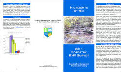
Highlights of the
2011 Forestry BMP Survey
Georgia's Best Management Practices for Forestry
Background
To better protect Georgia's streams and other water bodies from forestry nonpoint source pollution (primarily erosion and sedimentation), the forestry community developed Best Management Practices (BMPs) recommendations in 1981. These recommendations address all categories of practices that are encountered during normal silvicultural operations.
Since 1981, the Georgia Environmental Protection Division (GAEPD) has designated the Georgia Forestry Commission (GFC) as the lead agency for the forest water quality program. The GFC's main role is BMP education. Other responsibilities include mediating forestry complaints on behalf of GAEPD and monitoring BMP implementation.
In order to determine if BMP educational efforts have been effective, as well as the BMPs themselves, the GFC conducted BMP implementation surveys. In addition to this 2011 BMP Survey, GFC conducted surveys in 1991, 1992, 1998, 2002, 2004, 2007, and 2009, and also conducted a BMP effectiveness (turbidity) study in 1992. Together with these previous surveys and study, this 2011 Survey represents 20 years of forestry BMP monitoring in Georgia. These surveys have concluded that water quality, including aquatic habitat and overall stream ecosystem health, benefits when BMPs are consistently applied.
2011 Statewide BMP Survey
As with all our previous surveys, the objectives of the 2011 Statewide Forestry BMP Survey were to determine the: rates of BMP implementation; units of measure (acres, miles of road and stream) in BMP compliance; effectiveness of BMPs for any needed modifications; comparability of stream habitats above and below stream crossings; and areas to target for future BMP training.
The GFC conducted the survey using the protocol adopted by the Southern Group of State Foresters (SGSF). The SGSF developed this monitoring protocol through a task force comprised of hydrologists and water specialists from state forestry agencies, the US Forest Service, forest industry and the National Council for Air and Stream Improvement (NCASI) in consultation with the Environmental Protection Agency (EPA).
1
Statewide, 187 sites (covering approximately 22,000 acres) were selected in a stratified random sample and evaluated for BMP implementation and compliance. These sites had to have experienced forestry activities within the past two years, preferably within the last six months. By ownership, 59% of the sites were on nonindustrial private forest (NIPF) lands, 11% were on forest industry lands, 25% were on Corporate (TIMO) lands, and 5% were on publicly owned lands. Sites covered all geographic regions of the state.
Results
BMP implementation: The SGSF BMP monitoring protocol recommends that BMPs are assessed in terms of BMP Implementation. BMP Implementation rates were determined by dividing the number of applicable BMPs properly implemented by the total number of applicable BMPs. Implementation could then be determined for a category of practice, the entire site, and statewide. (see Figure 1)
Of the 5,711 applicable, individual BMPs evaluated, 95.3% were properly implemented. This is a 1.3% increase from the 2009 survey and a 30% increase since GFCs first survey in 1991.
Water Quality Risk: Another element of the SGSF BMP Monitoring Protocol is significant Water Quality Risk (WQR) assessment, a measure of BMP effectiveness. A WQR is assessed where impairment to a stream is occurring or imminent as a result of a forestry activity and presumably resulting from failure to properly implement one or more BMPs. WQRs remained low for the 2011 Survey at 26 total risks statewide. Since WQR began being assessed with the 1998 survey, WQRs have declined from over 450 (at least one or two per site) to 26 in the 2011 survey (0.1 per site). Where the BMPs were implemented, no water quality risks were identified. This means the BMPs are effective in reducing pollution when implemented. (see Figure 2)
BMP compliance: This BMP scoring methodology is specific to Georgia and attempts to quantify in units of measure areas impacted by any failure to fully implement BMPs. BMP Compliance rates were determined by dividing the number of units (acres, miles of road and stream) measured in compliance
2
with the BMPs by the total number of units measured. Compliance could then be determined for a category of practice, the entire site, and statewide.
Of the 21,977 acres of forestry activities evaluated, 99.8% are in compliance with BMPs. This figure has remained steady over the last few surveys.
Of the 359 total forest road miles assessed, 95.0% (341 miles) are in full compliance with BMPs. This is a one percent increase over the 2009 survey.
Of the 66 miles of stream evaluated, 93.6% (62 miles) were observed to have no impacts or impairments from forestry practices. This figure is statistically the same as for the 2009 survey.
Categories Surveyed
Pracetice or Category
% BMP Implementation
(SGSF Protocol)
% BMP Compliance
(Georgia Only Score)
Streamside
Management Zones
95
99.1 (acres)
(SMZs)
Stream Crossings
92.9
NA
Main Haul Roads
93.7
95 (miles)
Timber Harvesting
98.1
99.8 (acres)
Mechanical Site Preparation
95
99.9 (acres)
Chemical Site Preparation
100
100 (acres)
Control Burning
100
100 (acres)
Artificial Regeneration
100
100 (acres)
Equipment Servicing
97.9
NA
Special Management Areas
95.7
NA
Stream Miles
NA
93.6 (miles)
Overall
95.3
99.8 (acres)
3
Buffer of trees along the streams (SMZs) protects water quality.
Education is the Key
Overall, the forestry community's self-imposed BMPs are being implemented and are proving effective in protecting water quality on these sites. However, there
4
are still opportunities for improvement, including forest roads and stream crossings, especially in certain areas of the state. Since December 1995, the GFC has been cooperating with the University of Georgia, the Georgia Forestry Association (GFA), Southeast Wood Producers Association (SWPA) and the forest industry in the education of loggers and timber buyers through the Master Timber Harvester (MTH) program. This training includes intensive sessions on BMPs and related information conducted by GFC forest water quality professionals. Training stresses proper road layout and design and avoidance of stream crossings, but emphasizes full and proper installation of stream crossing BMPs where crossings are absolutely necessary. GFC Water Quality Program foresters average carrying out approximately 80 BMP training sessions per year, reaching an audience of over 2,500 forestry professionals annually . The GFC will continue to work with other natural resource agencies and organizations to educate private landowners on BMPs.
5