- Collection:
- Georgia Government Publications
- Title:
- Community wildfire protection plan, Columbia County : an action plan for wildfire mitigation and conservation of natural resources
- Creator:
- Abbott, Steve
Fell, Will - Contributor to Resource:
- Georgia. Forestry Commission
- Publisher:
- Macon, Ga. : Georgia. Forestry Commission
- Date of Original:
- 2009-05-01
- Subject:
- Wildfires--Georgia--Columbia County--Prevention and control
Fire management--Georgia--Columbia County
Chorochromatic maps - Location:
- United States, Georgia, 32.75042, -83.50018
United States, Georgia, Columbia County, 33.54412, -82.26406 - Medium:
- plans (reports)
- Type:
- Text
- Format:
- application/pdf
- External Identifiers:
- OCLC 1176222957
NZ MMS ID 9922031151302931
Call Number F600 .M1 2009 W5 C658 - Metadata URL:
- https://dlg.galileo.usg.edu/id:dlg_ggpd_s-ga-bf600-b-pm1-b2009-bw5-bc658-belec-p-btext
- Digital Object URL:
- https://dlg.galileo.usg.edu/do:dlg_ggpd_s-ga-bf600-b-pm1-b2009-bw5-bc658-belec-p-btext
- Language:
- eng
- Holding Institution:
- University of Georgia. Map and Government Information Library
- Rights:
-

__________________________
A Program of the Georgia Forestry Commission with support from the U.S. Forest Service
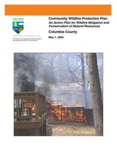
Community Wildfire Protection Plan
An Action Plan for Wildfire Mitigation and Conservation of Natural Resources
Columbia County
May 1, 2009
Prepared by; Steve Abbott, Chief Ranger Columbia County Will Fell CWPP Specialist Georgia Forestry Commission 5887 Wrightsboro Rd Harlem, GA 30814
The following report is a collaborative effort among various entities; the representatives listed below comprise the core decision-making team responsible for this report and mutually agree on the plan's contents:
Pam Tucker Columbia County EMA Director (706) 868-3303 ptucker@columbiacountyga.gov
Suzie Hughes Administrative Specialist Columbia EMA (706) 868-3303 shughes@columbiacountyga.gov.
Steve Abbott Chief Ranger, Columbia Co Forestry Unit (706) 556-3962 sabbott@gfc.state.ga.us
Mark Munns District Ranger Washington District (706) 678-2015 mmunns@gfc.state.ga.us.
Doug Cooper Chief Martinez Columbia Fire & Rescue (706) 831-1498 chiefcooper@mvfd.net .
Brent Willis Capt. Martinez Columbia Fire & Rescue (706) 863-7745 bwillis@mvfd.net
Chuck Meadows Interim Dir Harlem Dept of Public Safety (706) 556-6262 cmeadows@harlemga.org
Jesse Bowman Director Harlem Dept of Public Safety (706) 556-6262 JBowman@harlemga.org
Wayne Kent Captain Grovetown Dept of Public Safety (706) 863-1212 captkent@att.net
PLAN CONTENTS
I. Objectives ............................................................................................................................. 1 II. Community Collaboration .................................................................................................... 1 III. Community Background and Existing Situation ................................................................... 2 IV. Community Base Maps ......................................................................................................... 4 V. Community Wildfire Risk Assessment ................................................................................. 6 VI. Community Hazards Map ..................................................................................................... 9 VII. Prioritized Mitigation Recommendations ........................................................................... 12 VIII. Action Plan .......................................................................................................................... 16 IX. Wildfire Pre-Suppression Plan.............................................................Appended
WILDFIRE PROTECTION PLAN: AN ACTION PLAN FOR WILDFIRE MITIGATION
I. OBJECTIVES
The mission of the following report is to set clear priorities for the implementation of wildfire mitigation in Columbia County. The plan includes prioritized recommendations for the appropriate types and methods of fuel reduction and structure ignitability reduction that will protect this community and its essential infrastructure. It also includes a plan for wildfire suppression. Specifically, the plan includes community-centered actions that will:
Educate citizens on wildfire, its risks, and ways to protect lives and properties, Support fire rescue and suppression entities, Focus on collaborative decision-making and citizen participation, Develop and implement effective mitigation strategies, and Develop and implement effective community ordinances and codes.
II. COMMUNITY COLLABORATION
An initial meeting was held on December 17th 2008 at the Columbia County EMA Department attended by the following core planning team;
Will Fell Steve Abbott Mark Munns Doug Cooper Pam Tucker Suzie Hughes Wayne Kent Brett Willis Chuck Meadows
GFC CWPP Specialist GFC Chief Ranger Columbia County GFC Dist Ranger Dist 3 Fire Chief Martinez Columbia Fire & Rescue Columbia County EMA Director Admin Spec Columbia County EMA Captain Grovetown DPS Captain Martinez Columbia Fire & Rescue Interim Dir Harlem DPS
After an initial discussion of the processes and goals we hope to accomplish with this report, it was decided that we would define areas within the wildland urban interface. At the completion of this we would reconvene and discuss and evaluate the completed community wildfire risk assessments. It was further decided that we would provide for mitigation recommendations for the cities of Harlem and Grovetown and the suburban unincorporated areas of Evans and Martinez and the rural areas of the county. The chiefs of the area fire departments in the county assessed their districts and reconvened in February for the purpose of completing the following:
Risk Assessment
Assessed wildfire hazard risks and prioritized mitigation actions.
Fuels Reduction
Identified strategies for coordinating fuels treatment projects.
Structure Ignitability
Identified strategies for reducing the ignitability of structures within the Wildland interface.
Emergency Management Forged relationships among local government and fire districts and developed/refined a pre-suppression plan.
Education and Outreach Developed strategies for increasing citizen awareness and action and to conduct homeowner and community leader workshops.
Page 1
WILDFIRE PROTECTION PLAN: AN ACTION PLAN FOR WILDFIRE MITIGATION
III. COMMUNITY BACKGROUND AND EXISTING SITUATION
Background Columbia County lies along the Savannah River in east central Georgia, bordering South Carolina just northwest of Augusta. It was created by an act of the state legislature from a northern part of Richmond County on December 10, 1790. In the colonial era the territory that constitutes Columbia County was laid out as part of St. Paul Parish. Named for explorer Christopher Columbus, the county was created in response to a request by backcountry settlers that they be given court sessions that would be more convenient than those held in Augusta. Columbia County provided several leaders in national affairs. Of the six delegates appointed to attend the constitutional convention in Philadelphia, Pennsylvania, in 1787, William Few Jr. and Abraham Baldwin were from the portion of Richmond County that became Columbia. Few and Baldwin were the only two Georgia delegates who signed to ratify the Constitution of the United States. Both later served in the U.S. Senate, Baldwin as president pro tempore under U.S. president Thomas Jefferson. The earliest village in the county--Brandon--was founded around 1752. Brandon was abandoned sometime in the mid-1750s, although it appears on a 1779 map. The Quaker town of Wrightsborough was built on the same site in the 1760s, and William Bartram recorded a visit to that town in 1773. Both the oldest Baptist church in the state, Kiokee (established in 1772), and the third oldest, Abilene (established in 1774), were founded in what became Columbia County. There are more than thirty prehistoric sites in Columbia County. The most important, on Stallings Island, is a burial mound documenting a culture that flourished in the Archaic Period more than 4,000 years ago. After the Georgia Railroad was laid through the county around 1834-36, new communities, such as the incorporated cities of Harlem and Grovetown, sprang up or began to flourish. The current county seat, Appling, was chartered in 1816 and was named for Colonel Daniel Appling, a War of 1812 (1812-15) hero from the Columbia County area. Appling is one of many inactive municipalities that lost their incorporated status by an act of the Georgia General Assembly in 1993. In the 1850s thousands of acres in Columbia County were cotton plantations. Census records show that the county had a slave population of nearly 8,300, more than twice the white population. Columbia today is a bustling, fast-growing suburban county. According to the 2000 U.S. census, its population is 89,288 (82.7 percent white, 11.2 percent black, and 2.6 percent Hispanic). The county is economically diverse, with service, education, and health-related businesses as its major industries. (Courtesy New Georgia Encyclopedia)
Page 2
WILDFIRE PROTECTION PLAN: AN ACTION PLAN FOR WILDFIRE MITIGATION
Existing Situation
While Columbia County has in the past several decades become a rapidly growing suburban county with an estimated population of over 106,000, 66% of the land area still remains forested. There are large blocks of wildland remaining in the northern and western quadrants of the county. There is also suburban growth in the rapidly expanding suburbs of Augusta concentrated in the southeastern and central part of the county along with many homes and communities being built in traditionally forested areas of the county. This situation along with the many lake homes and communities nestled along the shores of Clark Hill Lake add to the growing concern among fire service agencies about the risks and hazards of protecting homes and infrastructure within the widening Wildland Urban Interface.
Columbia County is well protected by three organized fire departments. The Harlem Department of Public Safety covers the city of Harlem and the Grovetown Department of Public Safety covers the city of Grovetown and a small area of the county just to the south, each with two stations within their respective jurisdictions. The remainder of the county is covered by Martinez Columbia County Fire and Rescue with 16 stations well distributed throughout the unincorporated area county, 14 of which are staffed around the clock. The Georgia Forestry Commission maintains a unit with wildland fire suppression capability centered in the county.
While there are modern pressurized water systems available in the two incorporated cities and much of the suburban areas of Evans and Martinez, there is still a significant area outside these regions lacking ready access to hydrants and dependable water sources.
Over the past fifty years, Columbia County has averaged about 46 reported wildland fires per year and almost half of these have occurred during the months of February, March and April. These fires have burned an average of 169 acres annually. Of this annual acreage burned, 58% was lost during the above three months. Since the advent of the outdoor burning permit law about 20 years ago, the numbers of fires have decreased over the years as perhaps more residential areas have replaced wildland areas and the populace has become more cautious in their burning practices
The leading causes of these fires over the past 20 years, was debris burning causing 42% of the fires and 39% of the acres burned. Children were the next leading cause with 12% of the fires and 10% of the acres lost. More detailed records over the past five years show that almost 50% of these debris fires originated from escapes from household or residential debris burning.
Georgia Forestry Commission Wildfire Records show that in the past five years, four homes have been lost or damaged by wildfire in Columbia County resulting in estimated losses of $32,500 along with seven outbuildings valued at $24,600. According to reports during this period 174 homes have been directly or indirectly threatened by these fires. Additionally three vehicles valued at $8,000 and ten pieces of other mechanized equipment suffered damages estimated at $66,700. This is a significant loss of non timber property attributed to wildfires in Columbia County.
Page 3
WILDFIRE PROTECTION PLAN: AN ACTION PLAN FOR WILDFIRE MITIGATION
IV. COMMUNITY BASE MAP
Page 4
WILDFIRE PROTECTION PLAN: AN ACTION PLAN FOR WILDFIRE MITIGATION Page 5
WILDFIRE PROTECTION PLAN: AN ACTION PLAN FOR WILDFIRE MITIGATION
V. COMMUNITY WILDFIRE RISK ASSESSMENT
The Wildland-Urban Interface
There are many definitions of the Wildland-Urban Interface (WUI), however from a fire management perspective it is commonly defined as an area where structures and other human development meet or intermingles with undeveloped wildland or vegetative fuels. As fire is dependent on a certain set of conditions, the National Wildfire Coordinating Group has defined the wildland-urban interface as a set of conditions that exists in or near areas of wildland fuels, regardless of ownership. This set of conditions includes type of vegetation, building construction, accessibility, lot size, topography and other factors such as weather and humidity. When these conditions are present in certain combinations, they make some communities more vulnerable to wildfire damage than others. This "set of conditions" method is perhaps the best way to define wildland-urban interface areas when planning for wildfire prevention, mitigation, and protection activities.
There are three major categories of wildland-urban interface. Depending on the set of conditions present, any of these areas may be at risk from wildfire. A wildfire risk assessment can determine the level of risk.
1. "Boundary" wildland-urban interface is characterized by areas of development where homes, especially new subdivisions, press against public and private wildlands, such as private or commercial forest land or public forests or parks. This is the classic type of wildland-urban interface, with a clearly defined boundary between the suburban fringe and the rural countryside.
2. "Intermix" wildland-urban interface areas are places where improved property and/or structures are scattered and interspersed in wildland areas. These may be isolated rural homes or an area that is just beginning to go through the transition from rural to urban land use.
3. "Island" wildland-urban interface, also called occluded interface, are areas of wildland within predominately urban or suburban areas. As cities or subdivisions grow, islands of undeveloped land may remain, creating remnant forests. Sometimes these remnants exist as parks, or as land that cannot be developed due to site limitations, such as wetlands. (courtesy Fire Ecology and Wildfire Mitigation in Florida 2004)
Page 6
WILDFIRE PROTECTION PLAN: AN ACTION PLAN FOR WILDFIRE MITIGATION
As it was felt there was considerable variation in risk from one end of the county to the other, it was decided by the CORE assessment team to assess each of the two incorporated jurisdictions separately along with dividing the unincorporated area of the county into the largely suburban Martinez Evans area which is well serviced with a modern pressurized water system and the more rural western and northern sections with either pressurized water located only on the main roads or non existent.
The wildland fire risk assessments were conducted in early 2009 by the various Columbia County Fire Departments and returned an average score of 82, placing Columbia County overall in the "low moderate" hazard range. The assessments ranged from minimal risk in the Evans Martinez area to high risk in the rural north and western areas of the county. See the assessed factors and the summary of the assessments following.
The risk assessment instrument used to evaluate wildfire hazards to Columbia County's WUI was the Woodland Community Wildfire Hazard Risk Assessment Checklist. The instrument takes into consideration accessibility, vegetation (based on fuel models), topography, roofing assembly, building construction, and availability of fire protection resources, placement of gas and electric utilities, and additional rating factors. The following factors contributed to the wildfire hazard score for the various sections of Columbia County:
Evans Martinez Suburban Area (Low Risk); Sections of grown up wildland fuels within developed areas Lack of firewise construction and landscaping in some areas
City of Grovetown and adjacent subscription Area (Moderate Risk); Lack of defensible space in wildland interface areas. Lack of firewise construction and landscaping in some areas Large, adjacent areas of forest or wildlands Sections of grown up wildland fuels within developed areas.
City of Harlem (Moderate Risk) Long, narrow, and poorly labeled driveways Lack of defensible space in wildland interface areas. Lack of firewise construction and landscaping in some areas Large, adjacent areas of forest or wildlands High occurrence of wildfires in the several locations. Equipment to respond to off road situations.
Page 7
WILDFIRE PROTECTION PLAN: AN ACTION PLAN FOR WILDFIRE MITIGATION
Rural Unincorporated North and Western Columbia (High Risk) One way in and out in many communities. Addresses to homes not clearly marked. Long narrow driveways inaccessible to equipment. Thick, highly flammable vegetation surrounding many homes Minimal defensible space around structures Homes with wooden siding and roofs with heavy accumulations of vegetative debris. No pressurized or non-pressurized water systems available off major roads Dry hydrants and drafting sources unusable. Above ground utilities Large, adjacent areas of forest or wildlands Undeveloped lots comprising half the total lots in many rural communities. High occurrence of wildfires in the several locations
Dead end roads with inadequate turn arounds
Summary of Columbia County Assessment Ratings
Area
Fire Dept
Harlem
Harlem
Grovetown Evans Martinez
Rural County
Grovetown Martinez Columbia Martinez Columbia
Average
Access 5 5
Site Hazard
41
39
Bldg Hazard
10
10
Add. Hazards
26
28
Total Score
82
82
Hazard Rating Moderate Risk Moderate Risk
3
17
5
6
31 Low Risk
13
60
5
7
39
8
54
132 High Risk
Moderate
28
82 Risk
Page 8
WILDFIRE PROTECTION PLAN: AN ACTION PLAN FOR WILDFIRE MITIGATION
VI. COMMUNITY HAZARDS MAPS
Page 9
WILDFIRE PROTECTION PLAN: AN ACTION PLAN FOR WILDFIRE MITIGATION Page 10
WILDFIRE PROTECTION PLAN: AN ACTION PLAN FOR WILDFIRE MITIGATION Page 11
WILDFIRE PROTECTION PLAN: AN ACTION PLAN FOR WILDFIRE MITIGATION
VII. PRIORITIZED MITIGATION RECOMMENDATIONS
Executive Summary
The following recommendations were developed by the Columbia County CWPP Core team as a result of surveying and assessing fuels and structures and by conducting meetings and interviews with county and city officials. A priority order was determined based on which mitigation projects would best reduce the hazard of wildfire in the assessment area.
Proposed Community Hazard and Structural Ignitability Reduction Priorities
Primary Protection for Community and Its Essential Infrastructure
Treatment Area
Treatment Types
Treatment Method(s)
1. All Structures 2. Applicable Structures
3. Community Clean-up Day 4. Road Signage 5. Road Access 6. Subdivision Access
Create minimum of 30feet of defensible space**
Reduce structural ignitability**
Cutting, mowing, pruning**
At Replacement
Identify needed road improvements Alternate exits
Educate homeowners to trim shrubs and vines to 30 feet from structures, trim overhanging limbs, replace flammable plants near homes with less flammable varieties, remove vegetation around chimneys.
Educate owners to clean flammable vegetative material from roofs and gutters, store firewood appropriately, install skirting around raised structures, store water hoses for ready access, replace pine straw and mulch around plantings with less flammable landscaping materials.
Work with Homeowners Associations to encourage to cut, prune, and mow vegetation in shared community spaces where needed.
New road signage with minimum 4 inch reflective lettering on non flammable poles. Dead end (no outlet or turnaround) should be prominently tagged.
As roads are upgraded, widen to minimum standards with at least 50 foot diameter cul de sacs.
Work with developers to identify and create alternate access and exits routes to subdivisions and communities with only one way in and out.
Page 12
WILDFIRE PROTECTION PLAN: AN ACTION PLAN FOR WILDFIRE MITIGATION
7. Codes and Ordinances
Examine existing codes and ordinances.
Amend and enforce existing building codes as they relate to skirting, propane tank locations, public nuisances (trash/debris on property), Property address marking standards and other relevant concerns
As zoning, planning and subdivision ordinances are updated include fire department and emergency services input in the design of these.
Proposed Community Wildland Fuel Reduction Priorities
Treatment Area
Treatment Types
Treatment Method(s)
1. Adjacent WUI Lands
Reduce hazardous fuels
Encourage prescribed burning for private landowners and industrial timberlands particularly adjacent to residential areas
2. Corps of Engineer Lands
Reduce hazardous fuels
Enter into discussion with C o E land management on fuel reduction activities adjacent to residential areas.
3. Existing Fire Lines
Reduce hazardous fuels Clean and re-harrow existing lines.
Proposed Improved Community Wildland Fire Response Priorities
1. Water Sources
Dry Hydrants
Inspect, maintain and improve access to existing dry hydrants. Add signage along road to mark the hydrants
2. Fire Stations
Equipment
Wildland hand tools. Lightweight Wildland PPE Gear. Larger capacity hose. Investigate need for "brush" trucks.
3. Personnel
Training
Obtain Wildland Fire Suppression training for Fire Personnel.
**Actions to be taken by homeowners and community stakeholders
Page 13
WILDFIRE PROTECTION PLAN: AN ACTION PLAN FOR WILDFIRE MITIGATION
Proposed Education and Outreach Priorities
1. Conduct "How to Have a Firewise Home" Workshop for Columbia County Residents
Set up and conduct a workshop for homeowners that teach the principles of making homes and properties safe from wildfire. Topics for discussion include defensible space, landscaping, building construction, etc. Workshop will be scheduled for evenings or weekends when most homeowners are available and advertised through local media outlets. Distribute materials promoting firewise practices and planning through local community and governmental meetings.
2. Conduct "Firewise" Workshop for Community Leaders Arrange for GFC Firewise program to work with local community leaders and governmental officials on the importance of "Firewise Planning" in developing ordinances and codes as the county as the need arises. Identify "Communities at Risk" within the county for possible firewise community recognition.
3. Spring Clean-up Event
Conduct clean-up event every spring involving the Georgia Forestry Commission, Grovetown, Harlem and Martinez - Columbia County Fire Departments and community residents. Set up information table with educational materials and refreshments. Initiate the event with a morning briefing by GFC Firewise coordinator and local fire officials detailing plans for the day and safety precautions. Activities to include the following:
Clean flammable vegetative material from roofs and gutters Trim shrubs and vines to 30 feet away from structures Trim overhanging limbs Clean hazardous or flammable debris from adjacent properties Celebrate the work with a community cookout, with Community officials, GFC and Grovetown, Harlem and Martinez - Columbia County Fire Departments discussing and commending the work accomplished.
4. Informational Packets
Develop and distribute informational packets to be distributed by permitting authorities, code enforcement, realtors and insurance agents. Included in the packets are the following:
Be Firewise Around Your Home Firewise Guide to Landscape and Construction Firewise Communities USA Bookmarks
Page 14
WILDFIRE PROTECTION PLAN: AN ACTION PLAN FOR WILDFIRE MITIGATION
5. Wildfire Protection Display Create and exhibit a display for the general public at the various fire stations rotating around during fire prevention month. Display can be independent or combined with the Georgia Forestry Commission display. 6. Local Press Invite the Columbia County News - Times and the Augusta Chronicle to community "Firewise" functions for news coverage and regularly submit press releases documenting wildfire risk improvements in Columbia County. 7. Columbia County Website Create a community Firewise Page on the Columbia County Website. Publish the Columbia County Community Wildfire Protection Plan on the county's website and establish links to Firewise websites to provide easy access for homeowners to access this information.
Page 15
WILDFIRE PROTECTION PLAN: AN ACTION PLAN FOR WILDFIRE MITIGATION
VIII. ACTION PLAN
Roles and Responsibilities The following roles and responsibilities have been developed to implement the action plan:
Role
Responsibility
Hazardous Fuels and Structural Ignitability Reduction
Columbia County Wildland Urban Interface Fire Council
Create this informal team or council comprised of residents, GFC officials, Grovetown, Harlem and Martinez - Columbia County Fire Department officials, a representative from the cities and county governments and the EMA Director for Columbia County. Meet periodically to review progress towards mitigation goals, appoint and delegate special activities, work with federal, state, and local officials to assess progress and develop future goals and action plans. Work with residents to implement projects and firewise activities.
Key Messages to focus on
1 Defensible Space and Firewise Landscaping 2 Debris Burning Safety 3 Firewise information for homeowners 4 Prescribed burning benefits
Communications objectives
1 Create public awareness for fire danger and defensible space issues
2 Identify most significant human cause fire issues
3 Enlist public support to help prevent these causes
4 Encourage people to employ fire prevention and defensible spaces in their communities.
Target Audiences
1 Homeowners 2 Forest Landowners and users 3 Civic Groups 4 School Groups
Methods
1 News Releases 2 Personal Contacts 3 Key messages and prevention tips 4 Visuals such as signs, brochures and posters
Page 16
WILDFIRE PROTECTION PLAN: AN ACTION PLAN FOR WILDFIRE MITIGATION
Spring Clean-up Day Event Coordinator Event Treasurer Publicity Coordinator
Work Supervisor
Coordinate day's events and schedule, catering for cookout, guest attendance, and moderate activities the day of the day of the event.
Collect funds from residents to cover food, equipment rentals, and supplies.
Advertise event through neighborhood newsletters, letters to officials, and public service announcements (PSAs) for local media outlets. Publicize post-event through local paper and radio PSAs.
Develop volunteer labor force of community residents, develop labor/advisory force from Georgia Forestry Commission, Grovetown, Harlem and Martinez - Columbia County Fire Departments, and Emergency Management Agency. Procure needed equipment and supplies. In cooperation with local city and county officials, develop safety protocol. Supervise work and monitor activities for safety the day of the event.
Funding Needs The following funding is needed to implement the action plan:
Project
Estimated Cost Potential Funding Source(s)
1. Create a minimum of 30 feet of defensible space around structures
Varies
Residents will supply labor and fund required work on their own properties.
2. Reduce structural ignitability by cleaning flammable vegetation from roofs and gutters, appropriately storing firewood, installing skirting around raised structures, storing water hoses for ready access, and using firewise landscaping around homes
Varies
3. Amend codes and ordinances to provide
No Cost
better driveway access, increased visibility of
house numbers, properly stored firewood,
minimum defensible space brush clearance,
required Class A roofing materials and
skirting around raised structures, planned
maintenance of community lots.
Residents will supply labor and fund required work on their own properties.
To be adopted by city and county governments as needed.
4. Spring Cleanup Day
Varies
Community Business Donations.
5. Fuel Reduction Activities
$15 / Acre
FEMA & USFS Grants
Page 17
WILDFIRE PROTECTION PLAN: AN ACTION PLAN FOR WILDFIRE MITIGATION
POTENTIAL FUNDING SOURCES:
As funding is questionable in these times of tight government budgets and economic uncertainty, unconventional means should be identified whereby the need for funding can be reduced or eliminated. Publications / Brochures
FIREWISE materials are available for cost of shipping only at www.firewise.org.
Another source of mitigation information can be found at www.nfpa.org.
Access to reduced cost or free of charge copy services should be sought whereby publications can be reproduced.
Free of charge public meeting areas should be identified where communities could gather to be educated regarding prevention and firewise principles.
Mitigation Community Protection Grant:
o USFS sponsored prescribed burn program. Communities with at risk properties that lie within 3 miles of the USFS border may apply with the GFC to have their forest land prescribed burned free of charge.
FEMA Mitigation Policy MRR-2-08-01: through GEMA - Hazard Mitigation Grant Program (HMGP) and Pre Disaster Mitigation (PDM)
o To provide technical and financial assistance to local governments to assist in the implementation of long term cost effective hazard mitigation measures.
o This policy addresses wildfire mitigation for the purpose of reducing the threat to all-risk structures through creating defensible space, structural protection through the application of ignition resistant construction, and limited hazardous fuels reduction to protect life and property.
o With a complete and registered plan (addendum to the State plan) counties can apply for pre mitigation funding. They will also be eligible for HMGP if the county is declared under a wildfire disaster.
GFC - Plowing and burning assistance can be provided through the Georgia Forestry Commission as a low cost option for mitigation efforts.
Individual Homeowners
In most cases of structural protection ultimately falls on the responsibility of the community and the homeowner. They will bear the cost; yet they will reap the benefit from properly implemented mitigation efforts.
GEMA Grant - PDM (See above)
Ultimately it is our goal to help the communities by identifying the communities threatened with a high risk to wildfire and educate those communities on methods to implement on reducing those risks.
Page 18
WILDFIRE PROTECTION PLAN: AN ACTION PLAN FOR WILDFIRE MITIGATION
Assessment Strategy To accurately assess progress and effectiveness for the action plan, the Columbia County WUI Fire Council will implement the following:
Annual wildfire risk assessment will be conducted to re-assess wildfire hazards and prioritize needed actions.
Mitigation efforts that are recurring (such as mowing, burning, clearing of defensible space) will be incorporated into an annual renewal of the original action plan.
Mitigation efforts that could not be funded in the requested year will be incorporated into the annual renewal of the original action plan.
Continuing educational and outreach programs will be conducted and assessed for effectiveness. Workshops will be evaluated based on attendance and post surveys that are distributed by mail 1 month and 6 months following workshop date.
The Columbia County WUIFC will publish an annual report detailing mitigation projects initiated and completed, progress for ongoing actions, funds received, funds spent, and in-kind services utilized. The report will include a "state of the community" section that critically evaluates mitigation progress and identifies areas for improvement. Recommendations will be incorporated into the annual renewal of the action plan.
An annual survey will be distributed to residents soliciting information on individual mitigation efforts on their own property (e.g., defensible space). Responses will be tallied and reviewed at the next Columbia County WUIFC meeting. Needed actions will be discussed and delegated.
This plan should become a working document that is shared by local, state, and federal agencies that will use it to accomplish common goals. An agreed-upon schedule for meeting to review accomplishments, solve problems, and plan for the future should extend beyond the scope of this plan. Without this follow up this plan will have limited value
Page 19
WILDFIRE PROTECTION PLAN: AN ACTION PLAN FOR WILDFIRE MITIGATION
P. O. Box 819Macon, GA 312021-800-GATREESGaTrees.org
The Georgia Forestry Commission provides leadership, service, and education in the protection and conservation of Georgia's forest resources.An Equal Opportunity Employer and Service Provider
Page 20