- Collection:
- Georgia Government Publications
- Title:
- [Georgia facts and school report] [Jan. 2011]
- Creator:
- Georgia. Department of Economic Development. Tourism Division
- Contributor to Resource:
- Georgia. Department of Economic Development. Tourism Division
- Publisher:
- Atlanta, Ga. : Georgia. Department of Economic Development. Tourism Division
- Date of Original:
- 2011-01
- Subject:
- Georgia
- Location:
- United States, Georgia, 32.75042, -83.50018
- Medium:
- publications (documents)
- Type:
- Text
- Format:
- application/pdf
- External Identifiers:
- Call Number GA E200.T6 M1 2011 F3
- Metadata URL:
- https://dlg.galileo.usg.edu/id:dlg_ggpd_s-ga-be200-pt6-bm1-b2011-bf3-belec-p-btext
- Digital Object URL:
- https://dlg.galileo.usg.edu/do:dlg_ggpd_s-ga-be200-pt6-bm1-b2011-bf3-belec-p-btext
- Language:
- eng
- Holding Institution:
- University of Georgia. Map and Government Information Library
- Rights:
-

GEORGIA
In February 1733, James Edward Oglethorpe landed at Yamacraw Bluff, later known as Savannah, to establish the thirteenth colony and last British Colony. This British Colony was named in honor of King George II.
The only Indian tribe living within 50 miles of the new colony was the Yamacraw Indians. Other Indian tribes in Georgia were the Cherokee, Creek, Seminole, Weeden and Kolomoki who roamed Georgia for centuries. Although our Indians natives are long gone, picturesque reminders of their presence are in many geographical historic sites throughout Georgia.
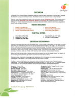
INDIAN MOUNDS
o Etowah Indian Mounds o Ocmulgee National Monument o Sautee Nacoochee Indian Mound
o Rood Creek Mounds o Kolomoki Mounds State Park o Rock Eagle Effigy Mound
CAPITAL CITIES
o SAVANNAH (1776-1785) o AUGUSTA (1785-1796) o LOUISVILLE (1796-1806)
o MILLEDGEVILLE (1807-1868) o ATLANTA (1868-Present)
GEORGIA GEOGRAPHY
Georgia is the largest state east of the Mississippi River. It has a variety of landscapes and soil types. No other state offers the contrasts that can be found, from the Appalachian Mountains in the north to the marshes of the Atlantic in the southeast and the mysteries of the Okefenokee Swamp. The Savannah River forms a portion of the eastern border of the state beginning in Augusta, and the Chattahoochee River flows between Alabama and Georgia from West Point to Florida, creating a western border. The Atlantic Ocean shapes our coastal boundary. Bordering states are Florida, North Carolina, South Carolina, Tennessee and Alabama.
Within the 58,906 square miles of Georgia, about half the streams flow into the Atlantic Ocean. The majority of the remaining streams flow through Alabama and Florida into the Gulf of Mexico.
Georgia's climate is mild with an average winter temperature 40 to 50 degrees and summer temperatures averaging 80 to 90 degrees. The average annual rain fall is about 47 inches.
Georgia is located in the Eastern time zone and is home to the world's busiest airport, Hartsfield-Jackson International. Four major Interstate highways run through the state, I-75, I-85, I-20, I-95. I-16 runs from Macon to Savannah and I-59 is in the far northwest corner of the state between Tennessee and Alabama.
Governor: Nathan Deal Lt. Governor: Casey Cagle Attorney General: Sam Olens Secretary of State: Brian Kemp State School Superintendent: John Barge Government: U.S. Congressional Districts 13, U.S. Senators 2, State Senators 56, State House Representatives 180 Georgia Population (2009): 9,829,211 Land Area (square miles): 57,906 Admission to Statehood: January 2, 1788 Statehood: 4th of the original 13 colonies Number of Counties: 159
Geographic Center: Twiggs County, 18 miles southeast of Macon Highest Point: 4,784 feet, Brasstown Bald Lowest Point: Atlantic coast, sea level State Motto: Wisdom, Justice, and Moderation Origin of State's Name: Named for King George II of England Nickname: Peach State Agriculture: Poultry and eggs, peanuts, cattle, dairy products, and vegetables Industry: Transportation equipment, food processing, paper products, chemical products, electric equipment and tourism
www.ExploreGeorgia.org 800-VISIT GA
Cherokee Rose State Flower
GEORGIA STATE SYMBOLS
Brown Thrasher State Bird
Live Oak State Tree
Bobwhite Quail State Game Bird
Large Mouth Bass State Fish
Honeybee State Inset
Tiger Swallowtail State Butterfly
Gopher Tortoise State Reptile
Right Whale State Marine Mammal
Shark Tooth State Fossil
Quartz State Fossil
Knobbed Whelk State Seashell
Staurolite Crystals State Mineral
Azalea State Wild Flower
Georgia Grown Peaches Vidalia Onion
State Fruit
State Vegetable
Peanut State Crop
Georgia on My Mind State Song "Just an old sweet Song keeps Georgia"
State Flag
Great Seal of Georgia
Additional information on Georgian can be found on our website www.ExploreGeorgia.org. The Secretary State's Office offers a complete overview of Georgia history at www.sos.georgia.gov.
www.ExploreGeorgia.org 800-VISIT GA
Georgia Department of Economic Development
75 Fifth Street
Atlanta, GA 30308
2