- Collection:
- Georgia Government Publications
- Title:
- West Point Quality Growth Resource Team report
- Creator:
- West Point Quality Growth Resource Team
Georgia. Quality Growth Partnership
Georgia. Department of Community Affairs - Contributor to Resource:
- Georgia. Department of Community Affairs. Planning and Environmental Management Division. Office of Planning and Quality Growth
- Publisher:
- Atlanta, Ga. : Georgia. Department of Community Affairs. Planning and Environmental Management Division. Office of Planning and Quality Growth
- Date of Original:
- 2008-01
- Subject:
- Cities and towns--Georgia--West Point
City planning--Georgia--West Point
Urban policy--Georgia--West Point - Location:
- United States, Georgia, 32.75042, -83.50018
- Medium:
- chorochromatic maps
transportation maps
conceptual drawings - Type:
- Text
- Format:
- application/pdf
- External Identifiers:
- Call Number GA C495.E5 M1 2008 W4
- Metadata URL:
- https://dlg.galileo.usg.edu/id:dlg_ggpd_s-ga-bc495-pe5-bm1-b2008-bw4-belec-p-btext
- Digital Object URL:
- https://dlg.galileo.usg.edu/do:dlg_ggpd_s-ga-bc495-pe5-bm1-b2008-bw4-belec-p-btext
- Language:
- eng
- Holding Institution:
- University of Georgia. Map and Government Information Library
- Rights:
-

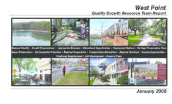
West Point
Quality Growth Resource Team Report
Regional Identity Growth Preparedness Appropriate Business Educational Opportunities Employment Options Heritage Preservation, Open Space Preservation Environmental Protection Regional Cooperation Transportation Alternatives Regional Solutions Housing Opportunities
Traditional Neighborhood Infill Development Sense of Place
January 2008
West Point Quality Growth Resource Team Report
Table of Contents Introduction................................................................................................1- 8 Growth Preparedness............................................................................... 9 - 12 Highway 18 Gateway Neighborhoods........................................................ 13 - 26 Historic Downtown.................................................................................... 27 - 36 Chattahoochee River and Rural Highway 29............................................... 37 - 44 Kia Parkway and Kia Boulevard.................................................................. 45 - 58
January, 2008
Introduction
Quality Growth Resource Team
What is a Resource Team?
The Resource Team concept was born of the realization that Georgia's communities often requested intense design and development assistance, and that the width and breadth of community need often exceeded that of the expertise of the Office of Planning and Quality Growth staff. Since 2000, the Department of Community Affairs, in conjunction with a variety of state, regional, local and private industry partners, has provided an opportunity for Georgia's governments to receive intense, targeted recommendations for managing growth and development in a sustainable, orderly fashion. Based on the charrette concept used by planning and architecture schools (which requires a team to create a product in a short, specified period), a Resource Team brings together experts from a variety of fields, most often:
Working together, these varied disciplines spend five days in the host community studying the physical space, the local government's ordinances and policies, and interviewing elected and appointed officials to determine options for change. The resource team creates a report for the host community that focuses on strategies for future community development and redevelopment; and presents it to all interested parties in the community on the final day of the team visit.
The Department of Community Affairs, acting as the project organizer, provides core staff and equipment to the team, and is responsible for the final report as well. The Department makes the draft report available to the public for comment after the team visit. Finally, members of the Resource Team return to the community to present the final report and assist community leaders in creating and prioritizing an implementation schedule.
Architecture Landscape architecture and streetscape design Urban design Transportation design Natural preservation Historic preservation Legal professionals Finance professionals Government and administration professionals
West Point Quality Growth Resource Team Report
Quality Growth Resource Team
Georgia's Quality Community Objectives
In 1999 the Board of the Department of Community Affairs adopted the Quality Community Objectives (QCOs) as a statement of the development patterns and options that will help Georgia preserve its unique cultural, natural and historic resources while looking to the future and developing to its fullest potential. These objectives are grouped around the broader concepts of:
Community Development Patterns Resource Conservation Social and Economic Development Government Relations
Because The Constitution of the State of Georgia embraces the ideals of Home Rule, each of our local governments has the power and responsibility to make land use and planning decisions within its jurisdictional boundaries. The Department's Quality Community Objectives may serve as guiding principles for elected and appointed leaders in our communities, as they strive to foster and create communities that Georgians are proud to call home.
Community Development Patterns
Traditional Neighborhoods
Traditional
neighborhood
development patterns should be
encouraged, including use of more
human scale development, compact
development, mixing of uses within
easy walking distance of one another,
and facilitating pedestrian activity
Infill Development
Communities should maximize the use of existing infrastructure and minimize the conversion of undeveloped land at the urban periphery by encouraging development or redevelopment of sites closer to the downtown or traditional urban core of the community.
Sense of Place Traditional downtown areas should be maintained as the focal point of the community, or for newer areas where this is not possible, the development of activity centers that serve as community focal points should be encouraged. These community focal
points should be attractive, mixed-use, pedestrian-friendly places
where people choose to gather for shopping, dining, socializing, and entertainment.
Transportation Alternatives Alternatives to transportation by automobile, including mass transit, bicycle routes and pedestrian facilities, should be made available in each community. Greater use of alternate transportation should be encouraged.
Regional Identity
Each region should promote and preserve a regional "identity," or regional sense of place, defined in terms of traditional architecture, common economic linkages that bind the region together, or other shared characteristics.
West Point Quality Growth Resource Team Report
Quality Growth Resource Team
Resource Conservation
natural terrain, drainage, and vegetation of an area should be
Heritage Preservation
preserved.
The traditional character of the
community should be maintained through preserving and revitalizing historic areas of the community, encouraging new development that is compatible with the traditional features of the community, and protecting other scenic or natural features that are important to defining the community's character.
Social and Economic Development
Housing Choices A range of housing size, cost and density should be provided in each community to make it possible for all who work in the community to also live in the community (thereby reducing commuting distances), to
promote a mixture of income and age-groups in each community,
Open Space Preservation
and to provide a range of housing choice to meet market needs.
New development should be
designed to minimize the amount Growth Preparedness of land consumed, and open Each community should identify and put in place the pre-requisites space should be set aside from for the types of growth it seeks to achieve. These might include development for use as public parks infrastructure (roads, water, sewer) to support new growth, or as greenbelts/wildlife corridors. appropriate training of the workforce, ordinances and regulations to Compact development ordinances manage growth as desired, or leadership capable of responding to are one way of encouraging this type of open space preservation. growth opportunities and managing new growth when it occurs.
Environmental Protection
Environmentally sensitive areas should be protected from negative impacts of development, particularly when they are important for maintaining traditional character or the quality of life of the community or region. Whenever possible, the
Appropriate Businesses The businesses and industry encouraged to develop or expand in a community should be suitable for the community in terms of job skills required, long-term sustainability, linkages to other economic activities in the region, impact on the resources of the area, and future prospects for expansion and creation of higher-skilled job oppor tunities.
Employment Options A range of job types should be provided in each community to meet the diverse needs of the local workforce.
Educational Opportunities Educational and training opportunities should be readily available in each community to permit community residents to improve their job skills, adapt to technological advances, or to pursue entrepreneurial ambitions.
Governmental Relations
Regional Solutions Regional solutions to needs shared by more than one jurisdiction are preferable to separate local approaches, particularly where this will result in greater efficiency and less cost to the taxpayer.
Regional Cooperation Regional cooperation should be encouraged in setting priorities, identifying shared needs, and finding collaborative solutions, particularly where it is critical to the success of a venture, such as protection of shared natural resources or development of a transportation network.
Each of these Quality Community Objectives frames the work of the Resource Team in West Point. It is our sincere belief that communities that build with the future in mind, with the principle of sustainability at the forefront, are those that will flourish in the 21st century and beyond.
West Point Quality Growth Resource Team Report
Quality Growth Resource Team
West Point, Georgia
is scheduled to begin production in 2009 and is expected to
The City of West Point has a long, proud history of railroading produce 300,000 vehicles a year at full capacity. The 224,000-
and manufacturing in the State of Georgia, and in the early square meter plant will be situated on a site covering 2.6 million
21st century, stands poised to carry that tradition far into the square meters. The plant will employ approximately 2,500
future. As with many small towns across the South, West workers, while multiple suppliers have announced operation
Point's fortunes have risen and fallen in accordance with the plans in Troup County and its environs, creating an additional
larger national and international manufacturing economies. 2,000 jobs.
During the late 19th and early 20th centuries, West Point and The
Valley (as the surrounding area is known locally) were national Straddling the Chattahoochee River, the States of Georgia and
leaders in textile manufacturing, home to eleven mills producing Alabama, and inextricably linked with the Alabama Cities of
a wide variety of products. Since the 1980s, however, the area Valley and Lanett, West Point enjoys a unique vantage point,
has seen a steady decline in the power of American textiles, both economically and geographically. As the last Georgia
and has watched as the mills have downsized and closed.
This shift in the local economy has left the area with a wealth
of beautiful, historic mill structures, but without 21st century
uses, these enormous buildings contribute little but a sense of
loss to the area.
town on I85 South, or the first Georgia town on I85 North, West Point entertains the possibility of making an impression for the entire State of Georgia. The Kia manufacturing facility, currently under construction in Winter 2008, makes a lasting visual impression on all travelers. We encourage the City and Kia to work to make that impression positive. As the City remakes itself for the 21st century, as a major player in the international automotive manufacturing industry, it has the potential to become one of Georgia's leading destinations. In the words of Mayor Drew Ferguson, "we want West Point to be the premiere city in Georgia." This Resource Team report is our best effort to help the citizens of the City of West Point live up to that estimable challenge.
Now, however, due to the determination of local leaders and the support of state economic development officials, West Point stands to undergo a significant change, from small mill-town to a regional city attracting international visitors. In 2005, with Governor Sonnny Purdue's announcement that Kia Manufacturing was locating its first North American automobile manufacturing facility in West Point, the city began considering its options to achieve its highest potential during the 21st century.
The Kia facility, Kia Motors Manufacturing Georgia (KMMG)
West Point Quality Growth Resource Team Report
Quality Growth Resource Team
Bringing a Resource Team to West Point
Realizing the potential for new development to affect the historic downtown, the West Point DDA initially prepared a request for a Resource Team in early 2007. City leaders understood that new development associated with KMMG could possibly detract from the viability of the existing downtown, and wanted to minimize the negative aspects of that potential.
Core members of the Quality Growth Resource Team began visiting West Point in November 2007, prior to the entire team's visit in January 2008. During these visits, staff met with elected and appointed officials of the city, as well as several citizens interested in the past and future of West Point. In addition, staff gathered all available information regarding current and future design and development of the city. As the core team continued its interviews, research and photographic sessions of the city, they began to define a series of "character areas" within the city on which to focus the team's attention. With the input of subsequent team members, invited for their particular expertise, the city and the Resource Team defined the final character areas as follows:
The Highway 18 corridor from Interstate 85 to Historic Downtown West Point: the road running through the area serves as the main gateway into the city for visitors outside The Valley area, and is surrounded on both sides by historic neighborhoods, small businesses, and West Point Elementary School. Its importance as the "first impression of West Point" cannot be stated too strongly.
Historic Downtown: the stock of late 19th century buildings,
the urban pattern built up around the existing railroad, and the (potentially) breathtaking views of the Chattahoochee River running through the center of town provide this area with a unique charm waiting to be revealed. The Chattahoochee River and Highway 29: this area provides the city with its highest potential for natural and recreational resources. In addition, the rural character of Highway 29 north of the city provides an interesting change in land uses outside of town that are well worth preserving. Kia Boulevard and Kia Parkway: the opportunity to create a new community from the ground up, using traditional design, environmentally sound principles, and an orientation to the human scale, for both residents and visitors, is an exciting idea for West Point, and one that the Resource Team thought was of great importance to the overall future of the city.
The Department of Community Affairs' Local Planning Requirements define a character area as:
A specific geographic area within the community that: i. has unique or special characteristics to be preserved or enhanced (such as a downtown, a historic district, a neighborhood, or a transportation corridor); ii. has potential to evolve into a unique area with more intentional guidance of future development through adequate planning and implementation (such as a strip commercial corridor that could be revitalized into a more attractive village development pattern); or
iii.requires special attention due to unique development issues (rapid change of development patterns, economic decline, etc.).
Each character area is a planning sub-area within the community where more detailed, small-area planning and implementation of certain policies, investments, incentives, or regulations may be applied in order to preserve, improve, or otherwise influence its future development patterns in a manner consistent with the community vision.
Historic Downtown Highway 18/10th
Street Chattahoochee
River and Highway 29 Kia Boulevard and Kia Parkway
West Point Quality Growth Resource Team Report
Quality Growth Resource Team
The Resource Team Process
as a policy; "We will promote and strengthen our downtown by
"In many cases, involving the public is a contentious and even messy
guiding new development that enhances our existing community."
process...but plans developed without citizen involvement....lack
When analyzing the options prior to making a decision, staff and
the buy-in necessary for success and make it more difficult to build
elected officials should consider the effects of the decision on
support."
the stated policies of the community.
International City County Managers' Association and American Planning
Investment: Communities guide development through their
Association
budget process, whether intentionally or not. Investments are
financial expenditures that will provide immediate and future
Human beings know good design when they see it just look at the public
returns to the community.
spaces that we love. All of these spaces, whether in small towns, state
Incentive: The classic example of quid pro quo. A community is
parks or big cities, have elements in common that people appreciate.
interested in certain types of development (a variety of housing
Some of these elements are intangible, like "sense of place," while others,
types, community greenspace or parks, infill development in
like sidewalk depth or tree spacing, are easily quantifiable. While humans
or near an already developed area, shade trees planted along
can see and feel good design, they often have a harder time describing
rights-of-way) and is willing to provide something to a developer
what they want in terms of their community. In order to provide the
or property owner in order promote these development patterns.
citizens of West Point the opportunity to articulate their visions for West
Some examples include: reducing filing and permitting fees for
Point, the resource team began its work by hosting an open house on
projects that meet certain criteria, expedited review for projects,
Monday evening. The team provided citizens an opportunity to comment
a portion of public investment in a project.
on a variety of the Quality Community Objectives, and then to provide
Regulation: A community's local ordinances. In this
input regarding their individual concerns and visions for West Point. This
report, regulation recommendations focus on land use and
citizen input is, first and foremost, the most important element of the
development.
resource team's recommendations.
As a builder uses a variety of tools to construct a house, so should a
community use a variety of tools when creating a great place. Each
Recommendations in the Report
of these tools complements the others, yet none of them will create a
The Resource Team report is segmented by study area, with specific finished product on their own.
recommendations for each. These recommendations are categorized as
follows:
Policy: The city leadership makes decisions on a variety of
topics each month. Local policies are those statements of ideals
that will help a community achieve its goals. For example, a
community that strives to create a strong sense of place may use
West Point Quality Growth Resource Team Report
Quality Growth Resource Team
Building the Team After defining the project scope with city leaders, staff from the Office of Planning and Quality Growth selected a team capable of meeting the city's specific needs. Each member brought a wealth of information, knowledge and commitment to excellence to the City of West Point. Their array of skills are the foundation for this report. Their
Cherie Bennett Georgia Department of Community Affairs
Matt Bishop The University of Georgia
John Cheek HOK
Casey Deen Georgia Department of Community Affairs
Cynthia Harrison Georgia Department of Community Affairs
Ulysses Mitchell Georgia Department of Transportation
Danny Bivins The University of Georgia
Dennis Epps The University of Georgia
Joanie Perry Georgia Department of Community Affairs
Rebecca Born Georgia Department of Community Affairs
Saskia Benjamin The Georgia Conservancy
Krystal Fowler Georgia Department of Transportation
Steve Gavigan Georgia Department of Community Affairs
Paul Simo MACTEC, Inc.
Corinne Blencoe Thornton Georgia Department of Community Affairs
Jan Coyne The University of Georgia
Kirby Glaze Public Private Partnership Project Management, Inc
Bradd Stuart Georgia Department of Community Affairs
Annaka Woodruff Georgia Department of Community Affairs
With Special Thanks to: Joy Wilkins, Georgia Institute of Technology; Karen Leone de Nie, Georgia Institute of Technology; Kent Kirbow, Friend of Safe, Decent and Affordable Housing
West Point Quality Growth Resource Team Report
1 Growth Preparedness
Growth Preparedness
West Point: Overall Growth Strategies:
The time is now for the City of West Point. The combination of private and public investment responsible for KMMG's location in the city is changing the face of the city and surrounding region significantly. This investment will draw other private investment, additional requests for public services, new residents, and new challenges as well.
Quality Community Objectives to Address:
Growth Preparedness
Regional Cooperation
Regional Identity
Issues to Address: The city has a very small planning staff, with little time available
to manage the multiple requests for rezoning of property adjacent to the Kia property.
The city has managed multiple annexation requests in recent months.
The city's current zoning plan, in several categories, does not promote Georgia's Quality Community Objectives.
The City of West Point is affected by the governments of two adjacent cities, two counties in Georgia, one county in Alabama, and, less directly, the governments of the States of
Georgia and Alabama.
Opportunities to Seize in West Point:
The city has an opportunity to affect dramatically the face of Georgia to all incoming and outgoing visitors with its development of the Kia Boulevard interchange at I-85.
The city can consider multiple housing options that will encourage and promote foot traffic in downtown businesses.
Consider transportation options that will increase mobility between the historic downtown and new development. Visually and physically tying the two districts, although several miles apart, can increase the vitality of the entire Valley region.
Recommendations: Plan for appropriate phasing. This Resource Team report proposes a theoretical final build-out for the City of West Point, and recognizes these recommendations will take quite some time to complete. The ability for one to experience a city's history through its built environment is a key component of great streets and great places. This long-range plan may take years to achieve. No matter the timeline for realizing the community's vision, this plan attempts to embody the ideals and desires of the community for how this area will reflect the true character of West Point.
During the Resource Team workweek and the weeks afterwards, staff and team members considered a phased timeline for completing the recommendations. The proposed phasing is not
intended to be a mandate ordering what is to be built when and where, but simply a general guideline illustrating one possible phasing scenario. Political will, population fluctuation, and the economy, among other forces, can affect the completion of these recommendations. The City of West Point should consider carefully its own abilities to make change happen in a self-determined "reasonable" timeframe. An incremental approach to growth in the area will permit infill development and redevelopment to happen in an organic fashion, with an end result of a livable, attractive, and economically important community reflective of West Point's vision for the 21st century.
Create an annexation plan to guide the city's future growth. In the last two years, the geographic area of the City of West Point has doubled due to annexations. In order for the city to maintain its current tax structure and levels of service to existing citizens (as well as new), it should analyze future annexation requests based on a written, agreed-upon plan.
Consider the availability of city services to the property (including water, sewer, telecommunications, police, fire, and professional city services)
The Georgia Municipal Association, provides a foundation for annexation decisions: http://www. gmanet.com/Assets/PDF/Publications/annexation.pdf
The Vinson Institute at The University of Georgia and the Georgia Municipal Association are available to provide information and technical assistance.
10 West Point Quality Growth Resource Team Report
Strengthen ties among local governments, both county-wide and regionally. The city of West Point is unique in that it bridges one river, two states, three counties, and three cities. Because of the blurred boundaries, both geographically and politically, the city should work to improve its ties with all its sister governments.
A. Host a quarterly meeting for Troup County and cities to discuss issues and opportunities.
B. Host a quarterly meeting for the Cities of Lanett, Valley, West Point (any others?) to discuss issues and oppor tunities.
C. Host a quarterly meeting with Harris County and cities to discuss issues and opportunities.
Strengthen ties among organizations within the City of West Point. The City is home to a variety of government, quasigovernmental and non-profit organizations focusing on community and economic development. Host an annual retreat (facilitated by a third party) to discuss common goals, issues and opportunities and how best to manage them.
Apply for membership with the Georgia Initiative for Community Housing. The Georgia Initiative for Community Housing ("Initiative" or "GICH") offers communities a three-year program of collaboration and technical assistance related to housing and community development. The objective of the Initiative is to help communities create and launch a locally based plan to meet their housing needs. The program represents a collaboration of three partners: the Georgia Department of Community Affairs (DCA), the Georgia Municipal Association (GMA), and the University
of Georgia (UGA) Housing and Demographics Research Center. Currently, GICH is funded by the Georgia Power Company, Wachovia Foundation, and the USDA Rural Development. Georgia Electric Membership Corporation is an implementation partner. More program information, including the application process, is available at this link: http://www.dca.state.ga.us/communities/CommunityInitiatives/ programs/downloads/GICH_ProgramDescription.pdf
Create a Capital Improvement Plan. The city should determine when and where its capital investments will go over the next ten years. The city should examine, outline and map its public expenditures in the following areas:
A. Public water B. Public sewer C. Stormwater D. Roads and Sidewalks E. Infrastructure for Police, Fire and EMS F. Parks and Recreation G. Public buildings including libraries and city
administration The Office of Planning and Quality Growth created a Capital Improvement Program tool to assist with plan development available on the Georgia Planning website at this link: http://www. dca.state.ga.us/intra_nonpub/Toolkit/Guides/CIP.pdf
Growth Preparedness
West Point Quality Growth Resource Team Report 11
2 Highway 18 Gateway Neighborhoods
Highway 18 Gateway Neighborhoods
Highway 18 Gateway Neighborhoods
Highway 18/ 10th Street is the primary artery into West Point from Interstate 85. This roadway is the first and last impression of the city for those coming from the interstate and places further east, and an integral part of the road network for southern Troup County, connecting downtown West Point to the rest of the region.
Because of the importance of this artery, and the neighborhoods along it, many members of the community expressed a desire for a more useable road; one that is attractive, comfortable, and conducive to development that complements and connects the existing neighborhoods. These recommendations for Highway 18 aim to improve the character and function of the corridor by designing for people while providing for the needs of automotive traffic.
The defined study area for the Highway 18/10th Street master plan is bound by Interstate 85 on the eastern end and the Chattahoochee River on the western end. The study area includes approximately 1,000 feet on either side of 10th Street between the Chattahoochee River and Martin Luther King Avenue, excluding the cemetery and the property owned by the West Point Housing Authority. In addition to the defined character area, the team made recommendations for incorporating the Harris County portions of the city (the parcels east of I-85) into the overall community fabric.
Quality Community Objectives Influencing Highway 1810th Street
Sense of Place Highway 18/10th Street functions as a gateway to West Point's historic downtown and defines the character of the City. The road provides the first and last impressions of the city, yet its design as a typical suburban thoroughfare detracts from West Point's true Sense of Place, rather than adding to it. Currently, the character of this gateway is defined by automobile-oriented, single-story
We resist the notion that scenic beauty is a luxury, available only to those with the means to travel to protected enclaves or to live in exclusive communities. Beauty should be part of the everyday life of all Americans, regardless of their economic
circumstances.
Scenic America (www.scenic.org)
strip commercial developments, drive-thru restaurants and banks, single-family housing and several industrial uses along the Chattahoochee River. The commercial uses are often set back from the street, typically behind an expanse of parking and disproportionately large signage.
Transportation Alternatives
Highway 18-10th Street from Interstate 85 to the Chattahoochee
River is designed to accommodate a high volume of automobiles at
speeds of 55 mph,
Connectivity - between cities, although the posted
communities,activitycenters,urban speed is 35 mph.
regions, and neighborhoods - is what makes an area both accessible and mobile...Consideration of all modes is important in the concept
of mobility
- Institute of Transportation Engineers (ITE), from
Smart Growth - Transportation Guidelines: An ITE Proposed Recommended Practice
The commercial development and most of the residential development along either side of the corridor appear to be characteristic of a single mode
roadway. Existing
sidewalks along
Highway 18 do not appear to be designed with a pedestrian's
comfort in mind, and do not extend the length of the roadway
out to I-85. Narrow sidewalks located directly adjacent to the
roadway do not create a sense of safety for pedestrians. There
are no bicycle facilities on any roadway within this study area. The
areas not fronting Highway 18 suffer from improper maintenance
of the roadways, building and drainage structure contributing to
the unsightly character of the area.
Traditional Neighborhoods Traditional neighborhoods typically provide a variety of housing options laid out with a well-connected transportation system;
14 West Point Quality Growth Resource Team Report
Highway 18 Gateway Neighborhoods
supported by a variety of small scale commercial and office uses Chattahoochee River does not appear to contribute to the adjacent
and access to a variety of recreation opportunities. The study area and nearby neighborhoods, and in fact, the river is inaccessible
is composed of several potentially great
to many of its closest neighbors. These
neighborhoods. Each neighborhood If people are going to walk, there have to impressions stand in stark contrast to the
has its own defining characteristics, be places to go and things to do nearby. voice of the public, however, during the
yet each shares common issues and There must be an assortment of private, Resource Team public meeting Monday,
opportunities, such as the connected commercial and public buildings; these January 11, 2008. Many citizens spoke
street network and the Chattahoochee River.
buildings must be connected by a variety
repeatedly of the City's pride in the river and their wishes to make it a focal point
of public spaces. Good neighborhoods for the City.
Although the view along Highway also have a balance of jobs, housing and
18/10th Street appears uncharacteristic
services.
Heritage Preservation
of West Point, the area has many - The Town Paper (a publication of The Kentlands, MD) Within the study area are a number of
positive attributes. The foundation
historic structures, or potentially historic
elements of the city, including the street network and the overall structures. Despite some areas of poor maintenance, these
design of the neighborhoods, indicate the "good bones" of West resources contribute significantly to the historic character of West
Point. The south side of Highway 18/ 10th Street between the Point. As well as the sites and structures, the area exhibits positive
Chattahoochee River and Martin Luther King Avenue has a well- urban design elements such as human scale neighborhoods,
developed, gridded street network, carrying over the street fabric sidewalks, on-street parking, buildings close to the property lines
from Downtown. Sidewalks line many of the streets, although and front porches on the houses. Although the Highway 18/10th
most are unmaintained, with grass growing over a good portion Street study area demonstrates an unflattering image on the surface,
of them. The same lack of maintenance hides the curb and gutter the framework and
throughout the area.
The development along the Chattahoochee River gives the impression that the City does not view the river as a valuable asset. Industrial development along its banks across from downtown and little, if any, public access to the river imply a lack of pride and interest in the river as a community resource. This treatment of the
foundation of the city in terms of street layout and other infrastructure are positive features on which the City of West Point can
All the property zoned commercial along and nearby Highway 18 is enough to provide the City of West Point with approximately 7 Super
Wal-Mart sites.
Bradd Stuart, DCA OPQG.
capitalize to make this area reflect the City's true character.
Infill Development The Highway 18/10th Street area has many vacant lots, and many underutilized commercial parcels, which provide opportunities for infill development. For this study, those lots that are used primarily for parking, developed with only a single use and developments that did not contribute successfully to the traditional character of West Point or the community's vision were considered underutilized or underdeveloped. By changing the uses and designs of the vacant and underdeveloped lots within this character area, the City of West
West Point Quality Growth Resource Team Report 15
Highway 18 Gateway Neighborhoods
Point can take advantage of existing water, sewer and other utilities as well as the street network and existing residential development adjacent to the area. Filling in these gaps will contribute to the preservation of historic residential areas and can help reduce development pressures on traditionally agricultural and open areas.
Housing Choices The single-family detached house is the most prevalent form of housing within the Highway 18/10th Street character area. With multifamily housing, upper-story residential and other forms of residential development either nonexistent or in very limited quantities, the housing options are limited. A variety in the types of housing often relates to a wider array of housing price points. With more housing options available, including housing types and price points, greater density and diversity can be accomplished that could contribute positively to the character and commercial viability of the Highway 18/10th Street area.
Issues to Address Along Highway 18/10th Street
Highway 18/10th Street is designed for a much higher capacity of traffic than it currently serves, or will serve for decades (need DOT traffic counts here). The excess capacity of the road invites inappropriate vehicular speed, and decreases pedestrians' ability or willingness to navigate it.
Much of the property along Highway 18-10th Street is currently for sale, lending a sense of urgency to the city's need to unify a vision for this gateway into the West Point.
Several portions of the corridor exhibit a lack of maintenance, which creates an overall sense of a lack of community pride.
The lack of connectivity in the much of the study area creates a need to use Highway 18 for every vehicular trip through the area; diminishing its usability for other transportation modes.
The existing commercial development is designed according at a highway scale and discourages pedestrian activity
West Point lacks transportation options. The team heard from some community activists that a large portion of residents living along or near Highway 18 do not own or have access to automobiles, making it difficult for them to shop, work, and participate in the community. Disconnect between Downtown and the west side of the River
Congestion at peak times near the intersection of I-85 and Highway 18, particularly in the afternoon.
Opportunities to Seize on Highway 18-10th Street
The Highway 18/10th Street study area contains a number of historic resources or potentially historic resources. These resources include residential buildings, institutional and commercial buildings and cemeteries.
Good connectivity south of Highway 18 between the River and Martin Luther King Avenue. The grid of streets carried over from Downtown makes possible a variety of ways to get from one place to another. This connectivity lessens the amount of traffic on any one street, making the area more pedestrian friendly. This connectivity is apparent to some degree on the north side of Highway 18/10th Street.
Highway 18/10th Street is designed currently to accommodate much more traffic than the City could expect to experience for decades to come. This excess capacity provides the opportunity to redesign the street so that it may accommodate a variety
of transportation modes, including pedestrian facilities and bicycle facilities, without sacrificing the necessary vehicular capacity. Existing development along portions of the corridor is showing signs of age and does not contribute positively to a more traditional pedestrian-oriented place. A redesign of the area may be in order to enhance the character of the adjacent and nearby neighborhoods. Chattahoochee River. The River is an incredible opportunity for the City. It connects the downtown to the rest of the City. It provides recreation opportunities, tourism potential, public park space and environmental protection, among other benefits. The River can act as a "front door" for the downtown that redevelopment can center around. Historic Cemetery. Cemeteries can act as positive attributes to neighborhoods. They often function as passive park space for a community.
Recommendations
Interconnect the area Highway 18/10th Street connects downtown West Point with southern Troup County. The roadway serves as an east/west connection, but much of the connectivity on the north and much of the south side of the highway is disjointed. The lack of connectivity in the area appears to be due to the lack of a cohesive vision for the area and development that followed no apparent plan. Many community members expressed frustration over automobile congestion on this road at peak travel times. This congestion could be due, in part, to the lack of connectivity among certain areas of the City. As the
16 West Point Quality Growth Resource Team Report
area develops this congestion will worsen if Highway 18-10th Street is the only road available to travel among commercial and residential locations. It is essential that West Point residents, and visitors, have more than one clear way to get from one place to another.
Improved connectivity not only makes getting around easier for an automobile, it also means a more pedestrian-oriented and friendly community.
Highway 18 Gateway Neighborhoods
West Point Quality Growth Resource Team Report 17
Highway 18 Gateway Neighborhoods
New development along Highway 18 should promote walkability among different businesses along the street,
as well as to and from the adjoining neighborhoods.
Creating an interesting corridor into the Historic Downtown will strengthen the economic position of the downtown, as well as improve the quality of life in the neighborhoods adjacent
to Highway 18
18 West Point Quality Growth Resource Team Report
Highway 18 Gateway Neighborhoods
Bridge the River . . . Again The 2002 Back to the Future charrette document recommended that the city reconnect itself across the Chattahoochee River by a pedestrian bridge. More recent plans for the River recommend going a step further and improving the land-uses and urban design on the west side of the river to unite the neighborhoods with the historic downtown. Also, the city should work with the Georgia Department of Transportation to redesign the existing automobile bridge to accommodate pedestrian and bicycle facilities. Less expensive options could include wider walkways or cantilevered walkways (outside the
existing bridge walls), while more expensive options would widen the bridge to provide bike lanes and on-street parking.
The City of Charleston, SC has implemented a policy to reserve the most important and valuable pieces of city-owned property for public use. The City of West Point should adopt this same policy and reserve the banks of the Chattahoochee River for public parks, recreation trails, cultural activities, and gathering areas, rather than as public safety facilities or storage areas. Consider creating space on either side of the river to unify both sides.
Enhance the Overall Character of the Neighborhoods through Design and Maintenance. Along with improving the area's roadways, the character of the surrounding neighborhoods is essential to the improvement of the study area. The community expressed a concern with the condition of the neighborhood bound by 10th Street, Seventh Street, MLK Street and Avenue G. This neighborhood appears to embody many positive design elements such as sidewalks, human scale, front porches and a well connected street network. Although the neighborhood appears to have a good urban foundation, much of it has fallen into disrepair over the years.
This bridge in Greenville, South Carolina provides pedestrians and vehicular traffic safe options for crossing
the Reedy River, while allowing room to park, as well.
Make Highway 18/10th Street a "Great Street" The City of West Point has a unique opportunity to showcase Georgia. The entrance into Georgia from Alabama via Highway 18 creates travelers' first impression of Georgia and what it has
to offer. Highway 18 quickly transitions into a neighborhood street, 10th Street, where people live, shop, work, worship and play. If you have to go somewhere in West Point you are more than likely going to end up on Highway 18/10th Street at some point. Because of its importance to visitors and residents alike, the community expressed the need for this road to be better, to be more attractive, and to be more functional, in short, citizens would like a Great Street.
In order to transform Highway 18/10th Street from simply a corridor to move automobiles, West Point must view this roadway not as a highway but as a street, a Great Street. 10th Street and its surrounding neighborhoods and districts should be viewed as an important and valuable part of town, built with time tested town building techniques typical of Downtown rather than an anything-goes suburban sprawl kind of development.
The Resource Team
recommends preserving the historic
character of the neighborhood while filling in the gaps with appropriate development.
West Point Quality Growth Resource Team Report 19
Highway 18 Gateway Neighborhoods
Historically, humans have designed cities to allow for movement among locations, as seen in these illustrations of Paris, Rome, and Savannah. The traditional street grid of West Point provides a variety of options for moving around the city. (West Point west- bottom left). While the city has an opportunity to impact design, it should take measures to provide a variety of street options in the newer portions of West Point (West Point east- bottom right).
20 West Point Quality Growth Resource Team Report
This corridor should be designed to accommodate throughtraffic, local traffic, bicycles and pedestrians (and perhaps light rail traffic in the future). This street type typically separates through traffic and local traffic via tree-lined and landscaped medians. Often times the through-travel lanes are separated with a tree-lined median as well. Simply put, the street is divided into two sections, the automobile realm and the pedestrian realm (or fast lanes and slow lanes). The difference between the two sections is primarily the speed of travel and the destination in mind. The automobile realm is intended for cars, trucks and cyclists traveling through. The pedestrian realm is intended for local traffic, on- street parking, sidewalks and storefronts. Since the street is nearly two miles long and is developed quite differently along various sections of the roadway, the boulevard section should vary accordingly.
Highway 18 Gateway Neighborhoods
Create a mix of uses and housing types In order for 10th Street and the surrounding neighborhoods to function properly as it develops, it is critical that the area supports a mixture of uses, including but not limited to residential, commercial and institutional and recreational. The neighborhoods south of 10th Street currently provide a variety of price and size options in single-family homes. Increasing those options, as well as mixing some land uses and housing types is important when attempting to calm traffic problems. Illustrations: Houses with porches, Neo-traditional townhouses, Santa Cruz cottages With the development of the Kia manufacturing plant and the
West Point Quality Growth Resource Team Report 21
Highway 18 Gateway Neighborhoods
Alan Jacobs, in his book Great Streets, outlines
the necessary principles for creating memorable
community spaces.
22 West Point Quality Growth Resource Team Report
The Georgia DOT Troup County Multi-Modal Transportation Study, by the Chattahoochee Flint Regional Development Center, recommends a series of bicycle lanes throughout
Troup County to provide an additional transportation option. This map indicates that Highway 18- 10th Street should provide bicycle lanes
as well as automotive lanes.
Highway 18 Gateway Neighborhoods
West Point Quality Growth Resource Team Report 23
Highway 18 Gateway Neighborhoods
subsequent growth that may follow, the potential for increased traffic congestionandothertransportationrelatedissuesismore likely. With separated land uses, as the current development regulations and zoning code require, accomplishing everyday errands becomes less viable without an automobile. Poorly connected streets require most trips to take place on the same road, 10th Street, increasing the burden of everyday tasks within an area with separated uses. Mixing uses and housing types brings up the issue of density. West Point must become more flexible in its thinking about density, and about how closely buildings are developed to each other.
Allowing very small lots in some neighborhoods can: 1. Reduce construction costs for builders 2. Reduce capital improvement costs to the developer and
community 3. Reduce homeowner maintenance costs 4. Create a compfortable neighborhood environment that
forces a sense of community
24 West Point Quality Growth Resource Team Report
Recommendations:
The following are implementation measures that will be necessary to accomplish the recommendations for the Highway 18/10th Street area:
1. Redesign Highway 18/10th Street as a multi-modal boulevard.
2. Redesign Eighth Street on the west side of the River to be a focal point of the City. A tree-lined median, onstreet parking and wide, tree-lined sidewalks may be appropriate. (see illustration)
3. Create streets within unimproved rights-of-way north of Highway 18/10th Street to improve connectivity and create streetfronts for more economic development (see illustration)
4. Update the City's zoning ordinance to create pedestrian oriented development. This step should begin by revising the Purpose and Intent of the Quality Development Corridor Overlay Districts from a automobile orientation to a pedestrian orientation.
5. Complete a comprehensive Historic Resources Survey of the study area (also recommended City-wide)
6. Create a master urban design plan for Highway 18/10th Street illustrating new streets, building placement, park space and design standards. From a master urban design plan, the City should adopt a form-based code that is easily administered. (links to and illustrations of urban design plans and form-based codes)
7. In order to expedite or facilitate the improved maintenance of the neighborhoods the City should
Highway 18 Gateway Neighborhoods
include a "demolition by neglect" section to the zoning ordinance. 8. Create a housing rehabilitation and/or maintenance program for low income homeowners. This can be a joint effort with various groups such as United Way, World Changers, among others. 9. Create programs to facilitate new infill housing that is appropriate for the neighborhood. This can be accomplished with assistance from the Georgia Department of Community Affairs as well as other agencies and organizations. 10. Create a maintenance program for the transportation infrastructure within neighborhoods. This should include maintaining the curb and gutters, sidewalks, street trees, and pavement marking, among others; 11. All utility lines should be buried or relocated to be less visible along public streets. 12. Create a pedestrian bridge connecting Downtown with the west side of the Chattahoochee River via 8th Street 13. Improve pedestrian conditions on the 10th Street Bridge. This may be accomplished with widening the walkway, including bike lanes and narrowing the existing travel lanes and perhaps including on-street parking along the bridge. It may also be accomplished by cantilevered walkways on the outside of the bridge. 14. Create a comprehensive tree planting program for public rights-of way.
West Point Quality Growth Resource Team Report 25
3 Historic Downtown
Historic Downtown
The general boundaries of the historic downtown are the Chattahoochee River to the east, the Georgia-Alabama State Line to the south, West 10th street to the north and 5th Avenue to the west.
Downtown West Point is situated on the west side of the Chattahoochee River between the river and the Georgia-Alabama state line. The downtown was originally constructed along a grid pattern with avenues running roughly parallel to the river and streets running perpendicularly. A CSX rail line bisects the district along 2nd Avenue. 3rd Avenue boasts a recently completed streetscape project (2007) that includes new sidewalks, street furniture, street lighting, and young shade-bearing trees. The city expects that this public investment will result, over several years, in private investment through this portion of downtown.
Hometown/2100 Foundation, as well as a railroad exhibit and public meeting space.
Current land uses in the downtown include: Retail Office Government Second-floor residences in only a few buildings Central Business District Light Industrial
Quality Community Objectives Influencing the Historic Downtown
The City applied for and received designation on the National Register of Historic Places in 2005 and contains many historic commercial buildings from the late 19th and early 20th centuries. The majority of the building stock consists of one and two-story, brick buildings. Several buildings in the downtown are vacant. Most of the upper floors of these downtown buildings are currently vacant.
Upon recommendation by the Department of Community Affairs' Office of Downtown Development, in its 2003 West Point Charrette, the city undertook a significant rehabilitation of the historic railroad depot located on Hwy 29. The structure currently provides office space for the West Point Downtown Development Authority/Better
Sense of Place
Downtown West Point, with its You can't know who
gridded blocks of historic brick you are, until you know
buildings, generous sidewalks, street trees, and benches is a
where you are.
-Wendell Berry, Author
traditional southern downtown.
The downtown area has been the hear t of the community since West
Point's founding. The importance of retaining the characteristics
of downtown contributing to its sense of place, such as its human
scale, walkability and distinct architectural details, cannot be
overstated. PHOTOS: train museum, West Point-night
28 West Point Quality Growth Resource Team Report
Historic Downtown
Heritage Preservation
West Point's history and culture as a railroad town, a textile center,
and a Civil War battle site
are significant Georgia History is a guide to resources. The downtown navigation in perilous times.
commercial area has a large History is who we are and
concentration of historic why we are the way we are.
commercial buildings from
-David C. McCullough, Author
the late 19th and early 20th
centuries. The historic significance of this area is recognized in
its listing in the National Register of Historic Places and in the fact
that it is a locally designated historic district. Beyond the bricks
and mortar of the century old buildings, the City of West Point
represents the history of the Southeastern United States, and our
move from an agrarian economy, through textile mills, and into
the 21st century global economies of manufacturing, real estate,
banking and tourism.
Appropriate Business As we, across Georgia and the nation, rediscover our downtowns, and their importance as community centers, we, too, discover the importance of a "business mix" in each of our communities. Not only do we seek to diversify our local economies to prevent an over-dependence on a sole employer, we should seek a diverse mix of businesses to create vibrant downtown areas. The City of West Point should recruit businesses to the downtown with the same vigor it recruits businesses to its industrial park in order to provide its citizens reasons to use the downtown not just as a series of intersections on the way to "somewhere else" but as the
destination itself.
Housing Options
West Point should encourage upper floor residential uses in
Infill Development
downtown to create a 24-hour city, in which residents can patronize
The historic fabric of downtown West Point has suffered some nearby businesses. As the demographics of American society
wear and tear over the last few decades. Fortunately, however, change, so do our housing needs. While downtown living may not
these gaps provide opportunities for new construction and uses appeal to all West Point citizens, it may be exactly what some of its
that may enhance the overall downtown vibrancy. As West Point younger and older citizens would like. As the community grows,
grows into the 21st century, it has the opportunity to expand its providing a wide variety of living options enhances West Point's
downtown area as a destination for living, working, and socializing. ability to attract new businesses and residents.
Photos: Darien, Greenville infill, infill illustration. Caption: The
riverfront cities of Darien, Georgia and Greenville, South Carolina Transportation Alternatives
have worked to ensure that new construction in their important Anyone in downtown West Point should be safe walking or riding
historic and riverfront districts complements the existing built and a bicycle to move about the area. Currently the downtown is
natural environment. Caption for infill illustration: Rebuilding in a friendlier to the automobile than it is to the human, and even those
gap will require careful attention to detail in order to maintain the citizens living downtown often drive their cars only a few blocks
original symmetry.
to preserve their personal safety. Most people don't fear crime in
downtown after all, West Point is a small southern town where
If our downtowns are to be true
most everyone knows everyone but rather, they fear crossing five lanes of automobile traffic while they're on foot. Transportation
community centers, and not just
accessibility of downtown is more than just appropriate curb
outdoor museums depicting how we used to live, they must provide goods and services that we, as citizens of our communities, need and seek on a
cuts for ADA compliance. It's creating the sense, for both the pedestrian and the driver, that downtown is a place that fosters human movement and involvement, and that all modes of moving around town are safe and comfortable.
regular basis.
-The Office of Planning and Quality Growth
West Point Quality Growth Resource Team Report 29
Historic Downtown
Issues to Address in Historic Downtown West Point
Vacant buildings that detract from the potential viability of the area
An unfriendly pedestrian atmosphere that discourages people from coming downtown
Too many vacant parcels in the area that are currently used as surface parking lots (when on-street parking is abundant and unused)
Refurbishing infill retail districts will create more value than slapping up another supermarket strip on the way
to exurbia.
-Emerging Trends in Real Estate 1999 (by Lend Lease Investments and Price
Waterhouse Coopers)
A lack of available residences in the downtown contribute to the unused and unloved feeling of the area, especially after 4:00 PM and on the weekends
City owned properties to the south of city hall are not wellmaintained and detract from the public space, rather than adding to it
The existing strip development on Hwy 29 is not well-maintained and much of it is underused.
The "terminal vista" (what a human is looking at as he or she approaches downtown from the Highway 18-29 bridge) does not draw the viewer into town. As one approaches the
downtown, the current rear-view of buildings with peeling
In 1997, Builder magazine published a survey of 516 new-home shoppers. While one-third said they preferred life in suburbia, nearly two-thirds objected to the extra driving suburbia typically requires. Some 84 percent desired proximity to
a town center with shops, cafes, and small parks.
paint, large expanses of unused parking lots, and boarded-up buildings creates a general feeling of civic disregard for this historic area.
Opportunities to Seize in Historic Downtown West Point
The historic building stock is a wonderful asset to the area and provides an immediate sense of permanence and endurance to West Point.
The existing street grid has good connectivity and provides ample opportunity to improve West Point's appeal to pedestrians.
The 2100 Foundation owns a significant number of properties in downtown. This organization, in conjunction with the City, has an opportunity to rehabilitate, lease and/or sell historic properties that can ultimately set the tone for future development and rehabilitation in the downtown area.
The Chattahoochee River is a beautiful amenity for downtown. Because so much riverfront property is currently in public
ownership, the City has a unique opportunity to create a riverfront public space that enhances and unifies the entire City of West Point.
Suburbs struggle because they have let (development) run amok, oblivious to traffic growth, sewer system capacity, or even recreational needs . . . In many areas you need a car to get anywhere to do anything-
from buying a quart of milk to jogging.
-Emerging Trends in Real Estate 1999
Because the City of West Point has always served as the traditional downtown for "The Valley" area, the city can build upon that tradition to attract Lanett, Valley, and Huguley residents to frequent downtown, as well as West Point residents.
Beaufort, SC, provides options for moving around the city comfortably without an automobile.
30 West Point Quality Growth Resource Team Report
Historic Downtown
Resource Team Recommendations
Hire a separate, full time director for the 2100 Foundation. The 2100 Foundation should seek an asset manager to manage buildings under its ownership and plan for their rehabilitation. A good asset manager determines the best route to optimal asset performance, whether through selling or developing the property.
The 2100 Foundation/DDA/Better Hometown should consider selling some of its eleven properties with easements or covenants attached that will ensure proper rehabilitation and ensuing use. For direct technical assistance to the 2100 Foundation regarding
attaching restrictive covenants to historic buildings, Contact The Georgia Trust for Historic Preservation: http://www. georgiatrust.org/ (Staff lead: Ann Farisee) and/or the Alabama State Historic Preservation Office:
Alabama Historical Commission (Frank White) 468 South Perry Street Montgomery, AL 36130-0900 Phone: 334-242-3184 Fax: 334-240-3477
The 2100 Foundation/DDA/Better Hometown should ensure that the buildings they own are developed to their fullest potential. To this end, the Foundation should become a developer, not just an owner. As it owns eleven properties, its action, or inaction, has a great impact on downtown West Point. The Foundation should seek qualified developers either to purchase outright (with easement/covenants, as noted above) and develop the properties, or to partner with the Foundation to redevelop these properties.
We further recommend that the 2100 Foundation begin work immediately on three properties, with a goal of completion in 1218 months:
Property 1: 719/721 Third Avenue West Point 2100 Foundation owns this building. This relatively simple facelift project will involve painting the exterior and installing new awnings. Property 2: 727 Third Avenue Property 3: 710 Third Avenue Full stabilization and rehabilitation needed. Ignore the state line when considering downtown revitalization projects, Downtown West Point's customers/markets cross the state line, and the actual commercial corridor spans the state line, as downtown West Point was, historically, the main commercial area for nearby Lanett and Valley. Coordinating with two state governments and three municipal governments may not be a simple task, but the potential long-term benefits can far outweigh the difficulty involved.
Install the "Welcome to West Point, Georgia" welcome center sign, as shown in the Office of Downtown Development Design Office plan, in front of depot, rather than at the state line.
Work with the Office of Downtown Development Design Office to adapt the current depot master plan to reduce the size of the proposed lot, as per the commitment from the local contractor to complete smaller lot, with the option to expand at a later date.
Begin working with the Georgia DOT to install a traffic light at the
intersection of Highway 29 and Cherry Street.
Paint and add landscaping to the rear of buildings that face Highway 29/18 to create "strong shoulders" in the downtown. The peeling paint and lack of landscaping create an unappealing and uninviting image of downtown.
West Point Quality Growth Resource Team Report 31
6th Street Cherry Drive
ALABAMA
Historic Downtown
Litter Receptacles
Benches
Signage Concepts
Victor Stanley Inc. Product #:ES-242 Economy Litter Bin www.victorstanley.com
Victor Stanley Inc. Product #:CR-18 www.victorstanley.com
Facility signage con-
Facility signage con-
State border feature monument
GEORGIA
Pre-cast concrete paving (Typ)
U.S. Highway 29 / 3rd Avenue
Exterior Lighting
Bollards
Exterior Lighting Product Info: Selux Beta Pendant Fixture Product #: BPC-L-R3-1-S150-BK-120 Pole Product #: S635-16-BK-REC www.selux.com/usa
Bollard Product Info: Architectural Iron Company AIC-714DB www.architecturaliron.com
Benches (Typ) - See spec sheet in upper left of this page
10' Poured concrete walk 10' Planted Buffer with lighting
Existing Framed Structure
Poured concrete walks (Typ.)
Roll-over curbs Service and emergency vehicle entrance
Pre-cast concrete pavers (Typ)
End curb and gutter, begin rollover curbs here.
Pre-cast concrete pavers (Typ)
Lawn Area
Signage for facility
Roll-over curbs for over-flow parking during events.
Poured concrete walks (Typ.)
Litter Bins (Typ) - See spec sheet in upper left of this page
Moveable planters
Depot Building
Poured concrete walks (Typ.)
Roll-over curbs for over-flow parking during events. Poured concrete ribbon
Poured and molded stained concrete - cobblestone pattern
(7) Bollards - See spec sheet in upper right of this page
Lawn Area
Handicap Parking (Typ.)
Existing Rail Car
Proposed Plaza
Proposed Rail Car Proposed Covered Access
0 5 10 20
40
60
Scale in Feet
North
32 West Point Quality Growth Resource Team Report
A MAin Street / Better HoMetown Project
Date: Scale: Designer: Checked by:
01-02-2007 1" = 20' - 0" JDR CF
Town:
WEST POINT, GA
Project:
TRAIN DEPOT BUILDING
This
drawing
was
prepared
a s
a
conceptual
design
solution. Neither the Georgia
Department of Community Affairs, The Georgia Trust, nor the
University of Georgia's School
of Environmental Design will be responsible for any prob-
lems which arise from the use
of this drawing as a working drawing for construction purposes.
SHeet
1 of 1
Owner:
CITY OF WEST POINT
Work to improve the Highway 29 Corridor between downtown West Point and Lanett. Focus on streetscape improvements. Reclaim vacant and abandoned lots. Consider forming a joint West Point DDA/Lanett DDA partnership to improve this corridor.
The 2100 Foundation should consider contracting for technical assistance with asset leveraging and management. Work with UGA Small Business Development Center to produce a regional market study to determine which businesses are likely to succeed in the downtown area. The DDA could then use that data to entice businesses that were shown to have the most potential to locate in the downtown.
he City should construct a new fire station in downtown on the west side of the railroad tracks, as there is concern that an emergency vehicle coming from the east side of town to a fire on the west side might be detained by a train on the track. This building should set the standard for future development in downtown.
Complete a thorough assessment of all existing property uses in downtown West Point. Some current uses may not be compatible with the community vision for downtown's future. This assessment should include a determination of uses that may be more appropriate outside of the downtown area, including those with a heavy industrial or warehouse function. Consider incentives to assist in relocating businesses to the Harris Co. Industrial Park located on Hwy 18 or the Technology Park in West Point. These
Historic Downtown
incentives should be offered in concert with other incentives to attract more "downtown appropriate" businesses to the historic downtown, in order to avoid creating more empty spaces in the downtown.
The DDA/BHT should advertise its faade grant program to encourage other property owners to rehabilitate their buildings' facades.
The 2100 Foundation should contact the City of Rome and other successful Main Street/Better Home Town cities for peer-topeer assistance. Rome, Georgia has created significant success for its downtown with a variety of revitalization techniques. The current Downtown Development Director, Ann Arnold, 706-2364520, downtown@romega is an excellent resource for technical assistance.
The City should enhance the pocket parks throughout downtown with landscaping, seating and lighting. Currently, these public spaces contribute little to the downtown and are unwelcoming to citizens.
Consider creation of a KIA/Valley shuttle line from the mills in Lanett to KIA, with stops in downtown. Short-route van or tram shuttles between potential mixed use developments along Kia Boulevard and the Kia plant could reduce the volume of auto traffic as well as help generate business for the retail / office component of the nearby developments on both sides of the interstate.
West Point Quality Growth Resource Team Report 33
Historic Downtown
The City of West Point's Historic Planning Commission should contract again with Jaeger and Company to expand on the guidelines for new construction in historic neighborhoods and include example photographs. The historic residential neighborhood east of the Chattahoochee River up to the historic West Point School offers significant infill opportunities. The City is currently considering designating this area as a local historic district, which will impact the type and form of appropriate development for the area. West Point's Historic Preservation Commission (HPC) has residential design guidelines for existing historic districts, however, the guidelines for infill construction are very limited. Create better directional signage from the east side of town to Fort Tyler on the west. In order to foster tourism and pedestrian activity,
34 West Point Quality Growth Resource Team Report
Fort Tyler should be easier to find.
Consider creating events in the downtown area that would coincide with the annual springtime events associated with the battle at Fort Tyler. Contact the University of Georgia Small Business Development Center: http://www.sbdc.uga.edu/newsite/index. aspx?page_name=index for assistance with targeted business development and recruitment.
Natural Resources Historic Preservation Division (Carole Moore, Grants Coordinator, 404-463-8434, carole. moore@dnr.state.ga.us) to fund this project.
Historic Downtown
Create a self-guided tour describing the mill heritage along the western banks of the Chattahoochee to enliven Georgia and Alabama tourists' experiences in West Point. This tour should include the historic architectural assets of downtown buildings and the intown residential historic districts. Consider applying for the Historic Preservation Fund grant (http://gashpo.org/content/displaycontent. asp?txtDocument=40)through the Georgia Department of
West Point Quality Growth Resource Team Report 35
4 Chattahoochee River & Rural Highway 29
Chattahoochee River & Rural Highway 29
The Chattahoochee River and Rural Highway 29
The Chattahoochee River, from the West Point Lake Dam to the Georgia Welcome Center on I85; and Highway 29, from its intersection with Highway 18, north to Gabbettville Road; provide an opportunity for the City of West Point and Troup County to enhance its scenic beauty, promote tourism opportunities, and provide the City and region with unique public spaces and access to the river.
The Chattahoochee River is a priceless gem in the City of West Point, and now is the time to recognize its value. Because the city owns so much riverfront property, West Point has an opportunity to
enhance the river and create a vibrant public space downtown. While the benefits to downtown and its businesses and property owners are immediately apparent, the City should view public investment in the river as an
enhancement to the entire region and the state.
Much of the land along Highway 29 is in low-density and rural single family residential o w n e r s h i p . A few light industrial areas within the city limits are currently underused or vacant, and provide opportunities for redevelopment. The 178 acre Trust for Public Land tract along the Chattahoochee River, provides a regional opportunity for West Georgia within the City of West Point.
Quality Community Objectives Influencing the River and Highway 29
Sense of place
Many West Point citizens described time spent on the Chattahoochee River as "peaceful," "beautiful," and "nourishing to the soul." As the city grows in population and as a regional entity, it should take specific actions to enhance and develop the benefits of having one of Georgia's greatest rivers flowing through it.
A river is more than an amenity.... It is a treasure. It offers a necessity of life that must be rationed among those who have power over it. - Oliver Wendell Holmes, Jr. U.S. Supreme
Court justice, New Jersey v. New York, 4 May 1931
38 West Point Quality Growth Resource Team Report
Regional identity
The Chattahoochee River and the rural land along Highway 29 offer an opportunity to enhance the regional identity of West Georgia. The region, here, is greater than West Georgia, and is tied closely to "The Valley" of Eastern Alabama, as well. The continued and increasing pressures from the States of
Alabama, Georgia and Florida to manage the resources of the Chattahoochee River wisely provides the City and other nearby governments an opportunity to play an important leadership role in resource management.
Highway 29 served as major transportation route between Florida and the Northeast long before the US Interstate system was built, and continues to serve as a major regional artery among the cities of West Georgia and East Alabama. In addition, it connects many scenic, tourist-attractive resources in West Georgia and provides an opportunity to build a stronger identity for the entire region.
Chattahoochee River & Rural Highway 29
Rivers run through our history and folklore, and link us as a people. They nourish and refresh us and provide a home for dazzling varieties of fish and wildlife and trees and plants of every sort.
We are a nation rich in rivers.
- Charles Kuralt
Open space preservation Preserving land in its natural state provides a variety of benefits to a community. As West Point and Georiga develops in the 21st century, we must take a conscious effort to preserve open spaces for future generations.
Environmental protection Take care of the land and the water. These precious resources are the foundations on which the economy of Georgia is built. The current "Green Movement" is proving that managing environmental resources does not preclude economic development, but in fact enhances the overall wealth and well-being of a community.
Accumulating evidence indicates that open space conservation is not an expense but an investment that produces important economic
benefits.
Will Rogers The Trust for Public Land
Growing up on a farm in rural Georgia, I learned early on the most basic principles of stewardship. I learned them from my Father and the land itself. And the most basic lesson was simply this: If you take care of the land, the land will take care of
you.
Governor Sonny Perdue October 2003
West Point Quality Growth Resource Team Report 39
Chattahoochee River & Rural Highway 29
Issues to Address along the Chattahoochee River and Highway 29
The area may be susceptible to rapid development, due to its natural beauty, its availability in large parcels, and road improvements along KIA Boulevard (is that the right road?) that may increase automotive traffic along Highway 29.
Many of the commercial and industrial properties along Highway 29 are currently vacant or underused.
Opportunities to Address along the Chattahoochee River and Highway 29
The Trust for Public Land property and other publicly owned land along the Chattahoochee River present an opportunity to create a series of parks, greenspace and trails extending for miles along the river, through the City of West Point, and up to the West Point Lake Dam.
Highway 29 and Highway 18 provide the traveler a variety of natural and historic beauty unique to West Georgia.
Resource Team Recommendations
Make the RIVER the focal point of the City of West Point. Currently, many citizens view the river simply as a hindrance to mobility, or as a potential flood hazard. The City owns many, many acres of riverfront property, but this valuable asset seems, from an outsider's viewpoint, to be deemed undesirable by the city and citizens, as much of the property is now used for
storage and maintenances purposes. Changing the perception and attitude of West Point citizens may be a slow task, and will require definitive actions on the part of the city, its staff, and par tners.
The City of Greenville, SC spent more than a decade constructing this downtown river park. The public investment has spurred millions of dollars of private investment sice 2005.
Because the City of West Point owns so much waterfront property, it has a unique opportunity to invest in public space that benefits the entire region.
Refocus the current planning and implementation efforts for the river on the public property downtown. West Point should be working to generate excitement about its river and riverfront, and should focus its efforts where it will generate the "biggest bang for the buck." By working to create a great, memorable
40 West Point Quality Growth Resource Team Report
Chattahoochee River & Rural Highway 29
public space downtown, the City can:
future
Jumpstart redevelopment efforts downtown
Initial deadlines for accomplishing the tasks
Create a Green Infrastructure Plan to ensure that the city
Make downtown (and its future park) the focal point of
maintains open space as it develops. A green infrastructure plan
the Chattahoochee River trail
Consider using the Old West Point High School as a trailhead can reduce public opposition of land development, especially
Generate and sustain interest in creating a trail and center, river interpretive center, and community facility. This when the plan specifically identifies areas of a community
waterway system that eventually extends all the way historic building provides an available structure within close designated for open space conservation. Identifying these areas
to the West Point Lake Dam
proximity of the trail, as well as lends itself to the character of can help appease public fears of haphazard development of all
West Point.
available land, and promote planned growth that is beneficial to
In order to make optimal use of the city's significant Conduct an asbestos assessment to determine the most cost the community. The website www.sprawlwatch.org provides
Chattahoochee River waterfront property, create a plan to:
effective method for removal or containment. Remember, an excellent technical resource on creating a community green
Relocate the police station and fire station to other deconstructing the building will have significant asbestos- infrastructure plan.
locations.
associated costs as well. Mitigating the asbestos and reusing
1. Begin an education initiative surrounding green
Relocate the City Public Works facilities to available the building, may, over time, prove to be a much more cost
infrastructure to build support and identify leaders and
property at the Water Treatment Plant
effective strategy than paying to tear the building down, dispose
par tners.
of the harmful contaminants, and then building a new facility
Start the information gathering process.
Create a comprehensive River Corridor Plan: The plan prepared for an interpretive center somewhere else.
Identify currently protected lands (either by
by JB+a is an excellent visioning document that has generated Connect the trails near the
easement or public ownership)
community goodwill and interest in creating a network of recreation facility to downtown
Identify existing parks, greenspace, trails, and
trails and parks through West Point and Troup County. The West Point through the city-
open space.
City and other partners along the Chattahoochee should use owned property (currently the
Identify opportunities for parks, greenspace,
this document to develop a detailed implementation plan that recycling facility) and across
trails, and open space.
identifies: JB+a photos here
the bridge into downtown.
2. Work with community members to begin to create a
The associated tasks to accomplish this vision
vision for a green infrastructure network.
Individuals and organizations to accomplish those Create directional and
3. Coordinate with surrounding jurisdictions to expand
tasks
informational signage to lead
the network beyond the city limits.
Realistic costs associated with those tasks (a budget)
people through downtown,
Potential funding sources
across the bridge, and to the trail
The National and State Scenic Byways programs are excellent
All public lands available to link this network
network PHOTOS: (Greenville
methods to enhance and highlight the natural beauty and
Critical land that may contribute to the network in the wayfinding signage)
cultural heritage of the area. In addition, the community
West Point Quality Growth Resource Team Report 41
Chattahoochee River & Rural Highway 29
involvement required encourages communities to take an active role in the protection and celebration of a variety of community resources:
1. Natural 2. Cultural 3. Archeological 4. Recreational 5. Historic The link to information about the Scenic Byway application and designation process is: http://www.dot.state.ga.us/DOT/planprog/planning/projects/scenic_byways/designation/index. shtml. In addition to the preservation of resources, all Scenic Byway communities are specially designated on the official State of Georgia Roadmap, and are eligible for grant dollars through a variety of organizations.
Maintain the current zoning designations along Highway 29 to maintain the rural and natural character of the area. Denser development is more appropriate along Highway 18.
Consider creating a Conservation Subdivision designation in
the zoning ordinance for use in the lower-density areas along Highway 29. Well-designed Conservation Subdivisions combine development with greenspace protection. By first setting aside undivided, permanently protected open spaces and then clustering development on the remainder of the designated property, communities can contribute to a green infrastructure. A critical component of conservation subdivisions (in terms of environmental stewardship) is ensuring that sensitive land
is set aside for permanent protection, and not just land that is least desirable for development. The Office of Planning and Quality Growth has prepared a model conservation subdivision
ordinance that may act as a guide for West Point: http:// www.dca.state.ga.us/development/PlanningQualityGrowth/ programs/documents/Part8aRuralClustering.pdf PHOTO: compact development 13, compact development aerial (illustrations, not photos)
Consider potential redevelopment options for the several formerly industrial or commercial properties along Highway 29 that are now vacant and contribute a sense of disinvestment to the city, including: a brownfield remediation plan, which includes an environmental assessment of the land to determine contaminants on the site and necessary remediation measures. Considering the best use of these properties in the future. Because they are near residential areas, they may provide more benefit to the community as a mixture of neighborhood uses.
42 West Point Quality Growth Resource Team Report
Pursue additional Conservation Easements along the Chattahoochee River. The City has a successful, ongoing relationship with The Trust for Public Land and should continue to partner with it to gain additional public access to land s between Highway 29 and the river for the purpose of a multiuse trail system. We recommend the City of West Point and Troup County work together with the Trust for Public Land (or another holding organization, if desired) to negotiate with land owners. Any negotiations should include a suggested, preferred route for new trails.
A conservation organization like the Trust for Public Land can assist in education of elected and appointed officials, government staff, and the general public, in particular local land owners.
Consider a Transfer of Development Rights (TDR) program. A TDR program allows property owners to sell the development rights to their property while retaining ownership of the land itself. A successful TDR program may take years to achieve, due to the significant investment in public education, land use studies, and creation of partnerships, but the benefits of such a program can make the difference between a sprawling, unsustainable community and one that will prove successful in the 21st century. Because the City of West Point is relatively small, area-wise, a truly successful TDR program would require the partnership and buy-in of other local governments, most notably Troup County and Harris County. This type of partnership has not yet been forged in the State of Georgia, but
Chattahoochee River & Rural Highway 29
we believe now is the time to begin exploring its possibilities. Some first steps (remembering this recommendation may take ten years to achieve):
1. Partner with the University of Georgia or another research institution to study the feasibility of a multi-jurisdictional Transfer of Development Rights program.
2. Begin a public education campaign to discuss the pros and cons of TDRs. The City of Chattahoochee Hill Country has the most noted TDR program in the state.
3. Partner with organizations who regularly provide information on TDR creation: The Georgia Conservancy, The Department of Community Affairs, The University of Georgia, and the Trust for Public Land are capable of providing assistance.
West Point Quality Growth Resource Team Report 43
6 Kia Parkway and Kia Boulevard
Kia Parkway and Kia Boulevard
Character Area Boundaries and Existing Conditions This
character area includes all areas within the city limits having direct transportation access to Kia Boulevard and Kia Parkway. The primary design of the Kia Boulevard and Parkway area accommodates a high volume of vehicular traffic. Currently the area is highly dependent upon the automobile for transportation to and from the KMMG site. In order to accommodate the human as well, the City should work to ensure that future development will provide humanscaled transportation options and enhance the scenic quality of the rolling landscape.
Current Land Uses
Other than the Kia site itself, the Kia Boulevard and Parkway area are completely rural with agriculture as the dominant existing land use. The Kia Boulevard transitions from the design of a four lane divided boulevard near I-85 and the Kia site to a two lane county roadway near Gabbettville. The new commercial and mixed use zoning designations, as well as the infrastructure investment, signal significant land use changes in the future.
46 West Point Quality Growth Resource Team Report
Kia Parkway and Kia Boulevard
Quality Community Objectives Influencing KIA Parkway Transportation Alternatives
and Boulevard
The KMMG site has access to a major north-south interstate and an
Sense of Place The I-85 corridor is a major gateway to the City of West Point, Harris and Troup Counties, and
Automobile travel is the reality, and cars must be accommodated, but
active north-south railroad. Kia Pkwy and Kia Blvd have been created to facilitate transportation for automobiles and commercial-freight trucks via access to I-85 and GA 18.
the State of Georgia. Until now, the character of the corridor has been rural, bucolic countryside, offering a refreshing contrast between many of the developed areas to the northeast in metro Atlanta and southwest in Alabama. The newly constructed Interstate 85 interchange and the KMMG facility increase the development potential of the
not at the expense of the health of the environment and the com-
munity.
Transportation and Successful
Infill (Northeast-Midwest Institute)
The location of the Kia plant, situated as it is in a relatively undeveloped area makes the automobile the early primary mode of transportation for employees between place of work and personal residences, commercial areas, and other destinations.
surrounding land. The City of West Point has
The city has expressed strong interest in planning for
expressed an interest in fostering new development that creates and
transportation alternatives as part of the design of
supports a sense of community, rather than a string of disjointed, individual commercial facilities.
new developments, in large part to avoid the problems that lack of planning has created in other high growth areas.
Well marked pedestrian and bicycle facilites (above and top right) provide safe alternatives to the automobile for short trips.
Ignoring the human in transportation design creates an unsafe atmosphere along our roadways.
West Point Quality Growth Resource Team Report 47
Kia Parkway and Kia Boulevard
Regional Identity The west Georgia area provides an abundance of valuable resources in the natural and built environments: farmlands, rolling hills, scenic vistas, attrac-
Georgia ranks 3rd, behind Texas and Florida, in the amount of farm land and open space converted to
tions, and various historic sites.
development
-The Georgia Conservancy
The heavy industrial character of the Kia
site presents a dramatic contrast to the rural, bucolic character of
the surrounding area. Leadership will determine whether the new
development near KMMG ultimately improves upon or detracts
from West Point's strong regional identity.
48 West Point Quality Growth Resource Team Report
Kia Blvd will transition from a four-landed divided highway near I-85 to the existing two lane rural road at Gabbettville, a segment of road exhibiting strong rural sense of place characteristics that
the city wishes to preserve.
Kia Parkway and Kia Boulevard
Growth Preparedness
mercial and Mixed Use. Properties within the character area are
The city is in an enviable, if difficult position of having to manage a also subject to Section 17, Quality Development Corridor Overlay
very large development of regional impact.
District (QDC).
Many areas near the KMMG site have been annexed into the city
Opportunities come
and are therefore subject to city land use regulation and zoning. Other
along all the time, nearby areas susceptible to new
but they're usually development pressure are located in
disguised as hard unincorporated Troup County, subject
work, so most peo- to a different set of local regulations ple miss them. and zoning.
- Ann Landers
Properties within the Kia Boulevard
and Parkway character area are regu-
lated by the Zoning Ordinance for the City of West Point adopted
March 12, 2007. All properties in the character area are currently
zoned for one of two underlying zoning districts: General Com-
Environmental Protection The western border of the KMMG site is a scenic stream that crosses under Hwy 18 near I-85, then crosses under I-85 and feeds into the Chattahoochee River south of the city. Currently the undeveloped nature of this stream makes it a valuable environmental asset.
The forested timberlands and farmlands that surround the area around KMMG have a relatively low impact on environmental
resources compared to the commercial, residential, and industrial development that will be attracted to this area in the future.
The City has expressed strong interest in protecting its environmental resources as part of the legacy of growth afforded by KMMG.
Forest are the lungs of our land, purifying the air and giving fresh strength to our people.
-Franklin Delano Roosevelt
West Point Quality Growth Resource Team Report 49
Kia Parkway and Kia Boulevard
Issues to Address at KIA Boulevard and Parkway
By designing Kia Boulevard and Kia Parkway almost exclusively for the automobile, the city is inadvertently fostering economic opportunity for other places, because when employees have to use their cars for any trip they need to make from the Kia plant, they can travel to developments outside the city limits almost as easily as developments inside the city.
Resource Team members measure walkability factors at the USS 441/I-85 interchange in Commerce.
The width of Kia Boulevard, designed for accommodating high volumes of vehicular traffic, creates challenges for providing meaningful pedestrian and bicycle connectivity between potential developments on opposite sides the parkway and of I-85.
Two commercial segments of US 441 shown
here one in Georgia and one in Florida,
present two differing approaches to creating pedestrian-friendly design. Besides sidewalks and lighting, the Florida example includes invest-
ments in landscaping and wayfinding signage.
The lack of inclusion of a bicycle lane and/or pedestrian walk in the design of the new Kia Blvd bridge across I-85 creates an additional barrier for pedestrians and cyclists between the Kia plant
and developable land east of I-85.
50 West Point Quality Growth Resource Team Report
The elevation of the Kia Boulevard above the surrounding terrain creates, in effect, a barrier to pedestrian connectivity between the Kia plant to the south and developable land on the north side of the boulevard.
Lack of coordination among prospective developers may create the same forms of disjointed, inefficient development patterns that often destroy sense of place and that are typical of freeway interchanges north and south of the site.
Without careful attention to development proposals, local governments are vulnerable to site design trends in recent years that emphasize modifying the terrain to fit cookie-cutter developments, instead of modifying development to fit the natural topography of our land. Where these practices are prevalent in rapidly growing areas, many communities have transformed scenic rolling countryside into a patchwork of excavated recesses that increase the volume of silt and pollution downstream and impede transportation connectivity with adjacent developments.
Some properties are currently zoned General Commercial within the Kia Interchange character area and others are zoned Mixed Use. The two zoning categories may create unnecessary confusion among prospective developers and encourage areas of isolated commercial development that do not link well to other types of development on adjacent properties.
Although the addition of an overlay district improves the current zoning ordinance applicable to the character area, the ordinance may need further revisions to eliminate potential confusion for prospective developers not familiar with the
Kia Parkway and Kia Boulevard
West Point Quality Growth Resource Team Report 51
Kia Parkway and Kia Boulevard
city's zoning ordinance. Specifically, the General Commercial zoning district specifies separate designations of C-1 and C-2, yet no text distinguishes one category from the other. Also, the boundaries of the overlay district which apply to the Kia Interchange character area are not evident on the map.
By creating a detailed small area plan for the Kia Boulevard and Parkway area, the City can influence design standards to im-
prove the aesthetic quality and site relationship of new developments and mitigate harmful environmental impacts.
52 West Point Quality Growth Resource Team Report
Every kind of land use typical of an interstate interchange is accommodated at Tradition, Florida, on I-95 in St. Lucie County. It is a self-contained livable community that works well both for travelers ofI-95 and residents of the development.
Kia Parkway and Kia Boulevard
West Point Quality Growth Resource Team Report 53
Kia Parkway and Kia Boulevard
Opportunities to Seize at KIA Boulevard and Parkway
New development at the Kia interchange should complement the natural beauty of the region and help associate West Point in peoples' minds with nearby attractions like Callaway Gardens and Pine Mountain. A well-designed development at the interchange would create hundreds or thousands of favorable first impressions every year of West Point, as well as Georgia. Favorable impressions are a critical factor in attracting quality growth in an increasingly knowledge-based economy in which more and more people are able to take their work to the place they choose to live, as opposed to having to live where their jobs are. Also, a well-designed development using proven community design qualities that emphasize the human scale, while accommodating automotive traffic, can help make West Point the preferred highway stop for hundreds or thousands of regular travelers along I-85 .
West Point has the opportunity to anticipate the volume of traffic to be generated by new development along Kia Blvd and Kia Pkwy and create as part of the recommended small area master plan a detailed transportation plan designed to
54 West Point Quality Growth Resource Team Report
Tallahassee road improvements include landscaped medians, mast arm traffic signals, internally lit street signage, etc.
The riverwalk trail in downtown Greenville provides a good model for how a greenway trail adjacent to the stream on the western border of the Kia site could help provide a pleasant bike route for employees who choose to live in downtown West Point.
facilitate travel using a variety of transportation modes. Ease of travel between Kia and nearby mixed-use developments connected by a well-designed network of pedestrian/bikeways (similar conceptually to Peachtree City's network of off-road trails) could enhance the City's appeal as the discerning Kia employees' top preference as a place to live, work, and play. It could help minimize traffic circulation problems, thereby providing a competitive advantage for nearby developments to those that are being developed in the less proximate vicinity. Also, the creek that forms the western border of the KMMG site provides an enticing prospect for a greenway park and trail
Kia Parkway and Kia Boulevard
Serenbe, a new town development in the City of Chattahoochee Hill Country
both respects and takes advantage of its undulating topography to create a more appealing built and
natural environment for residents and visitors.
West Point Quality Growth Resource Team Report 55
Kia Parkway and Kia Boulevard
as part of the overall network that would help provide the criti-
cal linkage between developments near the interchange and The City should consider incentives for development that con- The City should contract for preparation of transportation plan
future potential downtown riverwalk developments.
forms to the natural topography, and/or enhances the Sense
that includes a functional network of off-street trails through-
of Place for this new portion of the City. Potential incentives
out the area (perhaps like a state-of-the-art version of those
New development along Kia Boulevard can add a valuable
may include:
in nearby Peachtree City), linking KMMG to mixed-use com-
tourism dimension to the product here by incorporating the
Expedited review and permitting for development
munities throughout the area.
latest green technologies into the design of all new develop-
that includes developed public space (pocket
ment. Buildings could be designed to include features that
parks, plazas, or public art may qualify)
For the immediate future, the City should rezone the proper-
demonstrate state-of-the-art advances in neo-traditional site
One-stop permitting for grading and building for
ties within the Kia Boulevard and Parkway character area
design using form-based codes, advances in energy efficien-
development that enhances the vision for the area
currently zoned General Commercial to Mixed Use to provide
cy, and advances in green transportation technologies.
Reduced parking requirements for mixed uses
continuity throughout the area. The General Commercial
Transfer of Development Rights program (consult
designation does not provide the flexibility for the provision
Taking advantage of state provided training to planning com-
with Chattahoochee Hill Country (pop. 2,160) on
of residences, which are vital to the success of development
missioners will enable them to make informed, visionary
feasibility for West Point)
seeking to foster a strong sense of place.
decisions regarding the future development of West Point.
The city should contract for the preparation of a small area For other areas of the city where General Commercial may
Resource Team Recommendations
master plan that anticipates development generated by the future volume of traffic at Kia Parkway and Boulevard. By
be deemed the most appropriate zoning designation, the city should revise the existing zoning code and maps to consoli-
The City should make all offers of city assistance in the provision of infrastructure (including access road development) contingent upon consistency with a small area master plan representing the community's vision for this area.
planning to accommodate the development in ways that preserve the existing sense of place characteristics and provide appealing transportation alternatives, West Point can create a new village-styled development at the interchange that will showcase the City as the premier gateway to Georgia and
date C-1 and C-2 districts into a single General Commercial District.
The city should revise zoning maps to document that these areas are subject to the QDC overlay requirements as well as
The City should consider promoting LEED (Leadership in Energy and Environmental Design) designation for all new development in the character area. The United States Green Building Council offers extensive resources and technical assistance, beginning with this webpage: * http://www.usgbc. org/DisplayPage.aspx?CMSPageID=1779
give West Point and Troup County a significant competitive advantage with other areas vying for a share of Kia's commercial and residential economic impact.
The City should provide funding for all planning commissioners and staff to attend the Community Planning Institute and other specialized training offered by DCA at subsidized rates.
to the zoning classification. The city should investigate the success of form-based codes
in other communities. Several cities around the Southeast, of varying sizes, have created and adopted various degrees of form-based codes. These communities include Beaufort, South Carolina (pop. 12,029); Watkinsville, Georgia (pop. 2,709); Chattahoochee Hill Country, Georgia (pop. 2,160) and
56 West Point Quality Growth Resource Team Report
Porterdale, Georgia (pop. 1,728 - adoption pending)
Pursuant to the above recommended analysis, the Resource Team suggests that West Point consider adopting a formbased code for this newly developing area. Form-based code places less emphasis on intended use and increased emphasis on building type, dimension, parking location, and faade features. Form-based codes also place strong emphasis on streetscapes and creation of the public realm. As such, these codes fit very well toward the objectives stated in the West Point Code to "promote economic development and tourism, to enhance property values and the city's tax base, to ensure high quality site architectural design."
The City should review its site grading, and erosion and sedimentation ordinances to ensure that it is promoting (if not requiring) best practices in site design and grading.
Kia Parkway and Kia Boulevard
West Point Quality Growth Resource Team Report 57