- Collection:
- Georgia Government Publications
- Serial:
- On target (Georgia. Department of Transportation. Office of Planning)
- Title:
- On target, Vol. 9, no. 3 (Fall 2003)
- Creator:
- Georgia. Department of Transportation. Office of Planning
- Contributor to Resource:
- Georgia. Department of Transportation. Office of Planning.
- Publisher:
- Atlanta, GA : Georgia Department of Transportation, Office of Planning, 2003
- Date of Original:
- 2003
- Subject:
- Georgia. Department of Transportation. Office of Planning
Transportation--Georgia - Location:
- United States, Georgia, 32.75042, -83.50018
- Medium:
- state government records
- Type:
- Text
- Format:
- application/pdf
- Description:
- Began in 1994.
Issue for [spring 2005] called v. 4, #7 but consitutes v. 11, no. 2.
"Planning Georgia's future today."
"Newsletter for the Georgia Department of Transportation's Office of Planning."
Description based on: Vol. 4, no. 1 (winter 1997); title from caption.
Latest issue consulted: Vol. 11, no. 1 (winter 2005). - External Identifiers:
- Call Number GA T700.P6 P1 T3 9/3
- Metadata URL:
- https://dlg.galileo.usg.edu/id:dlg_ggpd_i-ga-bt700-pp6-bp1-bt3-b9-s3-belec-p-btext
- Digital Object URL:
- https://dlg.galileo.usg.edu/do:dlg_ggpd_i-ga-bt700-pp6-bp1-bt3-b9-s3-belec-p-btext
- Language:
- eng
- Holding Institution:
- University of Georgia. Map and Government Information Library
- Rights:
-

Georgia Department of Transportation
ON TARGET
Office of Planning
"Planning Georgia's Future Today"
Fall 2003
Vol. 9 No. 3
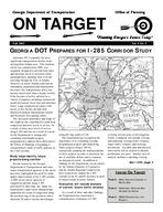
GEORGIA DOT PREPARES FOR I-285 CORRIDOR STUDY
Interstate 285 is arguably the most significant transportation facility in the metropolitan Atlanta area. This roadway, which was completed in 1969, was originally designed to provide both intra and interstate travel to motorists while simultaneously enabling them to avoid traveling through the City of Atlanta. However, as metro Atlanta experienced tremendous population and employment increases, this transportation artery has become much more than a bypass facility. It has become a facility utilized for a variety of purposes including commercial goods movement, local trips and interstate travel. Large employment centers with access to this facility include both Hartsfield-Jackson International Airport and Perimeter Area among others.
The increased importance and usage of this roadway has contributed to peak-hour congestion and poor levels of service. As a result of these poor levels of service along I-285 and also as a result of a need by the Department to strategically coordinate multimodal projects programmed to address these deficiencies, the Office of Planning is beginning a comprehensive study of traffic patterns in the I-285 corridor.
Study helps identify future projects along corridor
Recent reports by the Georgia Department of Transportation and other major transportation agencies in the metro area have highlighted the need for study and/or improvement of the I-285 corridor. A 2001 aerial survey analysis of congestion patterns along I-285 performed by Skycomp, Inc. under the Department's supervision tabulated and quantified the extent of congestion along the northern ring of the perimeter above Interstate 20 and at various interchanges
along the ring south of I-20. The Department has recognized the
importance of re-evaluating existing programmed projects and identifying future projects along I-285 by strategically planning the implementation of these projects in order to maximize the use of available dollars and to construct an integrated system. In addition to findings by the Department, recent reports by the Atlanta Chamber of Commerce and the Atlanta Regional Commission have respectively ranked the I-285 corridor as the #1 and #3 facilities in need of improvement in metro Atlanta.
Evaluation will include analysis of current, future traffic volumes
As a result of these and other findings, the Department has sanctioned a comprehensive evaluation of I-285
covering several areas of investigation. Traffic evaluation will include viewing and analyzing existing traffic volumes, future traffic volumes, and weaving movements. Accident data and physical observation will be utilized to identify problematic hot spots. Another area of analysis includes examining existing
See I-285, page 2
INSIDE ON TARGET
PAGE 2 - NEEDS ANALYSIS LAUNCHED IN MACON AREA
PAGE 3 - DEPARTMENT DEVELOPS NEW INFORMATION SYSTEM
PAGE 4 - CMAQ PROGRAM CALL FOR PROJECTS
Page 2
ON TARGET
I-285, from page 1
plans for improving interchanges. An analysis of these existing interchange plans will enable the identification of short term remedies that can be put in place until major reconstruction begins. Efforts will also involve an overview of HOV and transit improvements.
This study will be conducted in two phases. The first phase will involve development of a traffic simulation model to assess I-285 conditions. The simulation will be utilized to assess current conditions and will also be calibrated to reflect conditions with proposed projects for the years 2010, 2015, 2020, and 2030. Information obtained from phase one will be used to transition to phase two. Phase two involves the formulation of a 30 year strategic improvement plan for I-285. This plan will be comprehensive in nature and consist of a range of projects including but not limited to: traffic operations improvements, safety, signage, intelligent transportation systems, maintenance activities, bridge reconstruction, interchange reconstruction, and high occupancy vehicle lanes.
The initiation of this study demonstrates the Department's awareness of the present traffic challenges along the
I-285 corridor and the Department's responsiveness to these needs. Upon having reviewed regional reports and coordinated surface level evaluation of the I-285 corridor, the Office of Planning, through this study, is tasked with overseeing an intense analysis of I-285.
GDOT's planning partners, including GRTA, the Federal Highway Administration and the Atlanta Regional Commission, have participated in the development of this study to ensure a coordinated process. The study is presently in the consultant selection phase and work is tentatively scheduled to begin January, 2004. Through these study efforts, the Department aims to satisfactorily address the multiplicity of issues associated with traffic along Interstate 285 and to develop a well crafted strategic plan for implementing improvements along this important corridor.
Verdell Hawkins (404) 463-4376 Verdell.hawkins@dot.state.ga.us
MACON-BIBB CROSS COUNTY CONNECTOR STUDY
The Office of Planning has contracted with Day-Wilburn and Associates to evaluate a potential transportation need in the Macon Area Transportation Study (MATS) region. The study area DayWilburn will be focusing on extends from northern Bibb County at I-75 to eastern Bibb County. This study will also include a section of Jones County that is located in the MATS study area.
The planning study consists of two phases. Phase I will consist of gathering existing data to determine if a need exists for a new cross county connector. If during Phase I a need is determined to exist, Phase II would identify alternatives that would serve transportation purposes while minimizing impacts to social and natural environments. The study is
anticipated to be completed no later that May, 2004.
Phase I of the study began in October 2003. A study advisory group was identified at that time. The Advisory Panel consists of state, local, MATS and Middle Georgia Regional Development Center representatives. Currently DayWilburn is working with state and local officials to collect existing transportation system data. Day-Wilburn is reviewing local land use maps as well. A public meeting is to be scheduled for early December to establish and encourage participation from the public.
Lesa Walker (404)657-6693 lesa.walker@dot.state.ga.us
SCENIC BYWAYS
CONFERENCE
A SUCCESS
The 2003 Georgia Scenic Byways Conference was held this past spring at Unicoi State Park. Nearly 70 attendees and speakers from across the state gathered to discuss many byway-related issues ranging from marketing and interpretation to project funding and roadside design. Also included with the conference was a tour of the Russell-Brasstown National Scenic Byway.
In May, two of Georgia's Scenic Byways were awarded grants from FHWA and the National Scenic Byways Program. The South Fulton Scenic Byway received $85,200 for the purchase of a 16acre conservation easement while the Russell-Brasstown National Scenic Byway was awarded $25,000 to establish a byway organization and implement its Corridor Management Plan
The seventh Georgia Scenic Byway was designated by the State Transportation Board in September. The Cohutta-Chattahoochee Scenic Byway runs for 54 miles along State Routes 2, 52, and county roads through Whitfield and Murray Counties. Sponsored by the Dalton Convention & Visitors Bureau and the Chatsworth-Murray County Chamber of Commerce, the route highlights the rural countryside of North Georgia and also offers spectacular vistas as it climbs Fort Mountain. The route is also rich in historic and natural resources including Prater's Mill and the Chattahoochee National Forest.
Jordan Hoffman (404) 651-7603 Jordan.hoffman@dot.state.ga.us
Page 3
ON TARGET
GEORGIA DOT DEVELOPS NEW
INFORMATION MANAGEMENT SYSTEM
The Department is developing a new way to maintain, organize, store and access roadway characteristics. This new format, called "RC Next" ("RC" is short for "road characteristics") will provide many advantages over the existing "RC File" format the Office of Planning currently uses. The RC File serves as the official inventory of the public highway system with in the state of Georgia.
Roadway inventory data such as number of lanes, pavement width, functional classification, etc. is currently stored in the RC File database format which was developed in the 1980's. Every time a change is made to a database item such as number of lanes, the change is stored in a separate record. Each record is referenced to a county, route number, route type, city suffix and mile point of occurrence. This reference is then recorded on the General Highway Map Series (County Maps) to establish the geographic location of the roadway features.
Several application and databases such as the Accident Information System, the Railroad Crossing Management System and others utilize periodically updated copies of the RC File or connect to a flatfile copy within an Oracle database called RC Mirror (RCMR). The RCMR is updated weekly and can be accessed through the RC Applets web applications
The Office of Planning and its
planning and operations customers are major users of the RC File. The current RC File database, though, is technically limited in its ability to serve the needs of the Department. The data storage and organization will be changed in RC Next. Once RC Next is implemented, the Department will have the capability to uniquely reference roadway segments, intersections, interchanges, measurement of each side of divided highway, US routes, common routes, multiple street names and aliases, roadway segment and route history and project routes.
Also, RC Next users will be able to access the RC Next database through Open Data Connectivity (ODBC) and a new version of the RC Applets web application.
Web browsers will be able to run standard queries and reports directly from RC Next as well. Further, RC Next architecture will provide a foundation to support future application development and database integration. Testing for RC Next is expected to start December 2003. The IT Office anticipates that the RC Next will be operational by the end March 2004.
Stenley Mack (404) 657-6691 stenley.mack@dot.state.ga.us
IMPLEMENTATION PLAN FOR I-20/I-285 WEST DEVELOPED FOR ATLANTA
In April 2003, the Department initiated development of a Strategic Implementation Plan for the I-20/I-285 West interchange area to address the long term needs for this critical component of the Interstate system in the Atlanta Region. There are currently a number projects programmed in the Department's Construction Work Program (CWP) that will affect the I-20 and I-285 interchange area on the west side of Atlanta.
These projects include the construction of Collector-Distributor Lanes, High Occupancy Vehicle Lanes, Advanced Transportation Management Systems (ATMS) installations including cameras and message signs and noise barriers. These projects are programmed for various implementation schedules, ranging from FY 2003 to long range (beyond 3 years). Most of the
See Plan, page 4
COLUMBIA COUNTY
STUDY CONDUCTED
In February 2003, the GDOT Office of Planning partnered with Columbia County Planning officials and selected the consultant firm, TEI, to evaluate the transportation system in Columbia County. All modes of transportation, such as highways, bike and pedestrian facilities and public transit are to be evaluated. The results of the evaluation will be a comprehensive transportation plan that will address Columbia County's current and future (year 2025) transportation needs.
On June 24, 2003 a public workshop meeting was held to inform the public and local governmental officials of the Columbia County Planning Study and to receive input from the public regarding transportation issues. At that meeting, TEI stated that efforts were underway to evaluate Columbia County's existing transportation system and that feedback was needed from the public and local officials concerning transportation system issues.
On October 28, 2003, a 2nd public workshop meeting was held to discuss with the public and local governmental officials of Columbia County an overview of existing and future (2025) transportation operating issues. The workshop also allowed the public to further identify potential transportation improvements.
Currently, TEI is working with the GDOT Office of Planning and Columbia County officials to identify possible sources of federal, state and local transportation funding. Also, efforts are underway to develop a list of prioritized projects through 2025 based on preliminary results of the study.
A final public meeting to discuss the study findings will be scheduled before the expected completion date of the study, December 2003.
Radney Simpson (404) 657-6689 Radney.Simpson@dot.state.ga.us
Page 4
CMAQ PROGRAM CALL FOR PROJECTS
Last June the State Air Quality Partners issued the first request for transportation proposals whose implementation would reduce congestion and improve air quality. By the September deadline, project sponsors had submitted 140 applications. The State Partners reviewed the applications to evaluate the project's effectiveness in reducing emissions. This is a new level of involvement for the Partners with the CMAQ program.
The State Air Quality Partners are the three state agencies with responsibility for transportation, air quality, or both. The Department of Transportation, the Environmental Protection Division and the Georgia Regional Transportation Authority began collaborating in February 2001 on identifying transportation projects that improve air quality. They want to ensure that federal Congestion Mitigation and Air Quality Improvement (CMAQ) program funds are used as effectively as possible. CMAQ funded projects must reduce transportation related emissions in
Georgia's nonattainment areas. By evaluating projects based on
anticipated emission reductions relative to project costs, the Partners will recommend projects for CMAQ funding that best meet goals for cleaner air.
Many types of projects are eligible for CMAQ funding, and many kinds of projects were proposed. Categories included Bike/Ped, Transit, Alternative Fuels, Intelligent Transportation Systems and Rideshare projects. The primary consideration was the expected emission reduction per dollar spent. The Partners will recommend the most effective projects to the Atlanta Regional Commission for inclusion in the Regional Transportation Plan.
More information about the State CMAQ Program can be found at http://www.dot.state.ga.us/DOT/planprog/planning/cmaq/index.shtml
Julia Bottin (404) 657-6698 Julia.bottin@dot.state.ga.us
ON TARGET
Plan, from page 3
projects are currently included in the Atlanta Regional Commission's 25 year Regional Transportation Plan (RTP).
The Department is challenged to integrate the development and construction of all these projects. A major component of the study will be the evaluation of future needs for this interchange and the recommendation of a 2030 Master Plan. The Master Plan will identify projects needed to meet future travel demand and it will also address safety issues. Additionally, it will recommend implementation priorities. Finally, the study will develop a strategy for implementation of all of these projects so that construction impacts can be minimized while right of way and construction dollars are optimized. The Department will be holding public involvement meetings in the late fall.
Daryl Cranford (404) 656-5360 daryl.cranford@dot.state.ga.us
Georgia Department of Transportation Office of Planning No. 2 Capitol Square S.W. Atlanta, GA 30334-1002
On Target is a quarterly publication of the Georgia Department of Transportation's Office of Planning.
Please send address corrections to: Joel North
Office of Planning No. 2 Capitol Square S.W. Atlanta, GA 30334-1002
Phone: (404) 463-0694 Fax: (404) 657-5228
Email: joel.north@dot.state.ga.us
Visit our website at: http://www.dot.state.ga.us